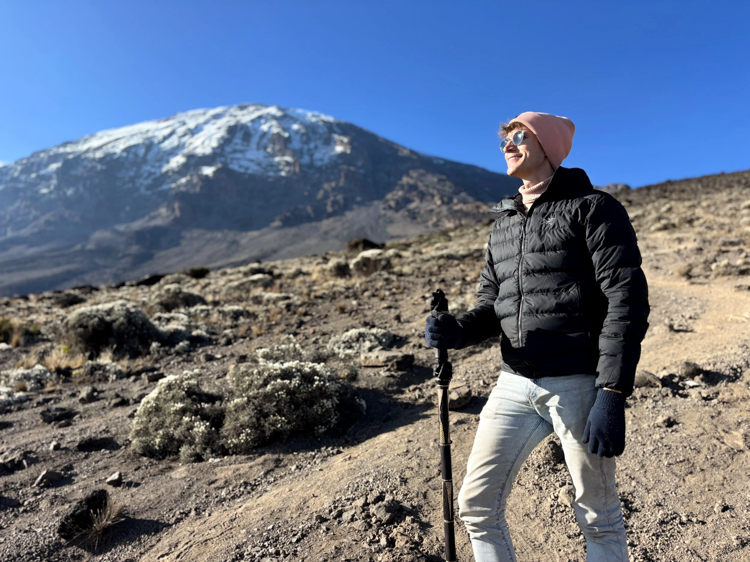
Summiting Mt. Kilimanjaro
Africa’s Tallest Mountain
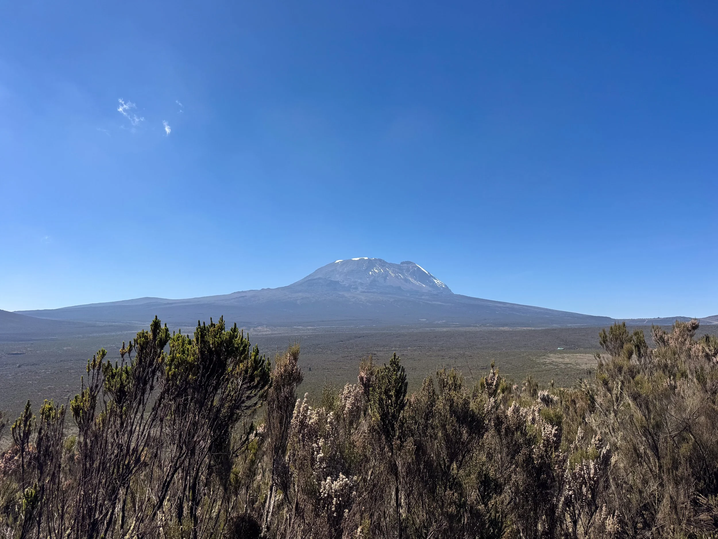
Mt. Kilimanjaro is Africa’s tallest mountain and one of the world’s Seven Summits. The highest point, Uhuru Peak, tops out at 5,895 meters or 19,341 feet above sea level. While difficult to hike, it’s considered a “walking mountain,” as it doesn’t require specialized equipment or experience to summit. We spent 7 days hiking the Lemosho Route, a scenic route with a higher success rate than others.
The Lemosho Route
The Lemosho Route is a multi-day trek to the summit of Mt. Kilimanjaro. It’s very scenic, leading through picturesque landscapes and all of the mountain’s climate zones. The summit becomes visibly closer each day of the hike, offering rewarding views. The Lemosho Route is best for slowly acclimating to the increases in altitude. It takes 8 days but can be completed in 6 or 7 days, depending on speed and acclimatization. The route has an elevation gain of 3,795 meters (12,450 feet) to reach the summit. It covers a distance of 48km (30 miles) to the Uhuru Peak.
Preparation
The day prior to beginning our Mt. Kilimanjaro hike gave us time to prepare for the adventure of a lifetime. We were introduced to our guide who briefed us on the week ahead and inspected our gear. He brought us to RRM Outdoor Rental Equipment Stores to rent all missing gear needed for the hike. Afterwards, we went shopping for snacks at the Rafiki Supermarketand purchased Diamox from the Mount Kibo Pharmacy. We spent the evening relaxing at our hotel and sipping on a Kilimanjaro Lager as a toast to the upcoming trek!
Day One
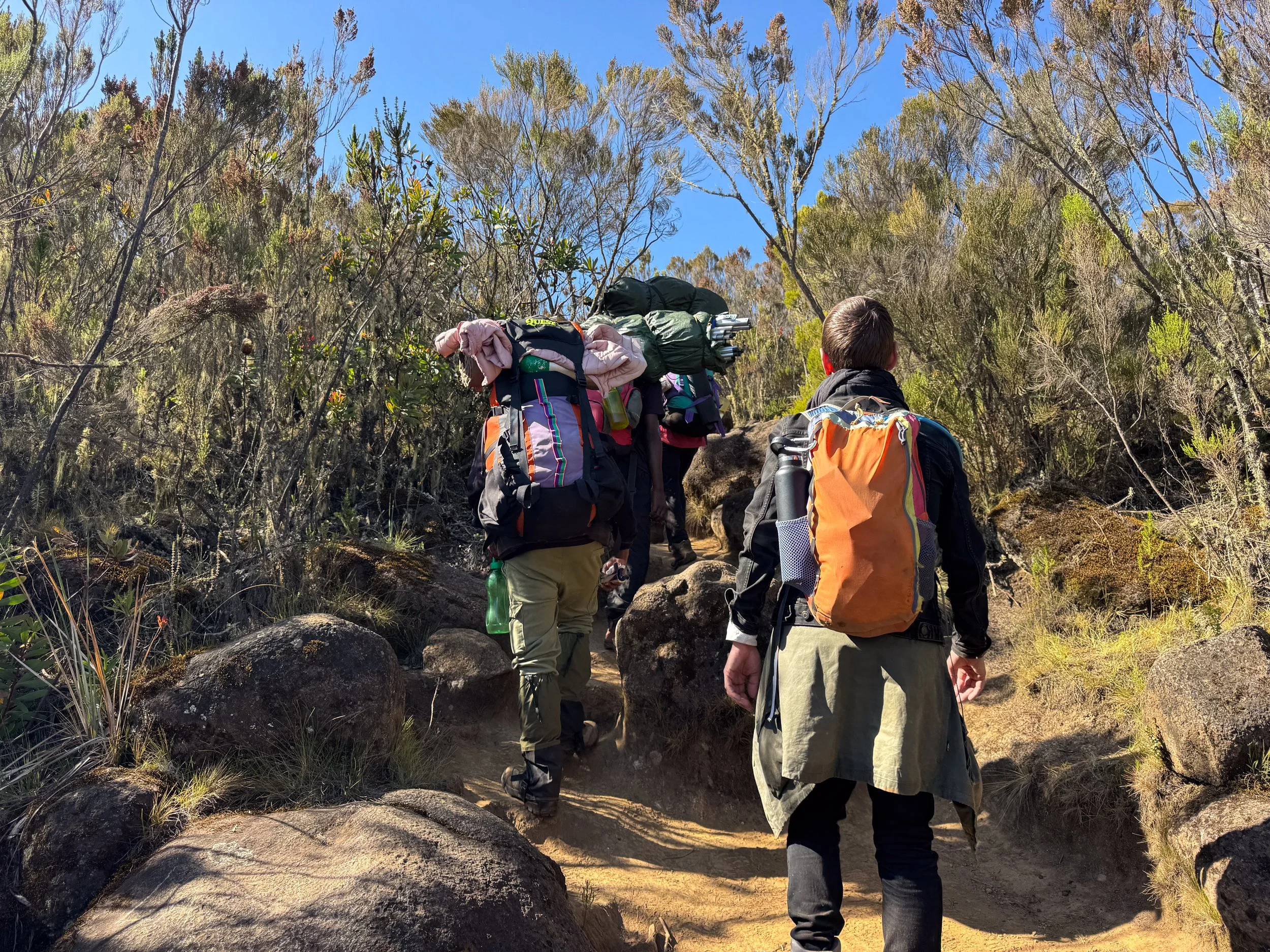
Introductions. The first day of our hike to the summit of Mt. Kilimanjaro began with an introduction to the crew that would be accompanying and supporting us over the week ahead. Our guide introduced us to the assistant guide, the cook and team of 10 porters! They sang the Kilimanjaro Song, Jambo Bwana, to warmly welcome us. We later heard it countless times at camps and along the trail to the summit.
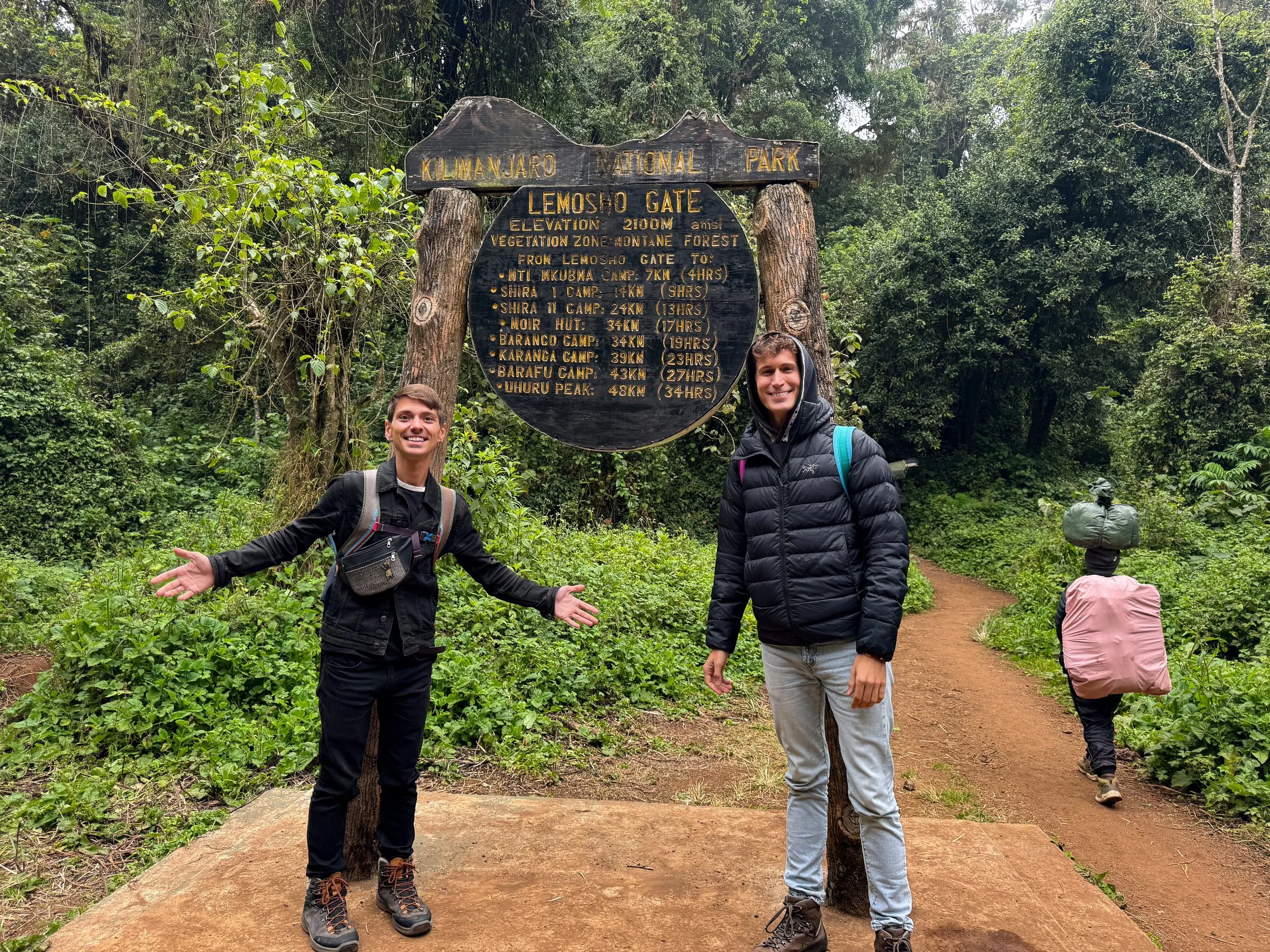
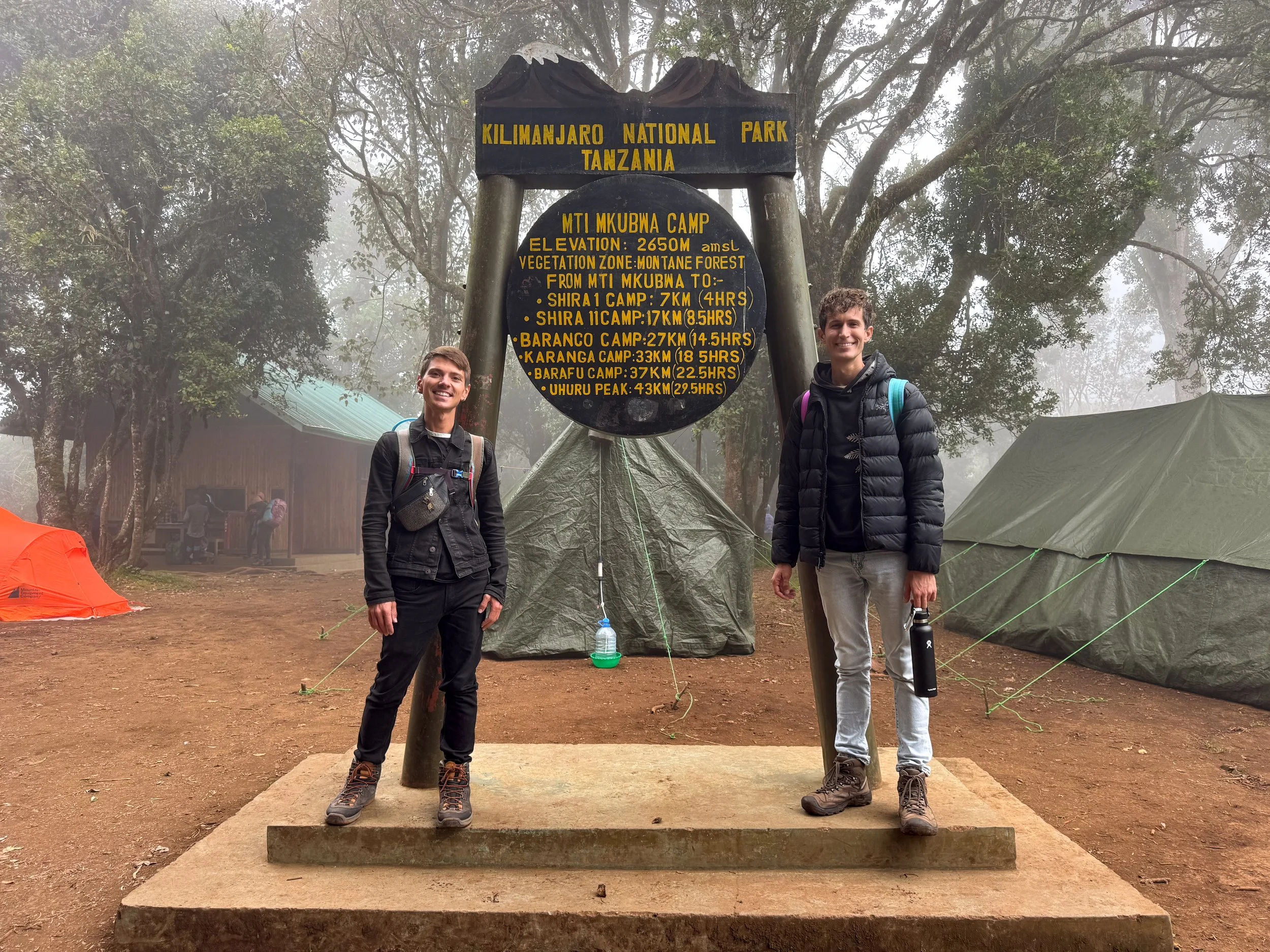
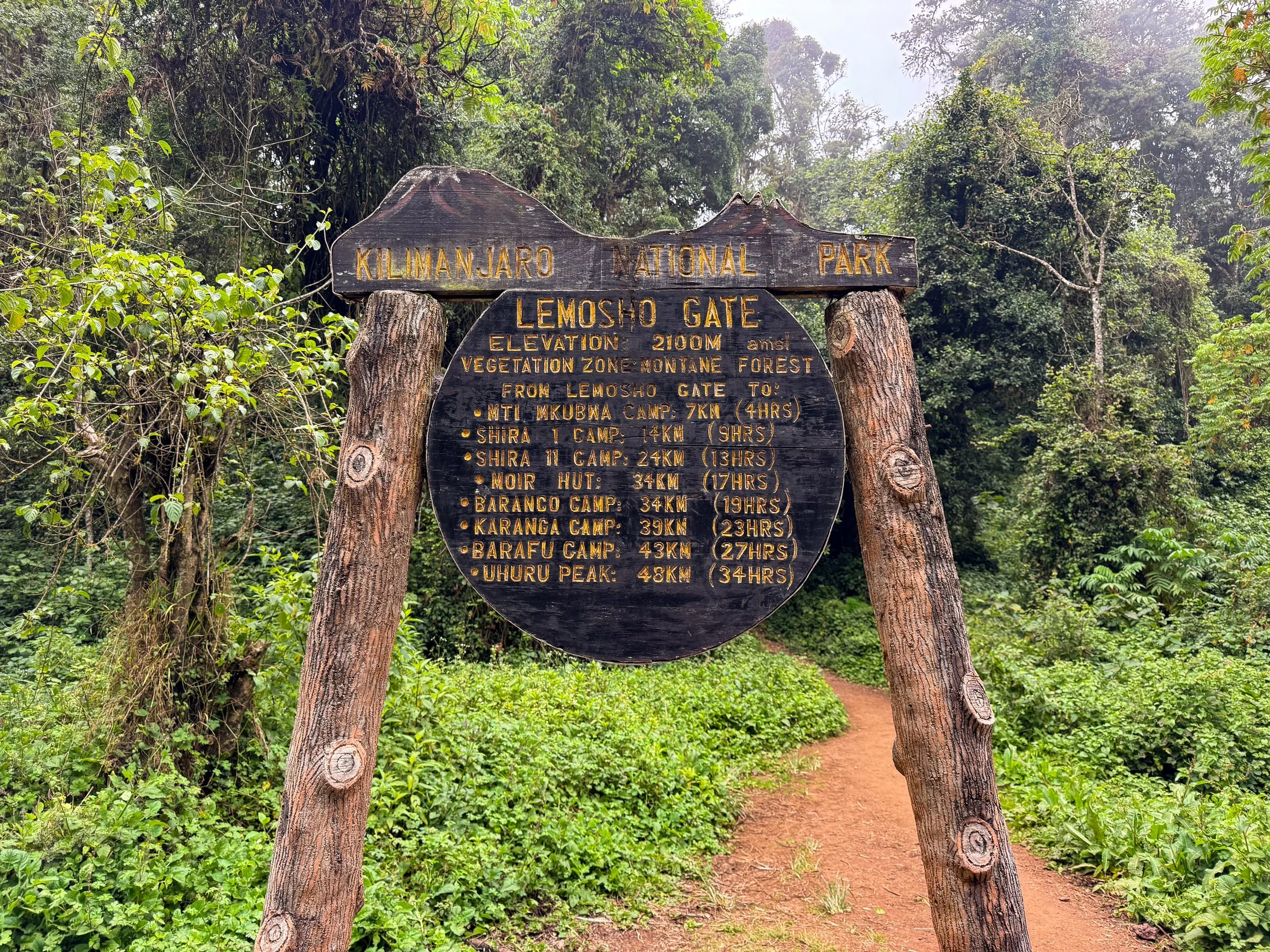
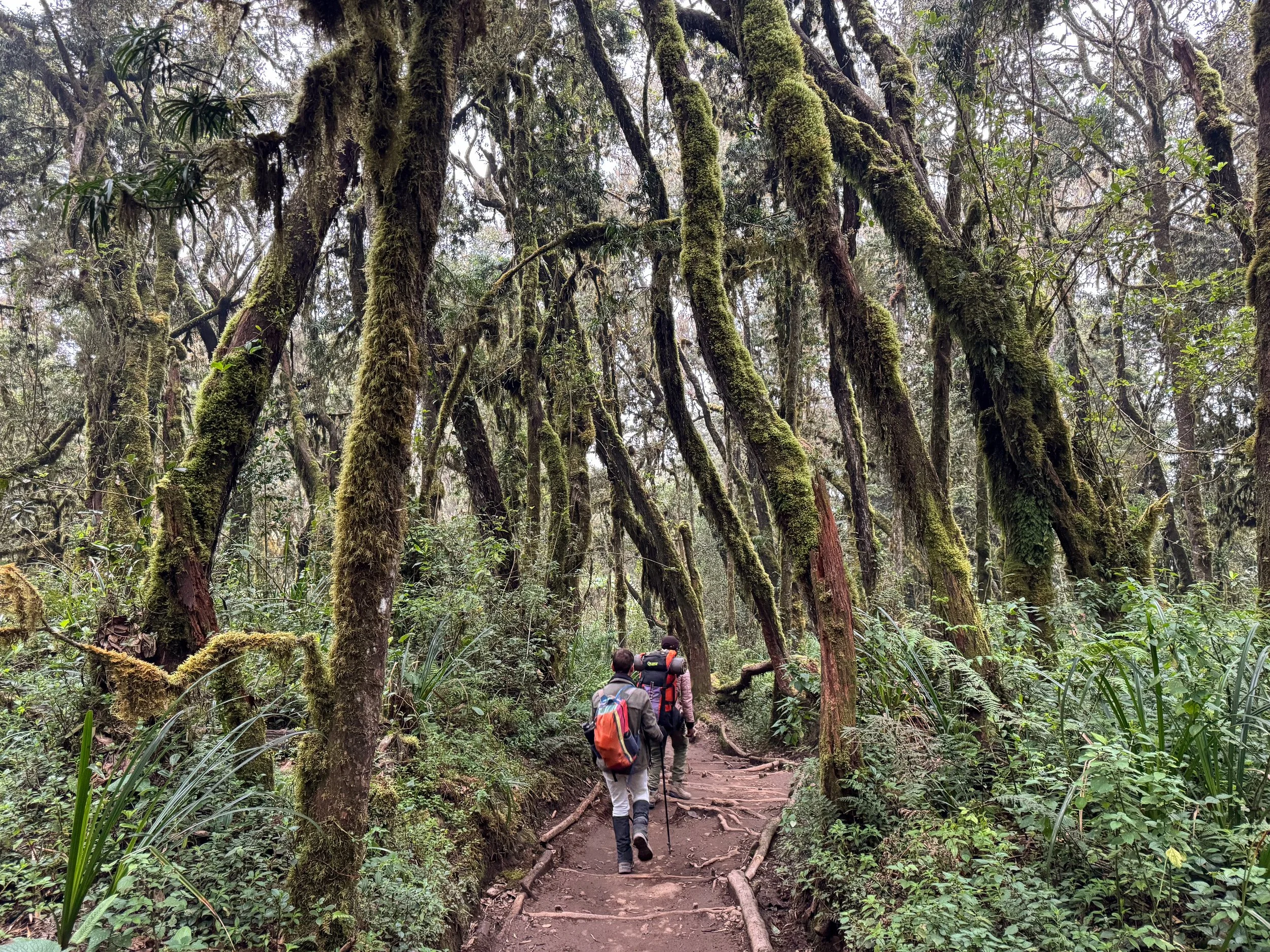
Lemosho Gate. The crew shuttled us to the Lemosho Gate for the official start of our hike. In route, we passed through The Cultivation Zone, one of five climate zones on the mountain, characterized by hilly fields of hardy crops and pine trees. The gate marks the start of the Lemosho Route, beginning at an elevation of 2,100 meters (6,890 feet). The first 7km leads through the Vegetation Zone to the Mti Mkubwa Camp.
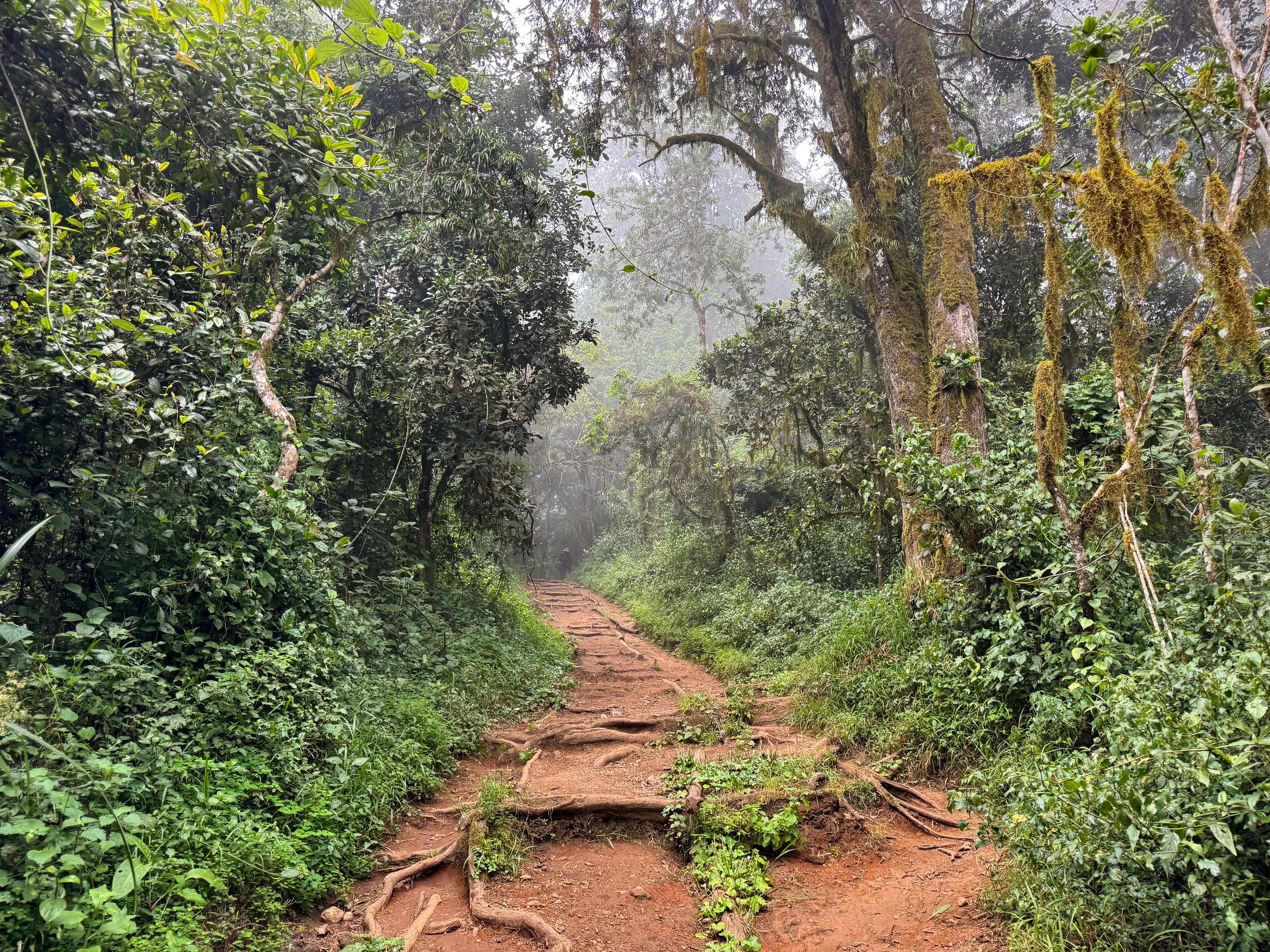
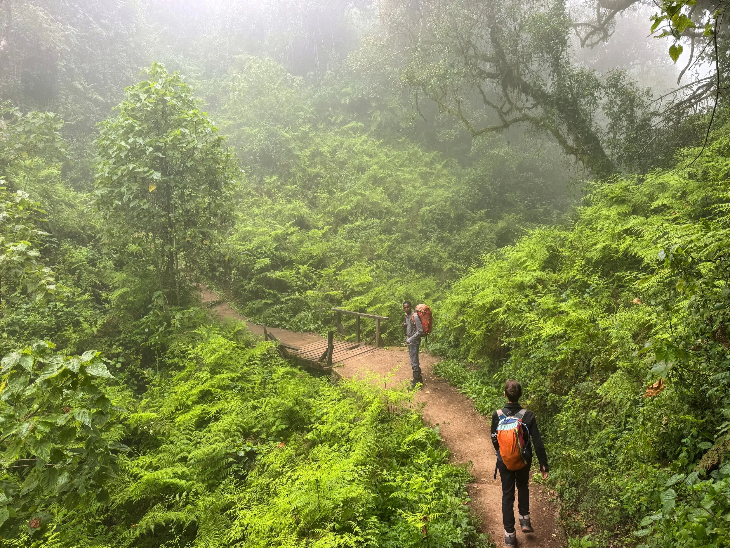
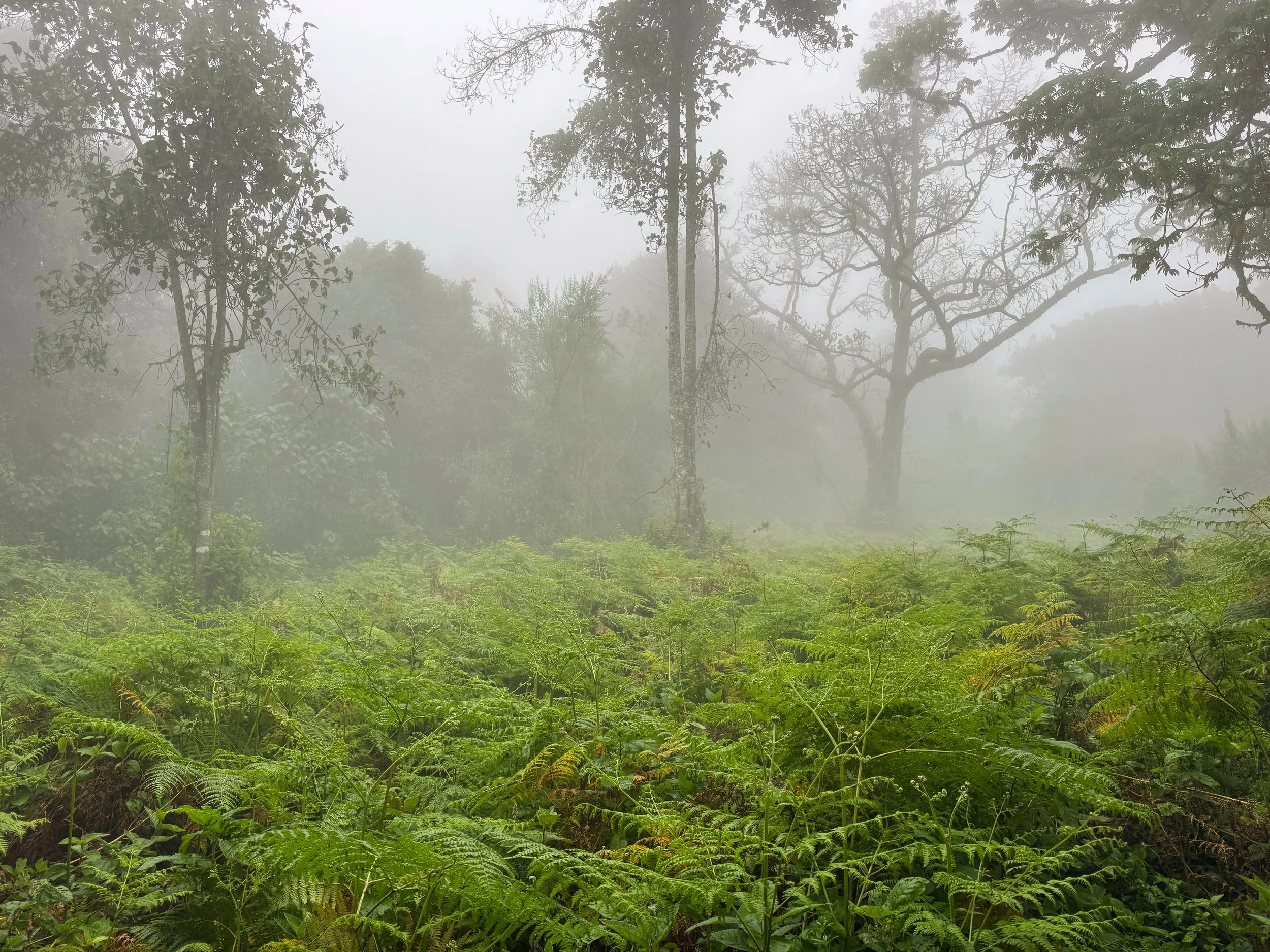
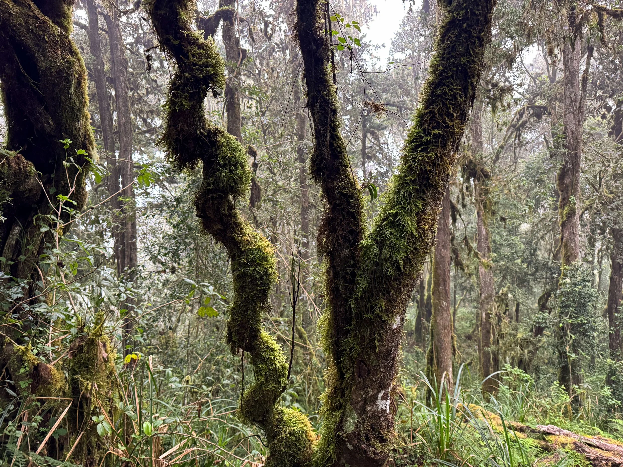
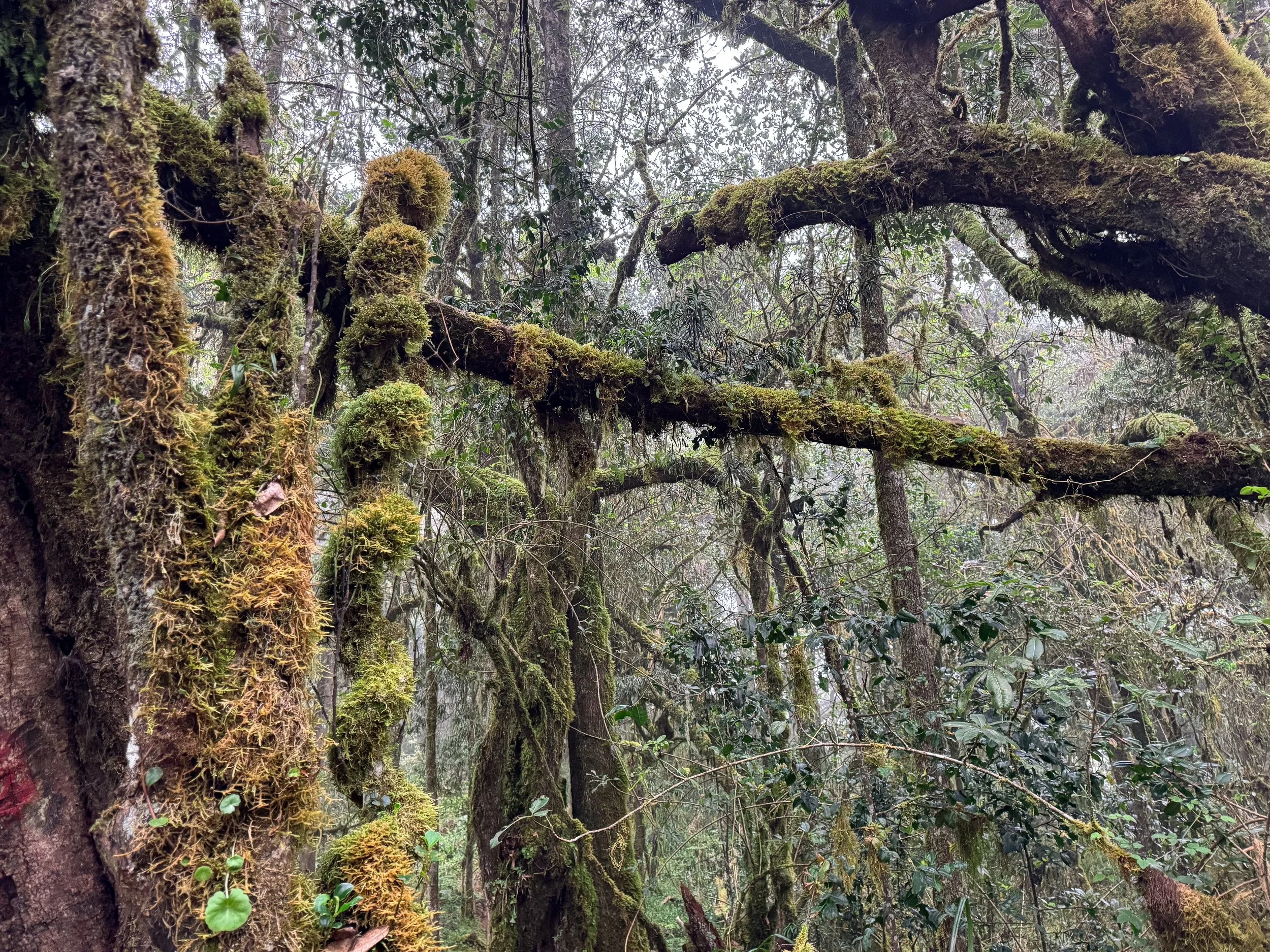
The Vegetation Zone. The Vegetation Zone is the second of five climate zones on the mountain. We hiked two hours through its verdant cloud forest and foggy pathways to reach the route’s first camp.
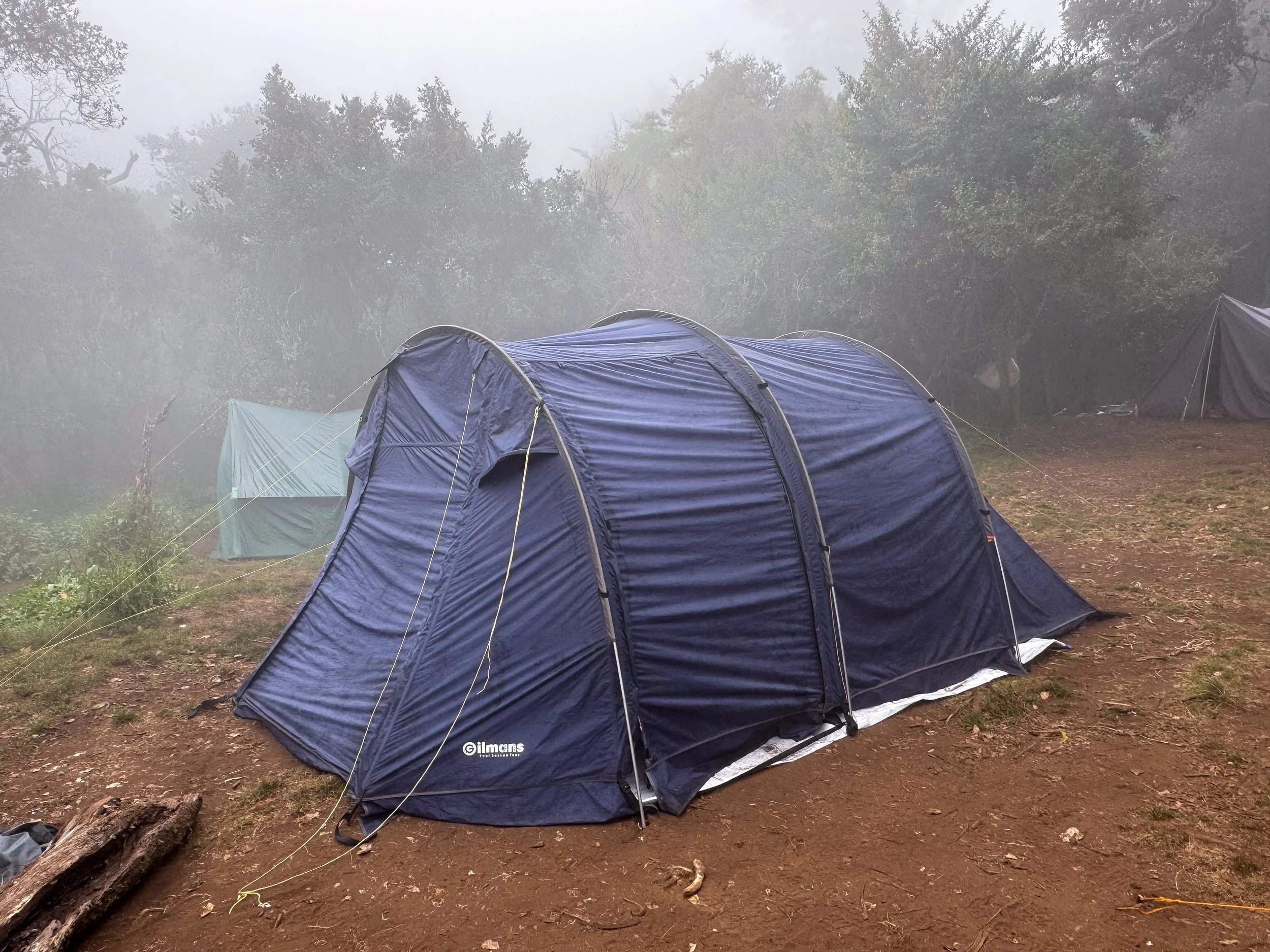
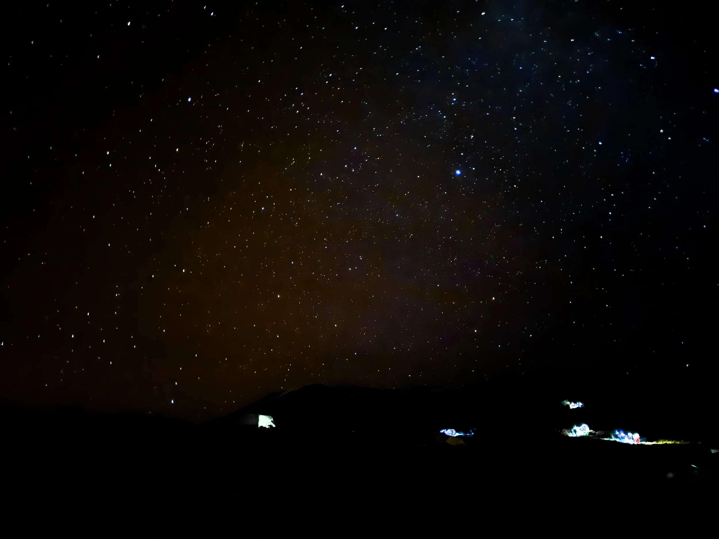
Mti Mkubwa Camp. A small forest clearing surrounded by dense trees inhabited by wild monkeys. It sits at a relatively low elevation of 2,650 meters (8,695 feet). We met our crew here for our first night on the mountain. They set up our tent and outfitted it with a small dining nook stocked with teas, coffee, spreads and snacks. The cook served us the first of many feasts to come. The meal included cucumber soup, avocado salad, fried potatoes and fish makange. We played cards before bed, waking up in the middle of the night to see the starry arms of the Milky Way stretching across the sky.
Day Two
An Early Start. The day began with an early start before the sunrise. The crew prepared “bed tea,” hot water for washing and a breakfast spread comprised of porridge, crepes, omelettes and toast. Soon after, we continued our hike through the Vegetation Zone, passing moss covered trees with colobus monkeys jumping between their branches.
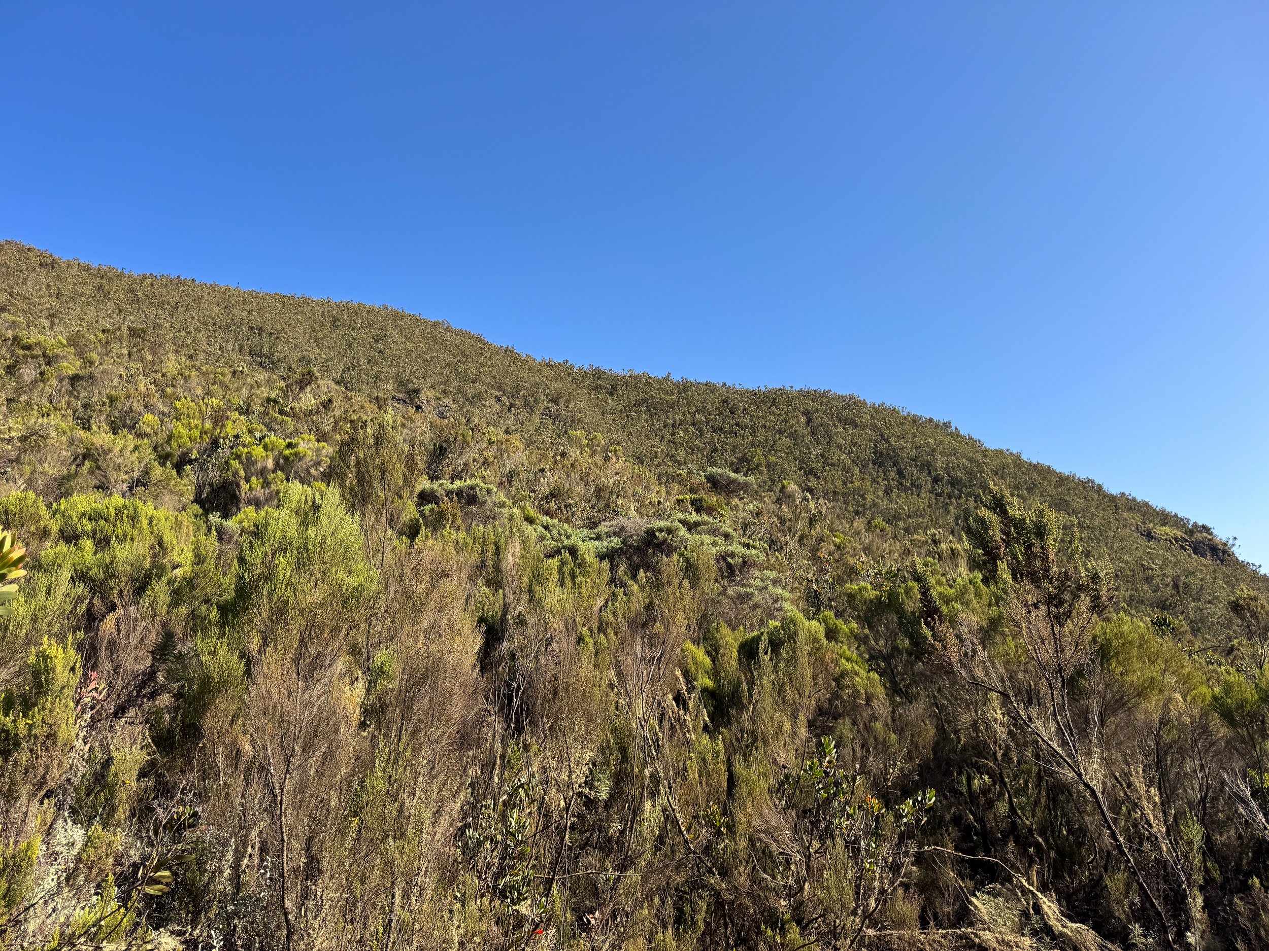
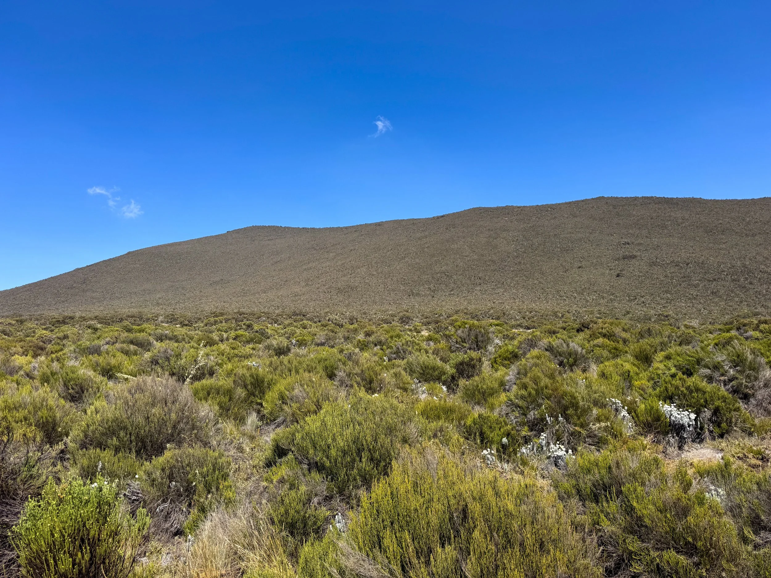
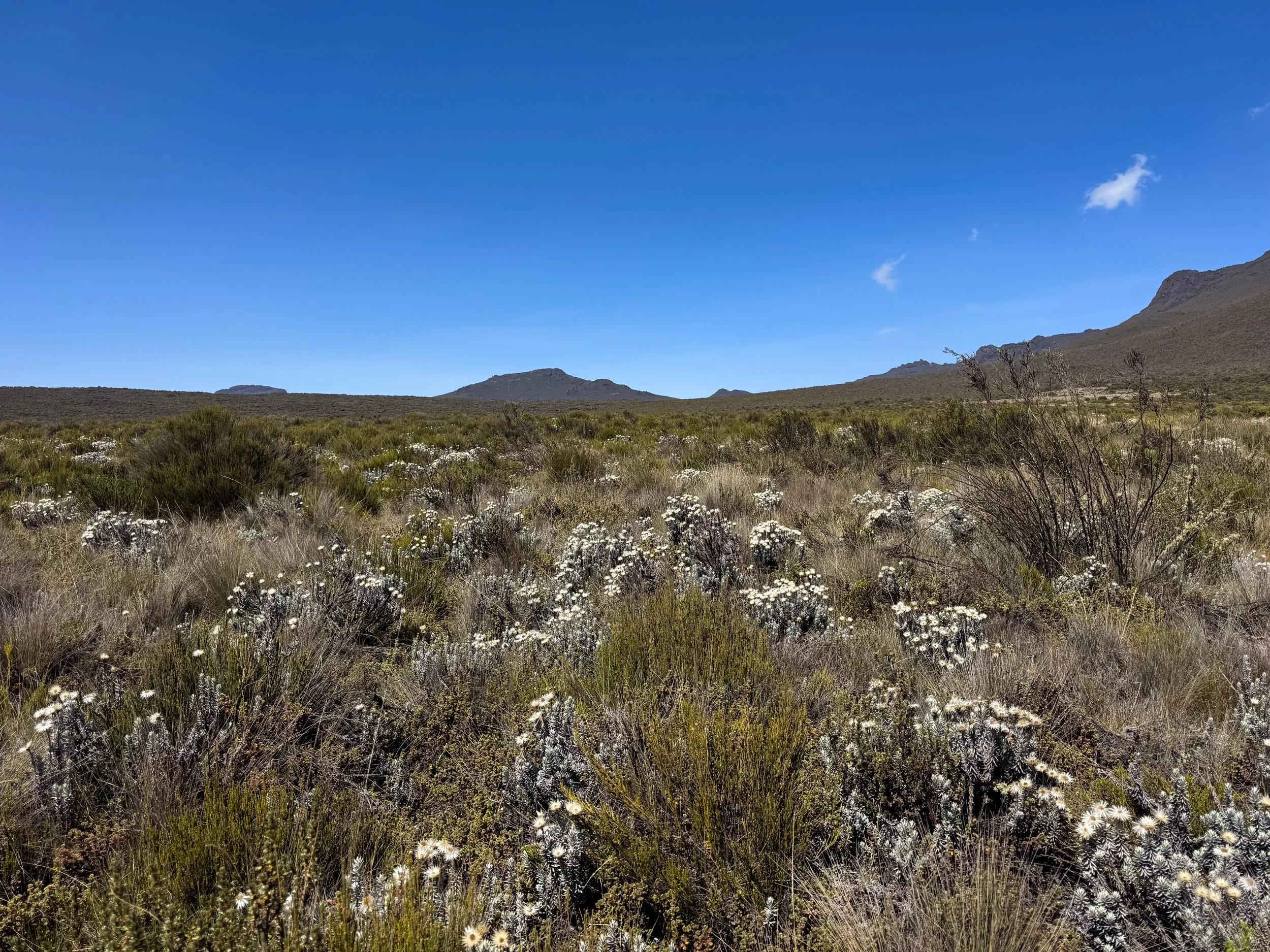
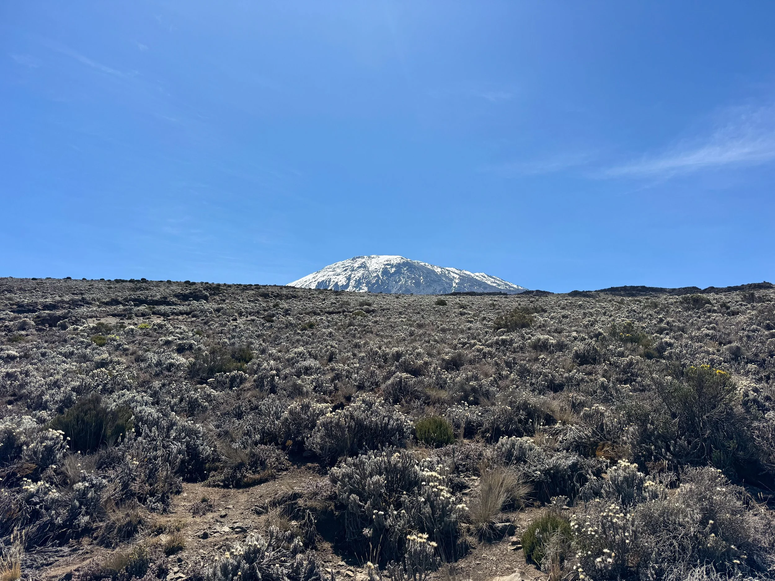
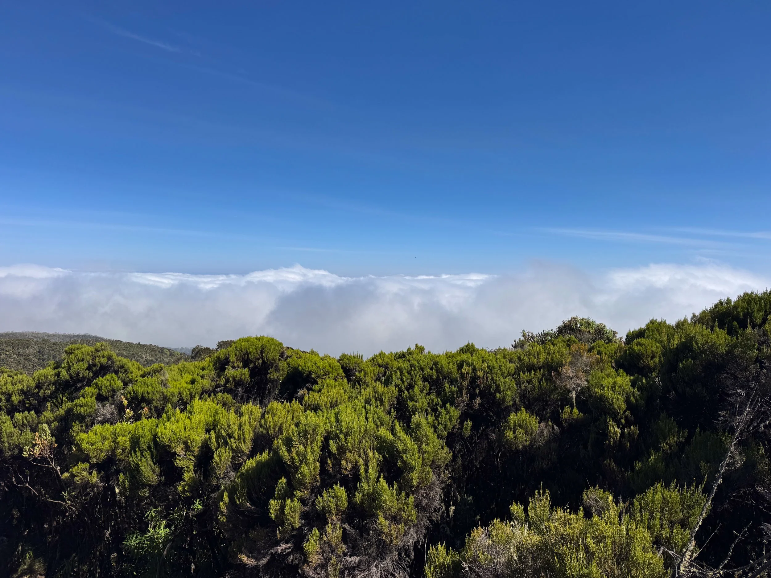
The Moorland Zone. The trail led into, The Moorland Zone, the third of five climate zones on the mountain. It’s characterized by low lying bushes, dry grasses, flowering plants and small boulders. The open and dusty trail revealed scenic panoramas of the landscape and distant views of Kilimanjaro’s snow capped peak. We hiked 7km over 4 hours until reaching the Shira 1 Camp.
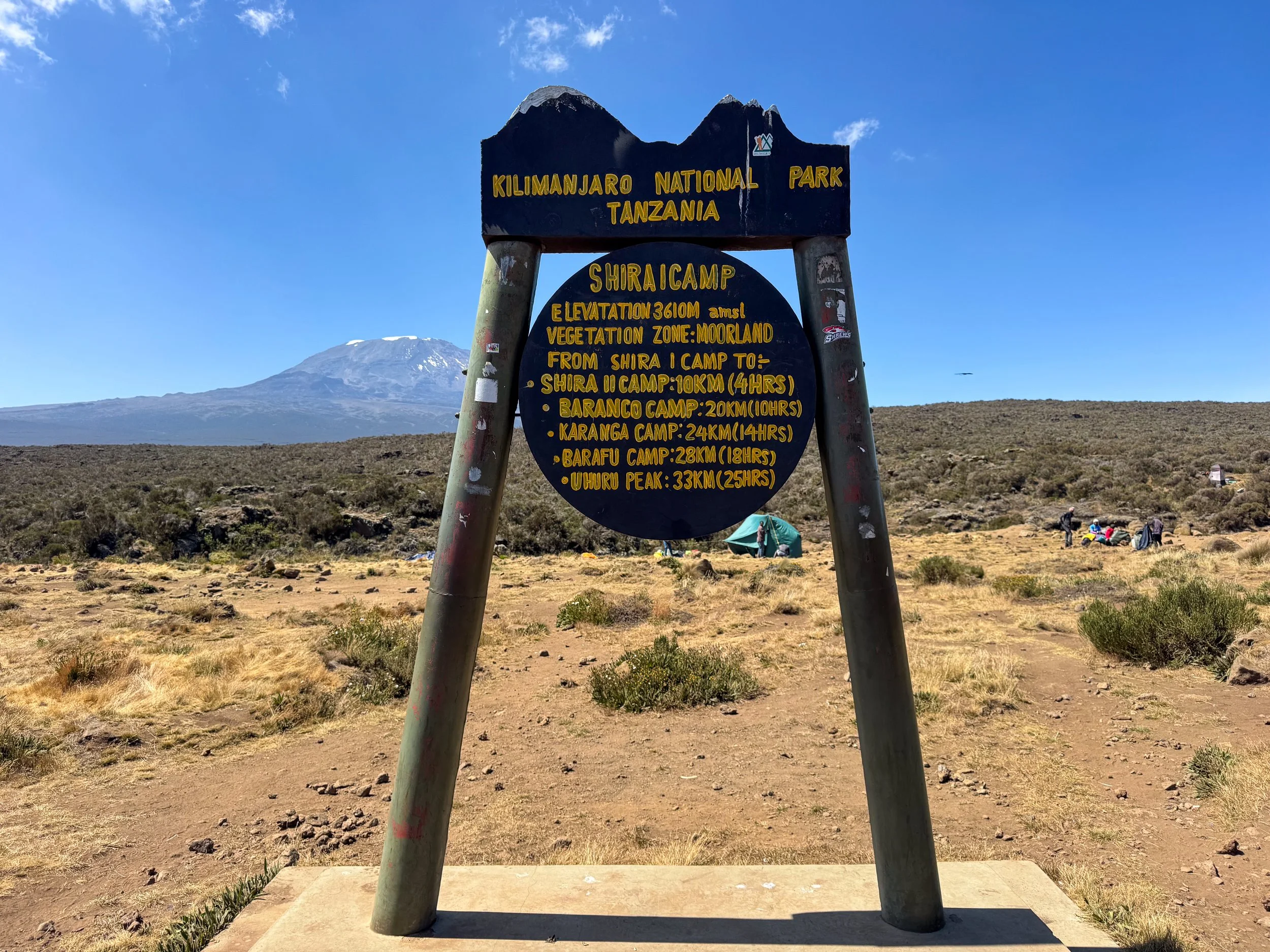
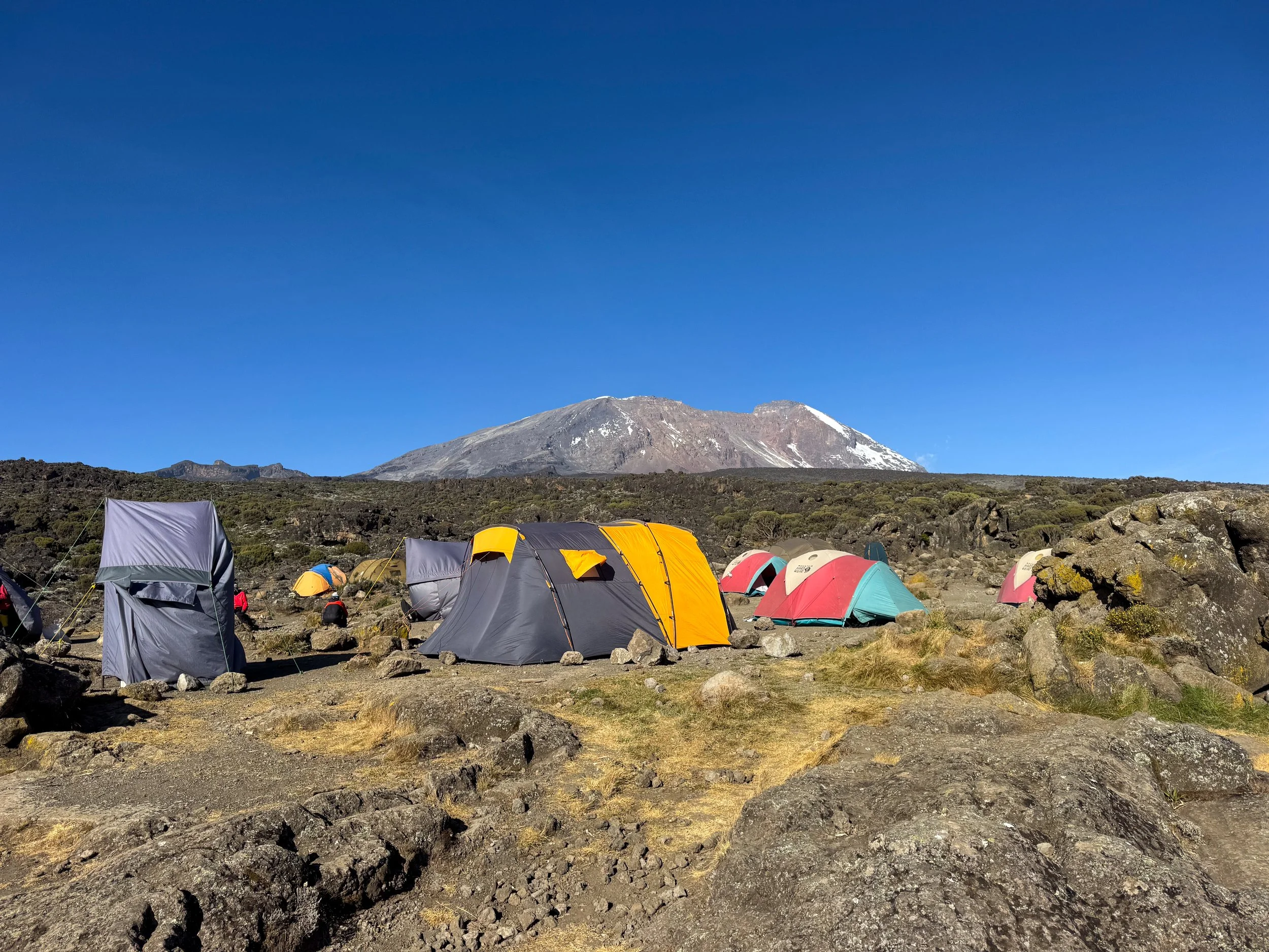
Shira 1 Camp. The first camp on the Shira Plateau, a relatively flat expanse of The Moorland Zone. The camp sits at a moderate elevation of 3,610 meters (11,844 feet). We arrived as the porters finished setting up our tent. Others arrived with large sacs balanced on their heads and packs slung over the shoulders. Ravens flew around us as we enjoyed the scenic views and ate vegetable pasta for lunch.
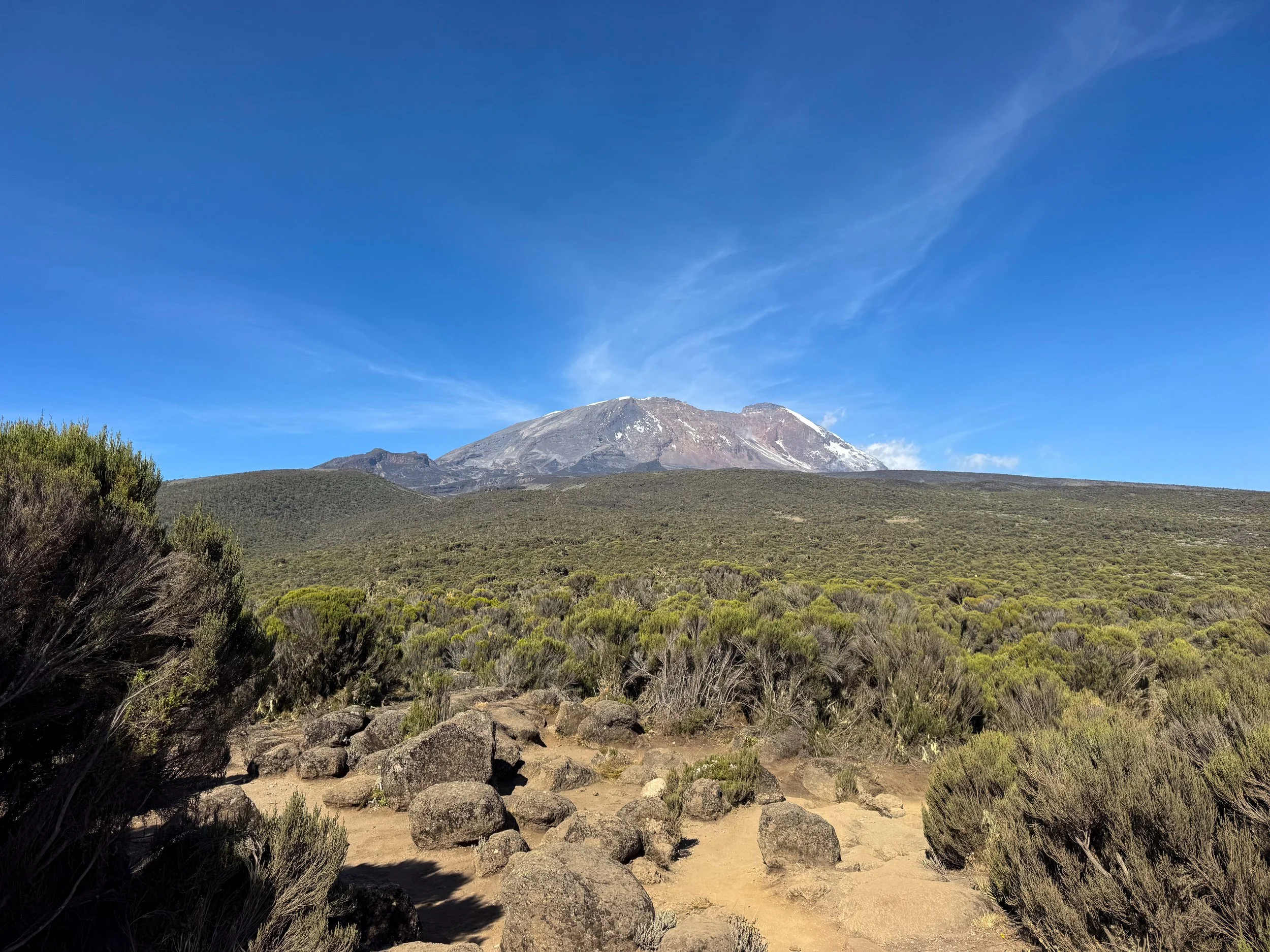
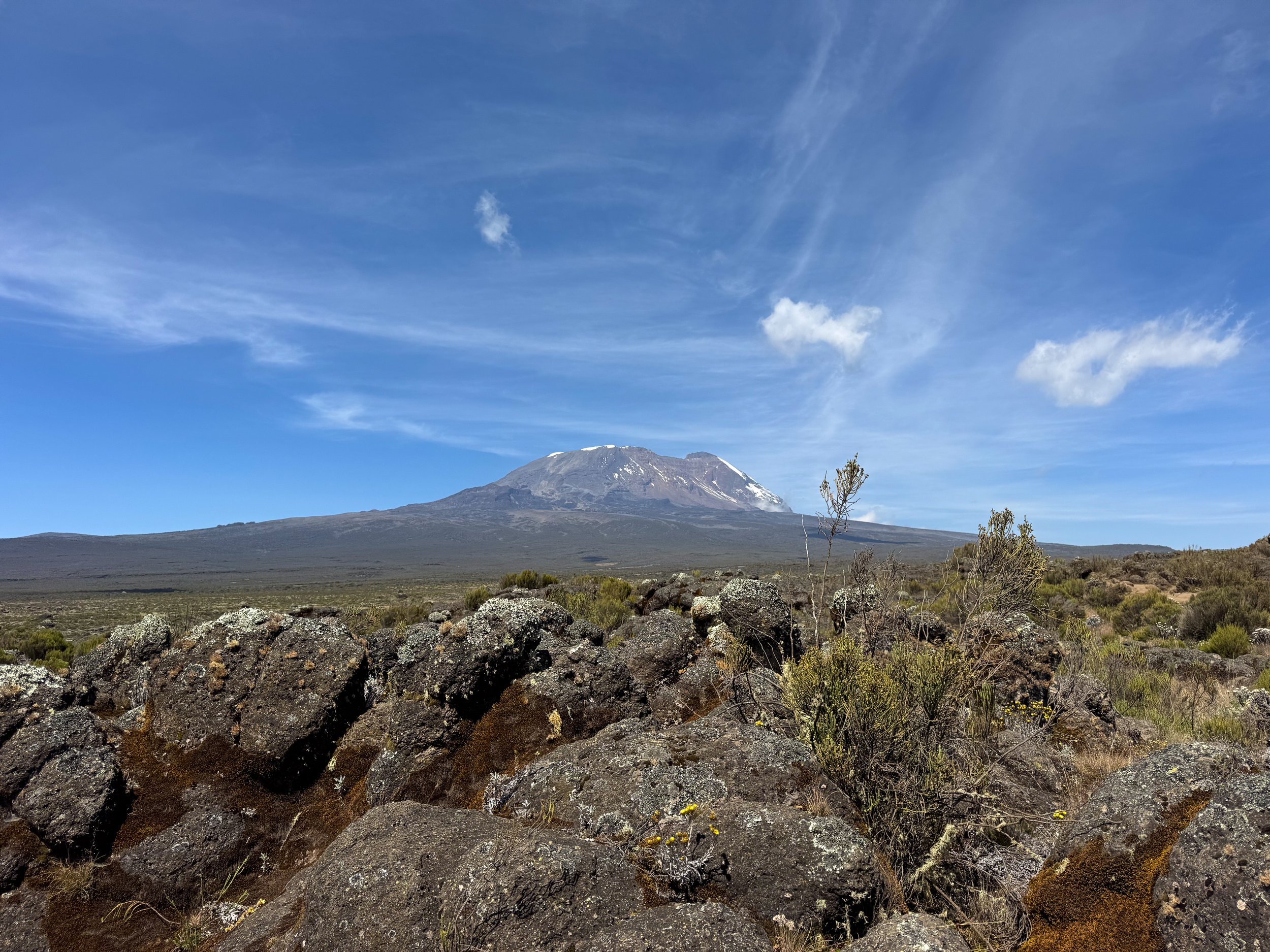
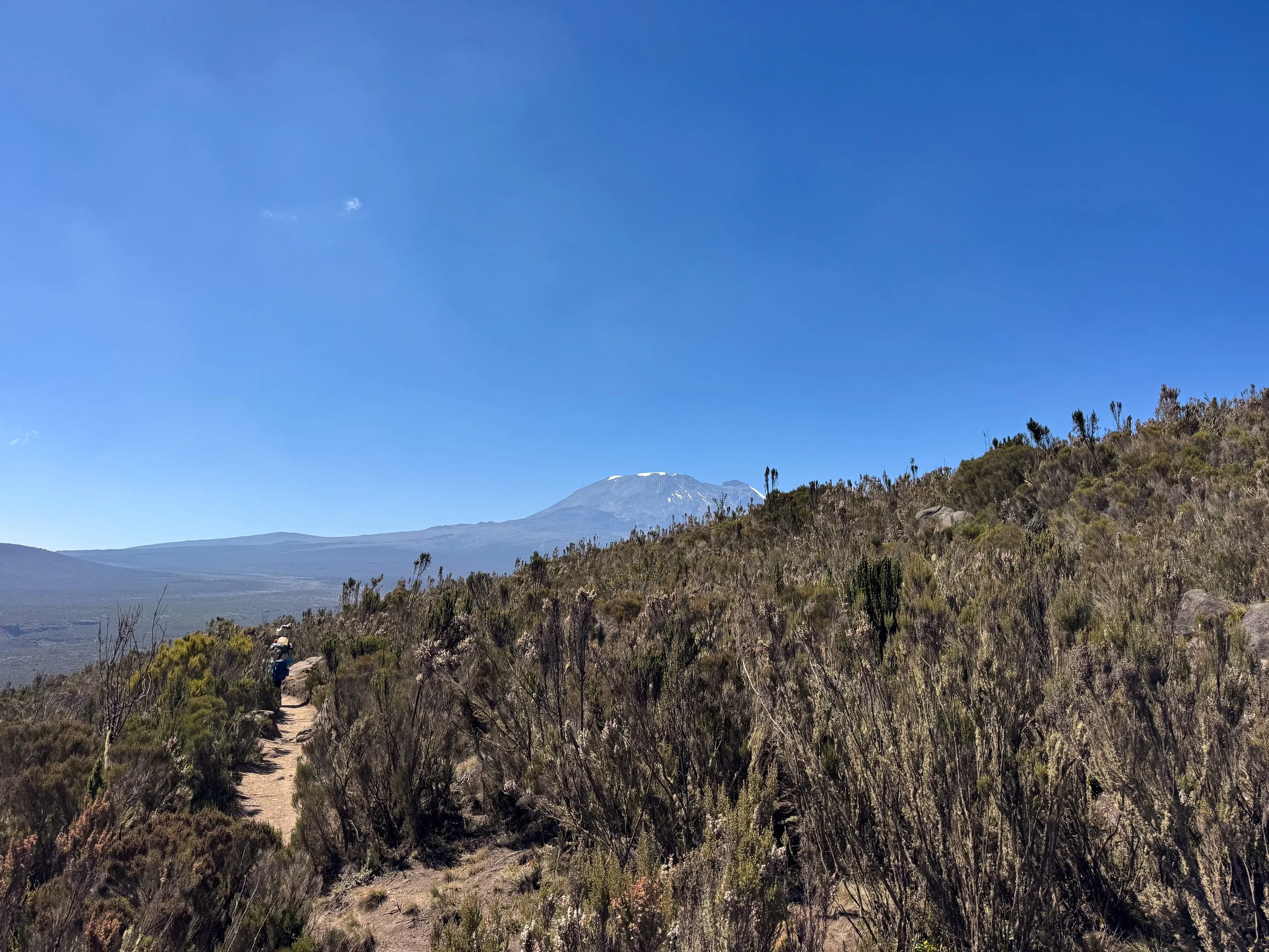
Back On the Trail. With plenty of energy and daylight left, we continued hiking across The Moorland Zone. The dusty trail lead us 10km further across the Shira Plateau to the Shira 2 Camp. We arrived a day ahead of schedule, having trekked 17km over the course of the day. Mt. Kilimanjaro’s icy peak grew noticeably closer.
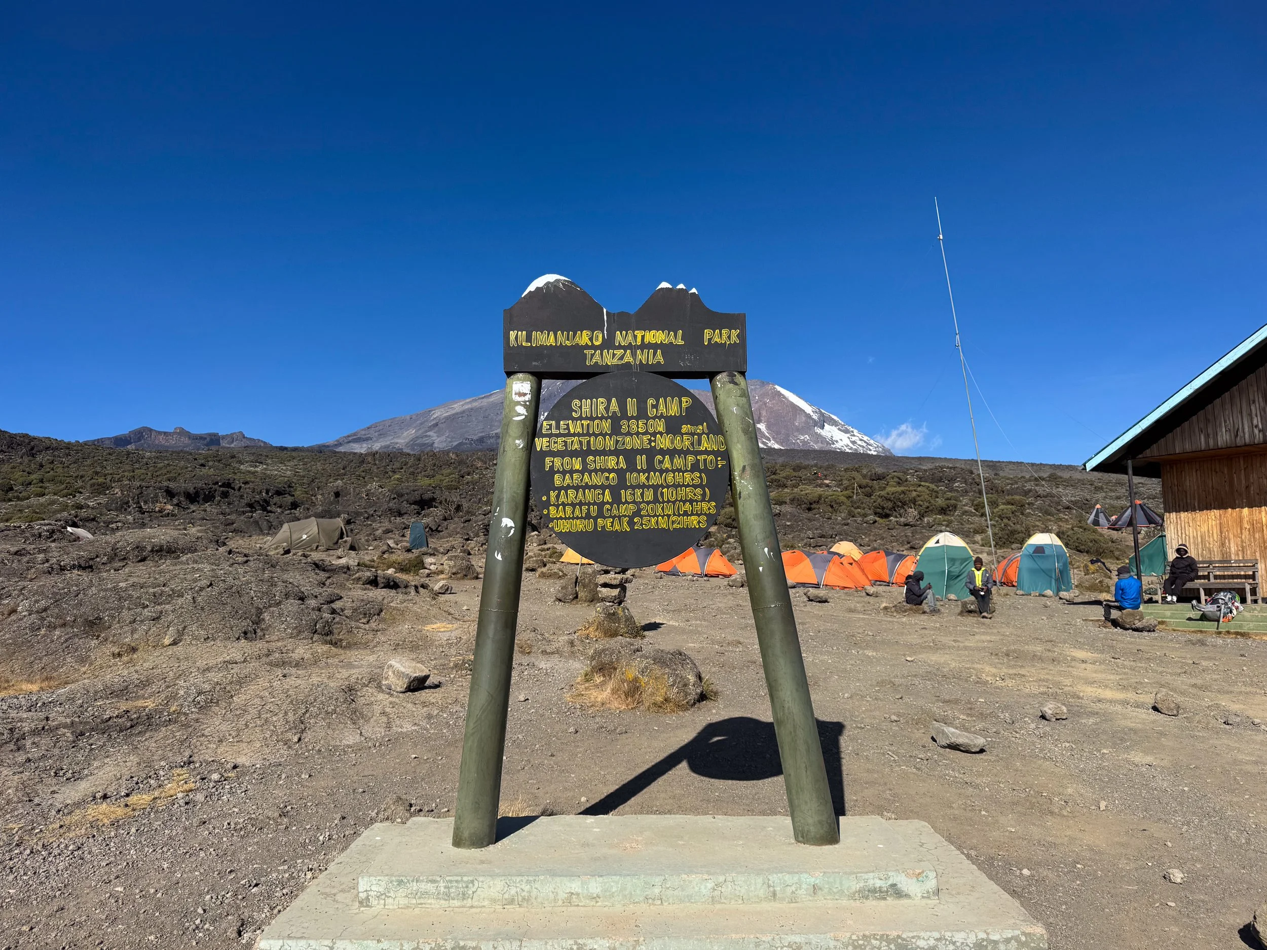
Shira 2 Camp. A camp at the opposite end of the Shira Plateau at an elevation of 3,850 meters (12,631 feet). Colorful tents stood between boulders and bushes, rattled by strong winds of the open terrain. The sunset cast an amber glow across the landscape as the cold of night set in. We hunkered down inside of our tent, resting and waiting for dinner. The cook served us leek soup, coconut milk stewed beans and rice. We celebrated the success of the day with a packet of m&ms.
Medical Evaluations. With the increased elevation, our guides began performing nightly medical evaluations. They checked our heart rate, blood oxygen levels and general wellbeing.

Day Three
A Rough Night. No one slept well during the previous night. The cold and wind kept us and our crew awake more than half of the evening. The warmth of the sun rose spread across the Shira Plateau, melting the frost as we began day three.
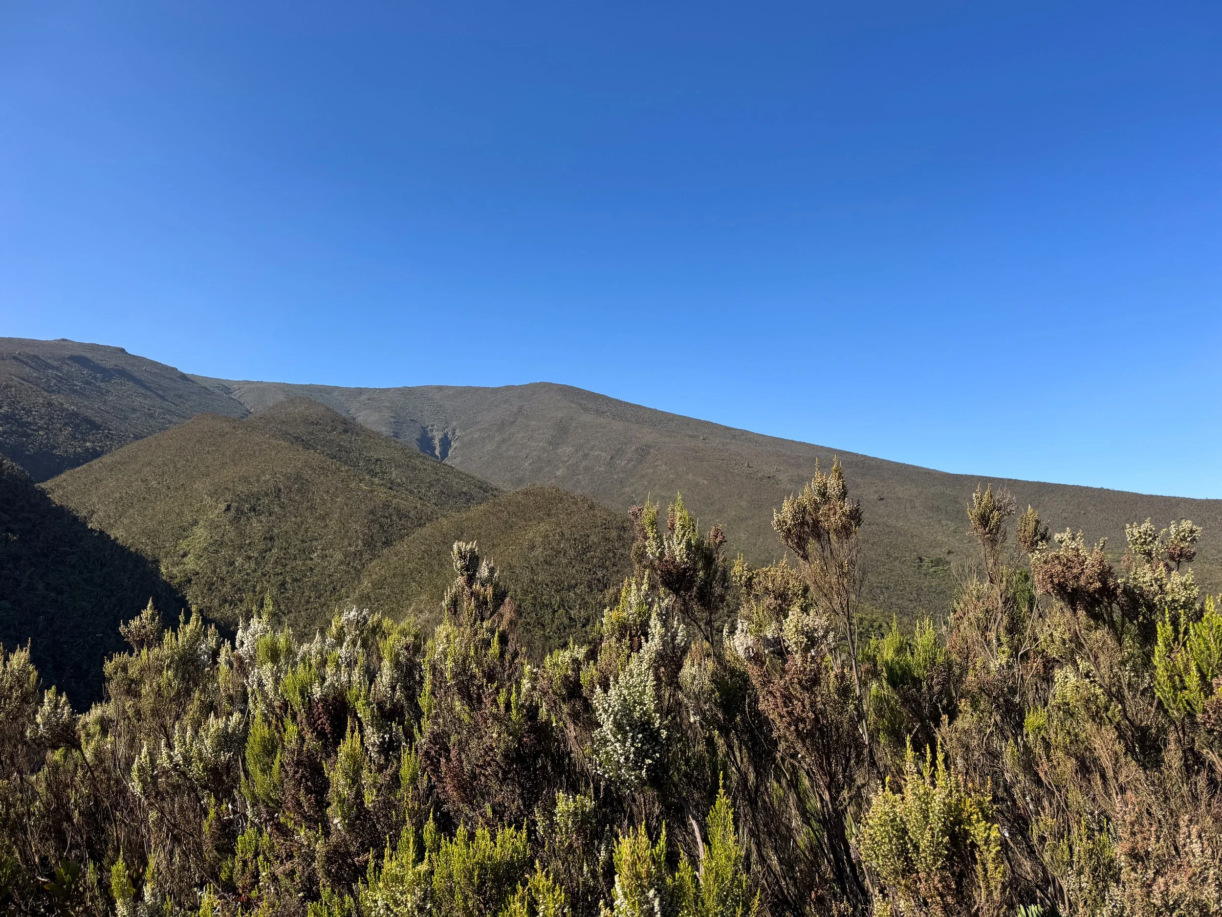
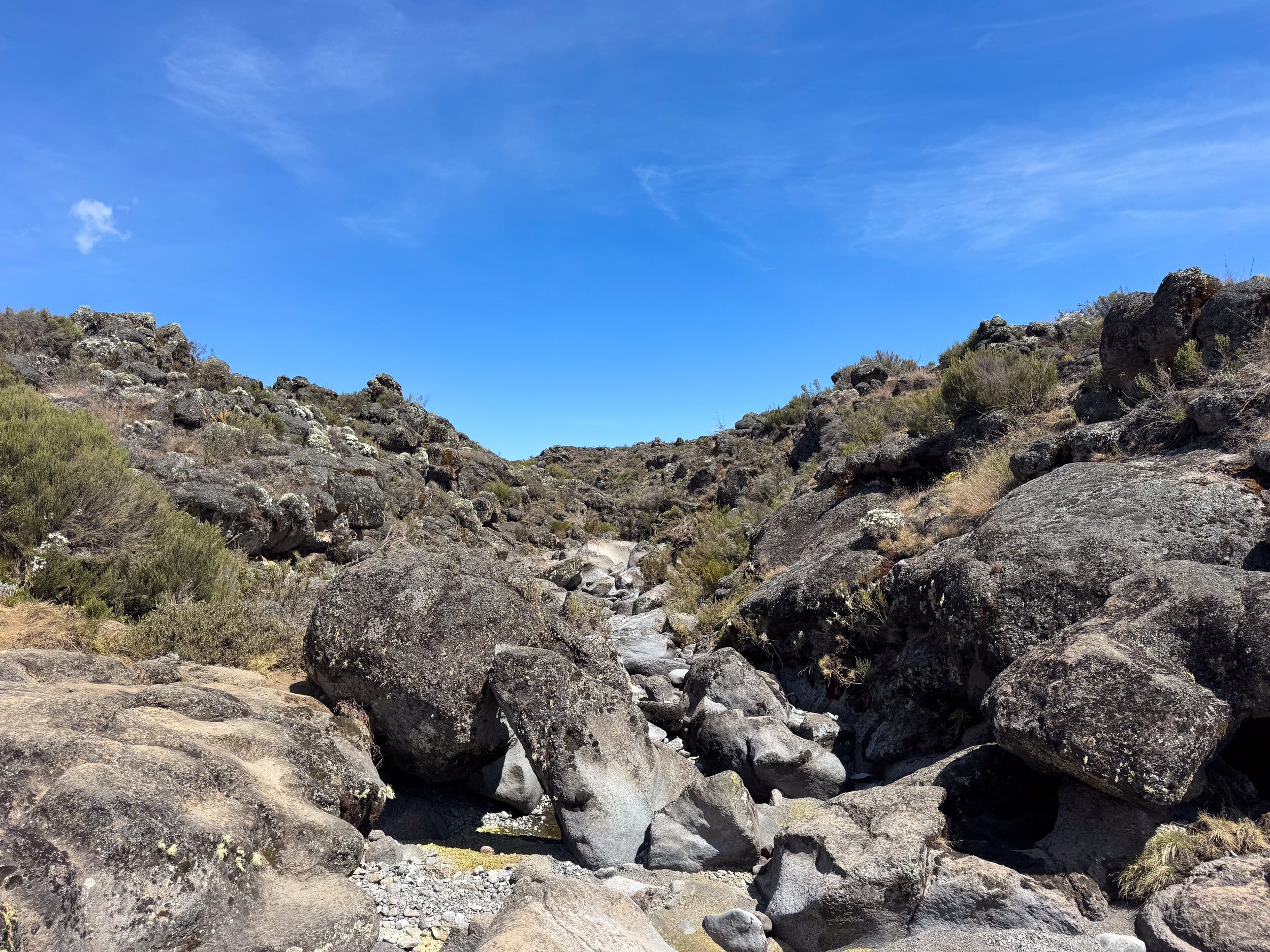
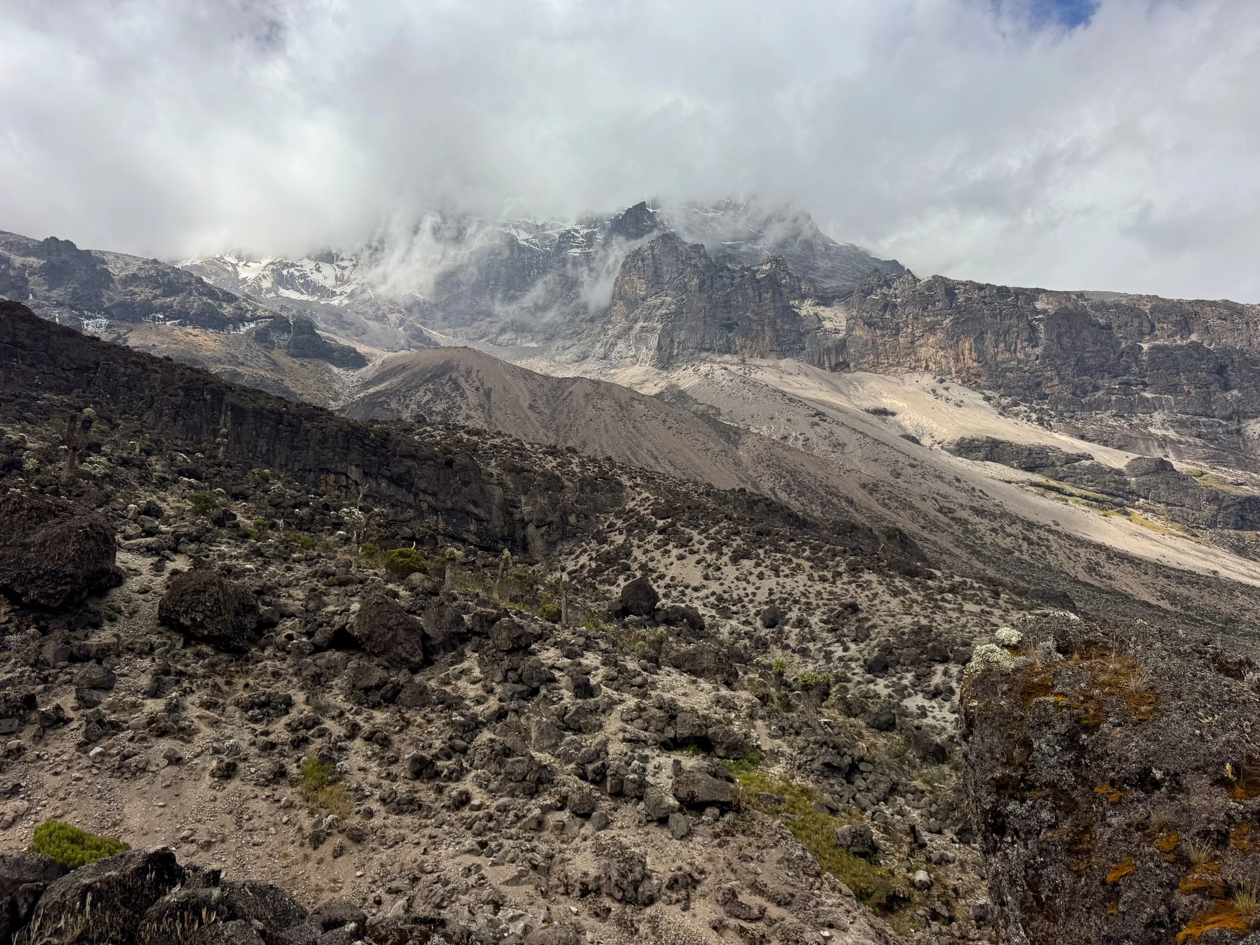
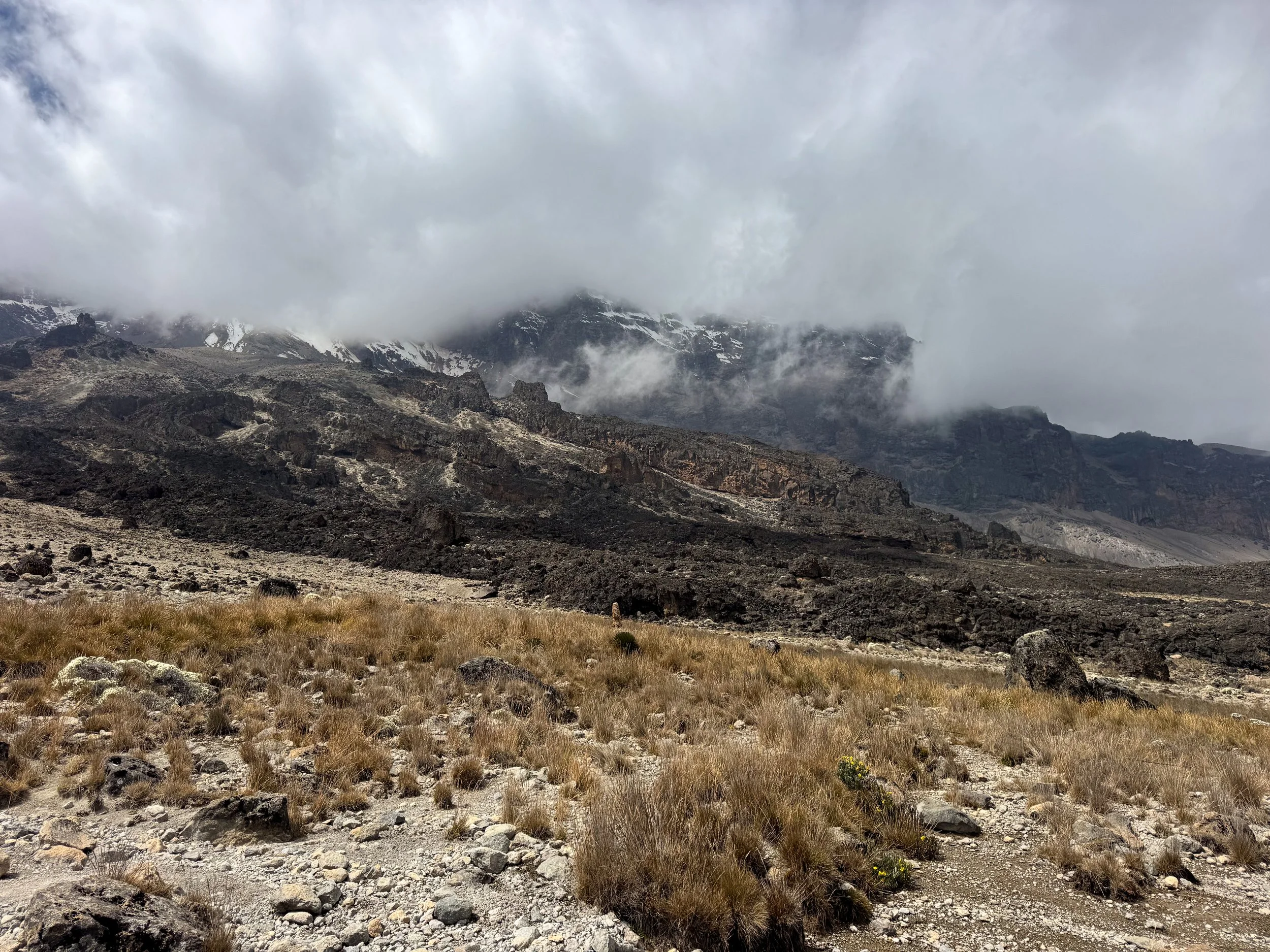
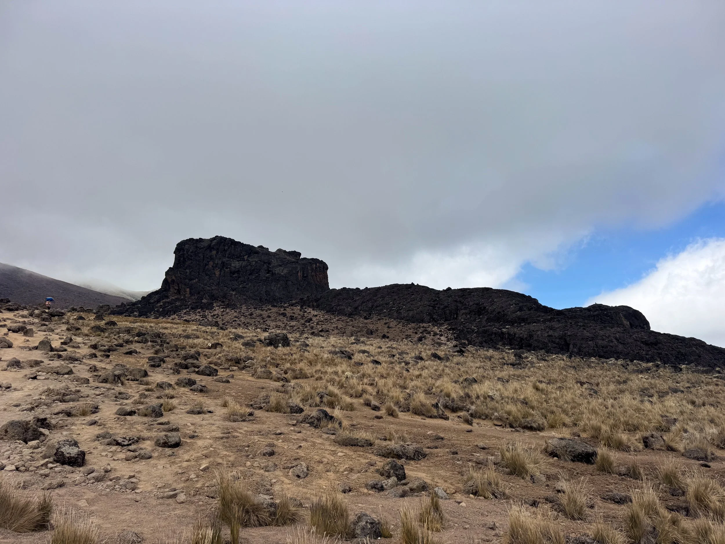
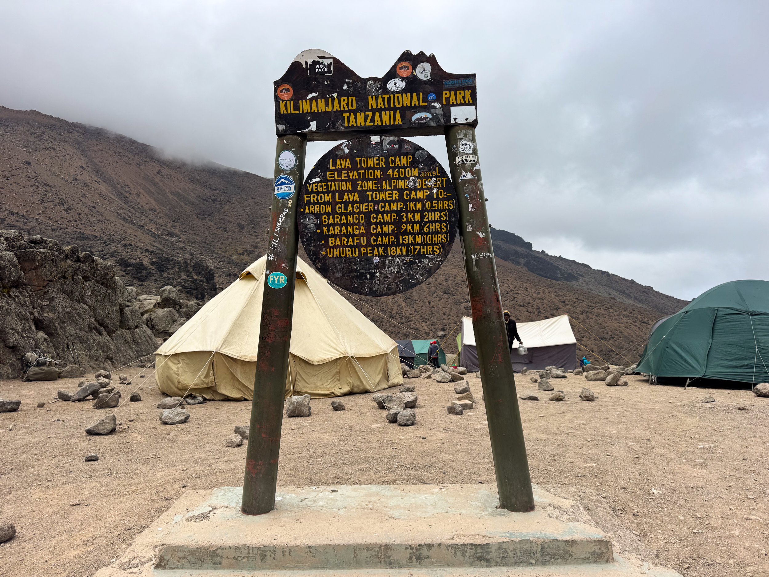
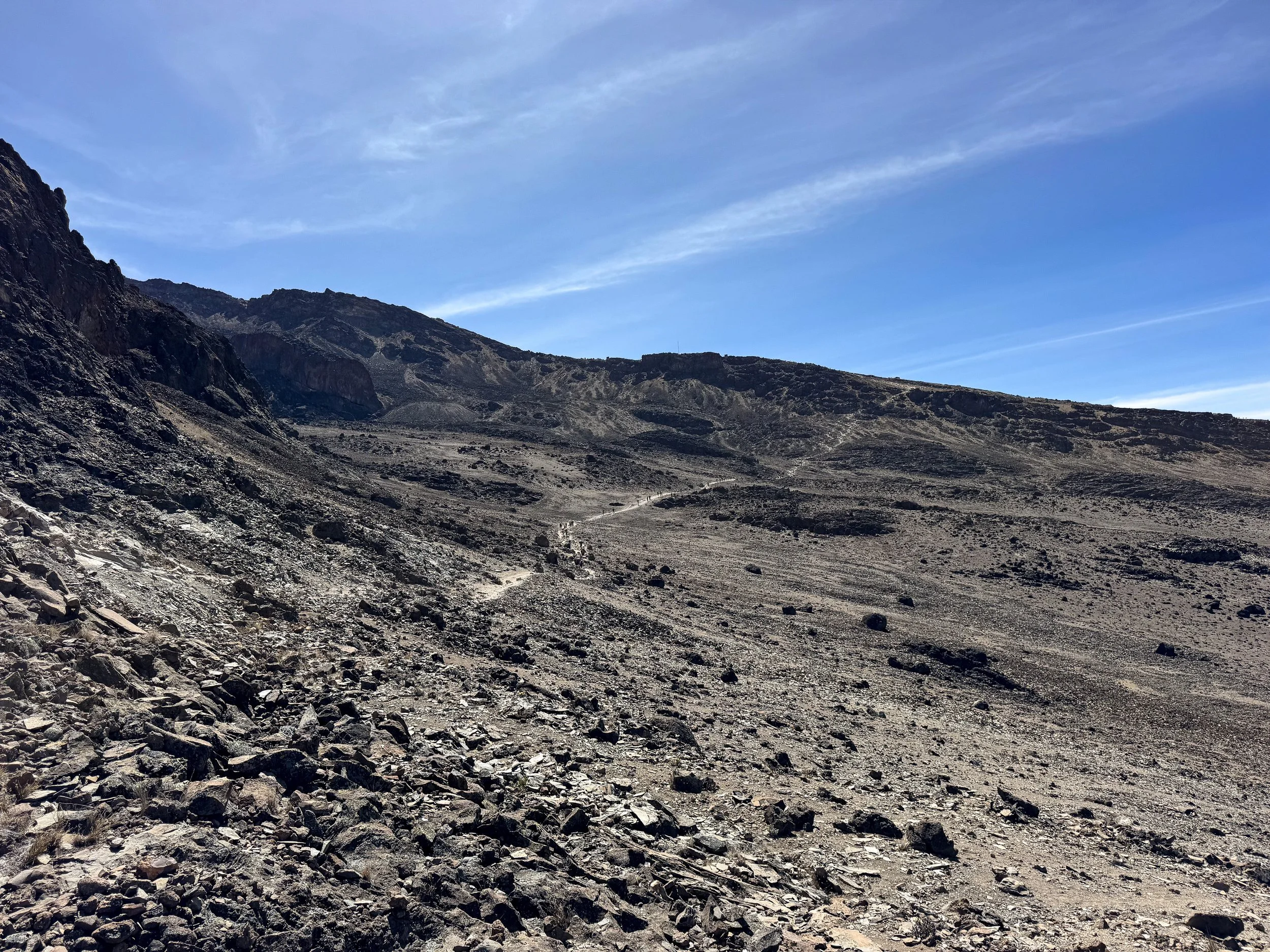
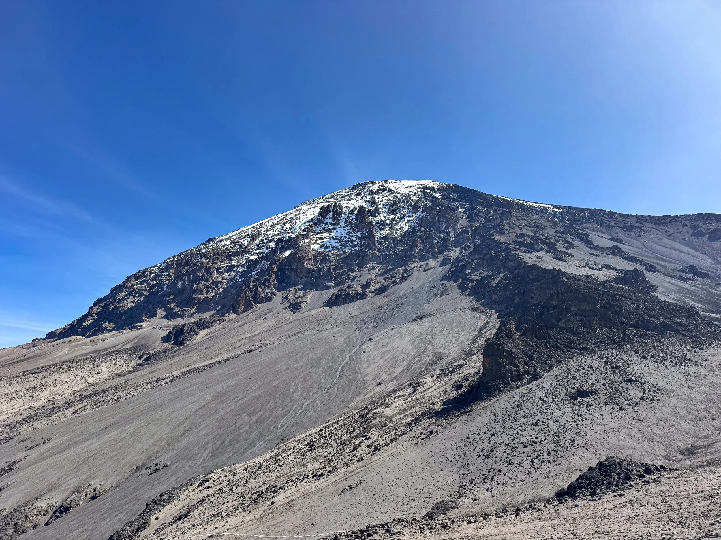
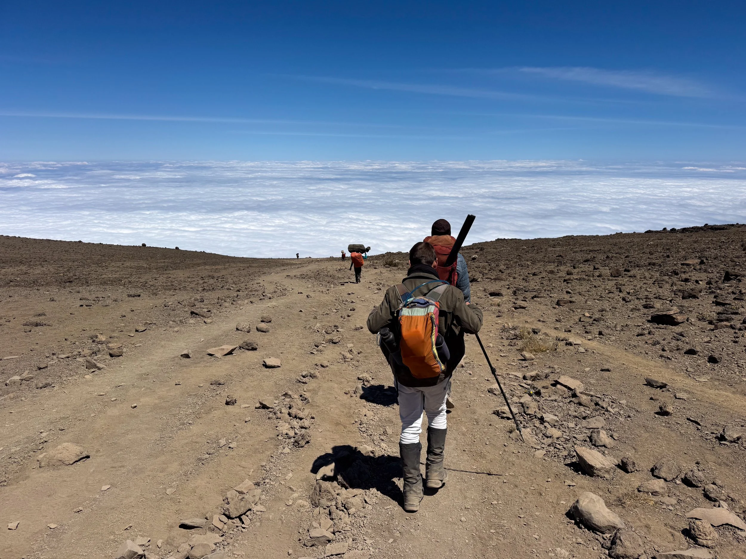
The Alpine Desert Zone. The trail lead higher in elevation to The Alpine Desert Zone, the fourth of five climate zones on the mountain. The terrain was dry, rocky and barren with little to no vegetation. We spotted a tiny Four Striped Grass Mouse scurrying between the rocks. The temperate became colder and the air noticeably thinner. The trail lead steeply uphill to The Lava Tower.
The Lava Tower. A jagged geological formation created by hardened lava that cooled inside a now eroded volcanic vent. At 4,600 meters (15,092 feet), it’s a key feature along the Lemosho Route and a high altitude campsite. Getting here was difficult due to the increased elevation, though necessary for acclimating.
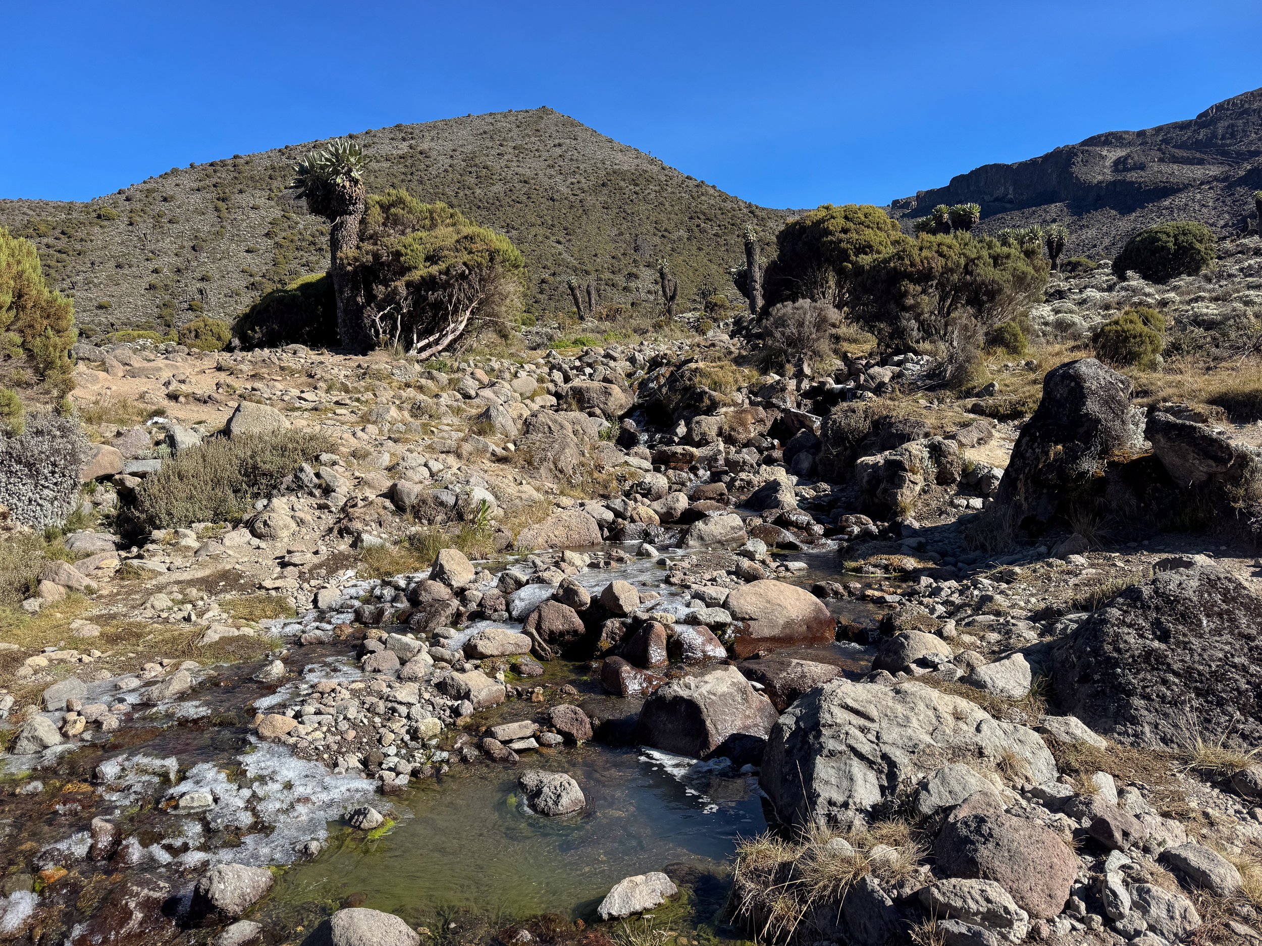
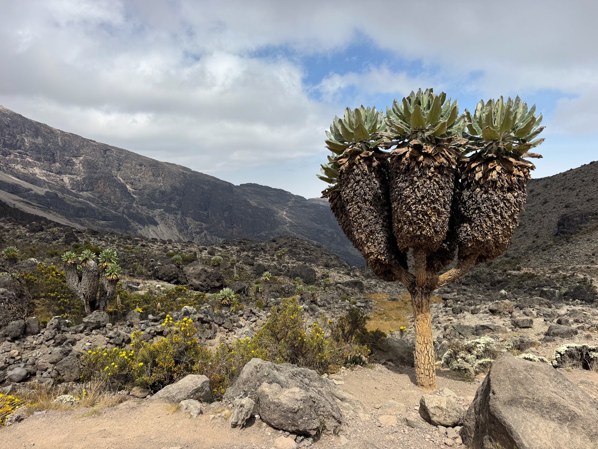
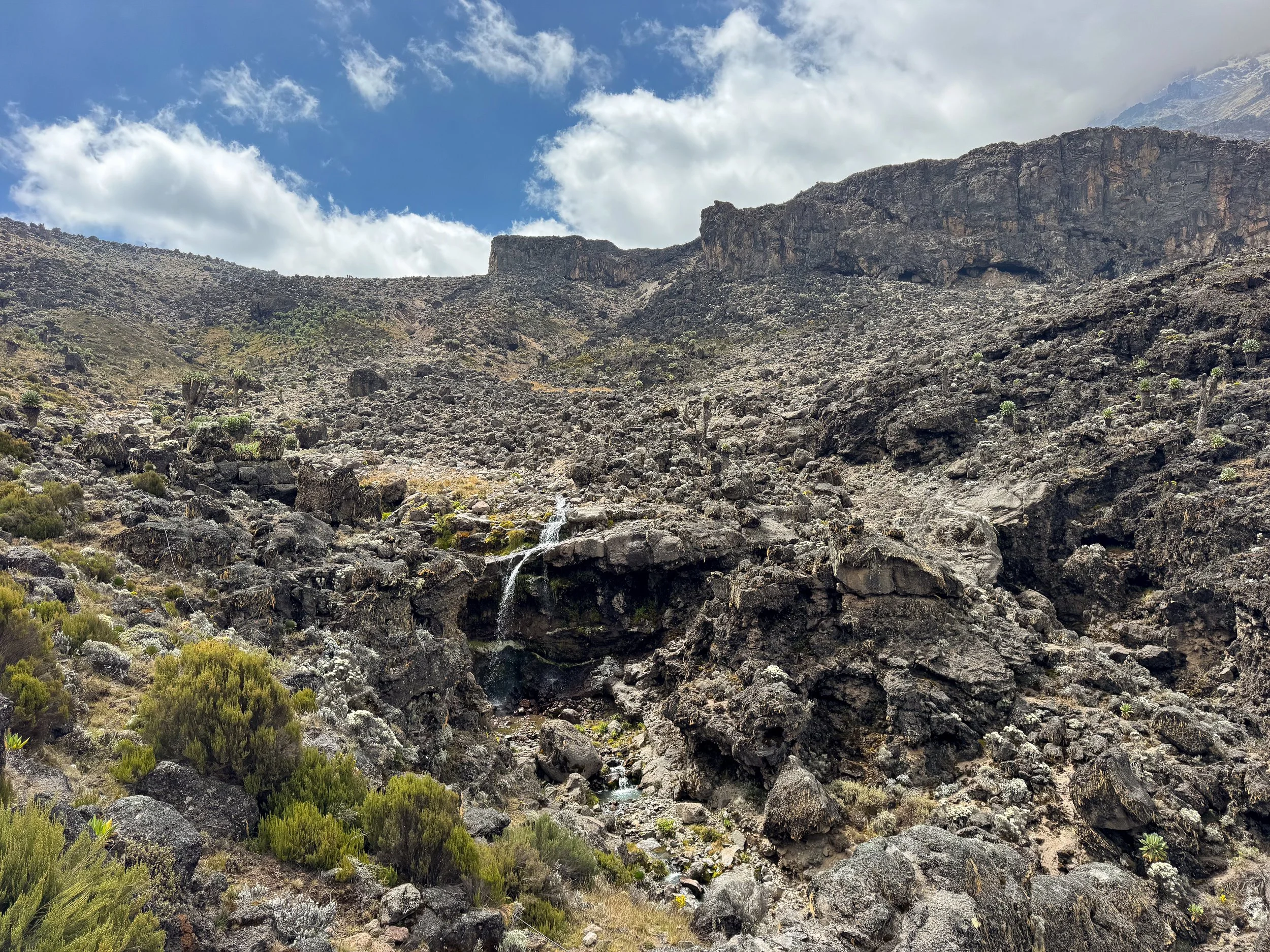
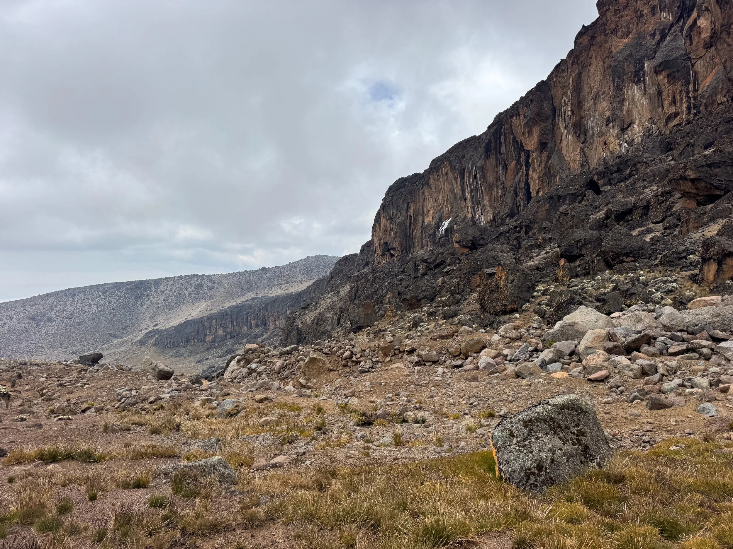
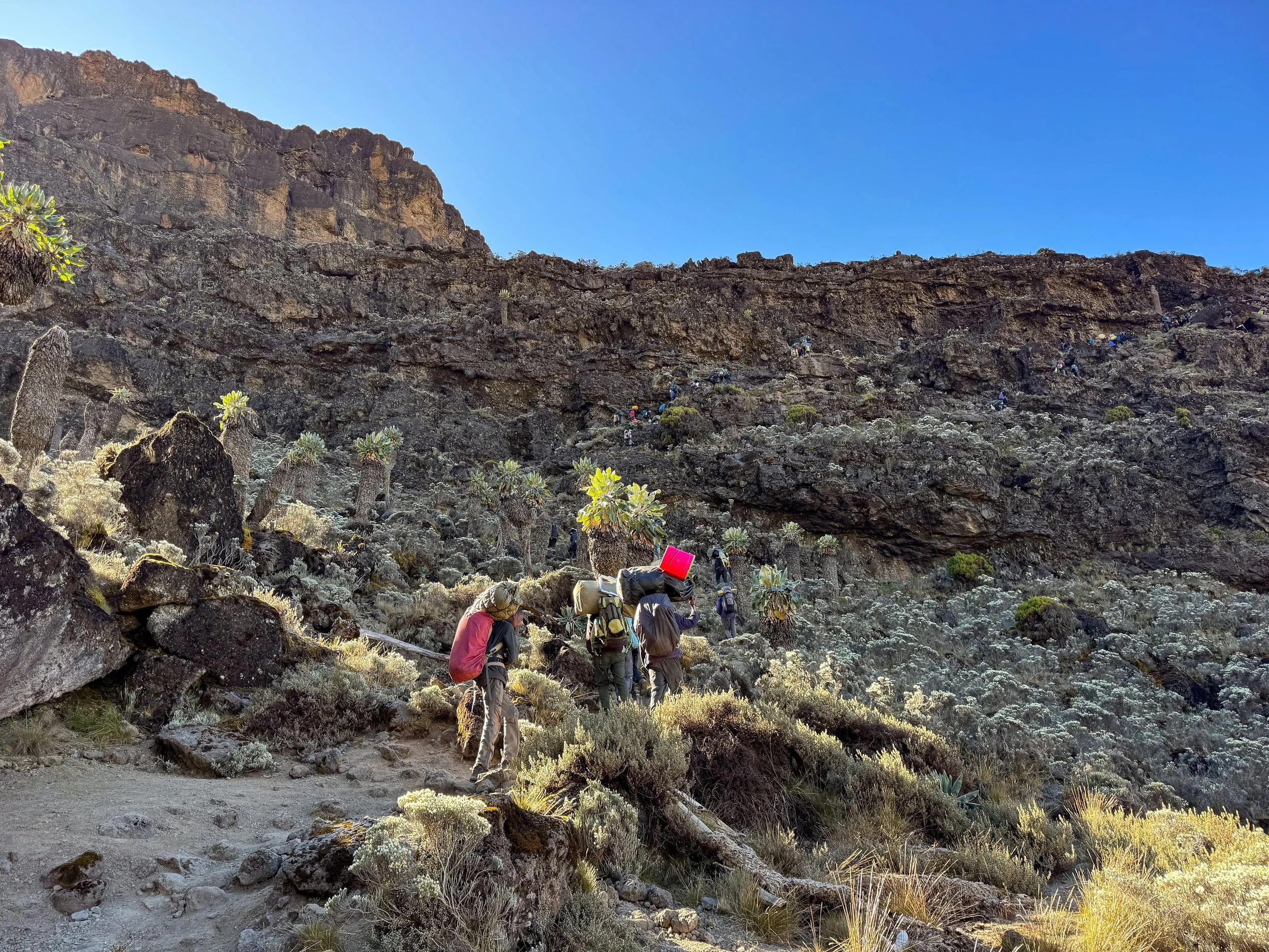
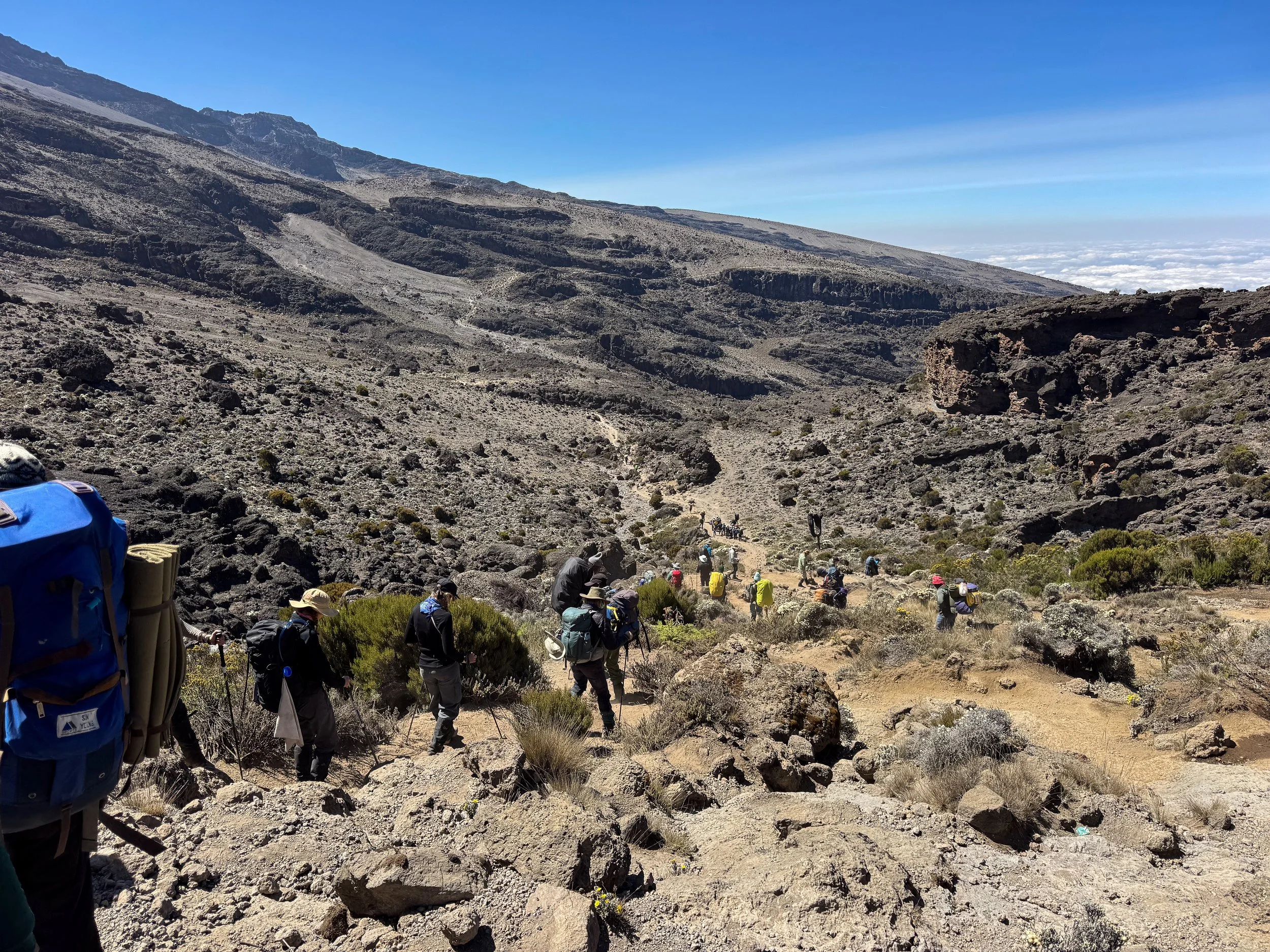
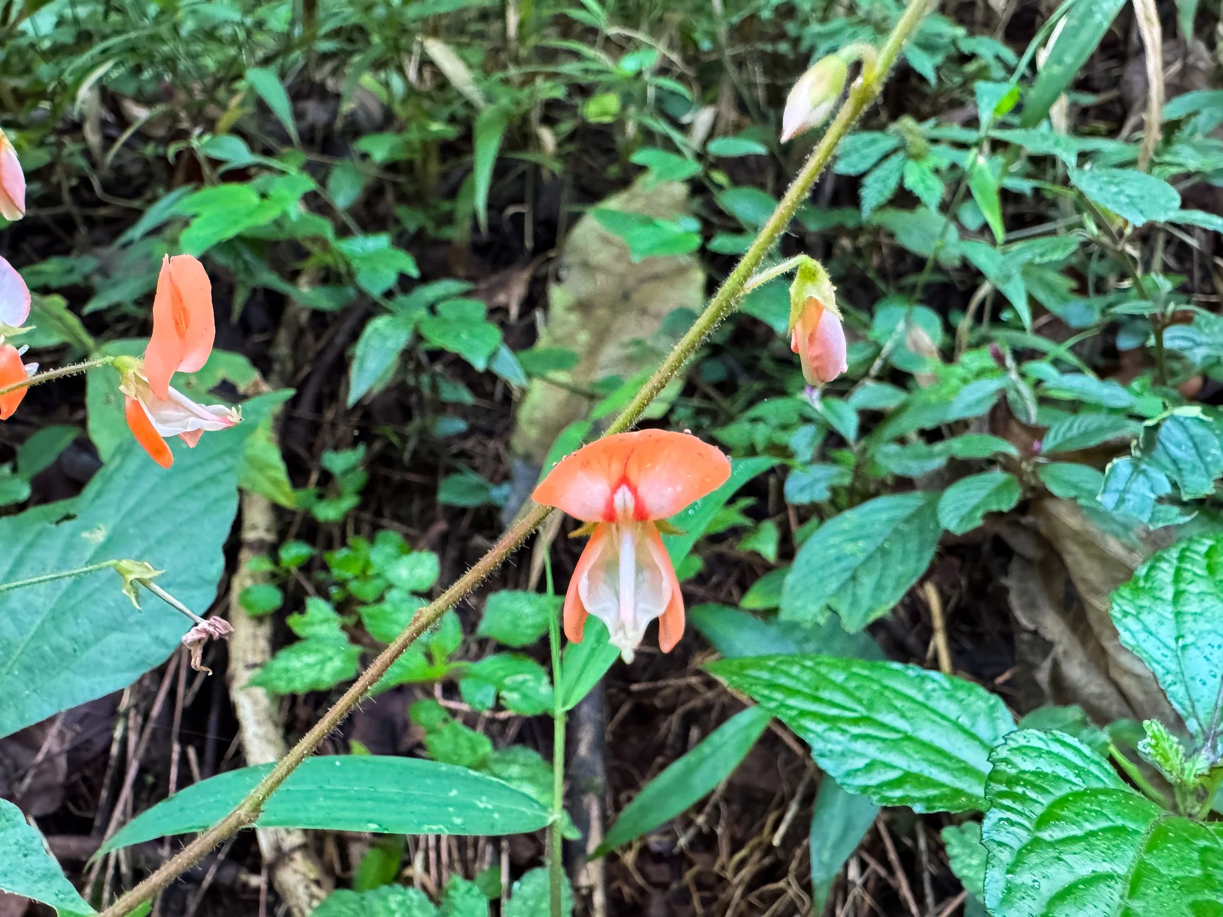
A Temporary Descent. The trail led us on a temporary descent from The Lava Tower, through The Alpine Desert and back into The Moorland. The path followed a partially frozen stream, past small waterfalls and into progressively lusher terrain. Colorful lichens covered boulders, green bushes sprouted from the hillside and flowers added color to the landscape. A grove of Giant Groundsels, grew from the riverside. They’re alien-like trees with a central trunk and bushy arms topped with green leafy flourish.
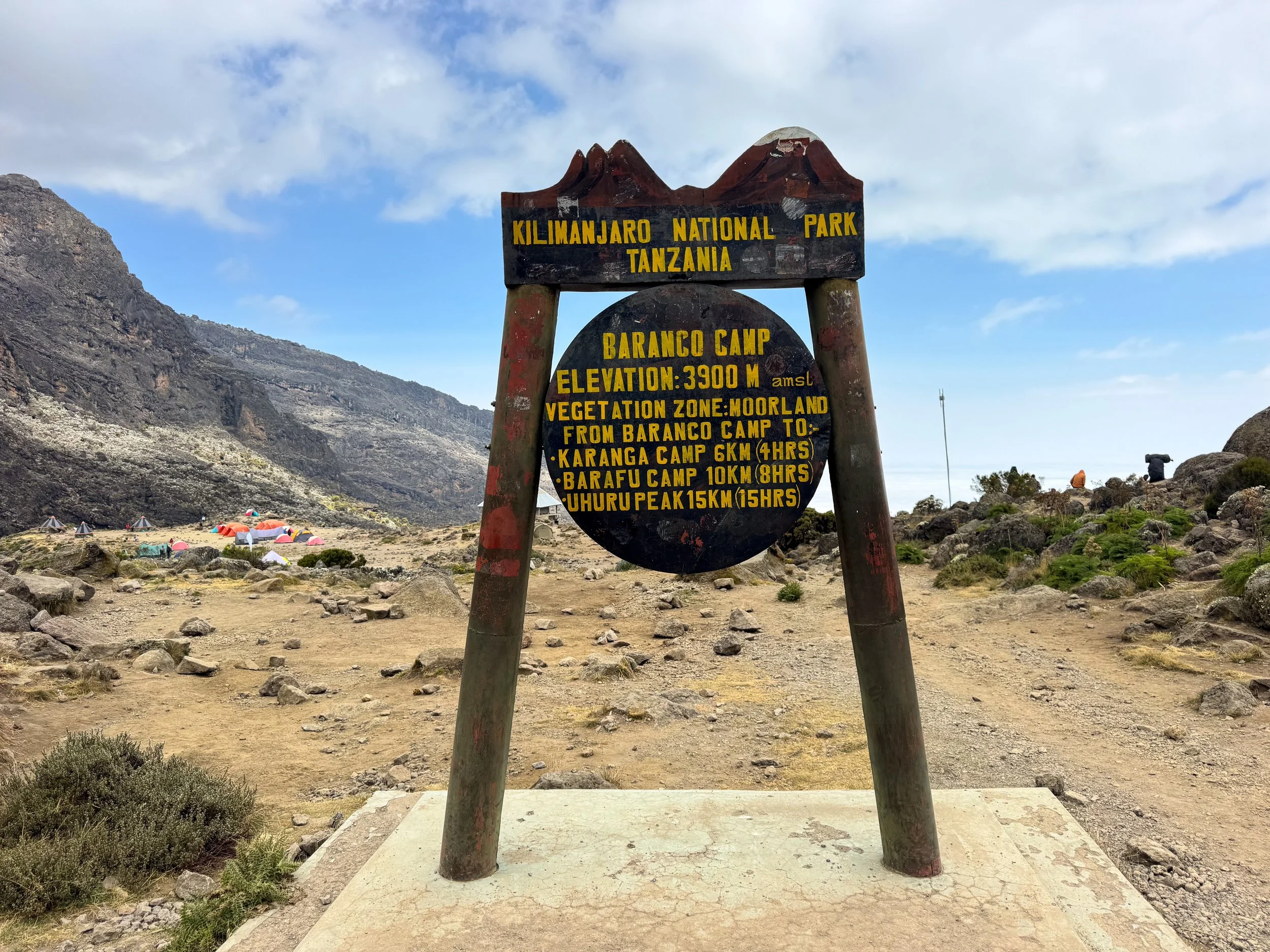
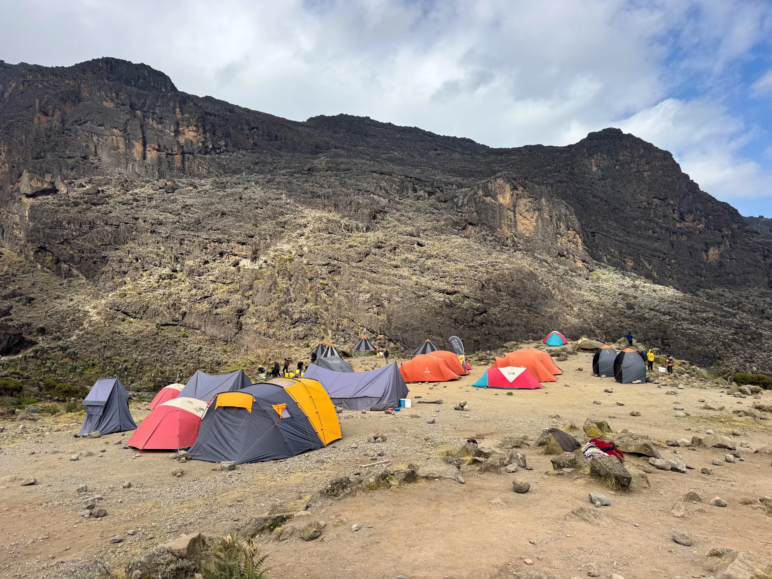
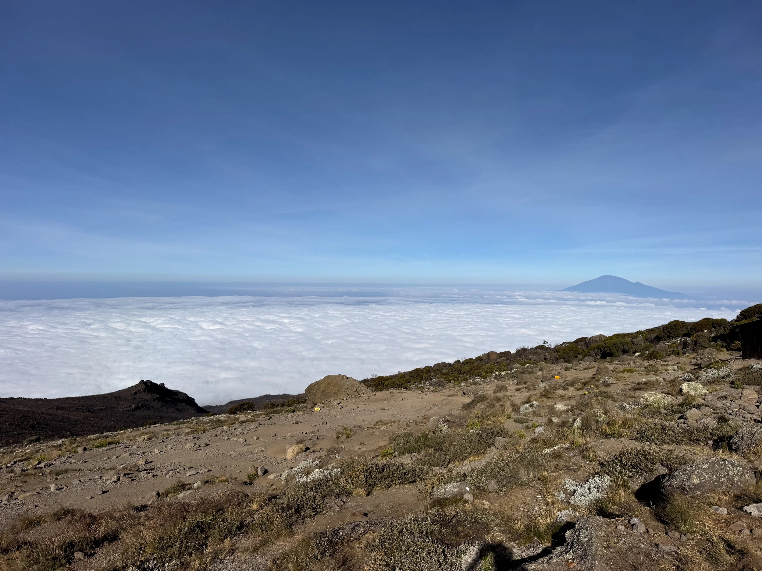
Baranco Camp. The trail led to the Baranco Camp, situated at an elevation of 3,900 meters (12,795 feet). It’s one of the largest camps on the mountain and a meeting point for multiple routes. A nomadic village of colorful tents, enthusiastic crews and optimistic hikers sprawl across the landscape. A sea of clouds parted to reveal the town of Moshi 3,200 meters (10,500 feet) below. We rested during the afternoon before dinner. The cook prepared Ndzi, a Tanzanian vegetable stew with plantains, sweet potato, green beans and onions served alongside Chapatti, an East African flatbread.
Day Four
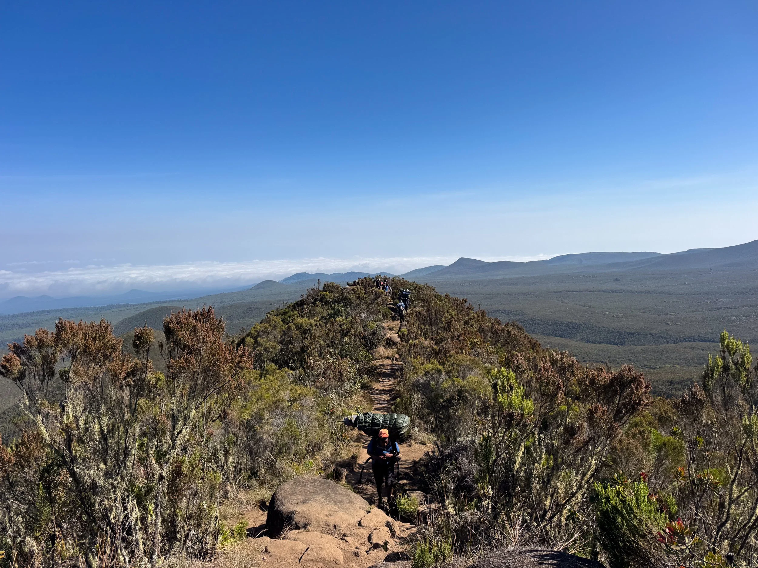
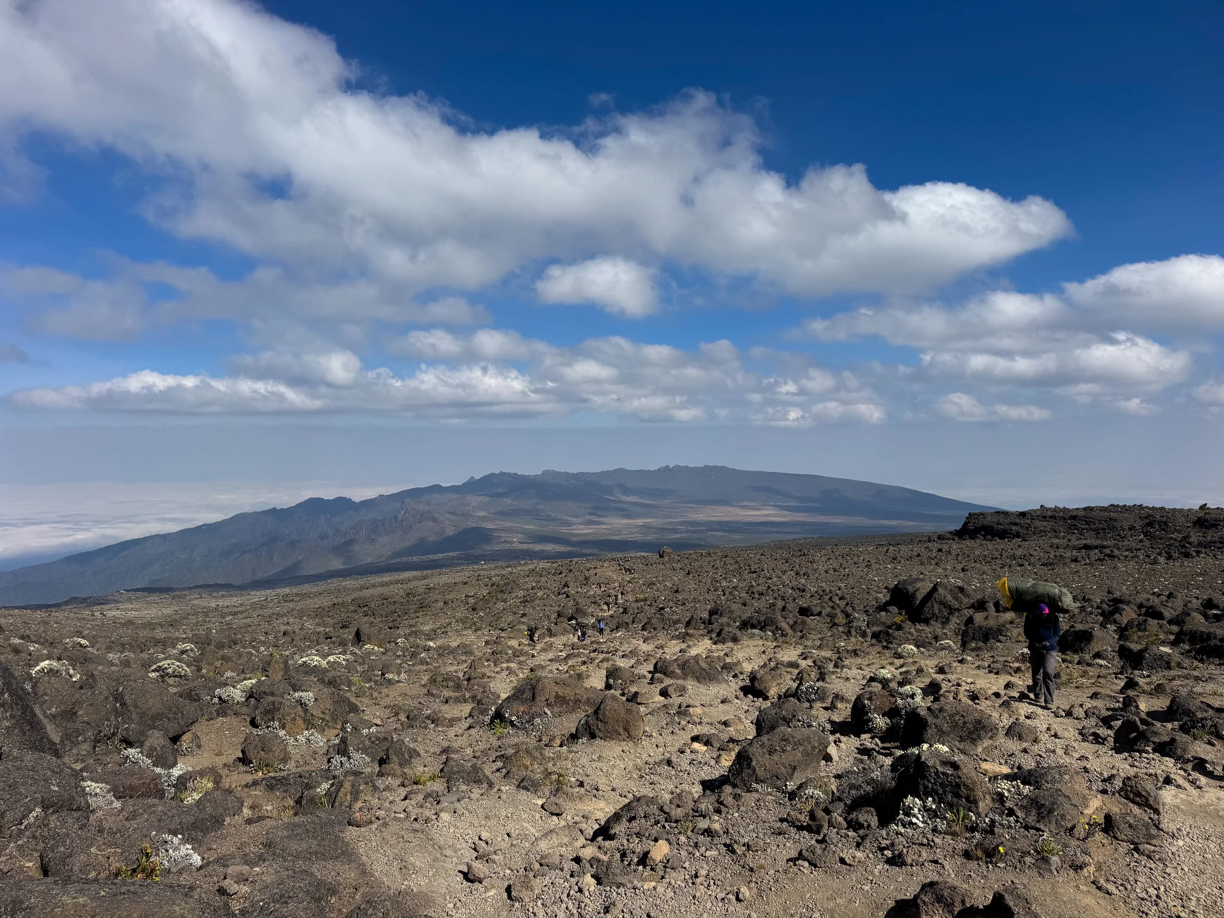
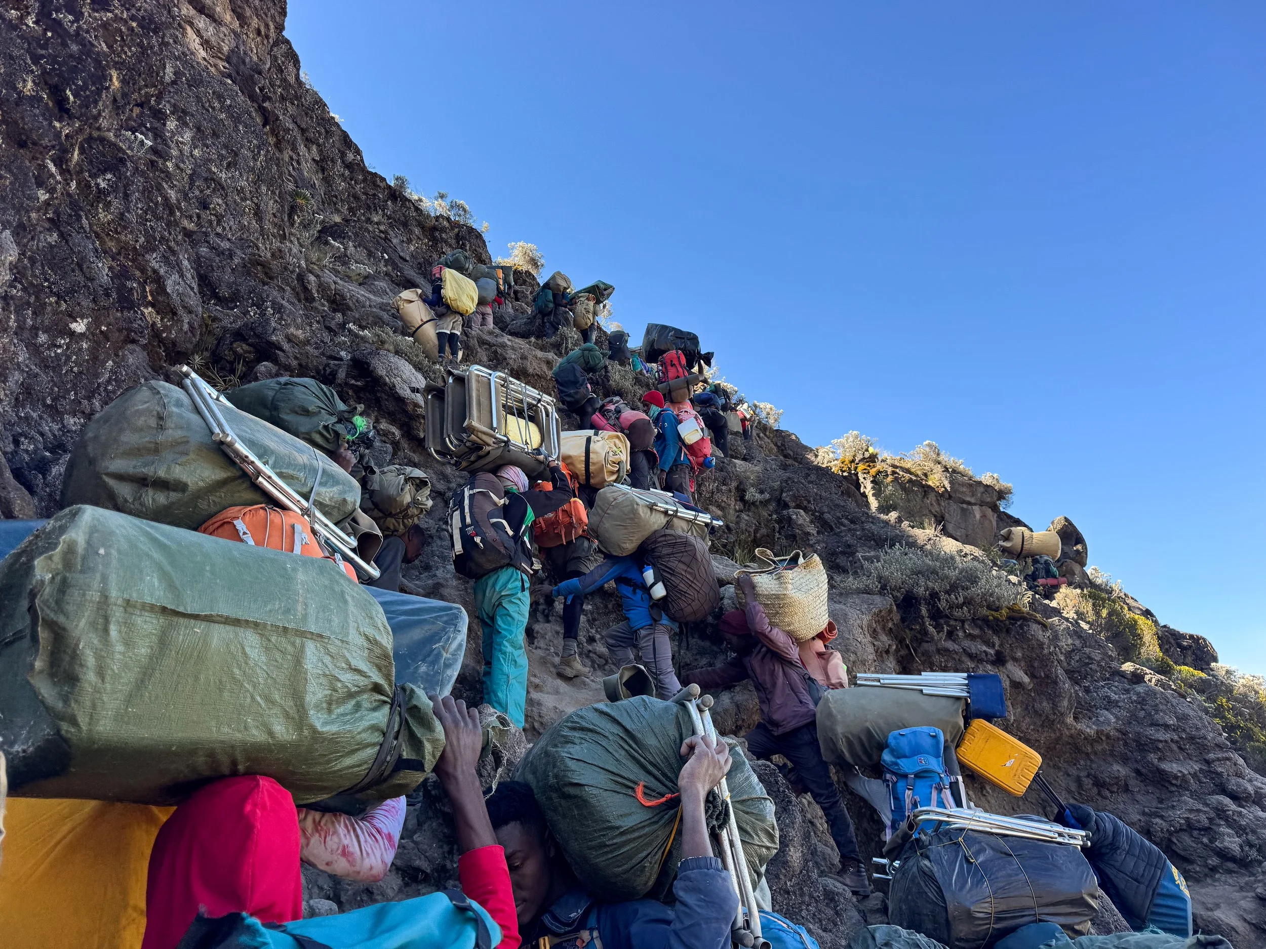
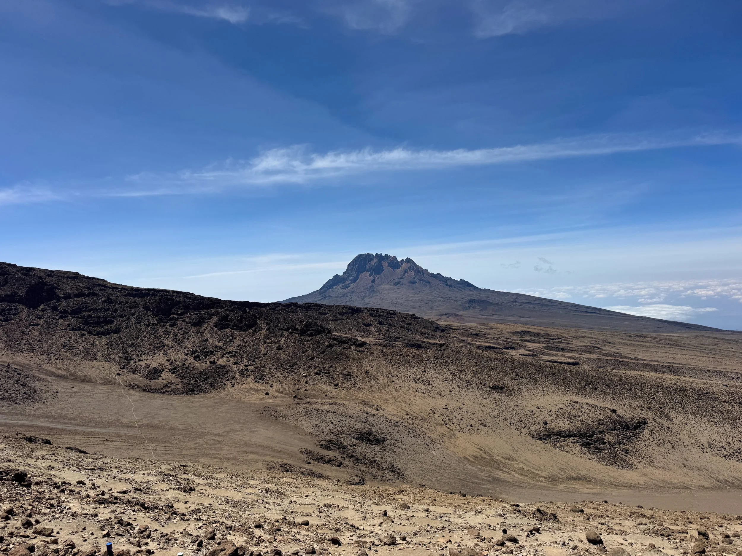
The Baranco Wall. The trail begins with a hike up the Baranco Wall, a steep rocky ridge just beyond the Baranco Camp. Hikers and their crews scale its 257 meter (843 feet) tall face. While steep, it doesn’t require any specialty equipment, only care and patience. The top of the wall has panoramic views of Mt. Kilimanjaro’s ice capped summit, the cloud covered lowlands and distant silhouette of the Meru Volcano. The trail continues 6km further through a series of scenic valleys to The Karanga Camp.
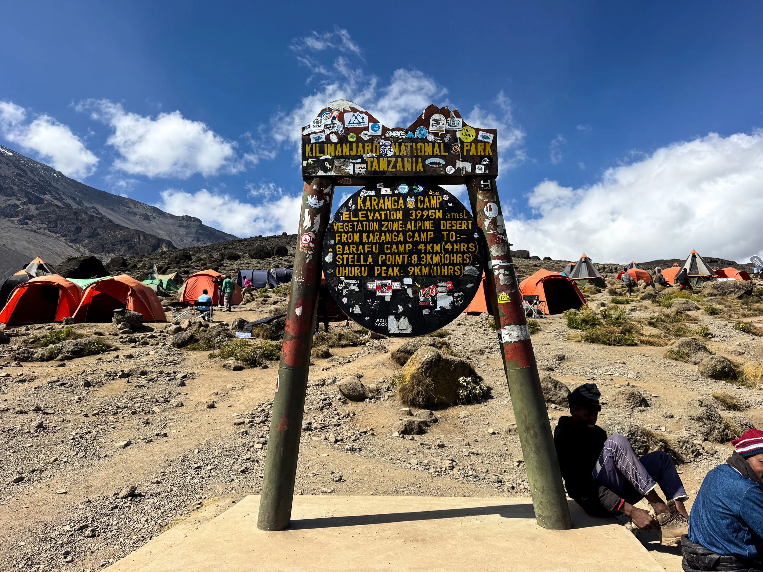
The Karanga Camp. The final camp before Mt. Kilimanjaro’s Base Camp. It resides at 3,995 meters (13,107 feet), similar in elevation to the past two camps. Us and our crew reached the camp by the early afternoon. We walked up the camp’s ridge to help with further with the acclimatization. The exposed location down slope from the glacial summit makes the camp cold, especially at nighttime.
Pro Tip. Stuff tomorrow’s clothes inside your sleeping bag at night to warm up before changing in the morning. Thanks mom!
Day Five
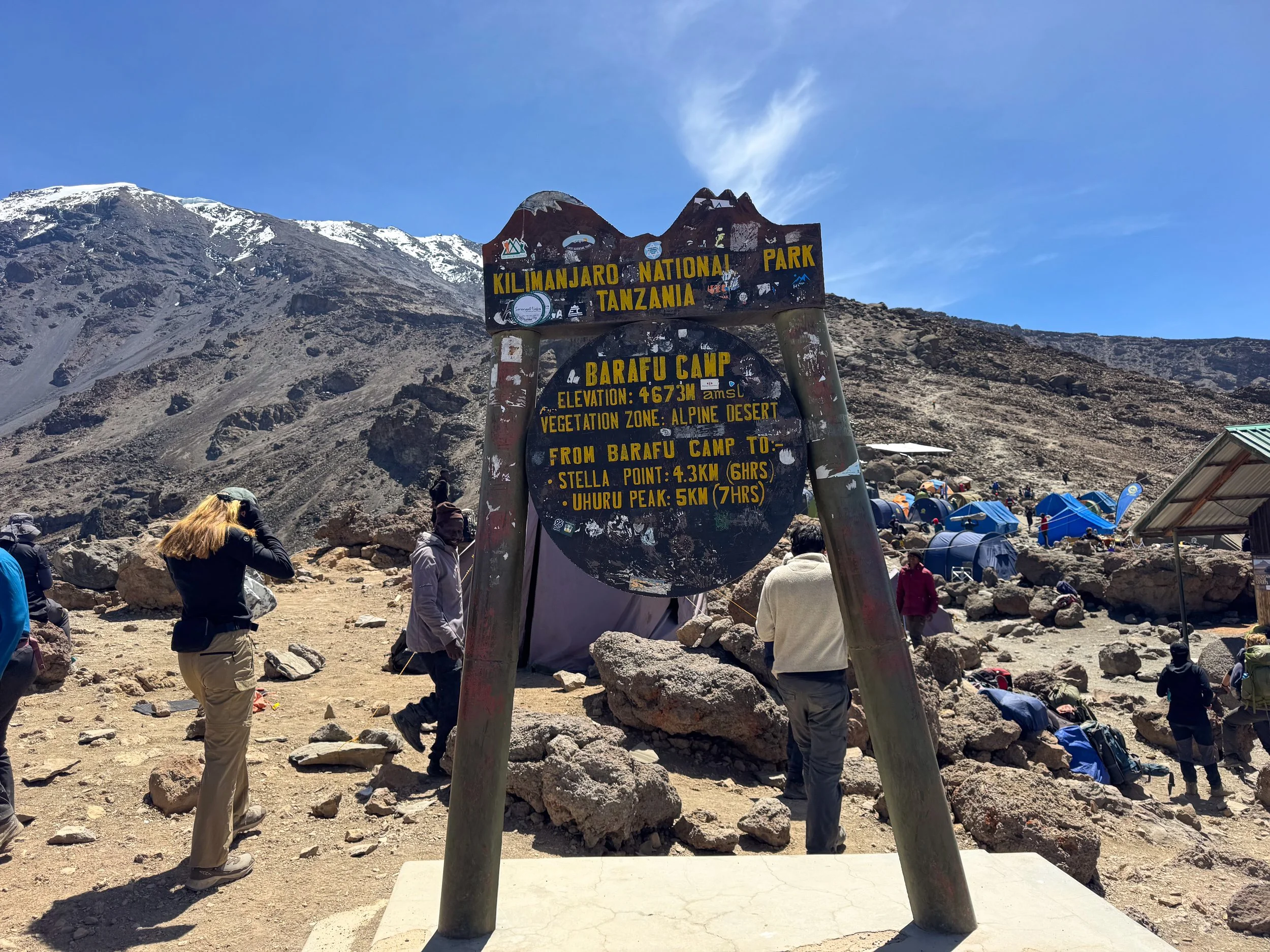
The Hike to Base Camp. Day 5 began with our assent to The Barafu Camp, Mt. Kilimanjaro’s Base Camp. We hiked 4km across the dry and aired terrain of The Alpine Desert. Slate rocks creaked like broken pottery beneath our feet. The snow covered peak of Mt. Kilimanjaro towered ahead. We reached the camp four hours later.
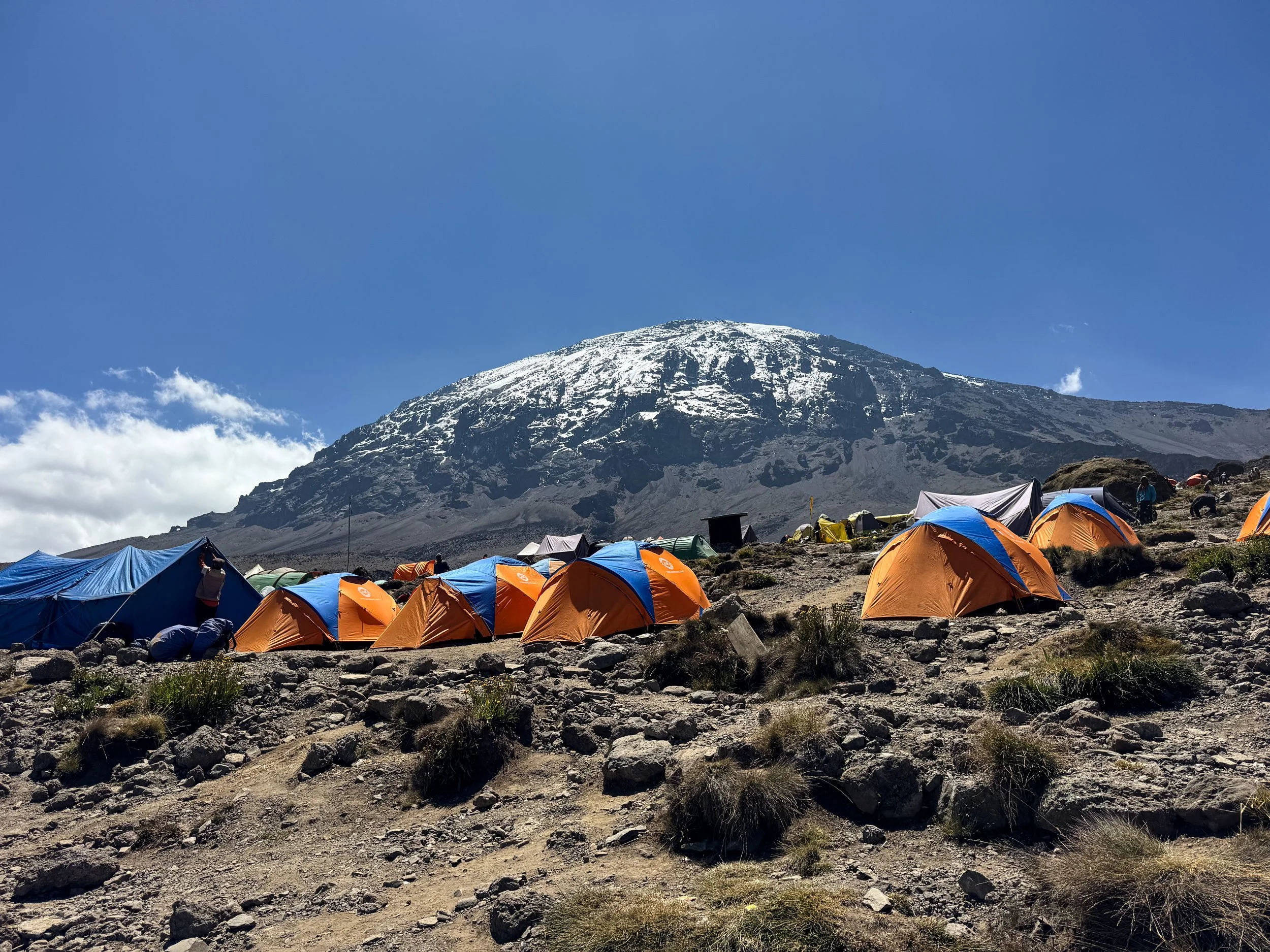
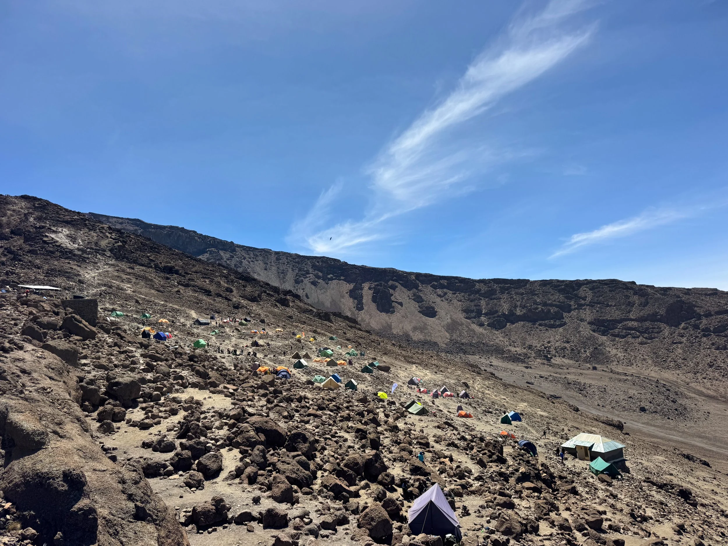
Barafu Camp. Barafu translates to “Ice” in Swahili. It’s a cold place, located at an elevation of 4,673 meters (15,331 feet). Tents covered the rugged mountain side. We sat outside of ours, peering across the mountain’s saddle towards the jagged Mawenzi Peak, the third highest in Africa. The cook prepared vegetable soup, fried fish and savory potato pastries stuffed with veggies for lunch. We spent the remainder of the afternoon and evening relaxing and acclimating.
Day Six
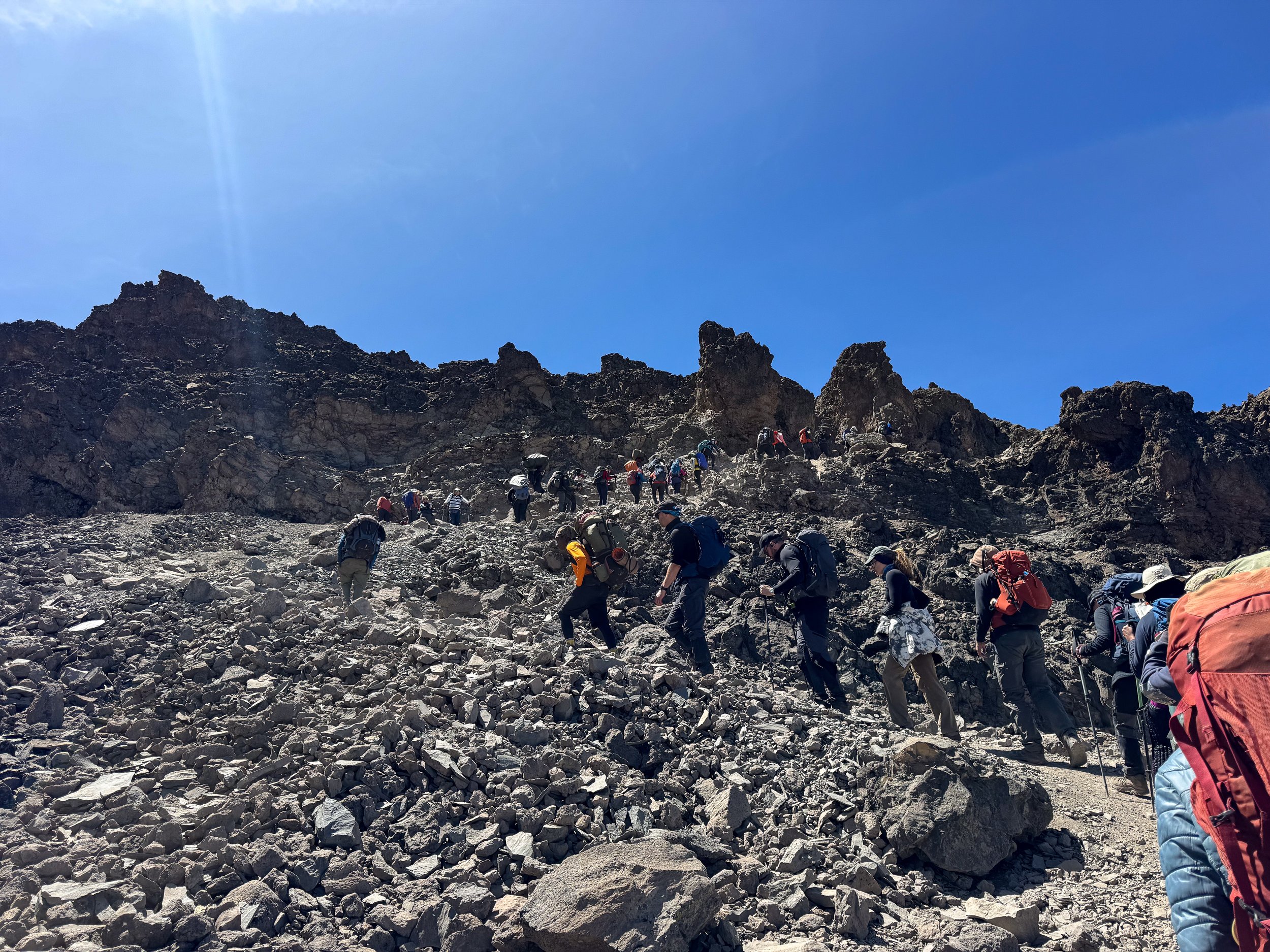
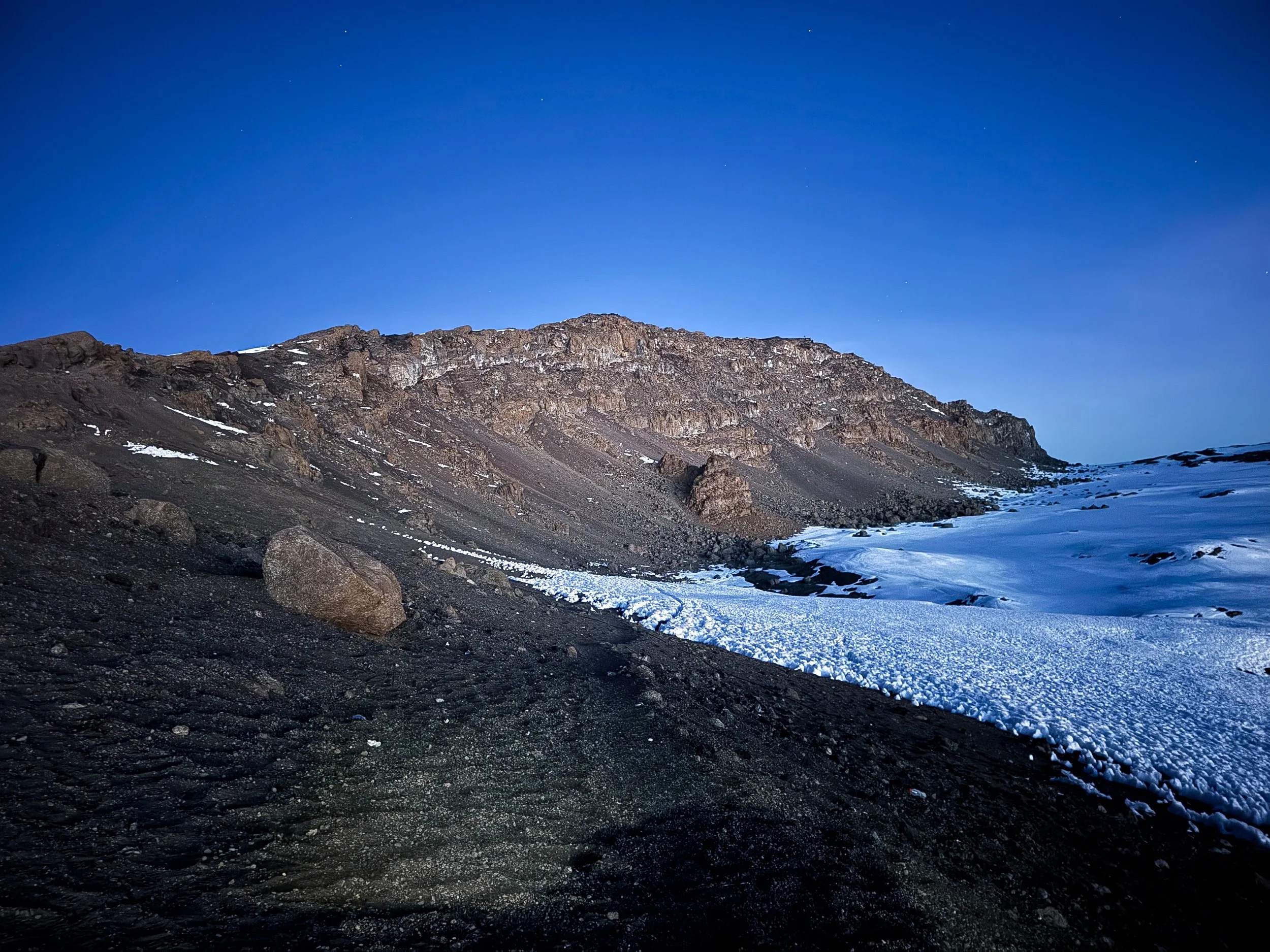
Midnight Hike to The Summit. The hike to the summit began at midnight. Our guides led us uphill along steep winding trails through the dark of night. Rocks, dust and fine gravel crunched beneath our feet. The stars spanned the night sky, twinkling brightly overhead. Ice and snow banks appeared the further we hiked. Guide erupted into spontaneous songs offering encouragement to those along the trail.
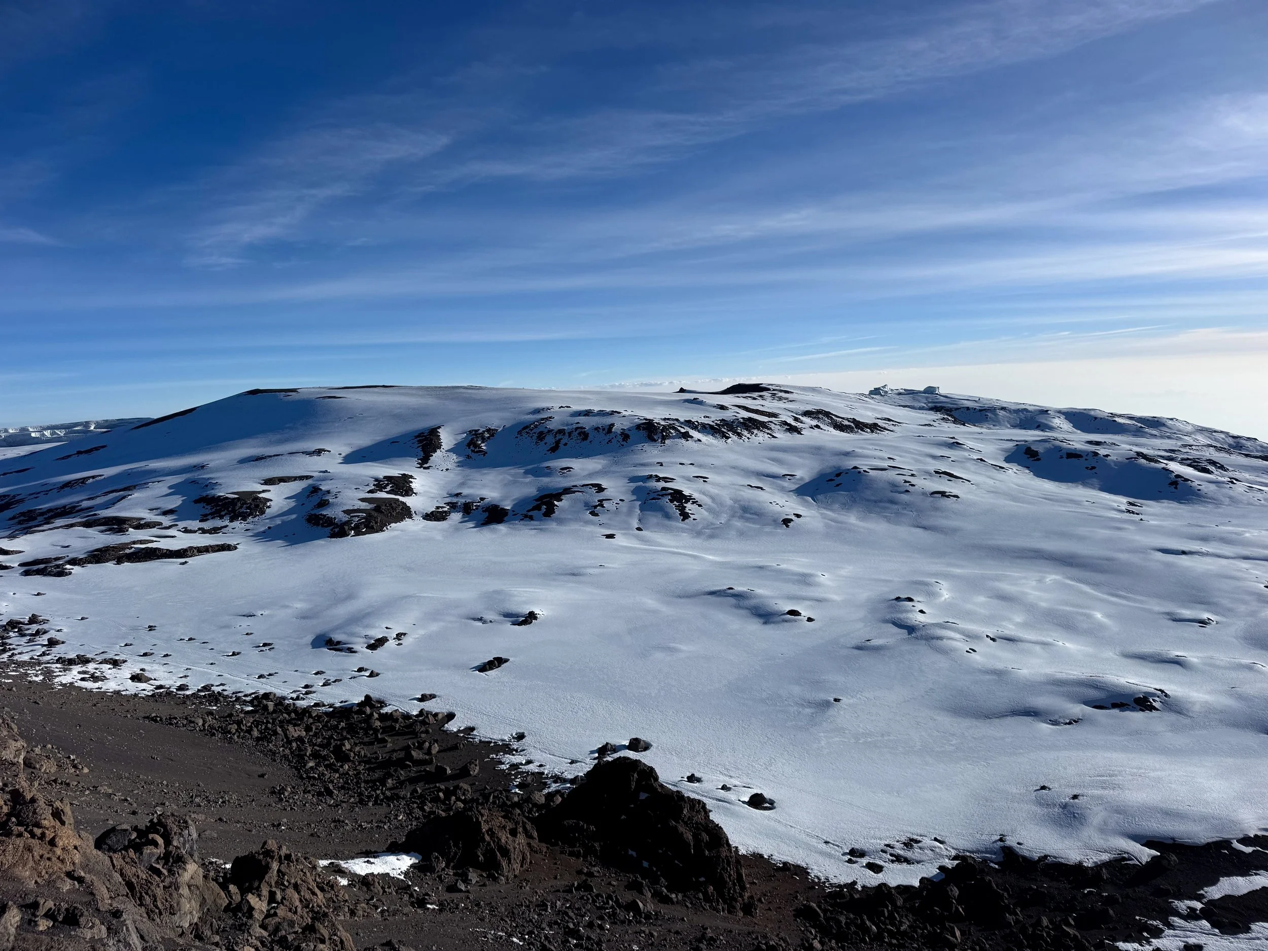
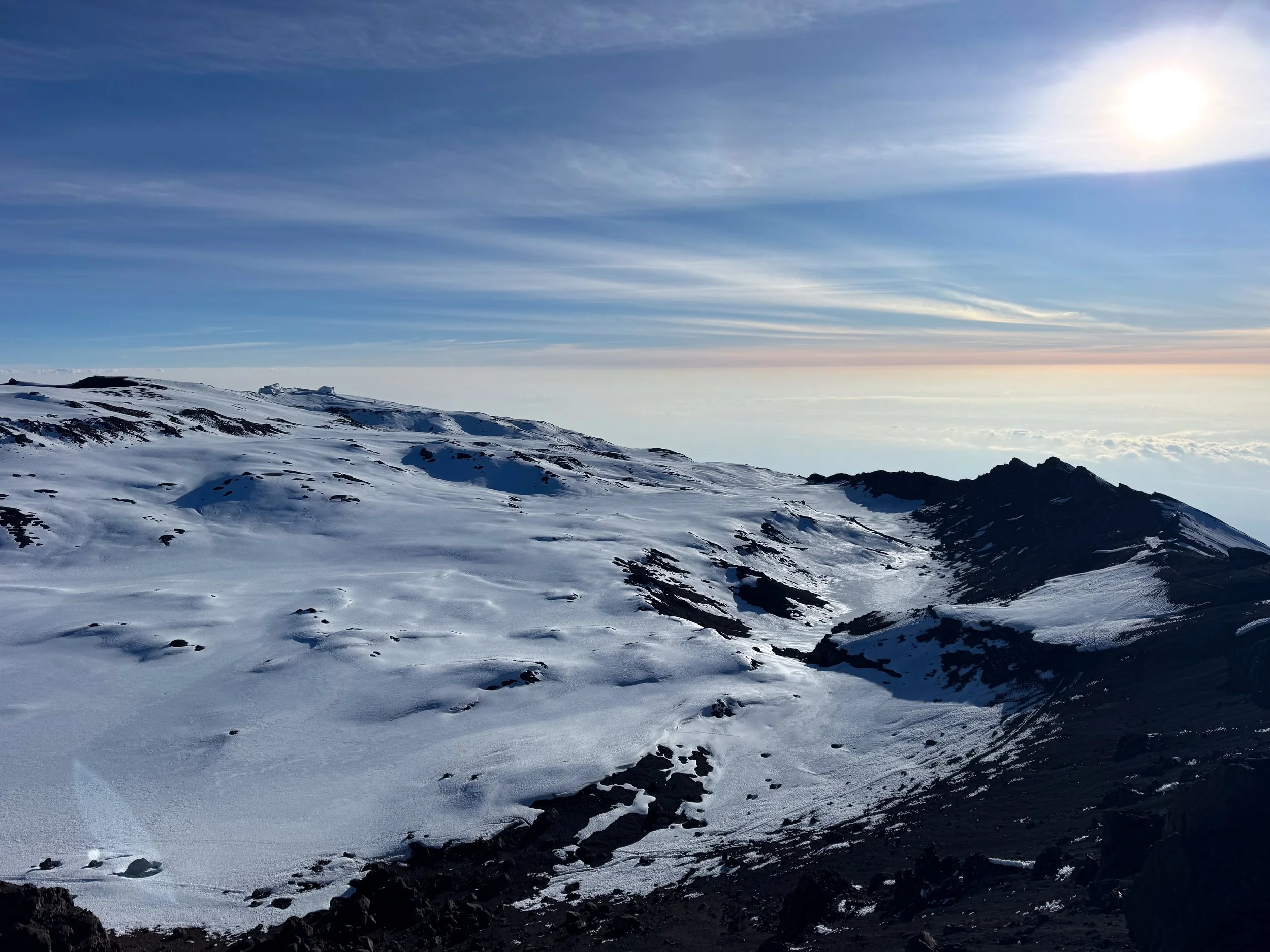
The Arctic Zone. The trek to the summit brought us into The Arctic Zone, the fifth of five climate zones on the mountain. It’s characterized by subzero temperatures, snow covered terrain and icy glaciers.
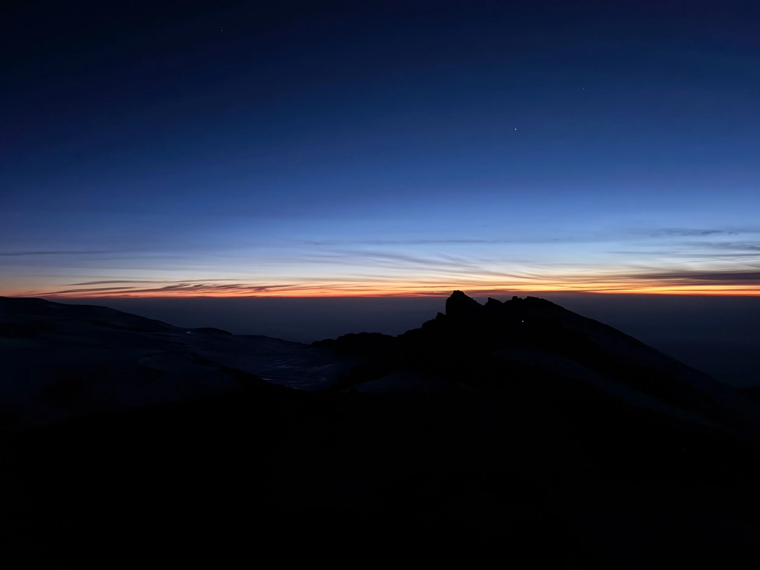
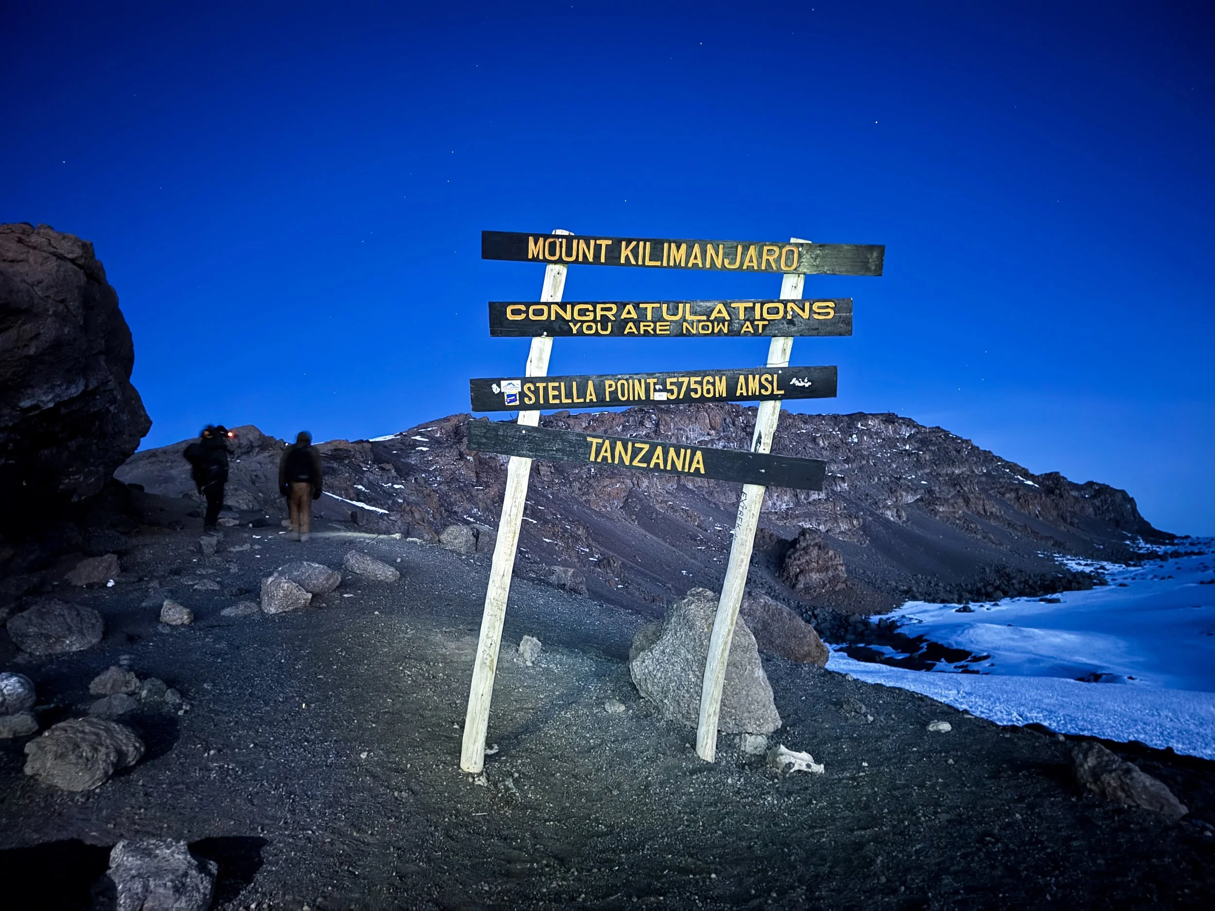
Stella Point. Daylight began to break 6 hours into our hike. The scarlet hued sunrise cast a warm glow over the cold and barren landscape. It was at the same time that we reached Stella Point, a lower peak below the main summit. It stands at 5,756 meters (18,885 feet).
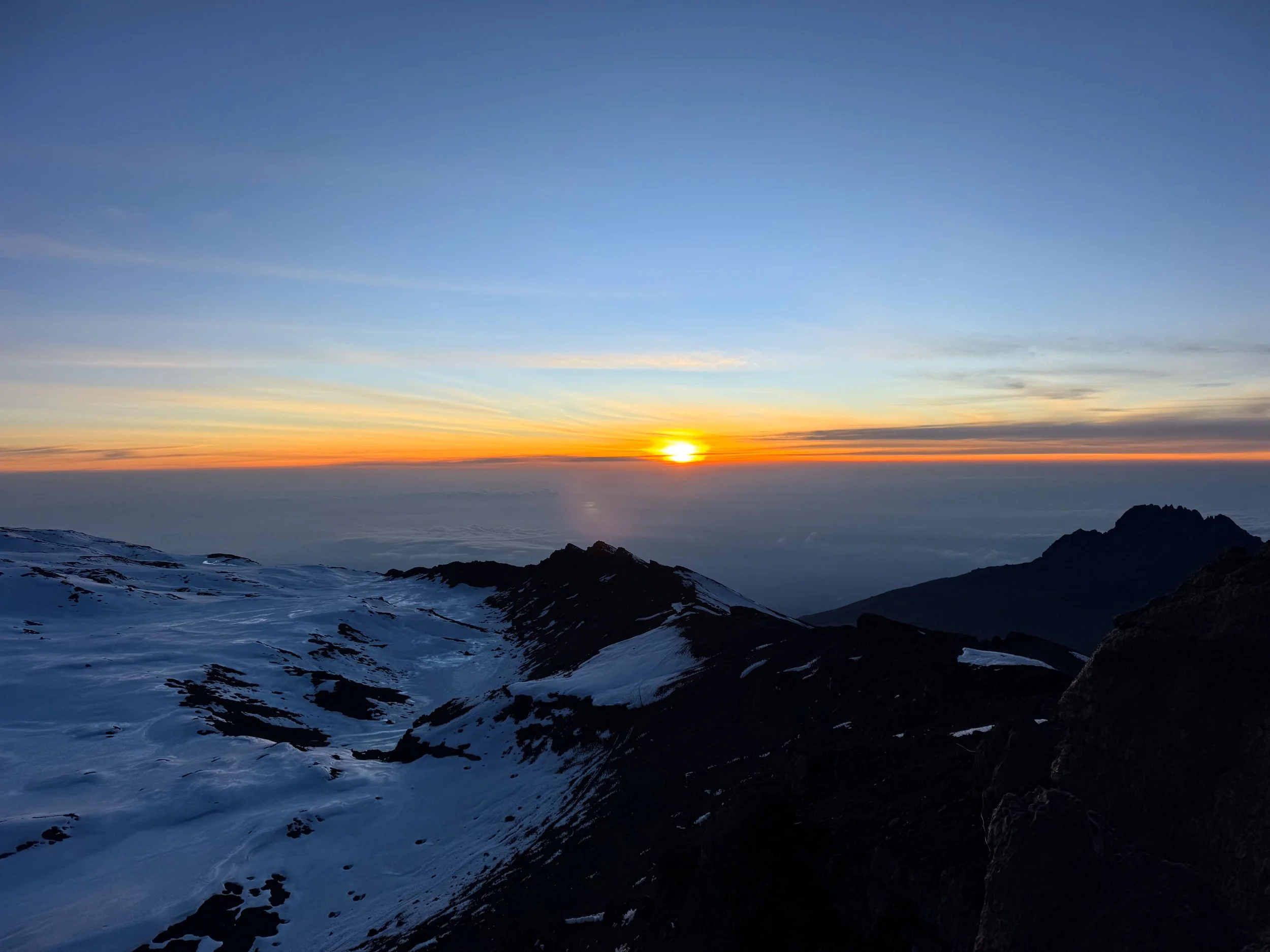
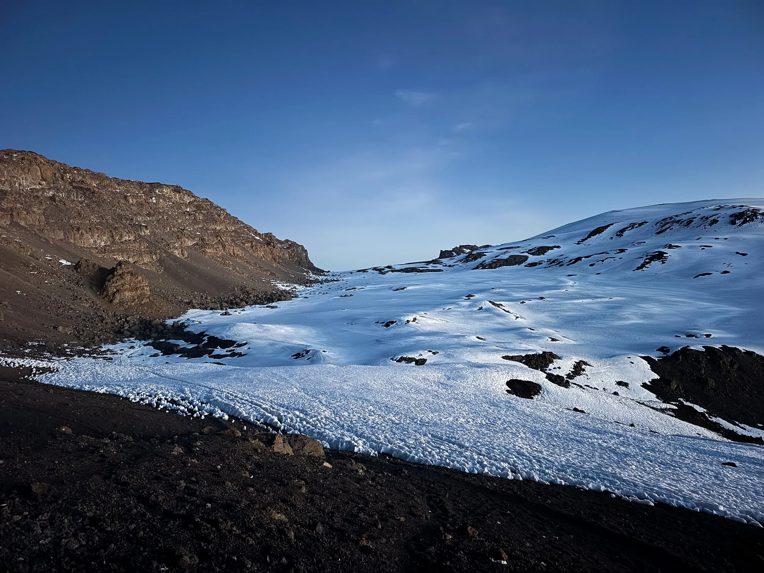
The Trail to the Summit. The trail continued one hour past Stella Point. Though relatively flat, the distance in between was the treacherous for many hikers suffering altitude sickness. Black lava rocks and glossy obsidian contrasted the white Arctic landscape. Icy pinnacles flanked the trail, glaciers hugged the slopes and snow blanketed the crater.
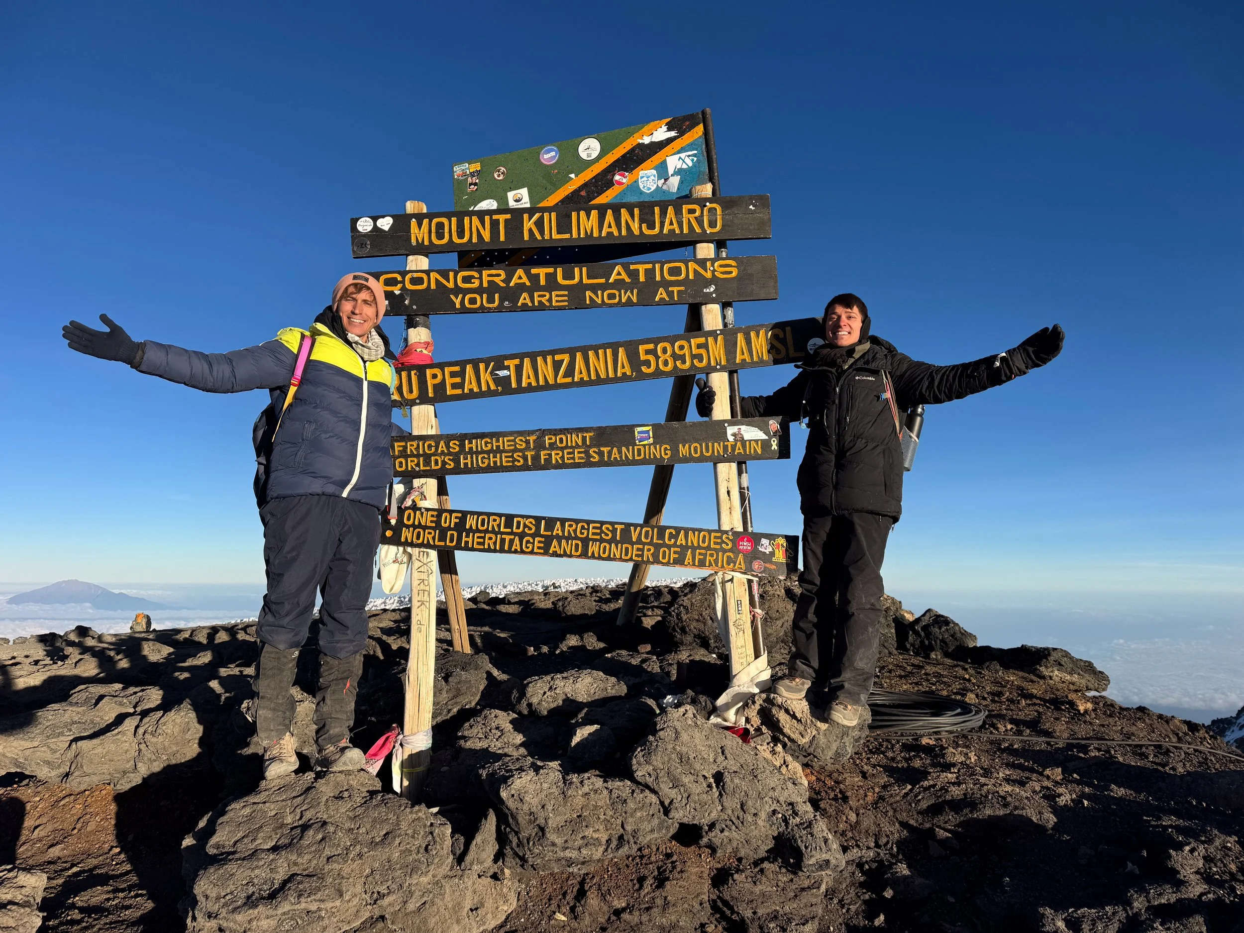
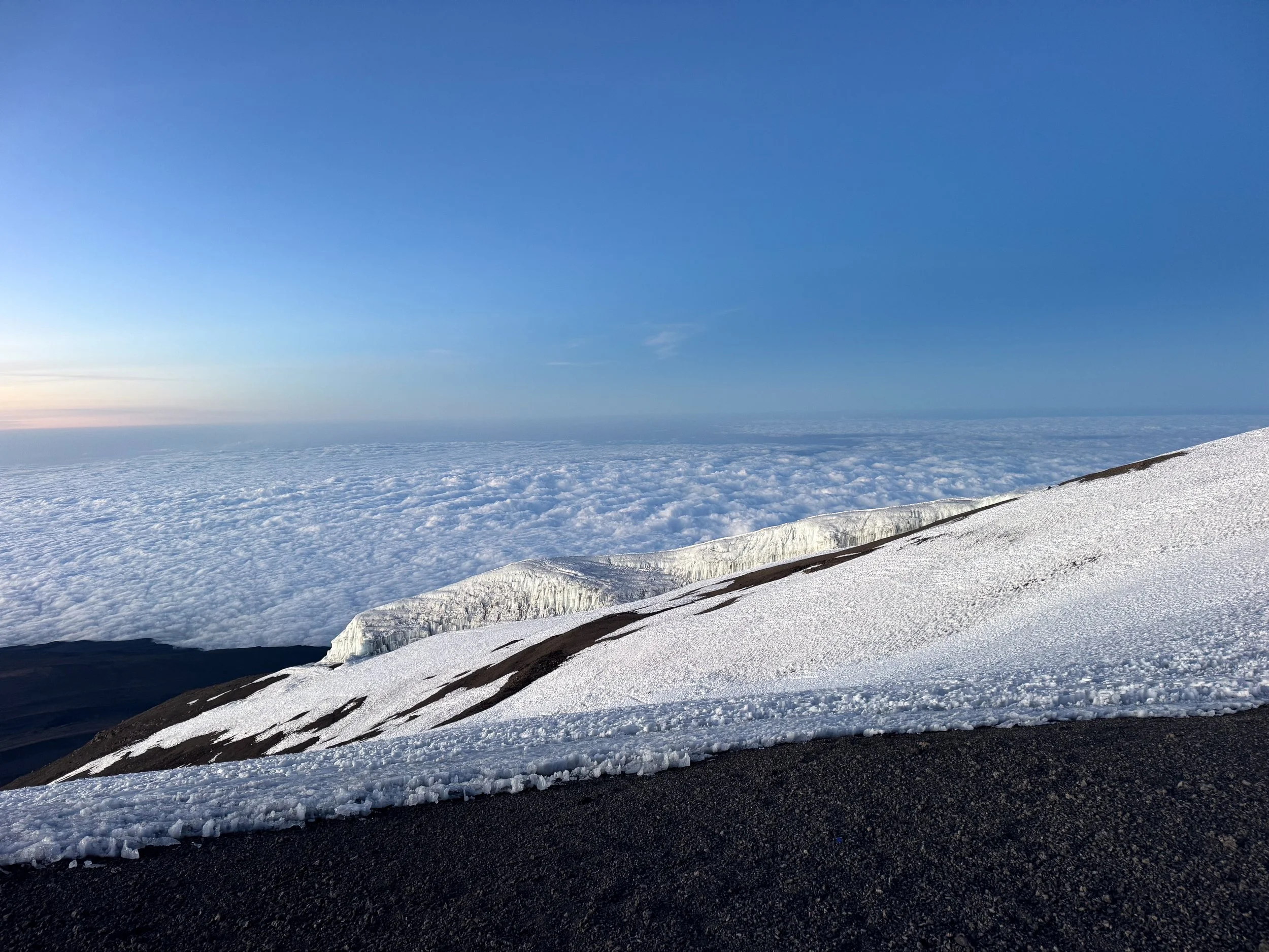
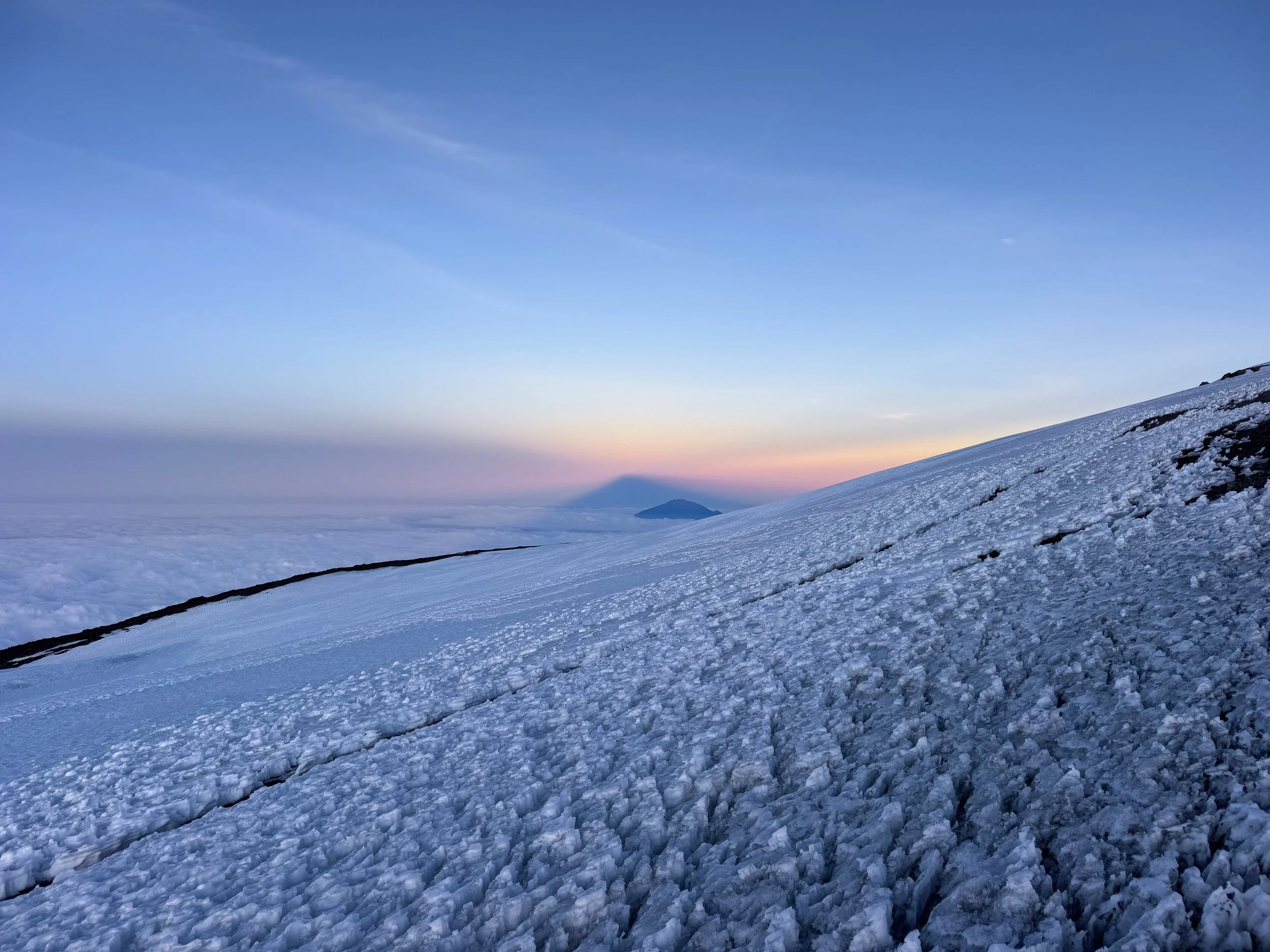
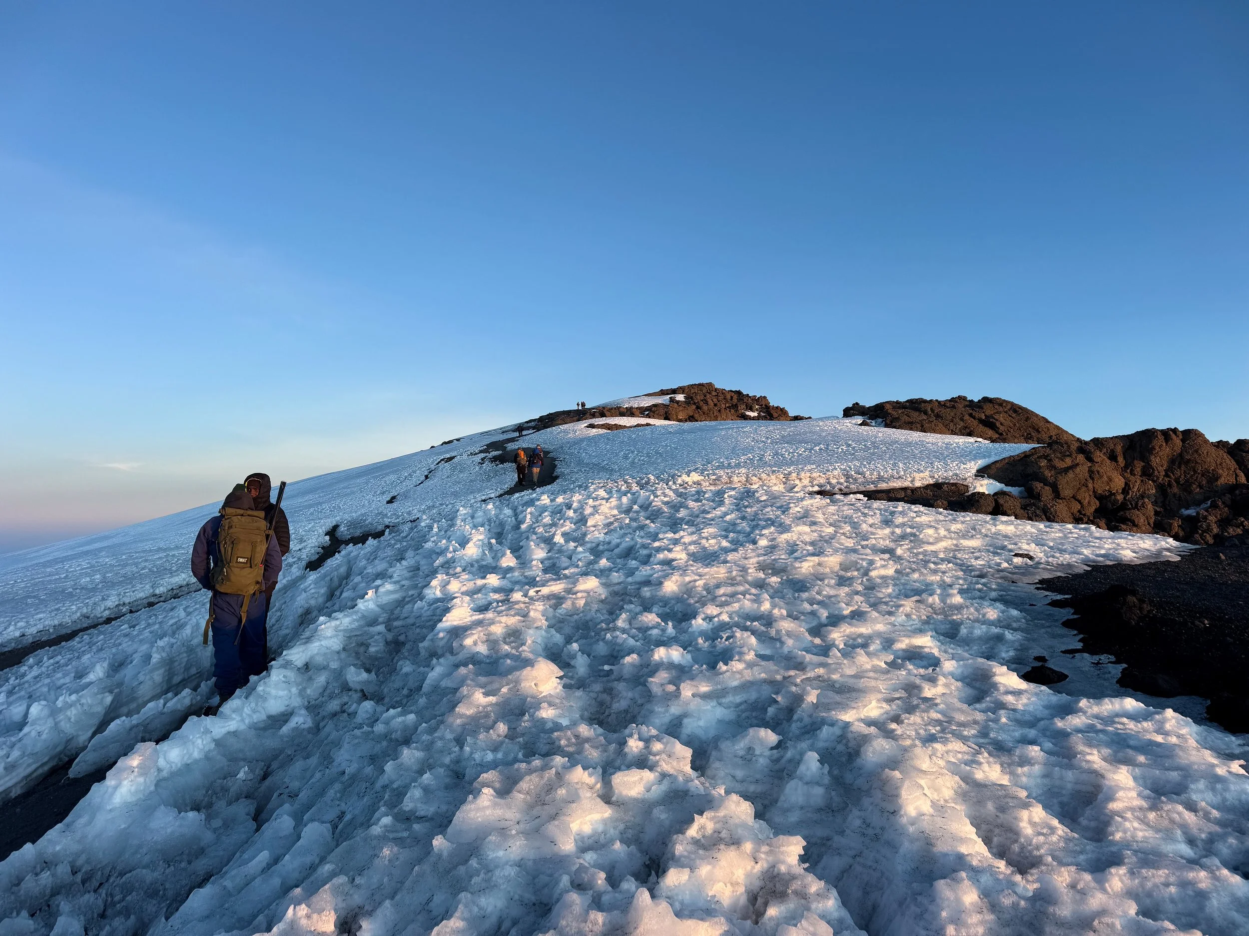
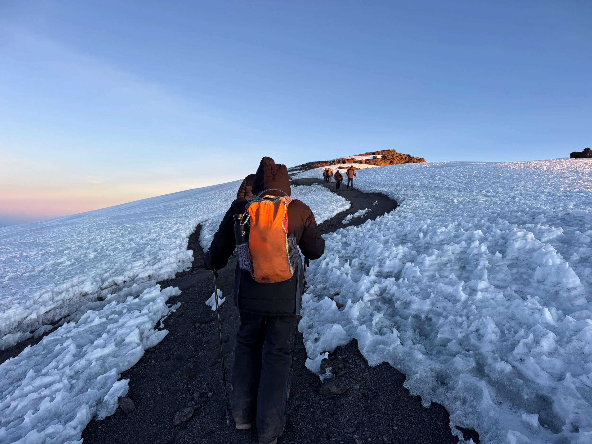
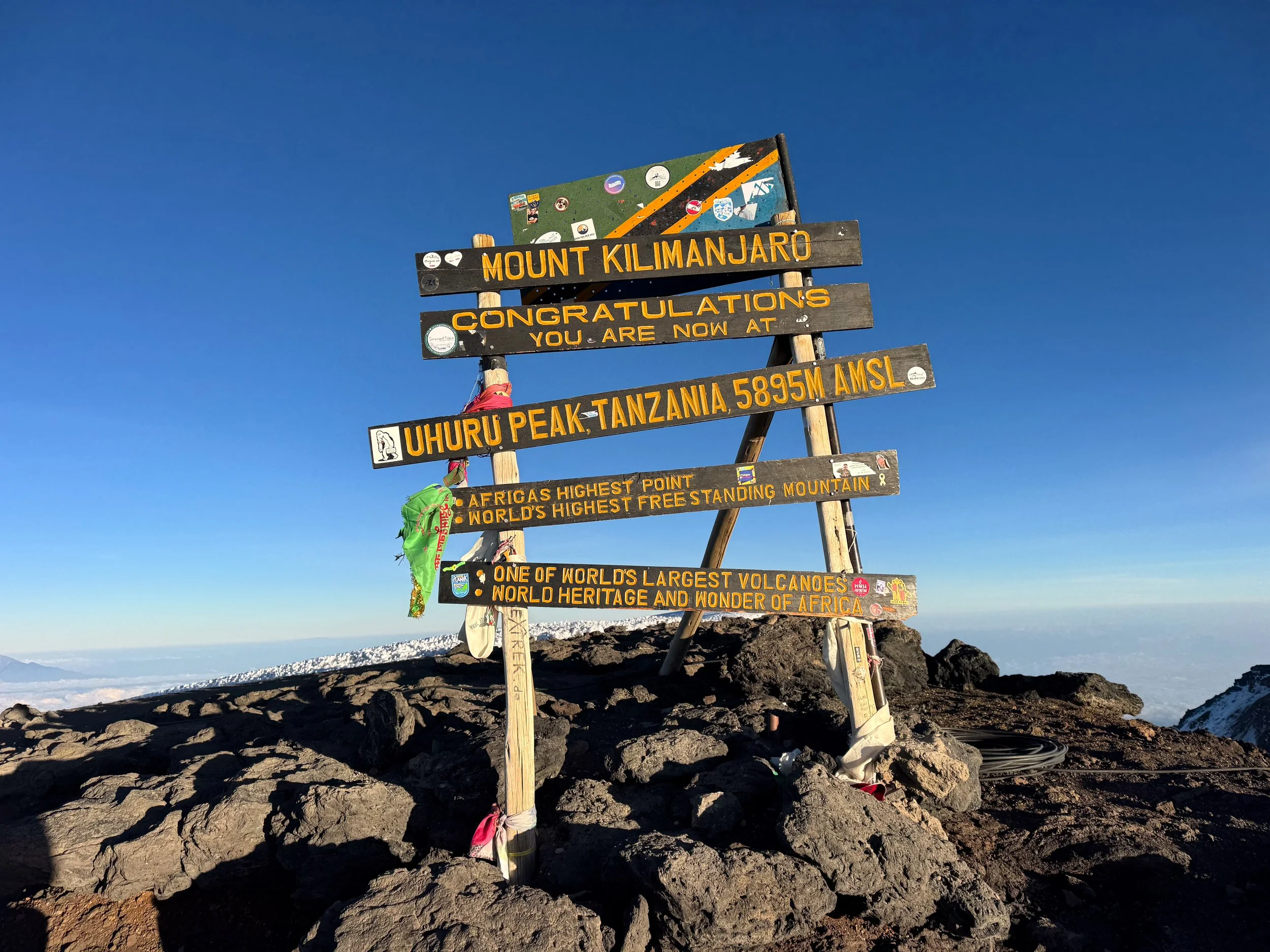
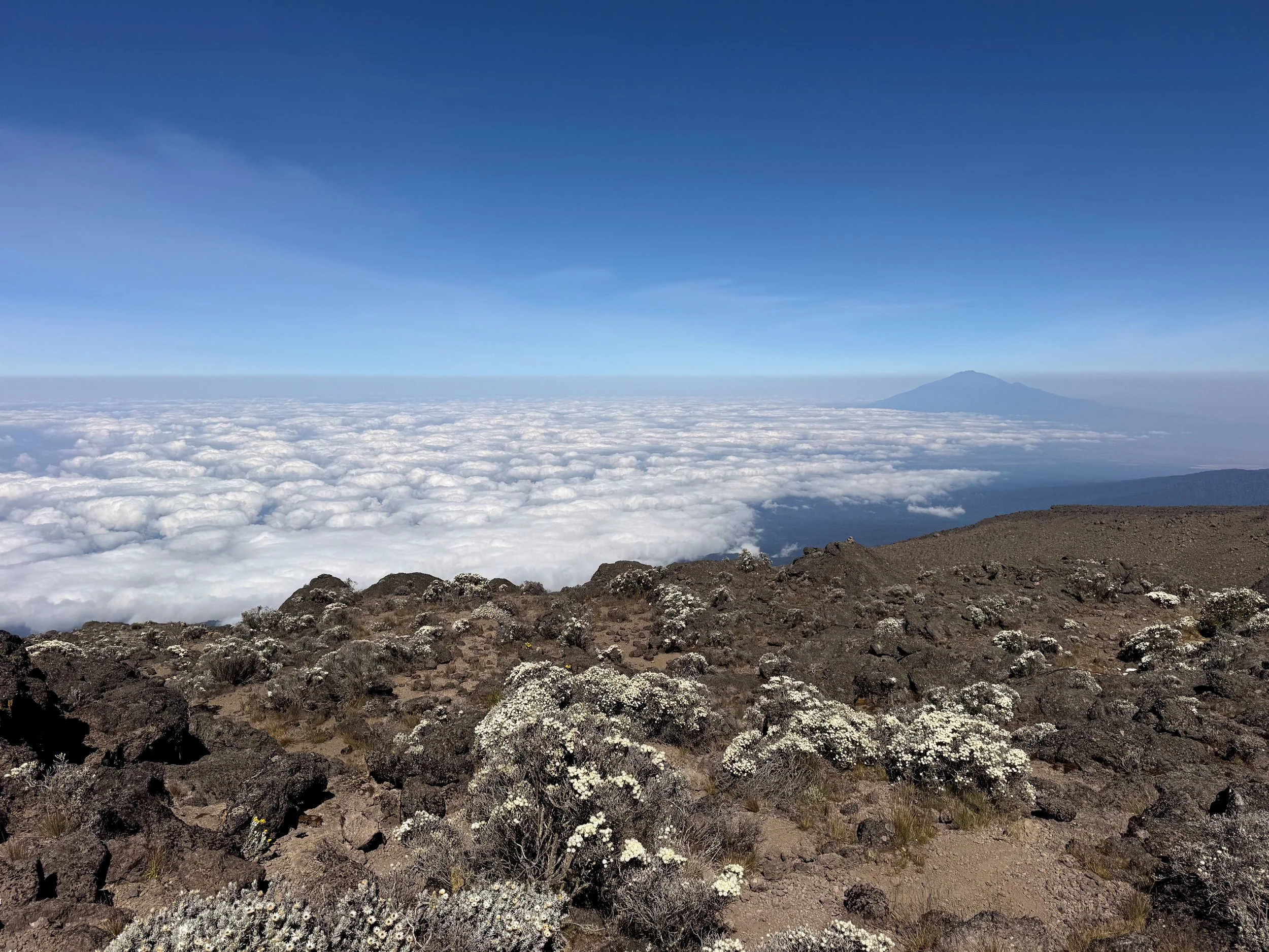
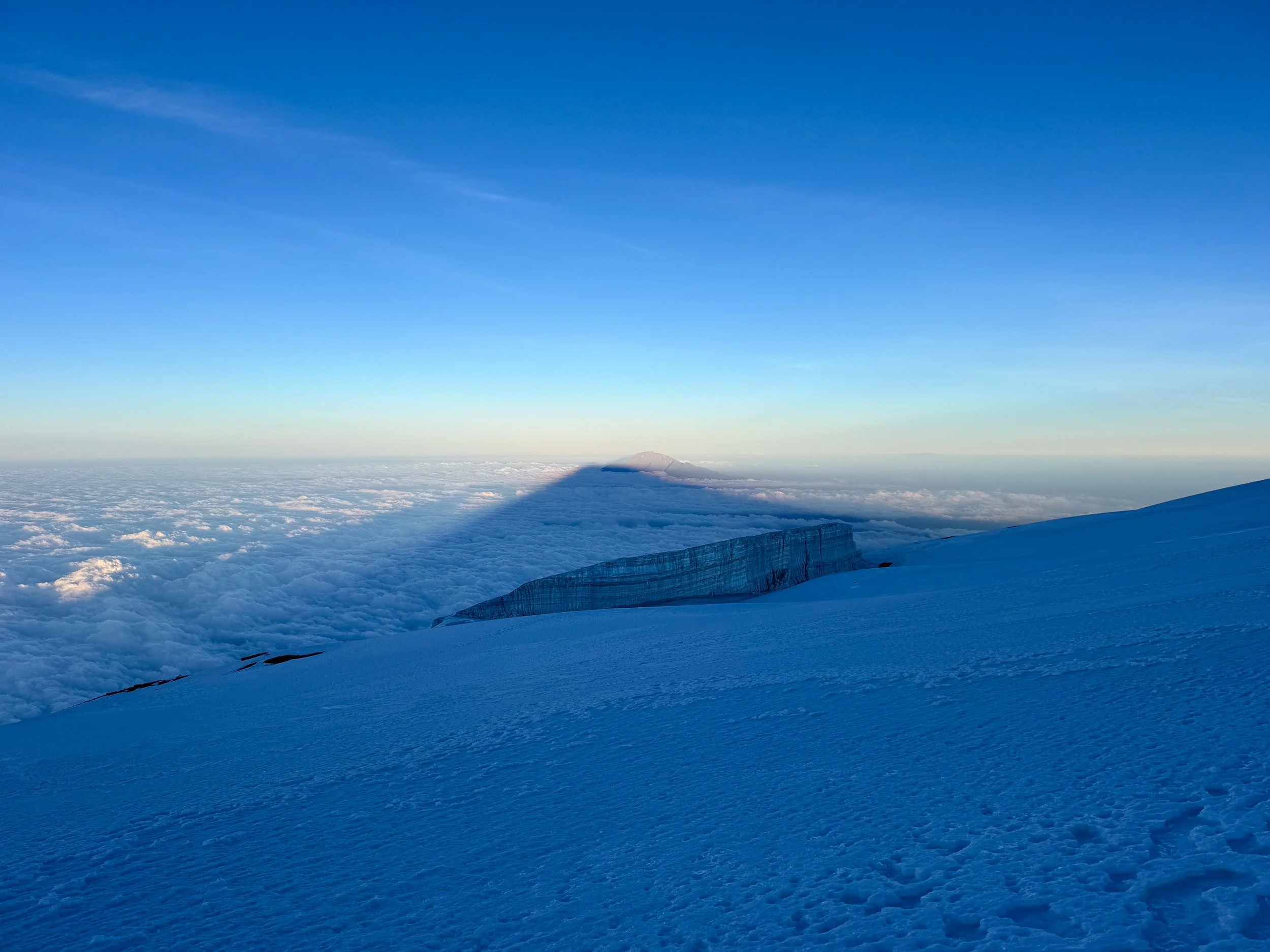
Uhuru Peak. Mt. Kilimanjaro is Africa’s tallest mountain and one of the World’s Seven Summits. The highest point, tops out at 5,895 meters (19,341 feet) above sea level. After days of hiking, a congratulatory sign welcomed us to the summit! it was an overwhelming experience to reach. Tears were indeed shed. We celebrated with frozen candy bars and hot ginger tea. The mountain was surrounded by a sea of puffy white clouds. The shadow of Mt. Kilimanjaro cast across them.
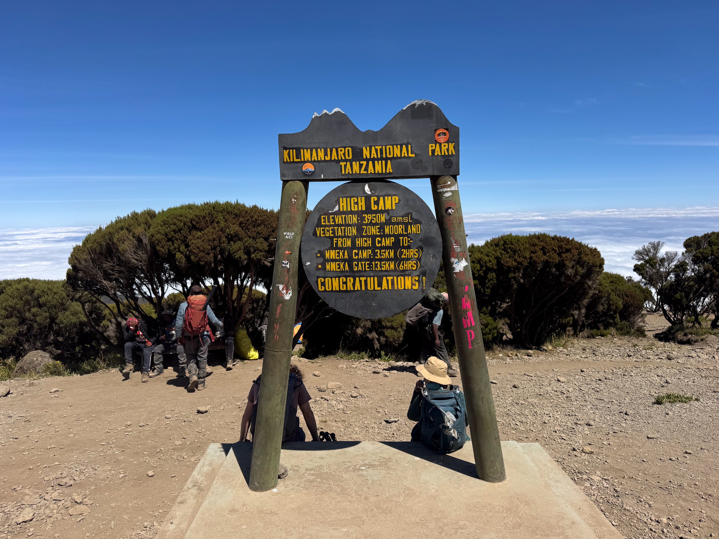
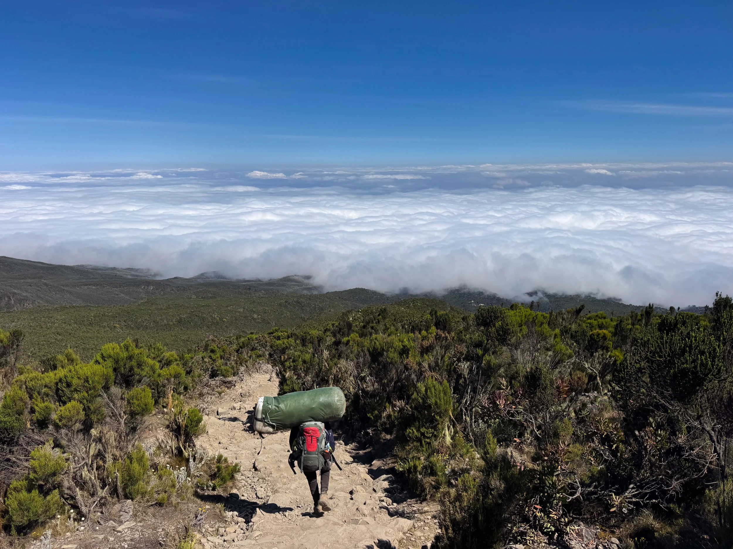
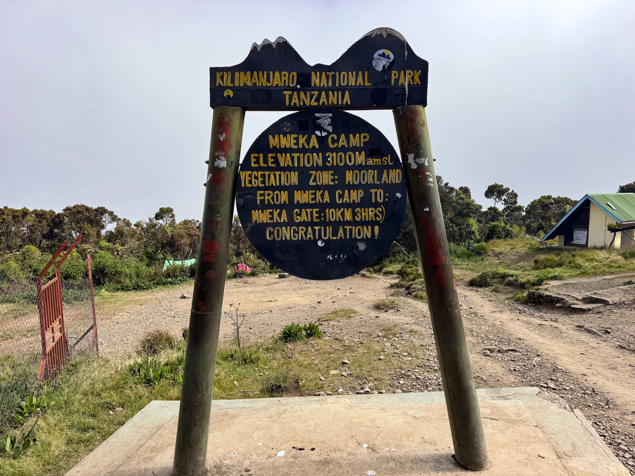
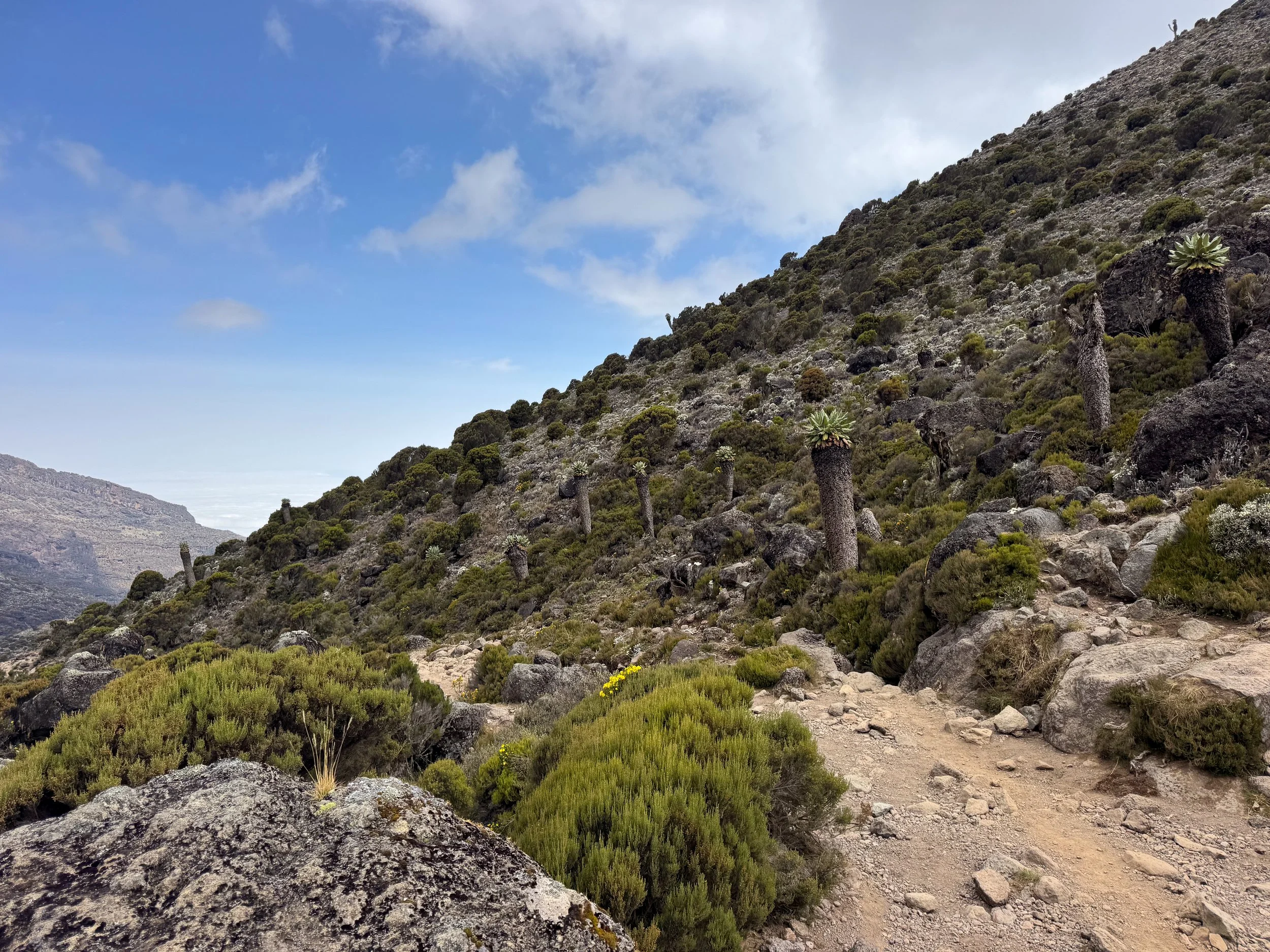
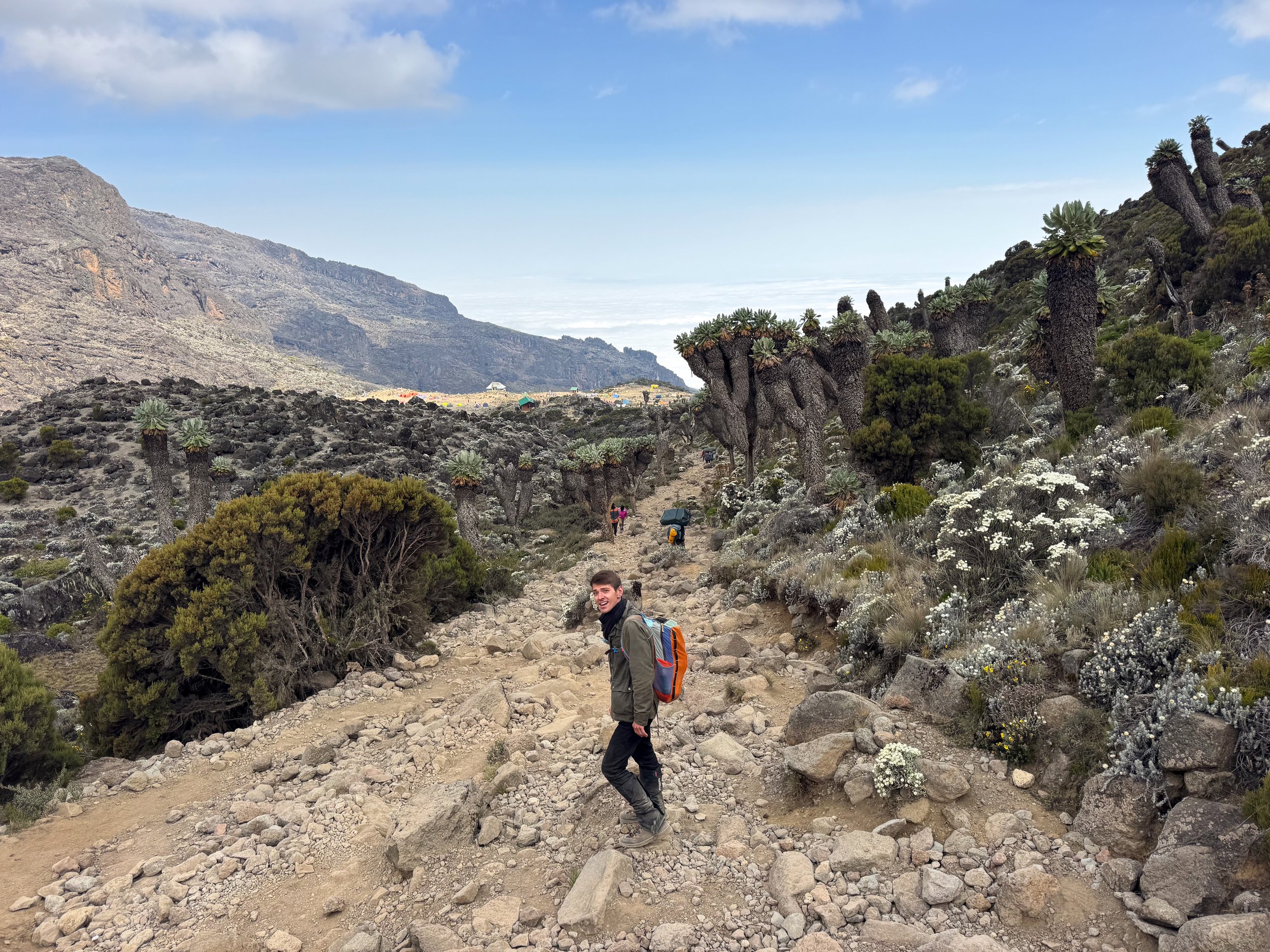
The Rapid Descent. The guides limited us to 15 minutes at the summit due to the harsh environmental conditions. The rapid descent to the base camp took 3 hours. We napped and ate lunch before descending further into the Moorland Zone. The trail lead to the High Camp, located at 3,950 meters (12,960 feet), one hour and a half later. It was the perfect rest area but not our final camp. The descent continued into the Vegetation Zone. Porters passed us in both directions as we followed the rocky path to the Mweka Camp, located at an elevation of 3,100 meters (10,171 feet). We spent our last night camping on the mountain here.
Day Seven
Crew Appreciation. The final day began with a goodbye to our mountain crew. We met them after breakfast to express our gratitude and to distribute tips.
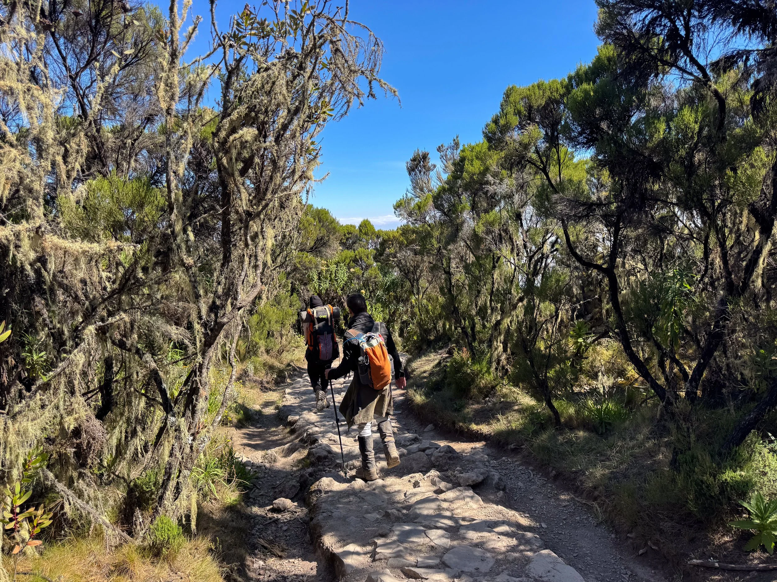
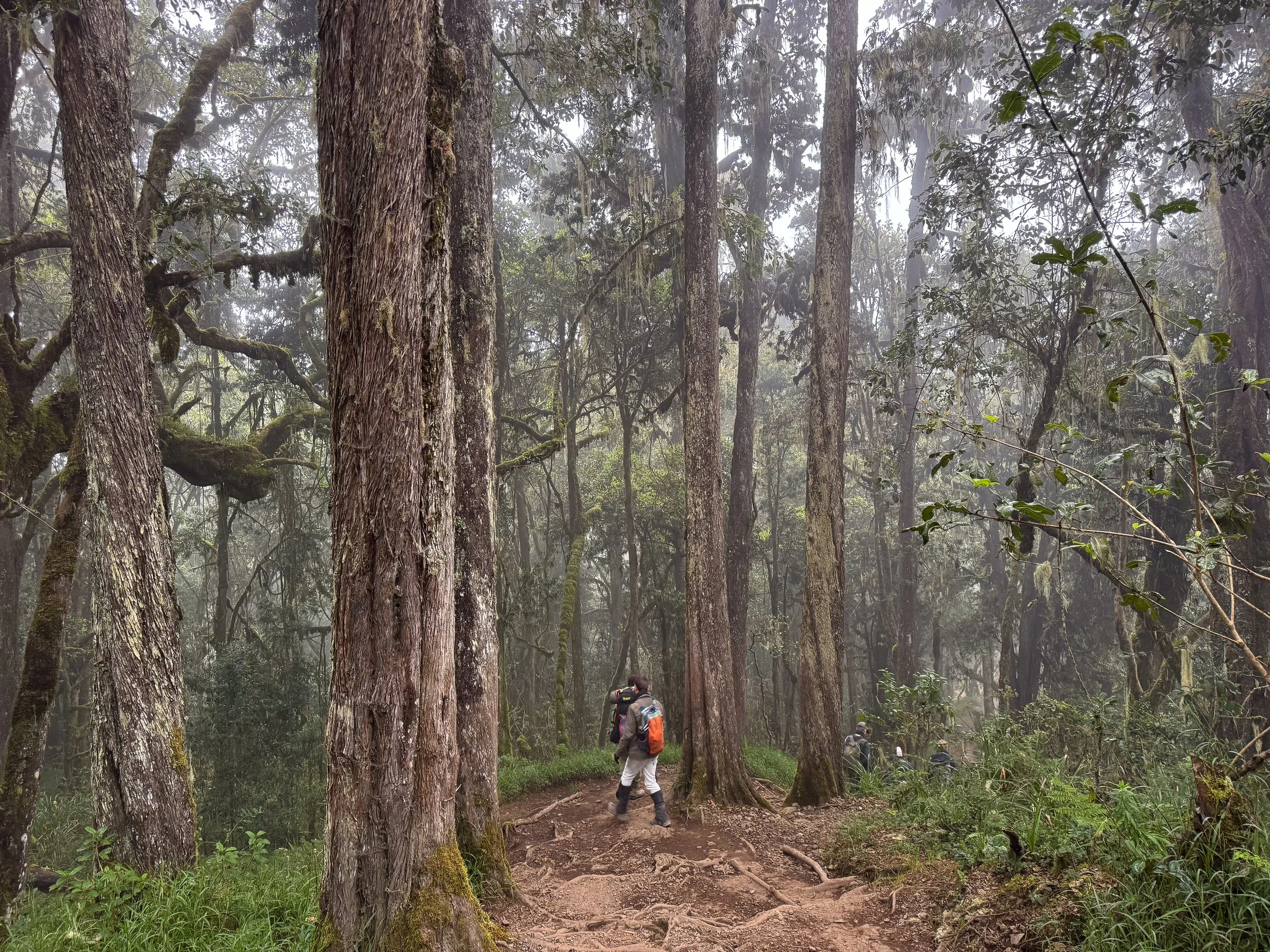
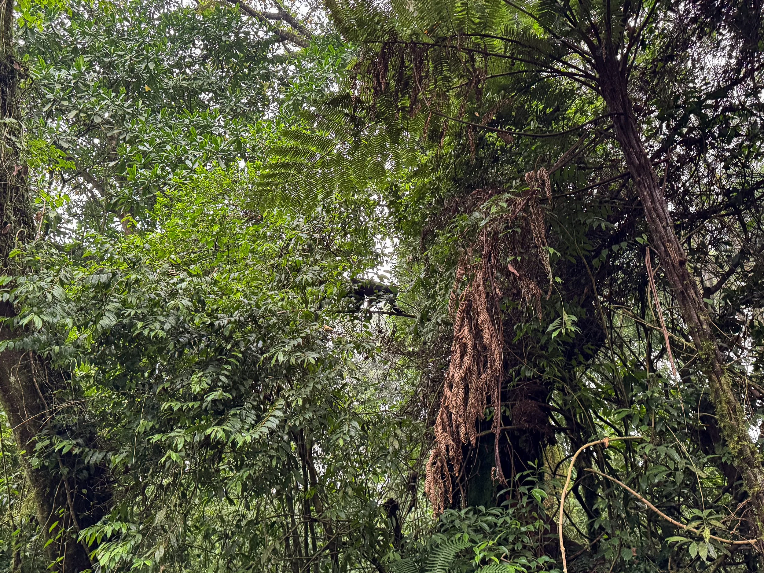
The Rainforest Hike. The last leg of our journey led us through the rainforest. Our guide led us along the muddy and slippery trail through the foggy forest. Moss covered trees, giant ferns and tiny orchids flanked the path. Monkeys hopped between tree branches as birds squawked in the canopy. It took 3 hours to reach the park gate.
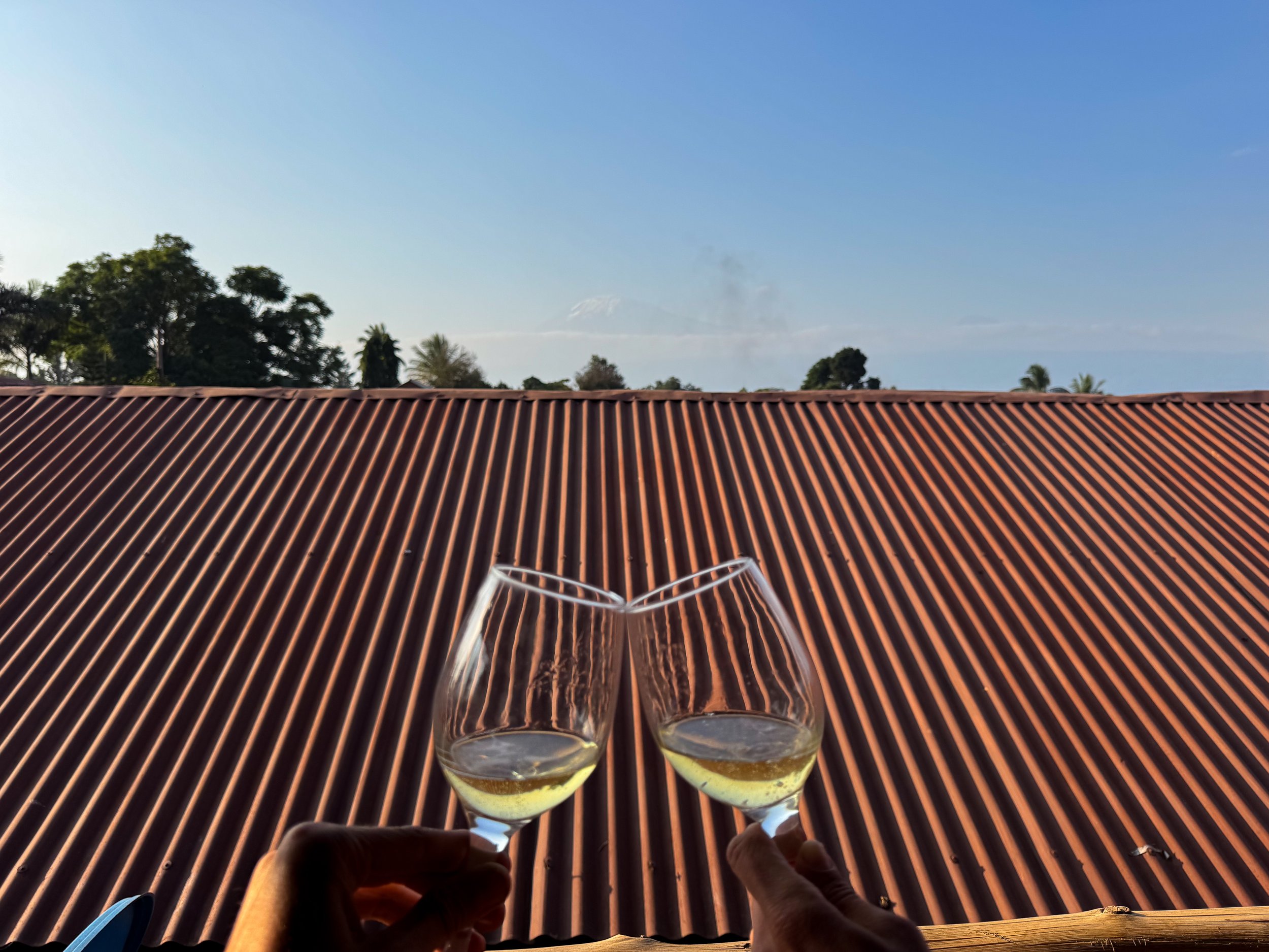
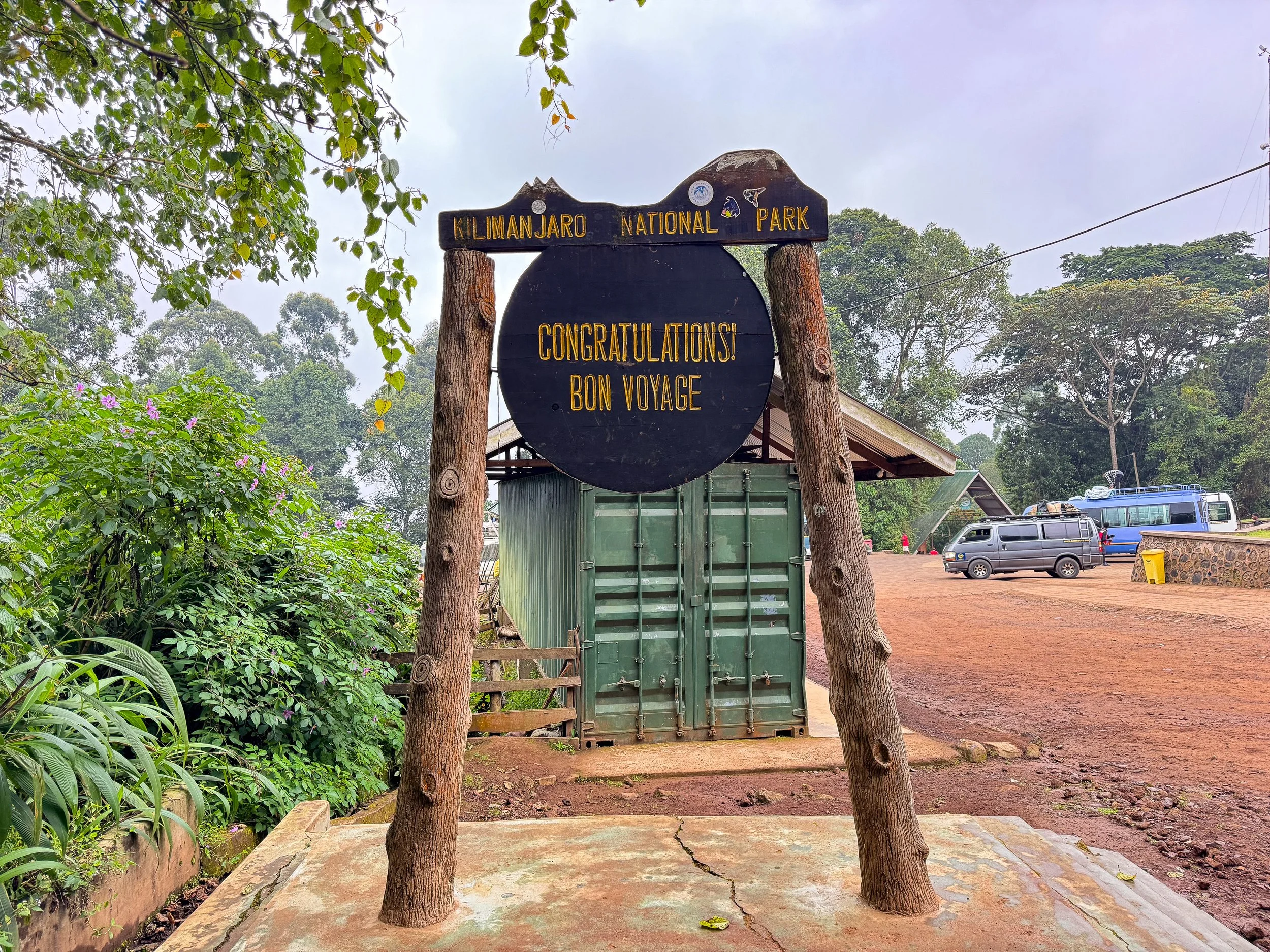
Certificates & Celebration. Park rangers verified our successful hike to the summit and awarded us certificates recognizing the achievement. Our crew brought us back to our hotel in Moshi and presented them to us while singing the Kilimanjaro song, Jambo Bwana. We spent the afternoon relaxing and celebrating with a bottle of South African bubbly while overlooking the summit of Mt. Kilimanjaro.
Moshi, Tanzania
Moshi is a town at the base of Mt. Kilimanjaro and starting point for many multi-day hikes up the mountain. The town is home to tour operators, gear outfitters, pharmacies, grocery stores and hotels making it easy location for last minute gear and needs.
Local Resources
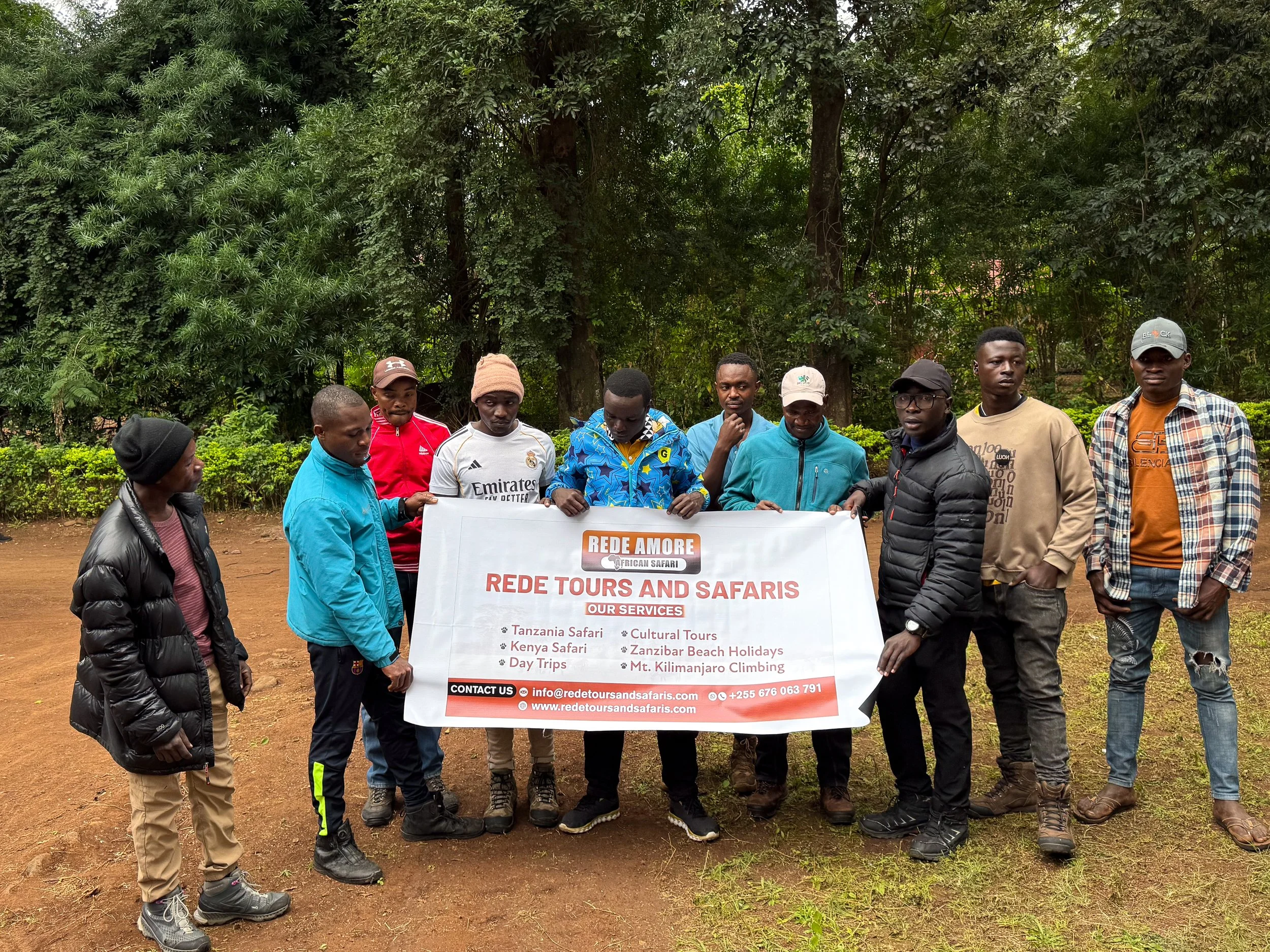
Rede Tours & Safaris. A well reviewed tour operator offering multi-day hiking trips to the summit Mt. Kilimanjaro. We booked the Unforgettable 8 Days Lemosho Route Trekking on Kilimanjaro with them prior to arriving in Moshi. They arranged every aspect of our hike including guides, porters, a cook and supplies.
Rafiki Supermarket. A chain grocery store with aisles of snacks and drinks. Come here to stock up on granola, dates, chocolates and chips prior to hiking.
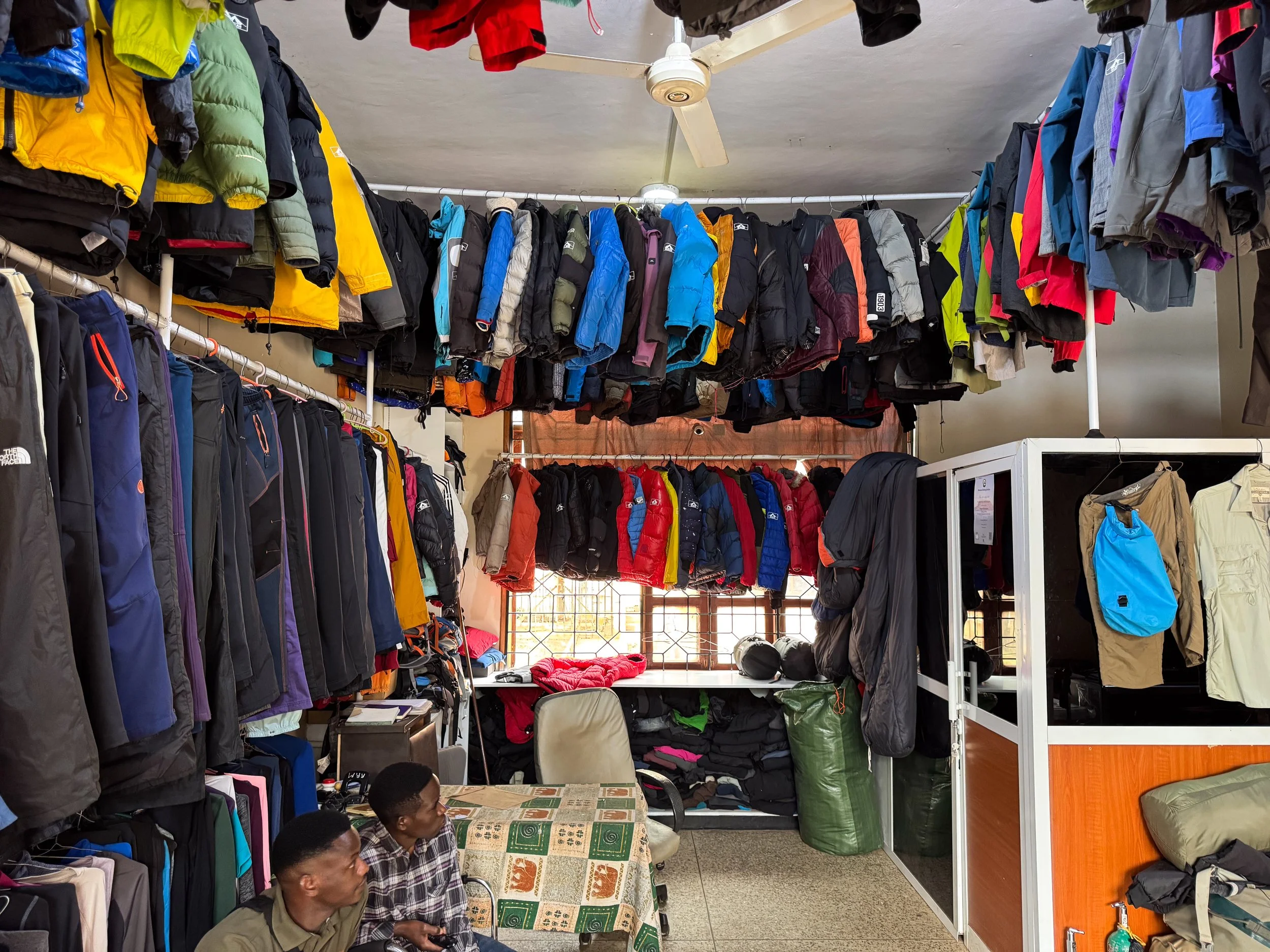
RRM Outdoor Rental Equipment Store. An outdoor outfitter with all rental gear needed to hike Mt. Kilimanjaro. We rented several items needed to complete the hike at the recommendation of our guide. Cost can quickly add up so be sure you actually need everything being recommended.
Mount Kibo Pharmacy. One of the largest pharmacies in Moshi. They sell Diamox, a medication used to cope with AMS (Acute Mountain Sickness) also known as altitude sickness. No prescription is needed and a weak supply costs less than $1.
Where to Stay
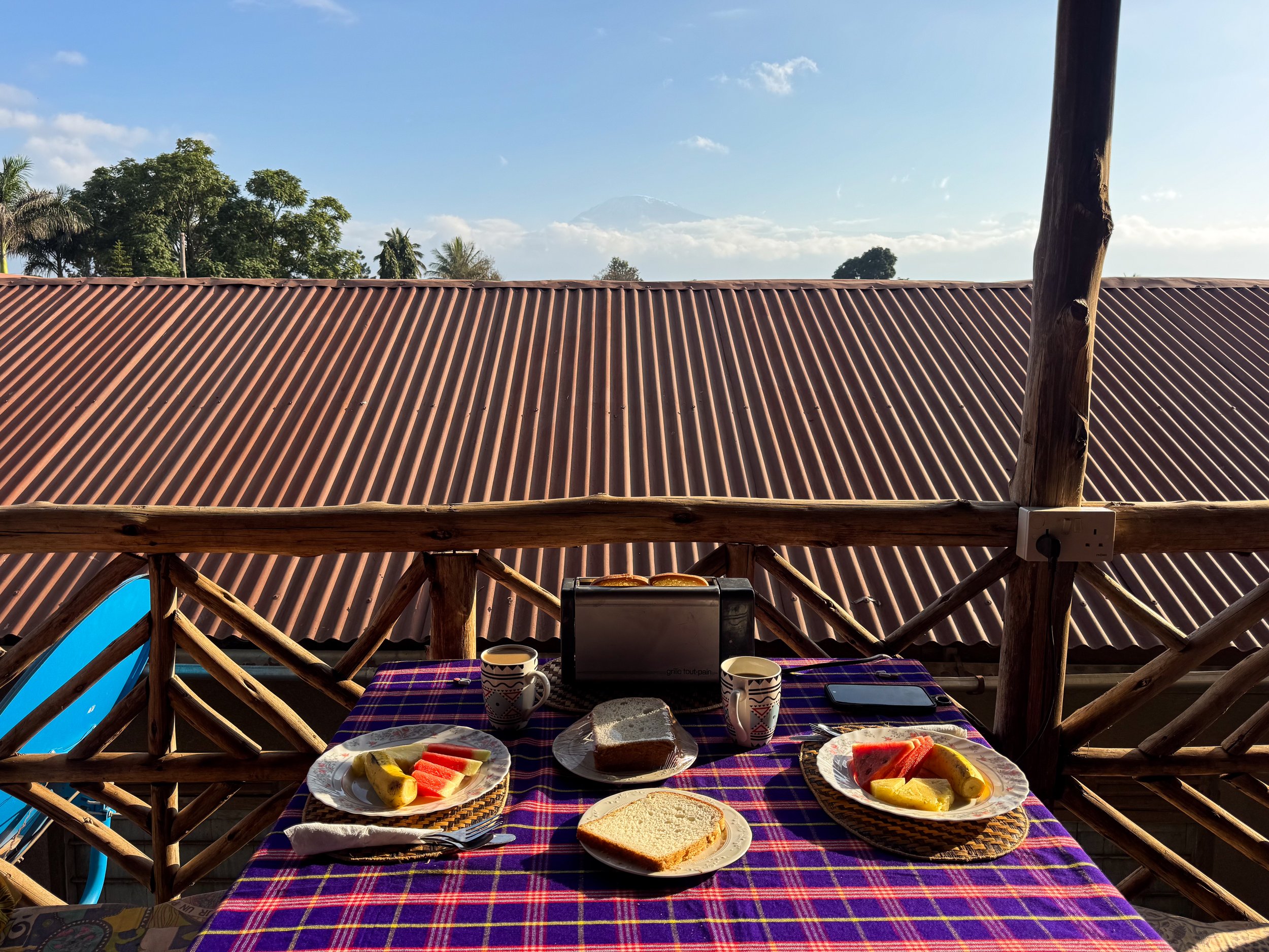
The Belle View Inn Bed and Breakfast. A small hotel with comfortable rooms, daily breakfast, luggage storage and transportation between the airport. We stayed here before and after our hike to Mt. Kilimanjaro. On a clear day, the peak of the mountain is visible from their second floor breakfast hut! Reserve on Booking.
Places to Eat & Drink
Having some time in Moshi before and after our hike to the summit of Mt. Kilimanjaro, we dined out at a couple local restaurants and a coffee house.
Maembe Garden. An elevated restaurant with Swahili cuisine and well made cocktails. We came here to celebrate after summiting Mt. Kilimanjaro. Try the veggies samosas and fish makange. To drink, order a Dawa, the local cocktail made with vodka, honey, lime and sugar.
Aikama Organic Restaurant. A restaurant in a commercial shopping center with Tanzanian and Swahili food. We each ordered the Fish Makange, a whole fried fish covered in a mixture of sautéed bell peppers and onions. It’s typically served with cardamom rice.
SSOH Coffee Factory. A cafe and roastery with house roasted Tanzanian coffee and artisanal madeleines.
Hiking Tips & Preparation
Hiking Mt. Kilimanjaro requires little preparation outside of practice hikes and acquiring the correct gear. We came up with several tips to follow while on the mountain.
Practice Hikes. Practice half to full day hikes on weekends with some steep inclines at least one month prior to condition yourself.
Support Network. Hike the mountain with a group or someone you know. Having a support network while hiking goes a long way. Guides are also great hype-men along the way!
Stay Positive. Believe in yourself and stay positive! Celebrate milestones with little rewards like the eating a chocolate when you reach the next camp or rest area.
Stay Hydrated. Dehydration is the largest concern when hiking. Bring or rent an CamelBak with capacity for 3 liters of water per day. Have guides refill them before hiking for the day. Drink ginger tea to open the airways. Avoid drinking alcohol.
Pace Yourself. The altitude and exhaustion can quickly added up. Hike a longer route, like the Lemosho Route, to spend more time acclimating to the high altitude.
Dress Warm. Temperatures at night and especially at the summit are below freezing. Plan to add layers the further you ascend and strip them off as you descend.
Extreme UV. Prepare for extreme UV radiation at high elevations. Wear sunblock during the day, protective lip balm and UV reflective sunglasses.
Nighttime Noise. The noise of the wind is enough to keep you up at night. Being ear plugs or noise canceling headphones to drown out sounds.
Best Time of Year. Hike during the dry season for the least chance of rain, snow and muddy trails. It’s colder during this time of year but is often the best time to hike Mt Kilimanjaro. The dry season lasts from July to October. We hiked in late July.
Hygiene. Basic squatting toilets are available at each campsite. Bring your own toilet paper and hand sanitizer. Guides often provide hot water and soap before meals. Some even offer scented hot towels.
Cell Service. There is minimal cell service or network on the mountain. Plan to disconnect or use limited service to keep family and friends updated.
Electricity. There is no electricity on the mountain. Bring a high capacity power bank to keep devices charged. Keep phones on airplane and low power mode to conserve battery. Store phones and power banks in a warm location.
Packing List
Clothing
Thermal leggings or underwear
Thermal long sleeve shirts
Waterproof rain jacket & rain pants
Insulated winter coat
Insulated snow pants
Winter hat, gloves & scarf
Wool sweaters
Thermal socks
Gear
Hiking boots
Pair of hiking poles
Gators (to cover ankles from dust)
Headlamp & extra batteries
High capacity power bank
Sunglasses
Sunblock
Lip balm with SPF
CamelBak for water
Thermal water bottle for hot drinks
Hand and toe warmers
Toilet paper
Hand sanitizer
Facial wipes
Diamox (altitude sickness medication)
Insulated sleeping bag
Backpack or Daypack
Pillow or neck cushion for sleeping
Hiking mattress(typically included)
Tent (typically included)
Snacks
Trail mix or granola
Chocolates (m&ms & candy bar)
Dried ginger candies
Peppermint hard candies
Ginger tea
Costs & Tipping
Hiking Mt. Kilimanjaro is expensive! Costs are not always clear when booking tours. Make sure to understand all costs and fees ahead of time.
Costs & Fees. We booked a “budget” hike for $1,500 USD per person. This covered entry permits, food and some equipment. An additional $700 USD per person was paid in person to cover crew wages.
Tipping. Providing gratuities is a standard practice and expected after hiking Mt. Kilimanjaro. Below is a breakdown of the expected amounts to pay per group. Individual tips will be less depending on group size, crew size and number of days hiking. Tips are given to the lead guide, announced and distributed on the last day of the hike.
Lead Guides: $20-$25 per day
Assistant Guides: $15-$20 per day
Cooks: $10-$20 per day
Porters: $8-$10 per day
Specialty Porter (Waiter, Summit Porter, Toilet Porter): $10-$12 per day
Swahili Words & Phrases
Swahili is the local language in Tanzania. We learned several basic words and phrases from our guides and porters while hiking Mt. Kilimanjaro.
Pole Pole. Slowly slowly or take it easy. It’s the speed and theme on the mountain often repeated by guides, porters and trekkers.
Hakuna Matata. The phrase made world famous by the Lion King. It’s a real Swahili phrase meaning no worries or no problems. It’s often used to let guides know you’re doing okay.
Jambo. A formal greeting meaning hello.
Mambo. An informal greeting meaning hello or how are you?
Poa or Poa Poa. A common response to Mambo, meaning good or well.
Habari Asubuhi.Good morning.
Lala Salama. Good night or sleep well.
Kwa Heri. Goodbye.
Asante. Thank you.
Asante Sana. Thank you very much.
Karibu. Welcome or you’re welcome.
Elsewhere in Tanzania
We spent four weeks traveling across Tanzania. The country is a remarkable destination for adventure seekers, nature lovers and cultural enthusiasts. Escape to beaches and spice gardens on the tropical island of Zanzibar or explore the country’s vast national parks and wildlife on a Tanzanian Safari.
For Next Time…
Though we don’t expect to hike Mt. Kilimanjaro again, we learned about Tanzania’s Mt. Meru, another hike-able volcano in the Arusha National Park. It’s the country’s second tallest mountain, after Mt. Kilimanjaro. Its summit reaches heights of 4,566 meters (14,980 feet). It can be hiked in 3-4 days. The route combines elements of a safari with bush camping and mountain hiking.