The American Southwest
The American Southwest
The American Southwest is a playground of incredible rock formations, other worldly deserts and endless highways. The region overlaps several states, includes many Native American reservations and is home to some of the country’s most cherished National Parks.
An American Road Trip
There’s something so freeing and spontaneous about road trips: listening to good music, driving with the windows down, stopping at roadside attractions and ordering drive through meals. Starting in Los Angeles, we spent 10 days driving along sections of Old Route 66 across Southern California, Arizona and Utah.

Southern California
Our roadtrip through Southern California led us from Los Angles into to desert. We passed roadside attractions, hiked through national parks and visited forgotten communities.
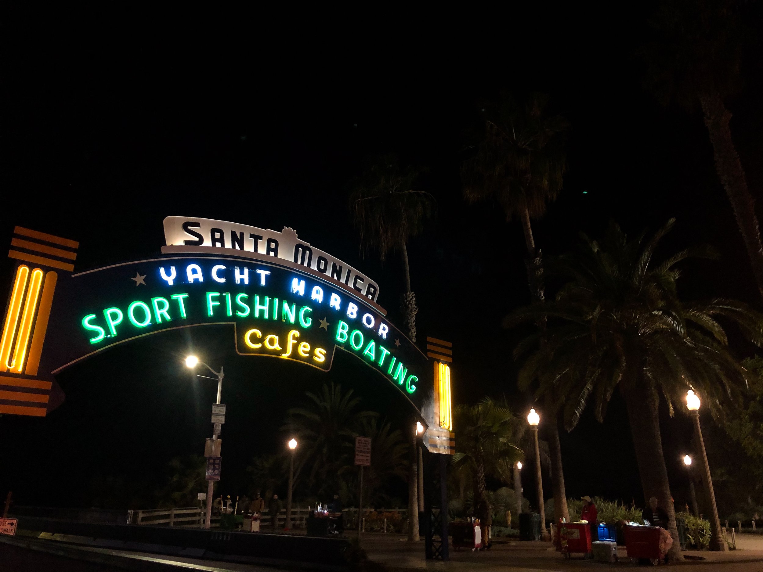
Santa Monica Pier
The Santa Monica Pier made for a fitting place start to our roadtrip, being the point where the historic Route 66 meets the Pacific Ocean. The wooden pier is buzzing with electronic violinists, fishermen and neon lights from vintage amusement park rides. It boasts coastal views of the ocean and tan sand shore line stretching along the Pacific Coast Highway.
The Lobster Restaurant. A seafood restaurant at the entrance of the Santa Monica Pier with dishes like grilled lobster, lobster mac and cheese and lobster rolls, all best paired with a Pacifico beer.
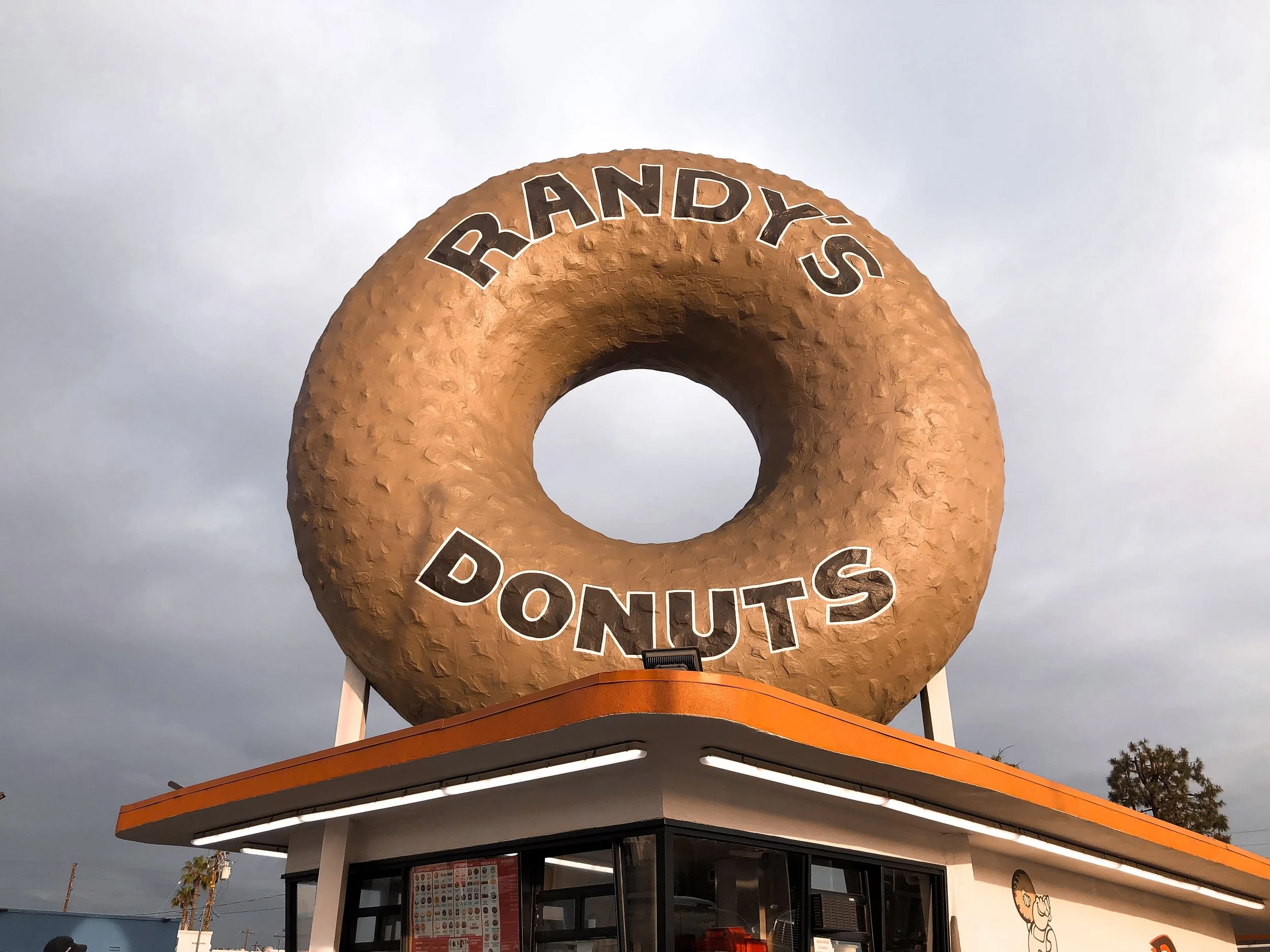
Randy’s Donuts
An landmark donut shop, easily recognized by the massive donut resting on top of its roof. It’s been featured in video games, movies, tv shows and referenced across Hollywood. We ordered coffees and a dozen donuts to begin our first morning on the road!
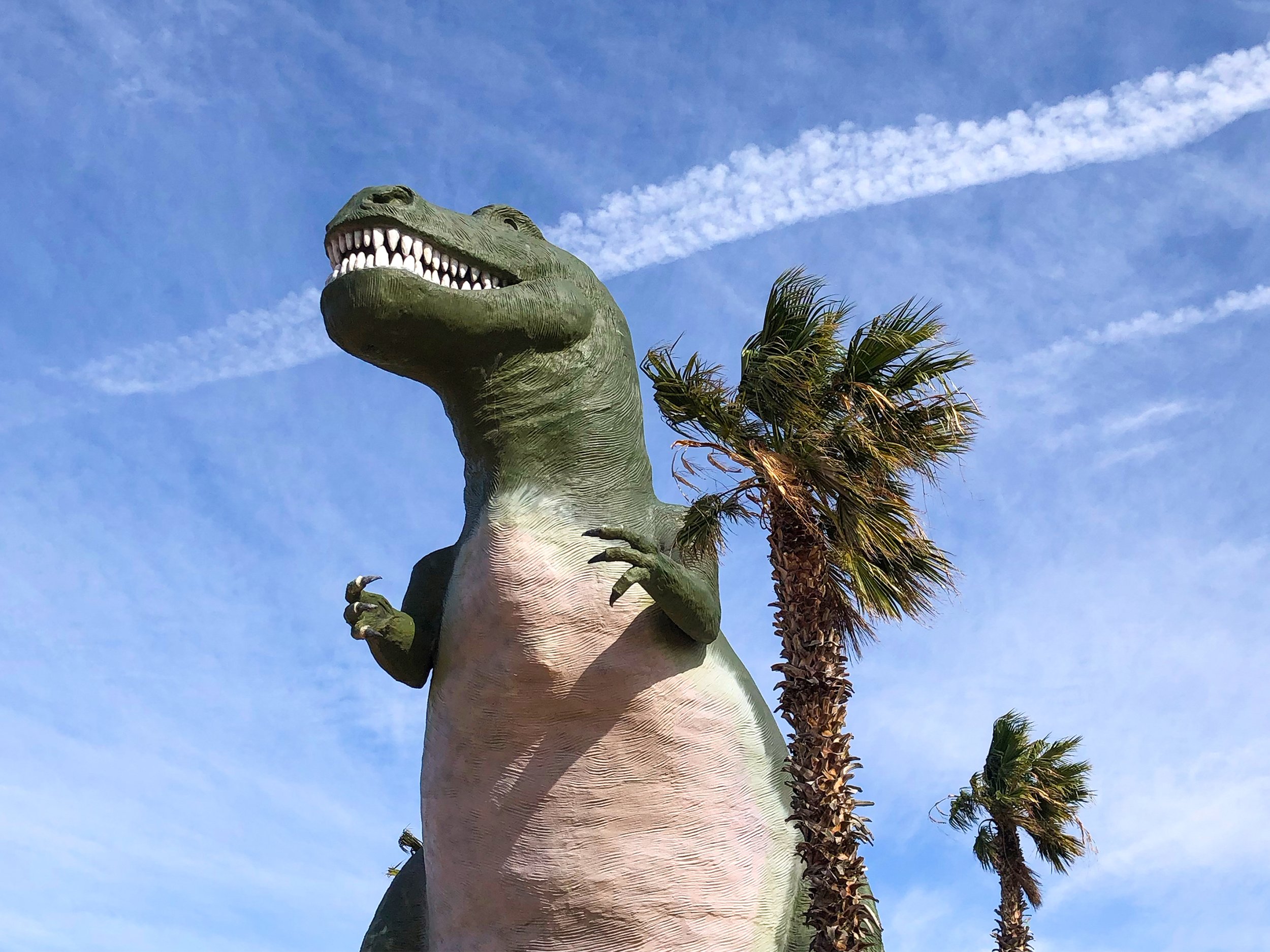
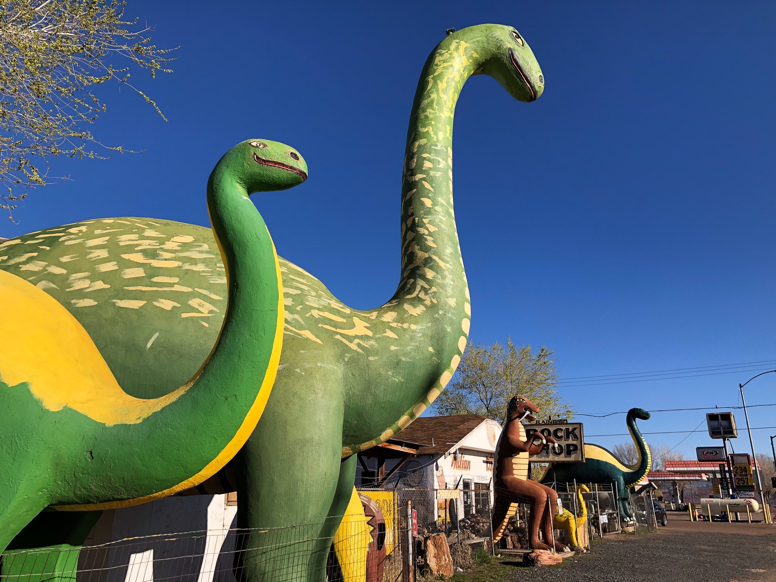
Cabazon Dinosaurs
Located just off the highway in Cabazon, CA, these dinosaurs captured our attention and imagination. This roadside attraction, considered to be one of the greatest, features two giant dinos: A brachiosaurus named Dinny the Dinosaur and a t-rex named Mr. Rex. We reveled at, walked under, around and even climbed inside both of them.
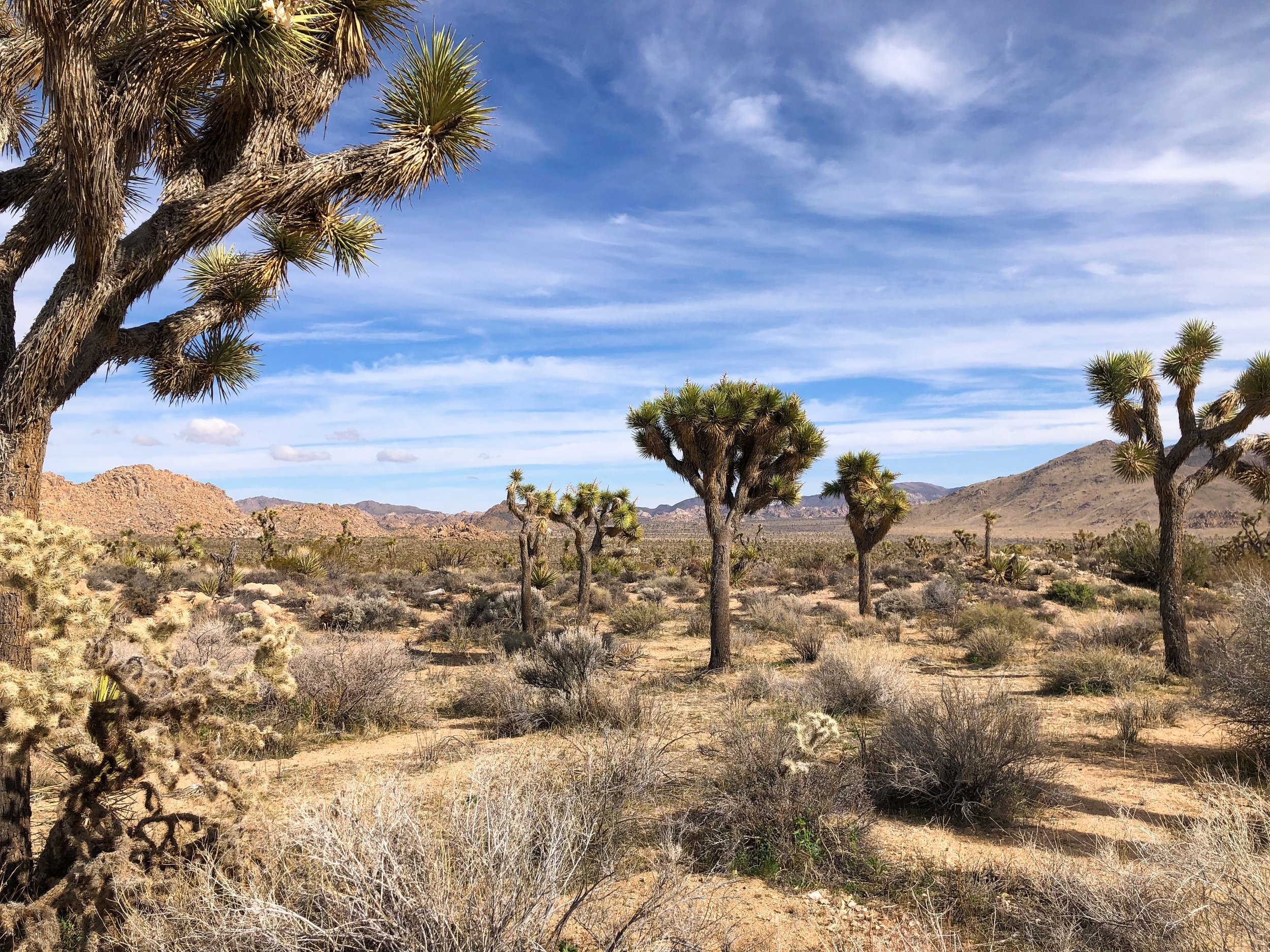
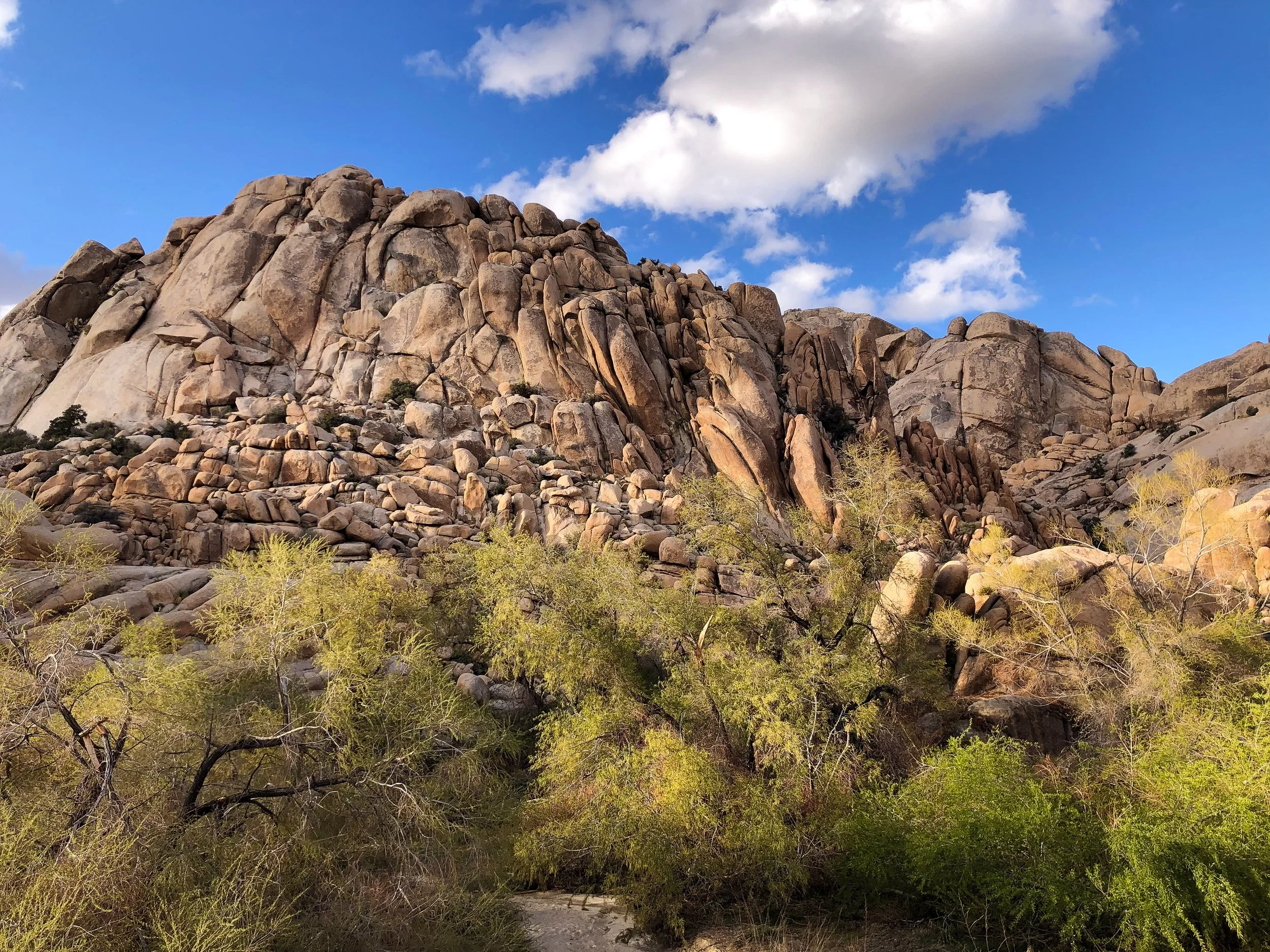
Joshua Tree National Park
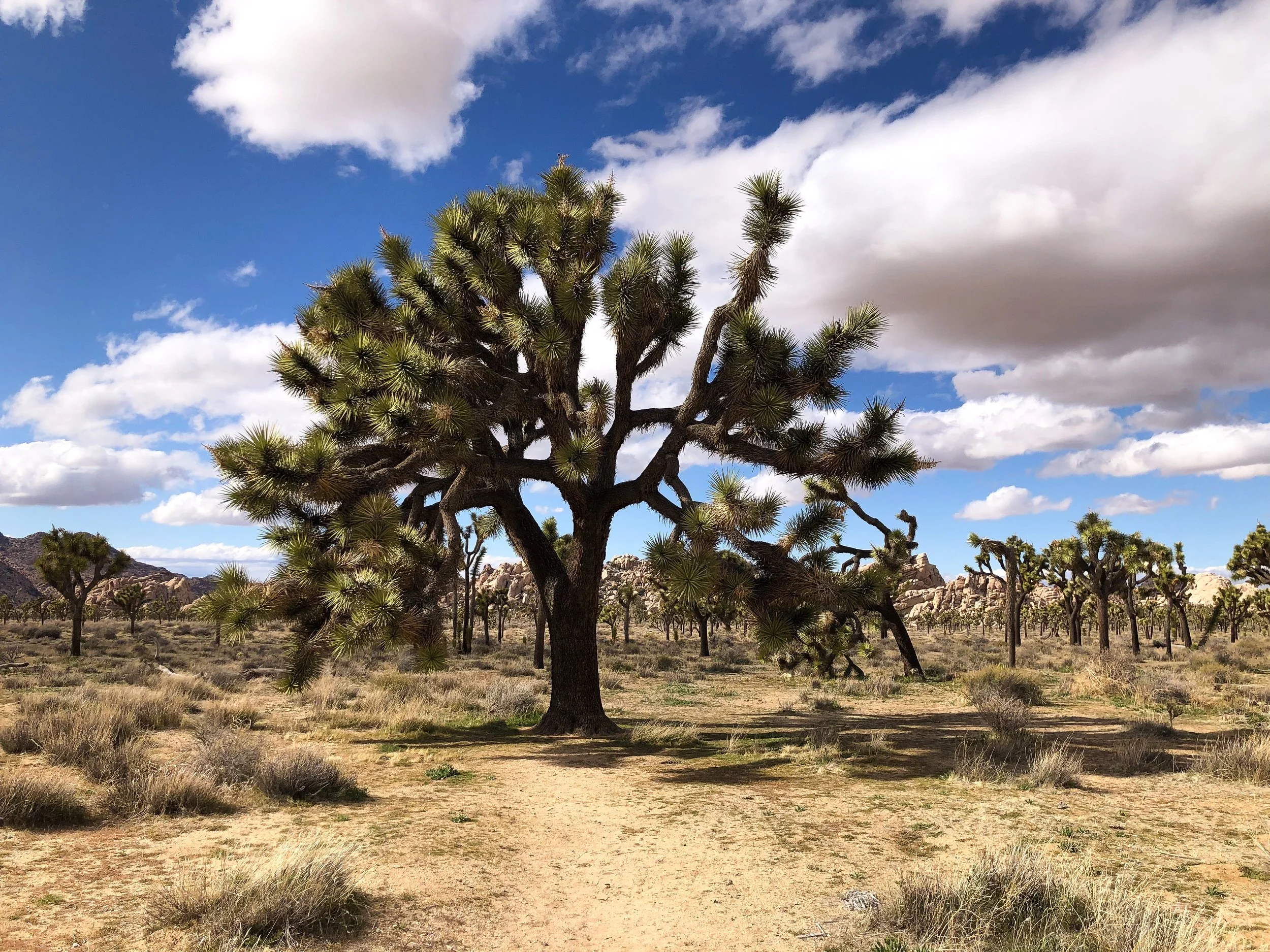
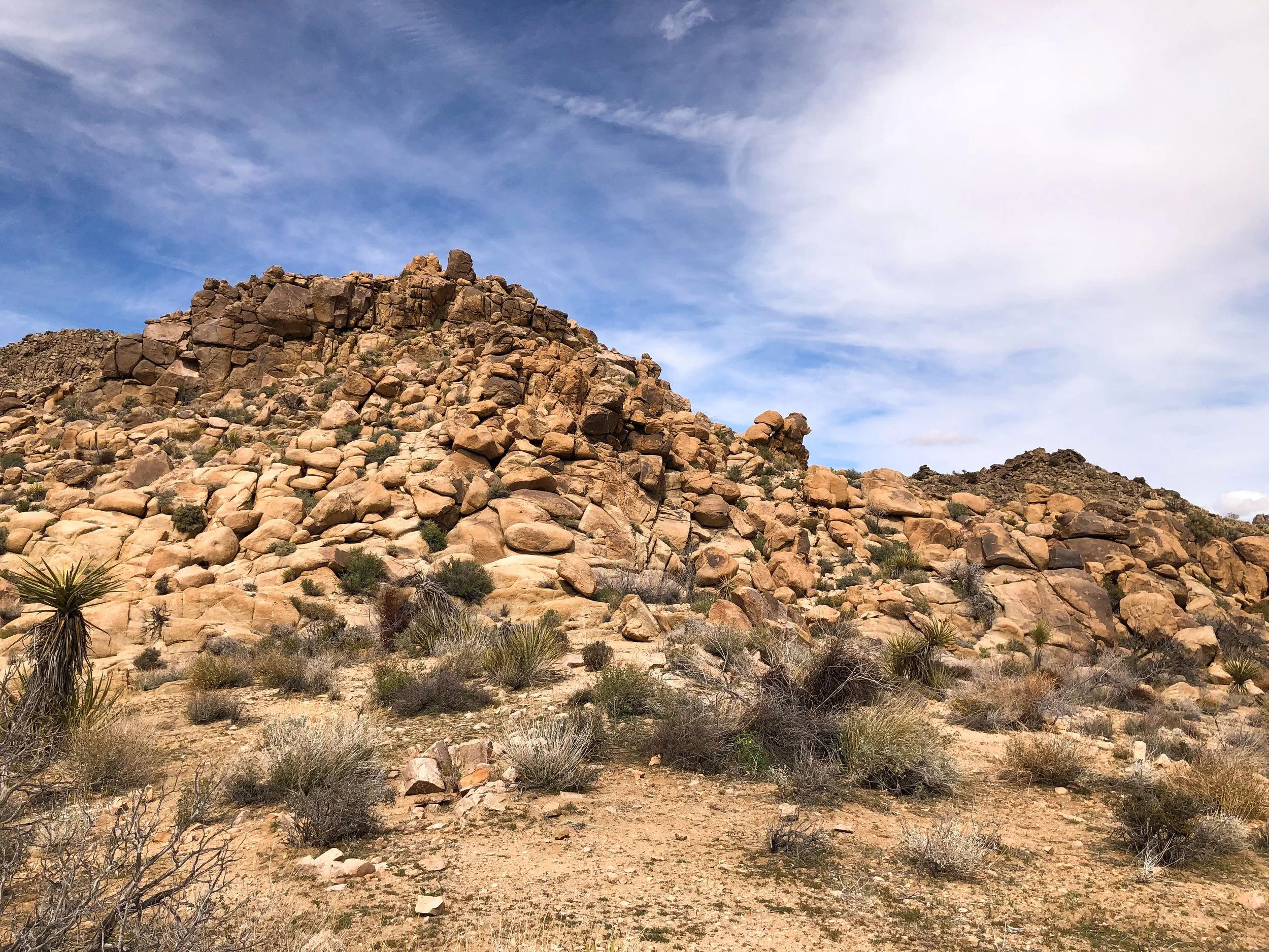
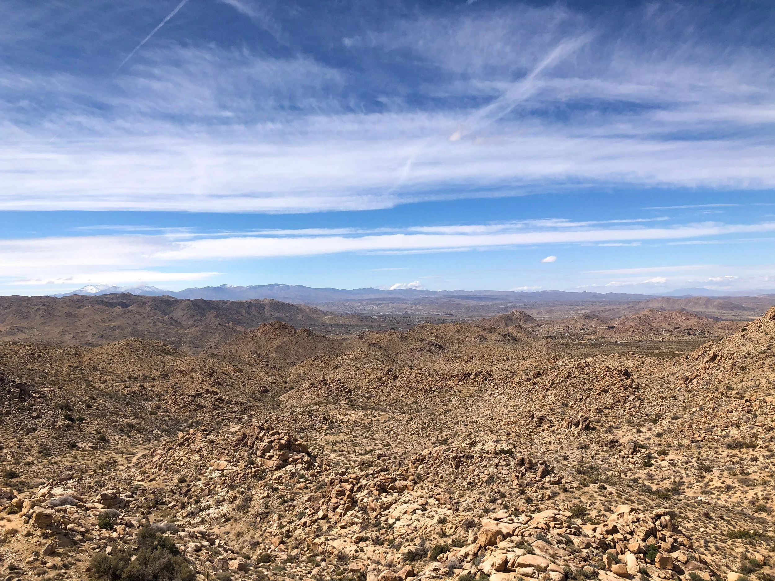
Joshua Tree National Park is one of the United States most treasured landscapes, home to exotic desert plant life, giant boulders and hiking trails. It’s famed for its namesake, the Joshua Tree, a multi-armed, spike leaved, desert growing plant. They are a fragile and enduring symbol the the Mojave Desert where the park resides, thriving in harsh conditions with little water and persistent sunlight.

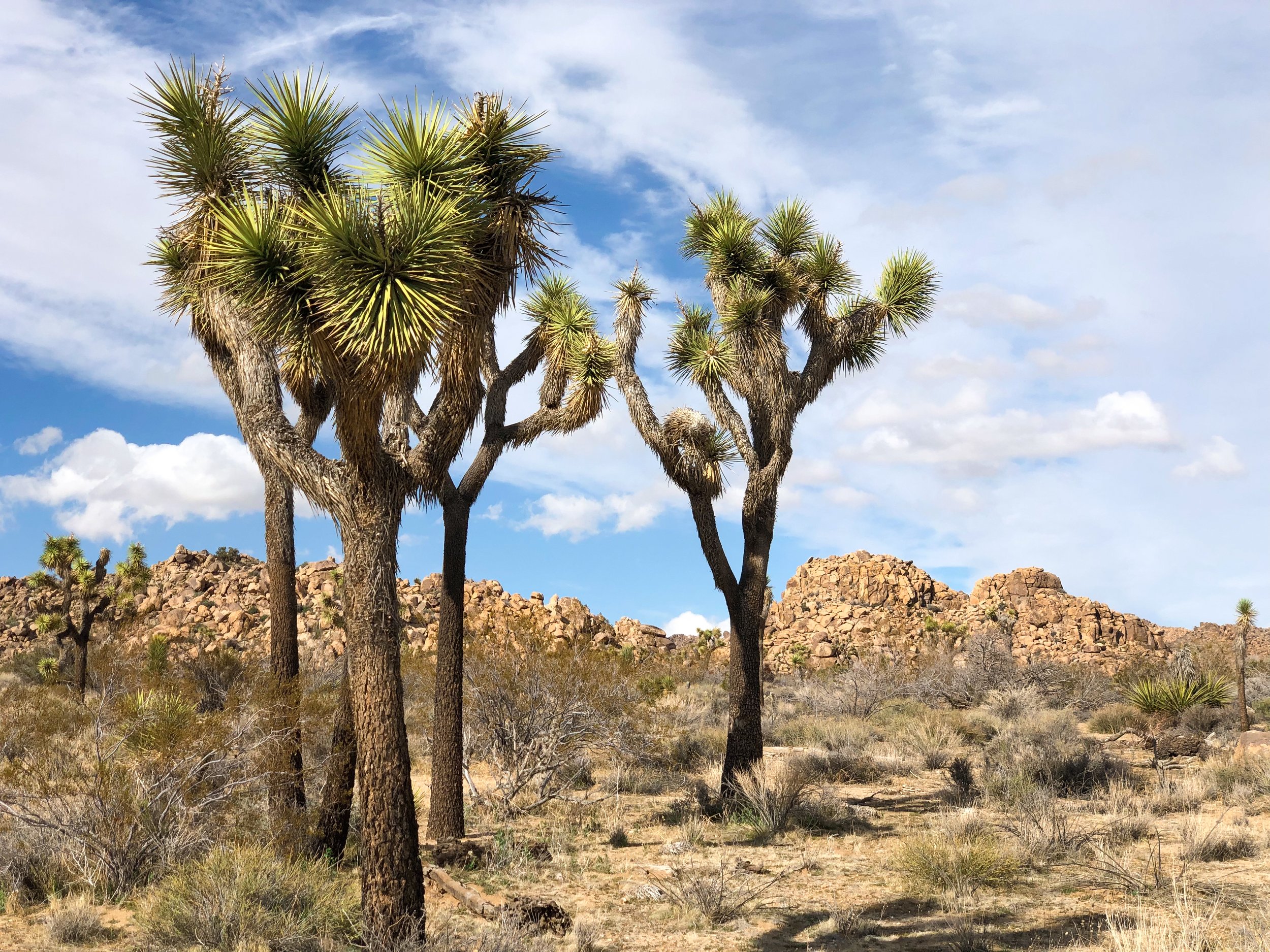
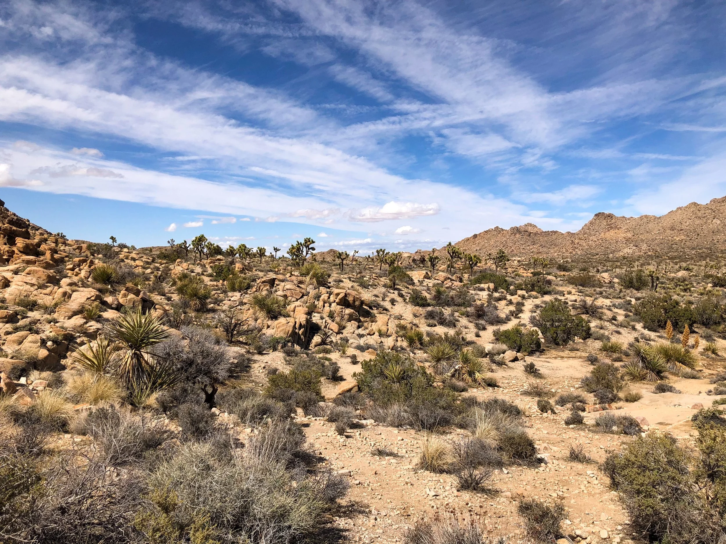
Hiking Trails & Desert Sights
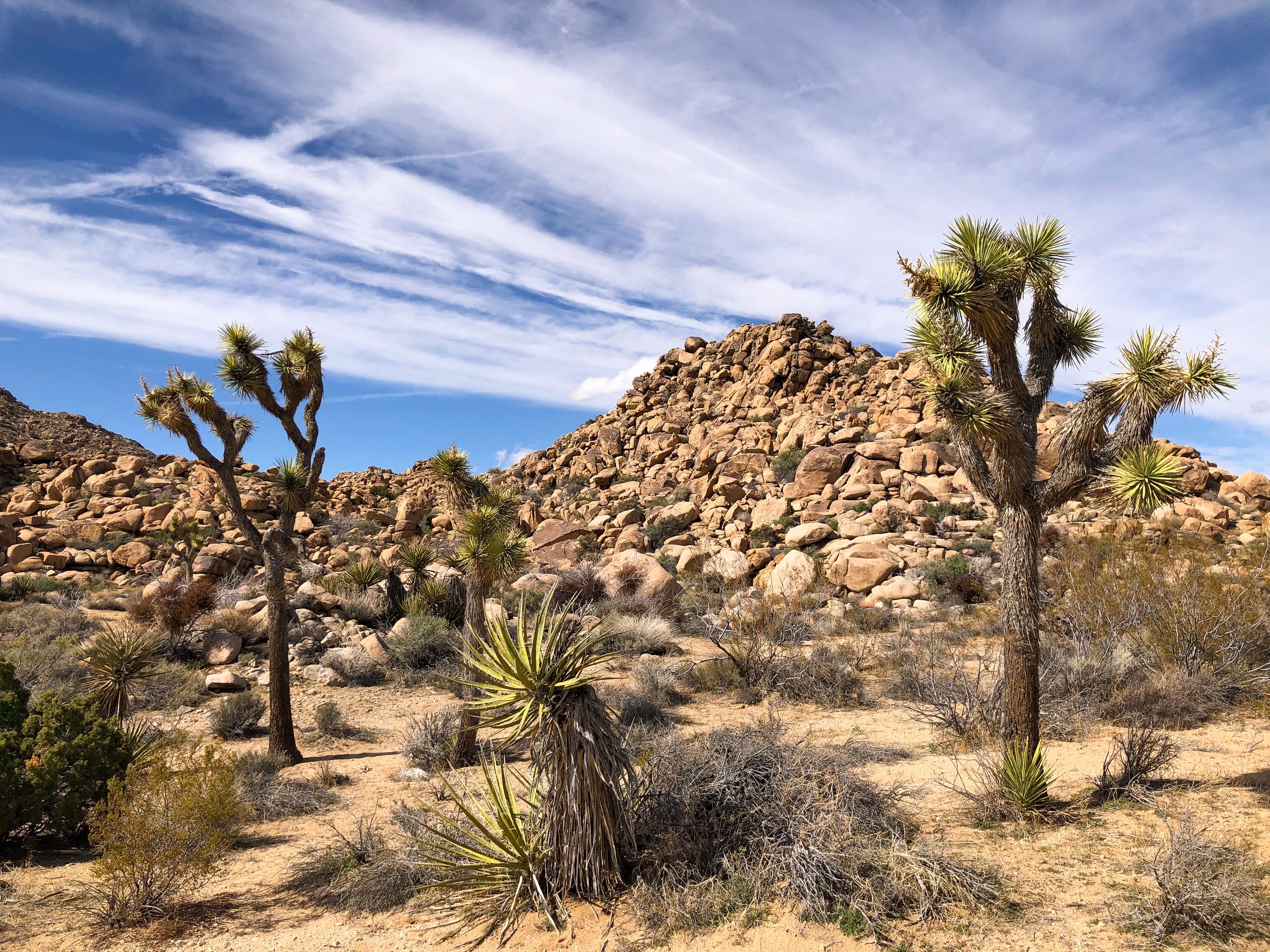
Park Blvd. The main road in Joshua Tree National Park. Several hiking trails branch off from it, meandering across the desert landscape and connecting with other trails. Choosing a trail head with available parking, we began hiking the South Side Connector Trail and later merging with the Big Foot Trail. We spent hours hiking through a forest of Joshua Trees, along side large rock formations and through an area with a wash where we saw a desert tortoises.
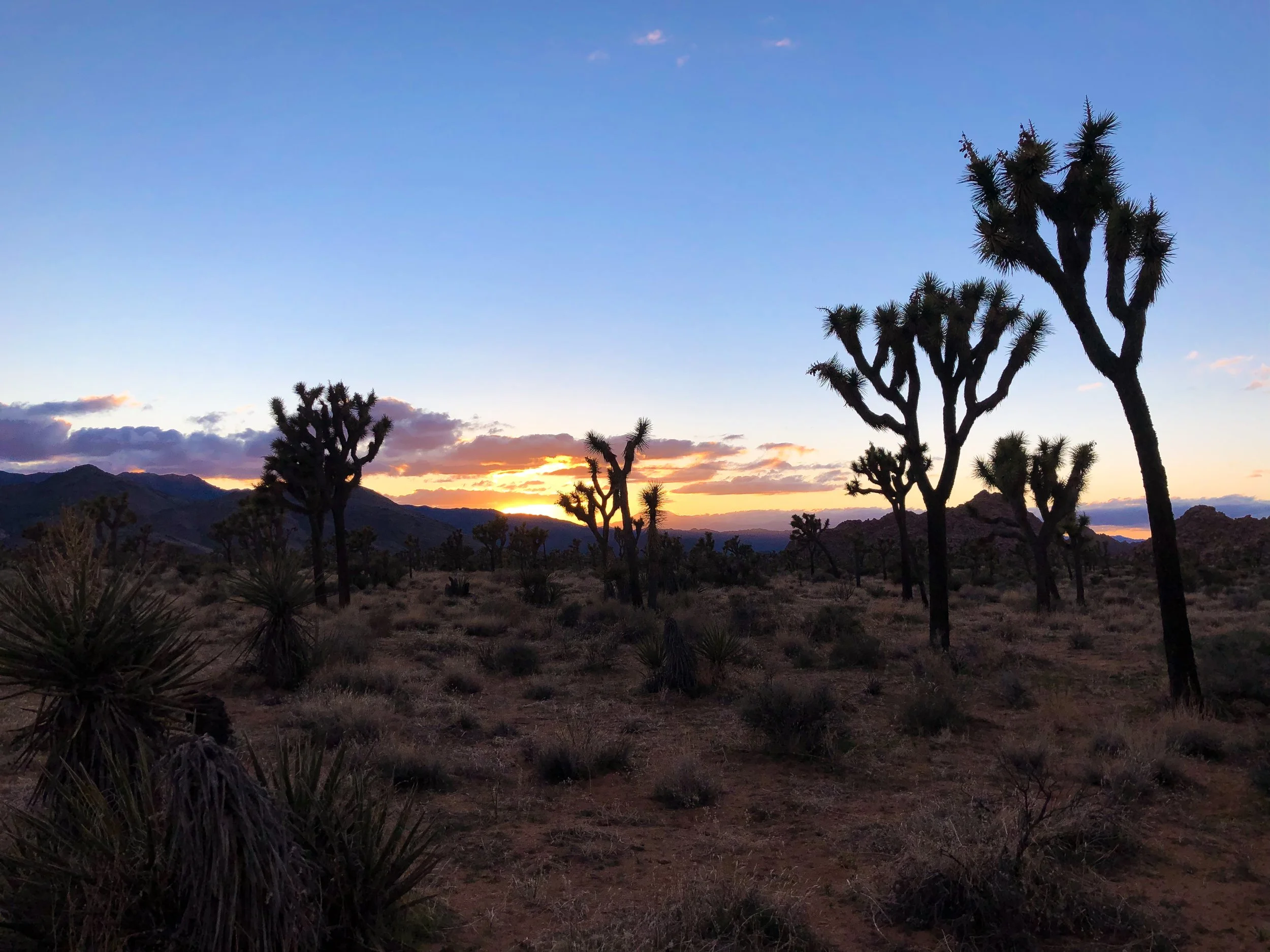
Willow’s Hole Trail. Considered one of Joshua Tree’s most scenic hikes. The trail offers a variety of the entire Joshua Tree landscape ending at a desert oasis surrounded by willow trees. The first half of the trial is relatively flat, surrounded by large rock formations, Joshua Trees, desert plants and countless whitetail and jackrabbits. The second half of the trail winds through a canyon with incredible cliffs and washes before ending at the peaceful oasis. During the return hike, we enjoyed golden hour illuminating the terrain and watched as the sunset painted the sky in an array of colors.
Pro Tip. Begin in the late afternoon to avoid peak heat, planning to finish the hike around sunset.
Good to Know. The hike spans more than 7 miles round trip and takes about 4 hours at a normal pace. Be prepared to climb over large boulders to avoid floods parts of the trail.
Chola Cactus Garden. Located midway along Pinto Basin Road is this incredible cactus garden filled with Chola cacti. Watch your step along the trail and don’t touch them.
Pinto Basin Road. A scenic road leading from the north end to south end of the park, taking about an hour to drive. Most Joshua Trees are located in the High Mojave Desert in the north while the Colorado Desert to the south is known for its its cacti patches.
Pinto Basin. A vast swath of cacti covered desert and mountains. It’s easily viewed from the Pinto Basin Road.
Ocotillo Patch. Located near the south end of Pinto Basin road is an extensive patch of Ocotillo Cacti. These massive cacti grow several feet high and gracefully sway in the wind.
Skull Rock. An eroded rock formation that resembles the shape of a human skull.
The Night Sky. The High Mojave Desert is located far enough from any major cities making light pollution very minimal and offering incredible night sky views.
Joshua Tree Essentials
Maps & Park Pass. Stop at one of the Visitor Centers to buy a park pass and map. Ask a ranger for recommendations on where to hike based on what you want to do or see. Visit the National Park Service for detailed info on Joshua Tree and its trails. Alternatively, set up an account with All Trails for detailed info on all of the parks routes with info curated by other hikers.
What to Bring
Water
Trail Snacks
Sunblock & Sunglasses
Flashlight
Map
Where to Stay
There’s no shortage of places to stay in and around Joshua Tree. The park itself has a few campgrounds while many quaint desert resorts, motels and unique stays surround the park.
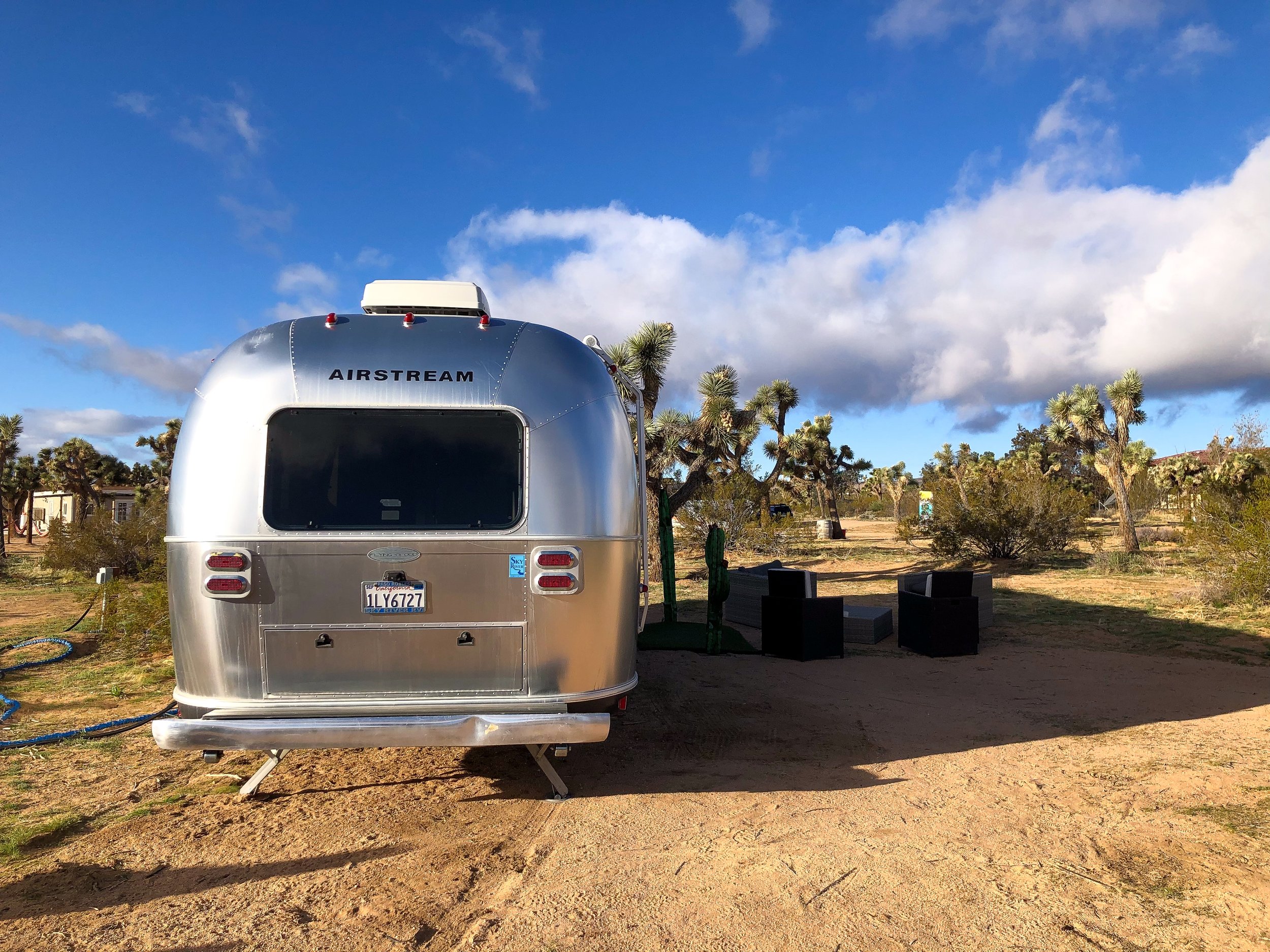
Joshua Tree Airstream. A traditional Airstream camper set amongst the shrub covered desert landscape. The cozy space is fully equipped with two beds, a communal area, kitchen, toilet and shower. It’s located less than 30 minutes from the West Entrance Station. Book on Airbnb.
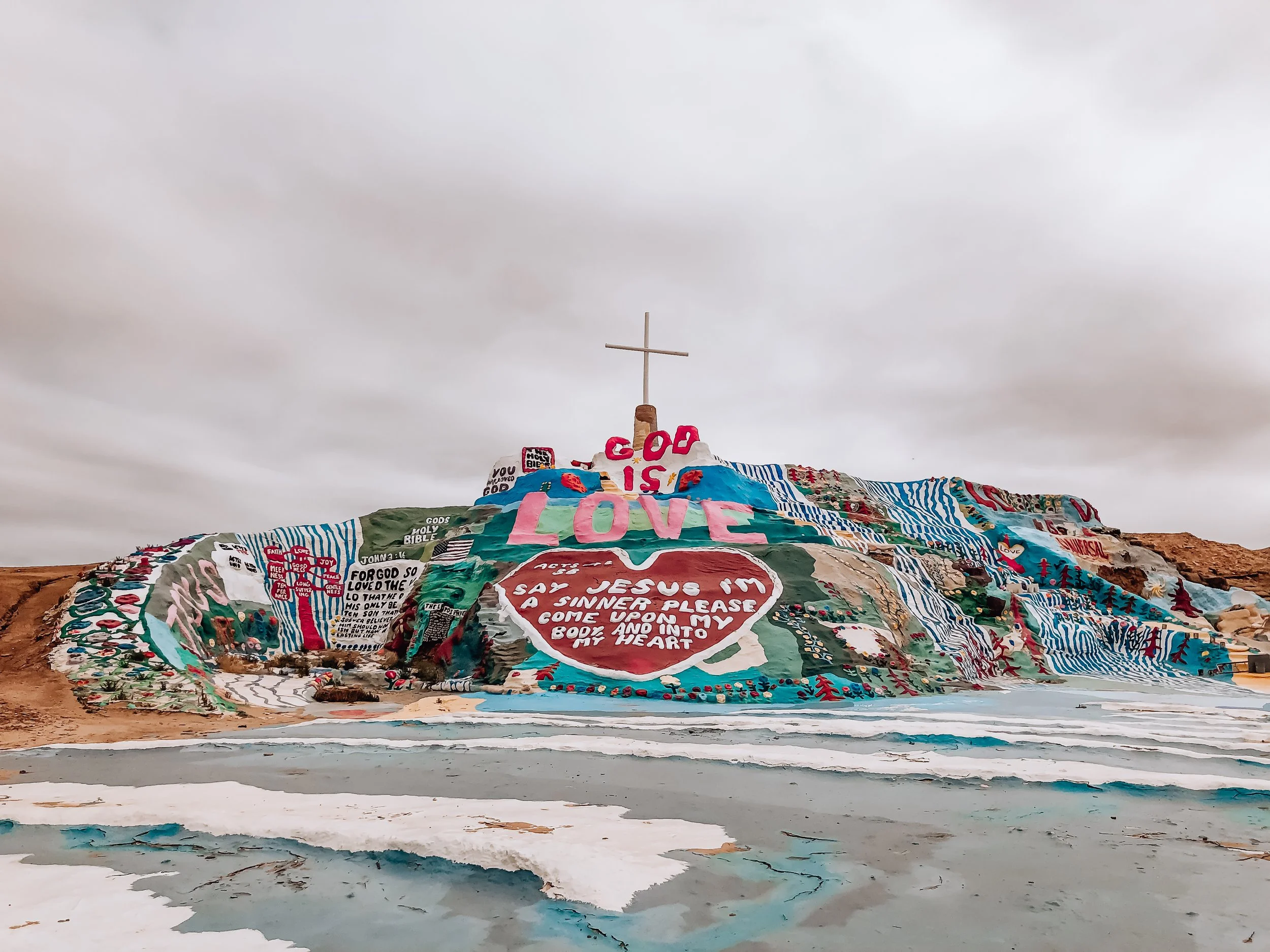
Salvation Mountain
Salvation Mountain is a massive art piece located in the California Desert started by Leonard Knight in the mid 80s. The site is inspired by the scriptural passages with the simple message, “god is love.” Love, in our opinion is the true theme of this place. The mountain is covered in colorful and peaceful imagery of waterfalls, flowers and the yellow brick road centered around the most prominent word, love, situated above a giant heart. The structure is built from a mixture of hay, packed clay and layers of paint.

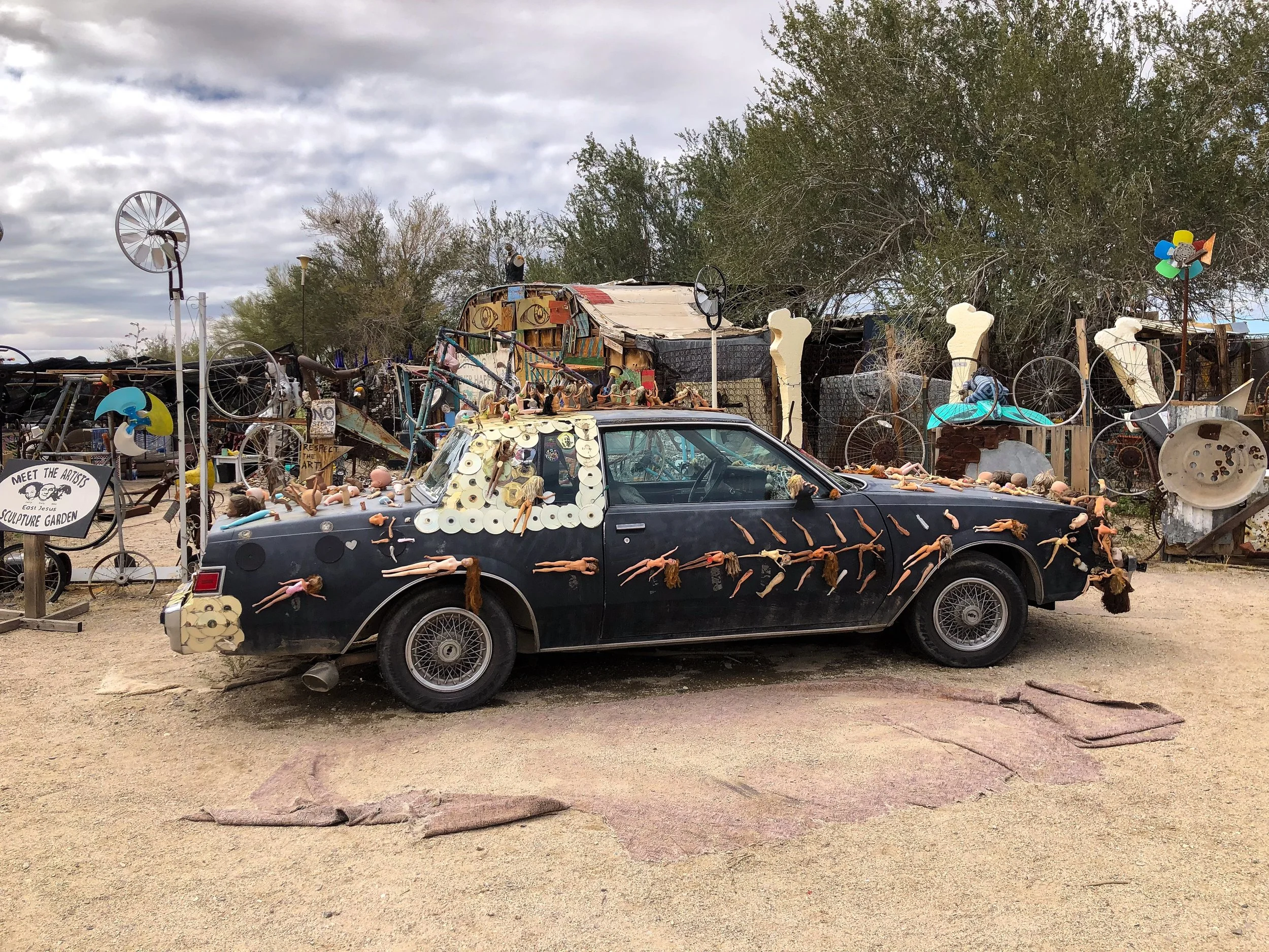
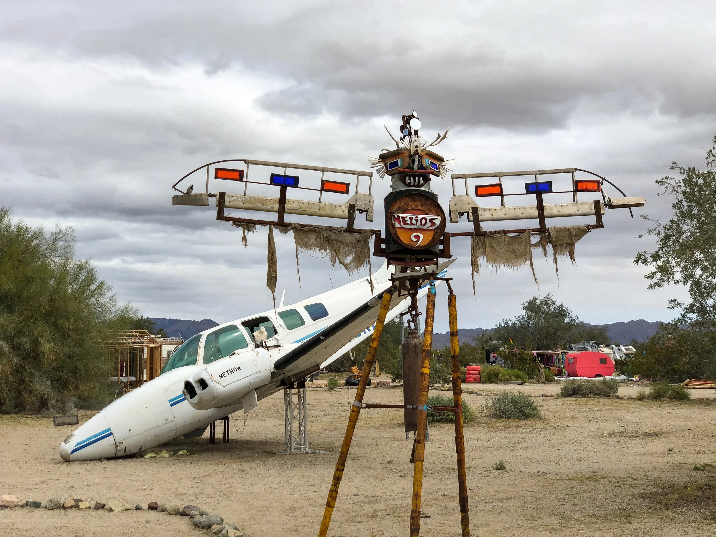
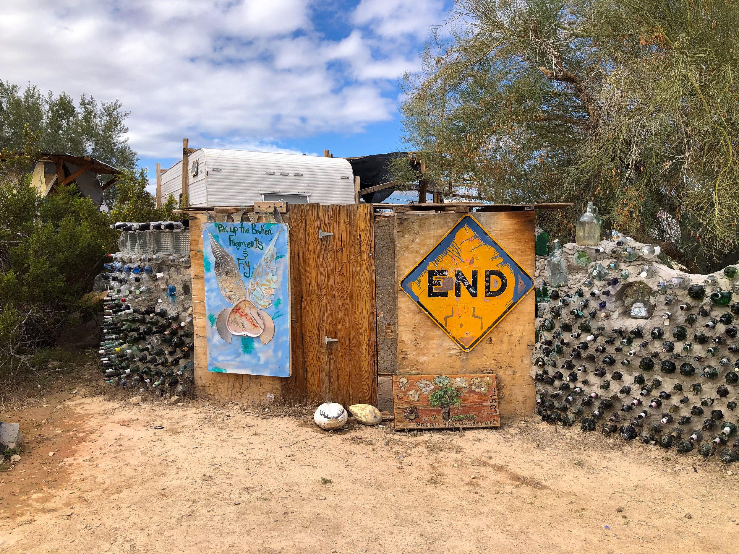
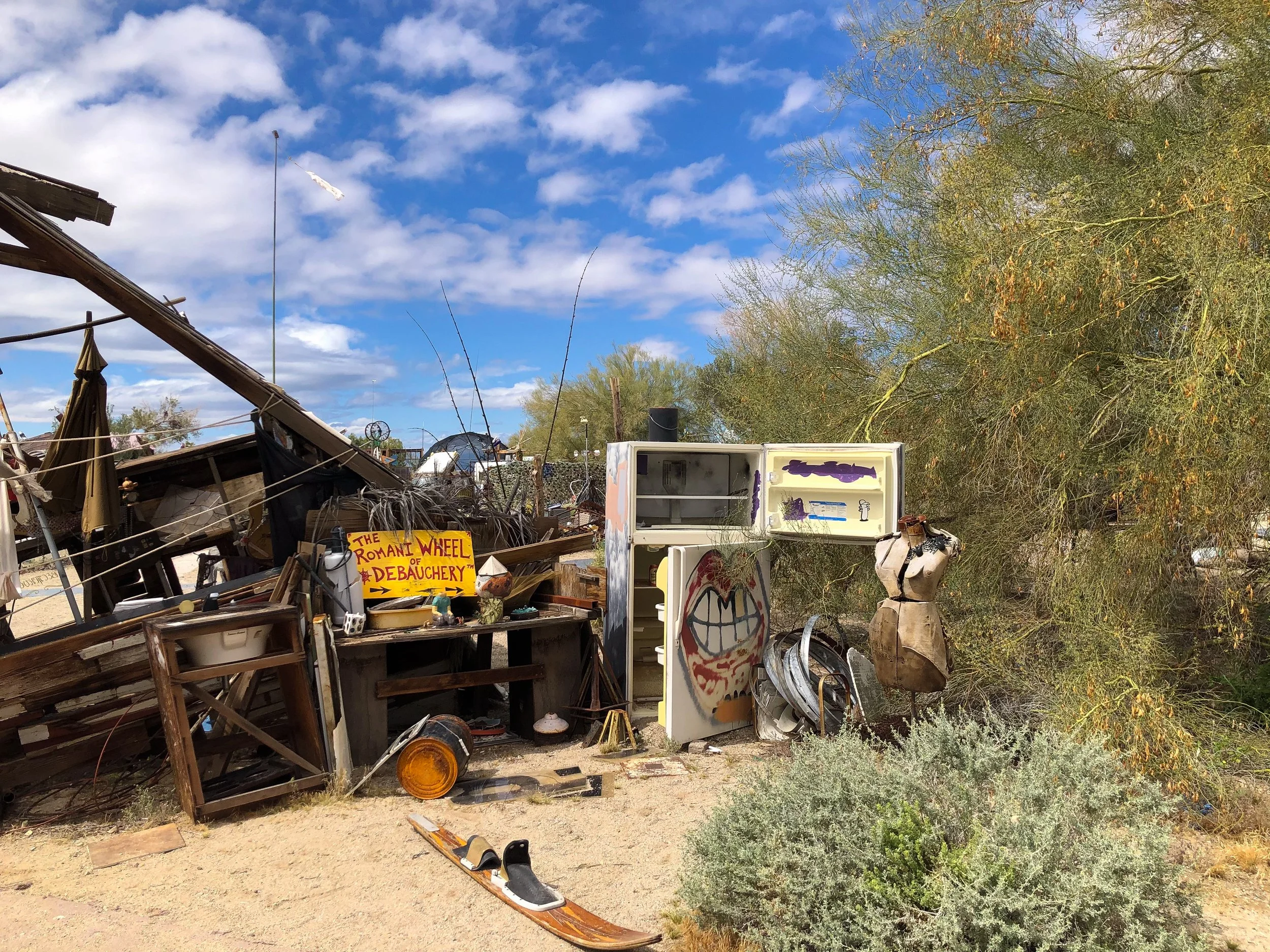
Slab City & East Jesus
Located just beyond Salvation Mountain are two off the grid alternative living communities, Slab City and East Jesus.
Slab City. A community named for remnants of concrete slabs left behind after the demolition of a military training camp. The slabs are home to RVs, permanent trailers, make shift buildings and piles of debris. Many of the folks who live here have come to live off the grid while others are here as a result of poverty. There is no electricity, running water, waste management or local government. Despite that, there is a certain since of community with its own library, golf course, clubs and music venues.
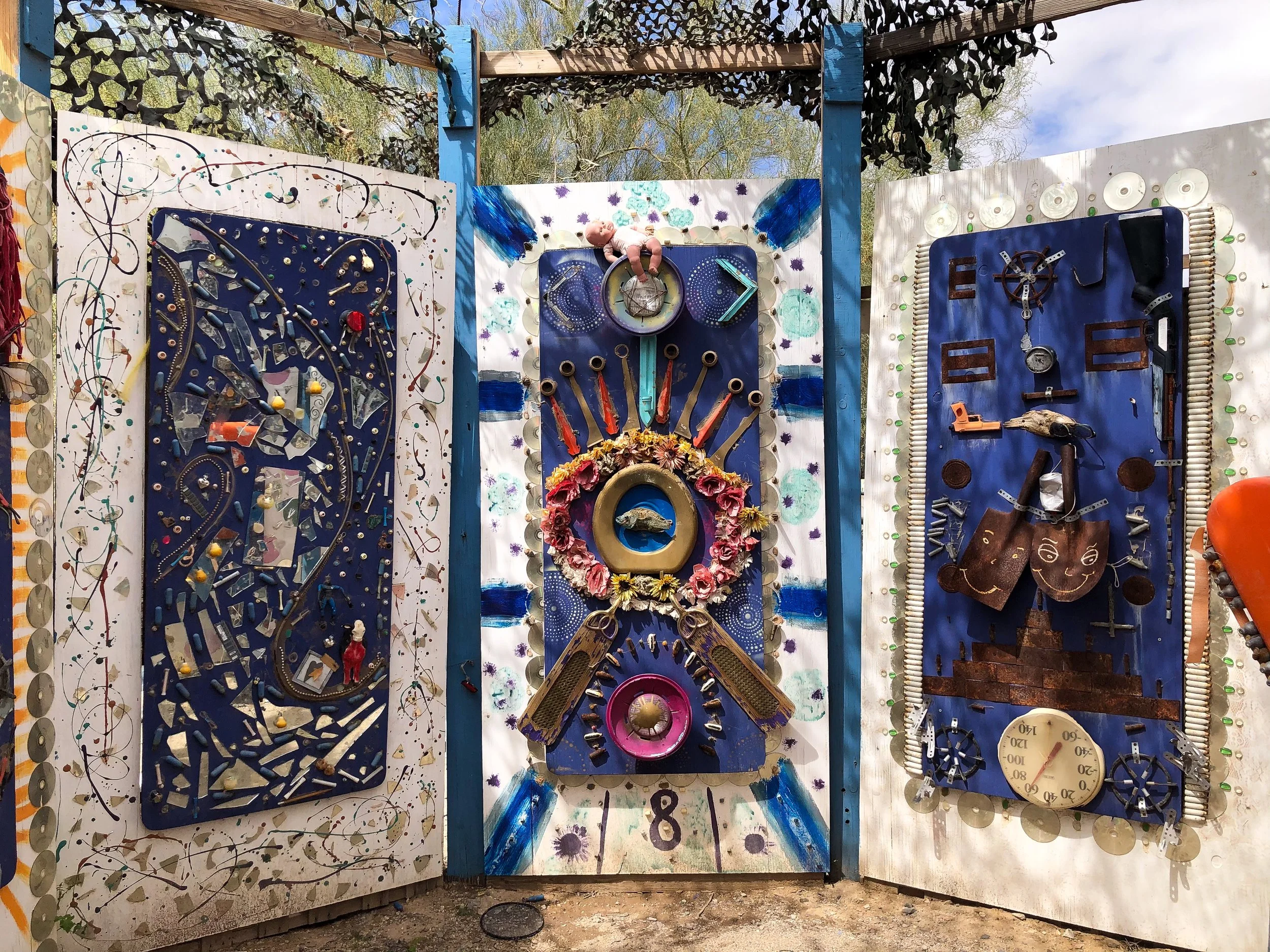
East Jesus. A sustainable and habitable art installation focused on creative re-use. The experimental community is built from discarded materials and salvaged waste. It’s inhabited by artists, musicians, writers and other creatives. We spent hours wandering, observing and talking with some of the locals to get a better perspective on the place. Come here with an open mind. There is no where else quite like it.
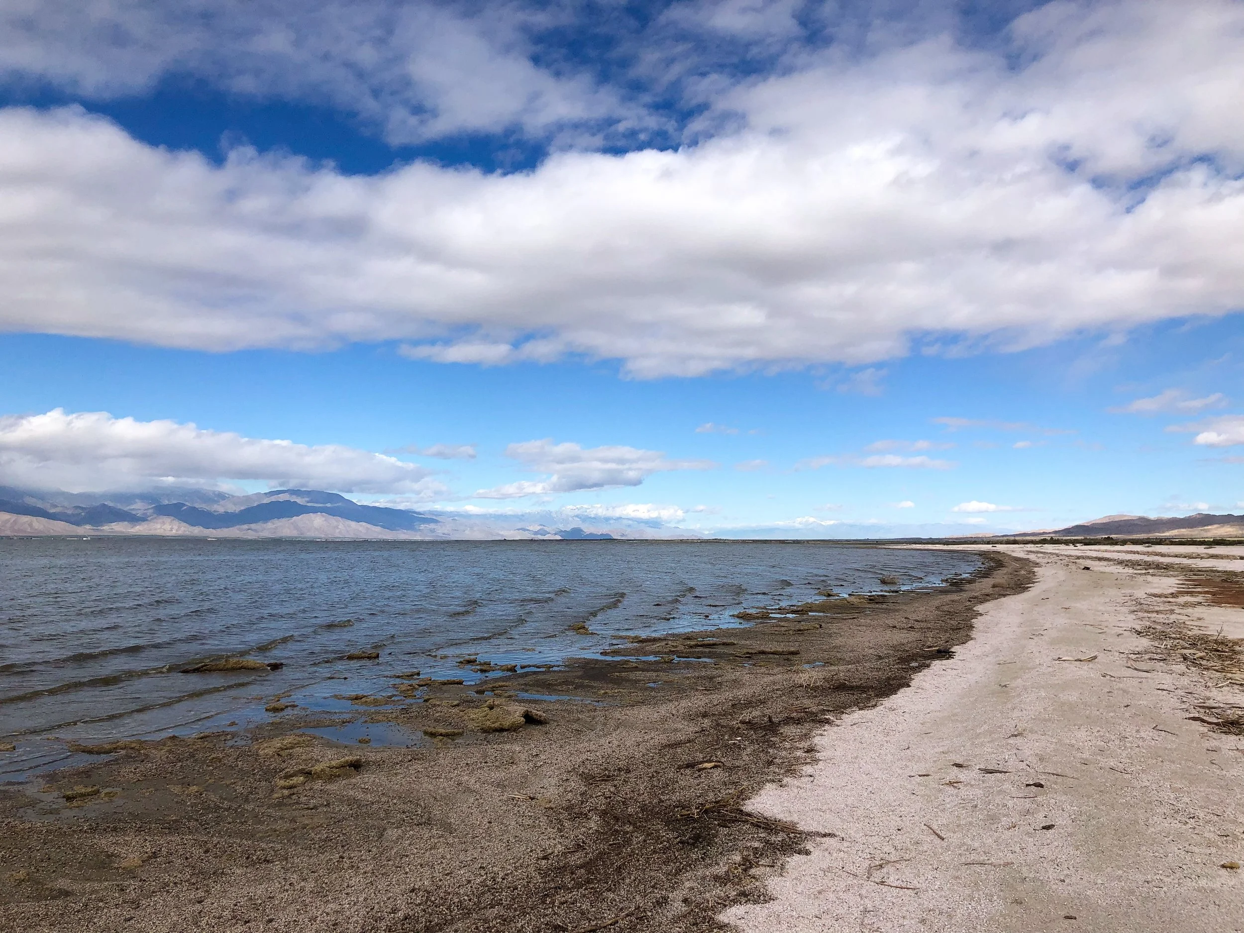
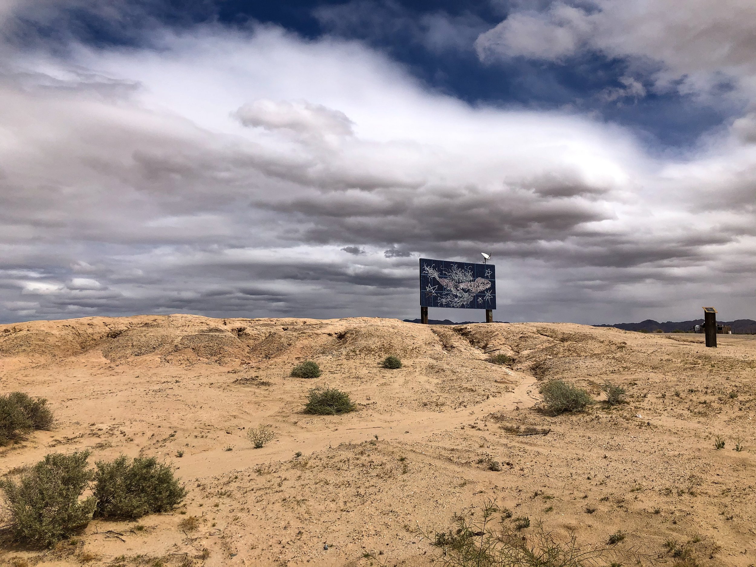
Salton Sea & Bombay Beach
The Salton Sea. An ancient lake bed, accidentally flooded during the early 20th Century, now contaminated with agricultural runoff. The shrinking body of water and its shoreline is covered in the decomposing remains of fish, dried clay and salt deposits.
Bombay Beach. A once thriving seaside community catering to celebrities, retirees and vacationers during the mid 20th Century. The town, now mostly forgotten is a place stunted in its growth yet still inhabited by a small number of families and artists. We passed a man painting television screens on the street, two children seamlessly sweeping dirt for leisure and a woman sitting alone on a chair in the middle of an empty lot. Many homes have been left behind due to the toxicity of the sea and damage caused by the salinity in the air. A sobering place that should’t be overlooked or looked down upon.
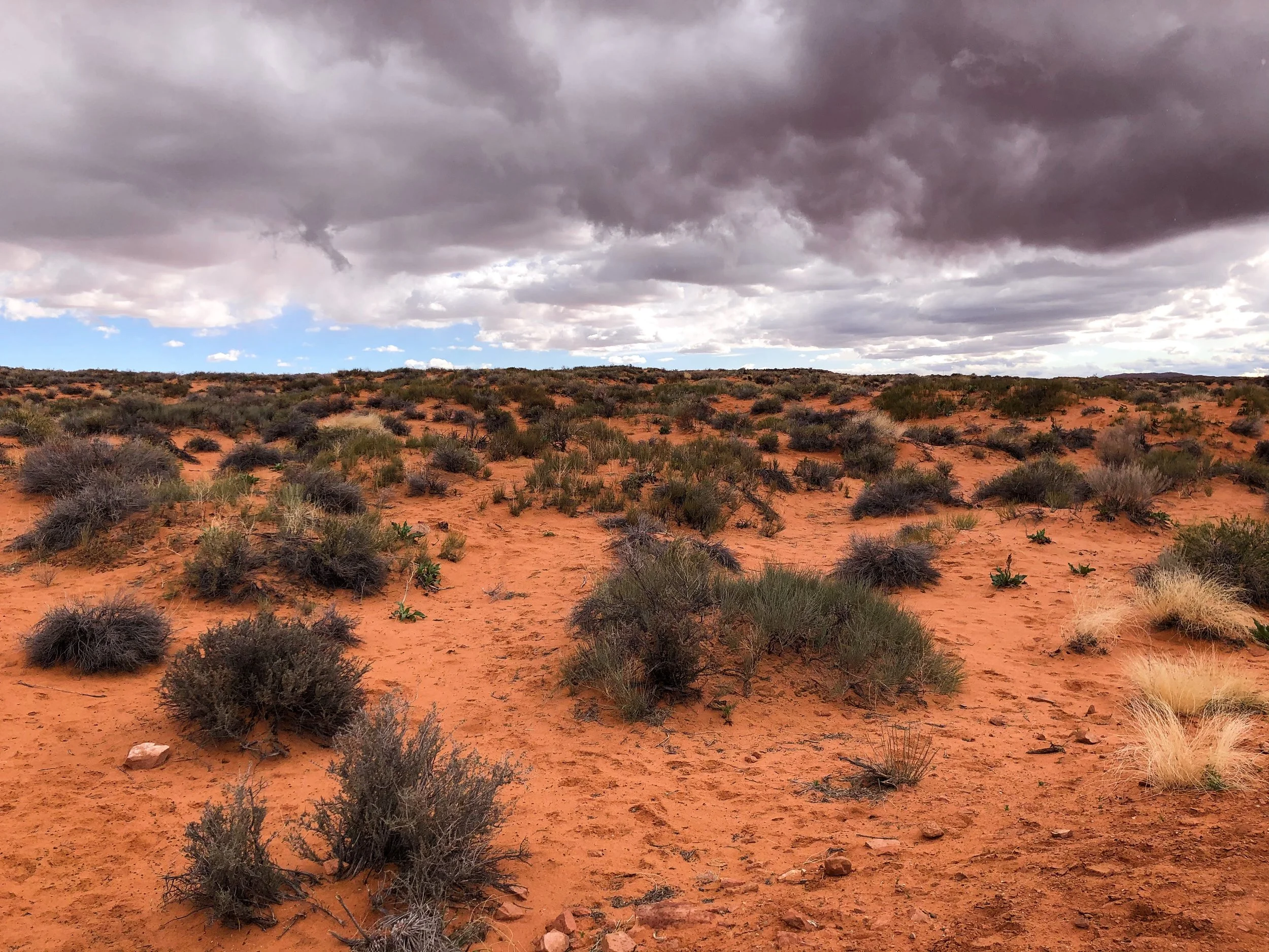
Northern Arizona
Our roadtrip through Northern Arizona led us to some of the United States greatest natural wonders and pre-Columbian ruins.
The Grand Canyon
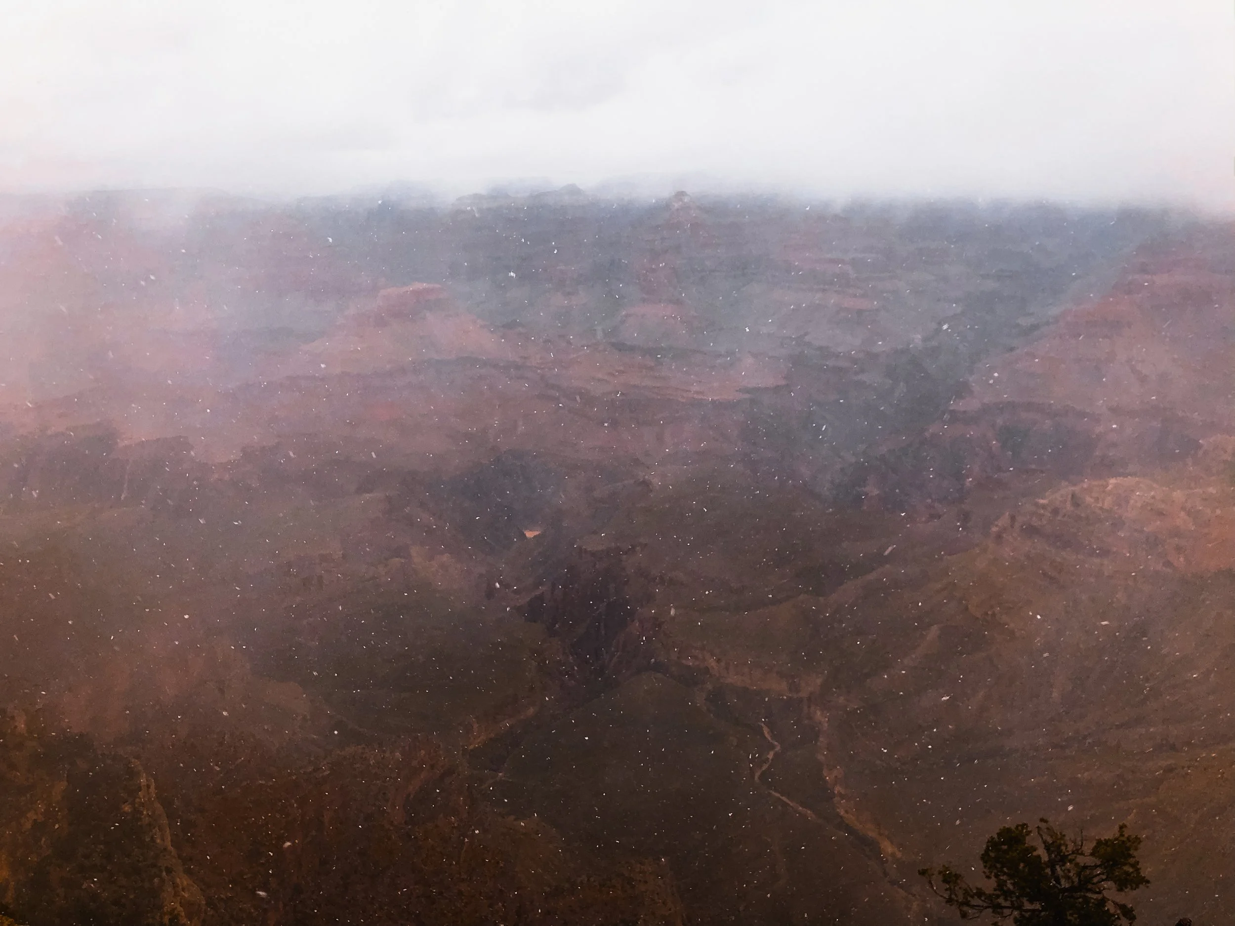
The Grand Canyon is revered as one of the greatest natural sights on Earth. Its size, at 1 mile deep and up to 18 miles wide, reveals millions of years of layered sediment and orange hued rock. We overlooked the South Rim of the canyon during the middle of a blizzard, unable to see much through the white out, we laughed and vowed to return one day!
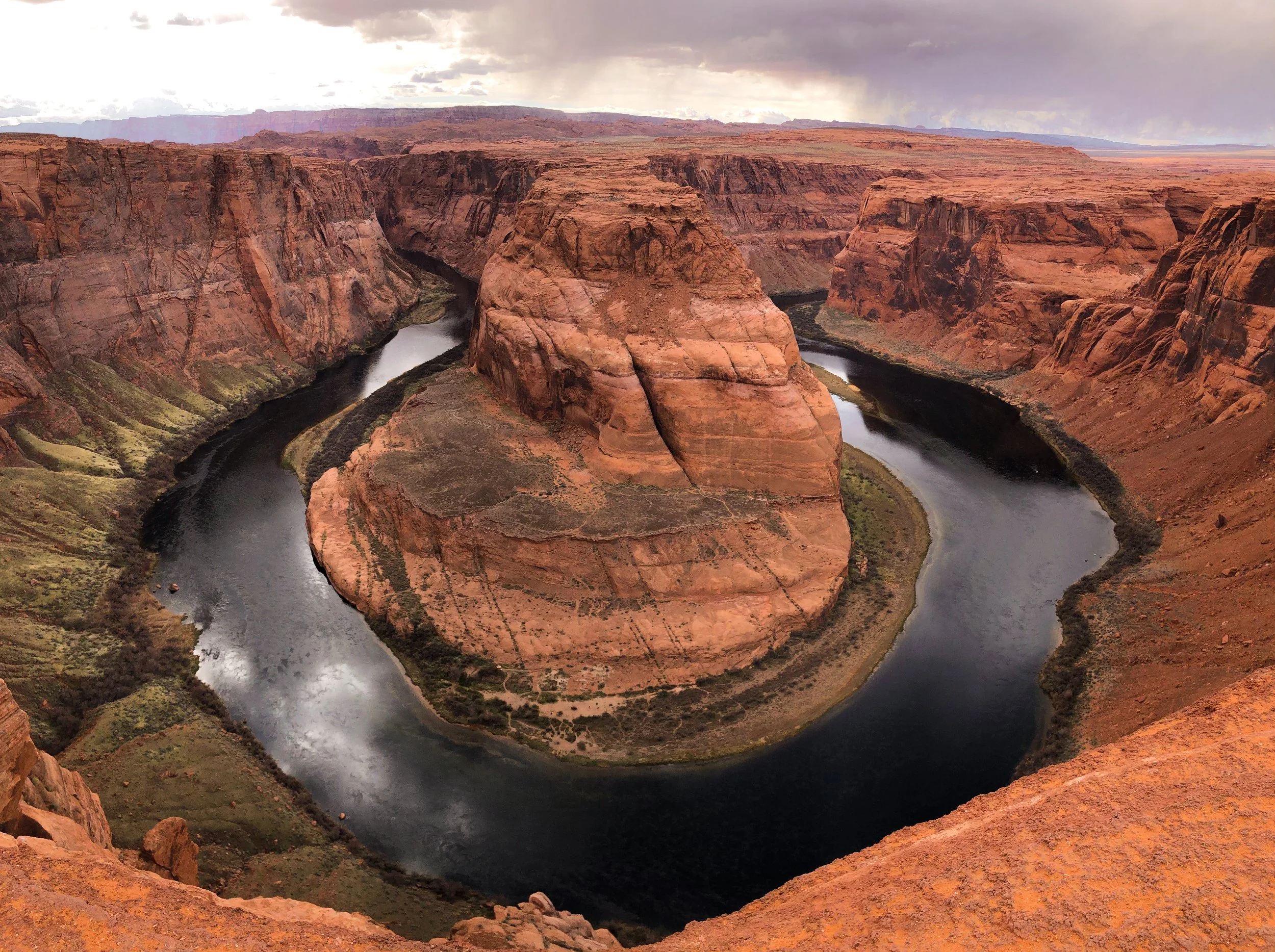
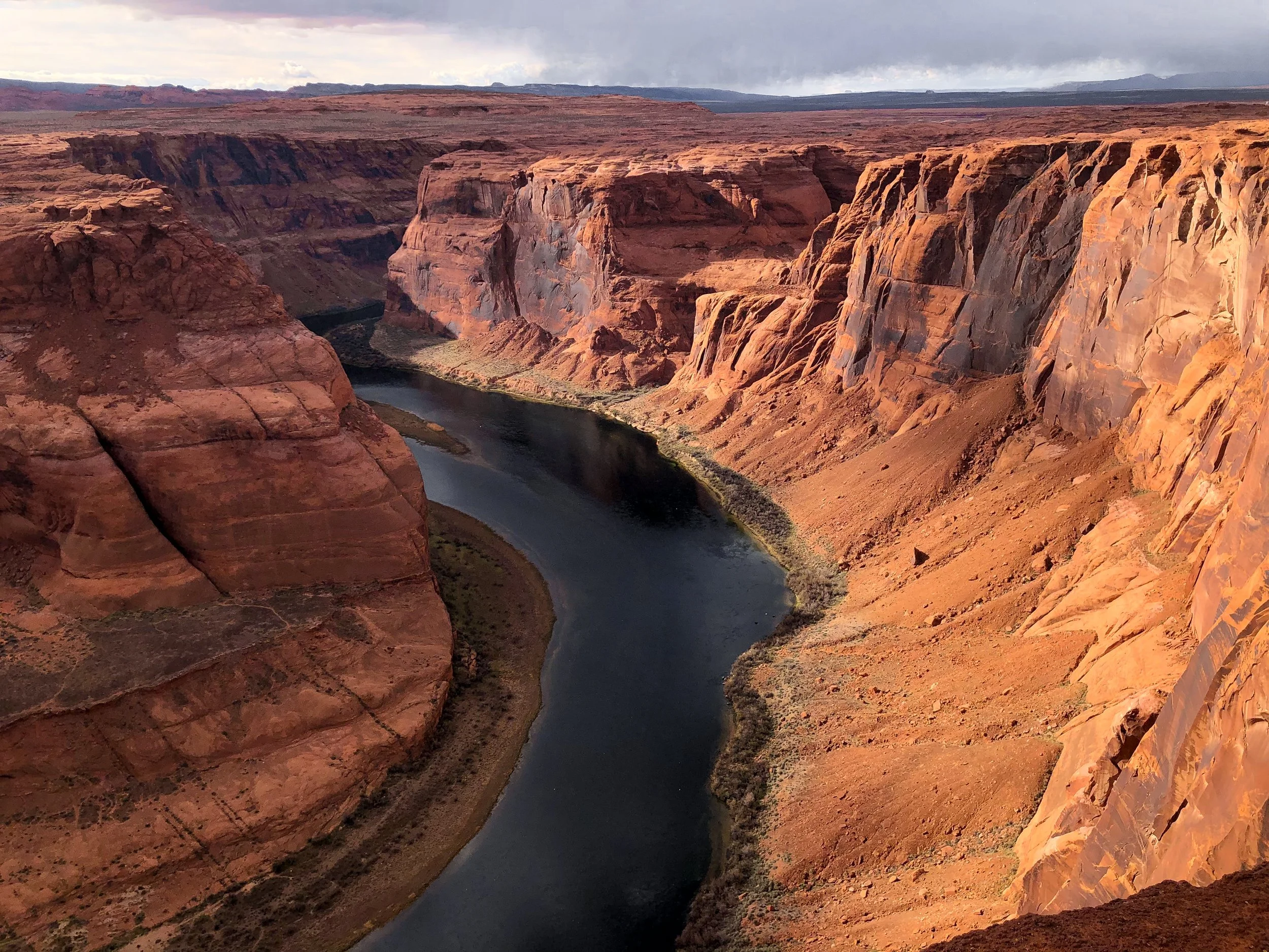
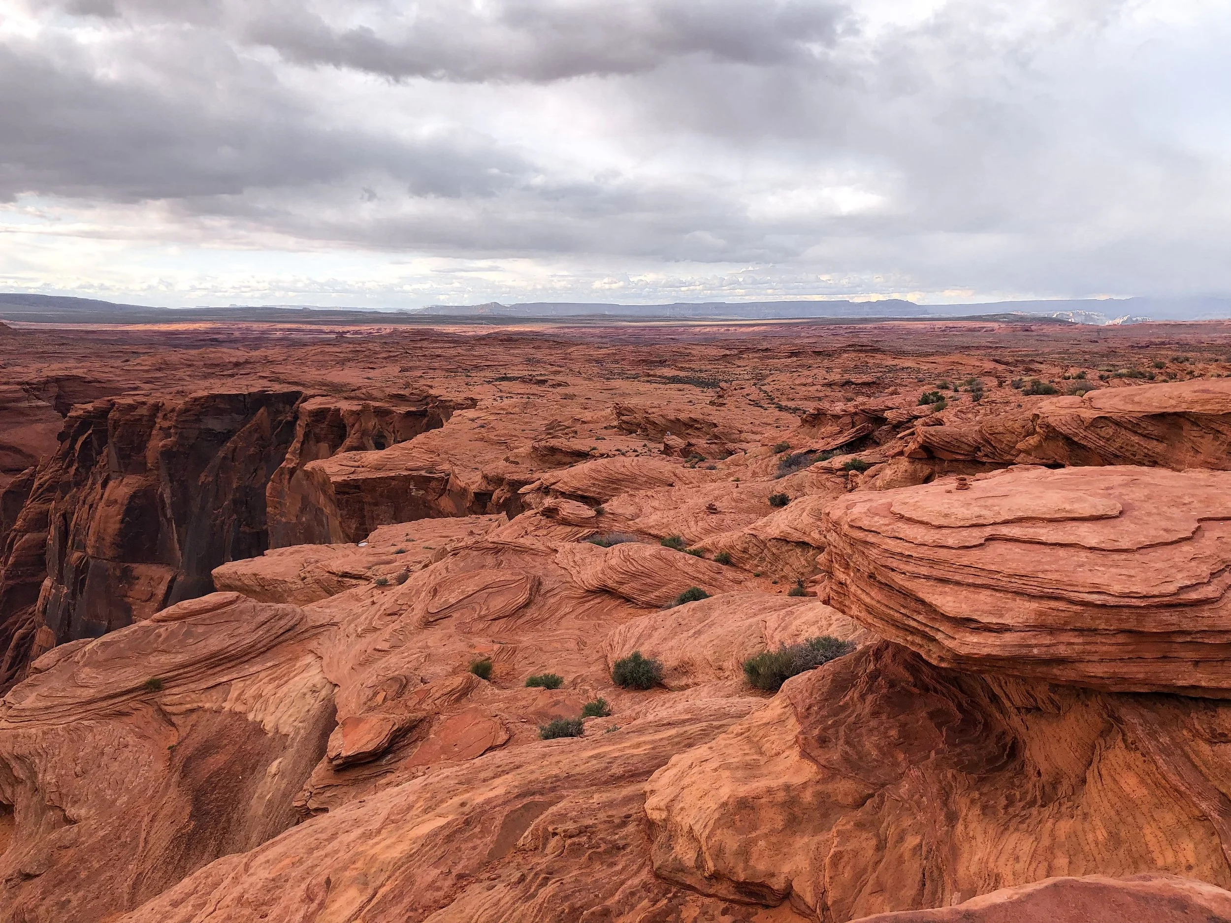
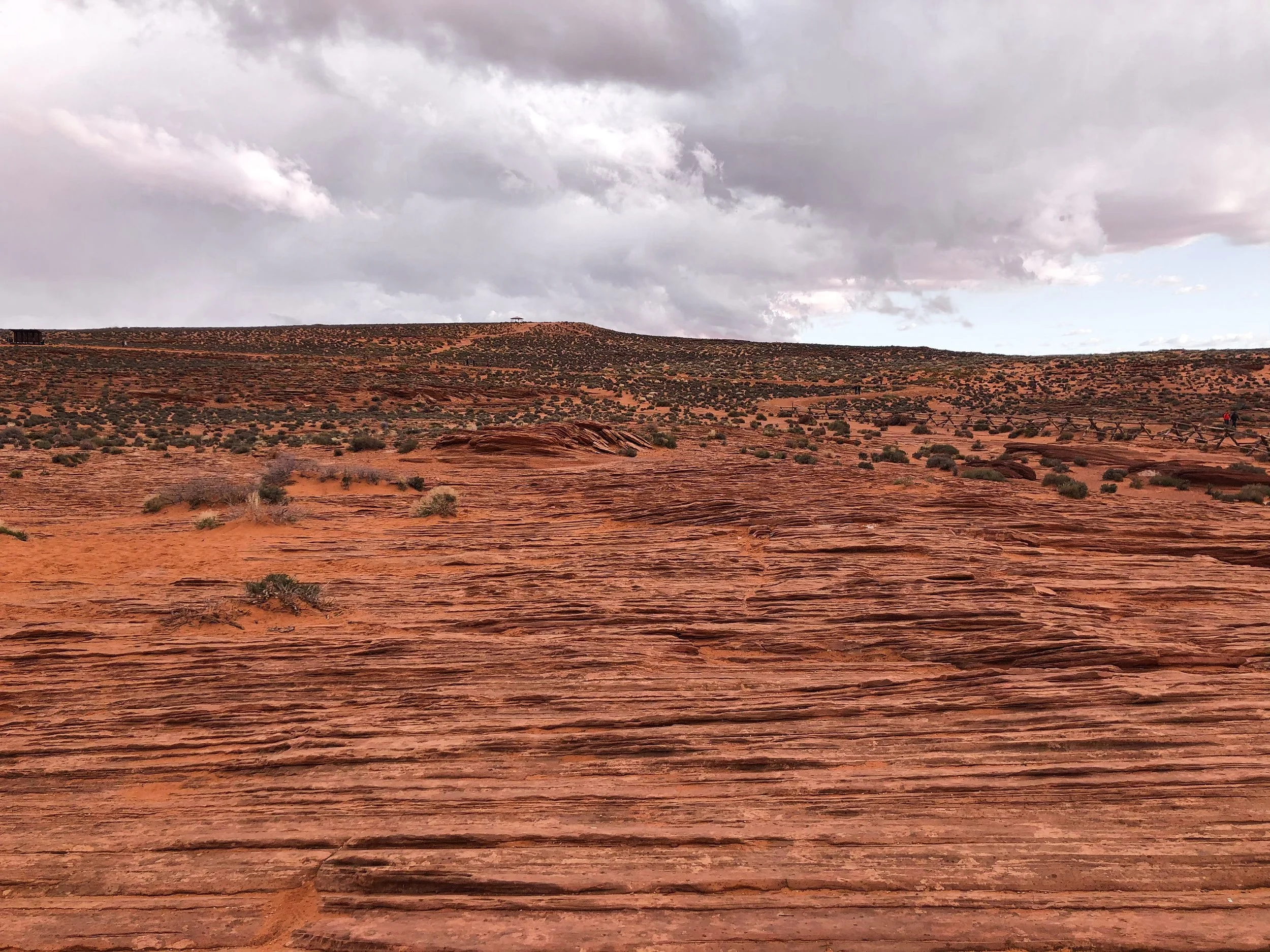

Horseshoe Bend
Horseshoe Bend is a 1,000 foot steep bend of the the Colorado River in the shape of a horseshoe. It’s a breathtaking and truly awe inspiring place. We spent the late afternoon wandering the rim and admiring its beauty. Located just off the highway outside of Paige, AZ and accessible by a 1.5 mile hike. The overlook is open daily from sunrise to sunset. Bring cash for the entrance fee.
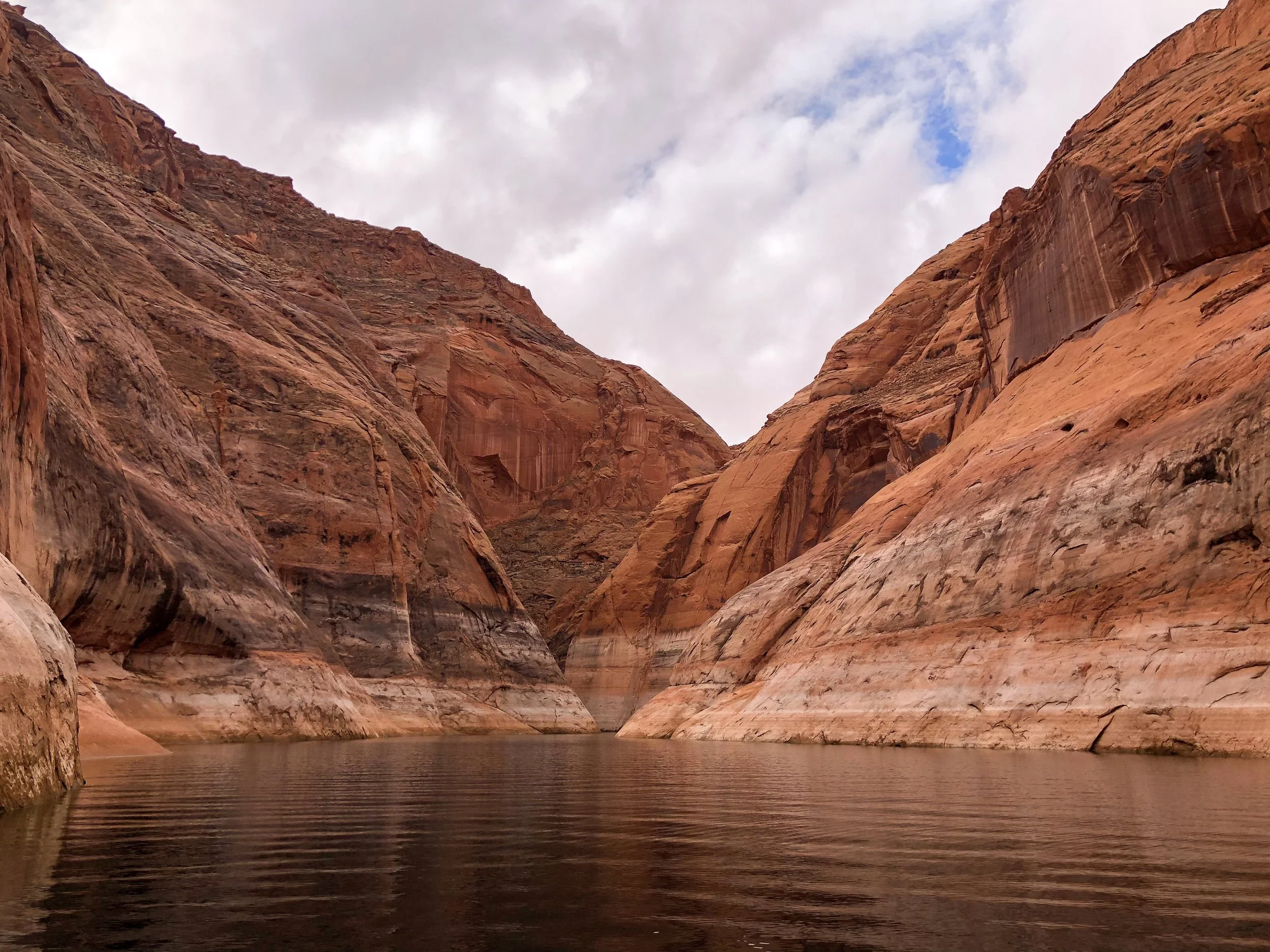
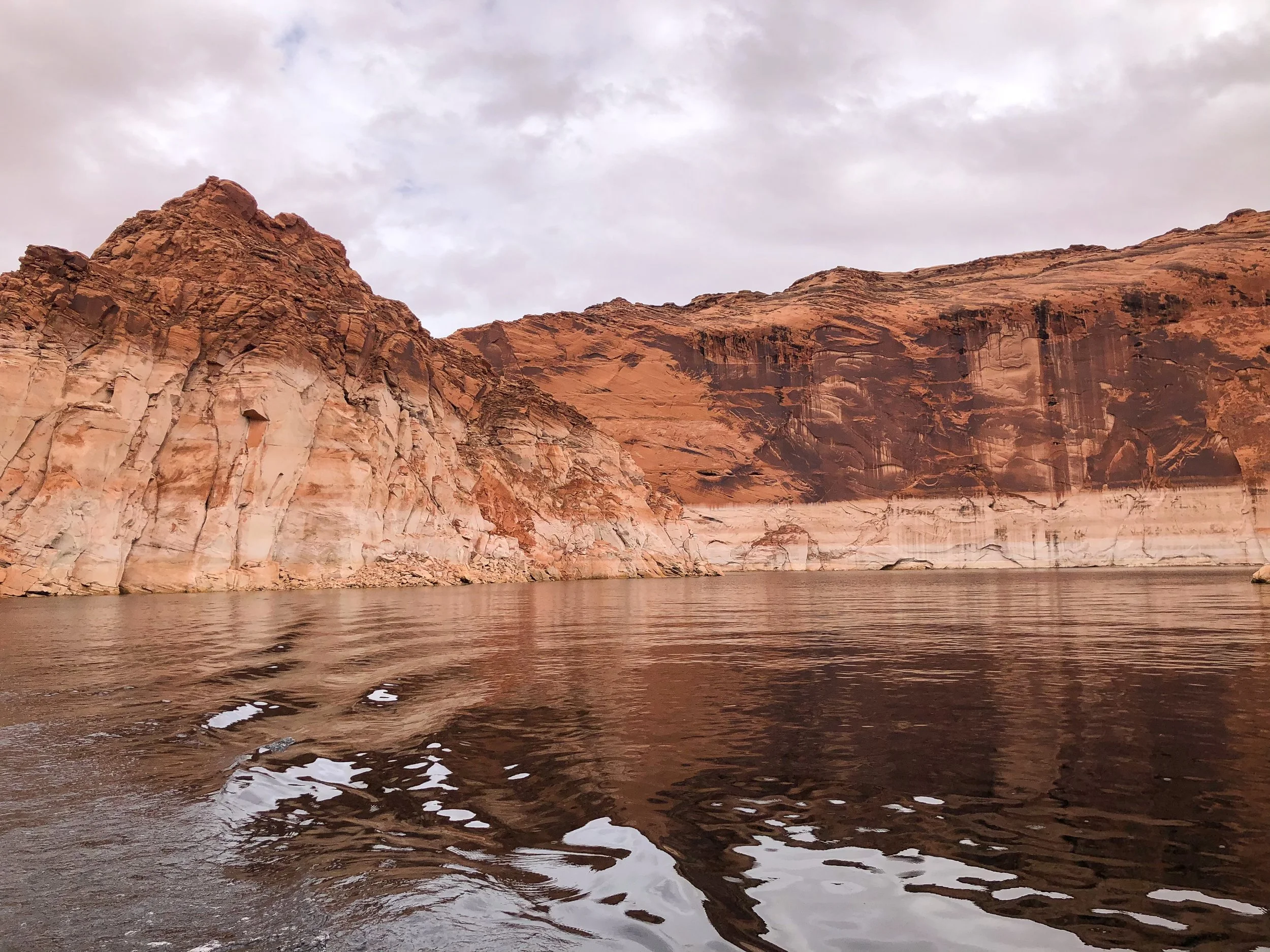
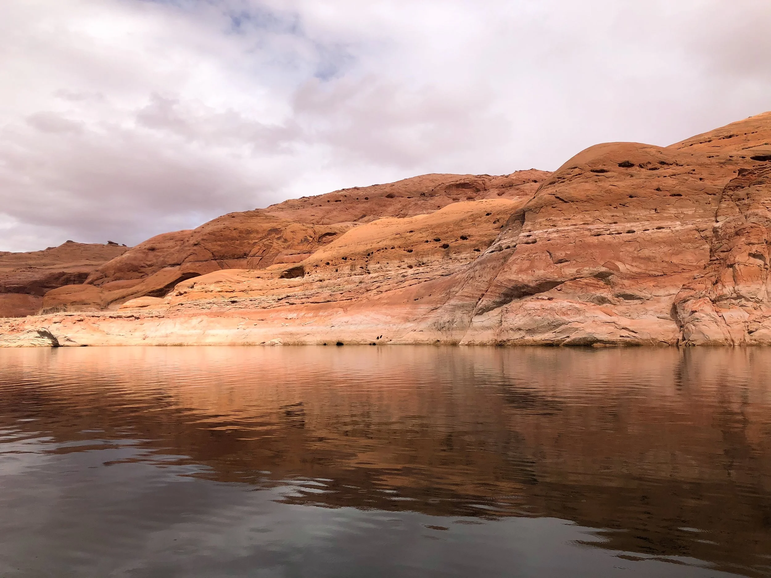
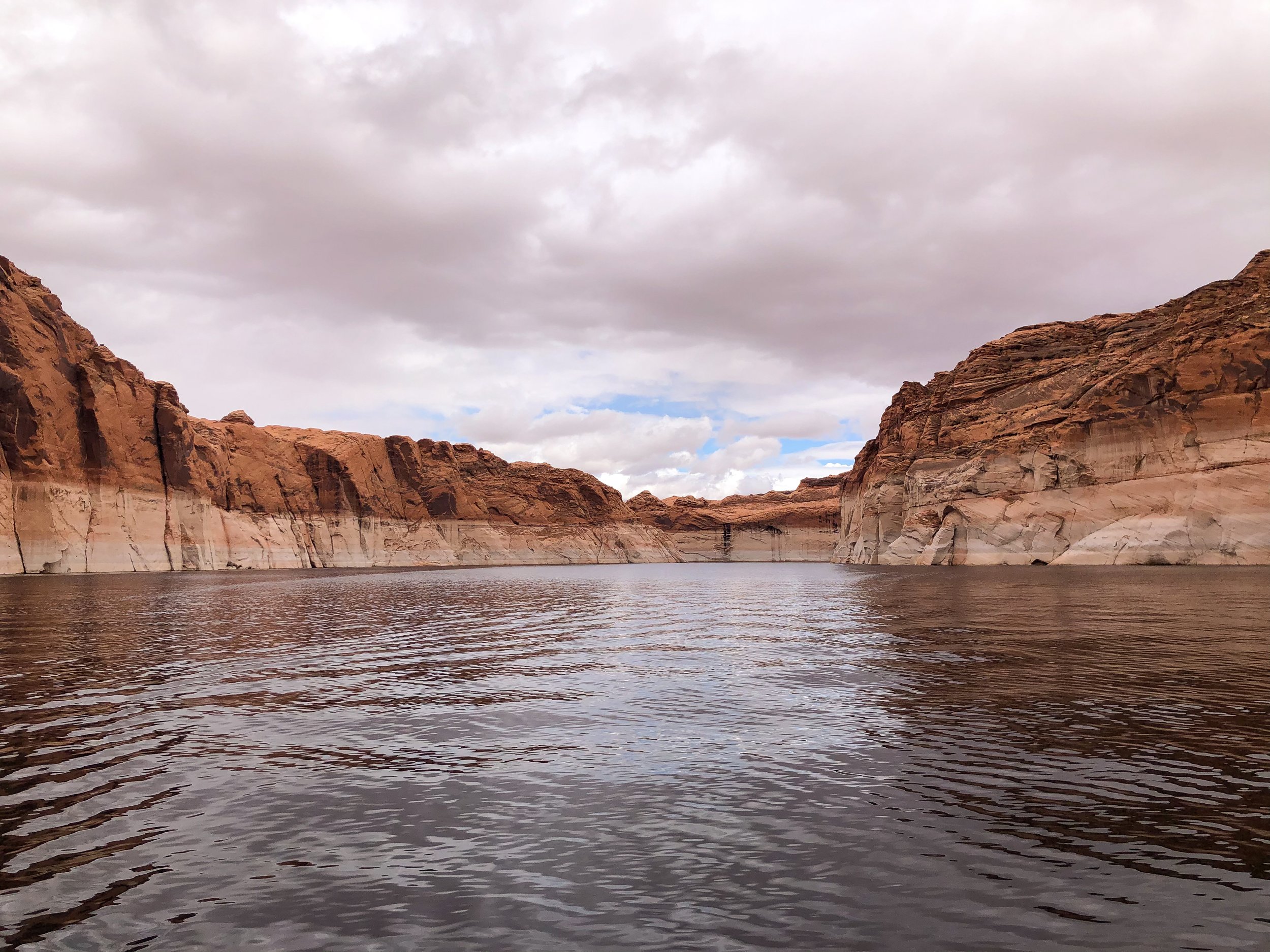
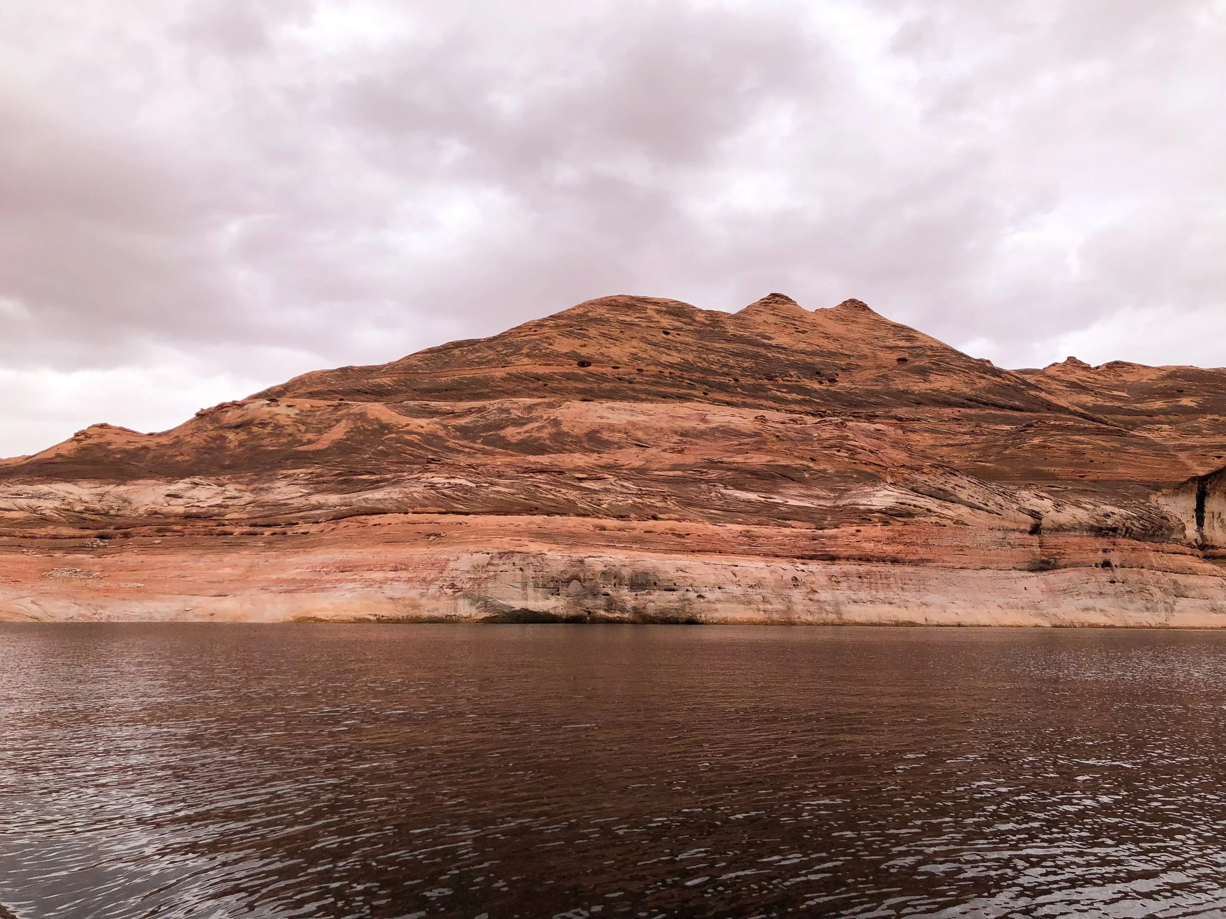
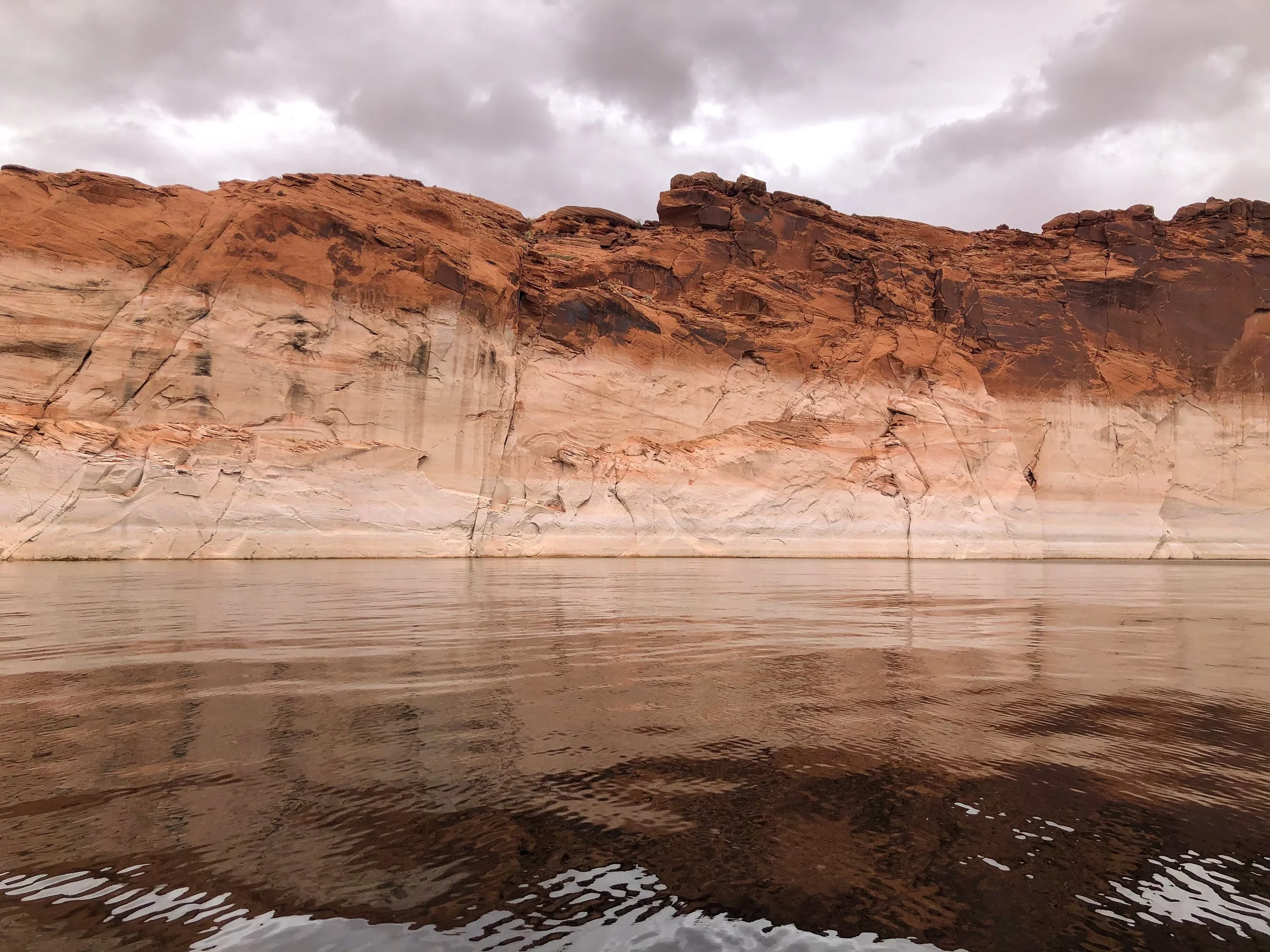
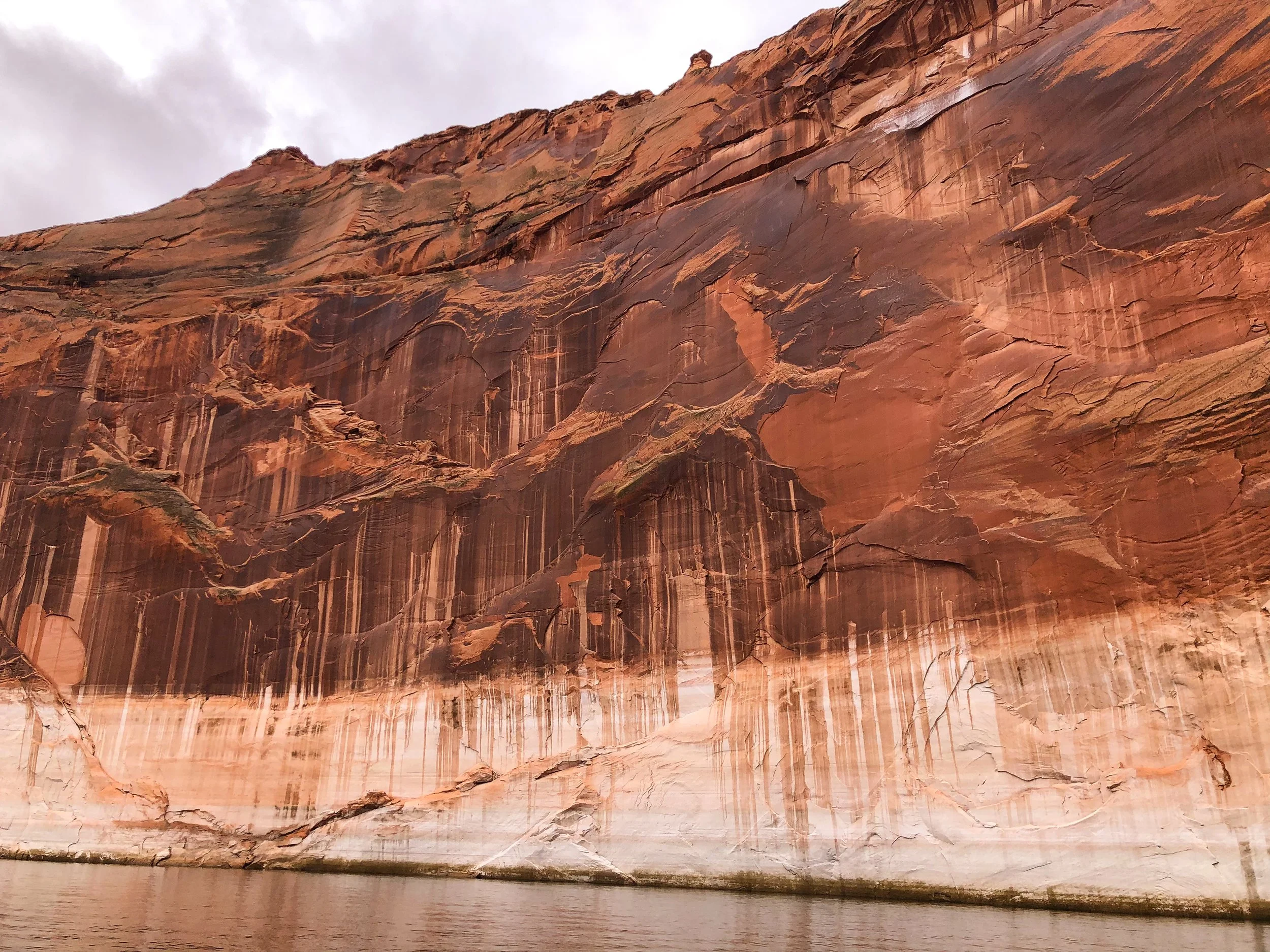
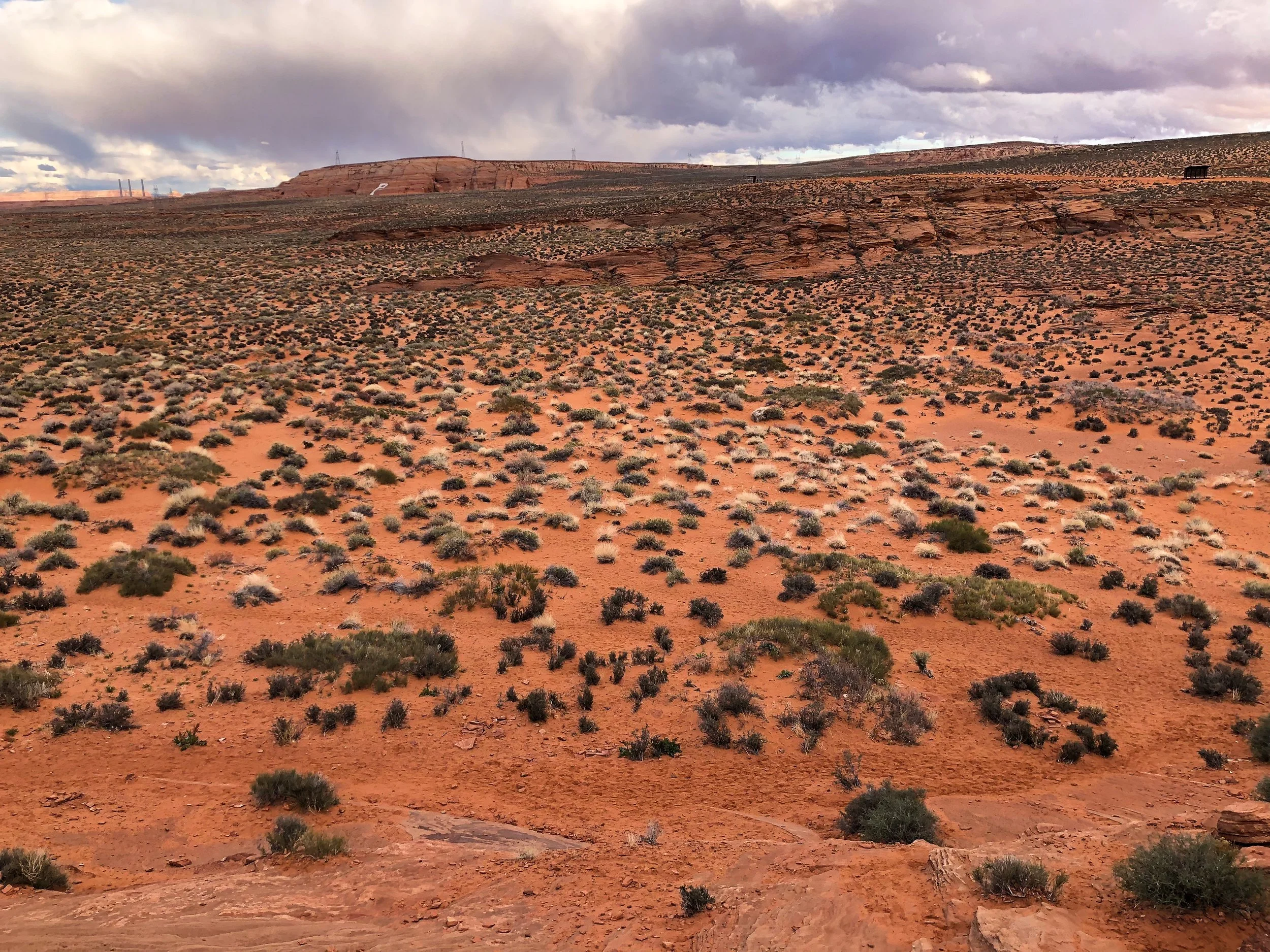
Lake Powell & Navajo Canyon
Lake Powell is a manmade lake created by the Glenn Canyon Dam with over 2000 miles of shoreline. One of the best ways to experience it is by boat. Rent an boat from the Antelope Point Marina to explore the lake. Visit Navajo Canyon, a 16 mile long canyon with massive orange and brown cliffs ranging in height on all sides. The canyon is fairly wide but narrows in areas with tiny offshoots, carefully accessible by boat.
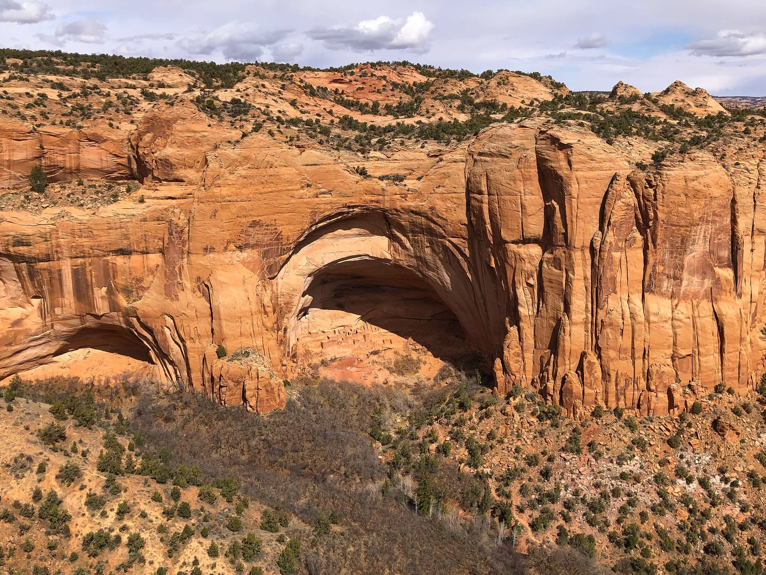
Navajo Cliff Dwellings
The Navajo Cliff Dwellings, also called The Betatakin Cliff Dwellings, are one of the best surviving examples of pre-Colombian civilization in the American Southwest. At its peak nearly 800 years ago, it was home to hundreds of people and contained over 120 sandstone structures built into the protected cliffside. The cave dwellings can be viewed from an observation point at the end of a short hike from the Navajo National Monument Visitor Center.
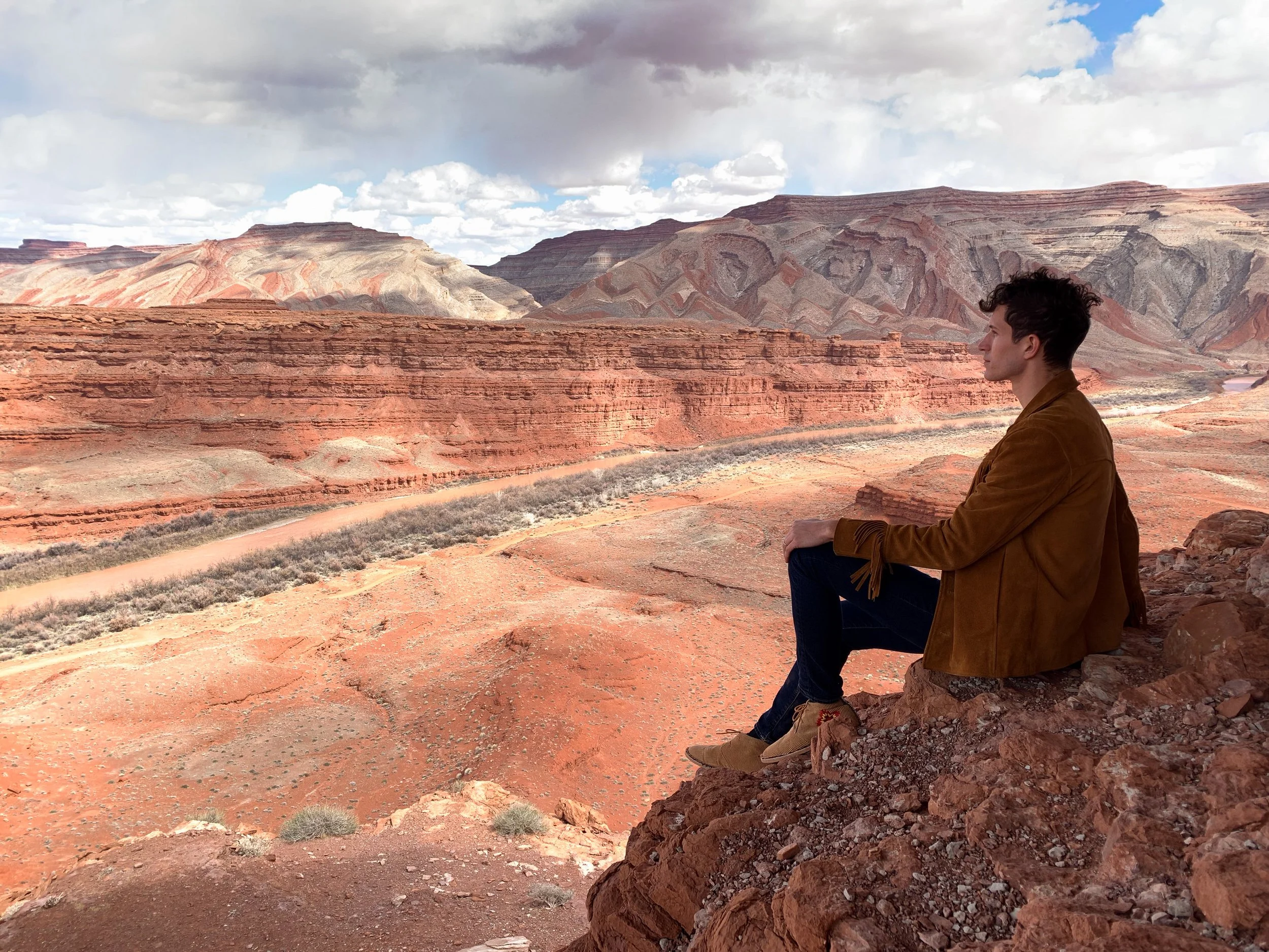
Southern Utah
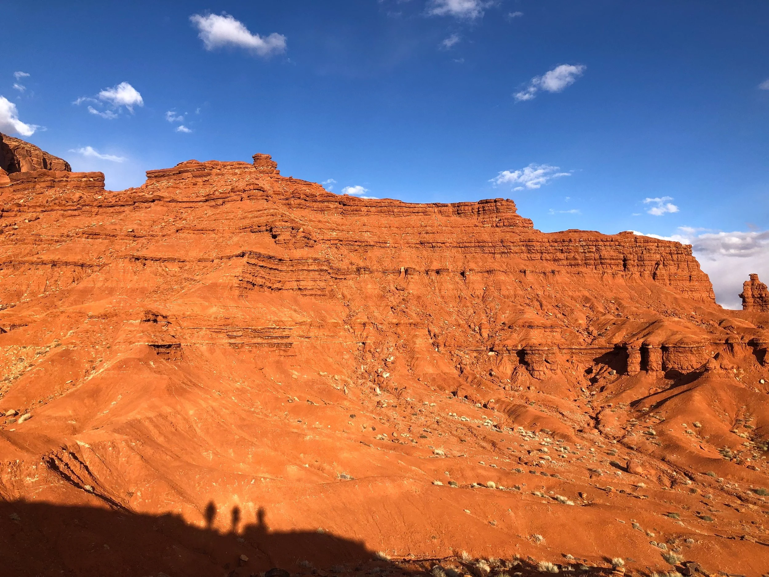
Our roadtrip brought us into the southern sliver of Utah, a part of the state overlapped by the Navajo Nation and defined by its dramatic buttes.

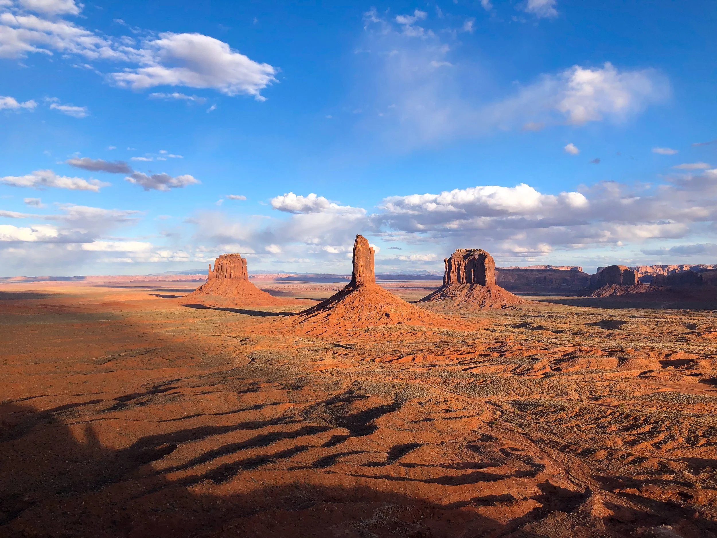
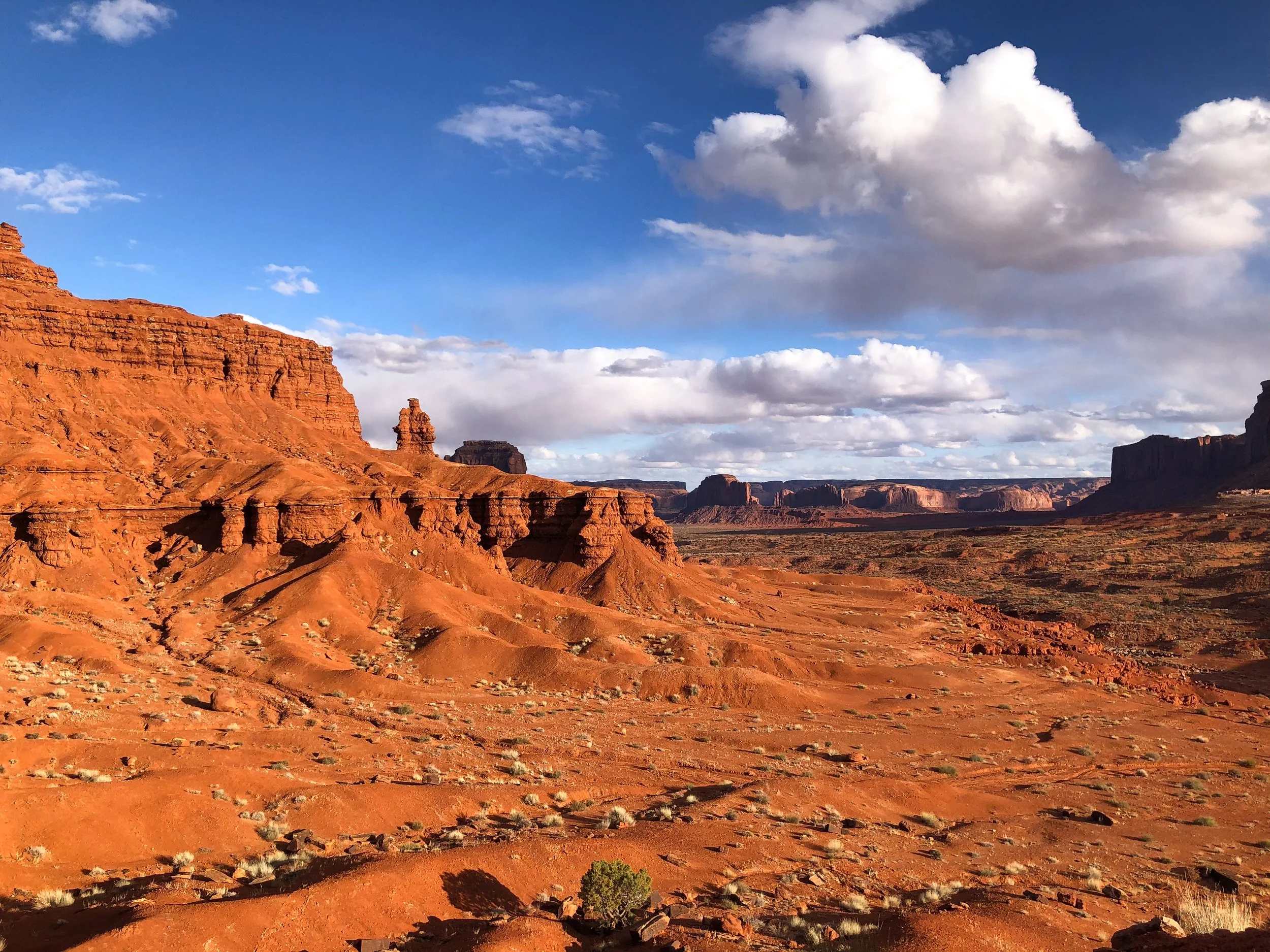
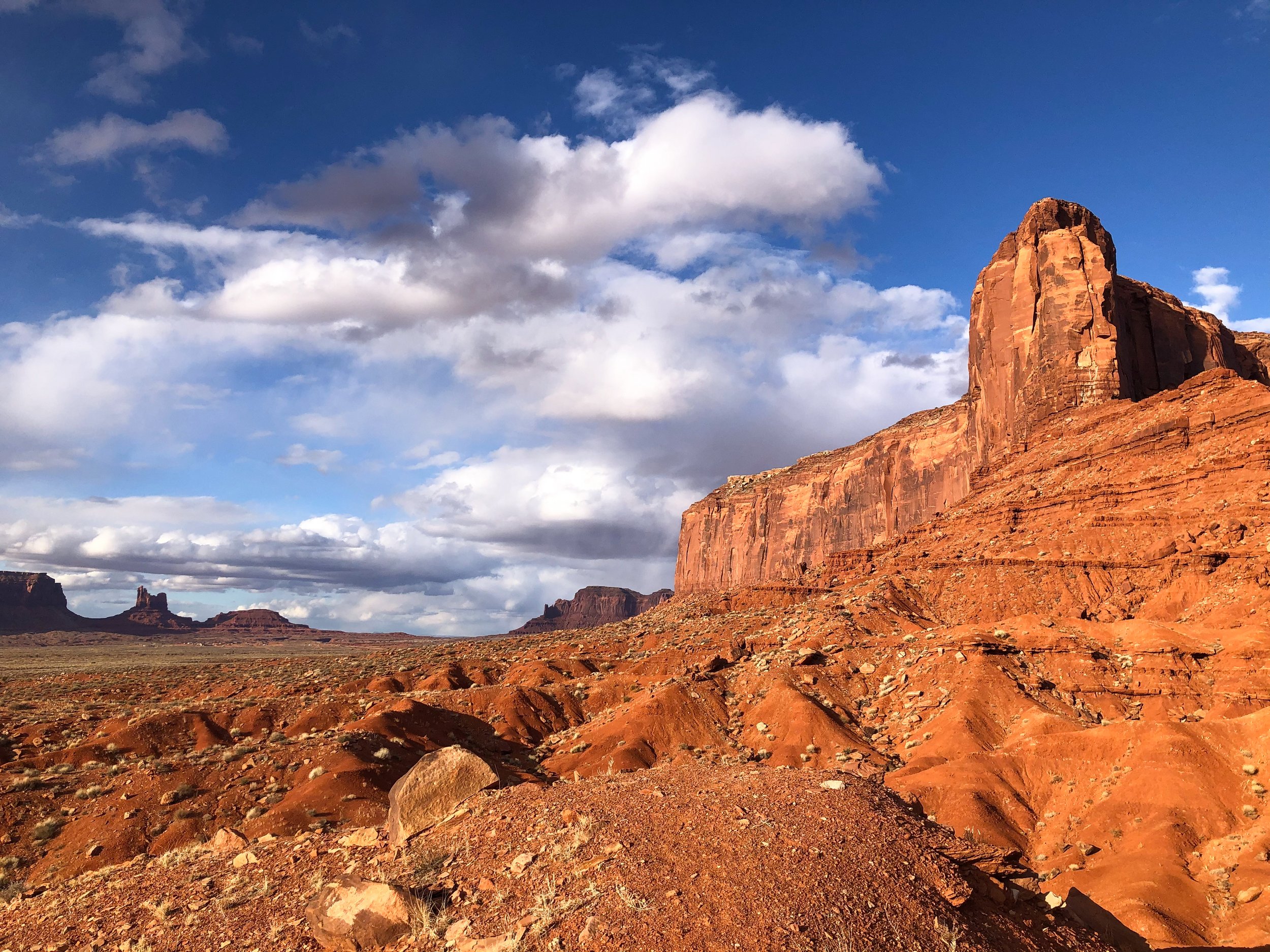
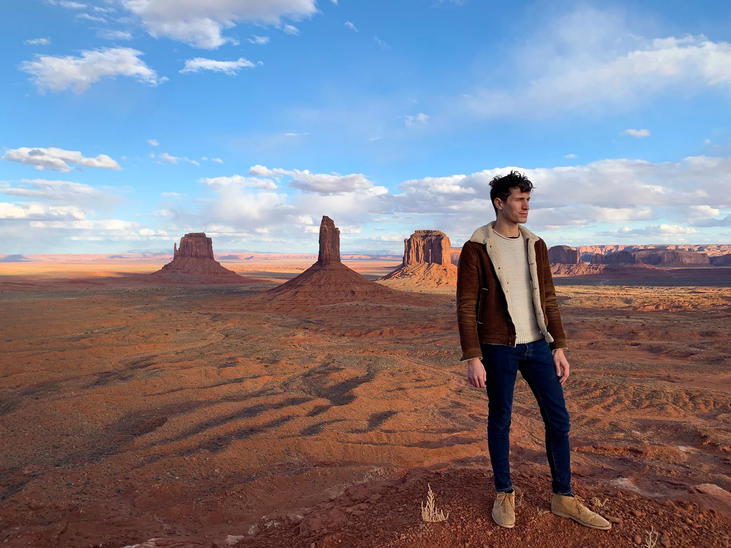
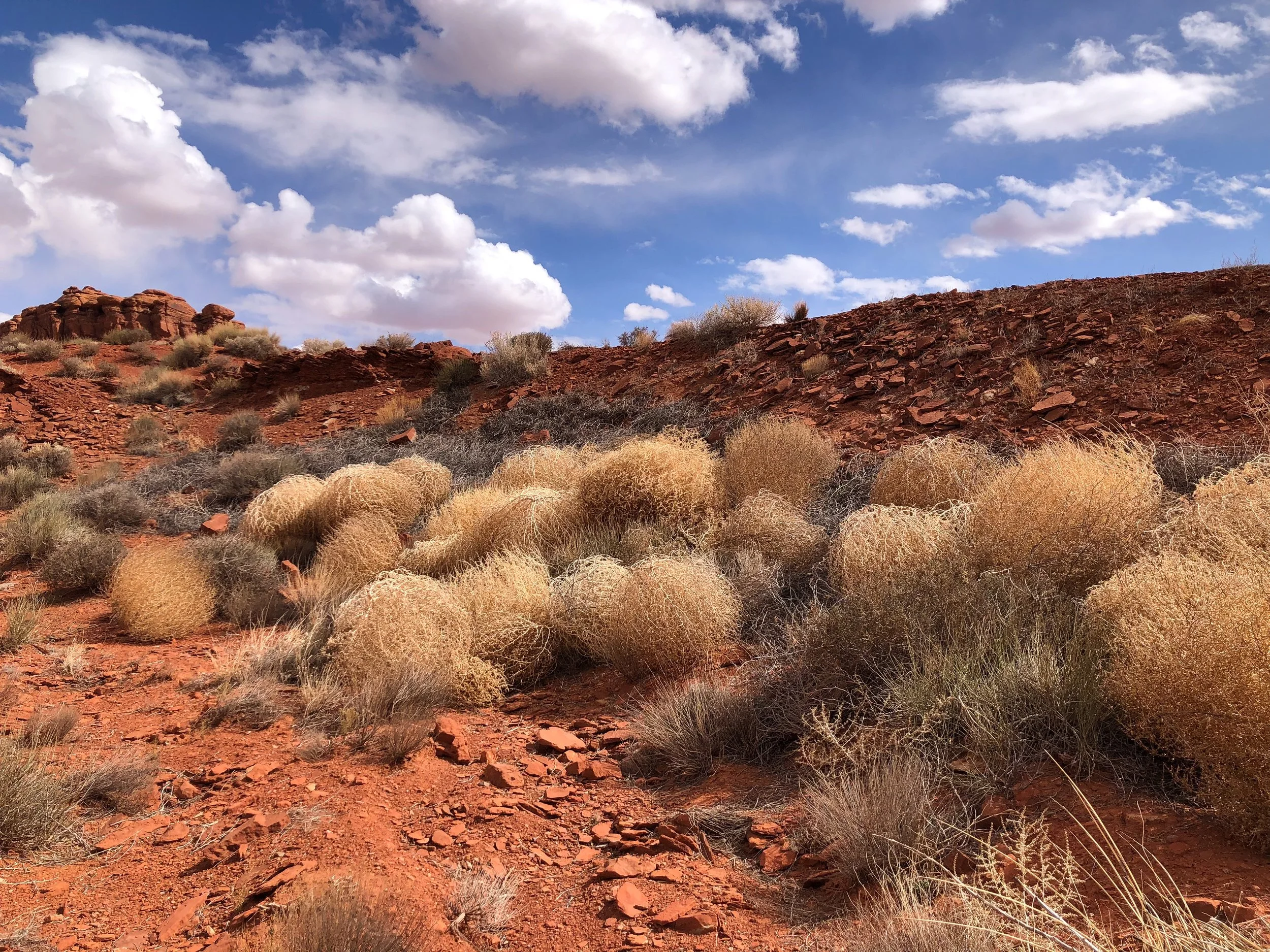
Monument Valley
Monument Valley offers views of the most quintessential western landscapes and scenery. The valley is comprised of towering buttes and crumbling rock formations that rise from the orange hued desert landscape. Many of the buttes and mesas are visible from roadside overlooks within and outside the Tribal Park.
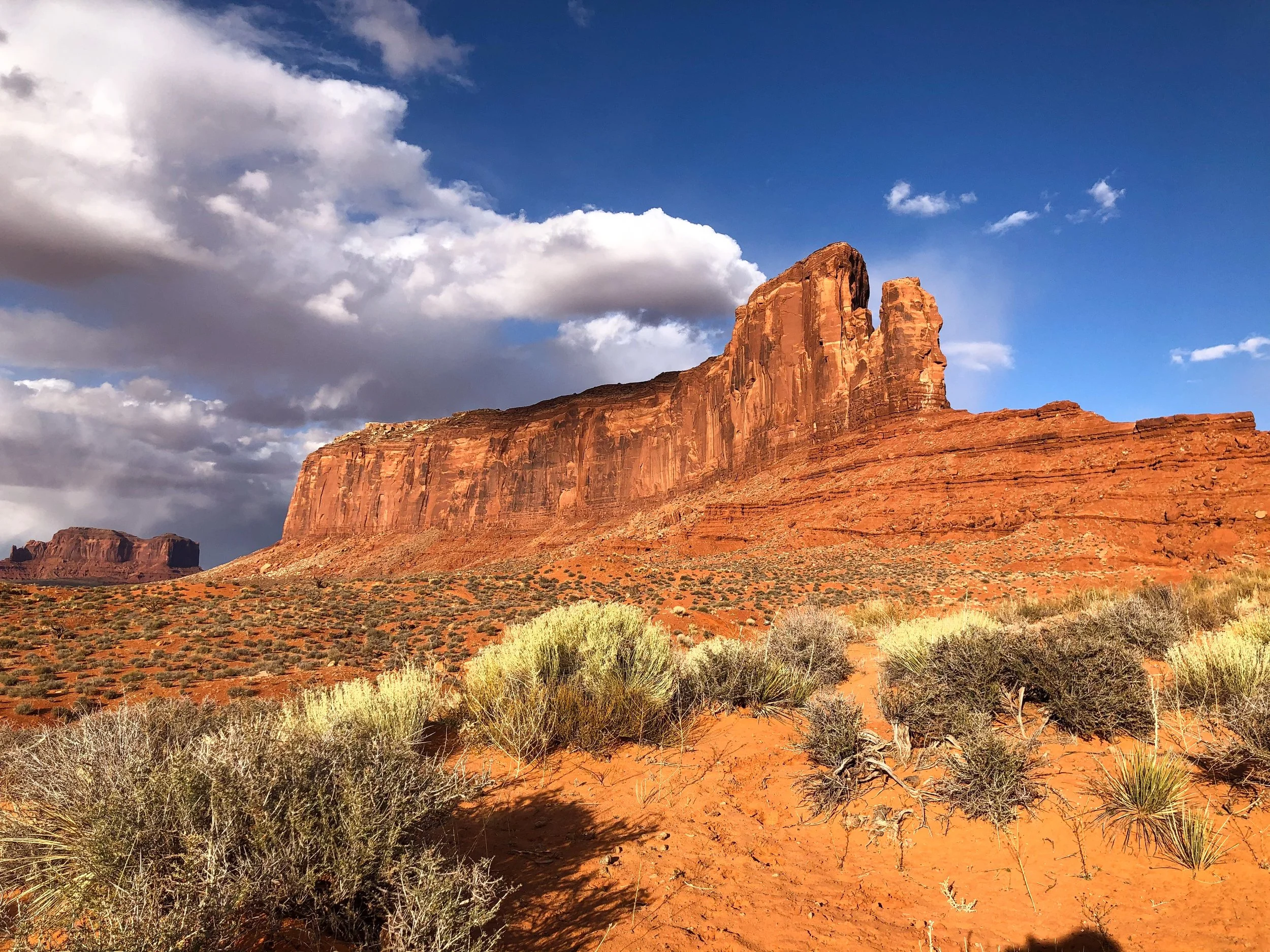
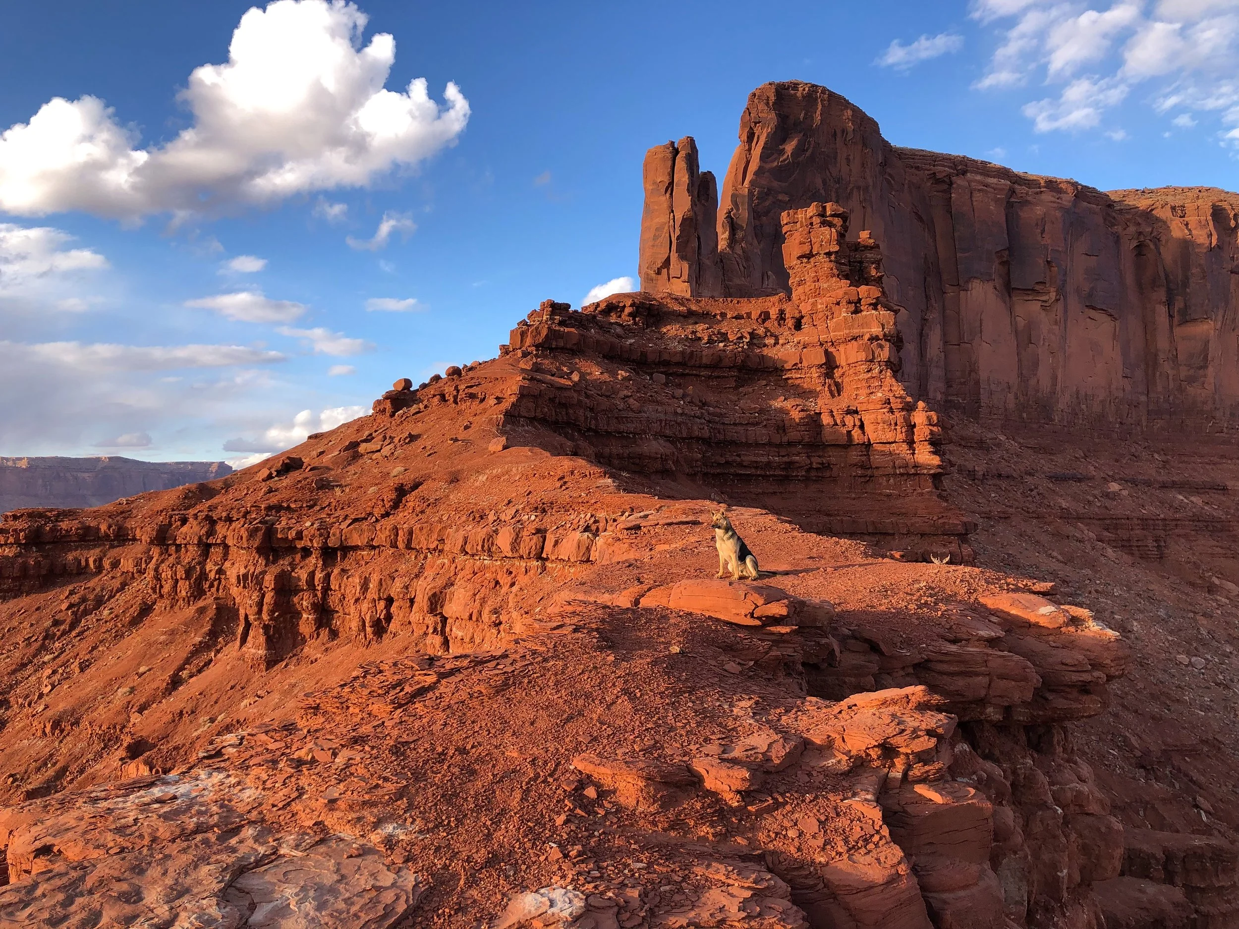
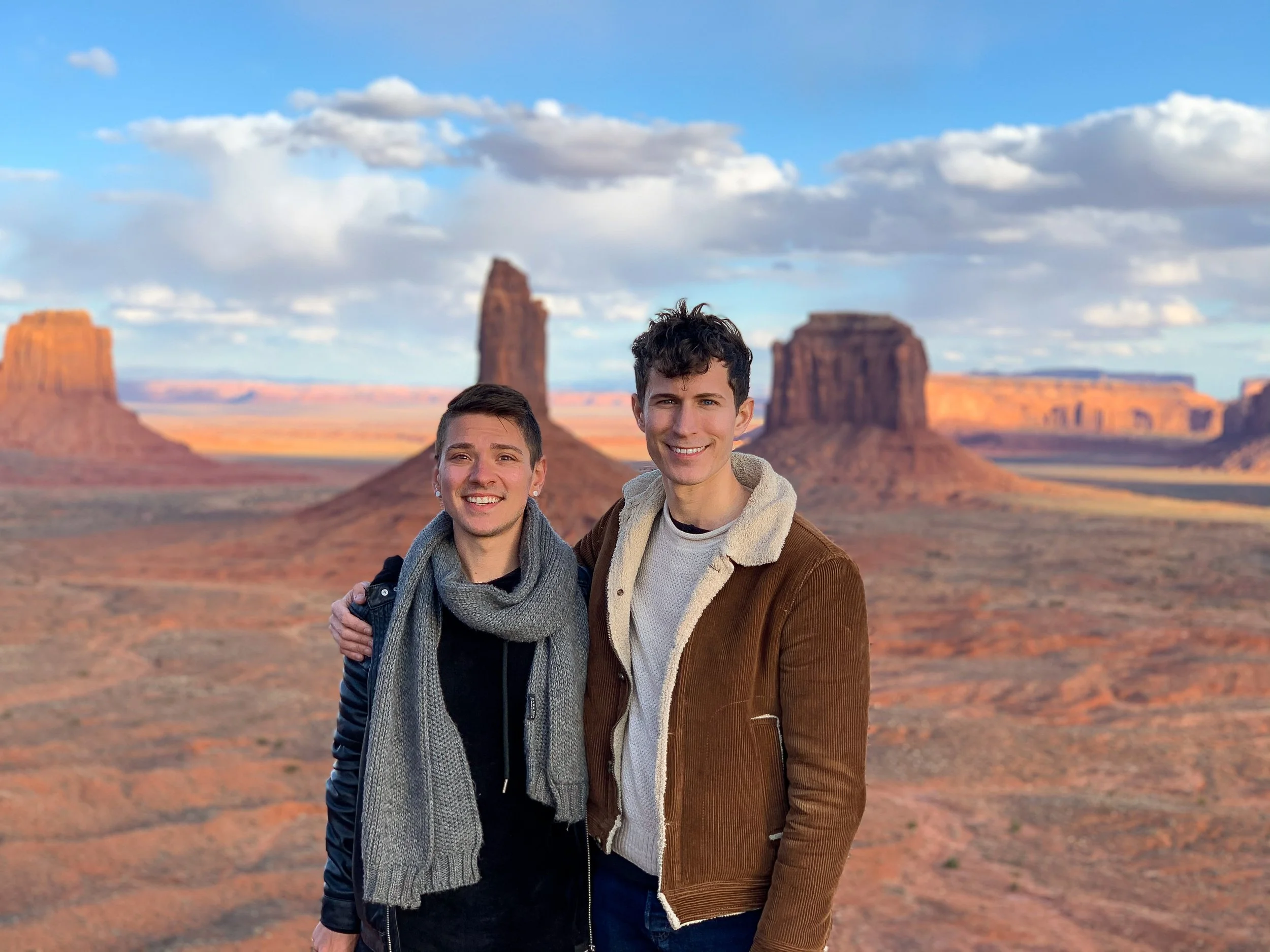
Sentinel Mesa. A desert plateau and cliff formation with dramatic views overlooking Monument Valley’s three most famous buttes: West Mitten Butte, East Mitten Butte and Merrick Butte. The observation point is reachable by hiking a trail at the end of Sentinel Mesa Road. Always ask for permission to park or hike on private property.
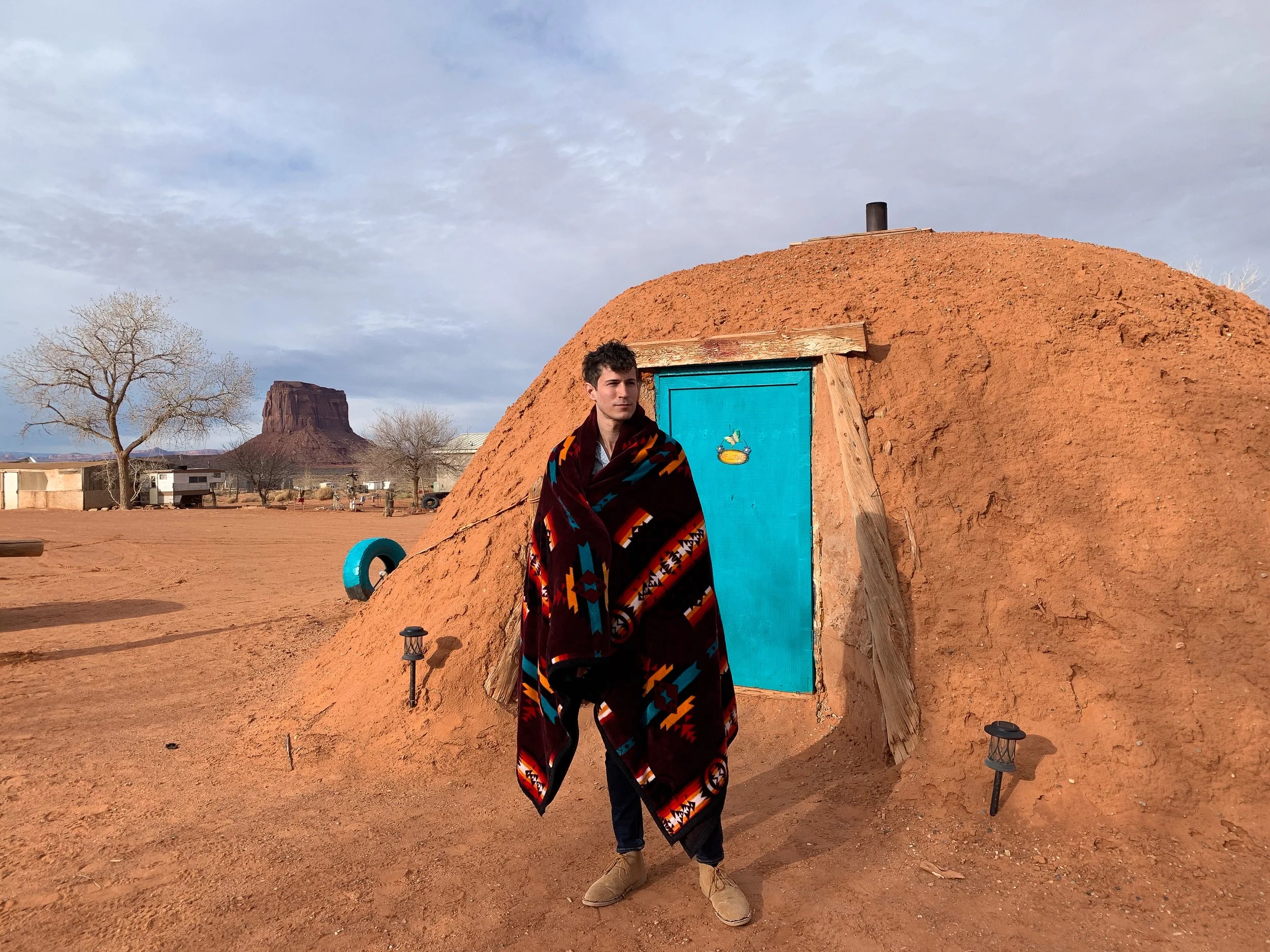
Stay in a Navajo Hogan. A Hogan is a traditional Navajo home, once common throughout the tribal nation. These domed huts are built from cedar structures covered in layers of sand and clay to provide insulation from the heat and cold. Most Navajo People live in modern homes today but keep a Hogan on their property for guests and ceremonial purposes. Staying in one in the middle of Monument Valley was an unforgettable experience. It’s interior was rustic, with beds covered in Navajo blankets and a central wood burning stove. Our particular Hogan was built in 1934 and has been maintained ever since. Book here on Airbnb!
Try Navajo Frybread. A round piece of flat dough deep fried until golden and puffy. It’s often made and served hot as a sweet or savory snack. Visit the San Juan Trading Post & Cafe in the town of Mexican Hat for their version, The Navajo Taco, with frybread covered in bean, tomato, lettuce, onion and cheese. For something sweet, order the Sweet Frybread, lightly covered in a sugary syrup.
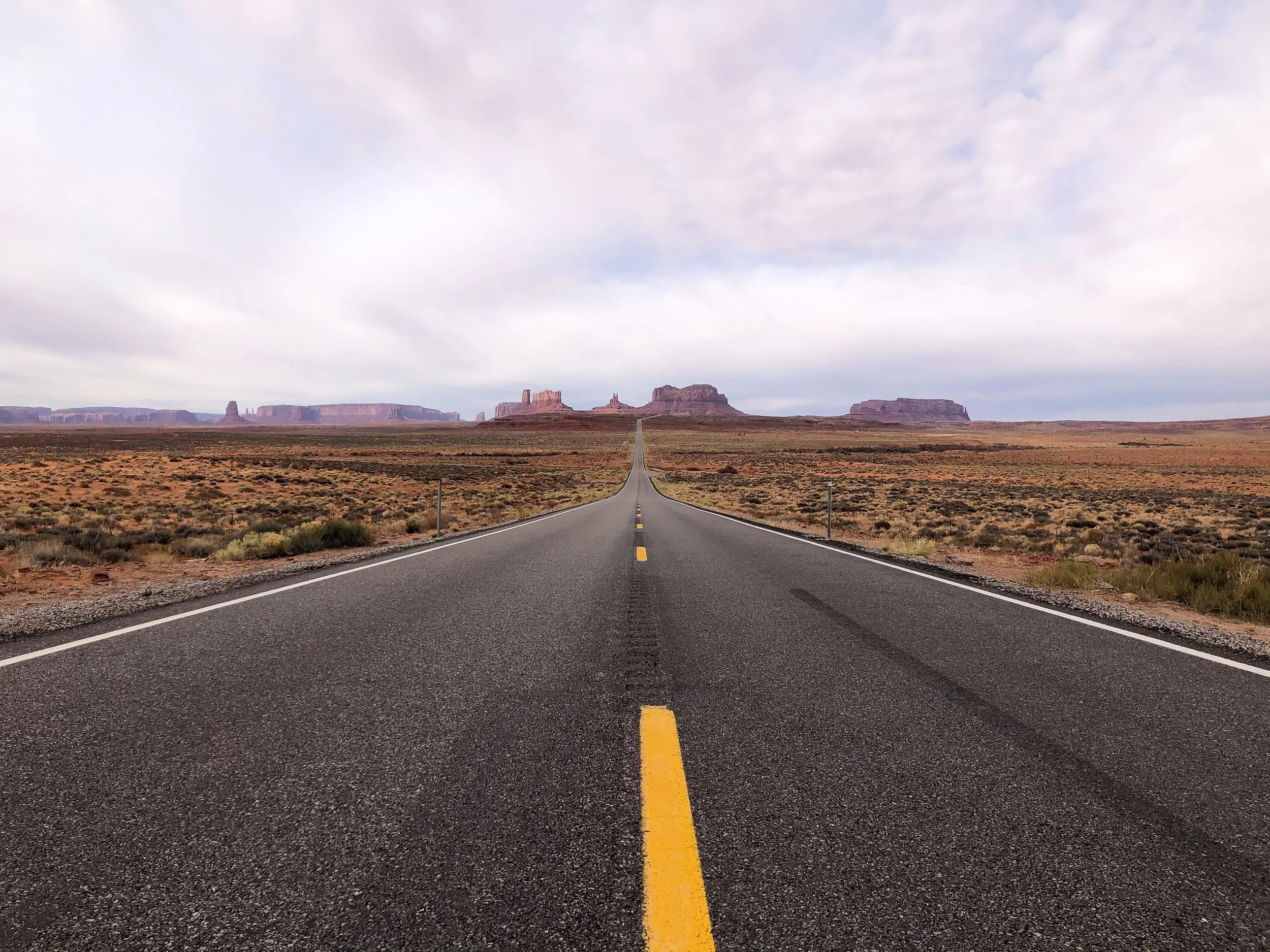
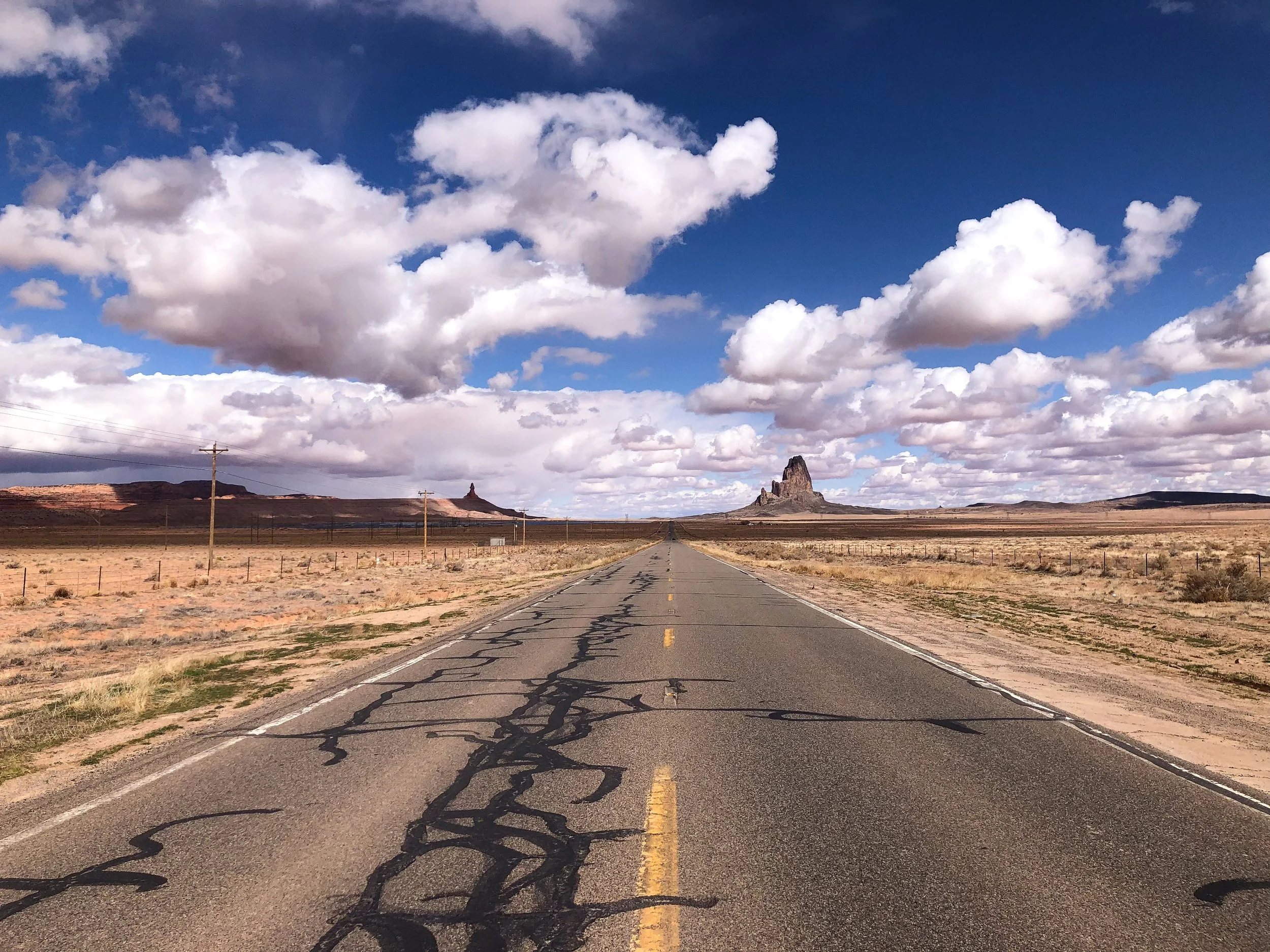
Forest Gump Hill
Forest Gump Hill is a scenic stretch of road that disappears into the horizon of Monument Valley. It’s been made famous by many Western movies and Hollywood films, most notably, Forest Gump. It’s here where Tom Hank’s character stopped running after 4 years crossing the country. It even has its own emoji.
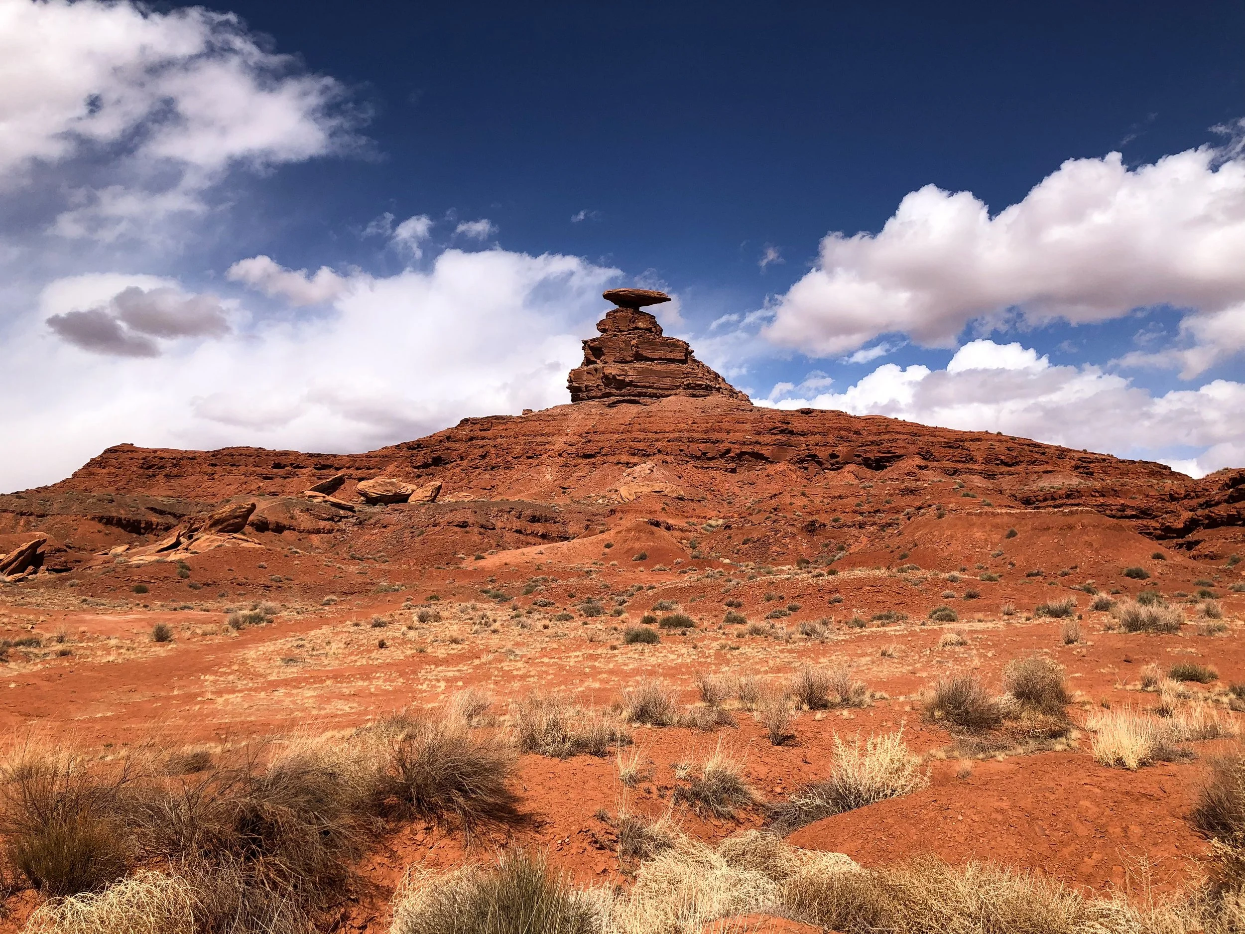

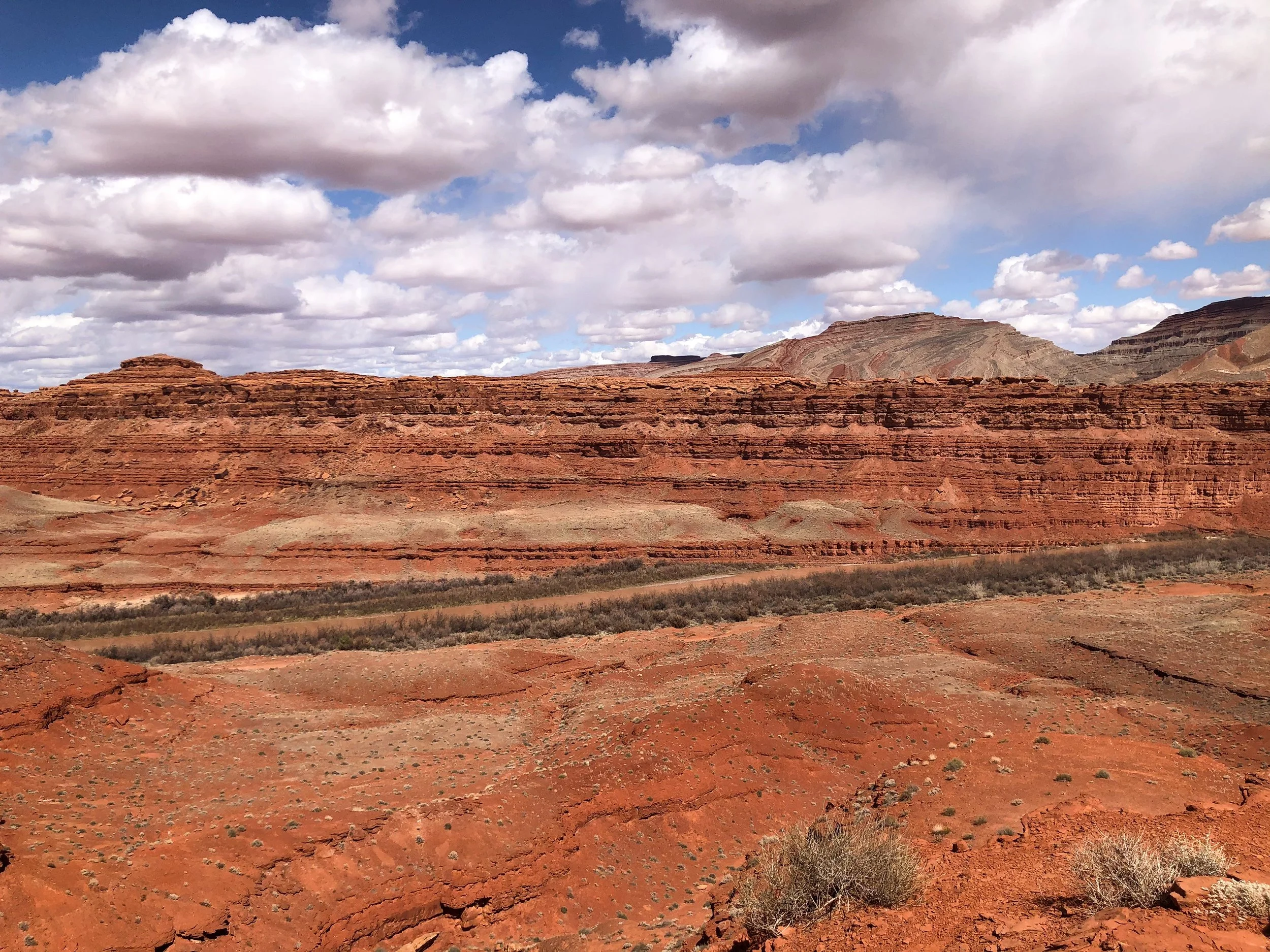
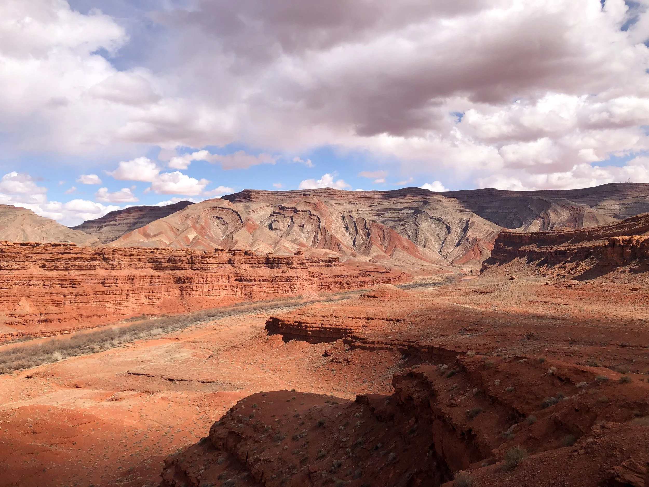

Mexican Hat
Mexican Hat is a rock formation named after a large flat rock, precariously balanced on top of a small vertical base protruding from the hillside, described as resembling a mariachi’s sombrero. Hiking trails lead around the base and underside of the “hat.” From here, there are beautiful views of the green and orange hillside carved out by the San Juan River.
Central Arizona
Central Arizona is home to desert landscapes, meteor craters and national parks, much of it reachable along Old Route 66 (now Interstate 40).
Old Route 66
Old Route 66 is one of the most famous and nostalgic roads in the United States. It’s dotted with numerous small towns, roadside attractions, motels and diners.
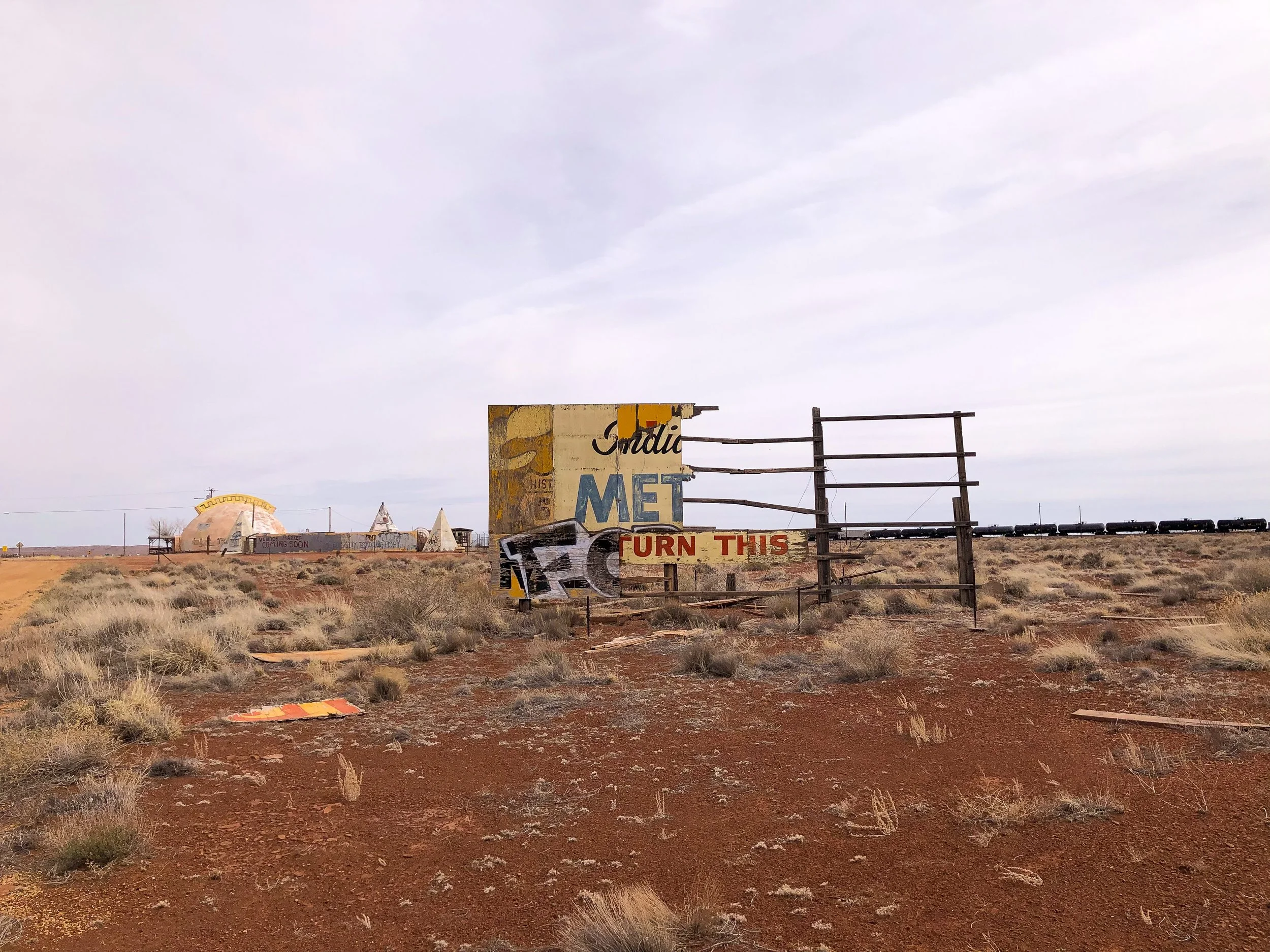
Holbrook, Arizona. A small town along Old Route 66 famed for its roadside attractions, western history and Americana charm. The main street is lined with old buildings surviving from the wild west, a tee pee themes motels, retro roadsigns, several rock shops and attention grabbing roadside dinosaurs.
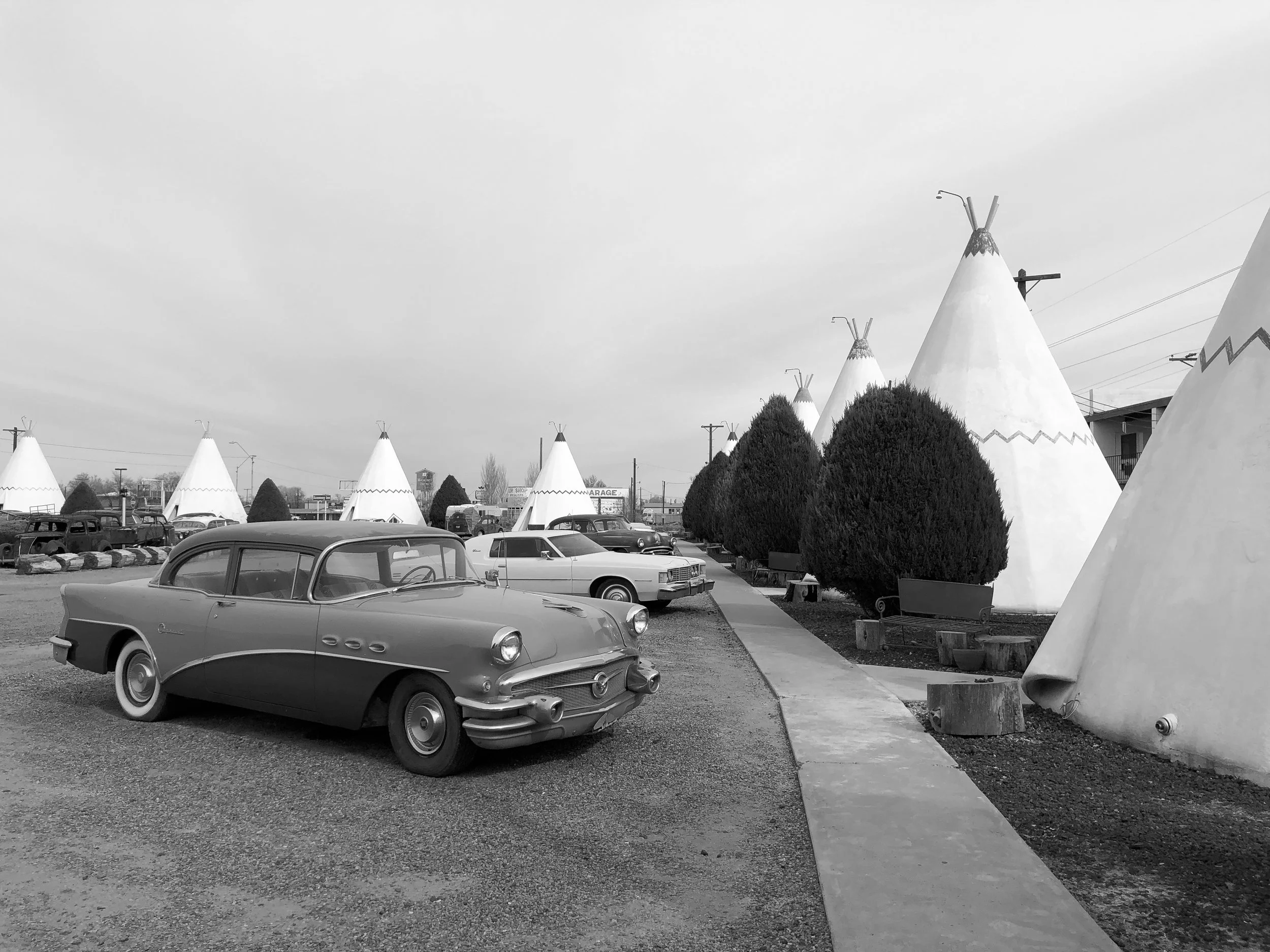
Wigwam Motel. A historic motel famed for its concrete and steel formed tee pees lined with vintage cars and a retro neon road sign. The motel has 15 tee pees, each acting as their own guest room. The stay was incredibly cute and felt like we had transported to a different era. Book here!
Winslow, Arizona. A historic town along Old Route 66 made famous by The Eagles 1972 hit, “Take It Easy,” featuring the lyrics “I'm a-standin' on a corner in Winslow, Arizona.” Drive through the town to stand on said corner as the song plays on repeat over loud speakers.
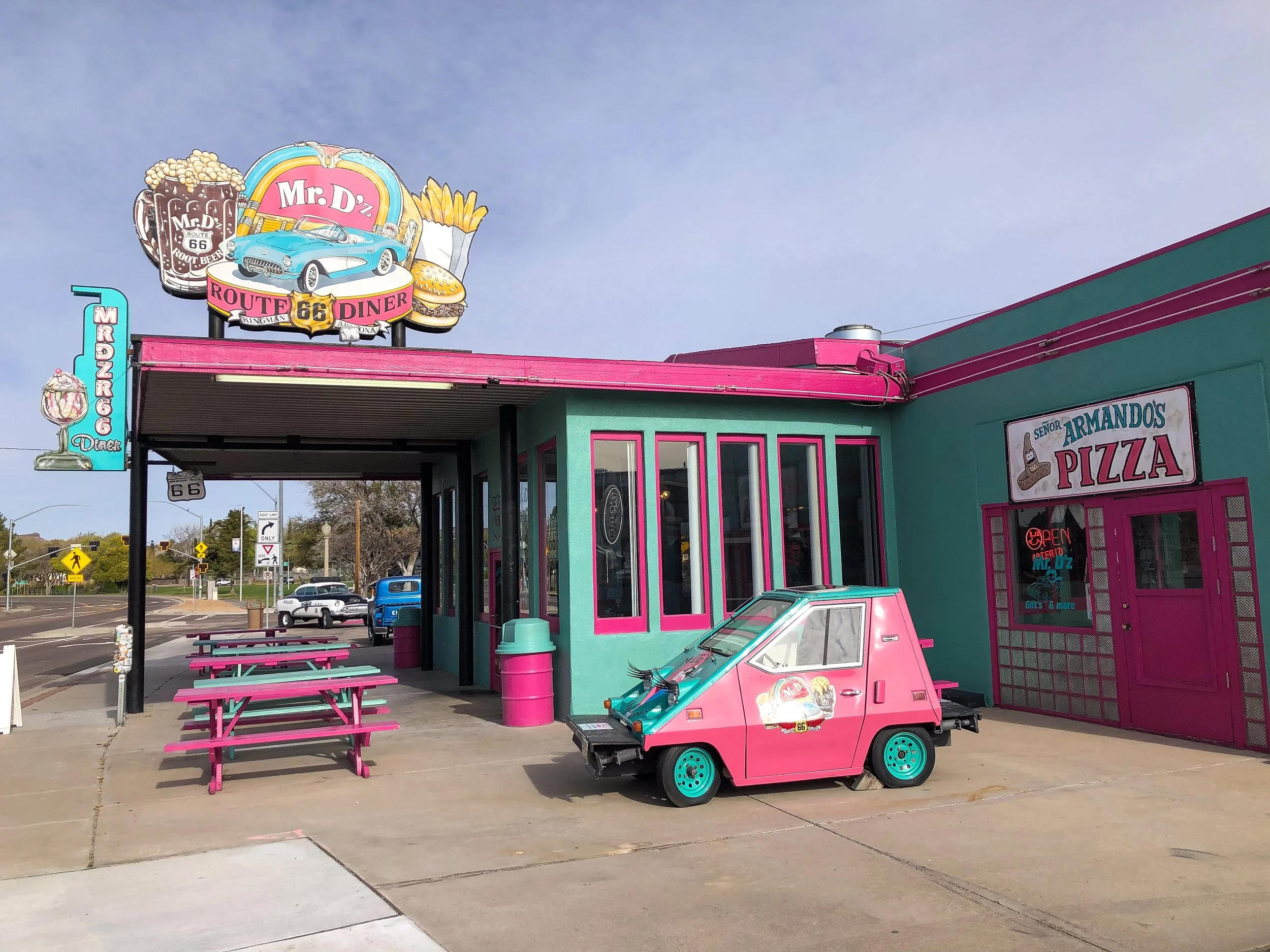
Mr D'z Route 66 Diner. A classic greasy spoon and retro style Americana style diner with an extensive menu of omelettes, sandwiches and milkshakes. It’s interior is decorated with teal and pink upholstered booths, black and white checkered floors, framed pictures and vintage memorabilia.
The Roadkill Cafe/O.K. Saloon. A famed restaurant along Old Route 66 with American style comfort foods like burgers, sandwiches and baked potatoes. It’s pine paneled interior is decorated with all kinds of taxidermy animals and vintage signs.
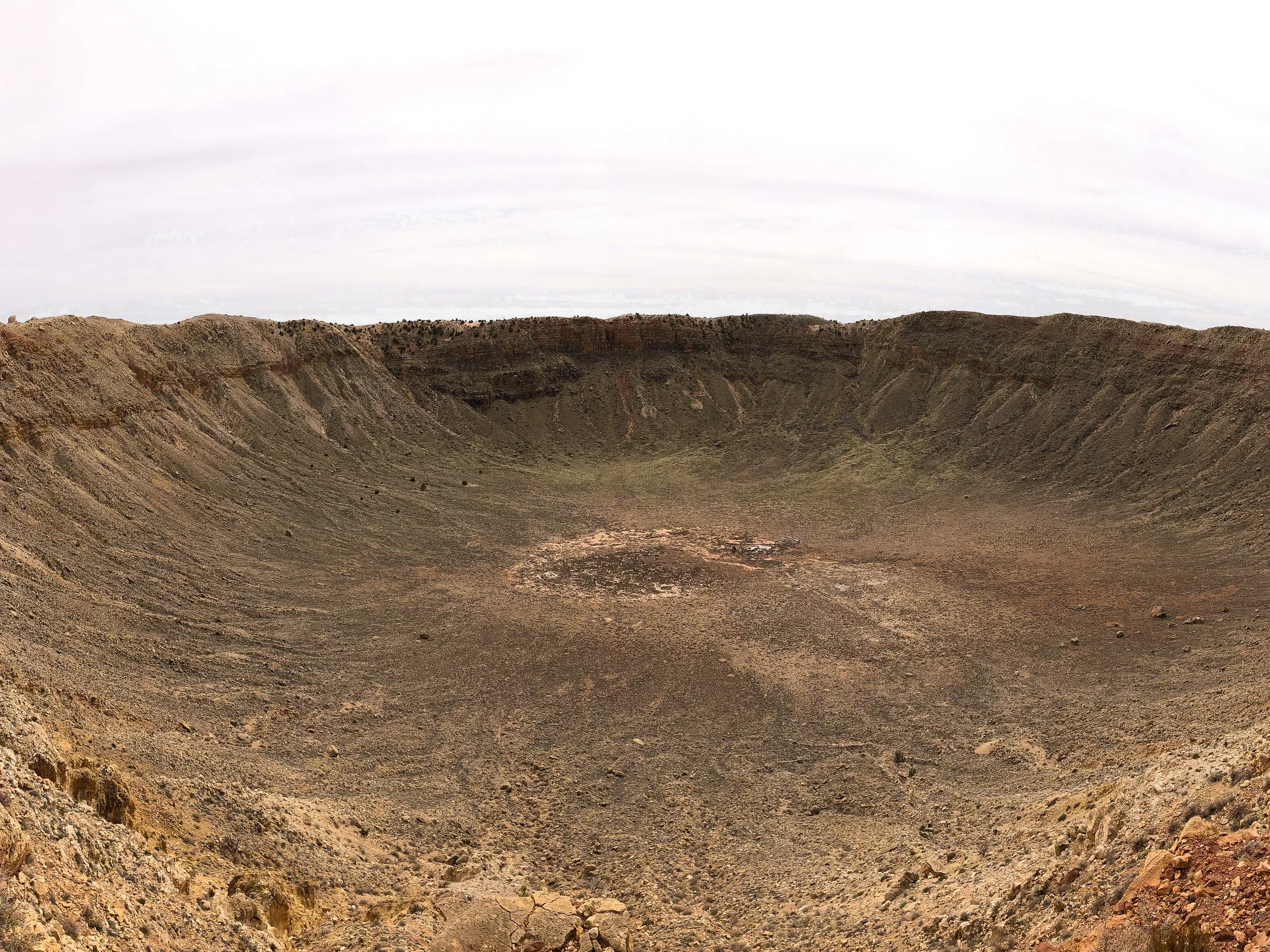
Barringer Meteor Crater
The Barringer Metror Crater is a giant impact crater formed over 50,000 years ago, measuring nearly a mile across and over 500 feet deep. The crater is accessible to view through the park’s visitor center and has two observation decks on its rim. Within the visitor center are a large number of meteorites on display as well as small fragments of it for sale.
Meteor City. An abandoned roadside attraction near the Barringer Metror Crater. It was started in the late 30s as a gas station, grocery store and souvenir stand along the Old Route 66.It’s an eerie spot to walk around and watch trains pass by.
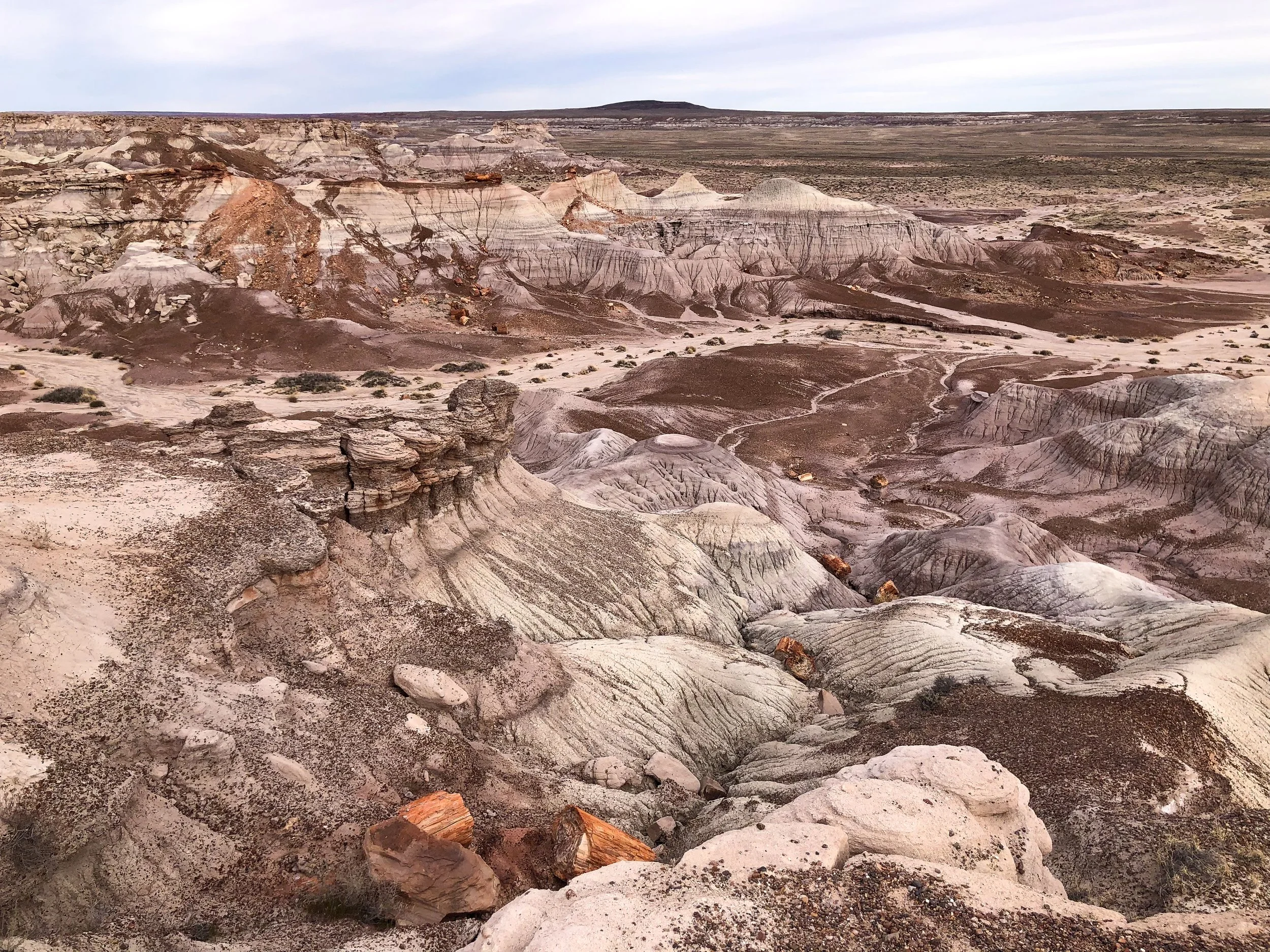

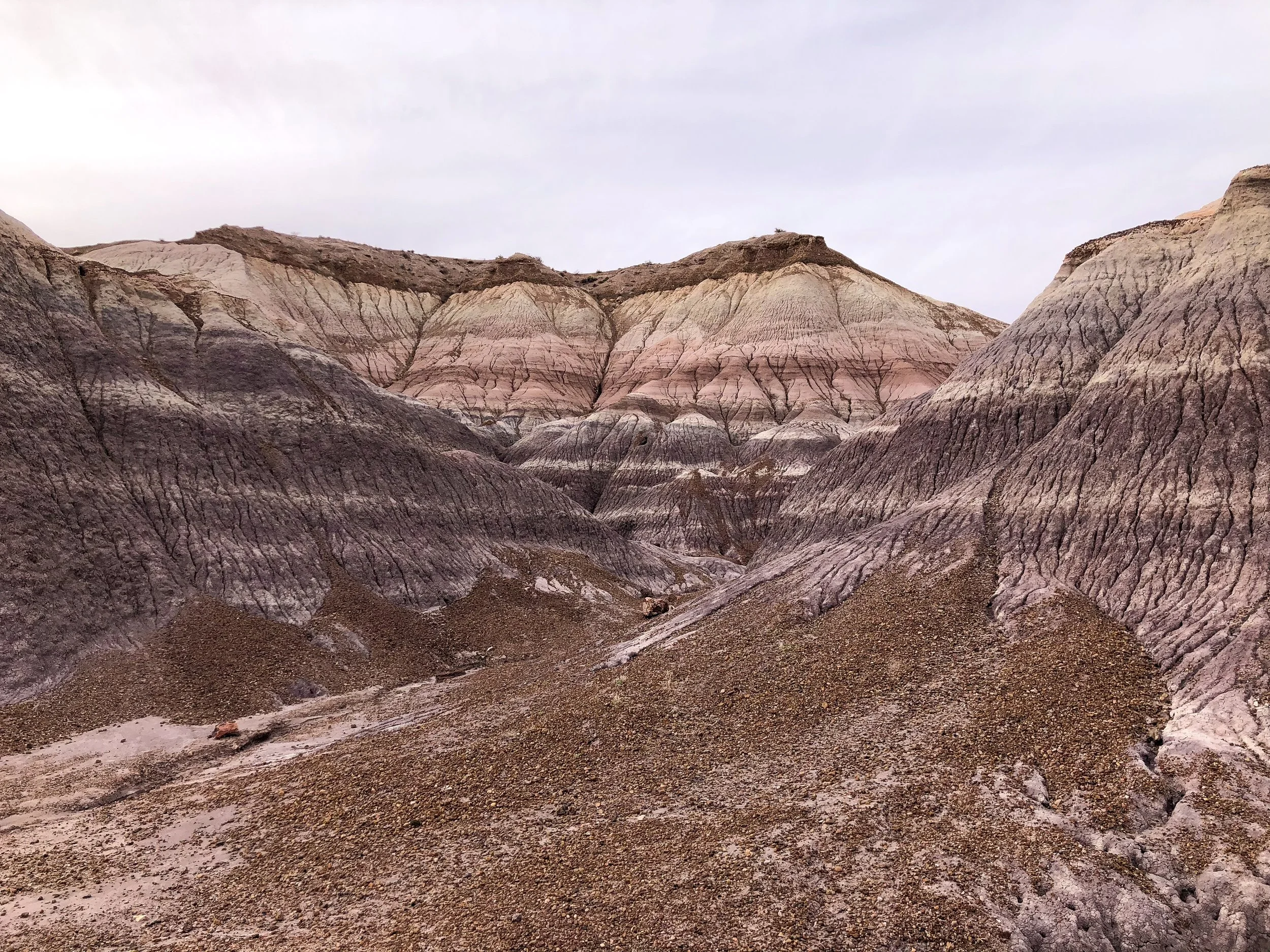
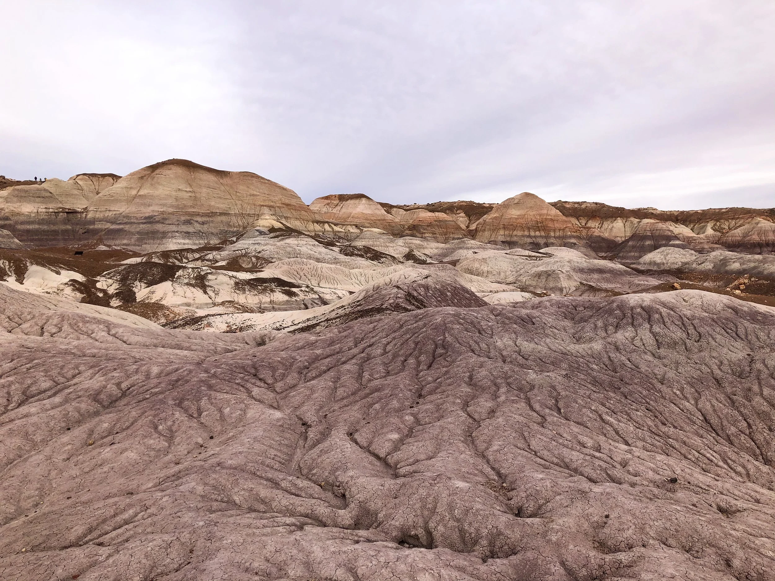
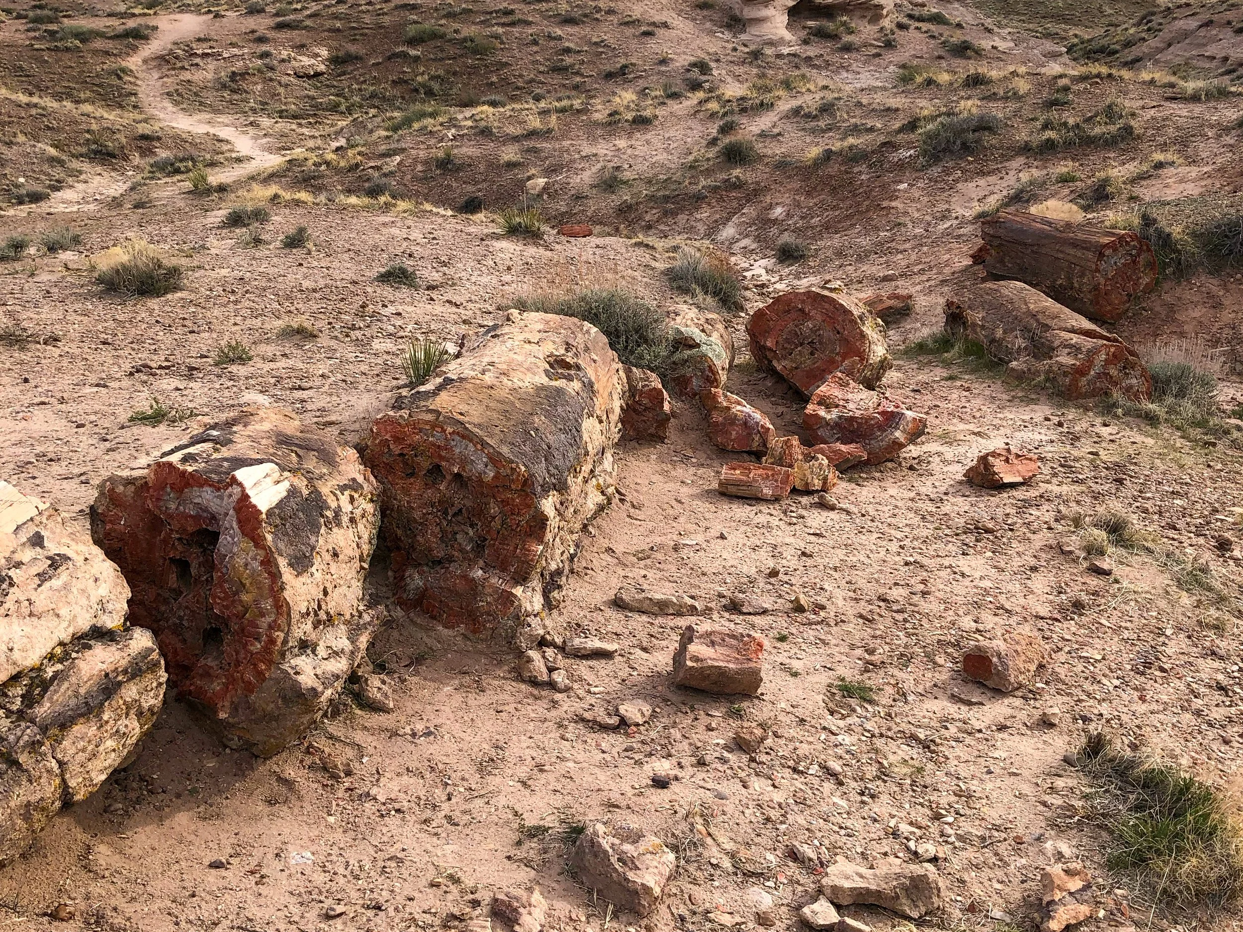
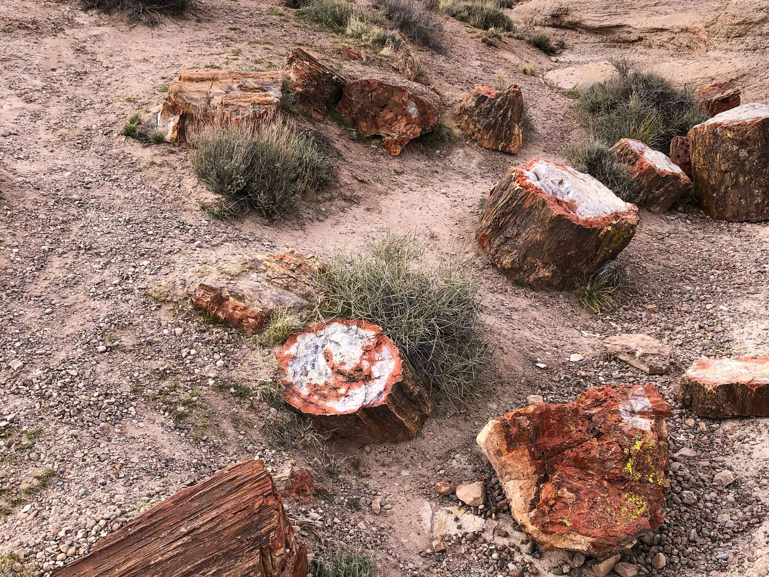
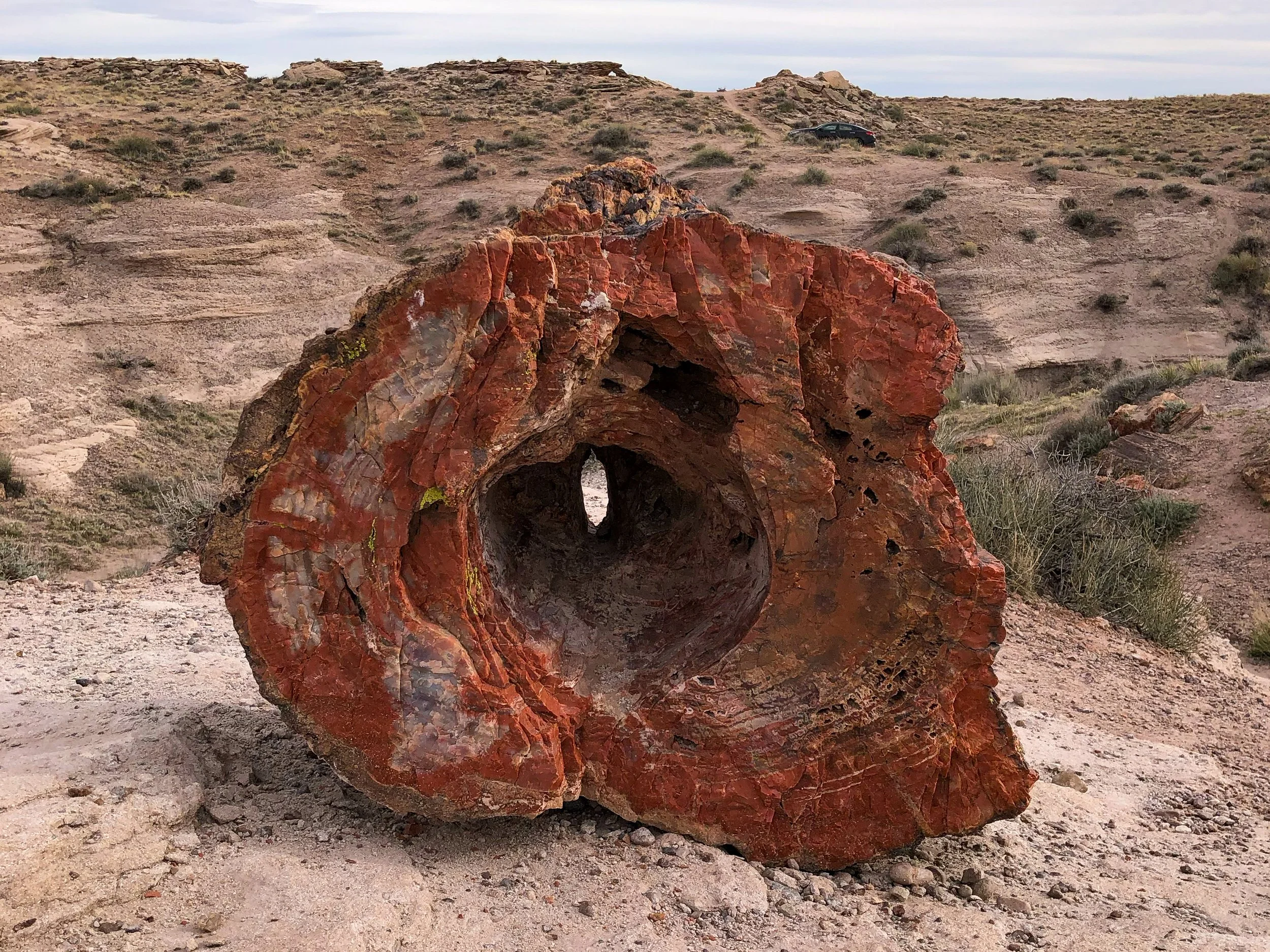
Petrified Forest National Park
The Petrified Forest is a National Park covers a vast area of desert that was once home to an ancient rainforest. Preserved under the soil and exposed due to erosion are the remains of fossilized trees from the forest that existed over 200 million years ago. Some of the trees are so well preserved that you can count the rings and feel the grain of the bark.
Blue Mesa. An area of the Petrified Forest eroded by rain revealing colorful bands of blue, purple, grey and red soil as well as the petrified wood. Drive around its loop and hike the Blue Mesa Trail, an area with massive logs and fragments of the fossilized trees laying across the ground. It was crazy to think that we were walking across land where the dinosaurs roamed and a forest thrived over 200 million years ago.
Southern Arizona
Southern Arizona is a dry and aired place, defined by its towering Saguaro cacti, desert landscapes and Southwestern cities.
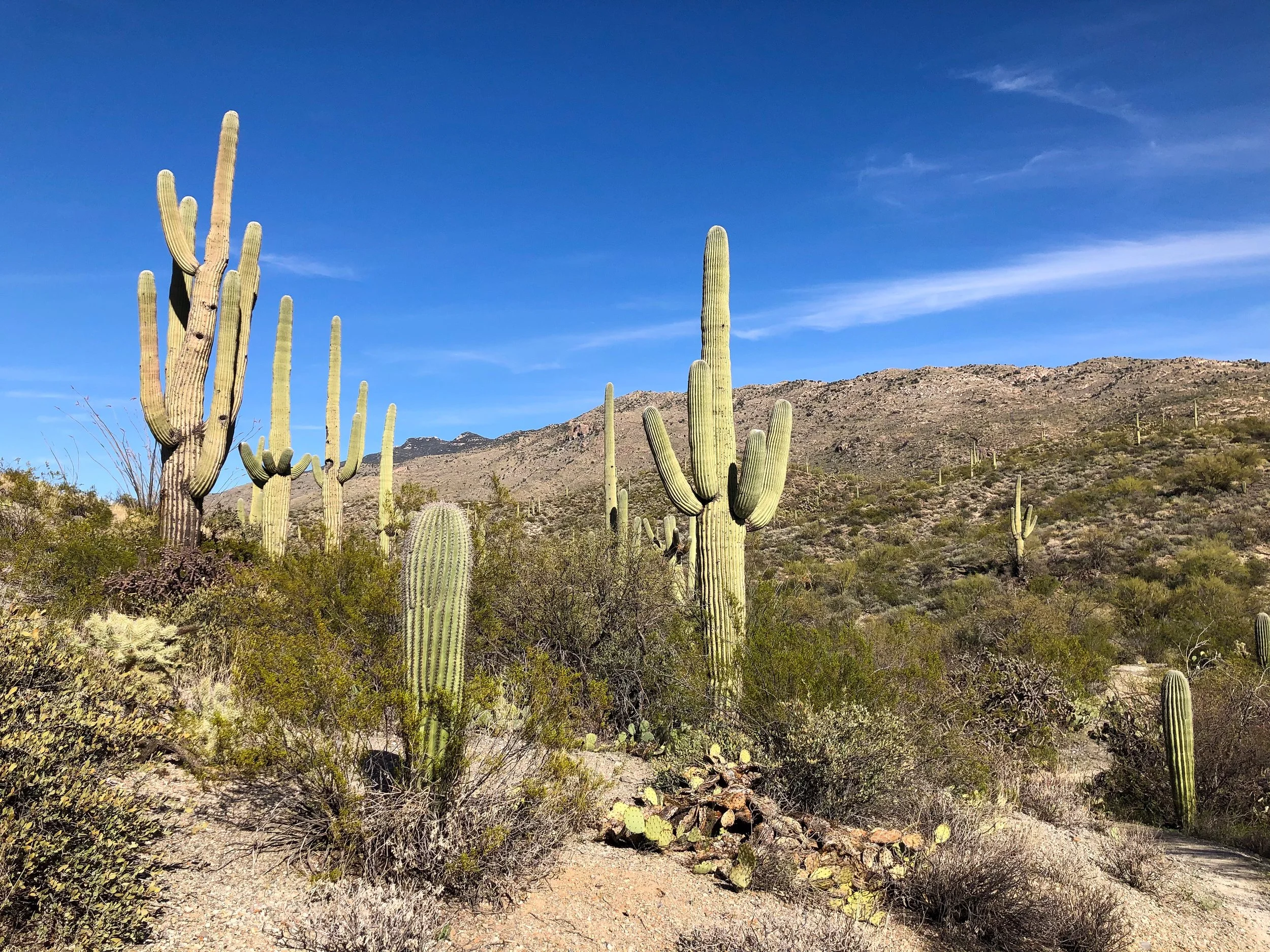

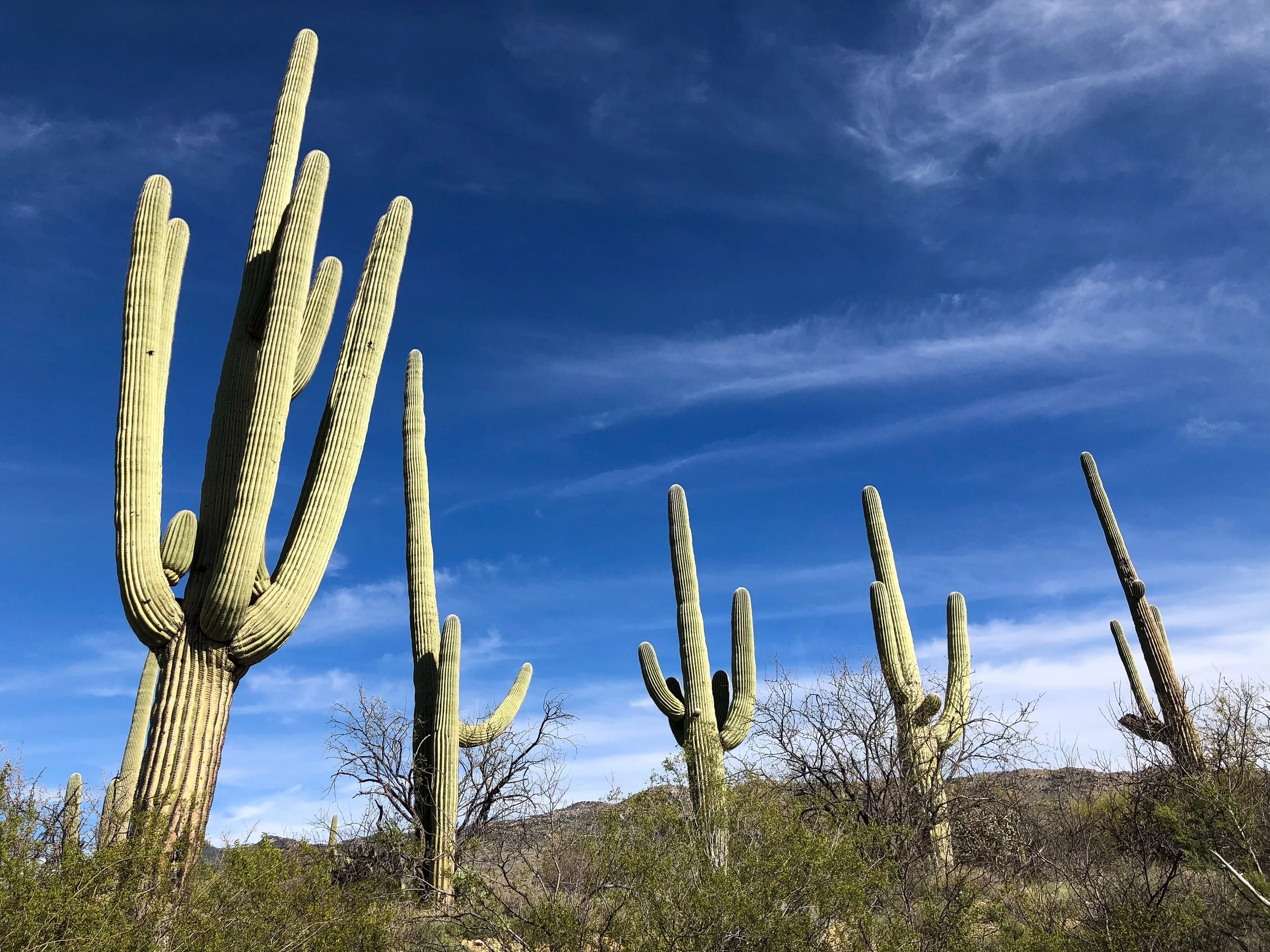
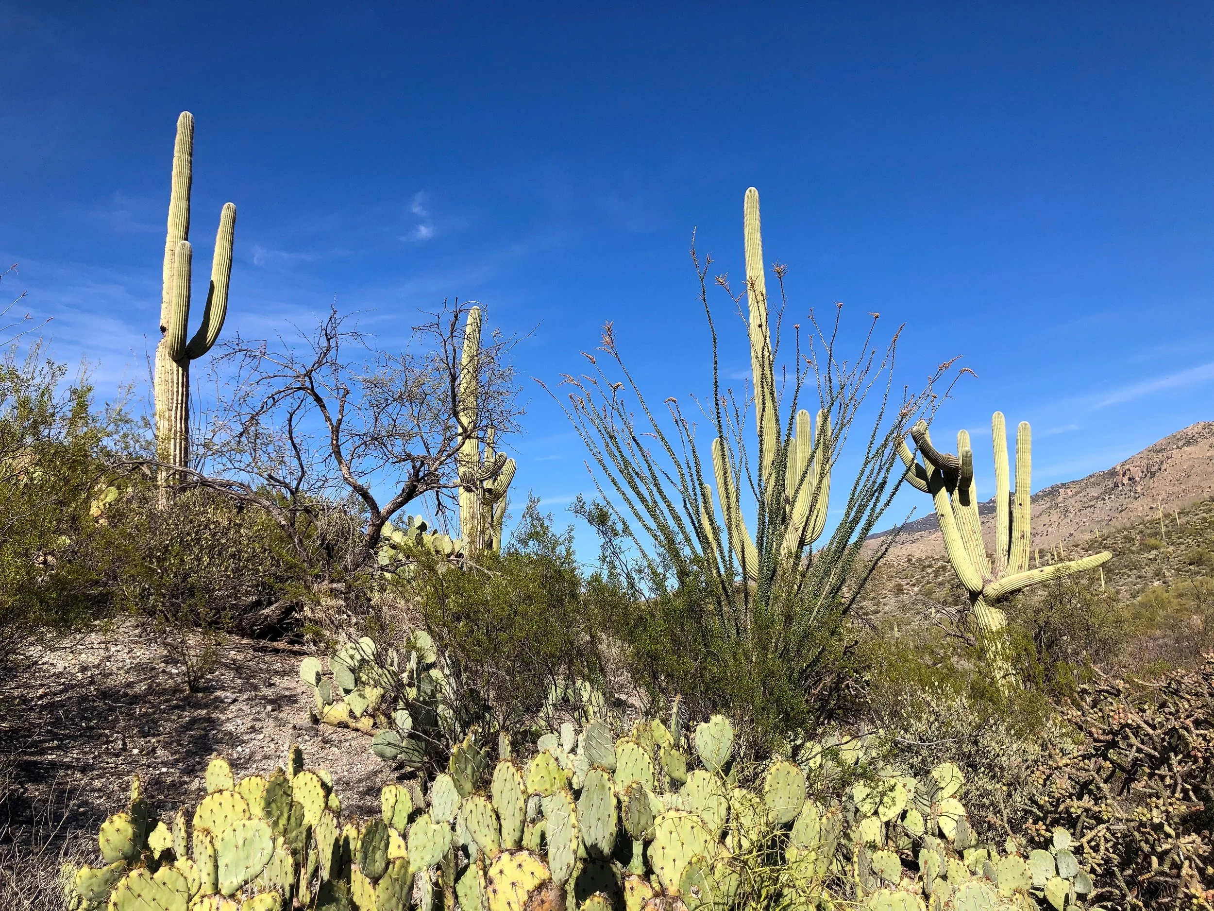
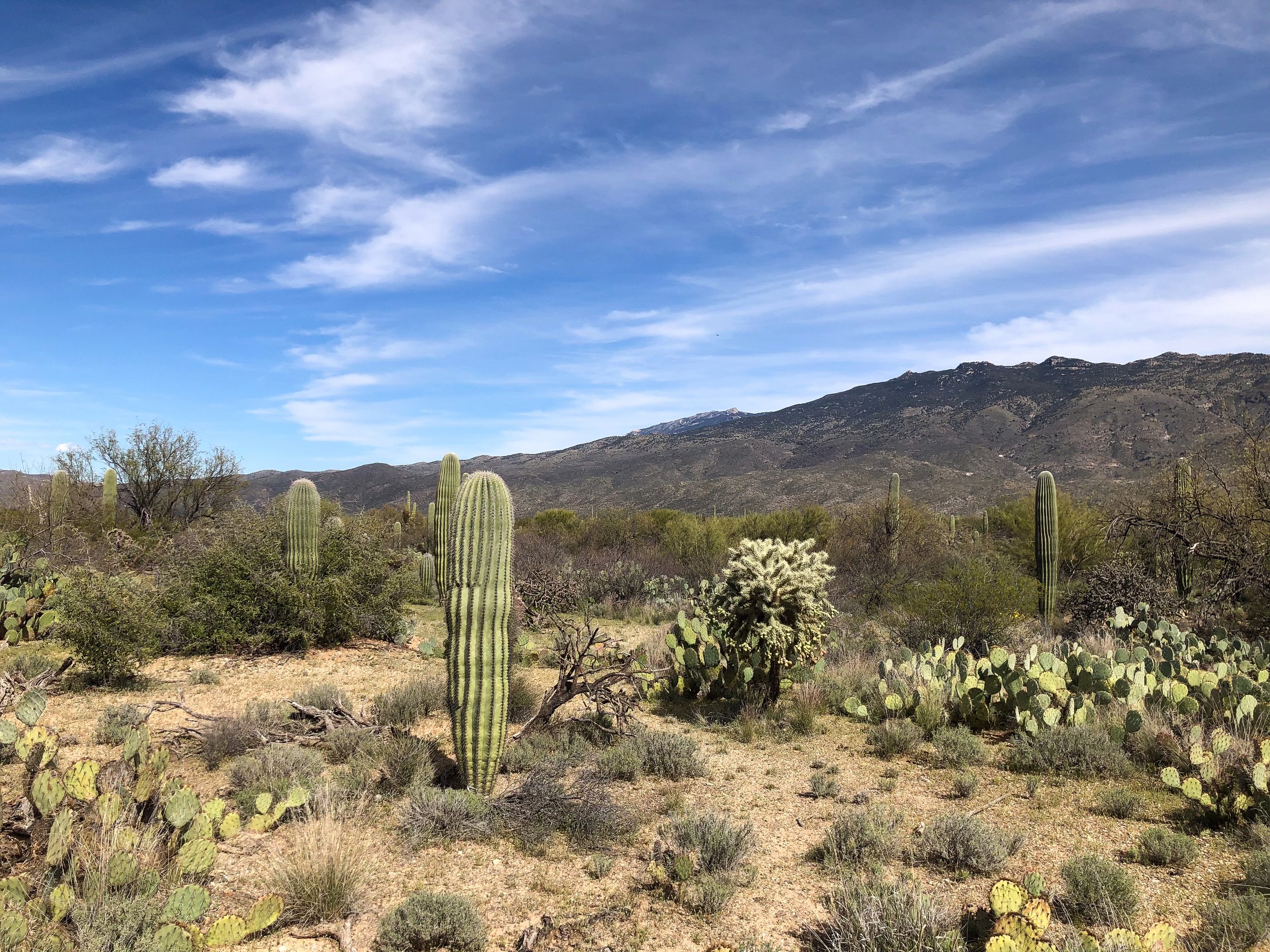
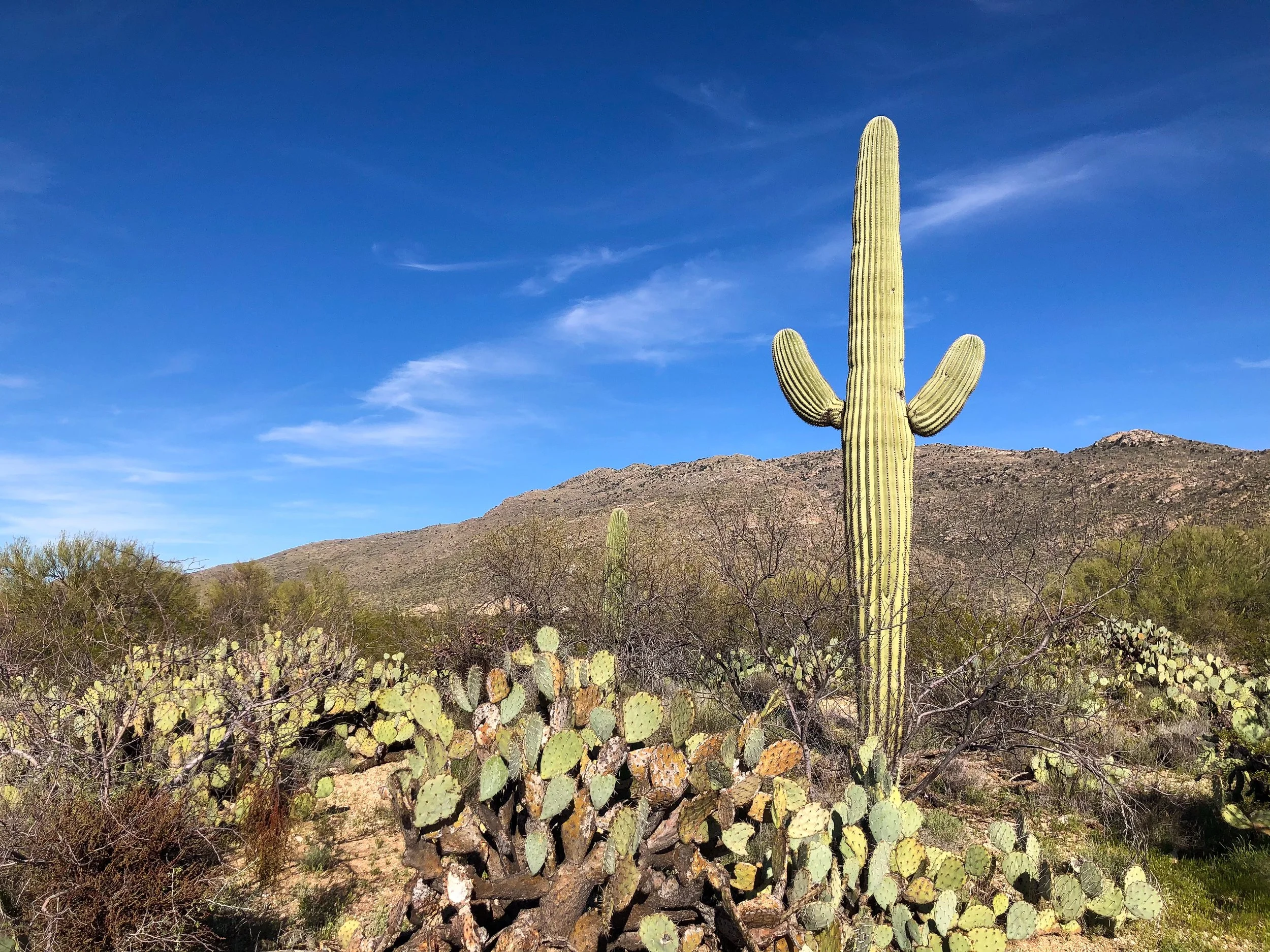

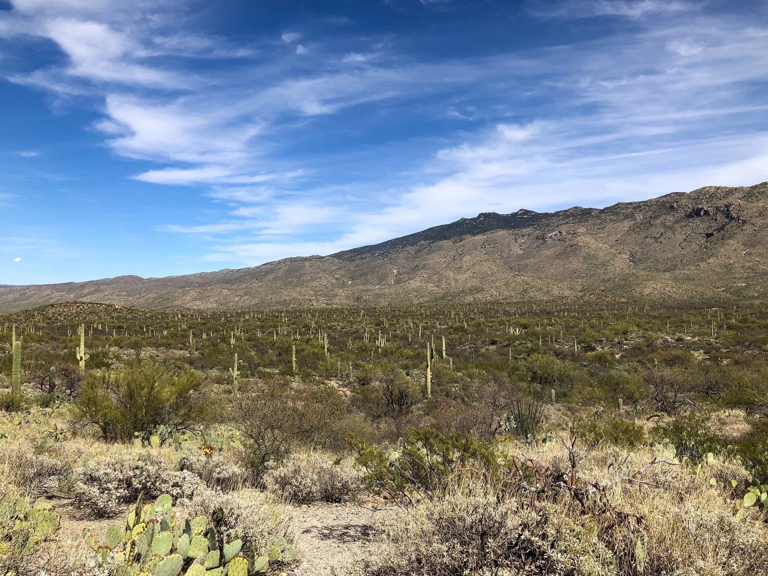
Saguaro National Park
Located within in the Sonoran Desert outside of Tucson is Saguaro National Park, home to the Saguaro Cactus. The Saguaro is the classic symbol of the Southwest with its tall waxy green trunk and multiple arms. The park is divided into two separate districts located on opposite sides of Tucson. The Tucson Mountain District to the West and The Rincon Mountain District to the East.
The Rincon Mountain District. The eastern half of Saguaro National Park with a drivable loop and hiking trails with views of the Sonoran Desert and it’s towering Saguaro Cacti. It’s easy to spend an entire day here.
Cactus Forest Drive. An loop road leading through the The Rincon Mountain District. Its a scenic way to see a vast region of the park, lined with hiking trails, observation points and picnic areas.
Cactus Forest Trail. A lengthy trail meandering across the desert terrain densely populated with mature saguaros. Beware of diamond back rattle snakes slithering across the trail.
Pro Tip. Wear sunblock and bring plenty of water for hiking, especially during the peak afternoon hours.
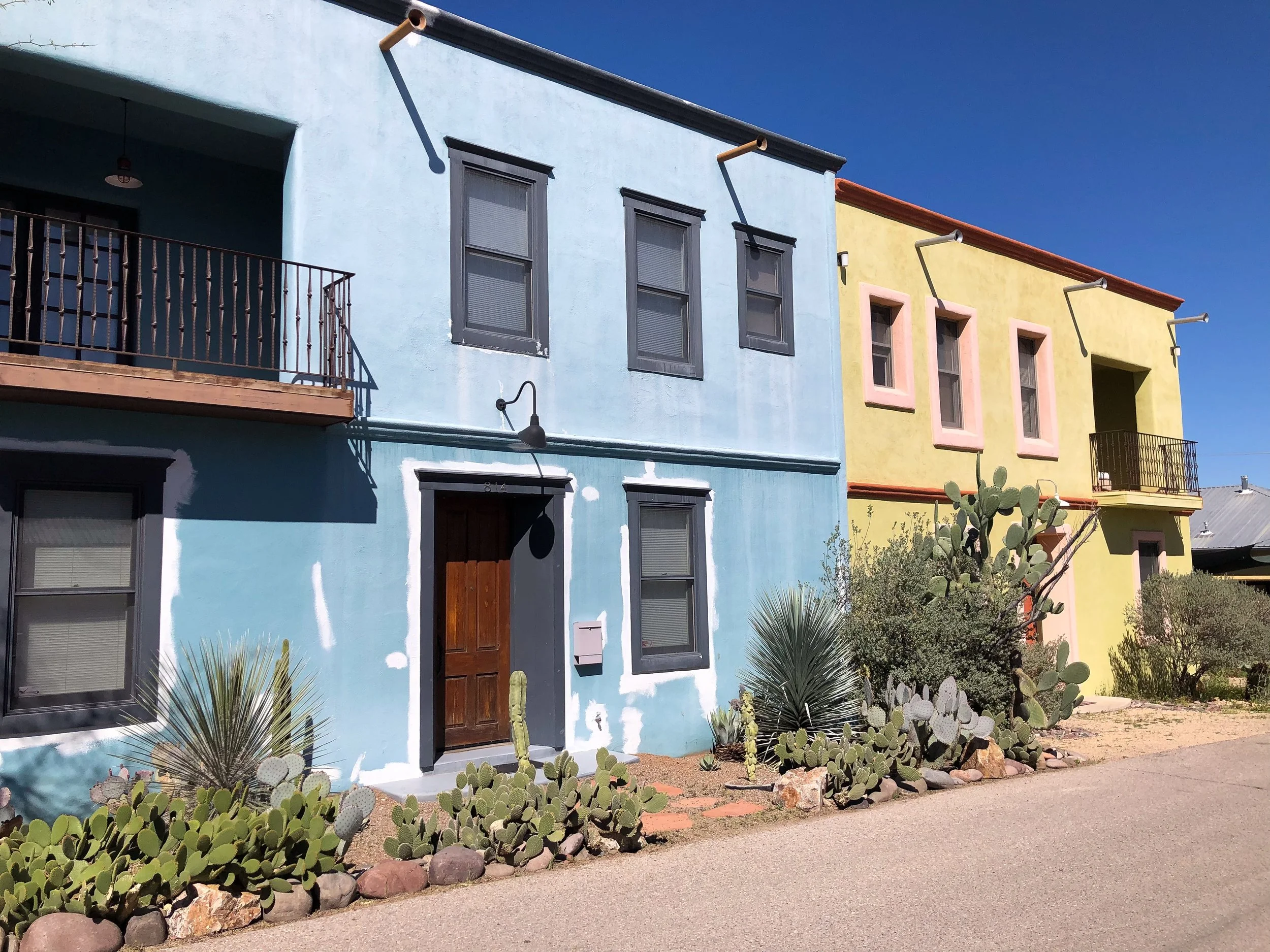
Tucson’s Barrio Viejo
Tucson’s Barrio Viejo is a historic neighborhood and one of the city’s first. It’s influenced by Mexican American influences with old adobe buildings, all painted vibrant colors and landscaped with desert cacti. Spend time walking around the barrio, imaging what it would be like to live in such a stunning place.
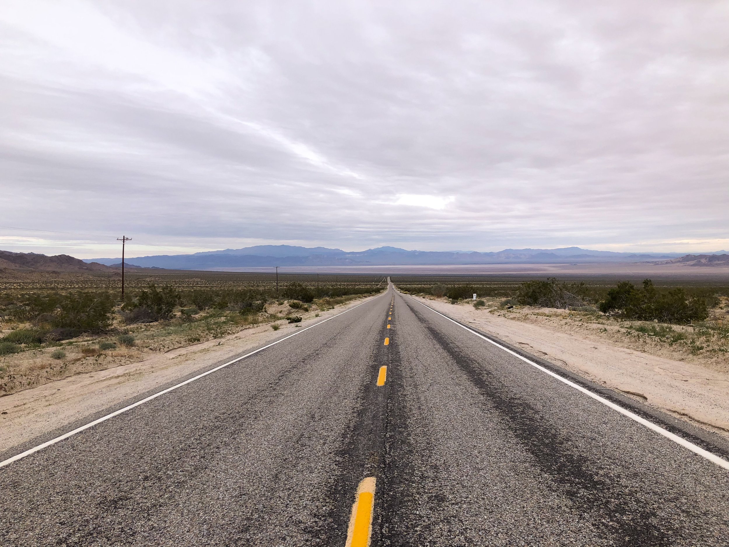
Driving in The American Southwest
We spent 10 days driving thousands of miles around the American Southwest and its seemingly endless highways. Below are some tips for a making a smooth roadtrip.
Maps. Download offline maps and plan your route. Ask for an old school paper map from the rental agency or pick one up at a rest stop as a back up.
Distance. The southwest is a vast region of the country. Expect to drive hundreds of miles a day and thousands during the course of a multi-day to two week roadtrip.
Gasoline. Keep your tank at least half full. There are vast stretches without any gas stations.
Be Spontaneous. Give yourself extra time to get around and expect to make unexpected stops at roadside attractions and lookout points. Expect the occasional detour.
Weather. Check the forecast prior to driving, especially in the mountains. It’s not fun to get trapped in a blizzard.
Playlist. Have plenty of music or audio books teed up for the long drive and days in the car.
For Next Time…
The American Southwest is a vast region of the country where endless roads criss cross dramatic landscapes, small towns, big cities and historic sights. If we had more time, there is so much more we would see and do. Below is an extensive list of some of those places:
The Pacific Coast Highway. A coastal road stretching hundreds of miles along California’s Pacific Coast.
Palm Springs. A California town famed for it’s retro and mid-century style architecture, palm lined boulevards and desert landscapes.
Pioneer Town. An 1880s themed western town with dirt roads, wooden buildings, saloons and wanted posters.
Sequoia National Park. A California park with a forest of towering sequoia redwood trees, including the, General Sherman Tree, the world’s largest living tree.
Death Valley National Park. Considered one of the hottest and driest places on Earth with summer time temperatures often exceeding 120 degrees fahrenhrit, especially in Furnace Creek.
Antelope Canyon. A picturesque, narrow and winding sandstone canyon. It can only accessed via a Navajo guide.
Vermilion Cliffs. A sweeping wave of orange and golden shades of sandstone.
Beaver Falls & Havasu Falls. Two turquoise waterfalls hidden in the middle of Arizona’s desert landscape on the Havasupai Reservation.
Sedona, Arizona. A desert town with striking rock formations, pine forests and breathtaking hiking trails, including the Devil’s Bridge Trail.
Santa Fe, New Mexico. A historic and artsy pueblo with galleries, museums and adobe landmarks.
White Sands National Park. A sprawling desert park with white sand dunes cresting across the horizon.
Taos Pueblo. An adobe city, home to the Taos Pueblo people, dating back over 1,000 years.
Zion National Park. A national park with verdant oases, emerald river pools, steep canyons and hiking trails including Angles Landing.
Bryce Canyon. A dramatic canyon filled with hundreds of red and orange sandstone spires.
Arches National Park. A national park with over 2,000 naturally formed sandstone arches.
Bonneville Salt Flats. The location of an ancient salt lake with a crystalline salt crust covering its floor.
Dinosaur National Monument. A reserve with hundreds of paleontological sights and fossilized dinosaurs.