
Southwest USA Road Trip Guide: National Parks & Desert Landscapes
Journey through the American Southwest, exploring national parks, desert landscapes, scenic drives and iconic landmarks across one unforgettable road trip.
The American Southwest
The American Southwest is a playground of incredible rock formations, otherworldly deserts and endless highways. The region overlaps several states, includes many Native American reservations and is home to some of the country’s most cherished National Parks.
An American Road Trip
There’s something so freeing and spontaneous about road trips: listening to good music, driving with the windows down, stopping at roadside attractions and ordering drive through meals. Starting in Los Angeles, we spent 10 days driving along sections of Old Route 66 across Southern California, Arizona and Utah.
Southern California
Our road trip through Southern California led us from Los Angles into the desert. We passed roadside attractions, hiked through national parks and visited forgotten communities.
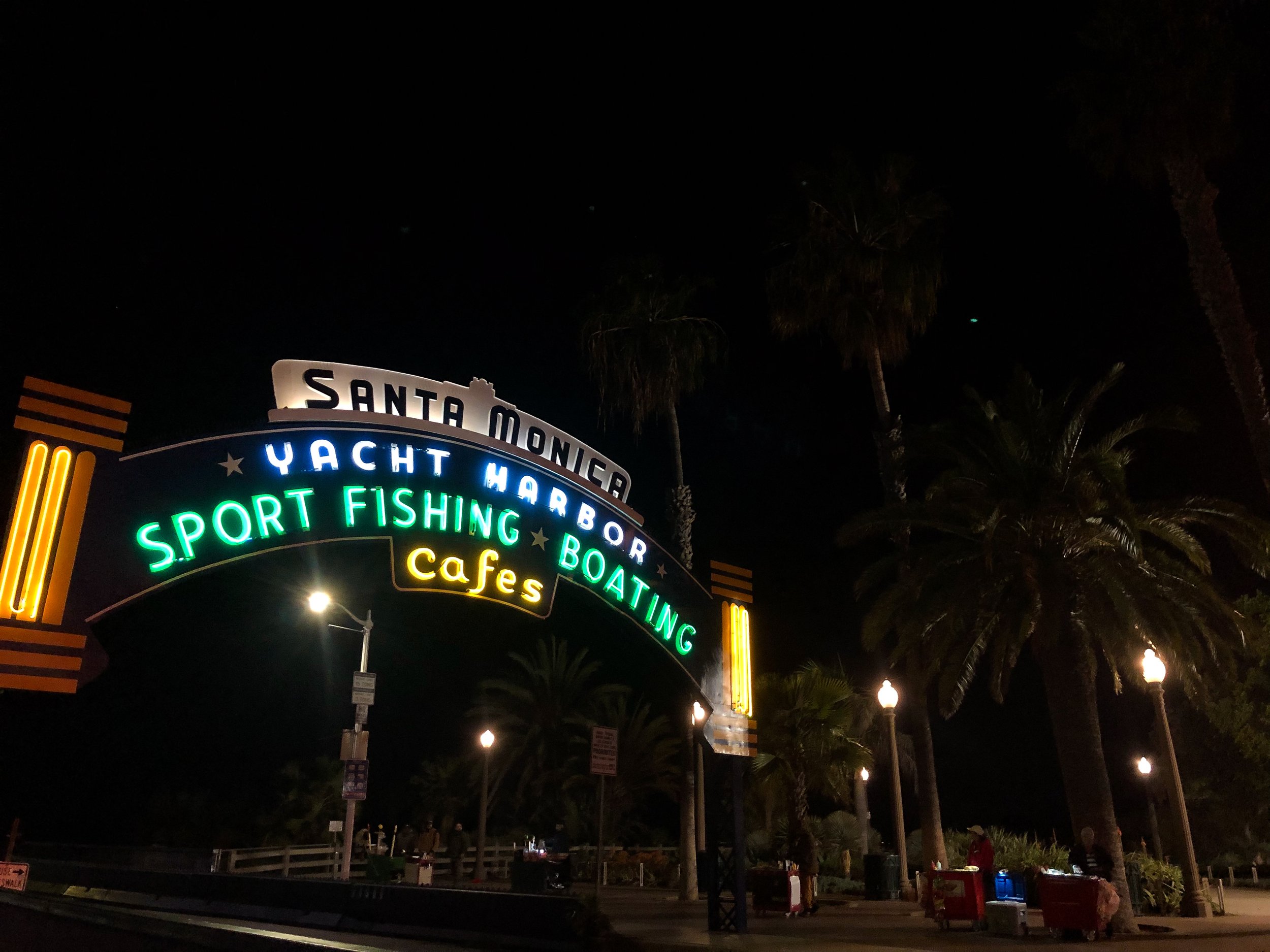
Santa Monica Pier
The Santa Monica Pier made for a fitting place start to our roadtrip, being the point where the historic Route 66 meets the Pacific Ocean. The wooden pier is buzzing with electronic violinists, fishermen and neon lights from vintage amusement park rides. It boasts coastal views of the ocean and tan sand shoreline stretching along the Pacific Coast Highway.
The Lobster Restaurant. A seafood restaurant at the entrance of the Santa Monica Pier with dishes like grilled lobster, lobster mac and cheese and lobster rolls, all best paired with a Pacifico beer.

Randy’s Donuts
A landmark donut shop, easily recognized by the massive donut resting on top of its roof. It’s been featured in video games, movies, TV shows and referenced across Hollywood. We ordered coffees and a dozen donuts to begin our first morning on the road!
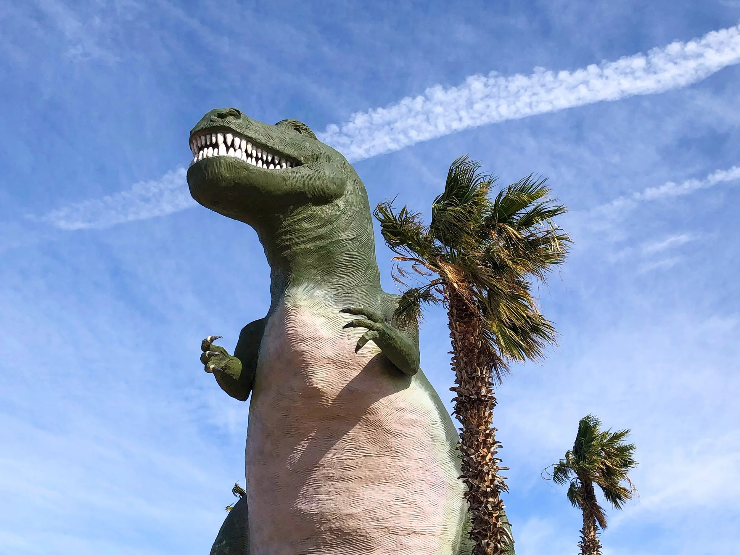
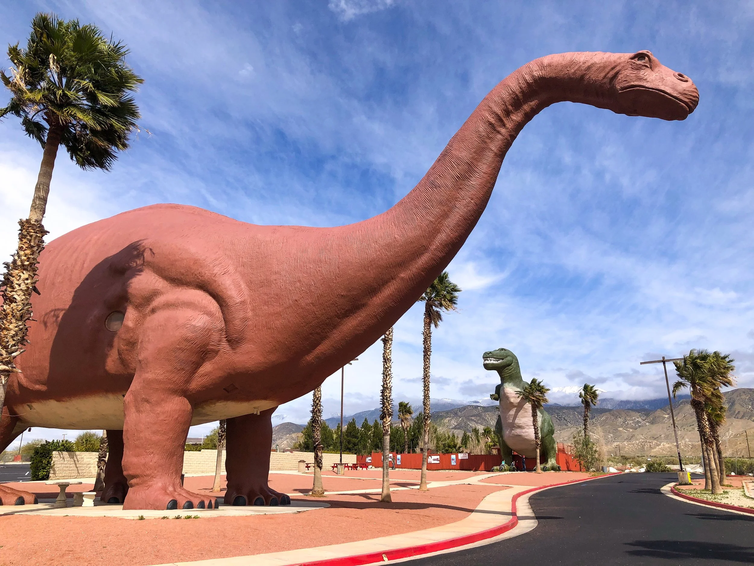
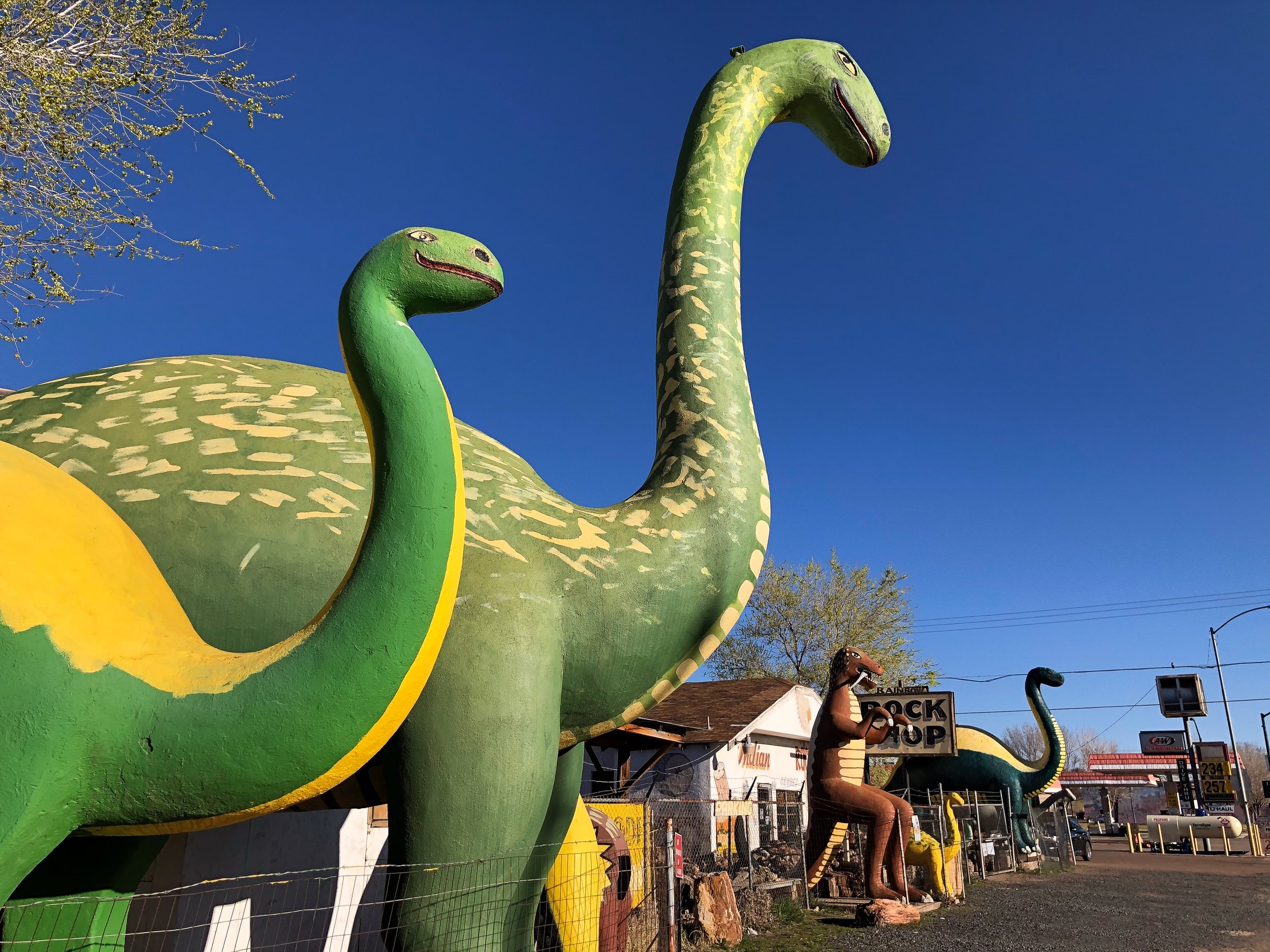
Cabazon Dinosaurs
Located just off the highway in Cabazon, CA, these dinosaurs captured our attention and imagination. This roadside attraction, considered to be one of the greatest, features two giant dinos: A brachiosaurus named Dinny the Dinosaur and a t-rex named Mr. Rex. We reveled at, walked under, around and even climbed inside both of them.
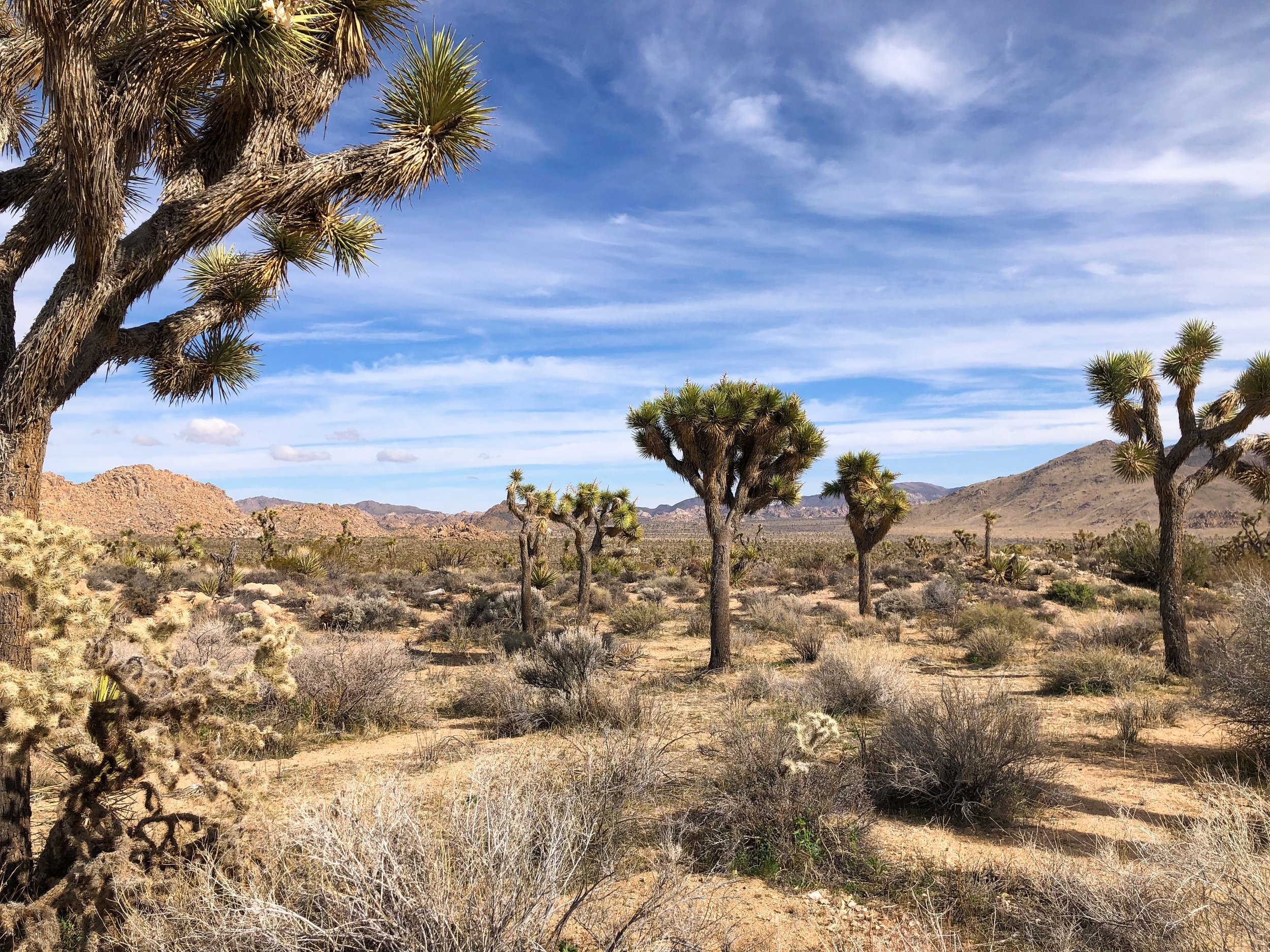
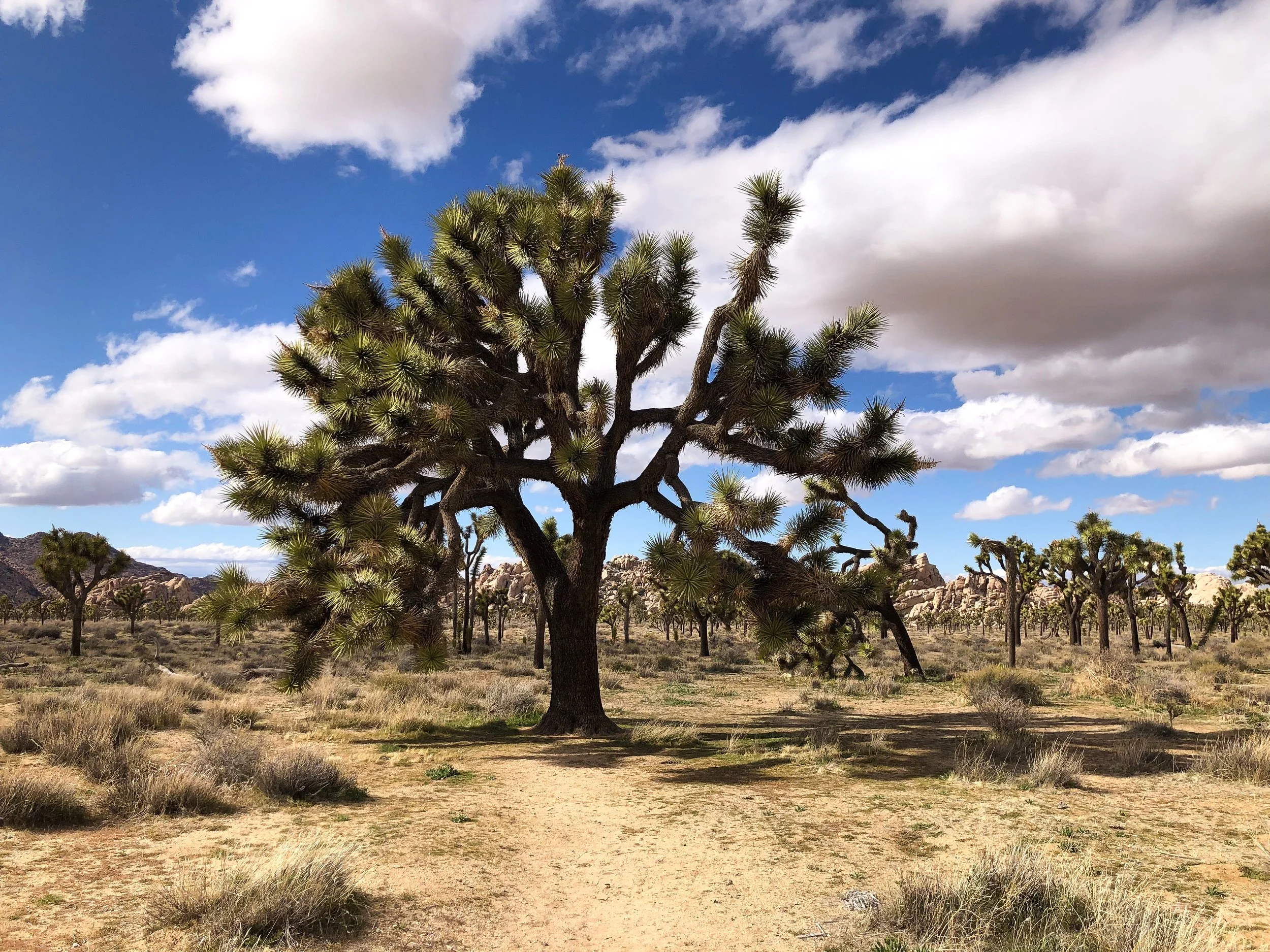
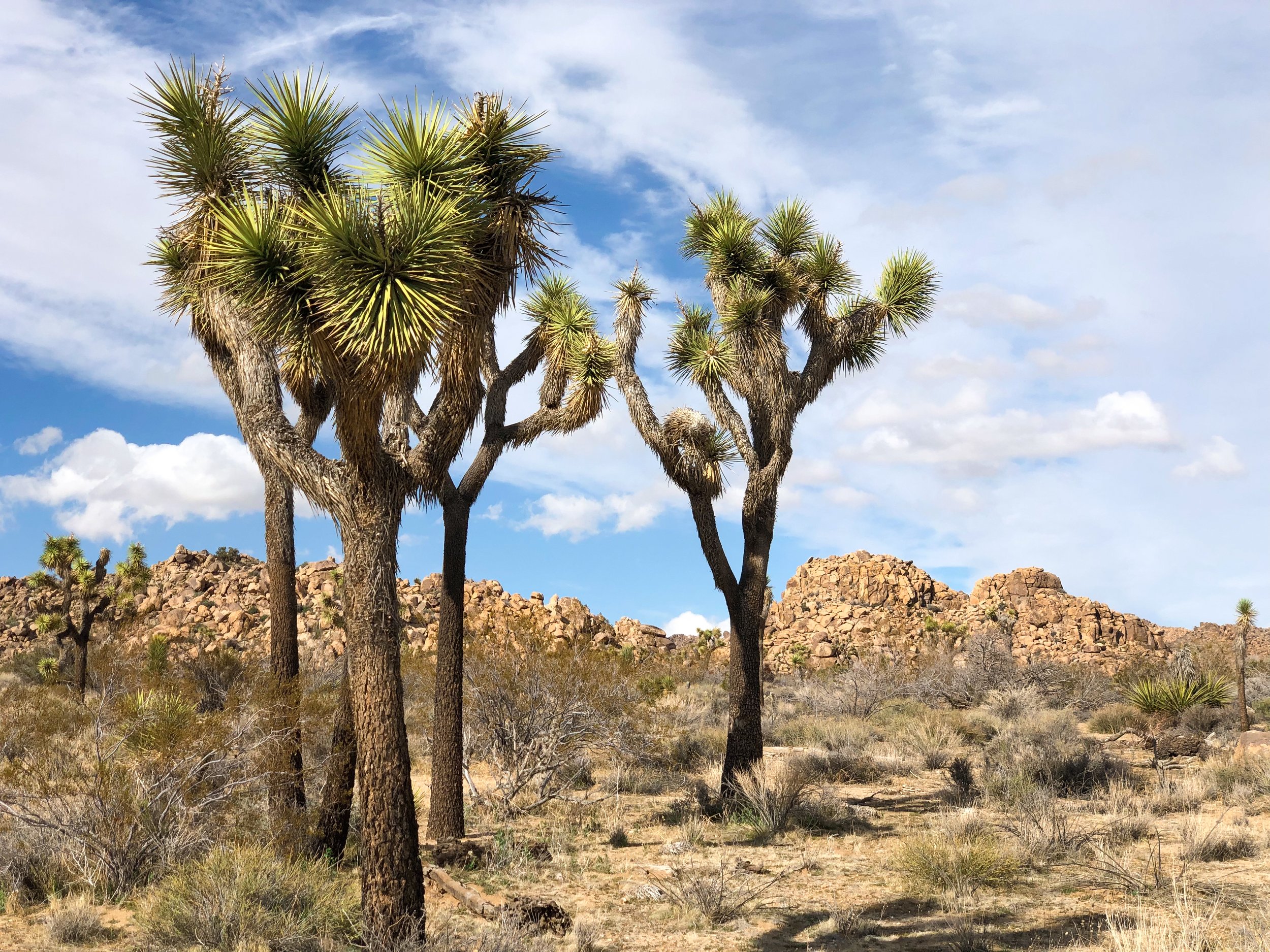
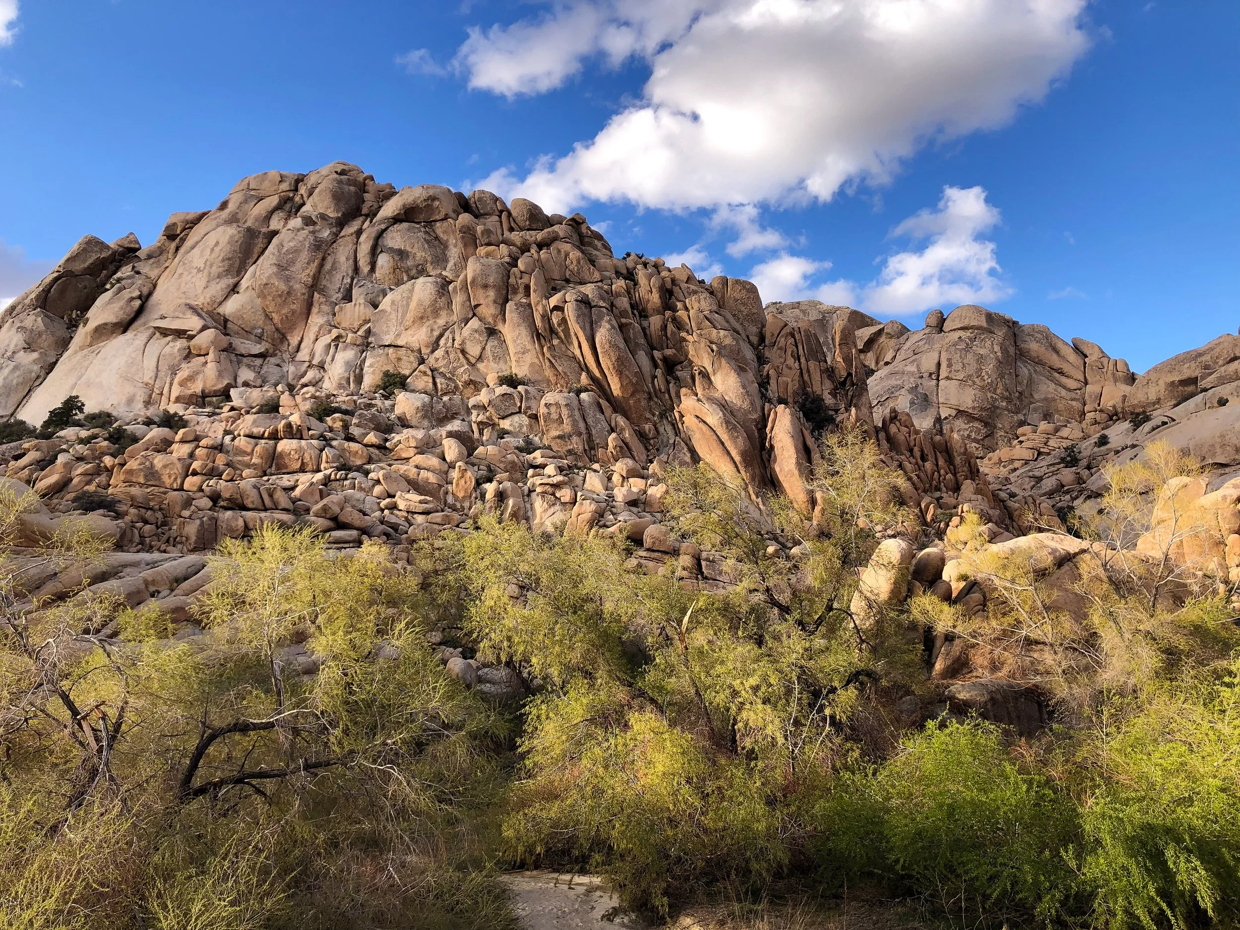
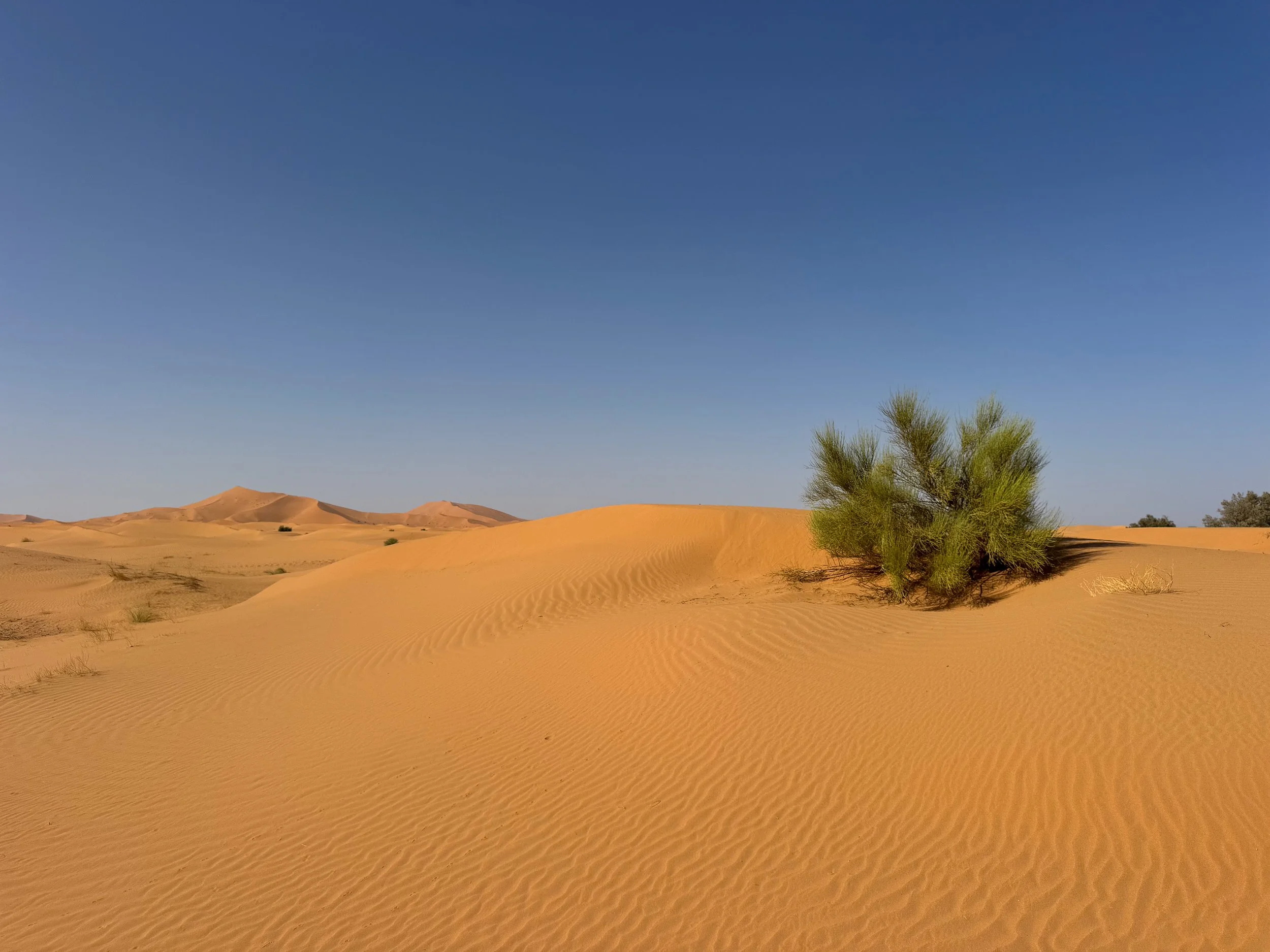
Joshua Tree National Park
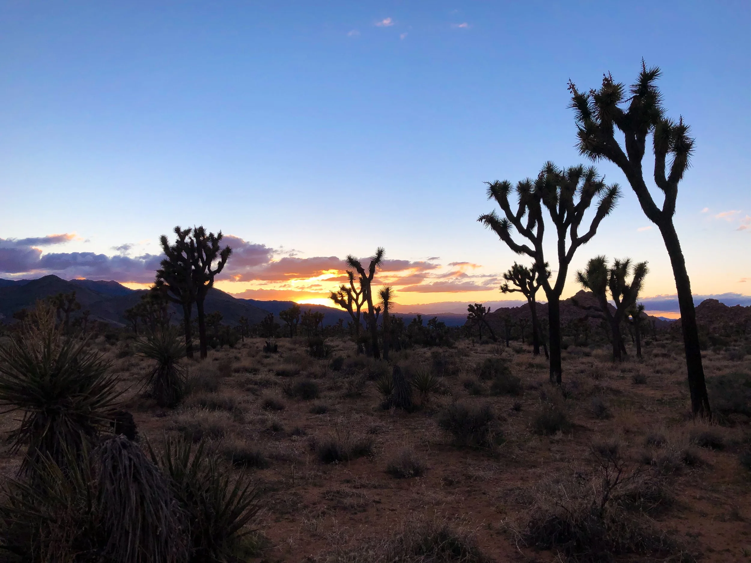
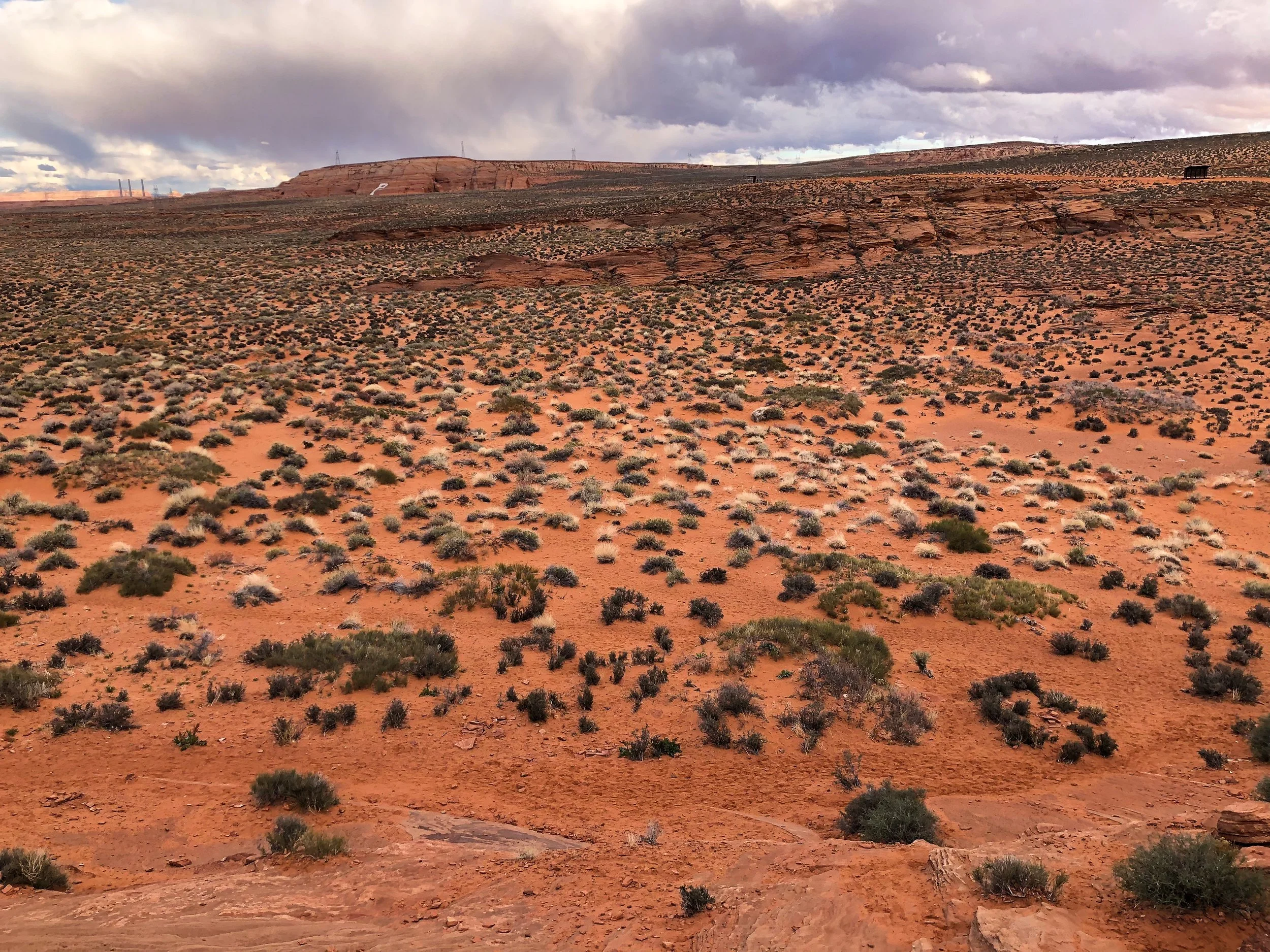
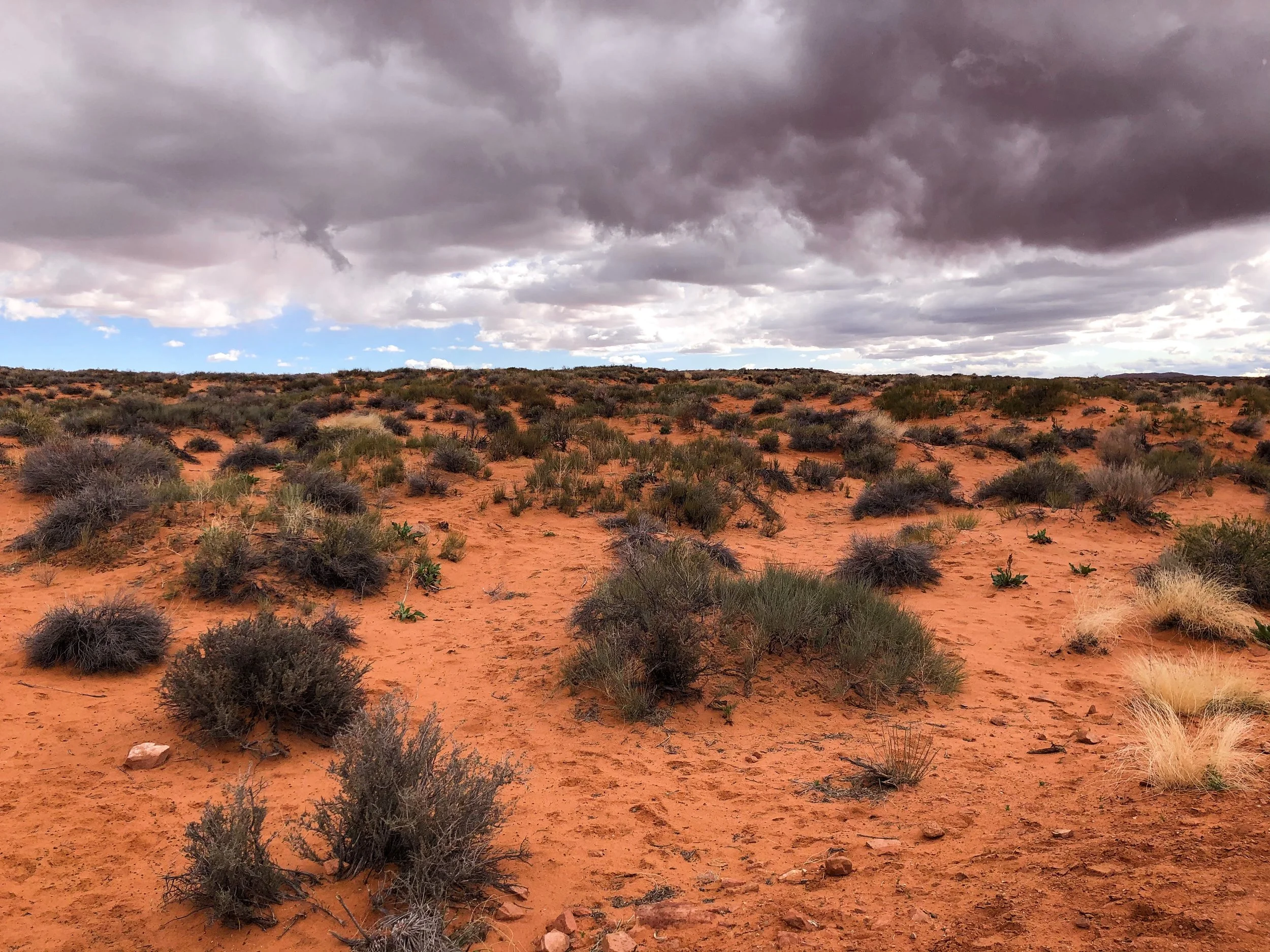
Joshua Tree National Park is one of the United States’ most treasured landscapes, home to exotic desert plant life, giant boulders and hiking trails. It’s famed for its namesake, the Joshua Tree, a multi-armed, spike leaved, desert growing plant. They are a fragile and enduring symbol the Mojave Desert where the park resides, thriving in harsh conditions with little water and persistent sunlight.

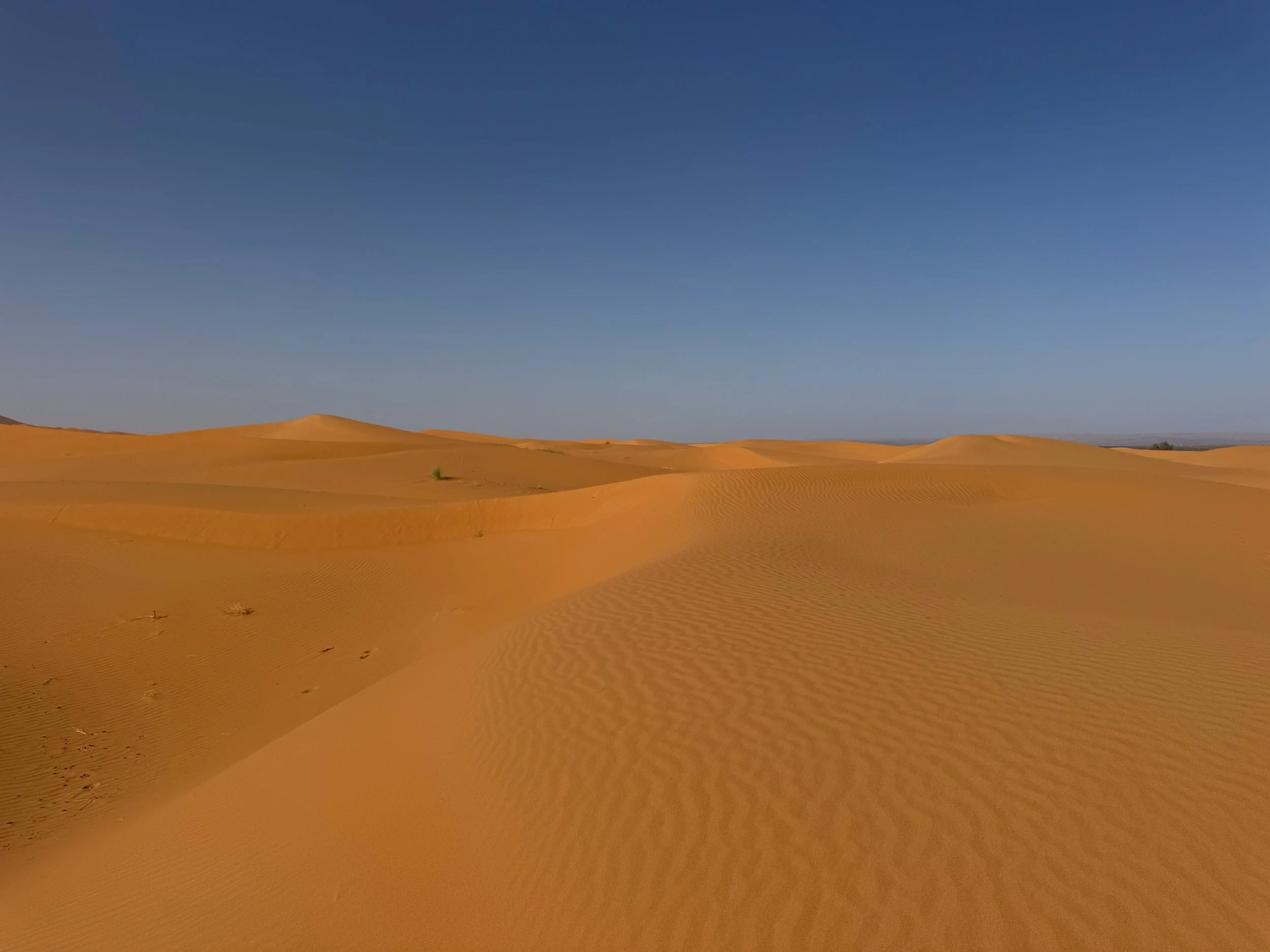
Hiking Trails & Desert Sights
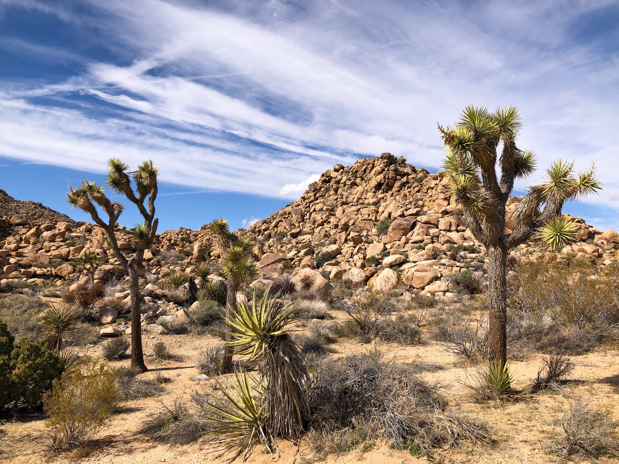
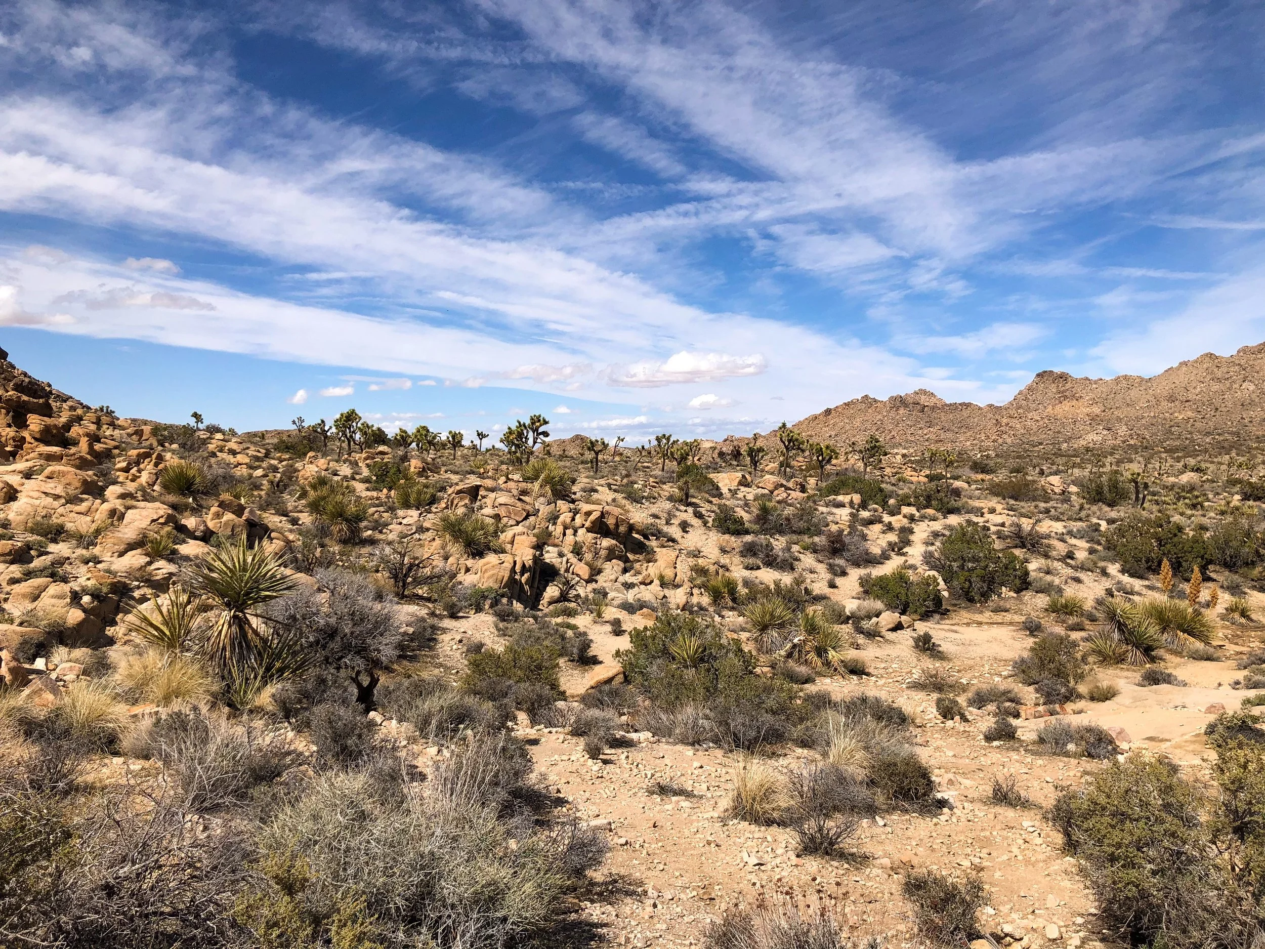
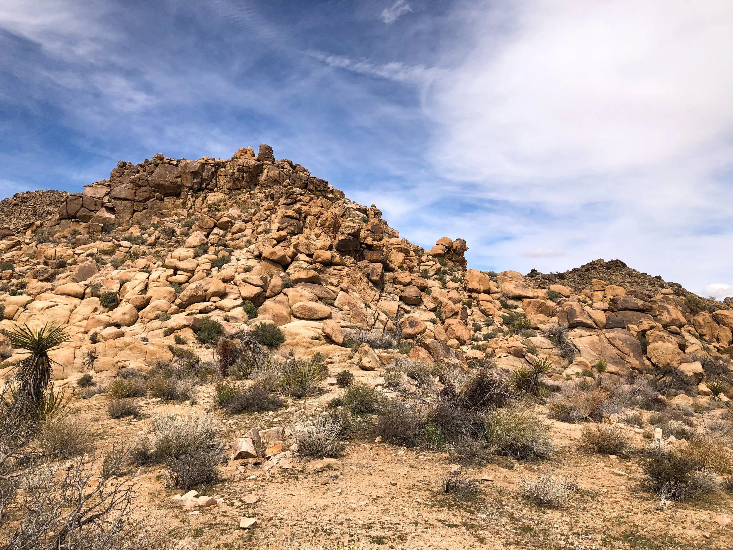
Park Blvd. The main road in Joshua Tree National Park. Several hiking trails branch off from it, meandering across the desert landscape and connecting with other trails. Choosing a trail head with available parking, we began hiking the South Side Connector Trail and later merging with the Big Foot Trail. We spent hours hiking through a forest of Joshua Trees, alongside large rock formations and through an area with a wash where we saw desert tortoises.
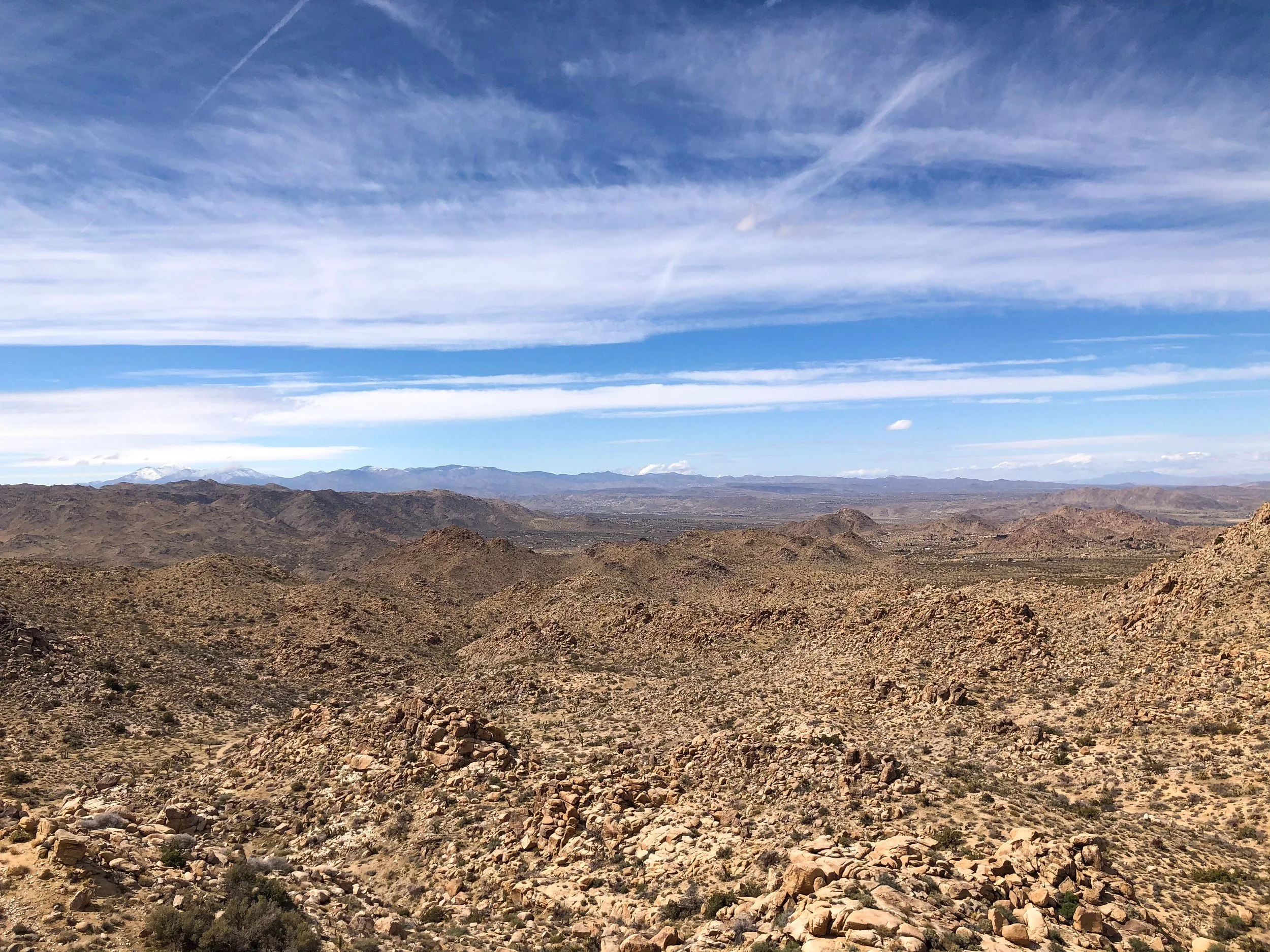
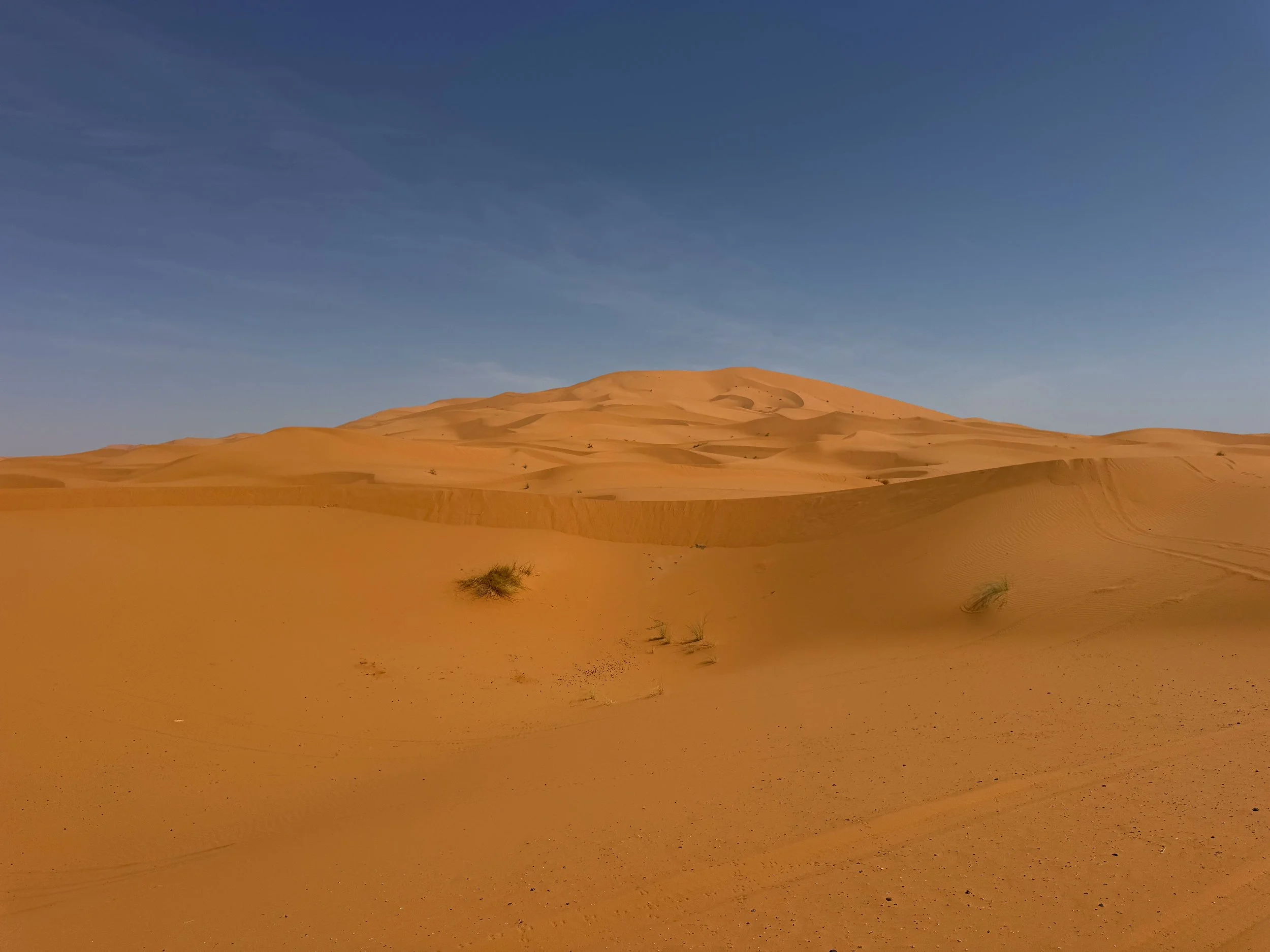
Willow’s Hole Trail. Considered one of Joshua Tree’s most scenic hikes. The trail offers a variety of the entire Joshua Tree landscape ending at a desert oasis surrounded by willow trees. The first half of the trail is relatively flat, surrounded by large rock formations, Joshua Trees, desert plants and countless whitetail rabbits and jackrabbits. The second half of the trail winds through a canyon with incredible cliffs and washes before ending at the peaceful oasis. During the return hike, we enjoyed golden hour illuminating the terrain and watched as the sunset painted the sky in an array of colors.
Pro Tip. Begin in the late afternoon to avoid peak heat, planning to finish the hike around sunset.
Good to Know. The hike spans more than 7 miles round trip and takes about 4 hours at a normal pace. Be prepared to climb over large boulders to avoid flooded parts of the trail.
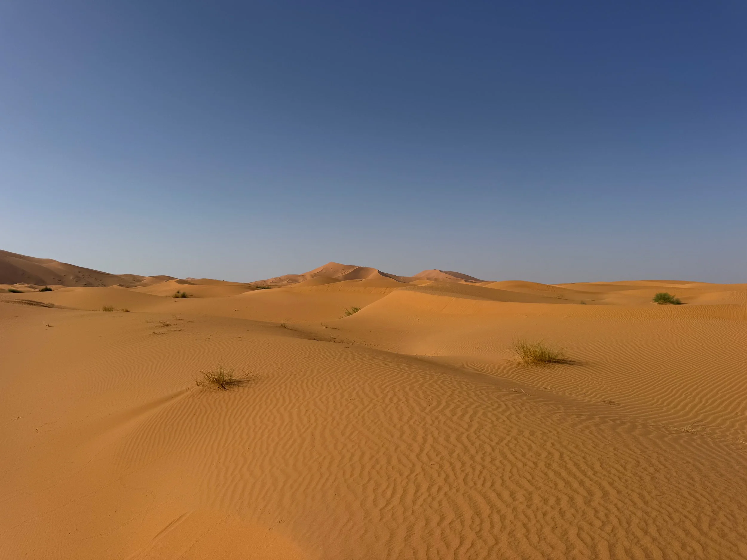
Chola Cactus Garden. Located midway along Pinto Basin Road is this incredible cactus garden filled with Chola cacti. Watch your step along the trail and don’t touch them.
Pinto Basin Road. A scenic road leading from the north end to south end of the park, taking about an hour to drive. Most Joshua Trees are located in the High Mojave Desert in the north while the Colorado Desert to the south is known for its cacti patches.
Pinto Basin. A vast swath of cacti covered desert and mountains. It’s easily viewed from the Pinto Basin Road.
Ocotillo Patch. Located near the south end of Pinto Basin road is an extensive patch of Ocotillo Cacti. These massive cacti grow several feet high and gracefully sway in the wind.
Skull Rock. An eroded rock formation that resembles the shape of a human skull.
The Night Sky. The High Mojave Desert is located far enough from any major cities making light pollution very minimal and offering incredible night sky views.
Joshua Tree Essentials
Maps & Park Pass. Stop at one of the Visitor Centers to buy a park pass and map. Ask a ranger for recommendations on where to hike based on what you want to do or see. Visit the National Park Service for detailed info on Joshua Tree and its trails. Alternatively, set up an account with All Trails for detailed info on all of the parks route’s with info curated by other hikers.
What to Bring
Water
Trail Snacks
Sunblock & Sunglasses
Flashlight
Map
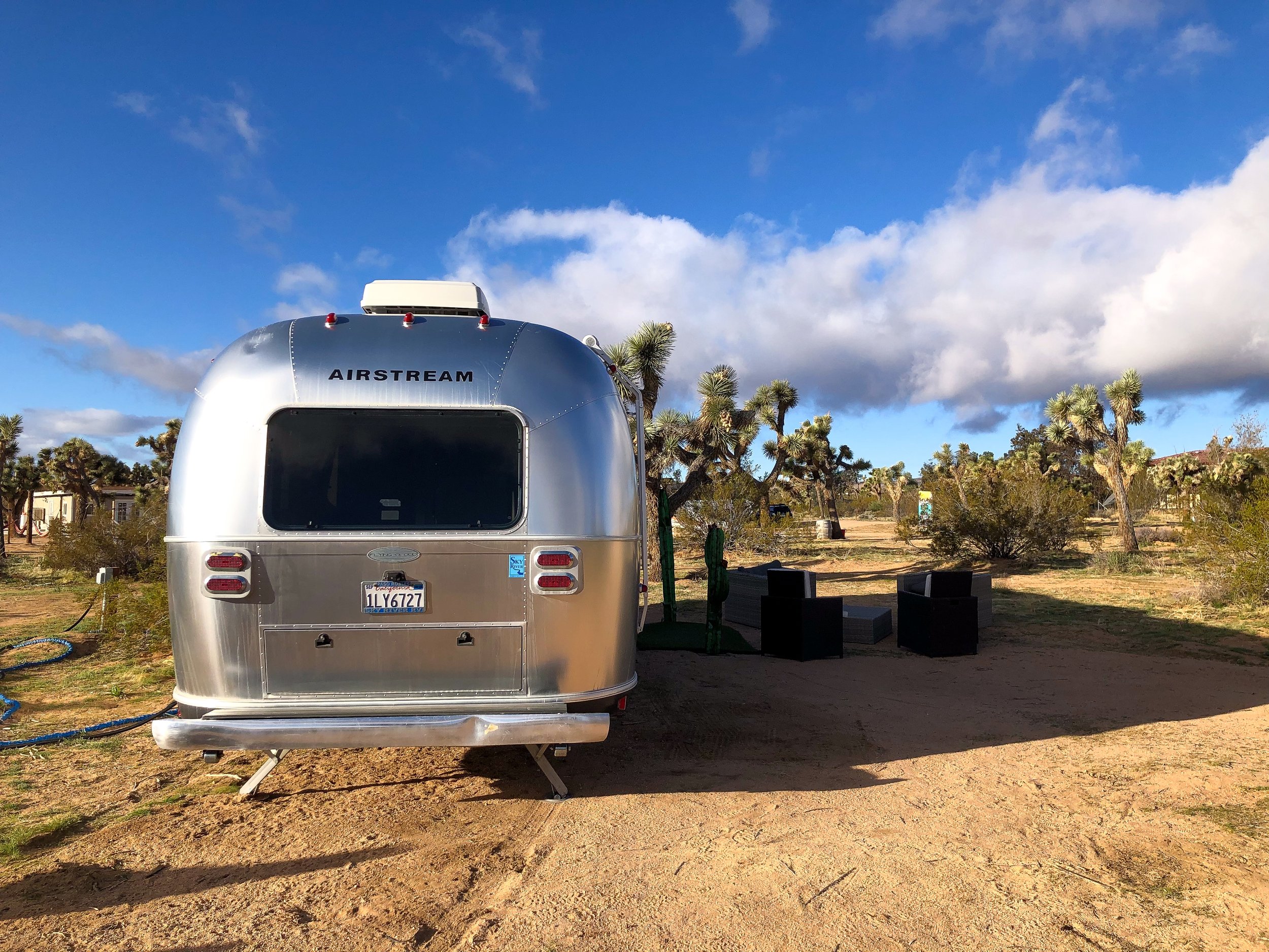
Where to Stay
There’s no shortage of places to stay in and around Joshua Tree. The park itself has a few campgrounds while many quaint desert resorts, motels and unique stays surround the park.
Joshua Tree Airstream. A traditional Airstream camper set amongst the shrub covered desert landscape. The cozy space is fully equipped with two beds, a communal area, kitchen, toilet and shower. It’s located less than 30 minutes from the West Entrance Station. Book on Airbnb.
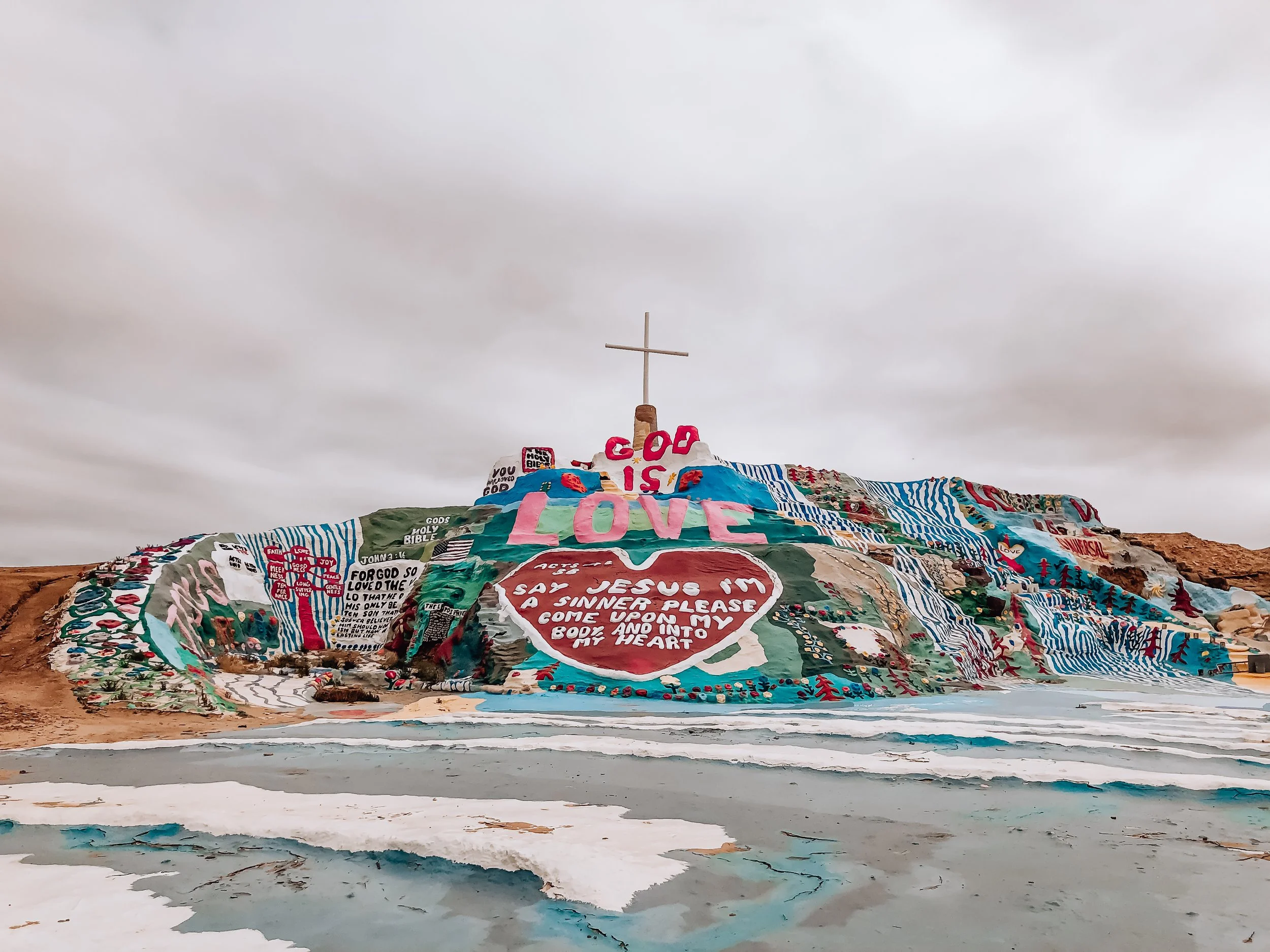
Salvation Mountain
Salvation Mountain is a massive art piece located in the California Desert started by Leonard Knight in the mid-80s. The site is inspired by the scriptural passages with the simple message, “God is Love.” Love, in our opinion, is the true theme of this place. The mountain is covered in colorful and peaceful imagery of waterfalls, flowers and the yellow brick road centered around the most prominent word, love, situated above a giant heart. The structure is built from a mixture of hay, packed clay and layers of paint.

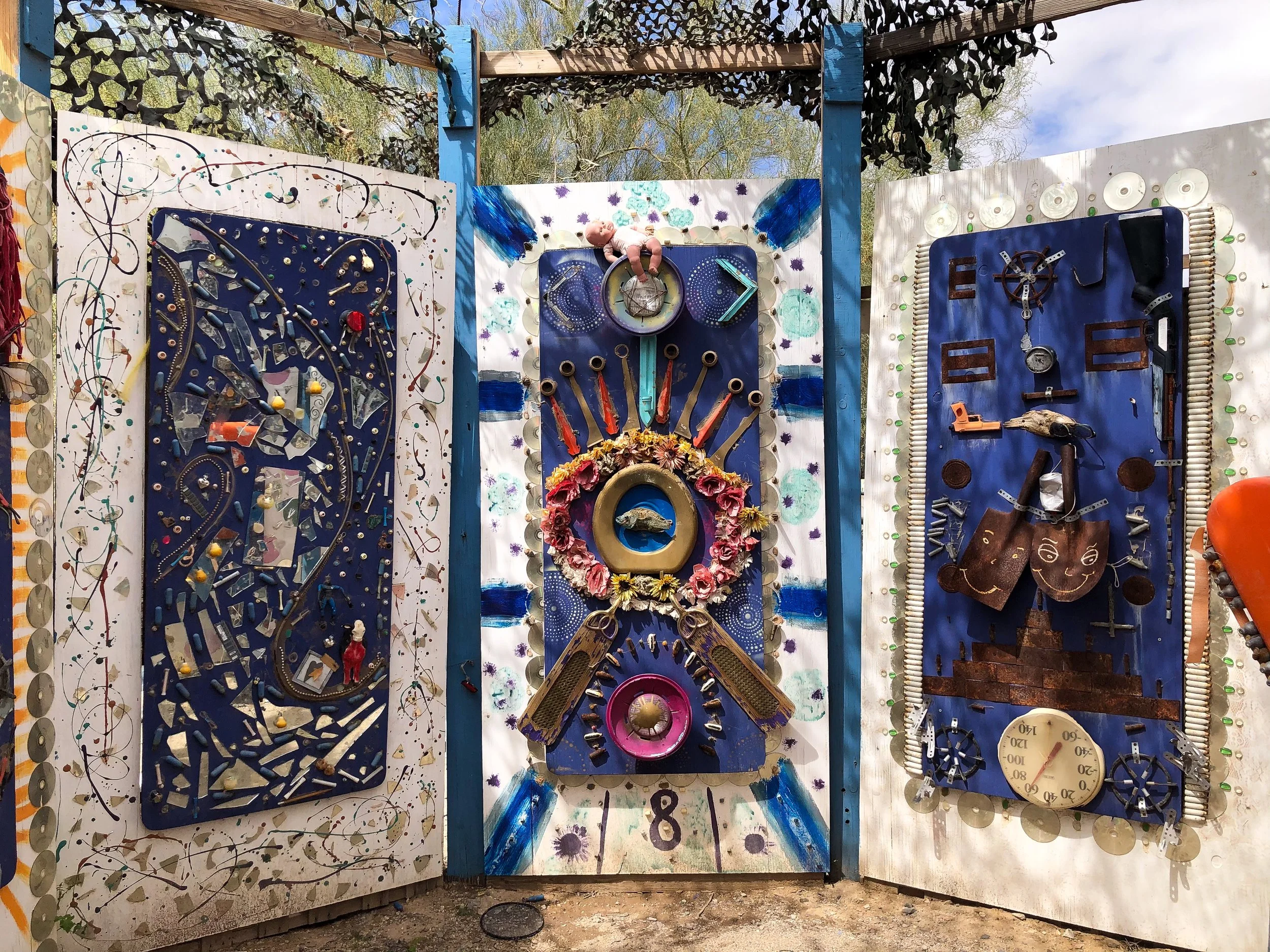
Slab City & East Jesus
Located just beyond Salvation Mountain are two off the grid alternative living communities, Slab City and East Jesus.
Slab City. A community named for remnants of concrete slabs left behind after the demolition of a military training camp. The slabs are home to RVs, permanent trailers, makeshift buildings and piles of debris. Many of the folks who live here have come to live off the grid while others are here as a result of poverty. There is no electricity, running water, waste management or local government. Despite that, there is a certain sense of community with its own library, golf course, clubs and music venues.
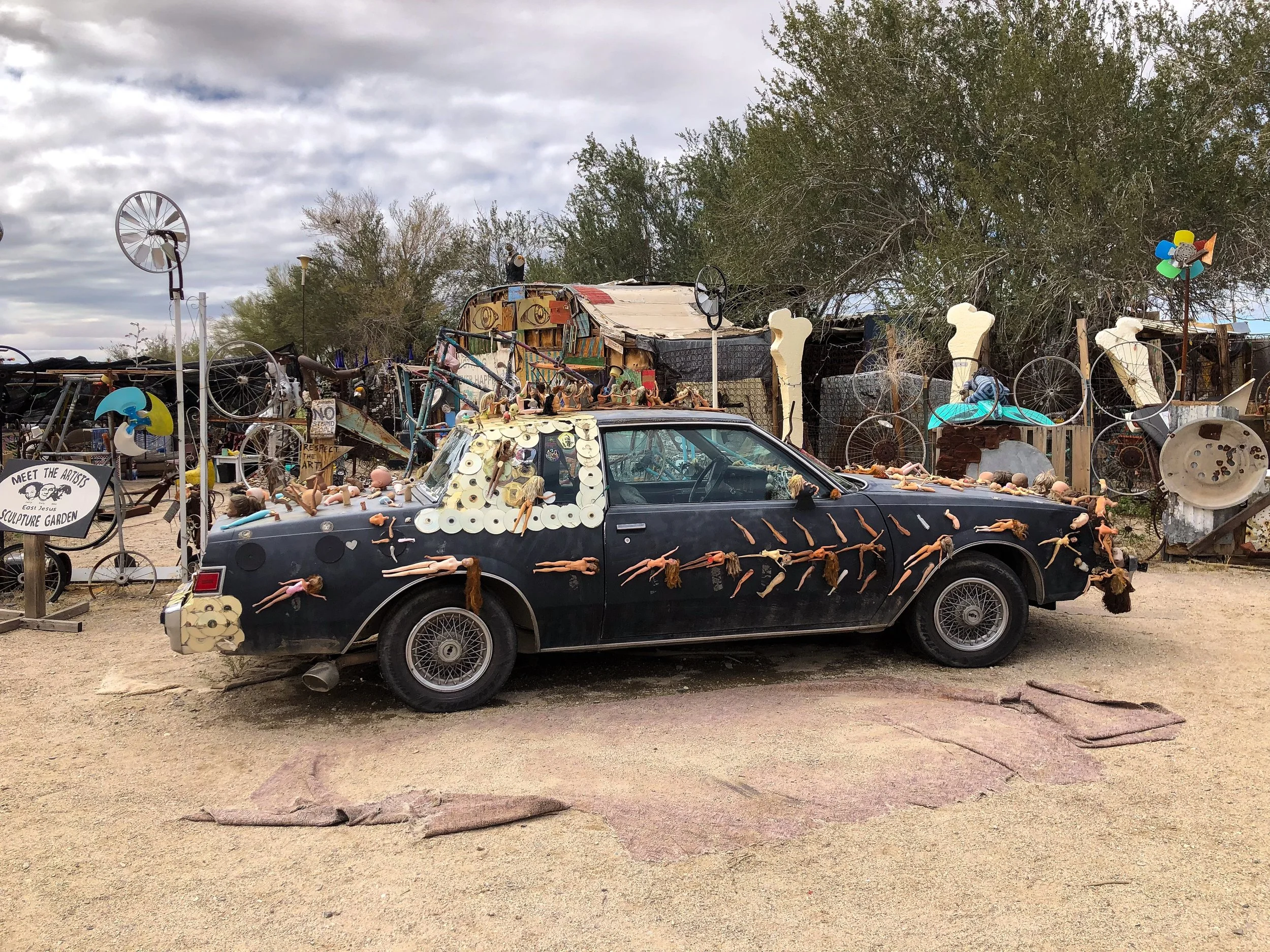
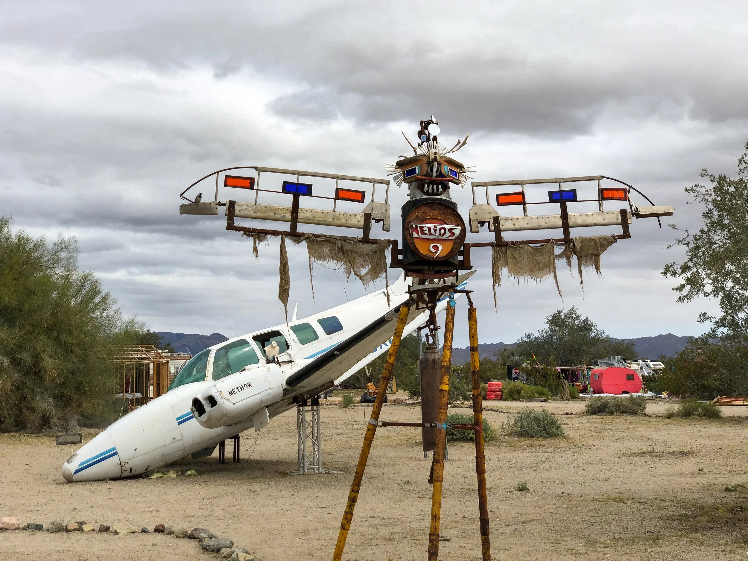
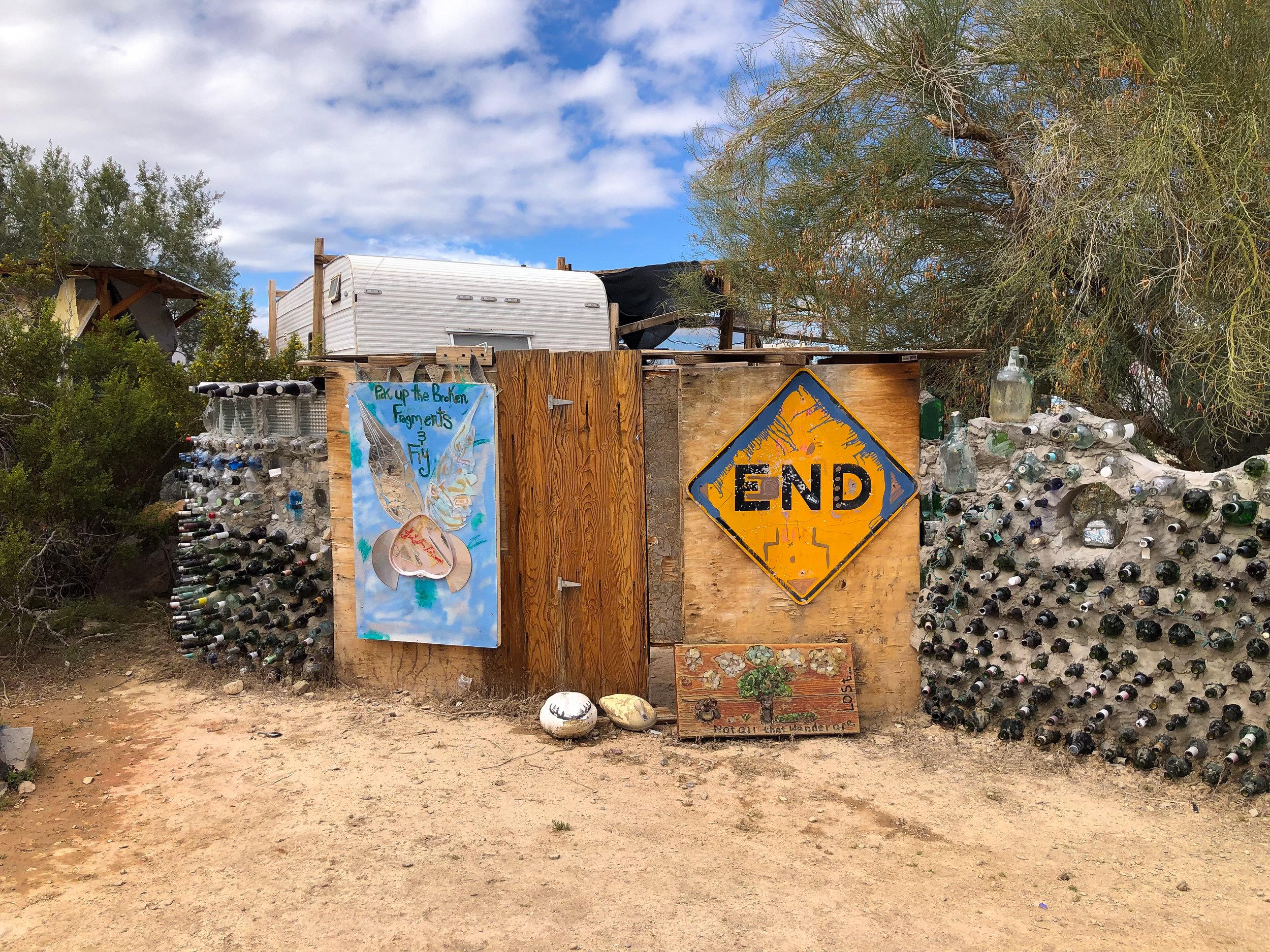
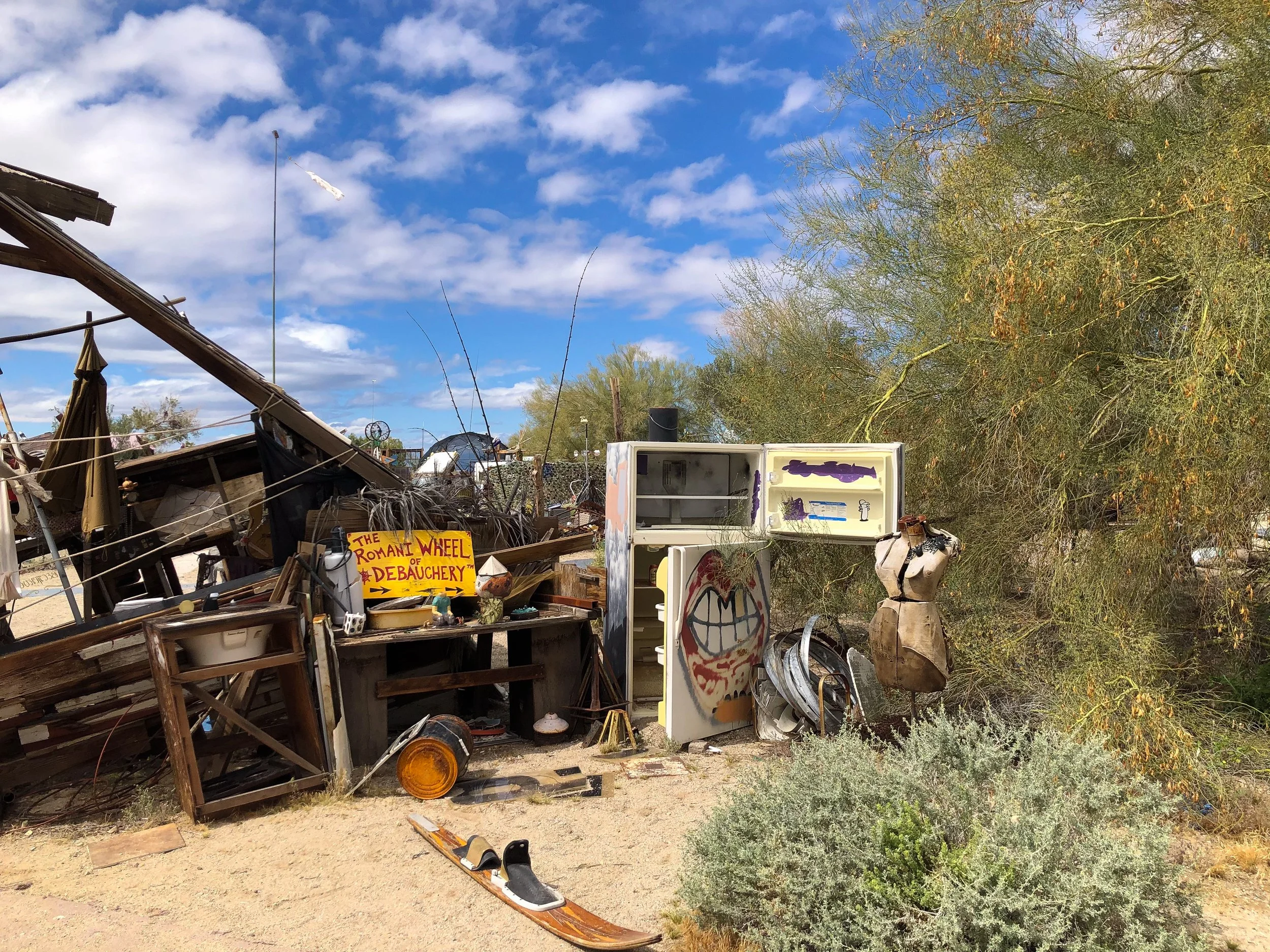
East Jesus. A sustainable and habitable art installation focused on creative re-use. The experimental community is built from discarded materials and salvaged waste. It’s inhabited by artists, musicians, writers and other creatives. We spent hours wandering, observing and talking with some of the locals to get a better perspective on the place. Come here with an open mind. There is nowhere else quite like it.
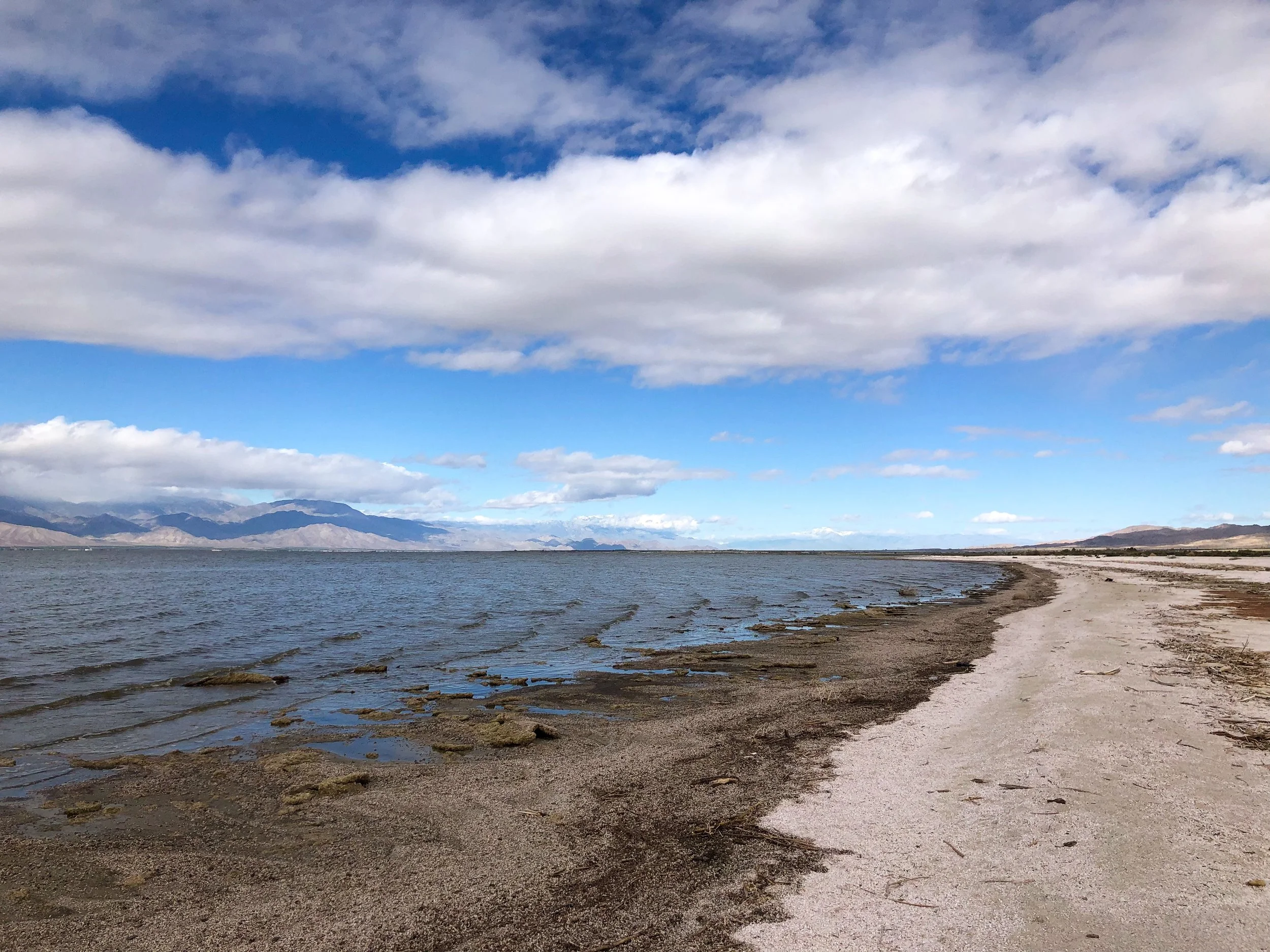
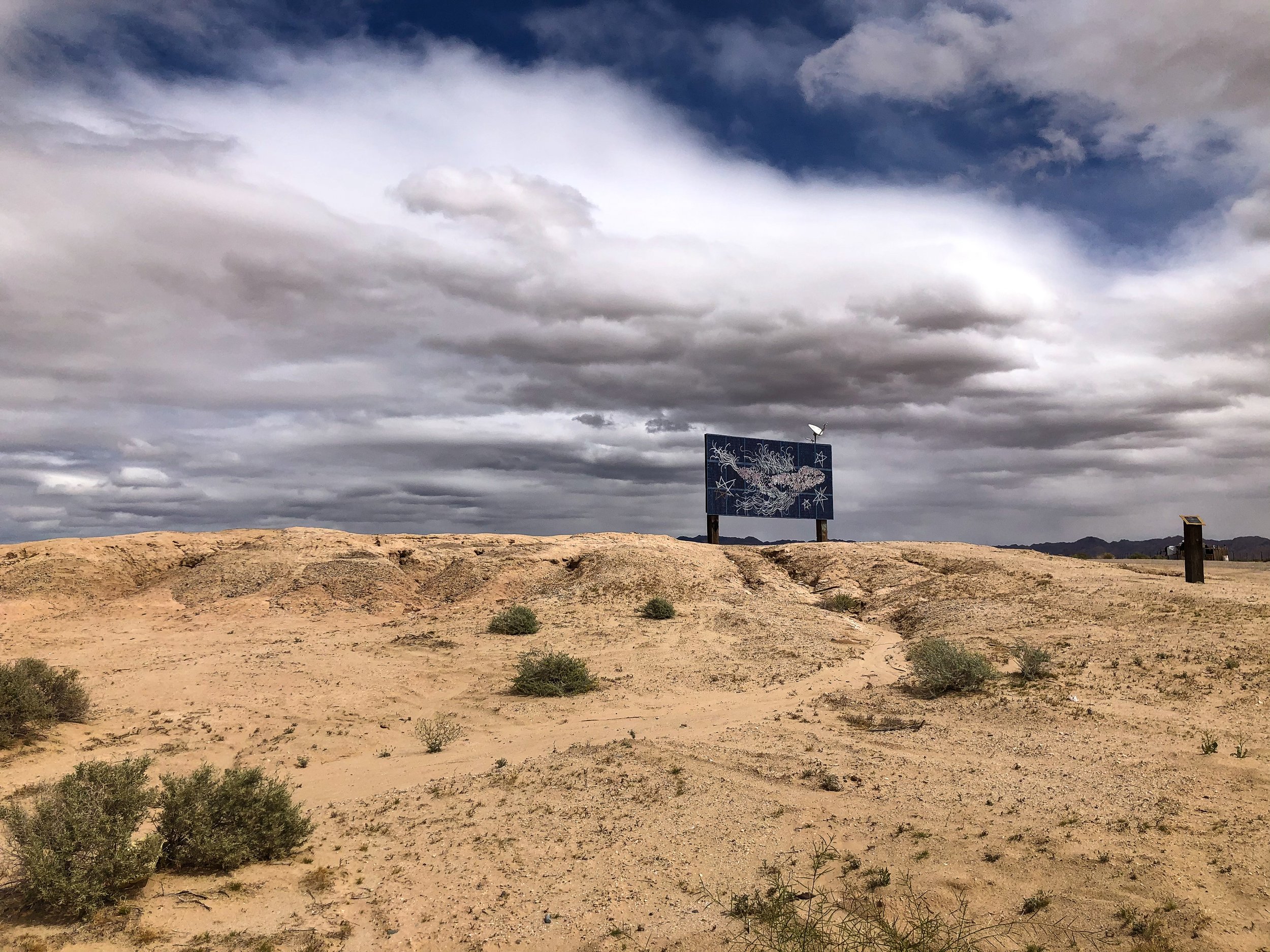
Salton Sea & Bombay Beach
The Salton Sea. An ancient lake bed, accidentally flooded during the early 20th century, now contaminated with agricultural runoff. The shrinking body of water and its shoreline are covered in the decomposing remains of fish, dried clay and salt deposits.
Bombay Beach. A once thriving seaside community catering to celebrities, retirees and vacationers during the mid 20th century. The town, now mostly forgotten is a place stunted in its growth yet still inhabited by a small number of families and artists. We passed a man painting television screens on the street, two children seamlessly sweeping dirt for leisure and a woman sitting alone on a chair in the middle of an empty lot. Many homes have been left behind due to the toxicity of the sea and damage caused by the salinity in the air. A sobering place that shouldn't be overlooked or looked down upon.
Northern Arizona
Our roadtrip through Northern Arizona led us to some of the United States’ greatest natural wonders and pre-Columbian ruins.
The Grand Canyon
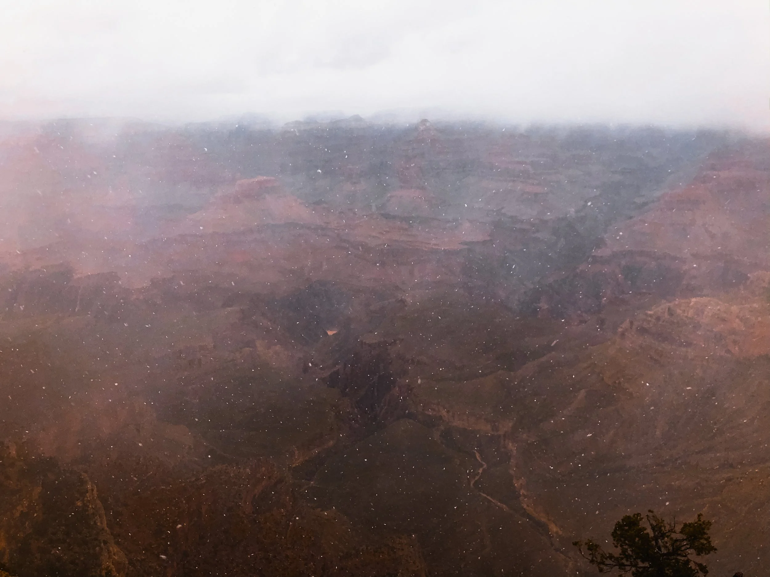
The Grand Canyon is revered as one of the greatest natural sights on Earth. Its size, at 1 mile deep and up to 18 miles wide, reveals millions of years of layered sediment and orange hued rock. We overlooked the South Rim of the canyon during the middle of a blizzard. Unable to see much through the whiteout, we laughed and vowed to return one day!
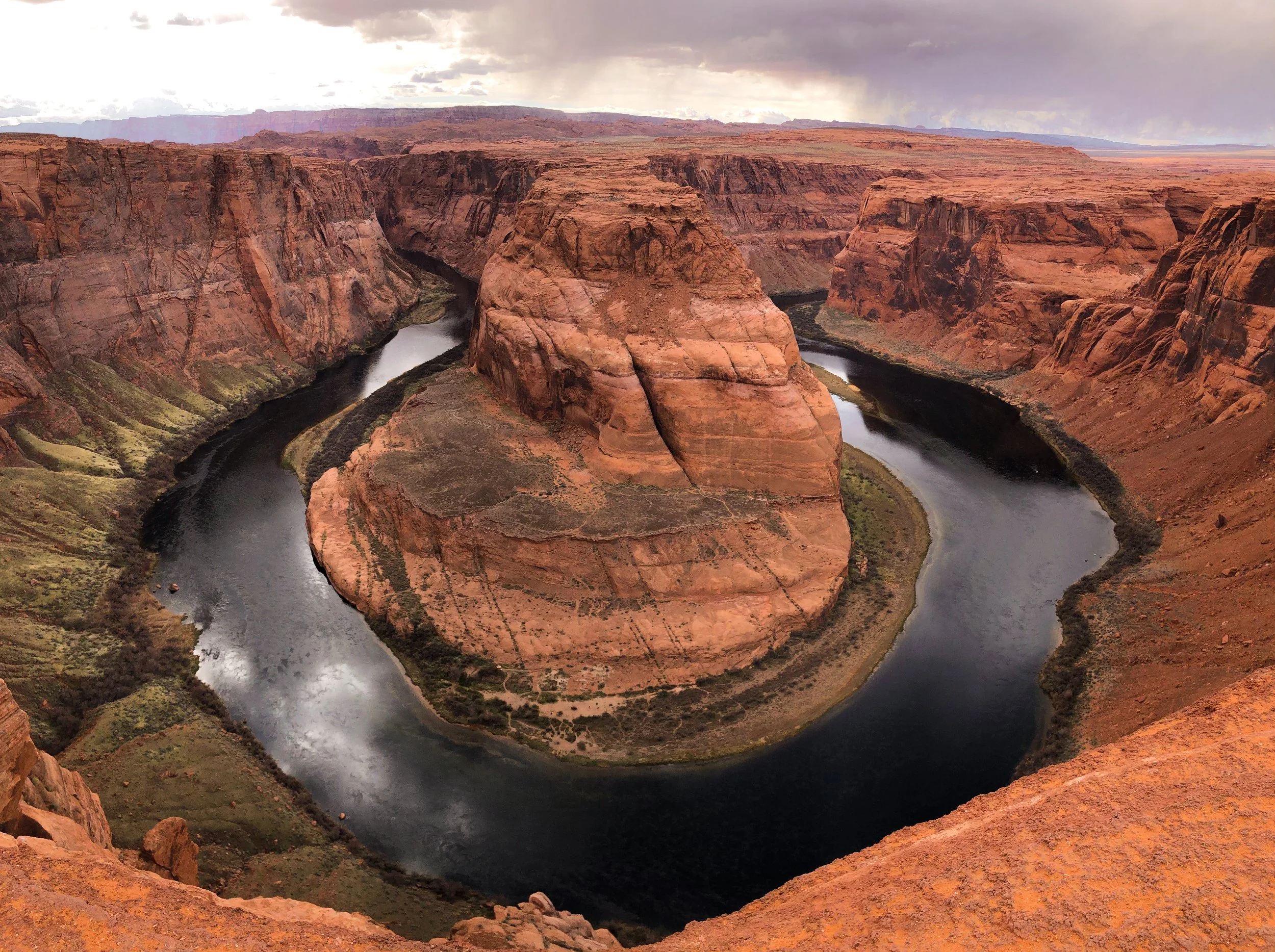
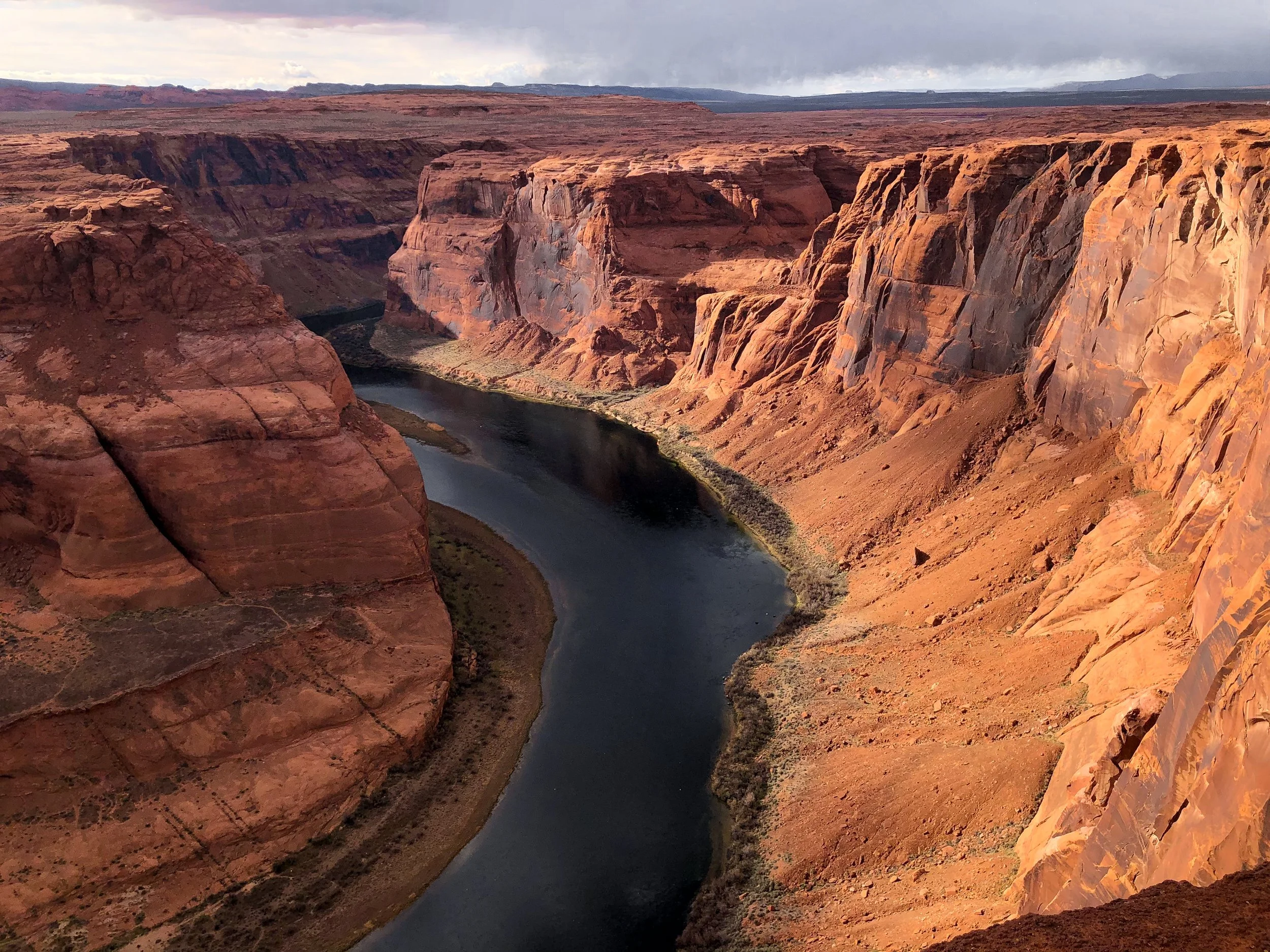
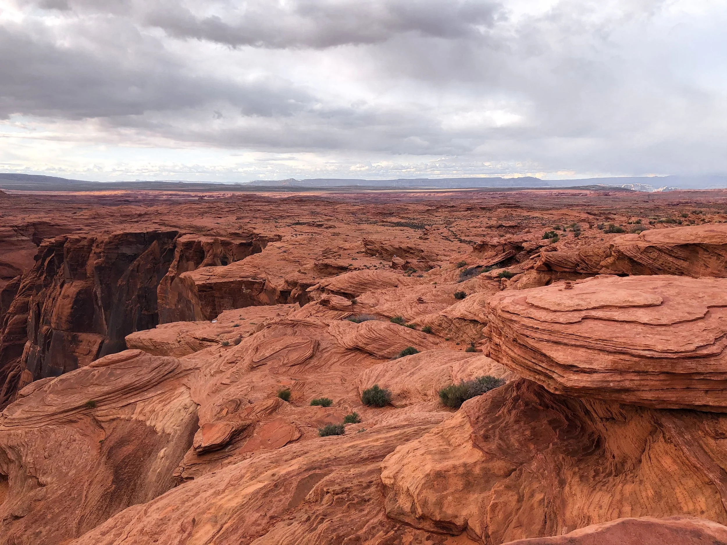

Horseshoe Bend
Horseshoe Bend is a 1,000 foot steep bend of the Colorado River in the shape of a horseshoe. It’s a breathtaking and truly awe inspiring place. We spent the late afternoon wandering the rim and admiring its beauty. Located just off the highway outside of Page, AZ and accessible by a 1.5 mile hike. The overlook is open daily from sunrise to sunset. Bring cash for the entrance fee.
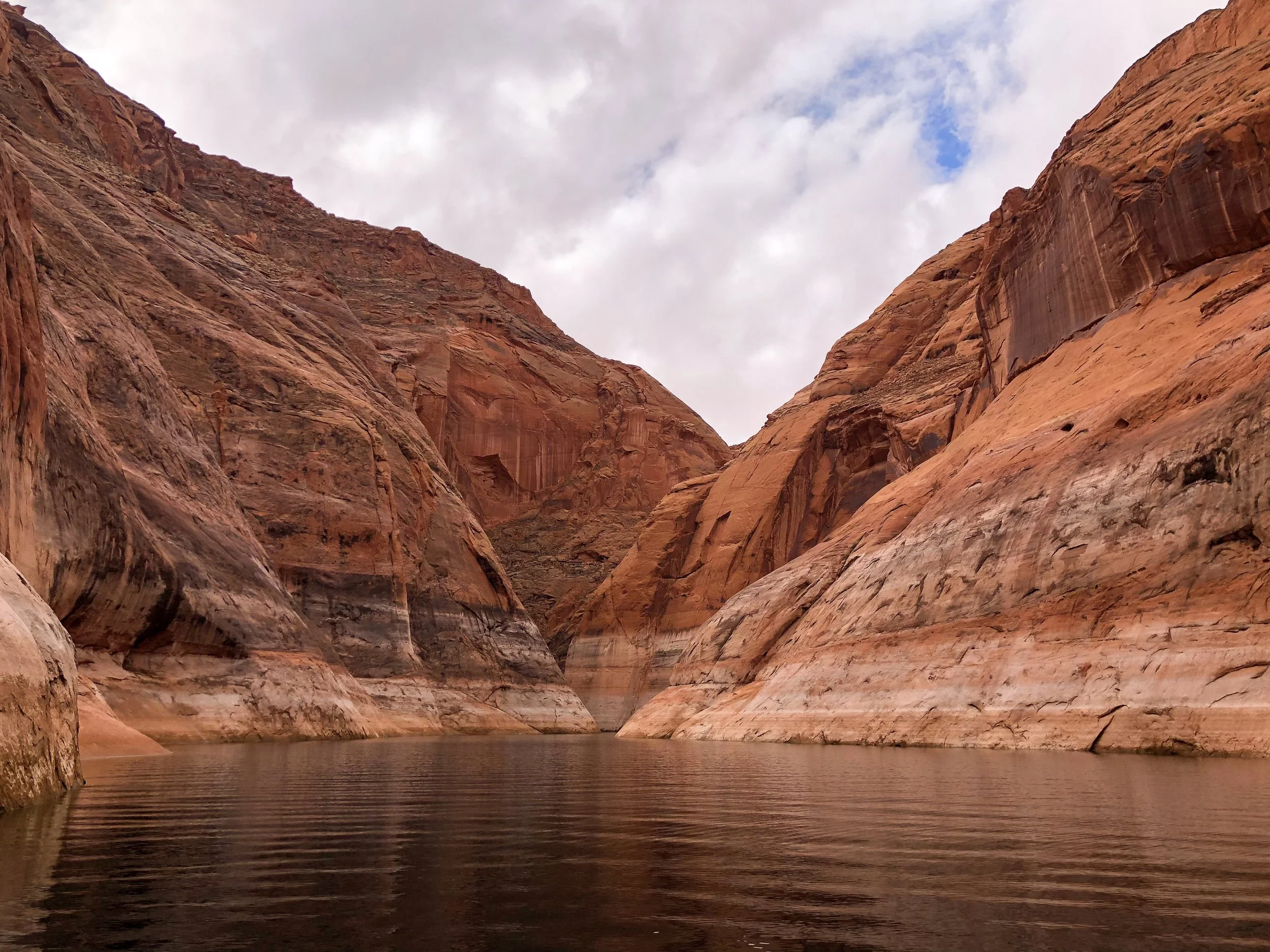
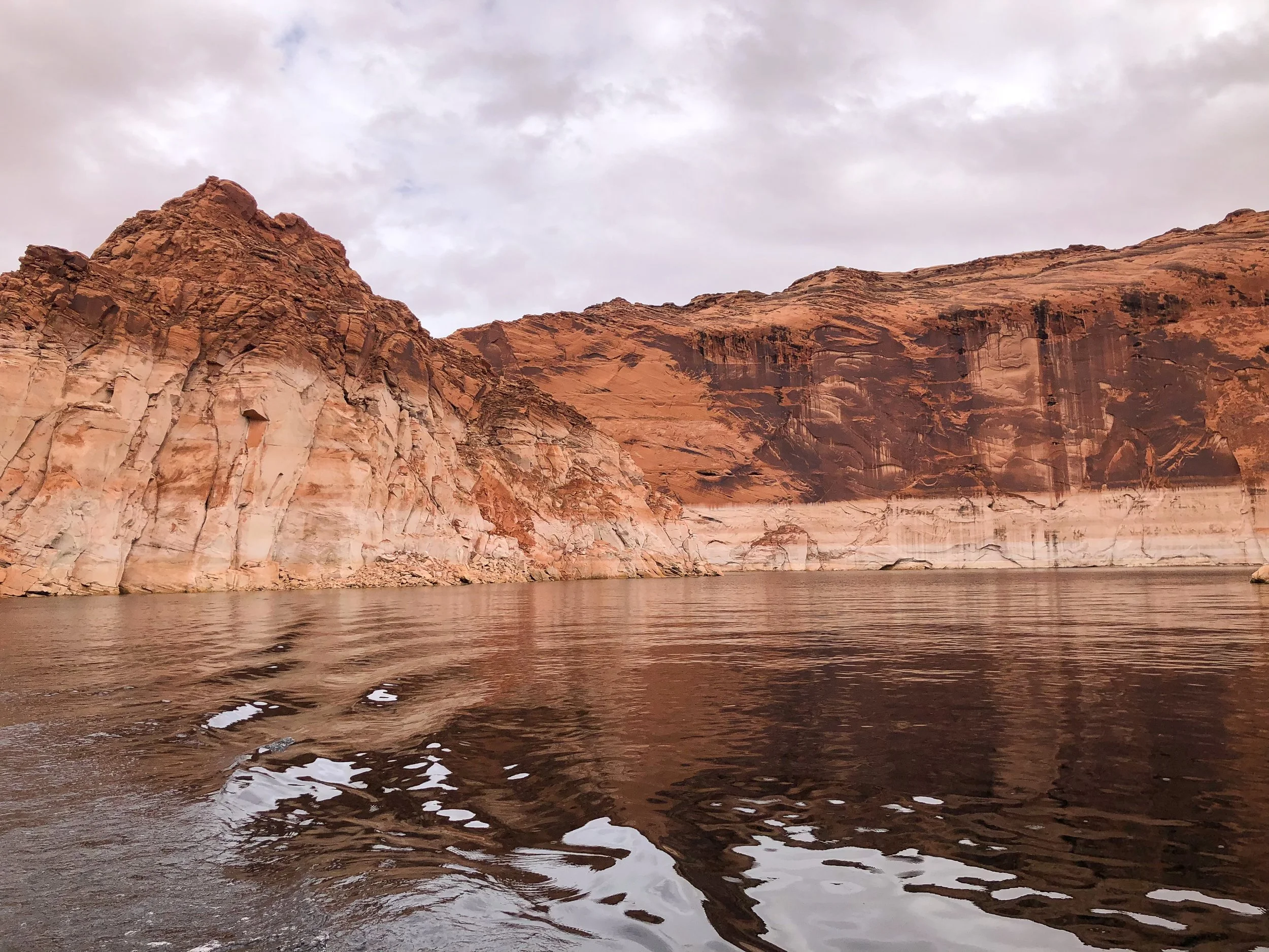
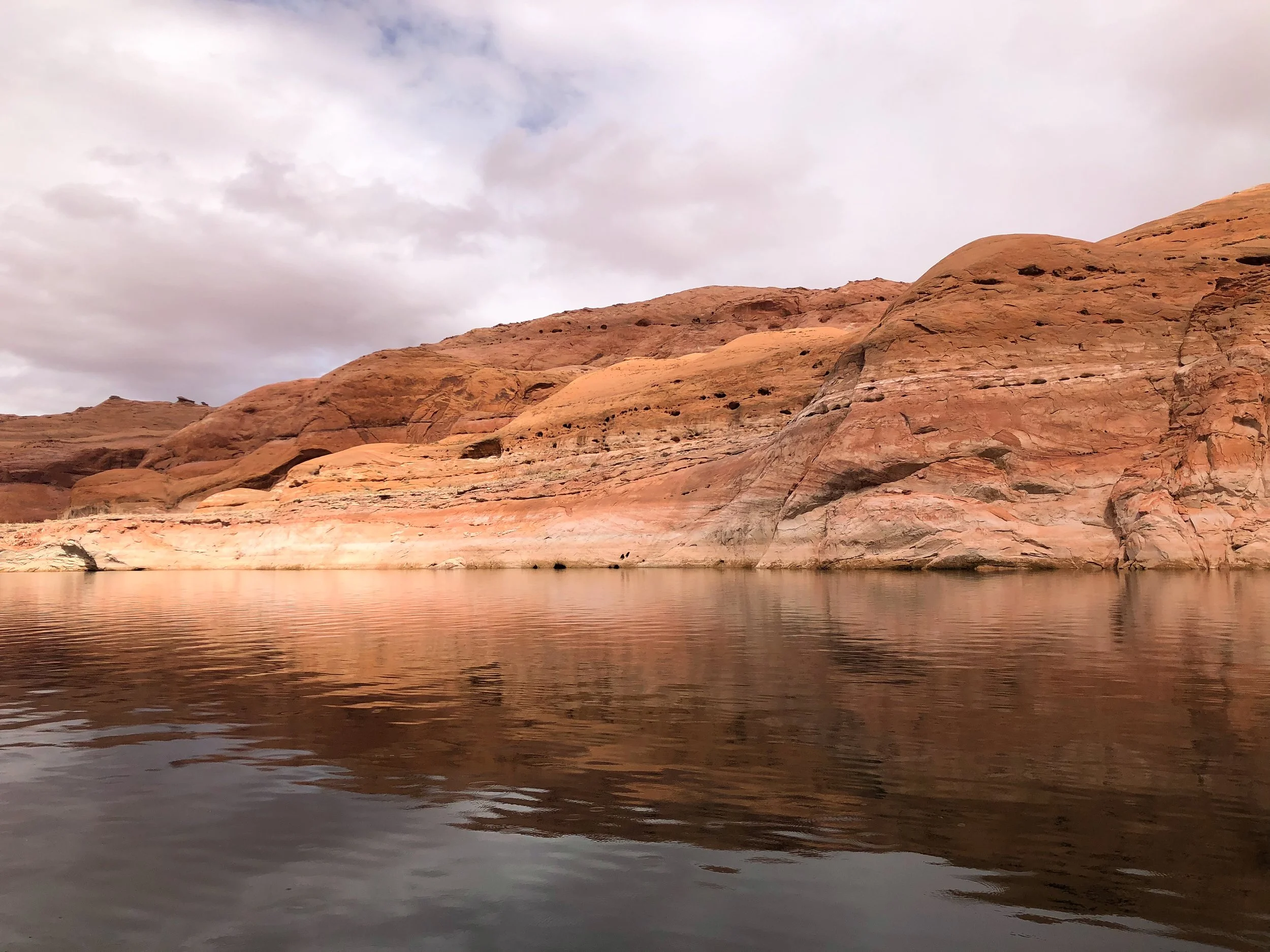
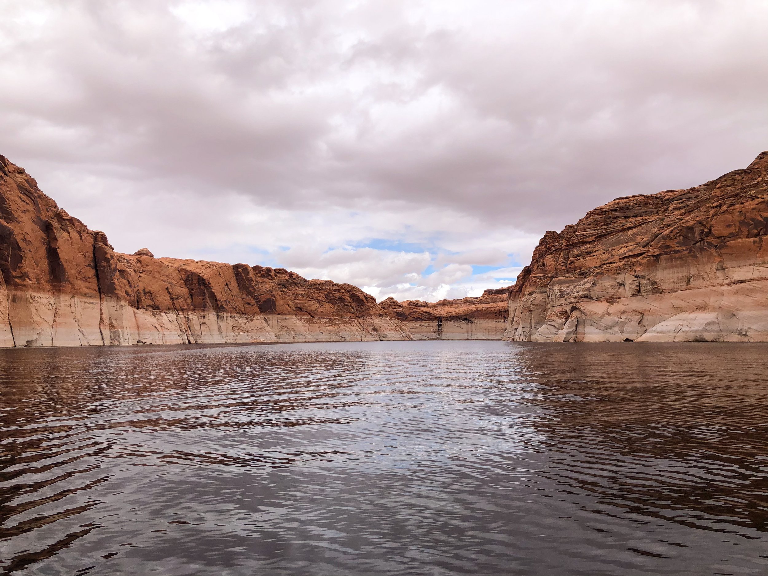
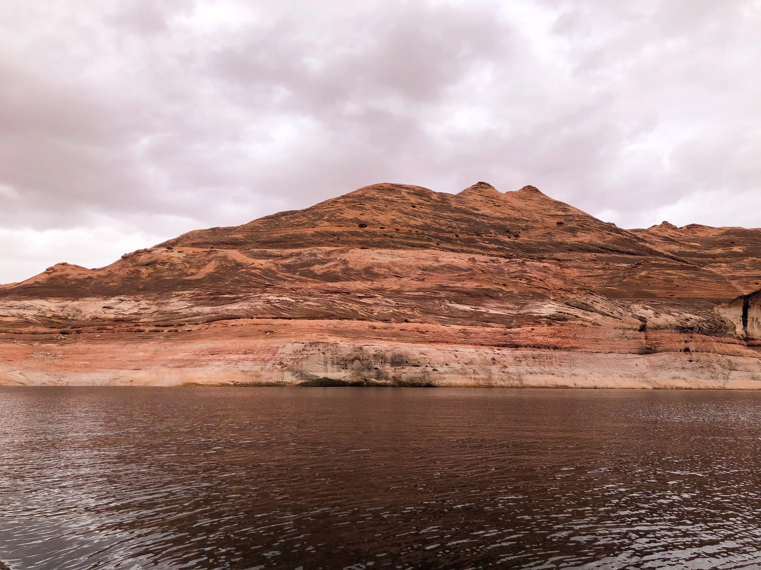
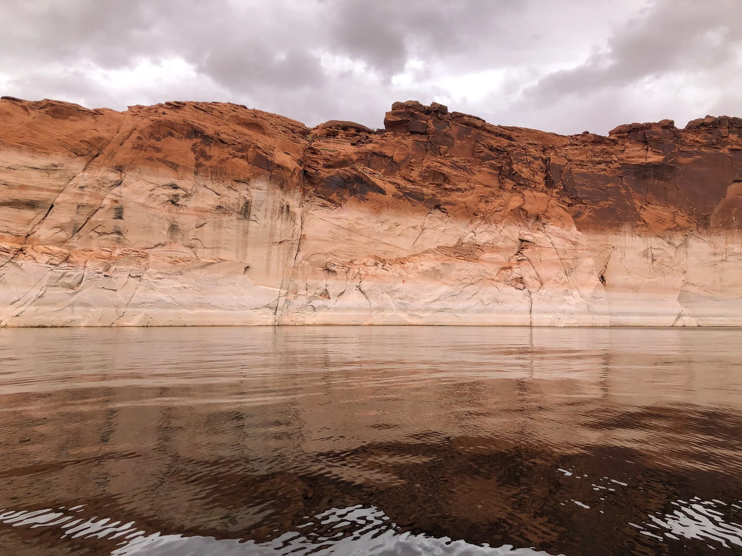
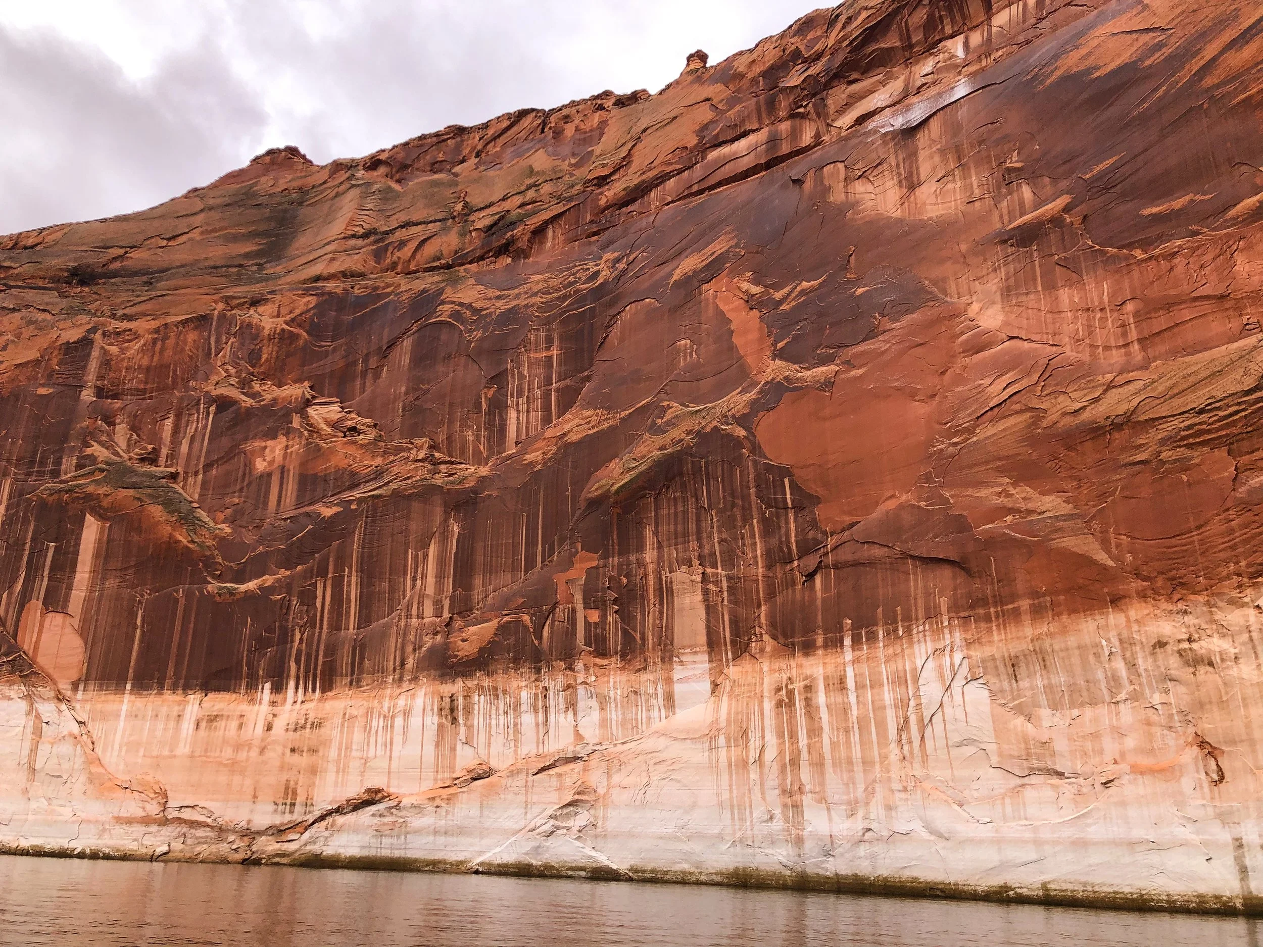
Lake Powell & Navajo Canyon
Lake Powell is a manmade lake created by the Glen Canyon Dam with over 2000 miles of shoreline. One of the best ways to experience it is by boat. Rent a boat from the Antelope Point Marina to explore the lake. Visit Navajo Canyon, a 16 mile long canyon with massive orange and brown cliffs ranging in height on all sides. The canyon is fairly wide but narrows in areas with tiny offshoots, carefully accessible by boat.
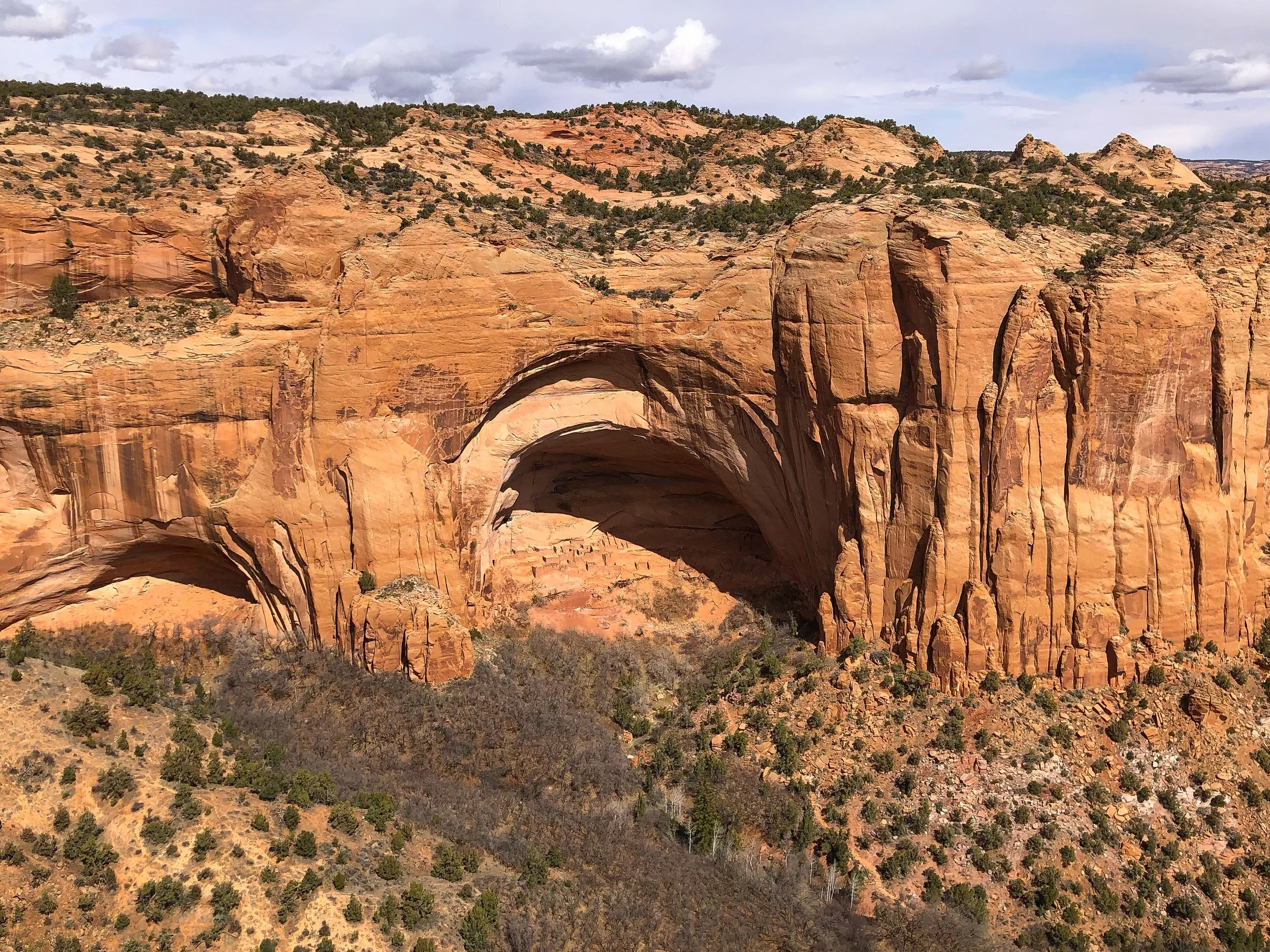
Navajo Cliff Dwellings
The Navajo Cliff Dwellings, also called The Betatakin Cliff Dwellings, are one of the best surviving examples of pre-Columbian civilization in the American Southwest. At its peak nearly 800 years ago, it was home to hundreds of people and contained over 120 sandstone structures built into the protected cliffside. The cave dwellings can be viewed from an observation point at the end of a short hike from the Navajo National Monument Visitor Center.
Southern Utah
Our roadtrip brought us into the southern sliver of Utah, a part of the state overlapped by the Navajo Nation and defined by its dramatic buttes.

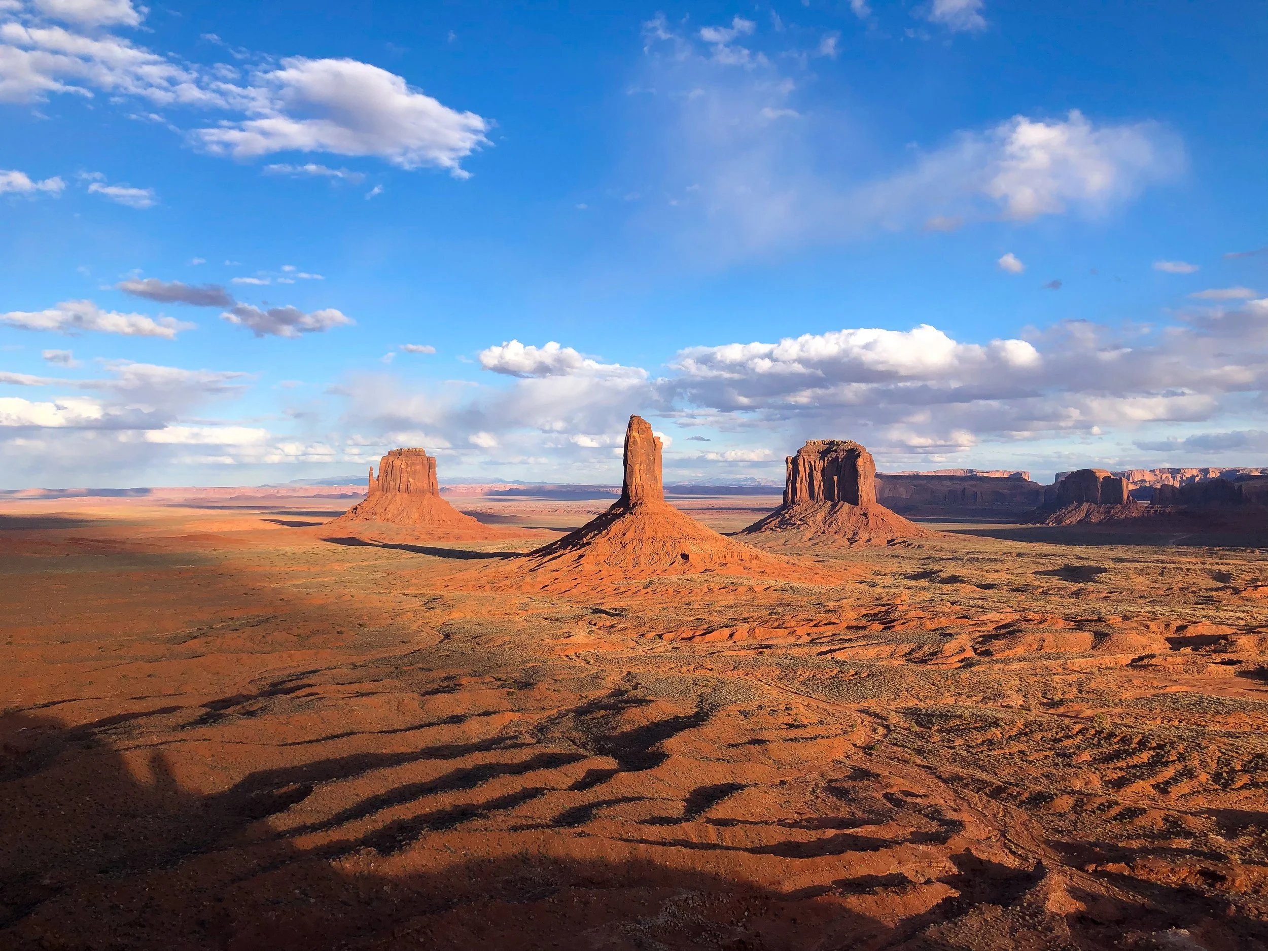
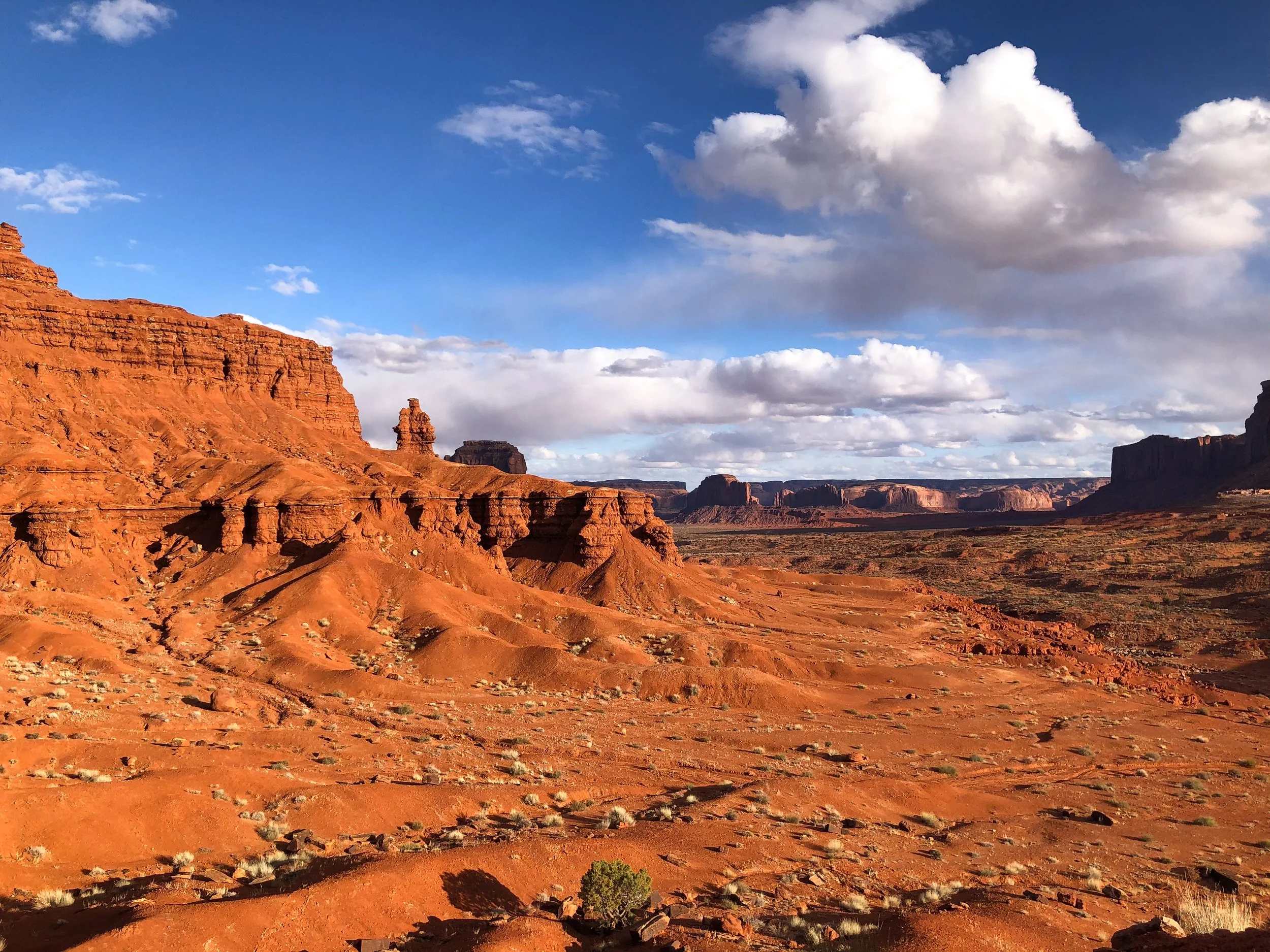
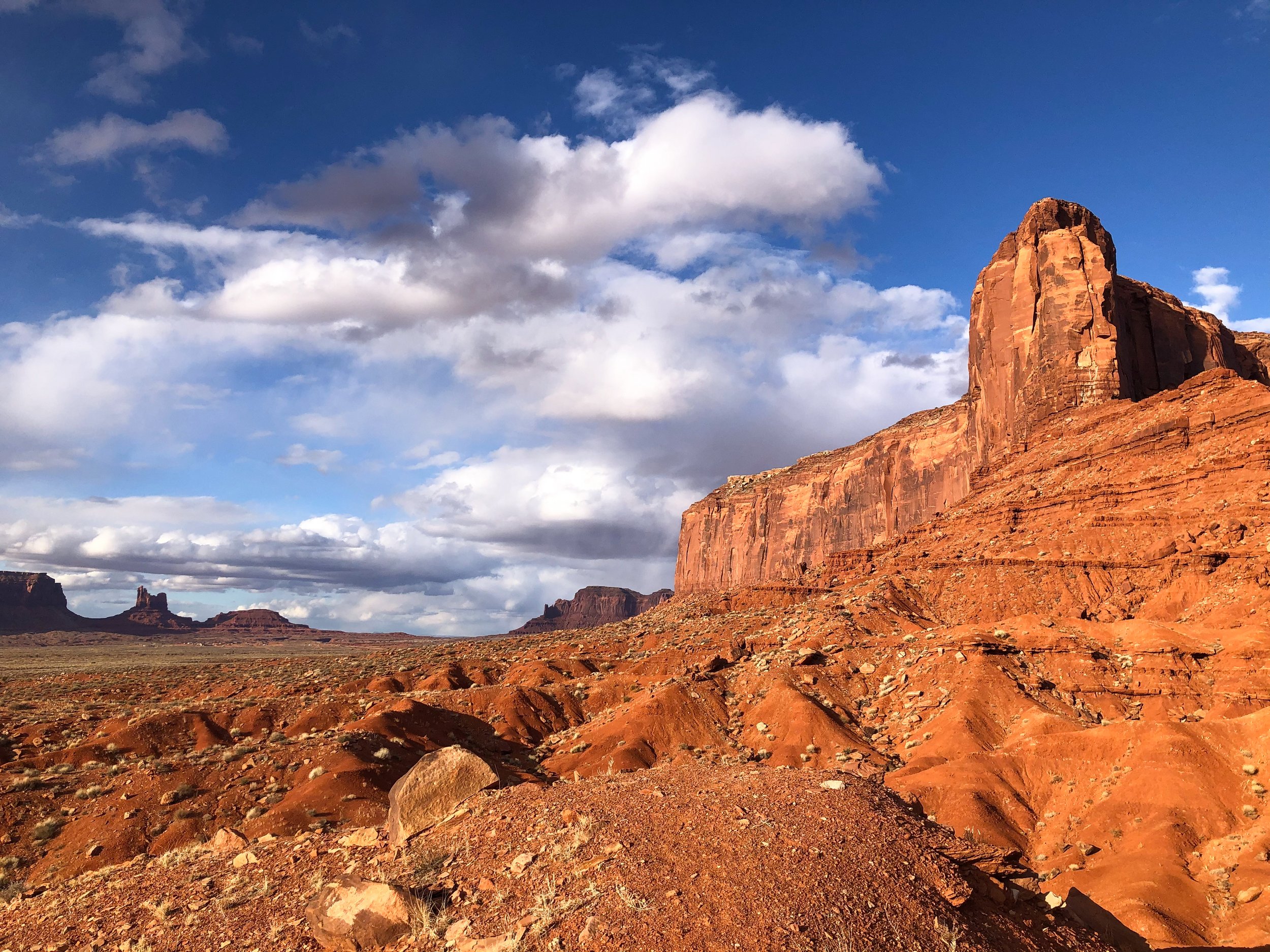
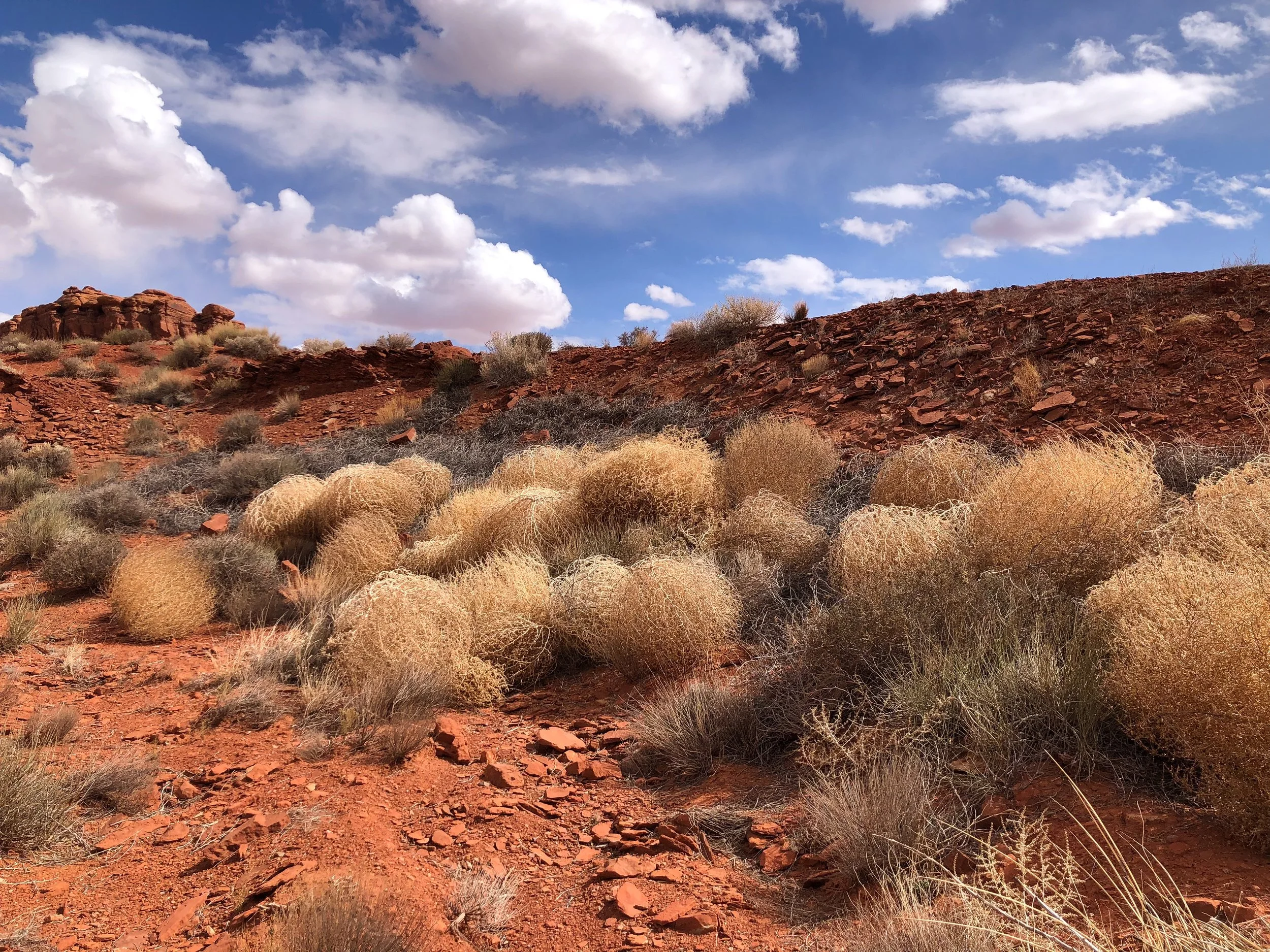
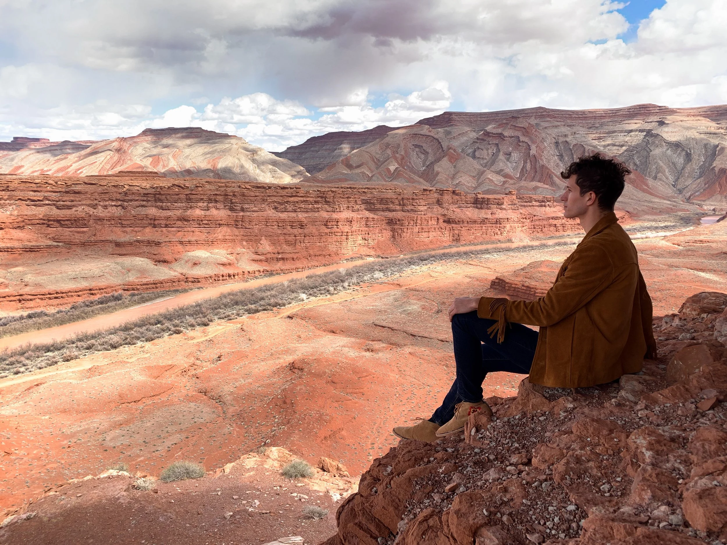
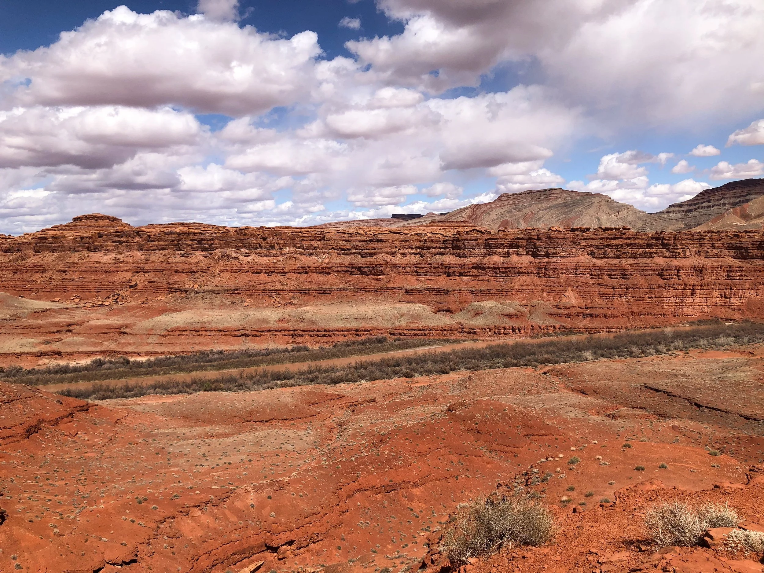
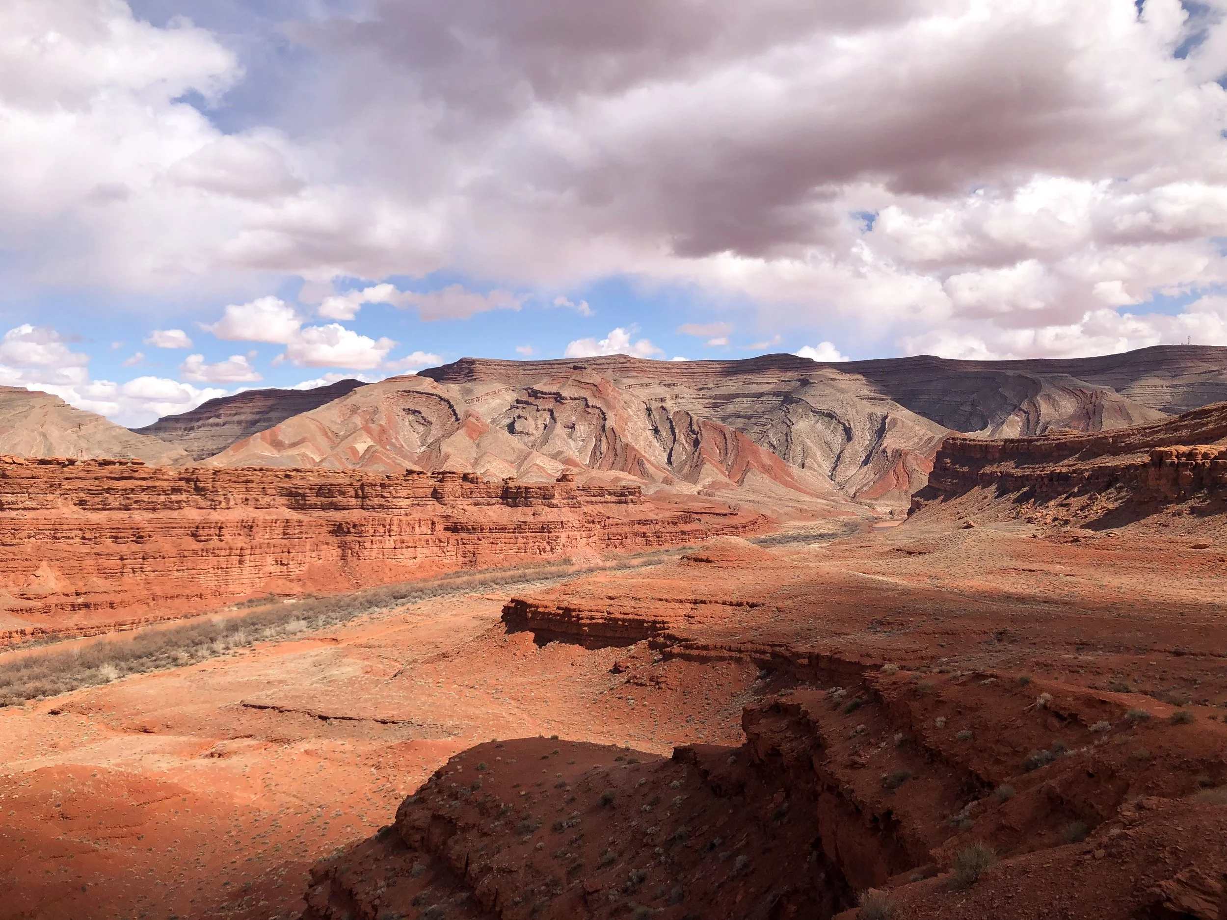
Monument Valley
Monument Valley offers views of the most quintessential western landscapes and scenery. The valley is comprised of towering buttes and crumbling rock formations that rise from the orange hued desert landscape. Many of the buttes and mesas are visible from roadside overlooks within and outside the Tribal Park.
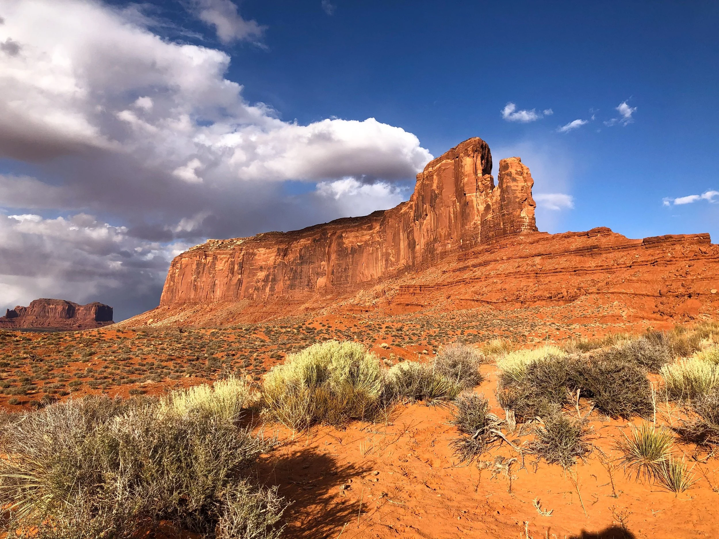
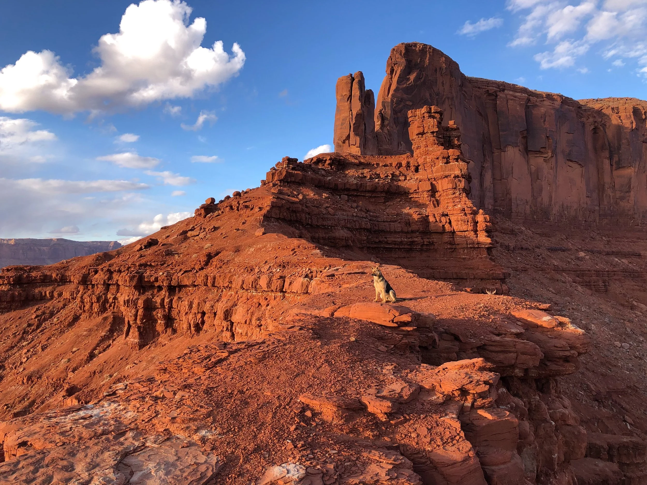
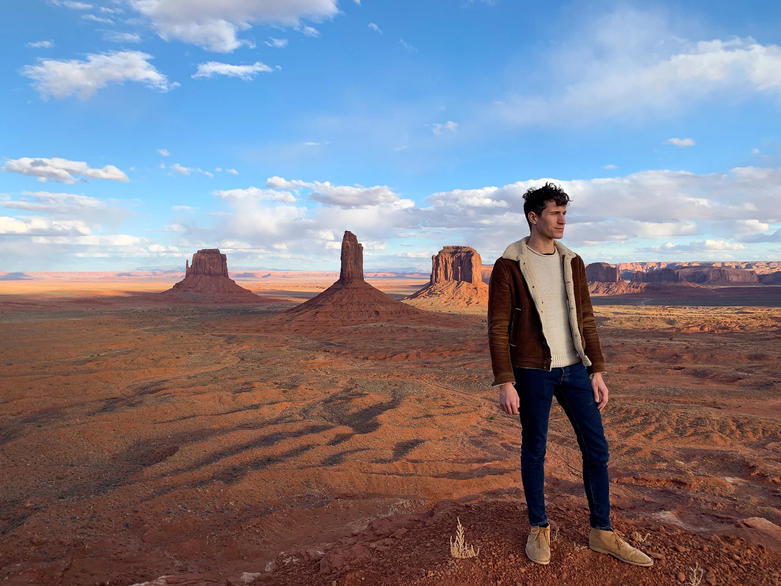
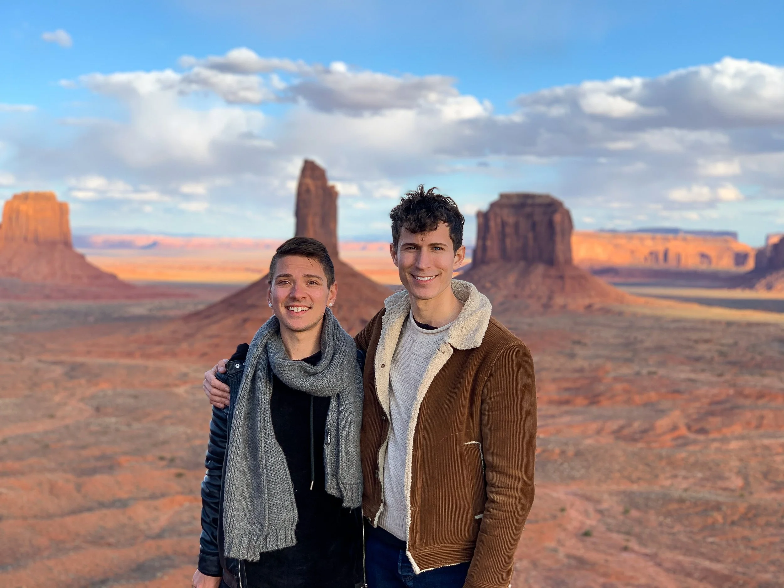
Sentinel Mesa. A desert plateau and cliff formation with dramatic views overlooking Monument Valley’s three most famous buttes: West Mitten Butte, East Mitten Butte and Merrick Butte. The observation point is reachable by hiking a trail at the end of Sentinel Mesa Road. Always ask for permission to park or hike on private property.
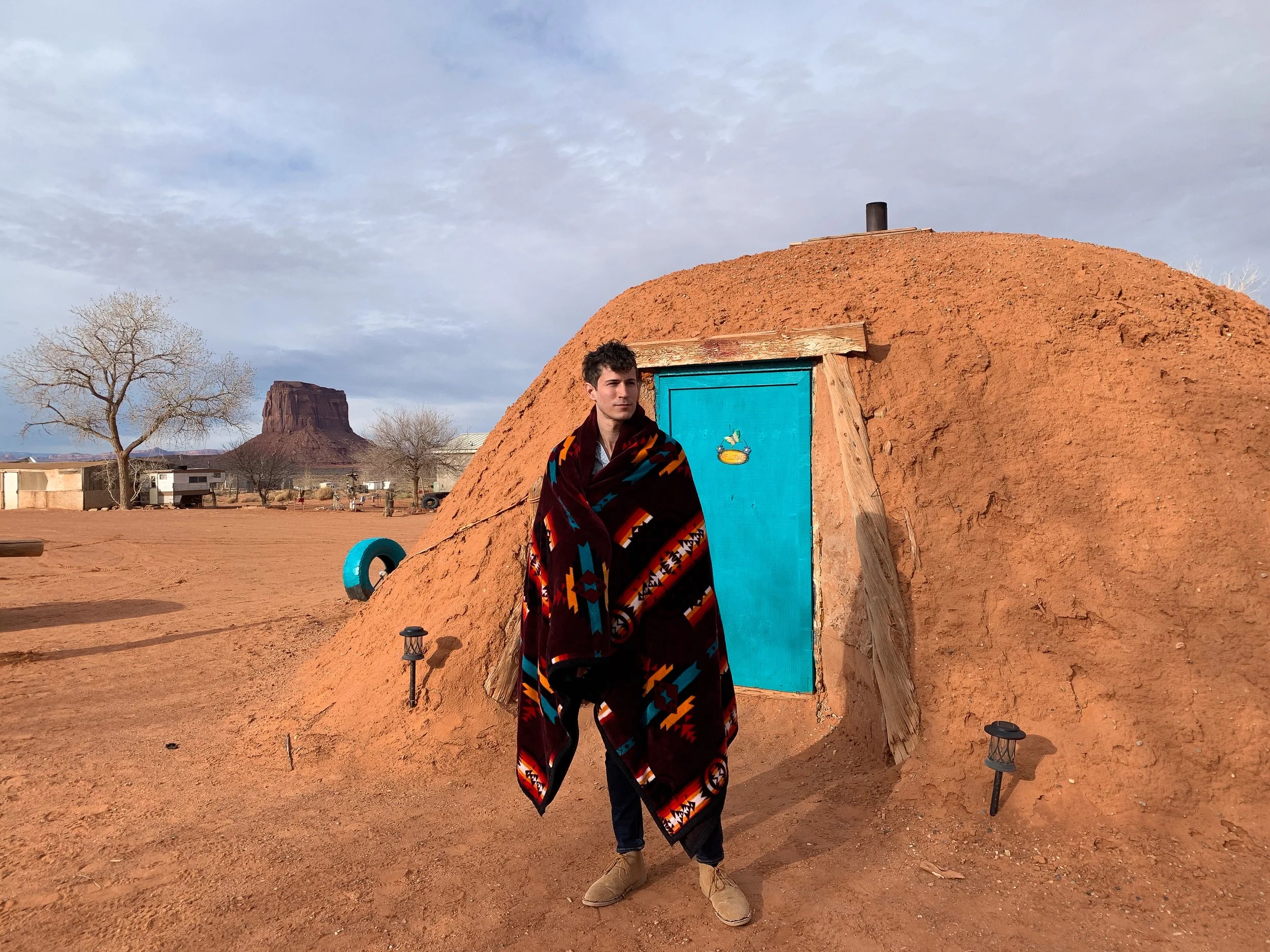
Stay in a Navajo Hogan. A Hogan is a traditional Navajo home, once common throughout the tribal nation. These domed huts are built from cedar structures covered in layers of sand and clay to provide insulation from the heat and cold. Most Navajo People live in modern homes today but keep a Hogan on their property for guests and ceremonial purposes. Staying in one in the middle of Monument Valley was an unforgettable experience. Its interior was rustic, with beds covered in Navajo blankets and a central wood burning stove. Our particular Hogan was built in 1934 and has been maintained ever since. Book here on Airbnb!
Try Navajo Frybread. A round piece of flat dough deep fried until golden and puffy. It’s often made and served hot as a sweet or savory snack. Visit the San Juan Trading Post & Cafe in the town of Mexican Hat for their version, The Navajo Taco, with frybread covered in bean, tomato, lettuce, onion and cheese. For something sweet, order the Sweet Frybread, lightly covered in a sugary syrup.
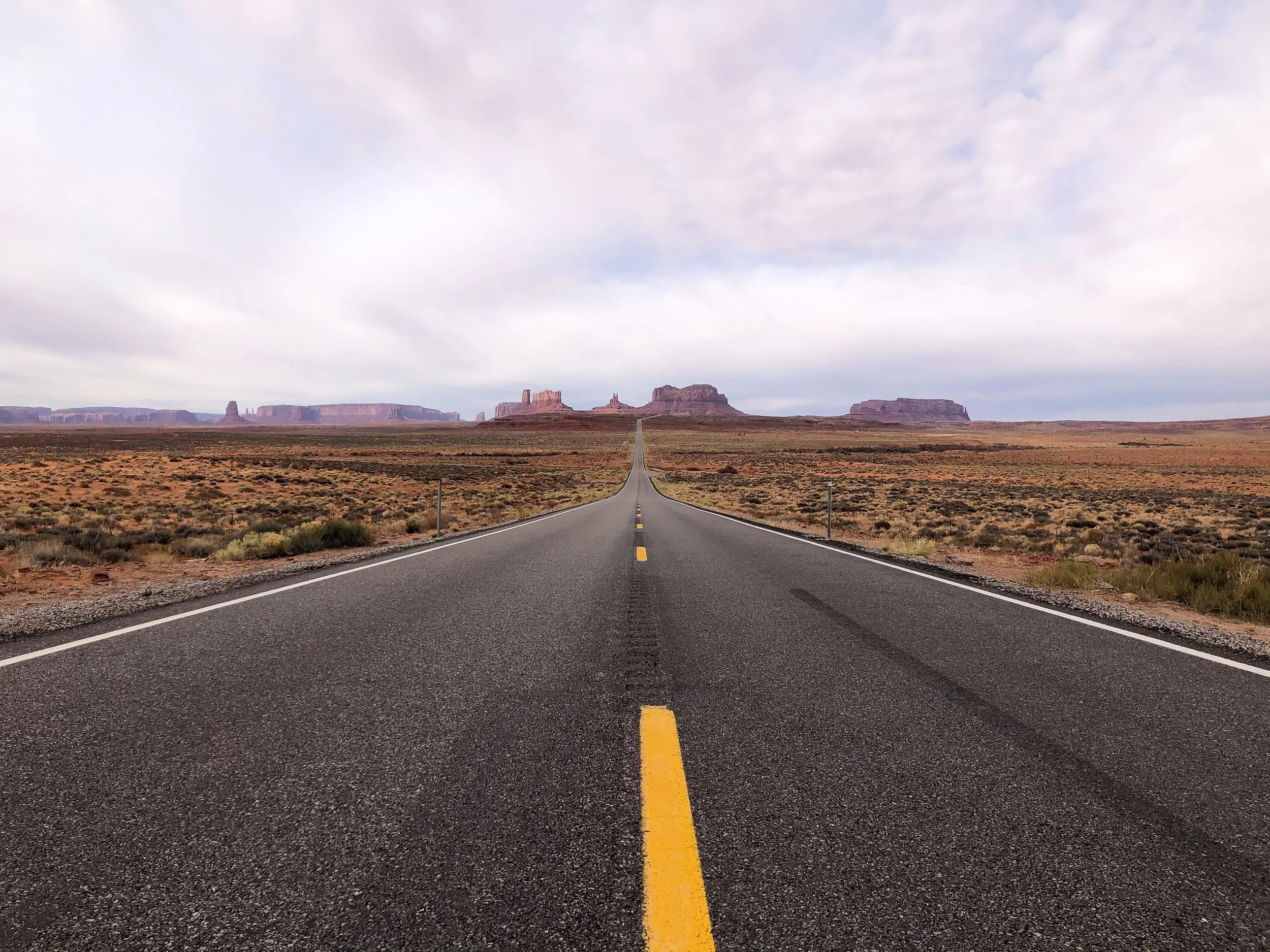
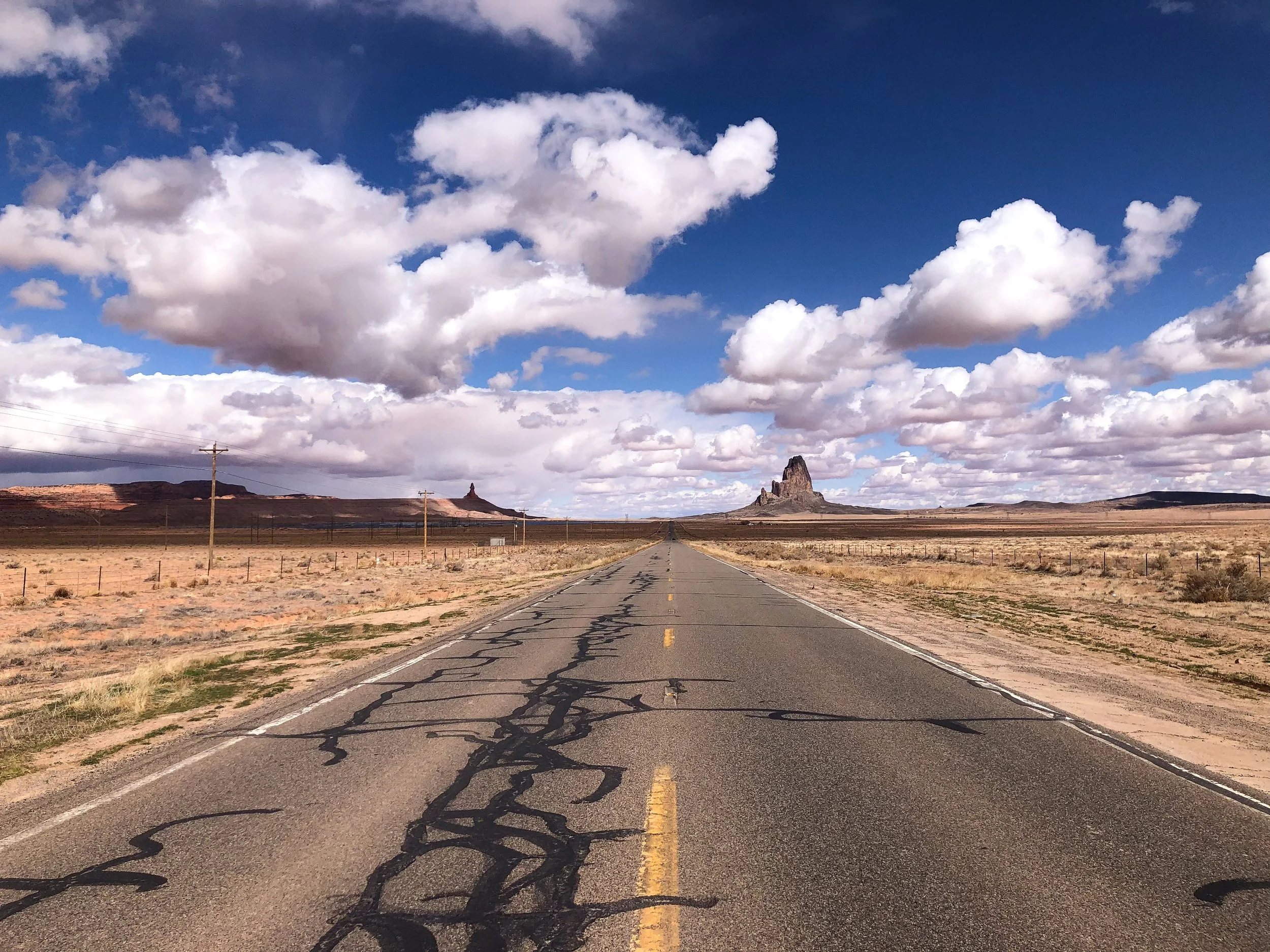
Forrest Gump Hill
Forrest Gump Hill is a scenic stretch of road that disappears into the horizon of Monument Valley. It’s been made famous by many Western movies and Hollywood films, most notably, Forest Gump. It’s here where Tom Hanks’ character stopped running after 4 years crossing the country. It even has its own emoji.
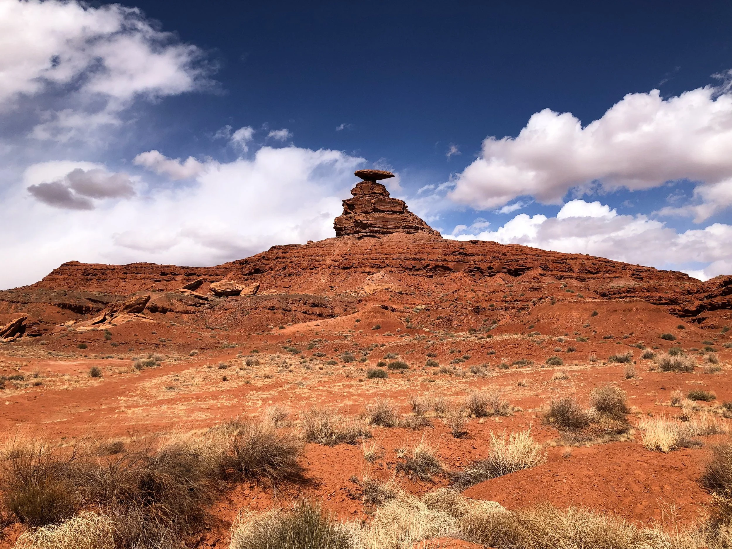
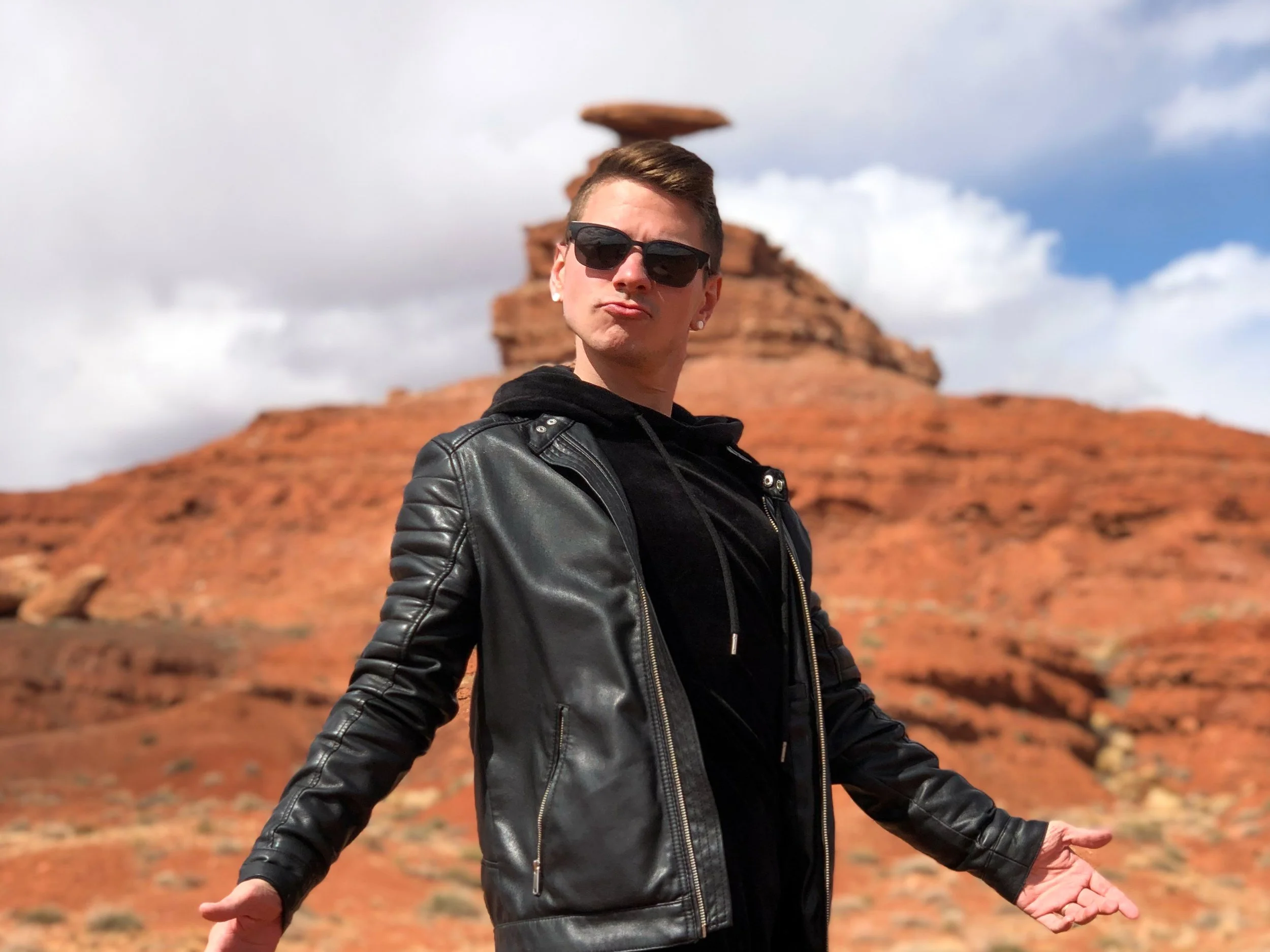

Mexican Hat
Mexican Hat is a rock formation named after a large flat rock, precariously balanced on top of a small vertical base protruding from the hillside, described as resembling a mariachi’s sombrero. Hiking trails lead around the base and underside of the “hat.” From here, there are beautiful views of the green and orange hillside carved out by the San Juan River.
Central Arizona
Central Arizona is home to desert landscapes, meteor craters and national parks, much of it reachable along Old Route 66 (now Interstate 40).
Old Route 66
Old Route 66 is one of the most famous and nostalgic roads in the United States. It’s dotted with numerous small towns, roadside attractions, motels and diners.
Holbrook, Arizona. A small town along Old Route 66 famed for its roadside attractions, western history and Americana charm. The main street is lined with old buildings surviving from the wild west, a tee pee themed motels, retro roadsigns, several rock shops and attention grabbing roadside dinosaurs.
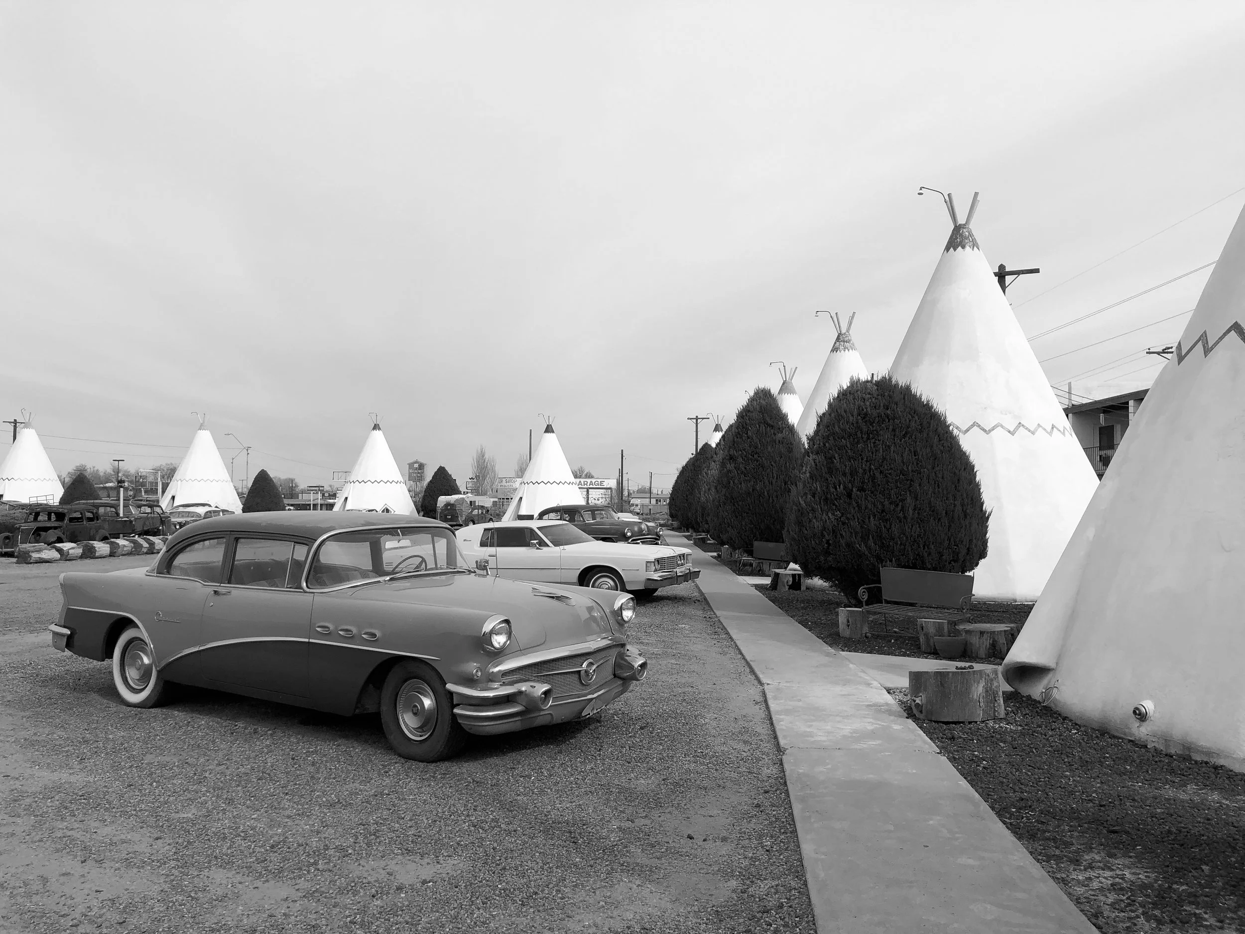
Wigwam Motel. A historic motel famed for its concrete and steel formed tee pees lined with vintage cars and a retro neon road sign. The motel has 15 tee pees, each acting as their own guest room. The stay was incredibly cute and felt like we had transported to a different era. Book here!
Winslow, Arizona. A historic town along Old Route 66 made famous by The Eagles’ 1972 hit, “Take It Easy,” featuring the lyrics “I'm a-standin' on a corner in Winslow, Arizona.” Drive through the town to stand on said corner as the song plays on repeat over loudspeakers.
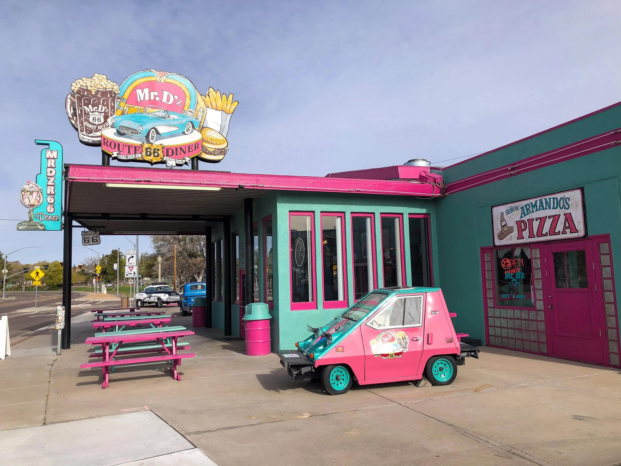
Mr D'z Route 66 Diner. A classic greasy spoon and retro Americana style diner with an extensive menu of omelettes, sandwiches and milkshakes. Its interior is decorated with teal and pink upholstered booths, black and white checkered floors, framed pictures and vintage memorabilia.
The Roadkill Cafe/O.K. Saloon. A famed restaurant along Old Route 66 with American style comfort foods like burgers, sandwiches and baked potatoes. Its pine paneled interior is decorated with all kinds of taxidermy animals and vintage signs.
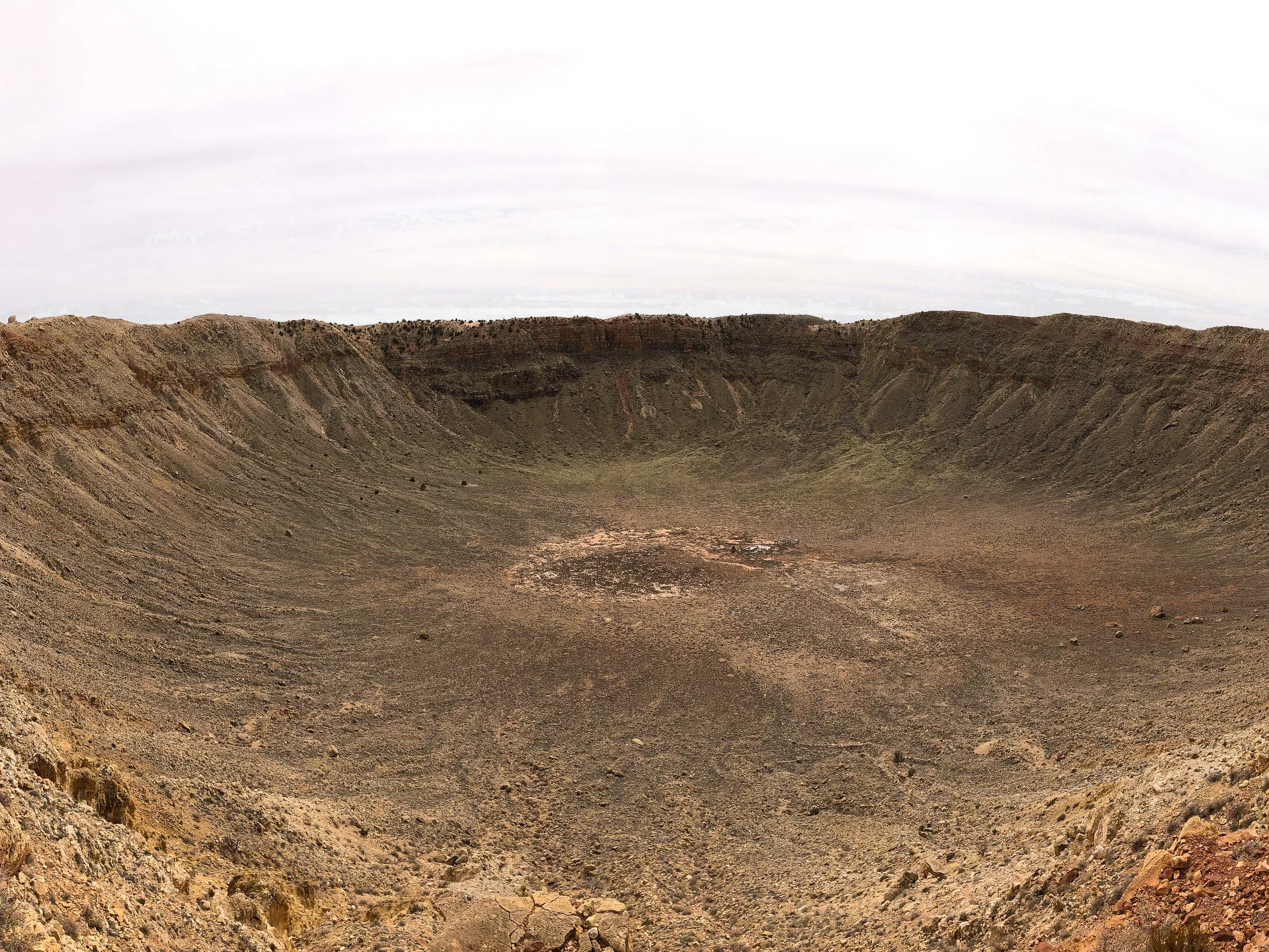
Barringer Meteor Crater
The Barringer Meteor Crater is a giant impact crater formed over 50,000 years ago, measuring nearly a mile across and over 500 feet deep. The crater is accessible to view through the park’s visitor center and has two observation decks on its rim. Within the visitor center are a large number of meteorites on display as well as small fragments of it for sale.
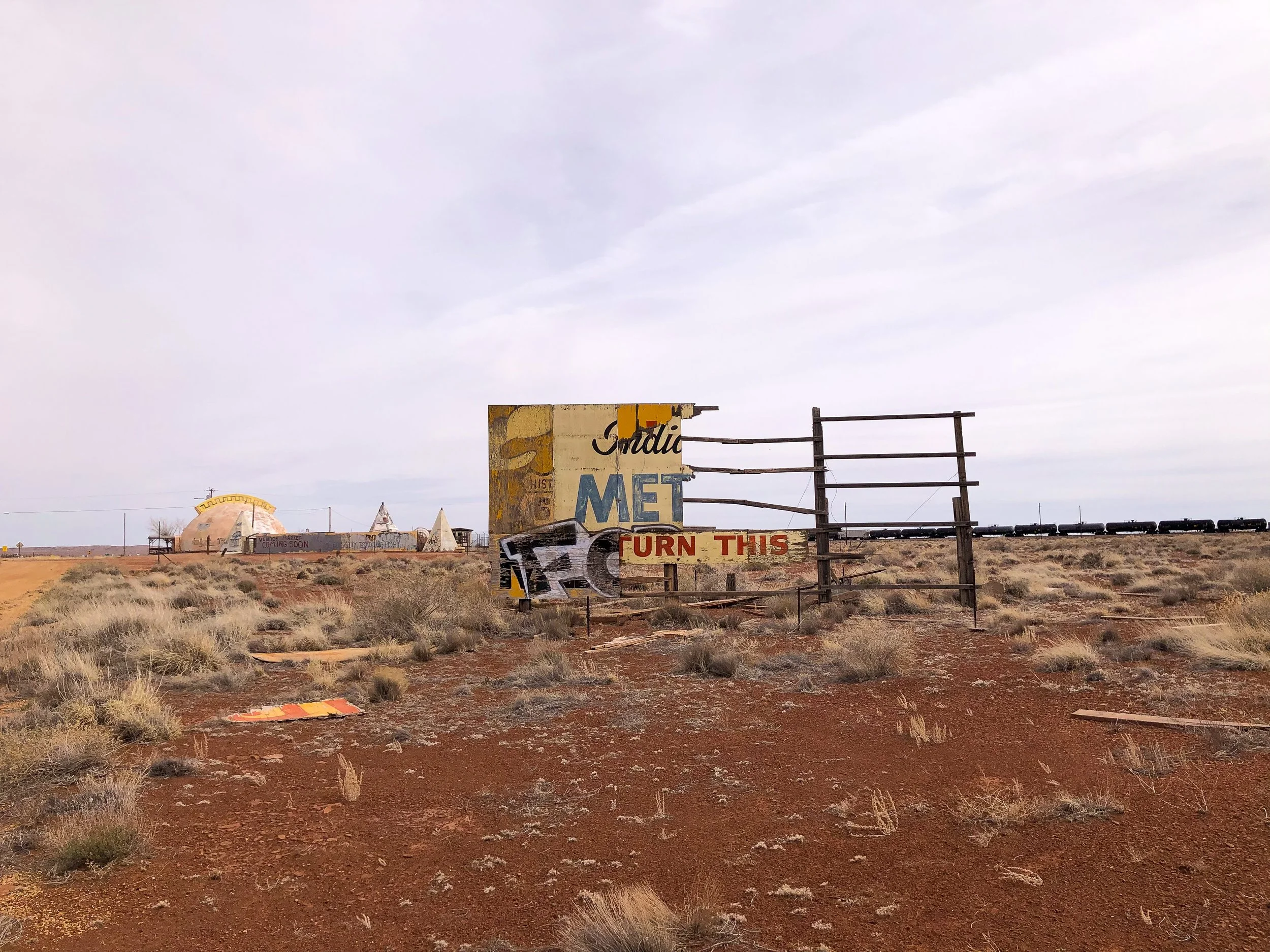
Meteor City. An abandoned roadside attraction near the Barringer Meteor Crater. It was started in the late ‘30s as a gas station, grocery store and souvenir stand along the Old Route 66. It’s an eerie spot to walk around and watch trains pass by.
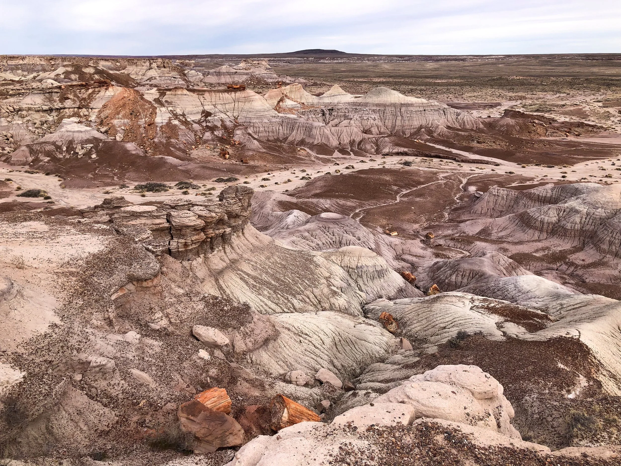

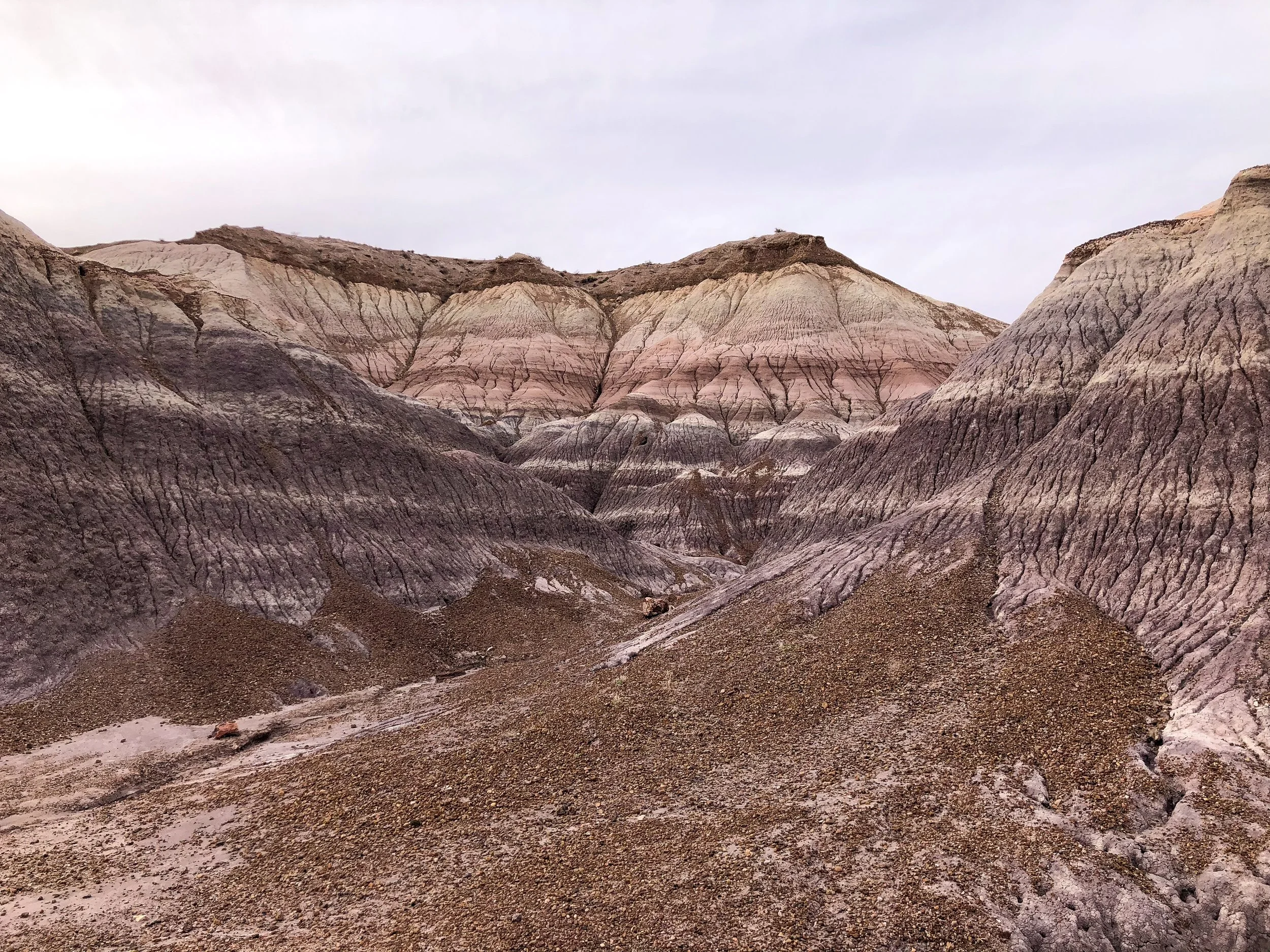
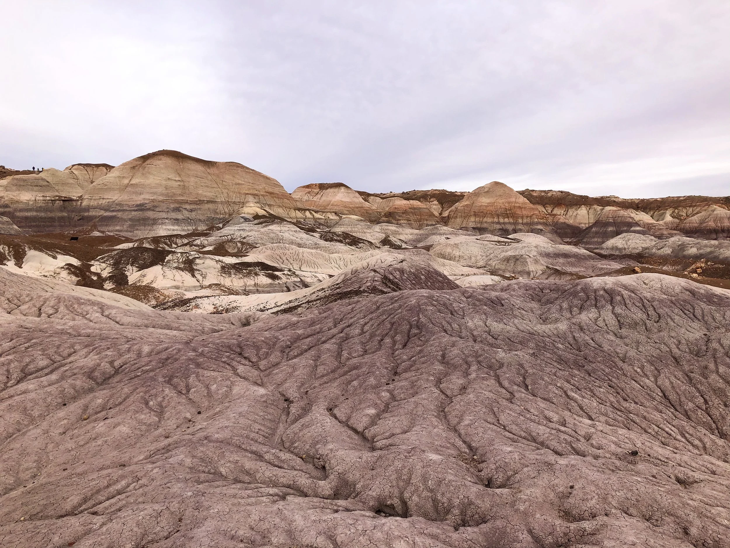
Petrified Forest National Park
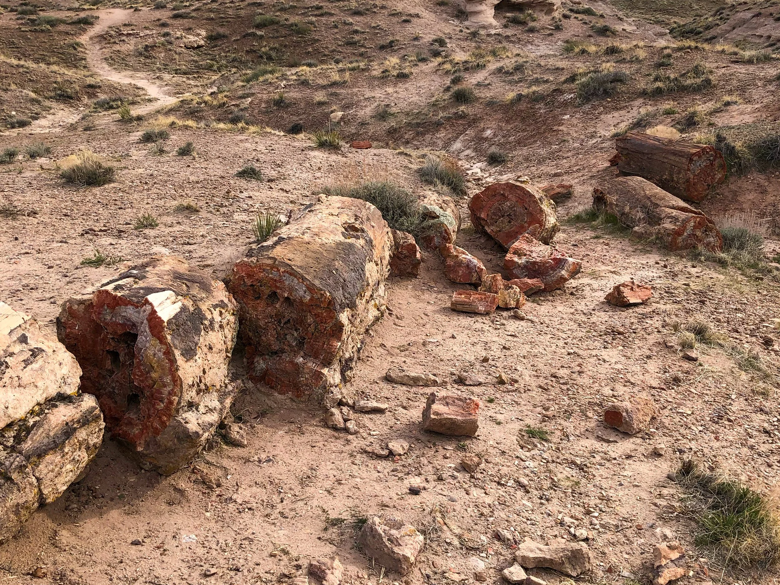
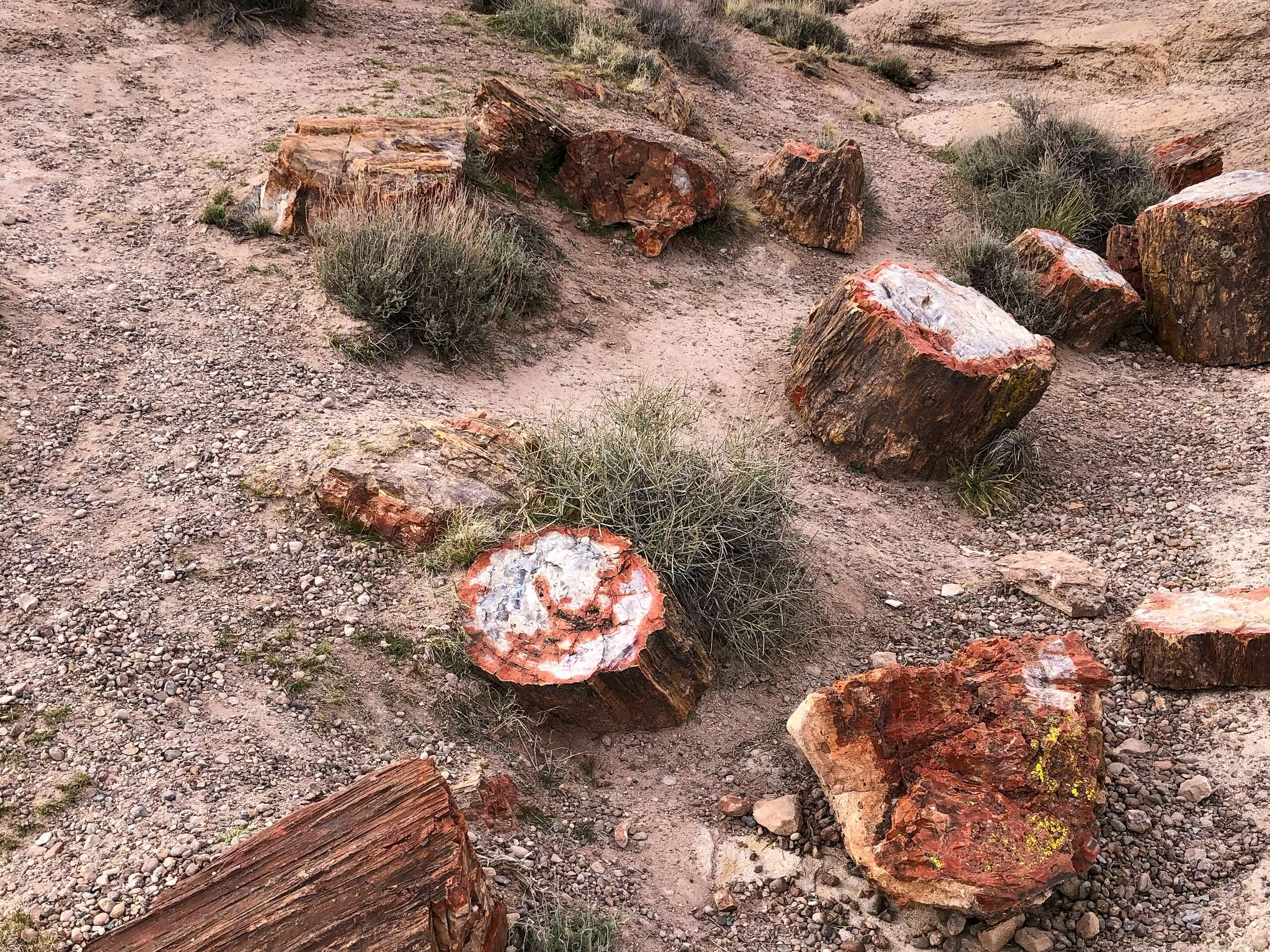
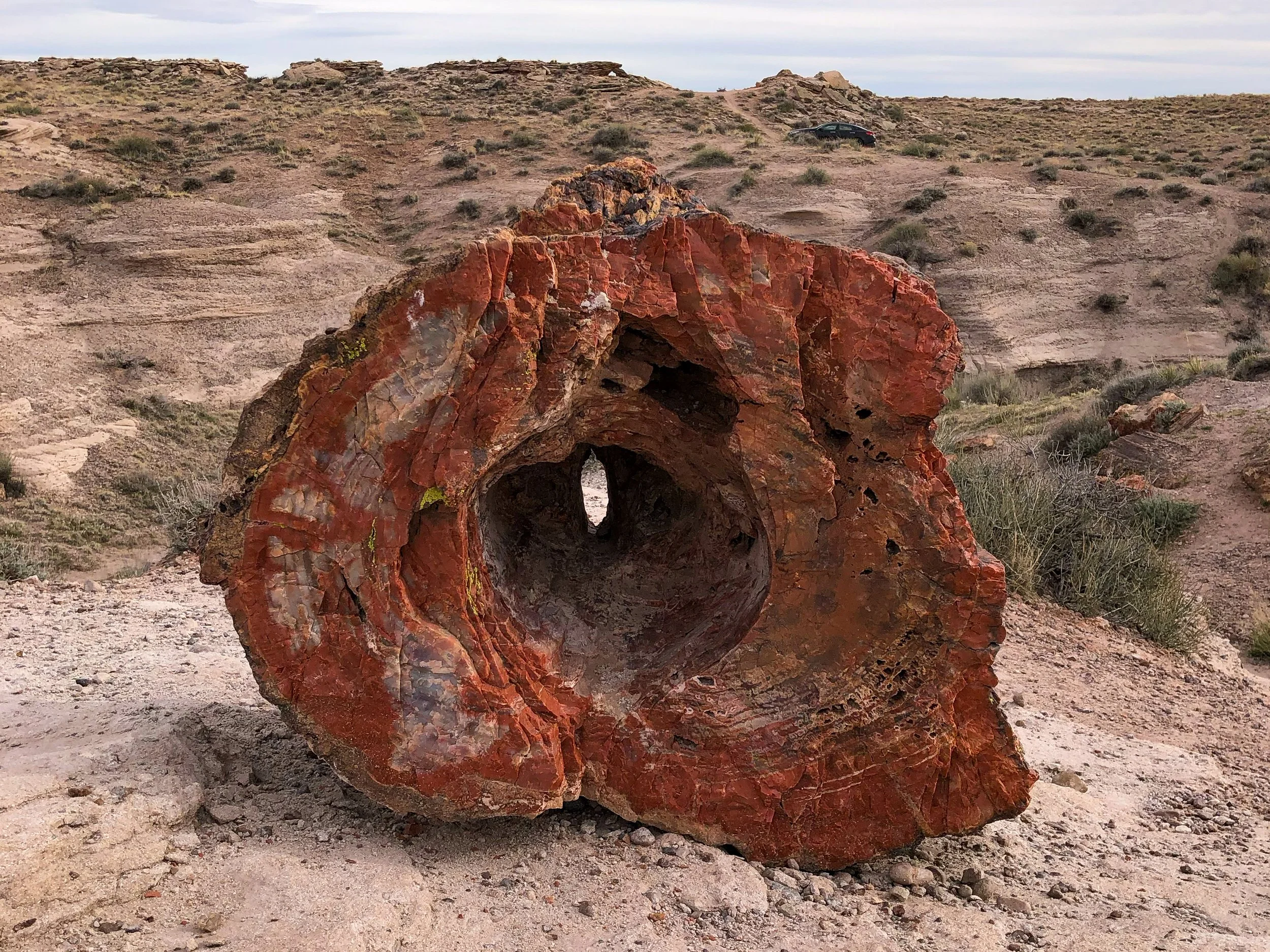
The Petrified Forest is a National Park that covers a vast area of desert that was once home to an ancient rainforest. Preserved under the soil and exposed due to erosion are the remains of fossilized trees from the forest that existed over 200 million years ago. Some of the trees are so well preserved that you can count the rings and feel the grain of the bark.
Blue Mesa. An area of the Petrified Forest eroded by rain revealing colorful bands of blue, purple, grey and red soil as well as the petrified wood. Drive around its loop and hike the Blue Mesa Trail, an area with massive logs and fragments of the fossilized trees lying across the ground. It was crazy to think that we were walking across land where the dinosaurs roamed and a forest thrived over 200 million years ago.
Southern Arizona
Southern Arizona is a dry and arid place, defined by its towering Saguaro cacti, desert landscapes and Southwestern cities.
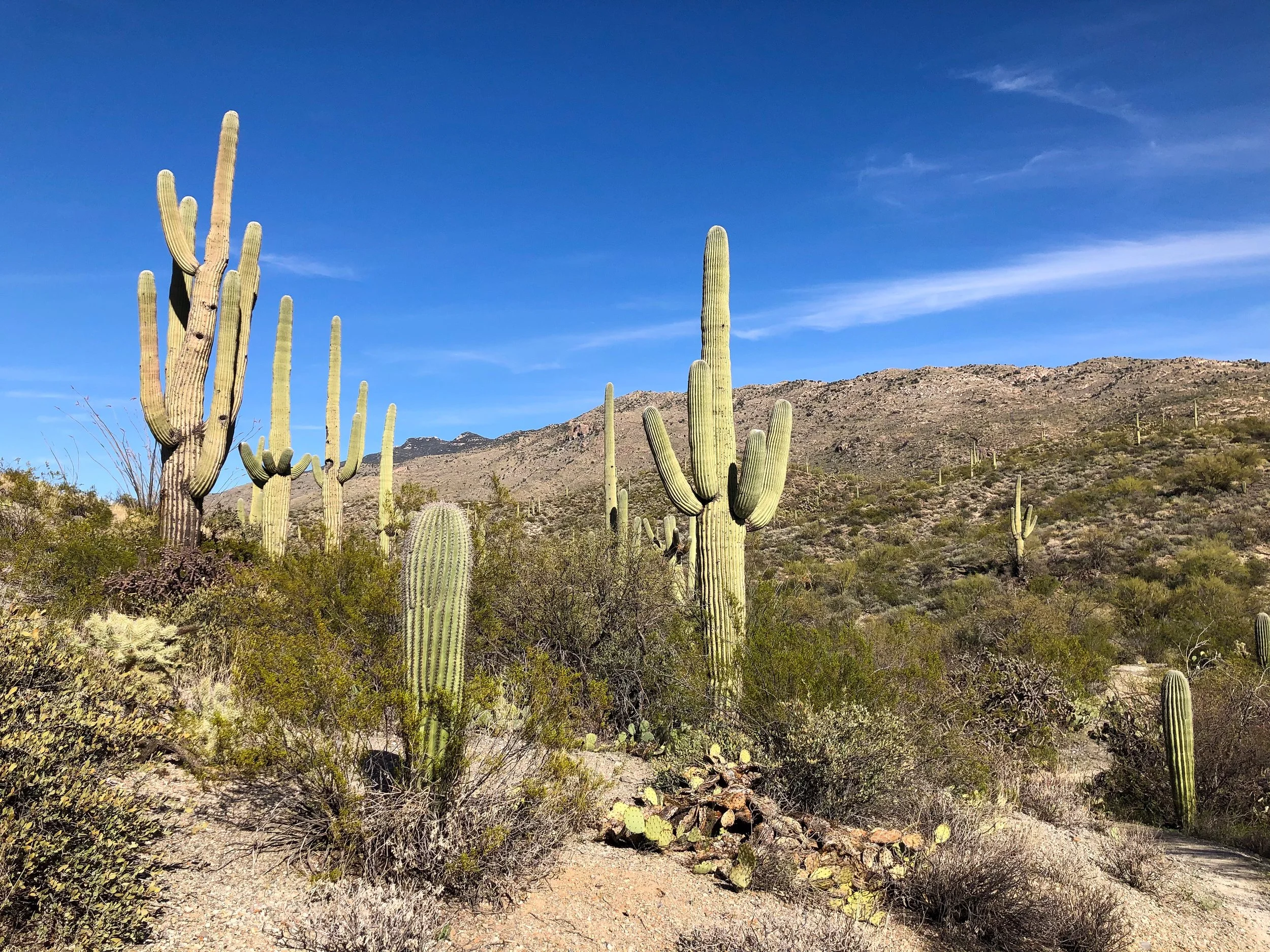

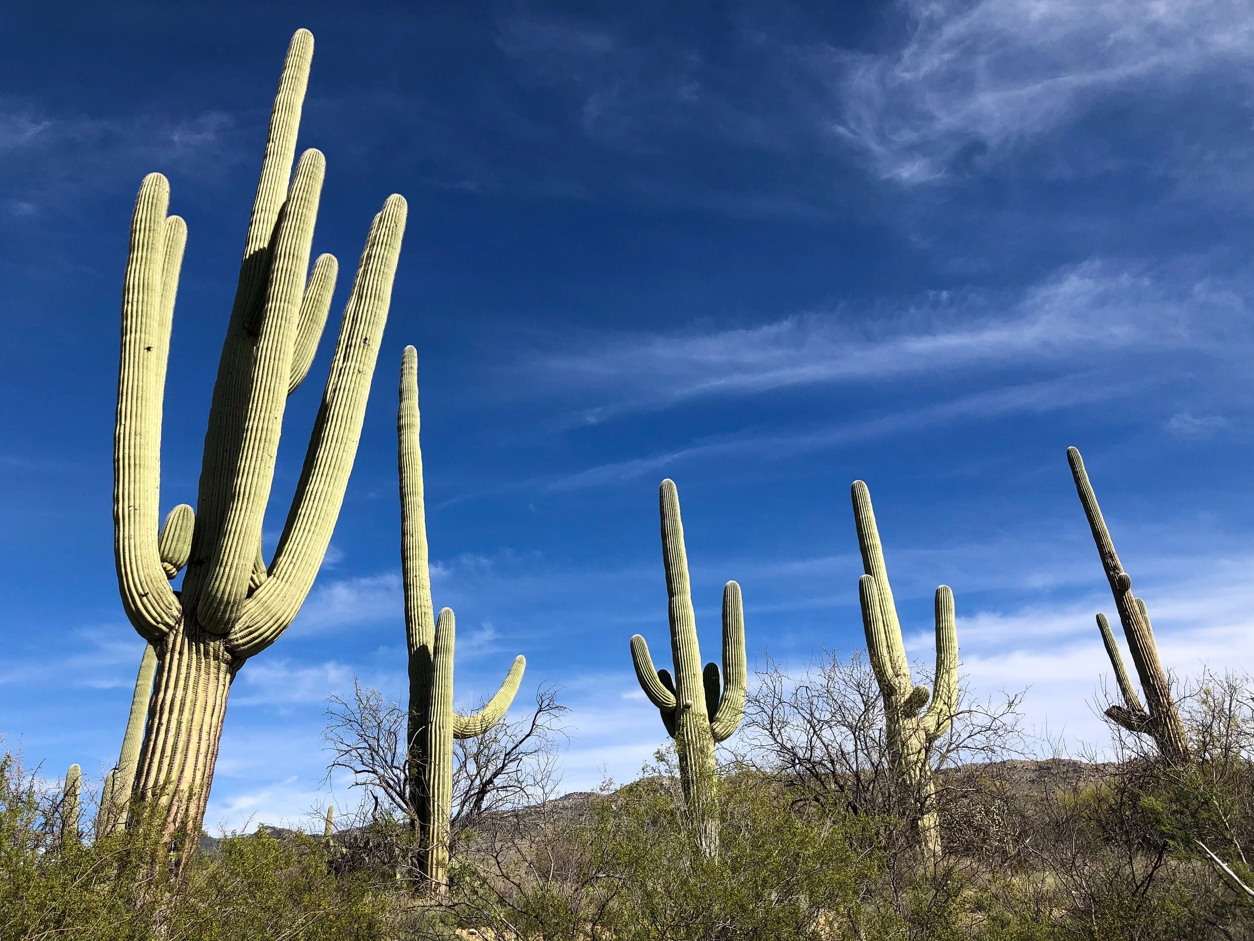
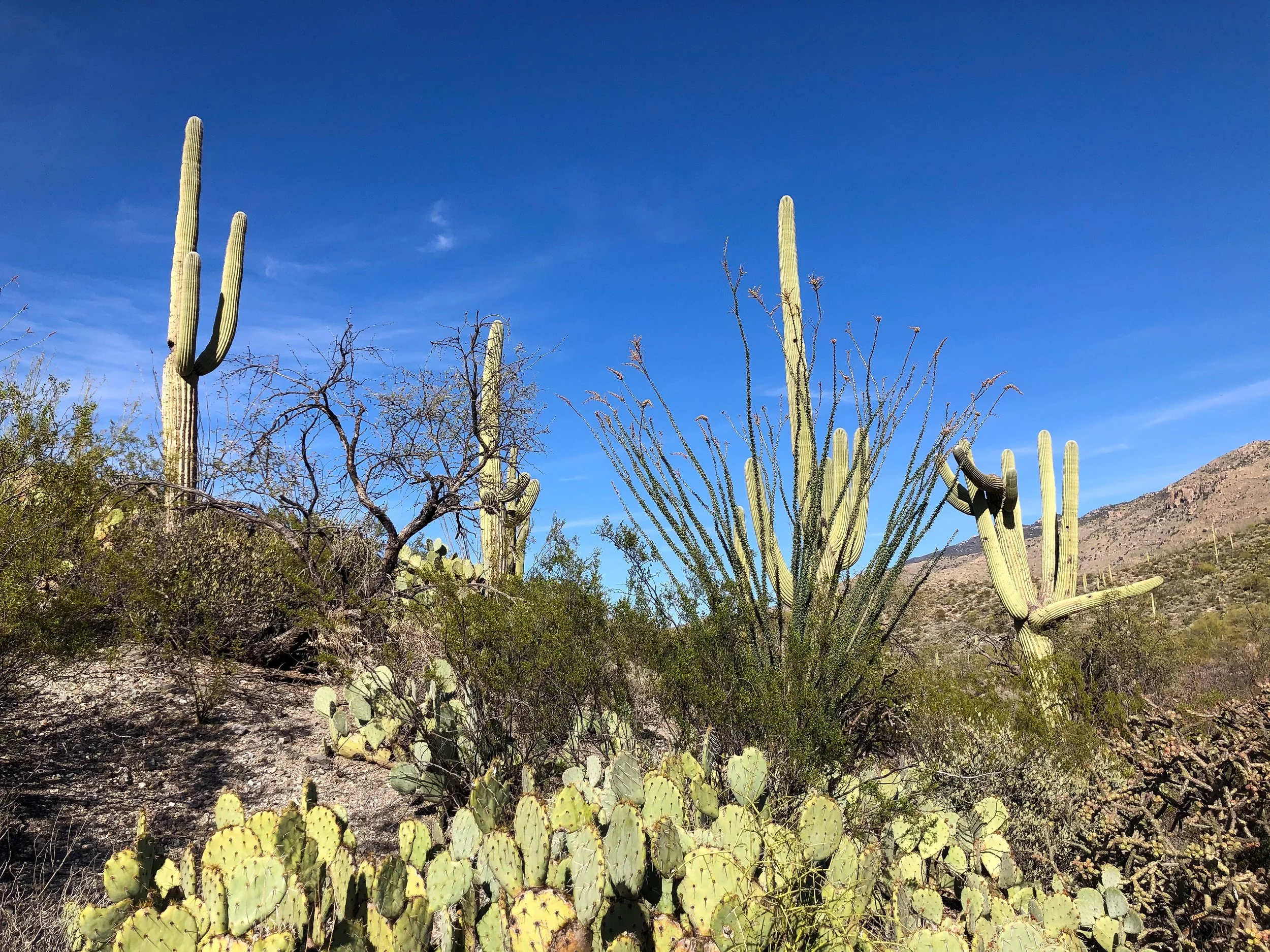
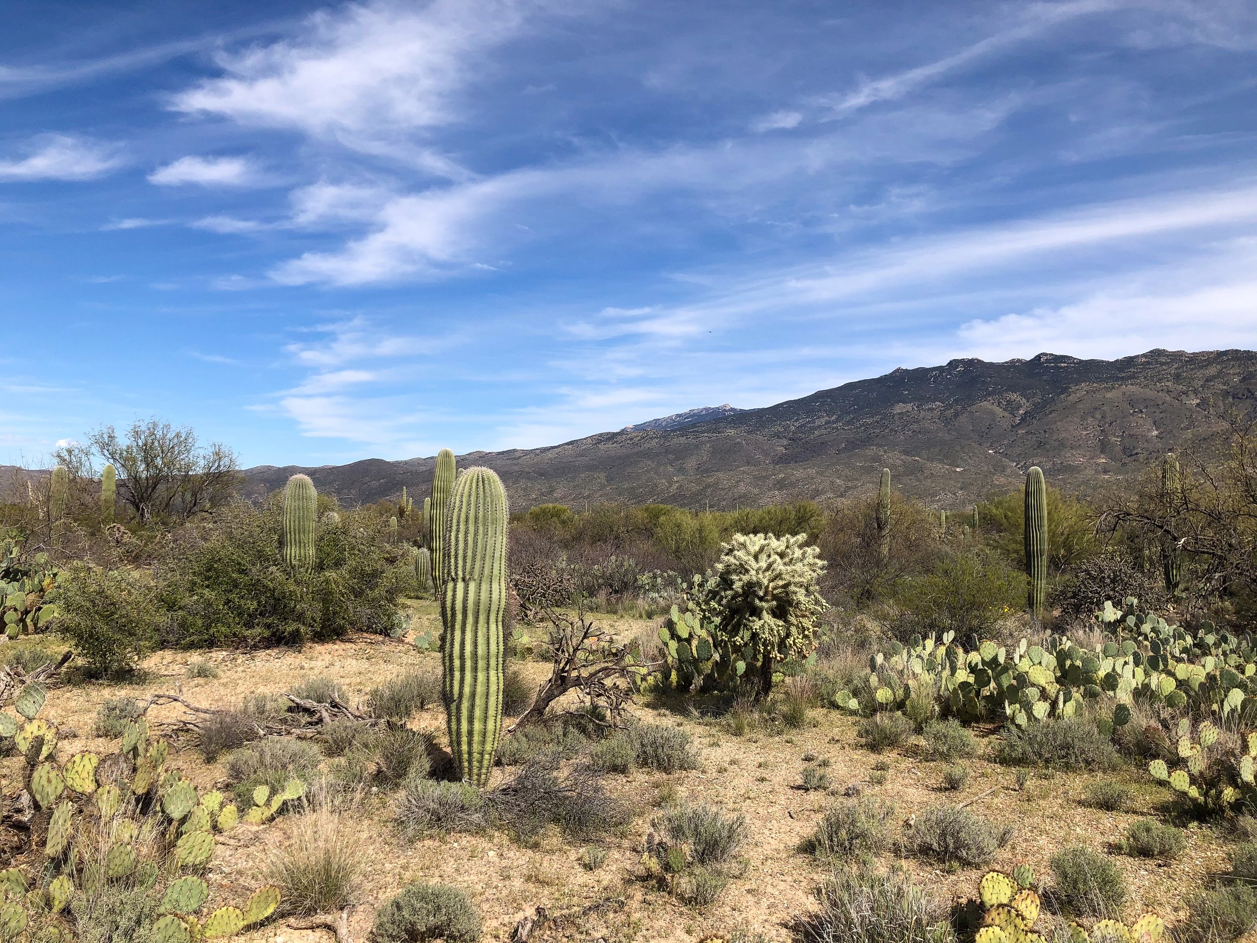
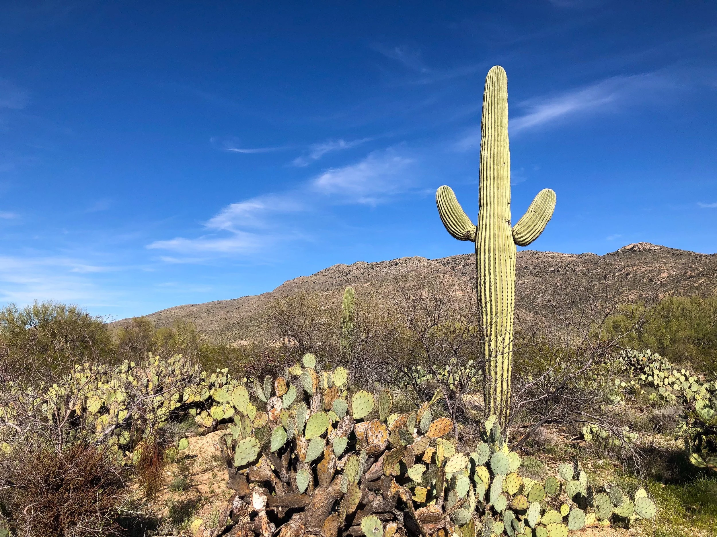
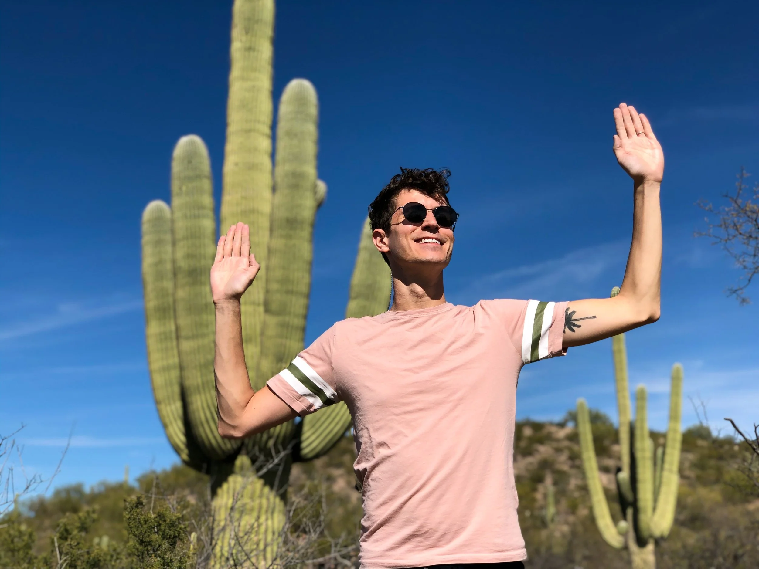
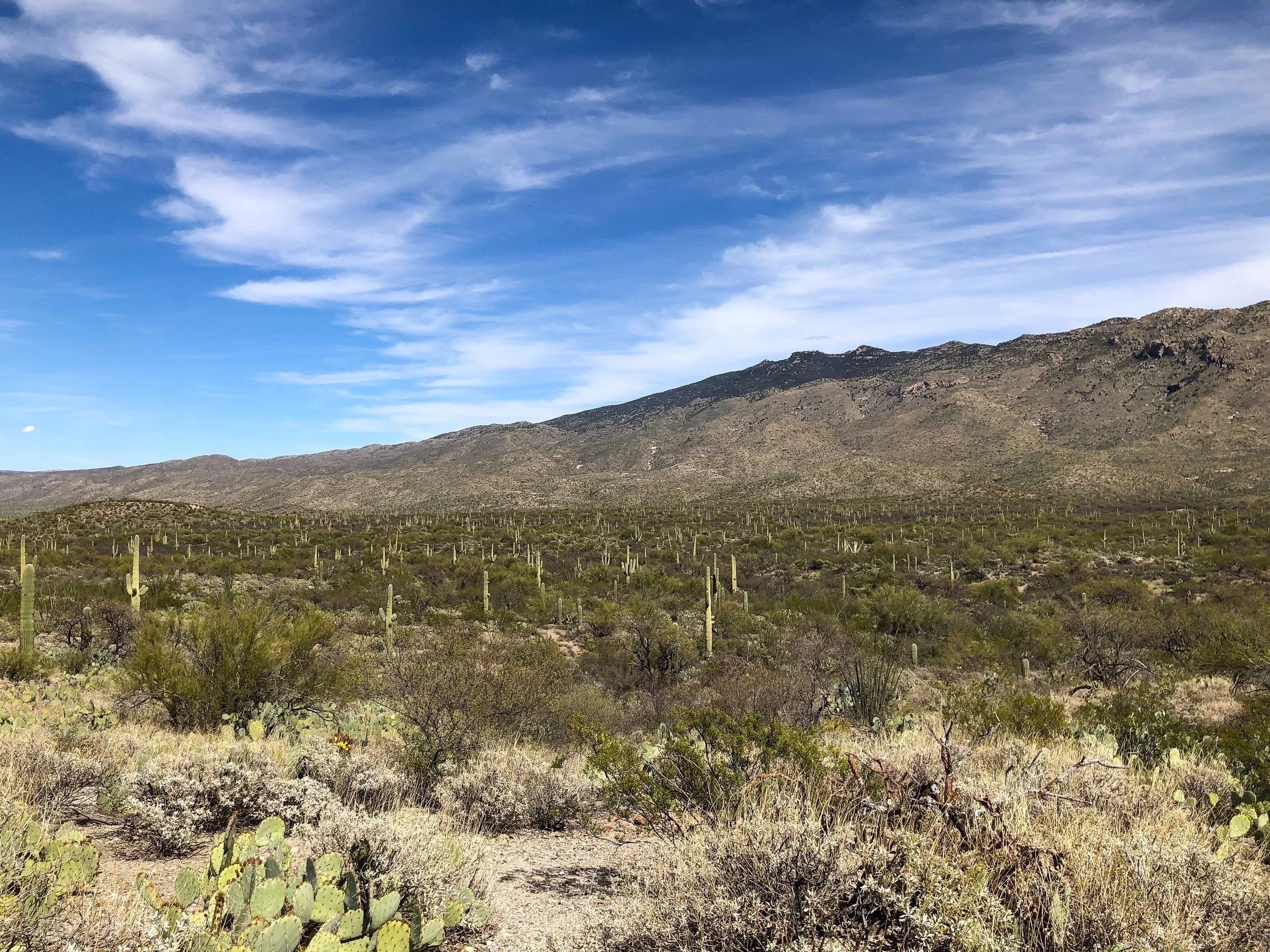
Saguaro National Park
Located within the Sonoran Desert outside of Tucson is Saguaro National Park, home to the Saguaro Cactus. The Saguaro is the classic symbol of the Southwest with its tall waxy green trunk and multiple arms. The park is divided into two separate districts located on opposite sides of Tucson. The Tucson Mountain District to the West and The Rincon Mountain District to the East.
The Rincon Mountain District. The eastern half of Saguaro National Park with a drivable loop and hiking trails with views of the Sonoran Desert and its towering Saguaro Cacti. It’s easy to spend an entire day here.
Cactus Forest Drive. A loop road leading through the The Rincon Mountain District. Its a scenic way to see a vast region of the park, lined with hiking trails, observation points and picnic areas.
Cactus Forest Trail. A lengthy trail meandering across the desert terrain densely populated with mature saguaros. Beware of diamondback rattle snakes slithering across the trail.
Pro Tip. Wear sunblock and bring plenty of water for hiking, especially during the peak afternoon hours.
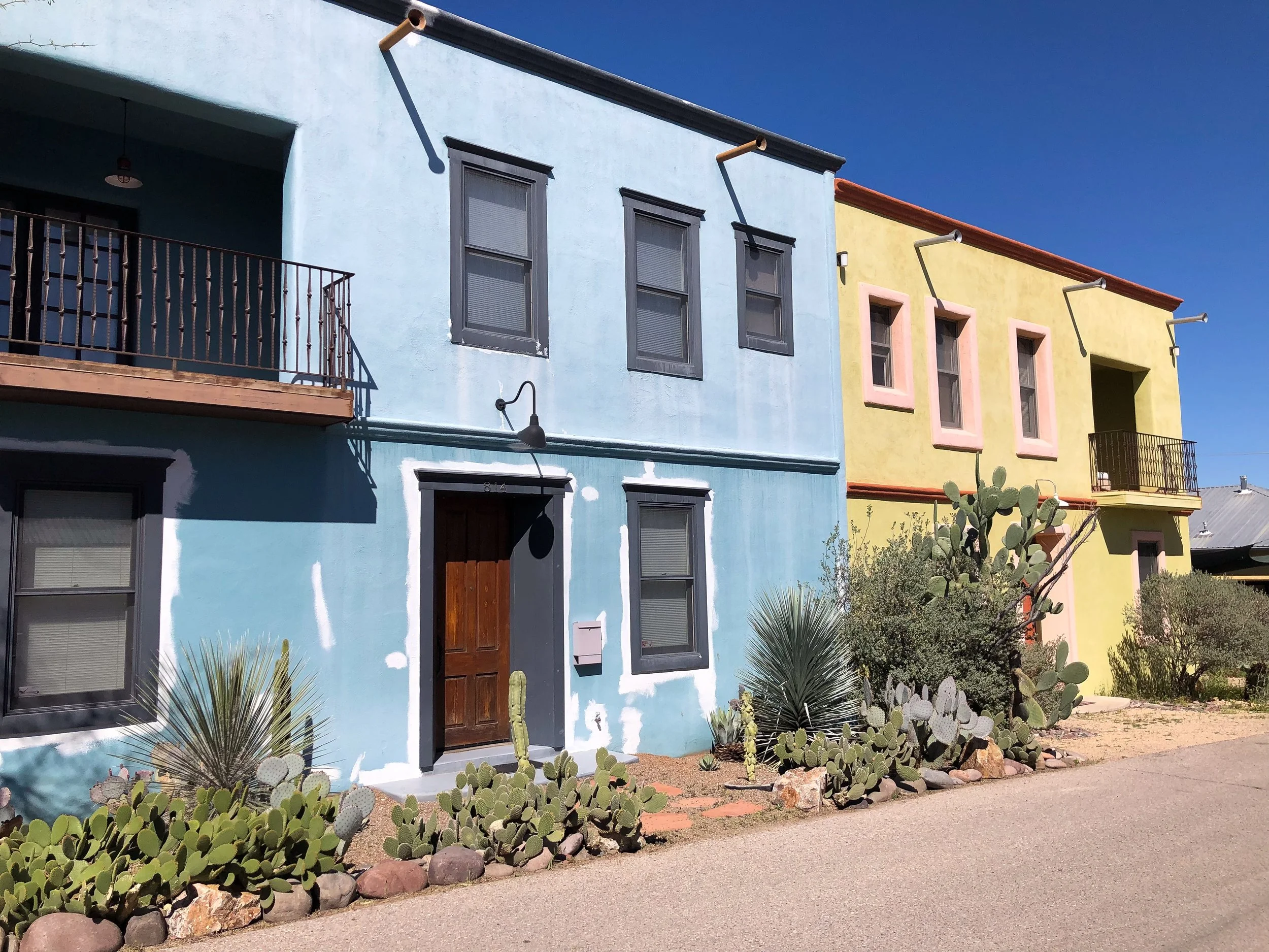
Tucson’s Barrio Viejo
Tucson’s Barrio Viejo is a historic neighborhood and one of the city’s first. It's influenced by Mexican American styles with old adobe buildings, all painted vibrant colors and landscaped with desert cacti. Spend time walking around the barrio, imagining what it would be like to live in such a stunning place.
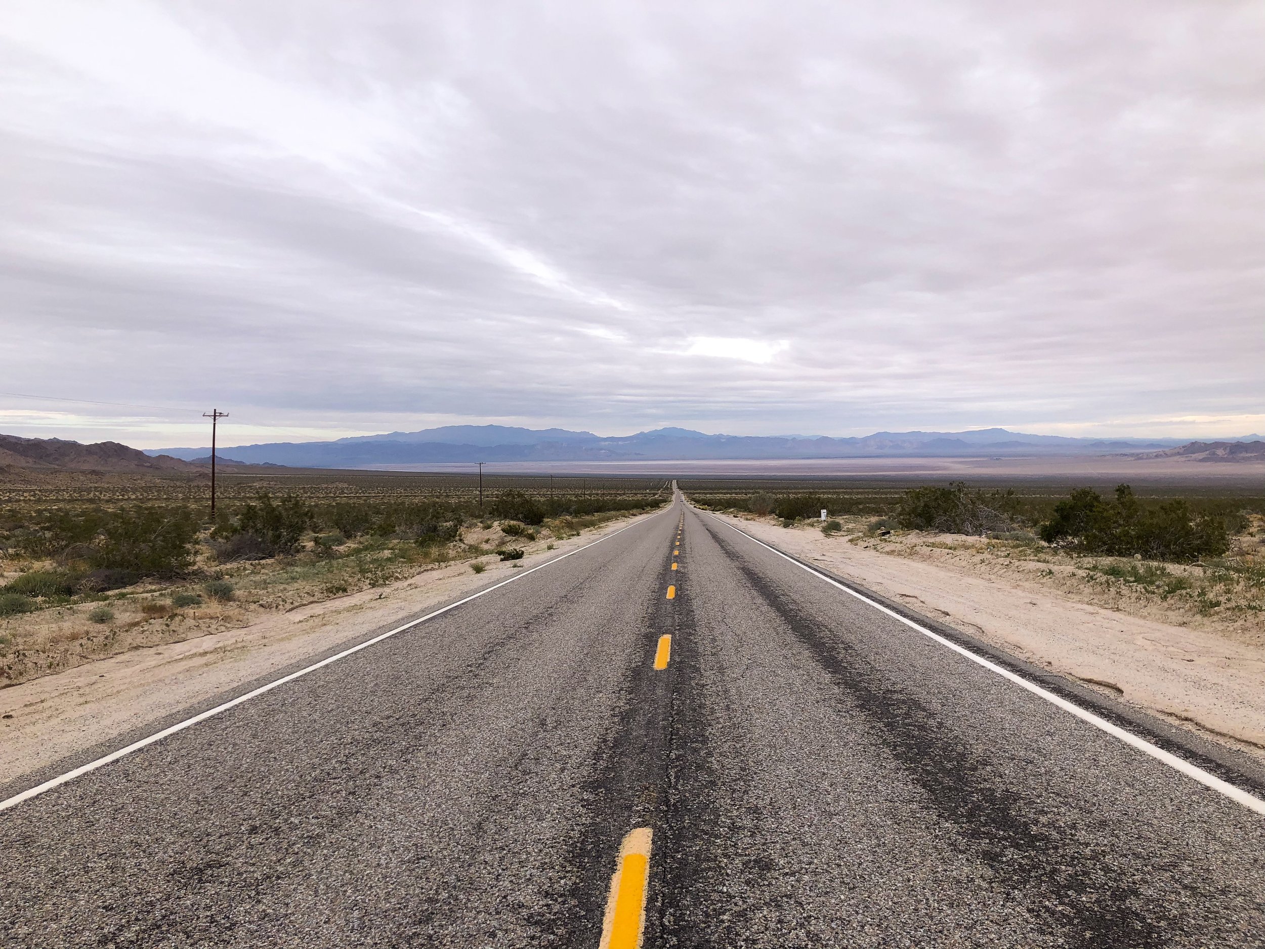
Driving in The American Southwest
We spent ten days driving thousands of miles around the American Southwest and its seemingly endless highways. Below are tips for making a smooth road trip.
Maps. Download offline maps and plan your route. Ask for an old school paper map from the rental agency or pick one up at a rest stop as a back up.
Distance. The southwest is a vast region of the country. Expect to drive hundreds of miles a day and thousands during the course of a multi-day to two week roadtrip.
Gasoline. Keep your tank at least half full. There are vast stretches without any gas stations.
Be Spontaneous. Give yourself extra time to get around and expect to make unexpected stops at roadside attractions and lookout points. Expect the occasional detour.
Weather. Check the forecast prior to driving, especially in the mountains. It’s not fun to get trapped in a blizzard.
Playlist. Have plenty of music or audio books teed up for the long drive and days in the car.
For Next Time…
The American Southwest is a vast region of the country where endless roads criss cross dramatic landscapes, small towns, big cities and historic sights. If we had more time, there is so much more we would see and do. Below is an extensive list of some of those places:
The Pacific Coast Highway. A coastal road stretching hundreds of miles along California’s Pacific Coast.
Palm Springs. A California town famed for its retro and mid-century style architecture, palm lined boulevards and desert landscapes.
Pioneer Town. An 1880s themed western town with dirt roads, wooden buildings, saloons and wanted posters.
Sequoia National Park. A California park with a forest of towering sequoia redwood trees, including the General Sherman Tree, the world’s largest living tree.
Death Valley National Park. Considered one of the hottest and driest places on Earth with summer time temperatures often exceeding 120 degrees Fahrenheit, especially in Furnace Creek.
Antelope Canyon. A picturesque, narrow and winding sandstone canyon. It can only be accessed with a Navajo guide.
Vermilion Cliffs. A sweeping wave of orange and golden shades of sandstone.
Beaver Falls & Havasu Falls. Two turquoise waterfalls hidden in the middle of Arizona’s desert landscape on the Havasupai Reservation.
Sedona, Arizona. A desert town with striking rock formations, pine forests and breathtaking hiking trails, including the Devil’s Bridge Trail.
Santa Fe, New Mexico. A historic and artsy pueblo with galleries, museums and adobe landmarks.
White Sands National Park. A sprawling desert park with white sand dunes cresting across the horizon.
Taos Pueblo. An adobe city, home to the Taos Pueblo people, dating back over 1,000 years.
Zion National Park. A national park with verdant oases, emerald river pools, steep canyons and hiking trails including Angels Landing.
Bryce Canyon. A dramatic canyon filled with hundreds of red and orange sandstone spires.
Arches National Park. A national park with over 2,000 naturally formed sandstone arches.
Bonneville Salt Flats. The location of an ancient salt lake with a crystalline salt crust covering its floor.
Dinosaur National Monument. A reserve with hundreds of paleontological sights and fossilized dinosaurs.
Costa Rica Road Trip Guide: Arenal Volcano, Manuel Antonio & Wildlife Adventures
Road trip across Costa Rica through lush rainforests, active volcanoes, wildlife reserves and tropical beaches from Arenal to Manuel Antonio.
Costa Rica, Nature & Biodiversity
Costa Rica is a lush and biodiverse country in Central America known for its tropical rainforests, active volcanoes, nature reserves and exotic wildlife. We spent a week road tripping across the country, splitting our time equally between the Arenal Volcano in the mountains and Manuel Antonio Park on the Pacific coast.
San José, The Gateway to Costa Rica
San José is the capital city and gateway to Costa Rica. Located in the center of the country, it’s an easy point to begin and end any road trip from. We flew in around midnight and spent the evening at the nearby Hotel Mango before beginning our road trip the following morning. Reserve a rental car with Sixt.

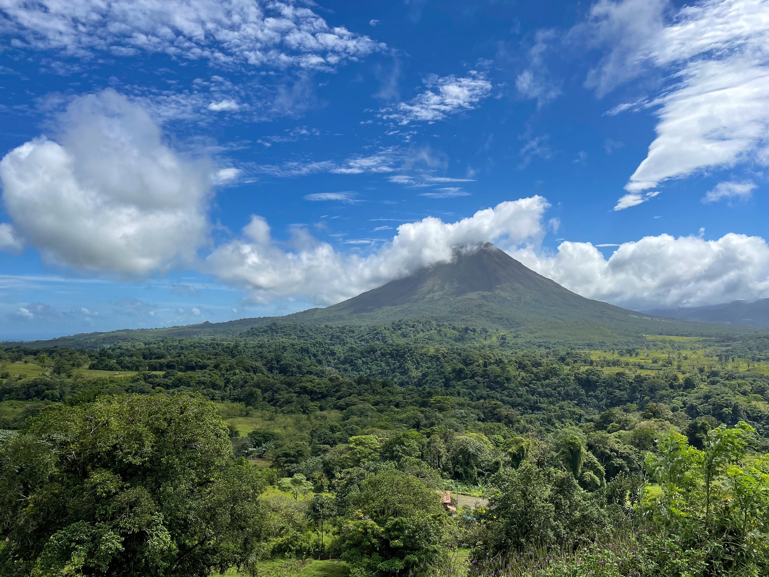
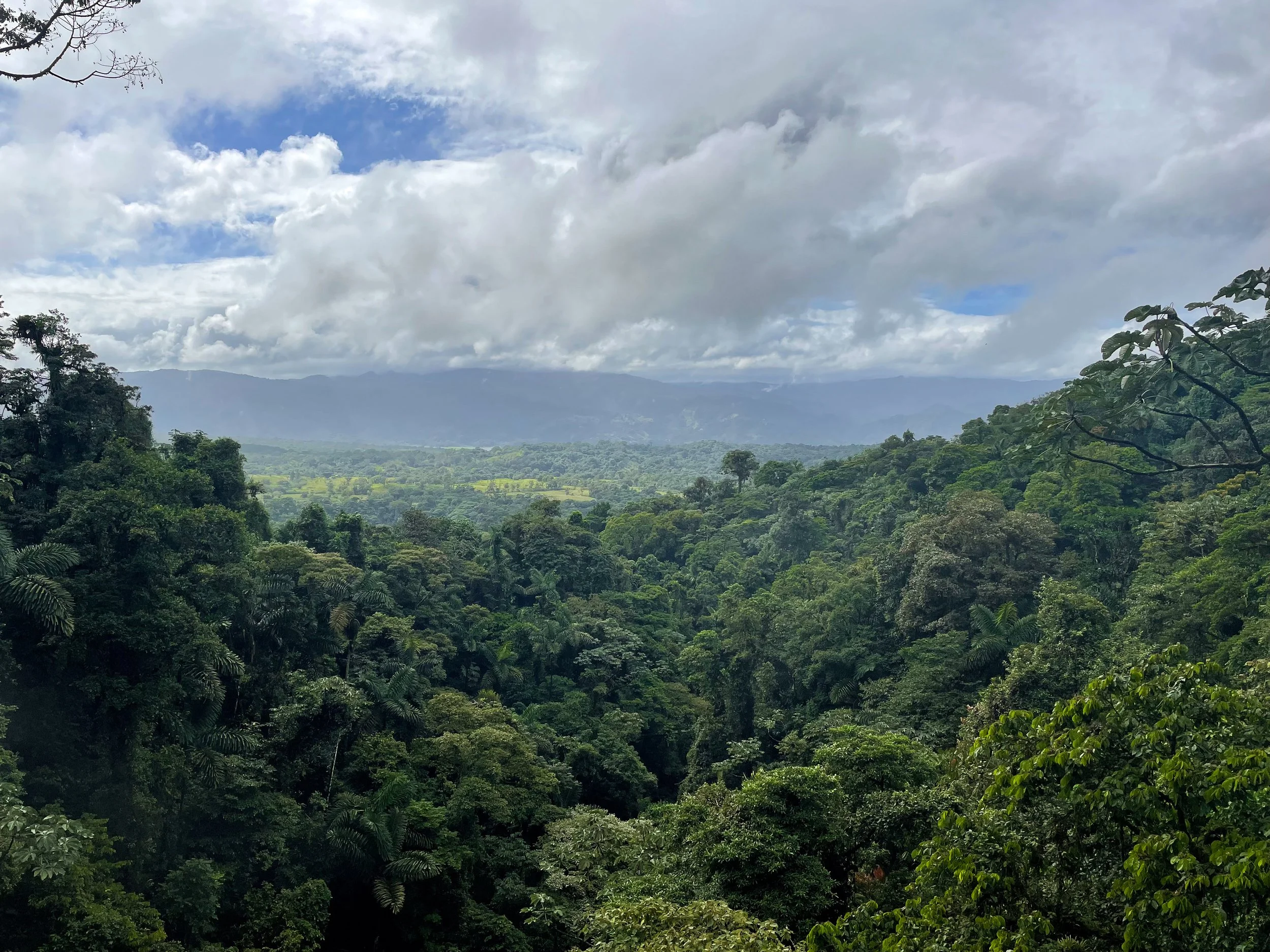
Volcán Arenal
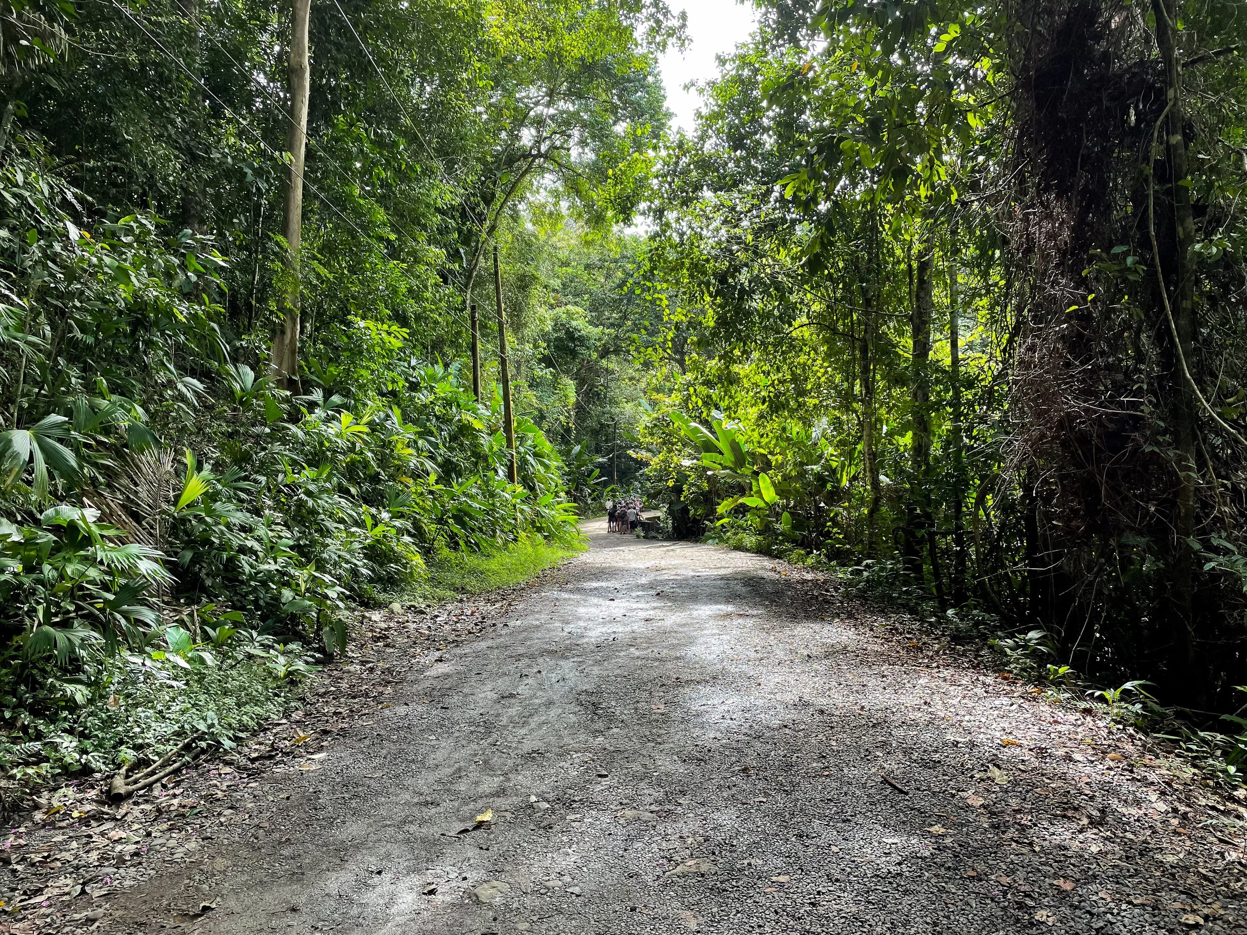
The Arenal Volcano is known for its symmetrical cone shape, hardened lava fields, hiking trails and large lake. We drove here from San José and arrived by early afternoon then hiked for about 3 hours.
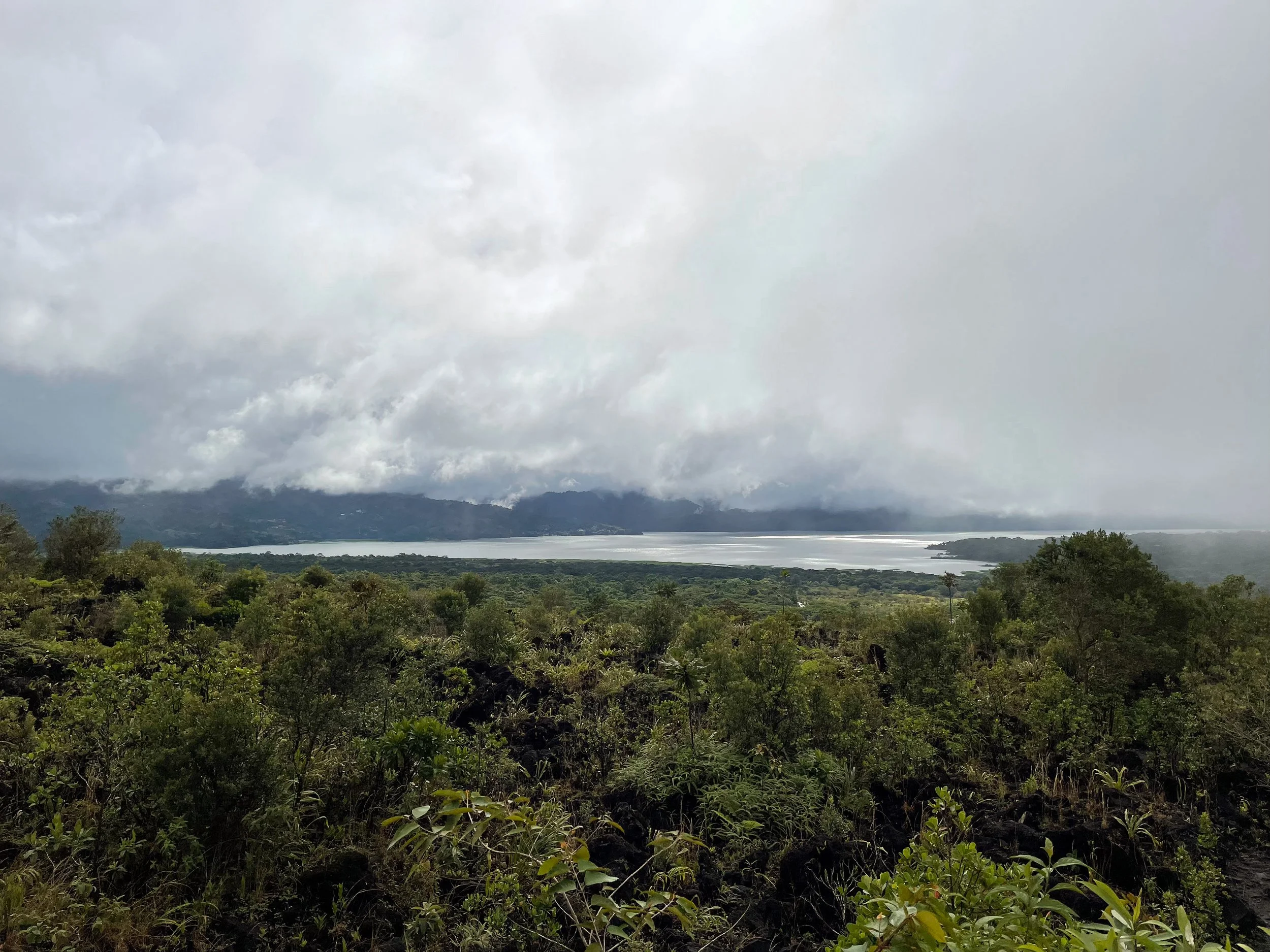
Parque Nacional Volcán Arenal
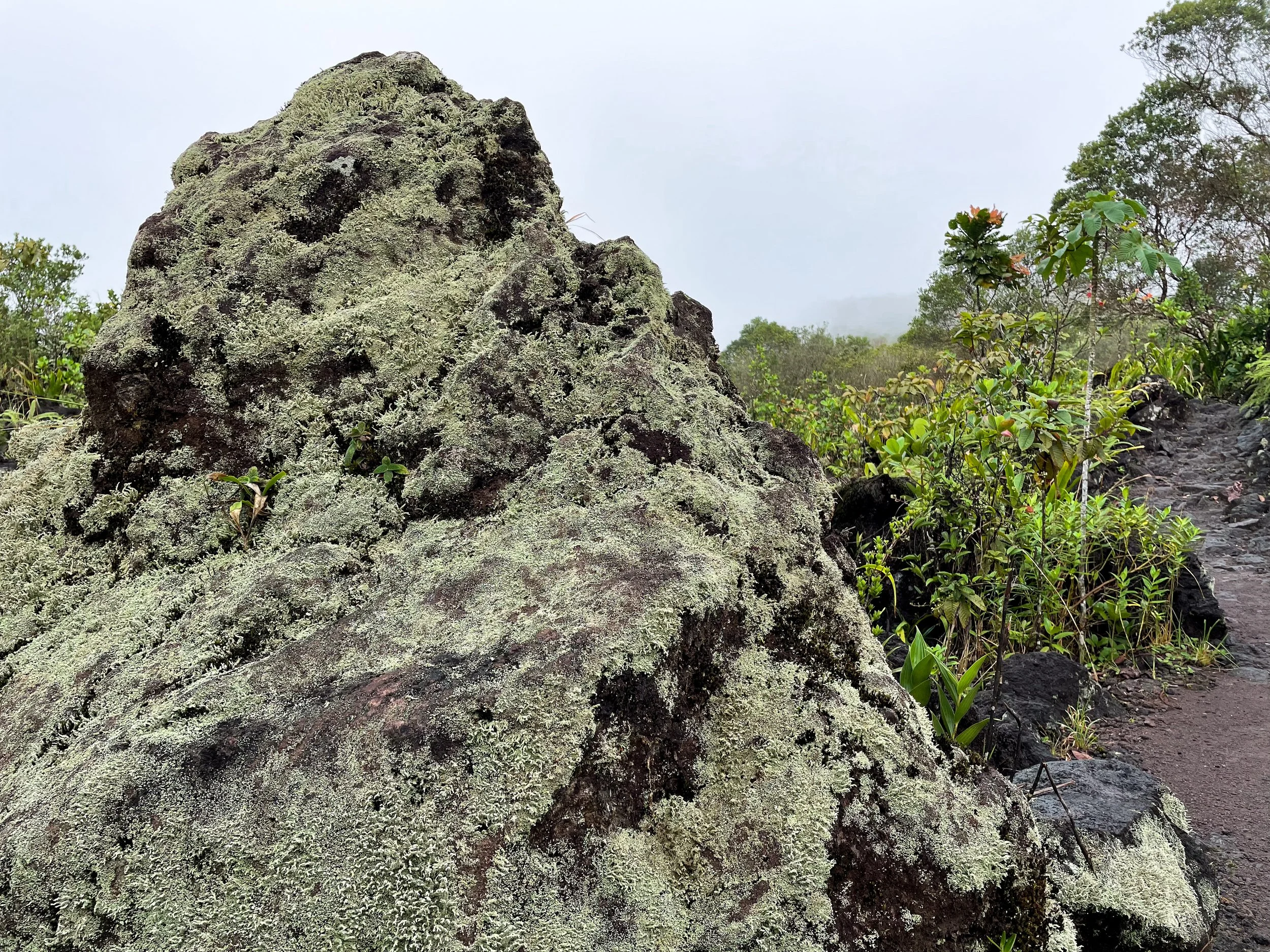
We hiked the Reserva Mirador el Silencio Loop at the Arenal 1968 Park, the site of a 1968 eruption. It connects multiple trails through lush secondary forest, hardened lava fields and dense primary forest around a lagoon. At the end of the hike is a small restaurant with snacks and beverages.
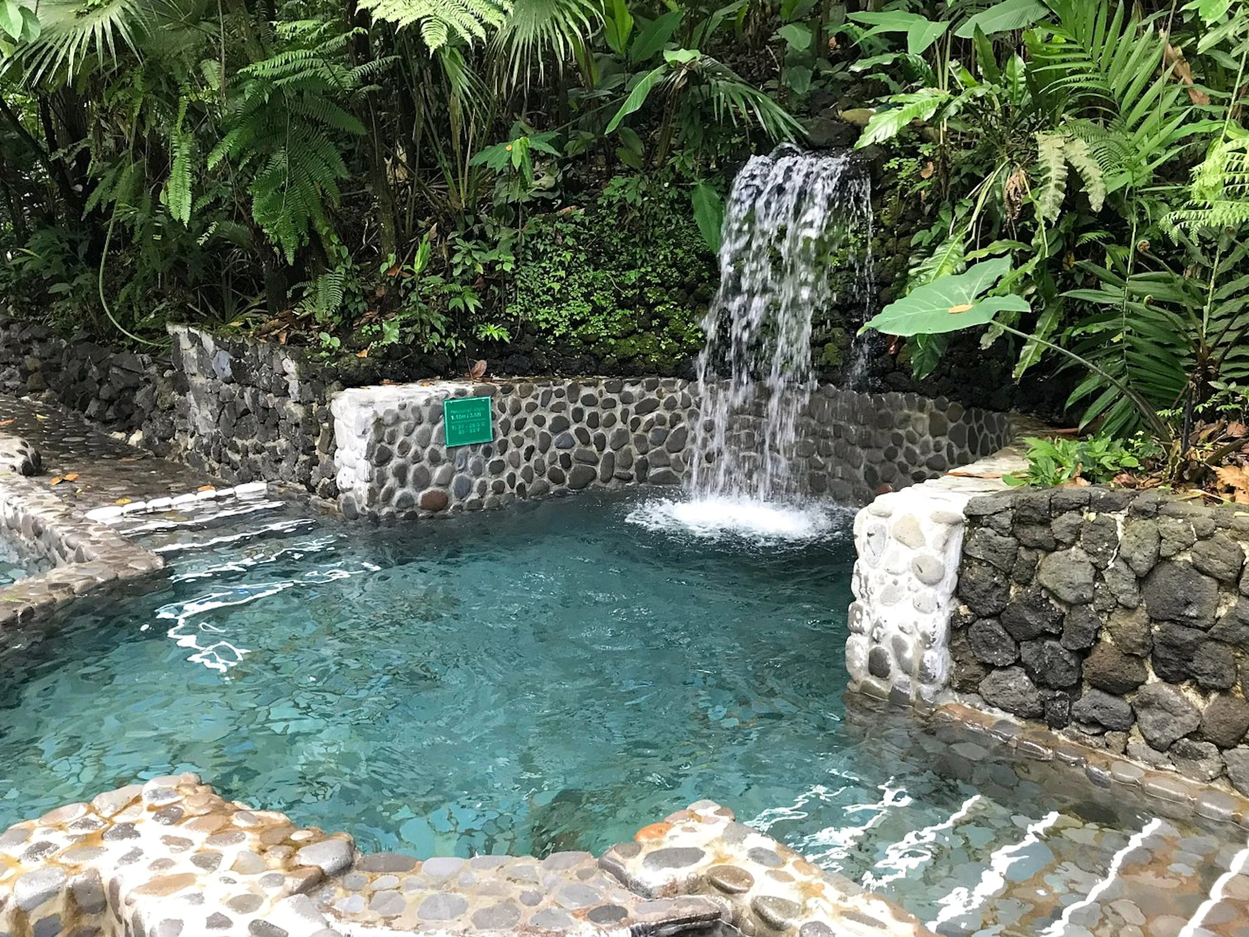
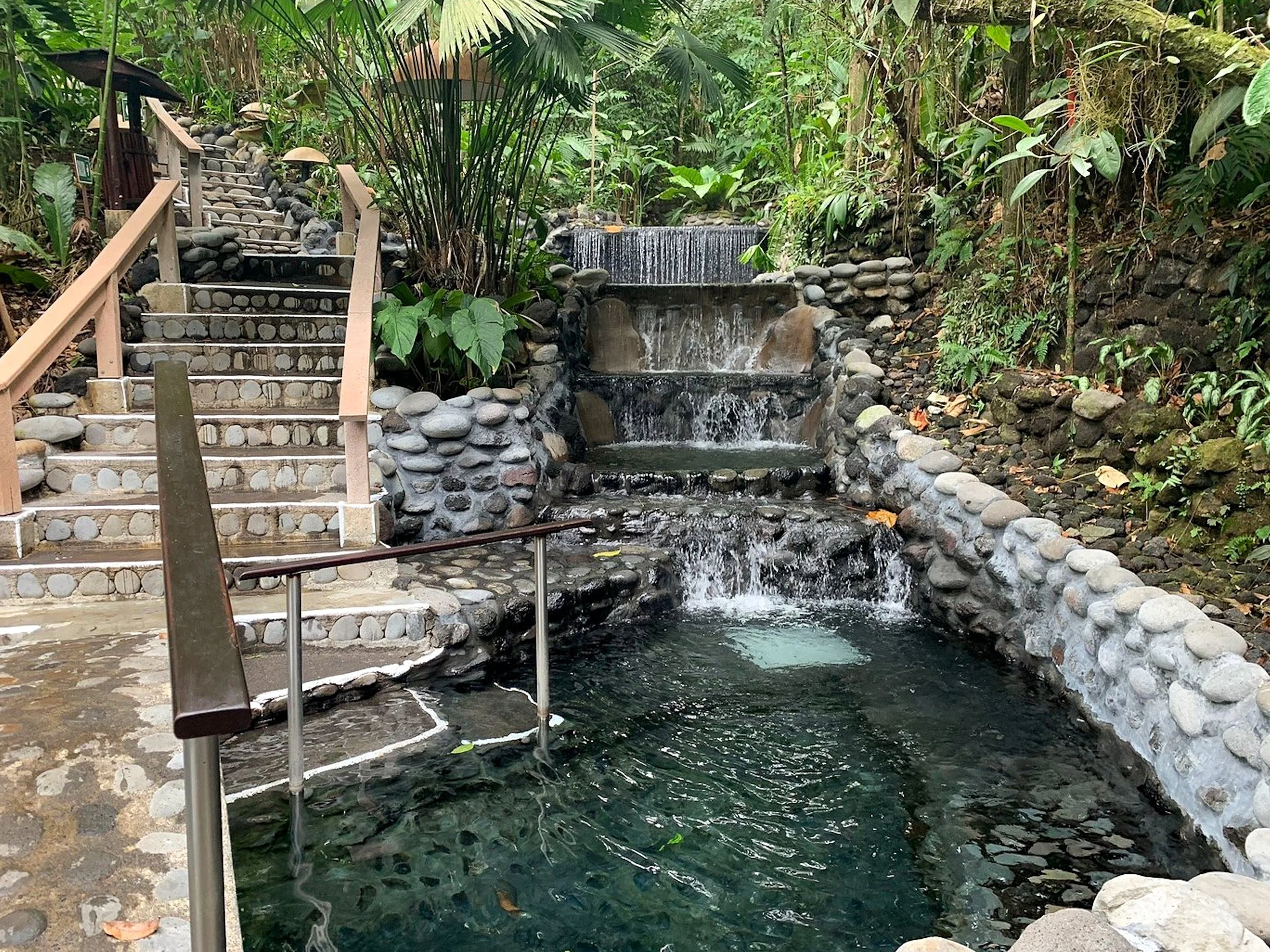
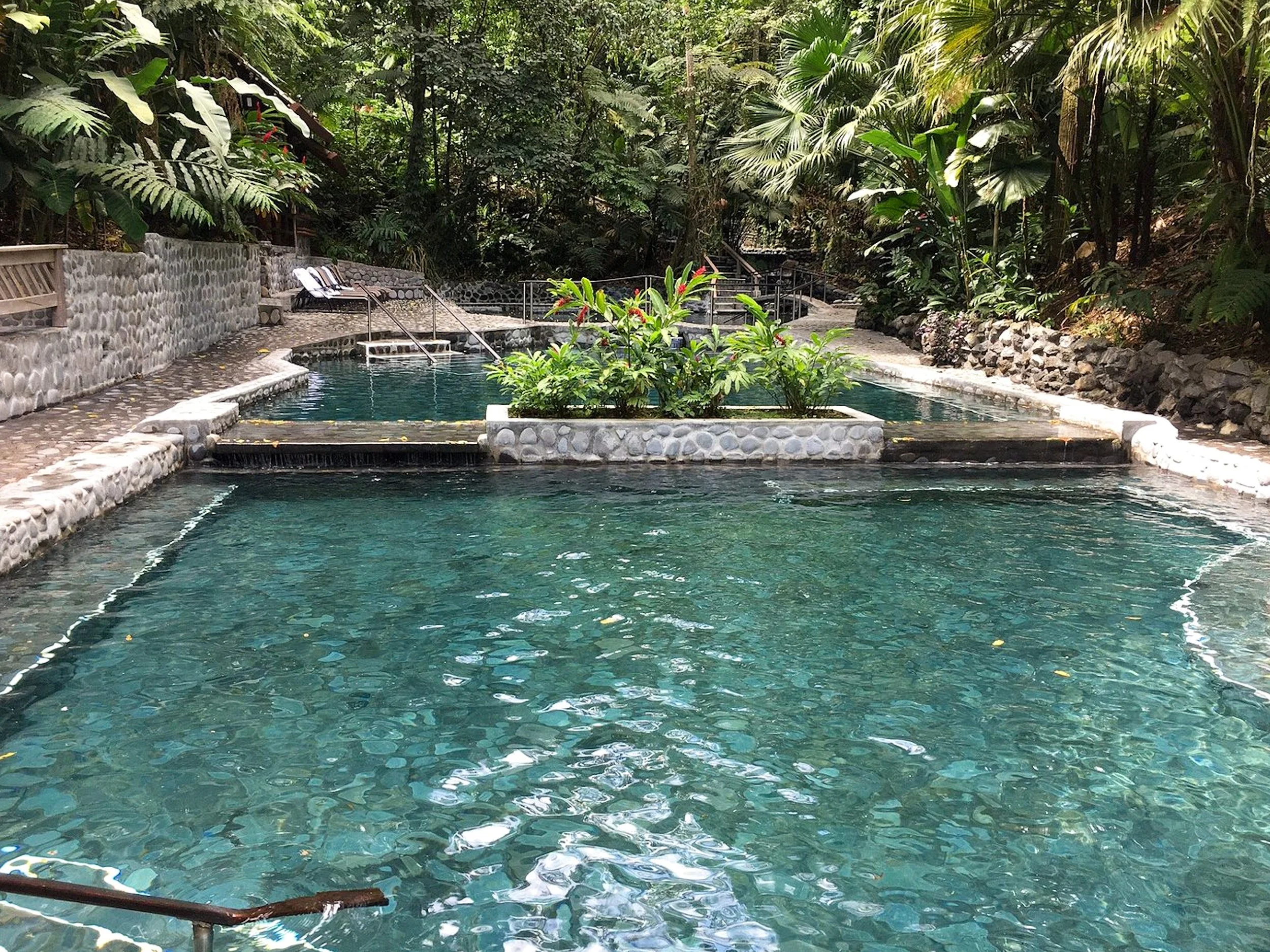
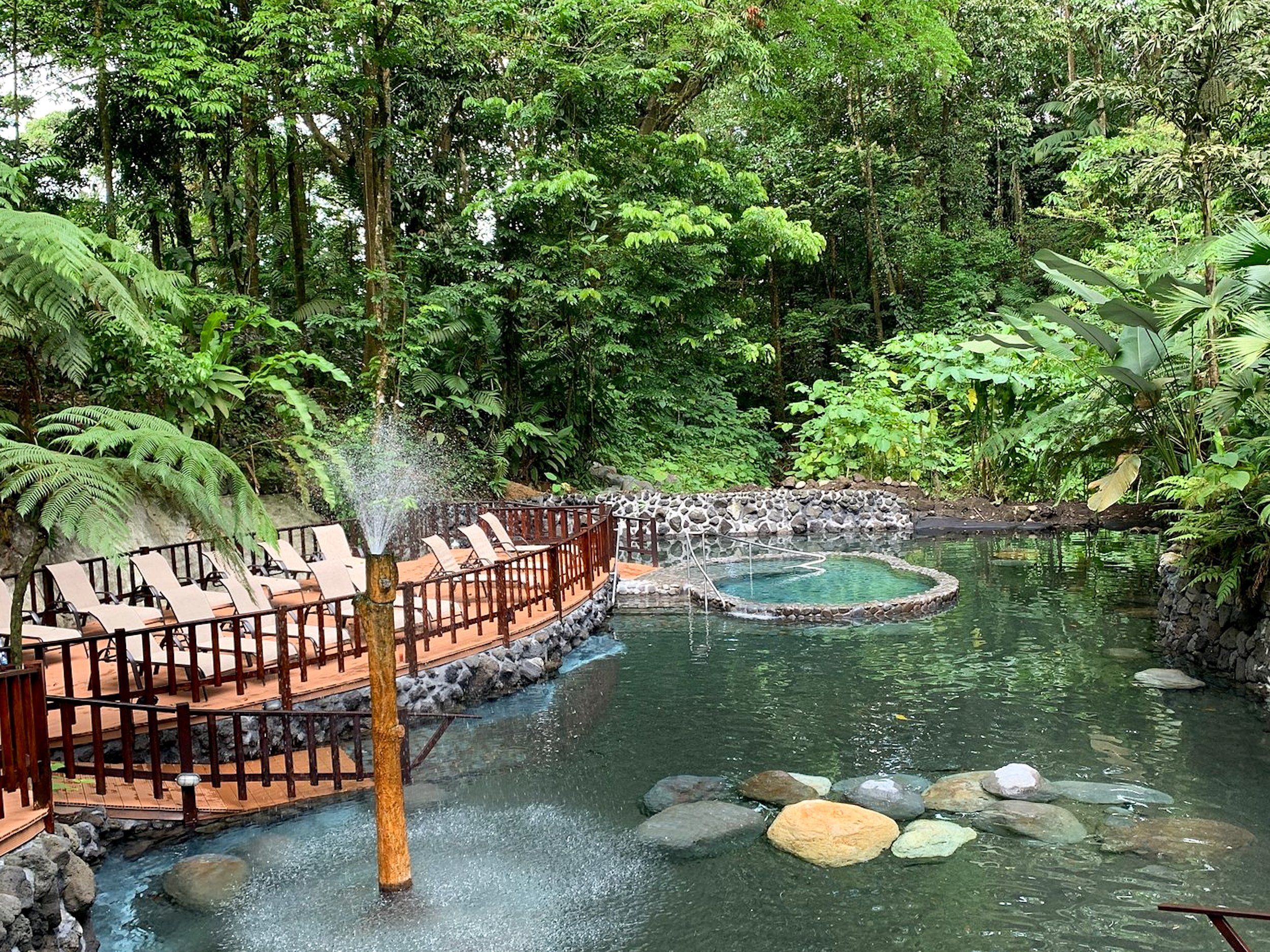
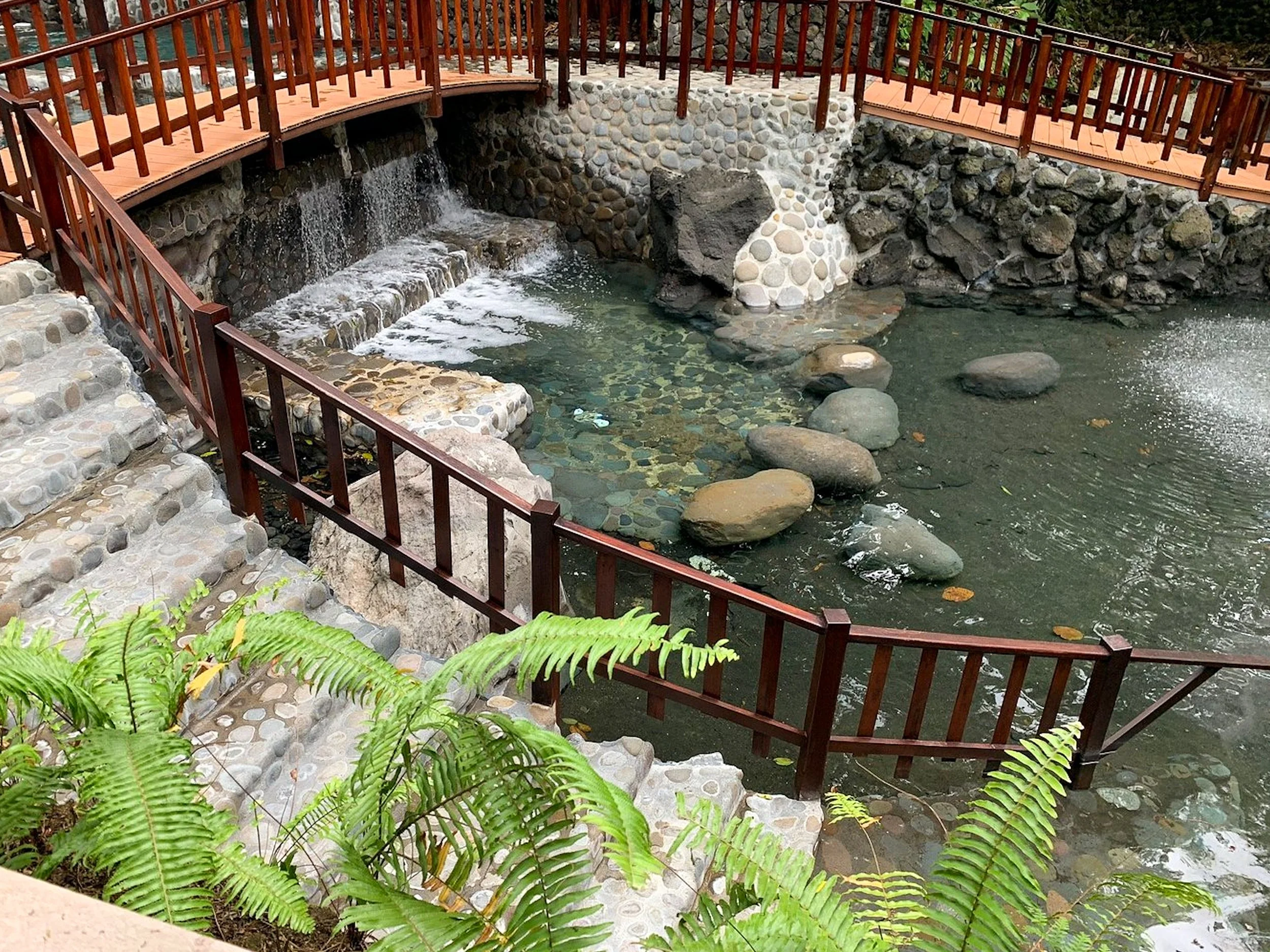
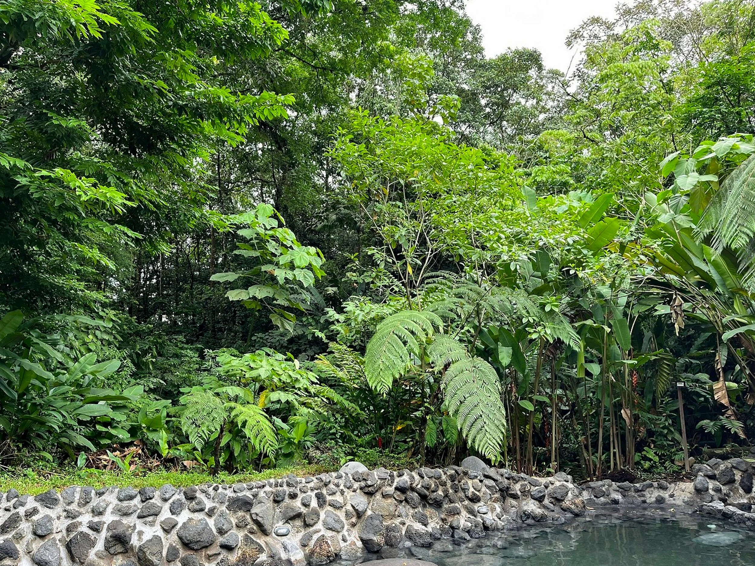
Arenal Hot Springs
The area around the Arenal Volcano has several hot springs and resorts. We visited the Ecotermales Hot Springs for a relaxing evening after our hike. The hot springs consist of several cascading thermal pools ranging in temperature from hottest at the top to coolest at the bottom. The upper pool has a steamy waterfall that feeds into lower pools. A second waterfall flows into the bottom pool with seats below it. The resort offers Costa Rican cuisine like rice and beans, yucca, fish in a coconut sauce and sweet plantains. Photo credit to Trip Advisor.
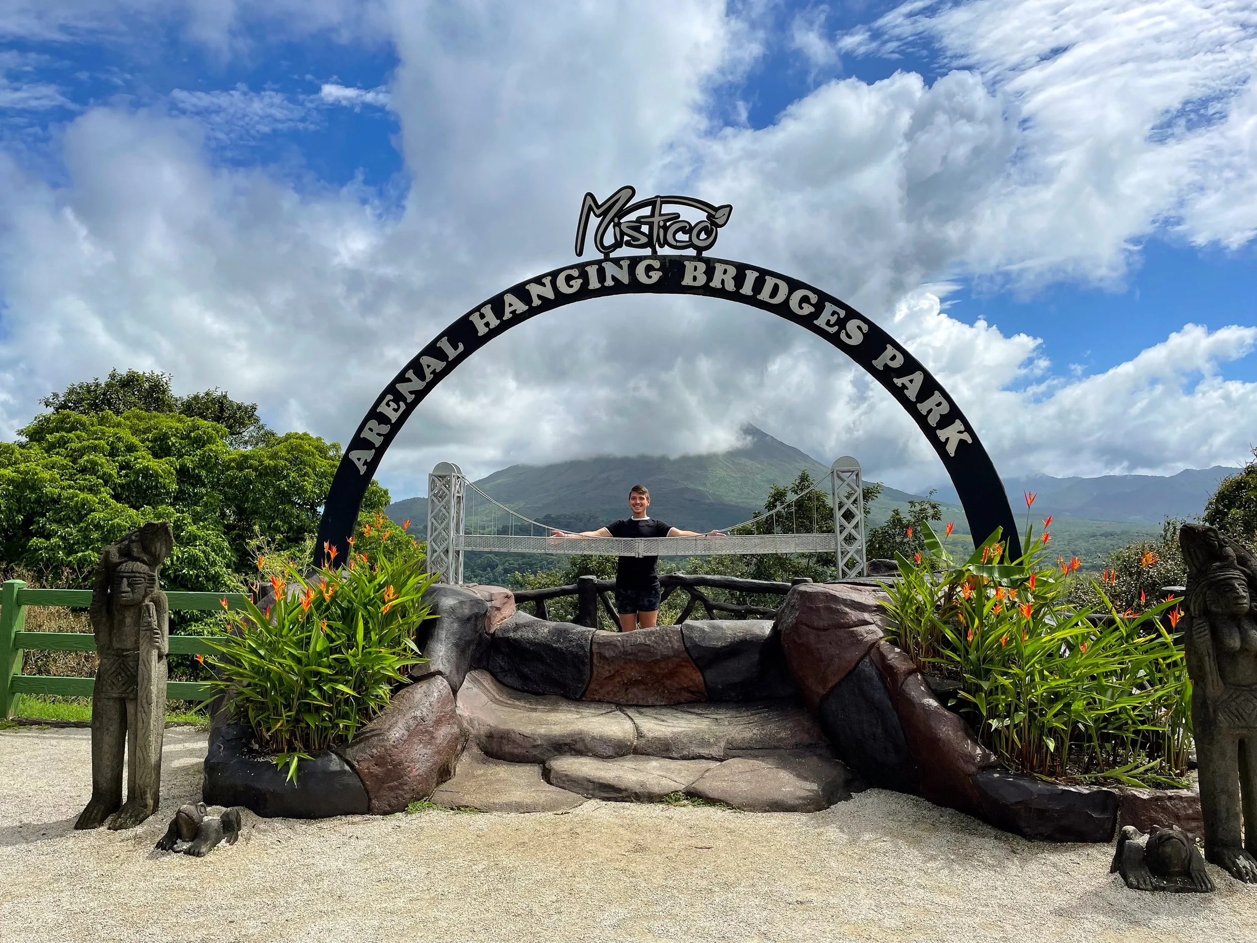
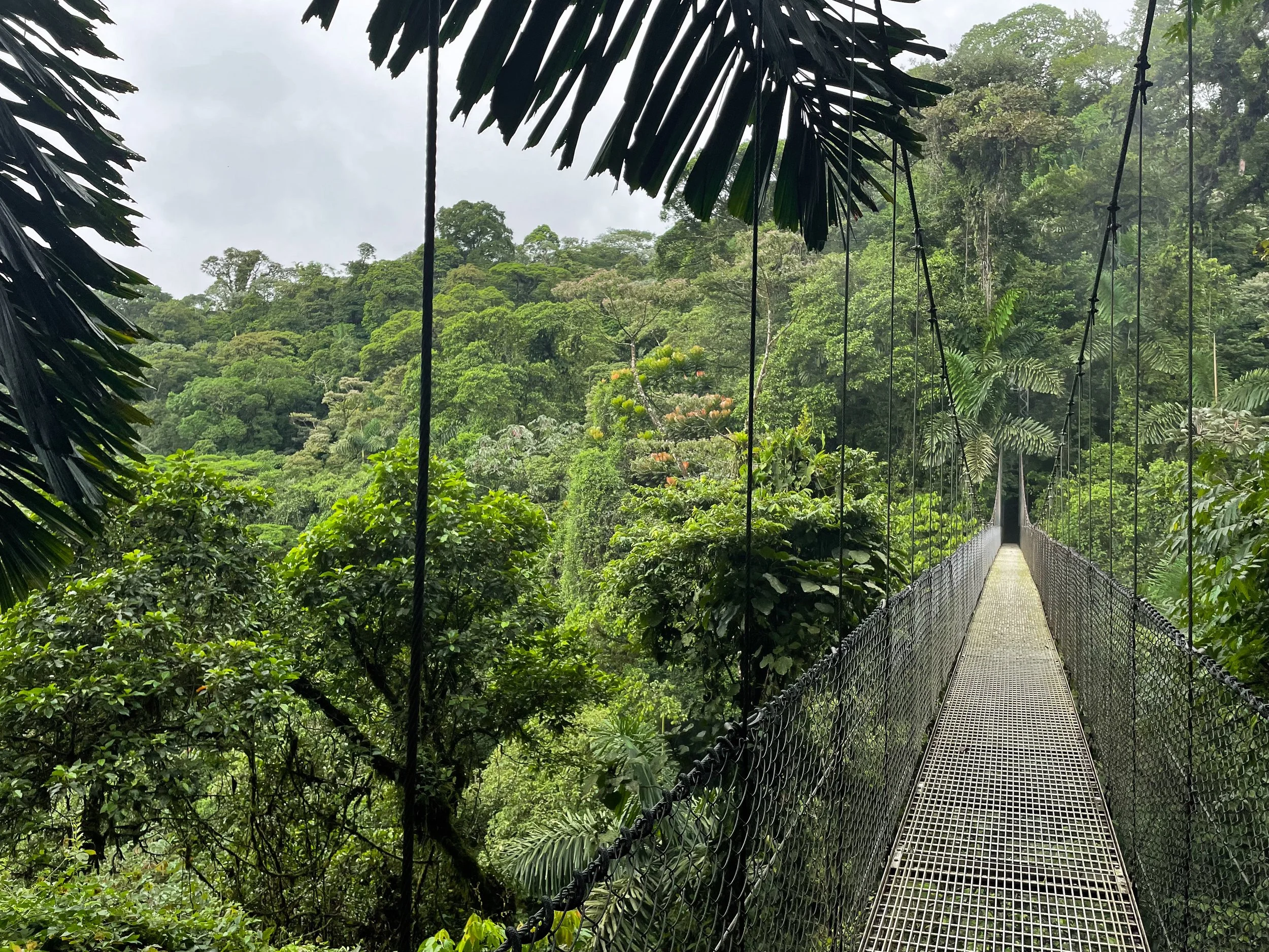
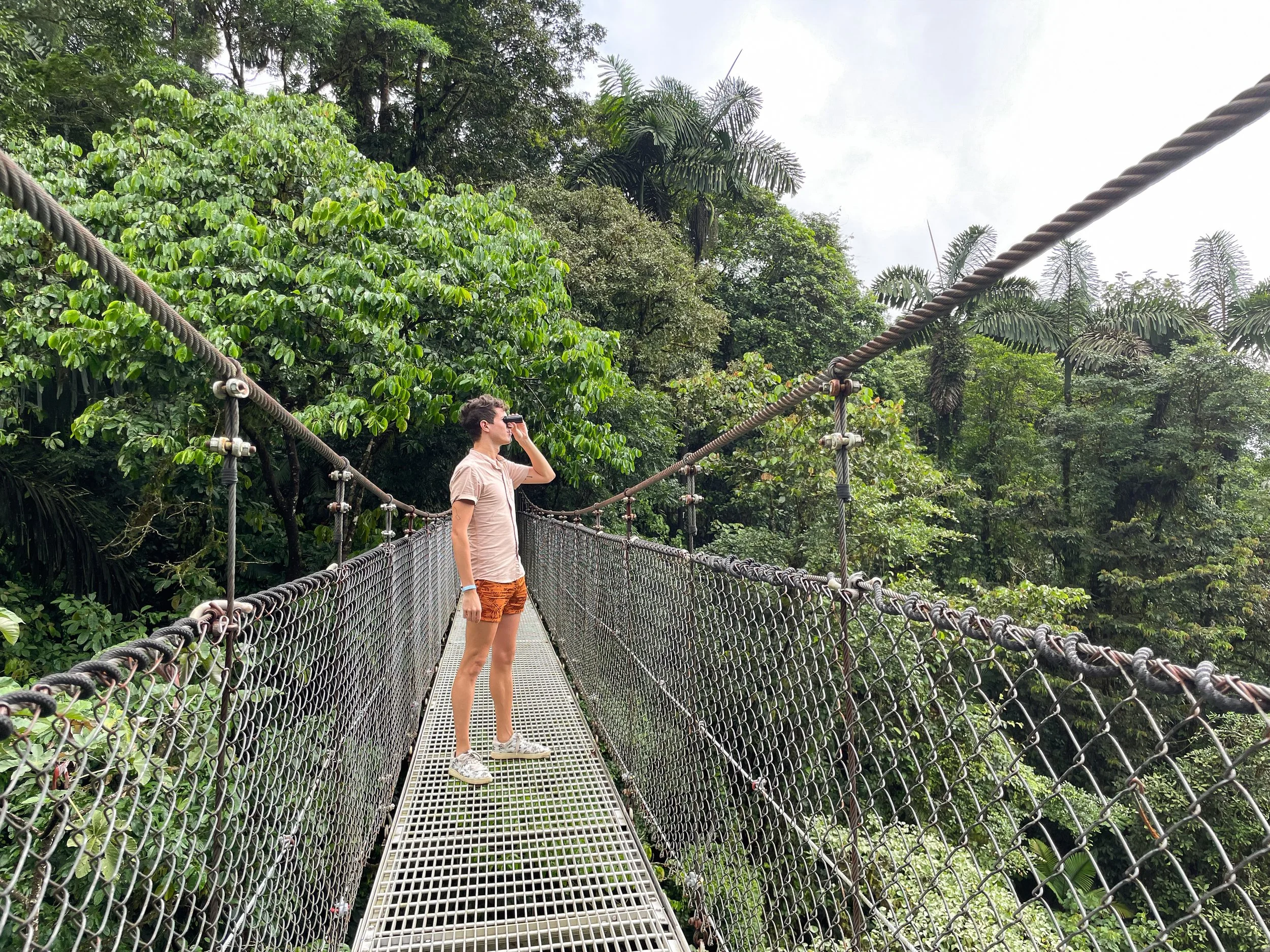
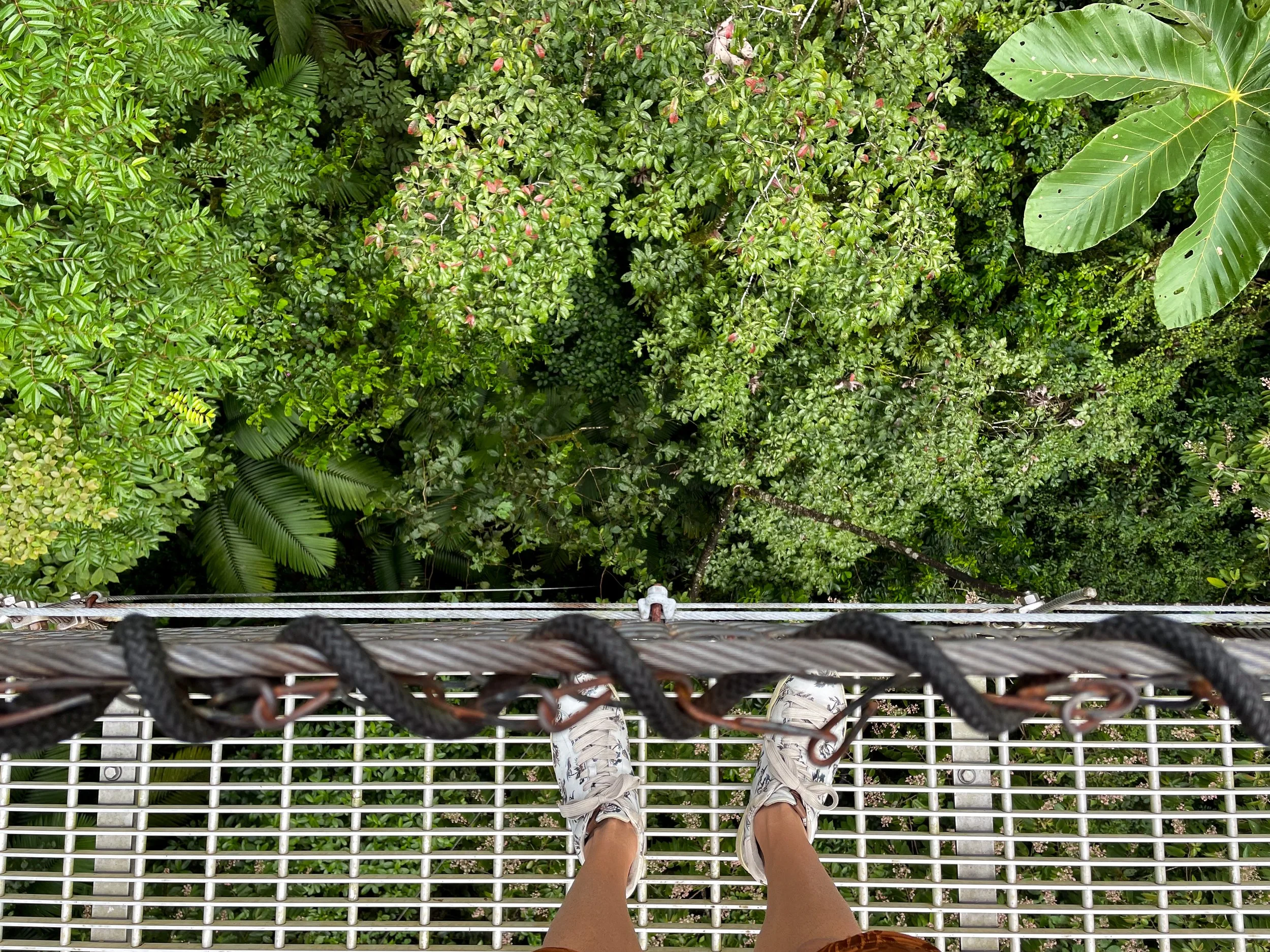
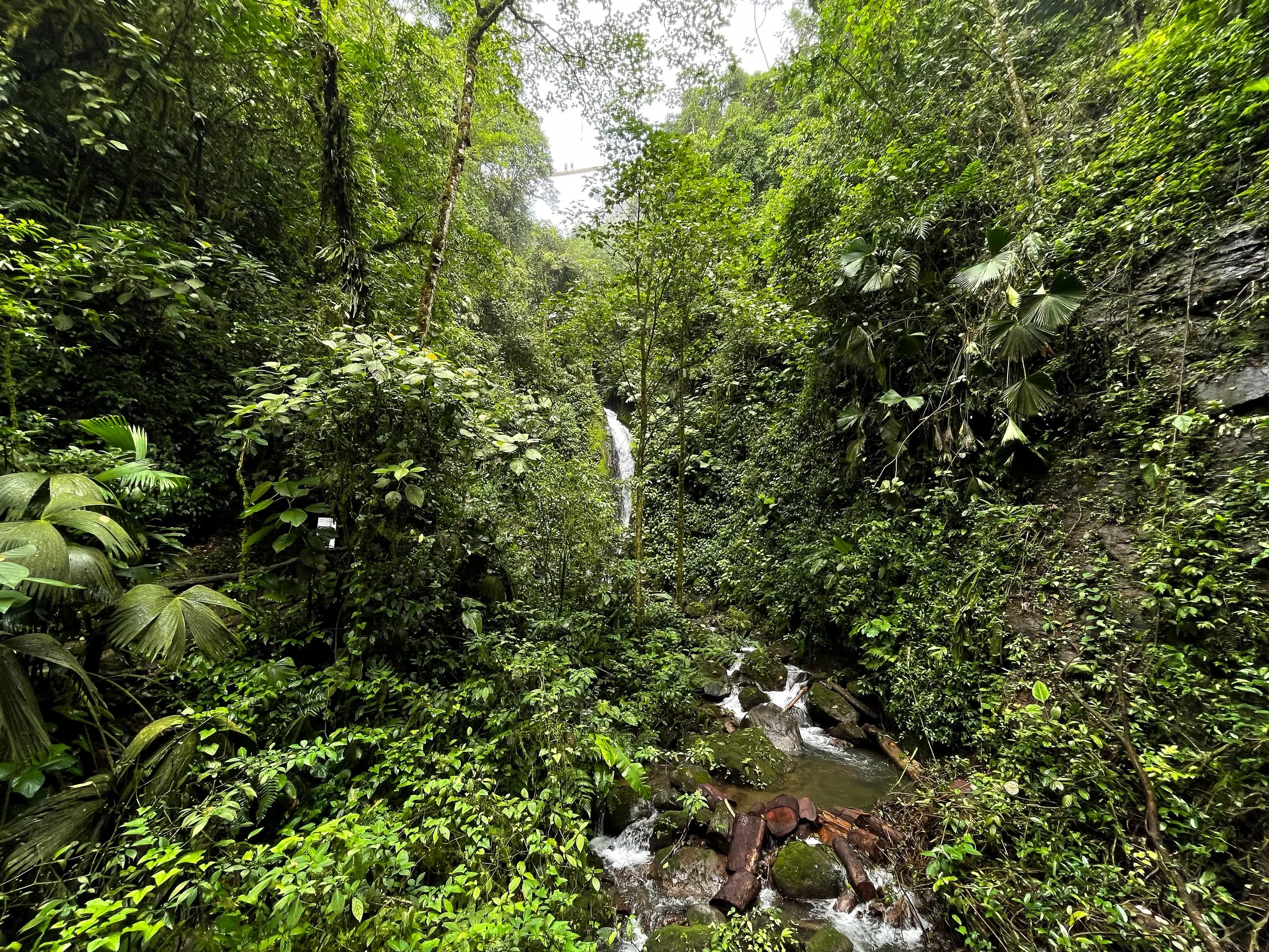
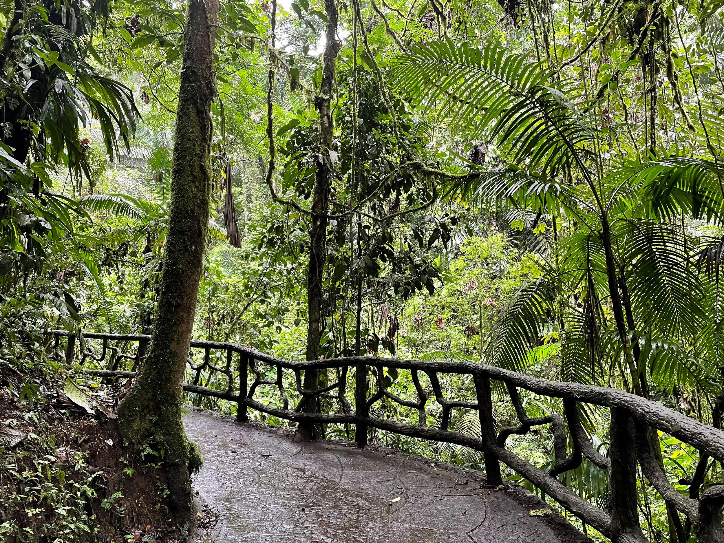
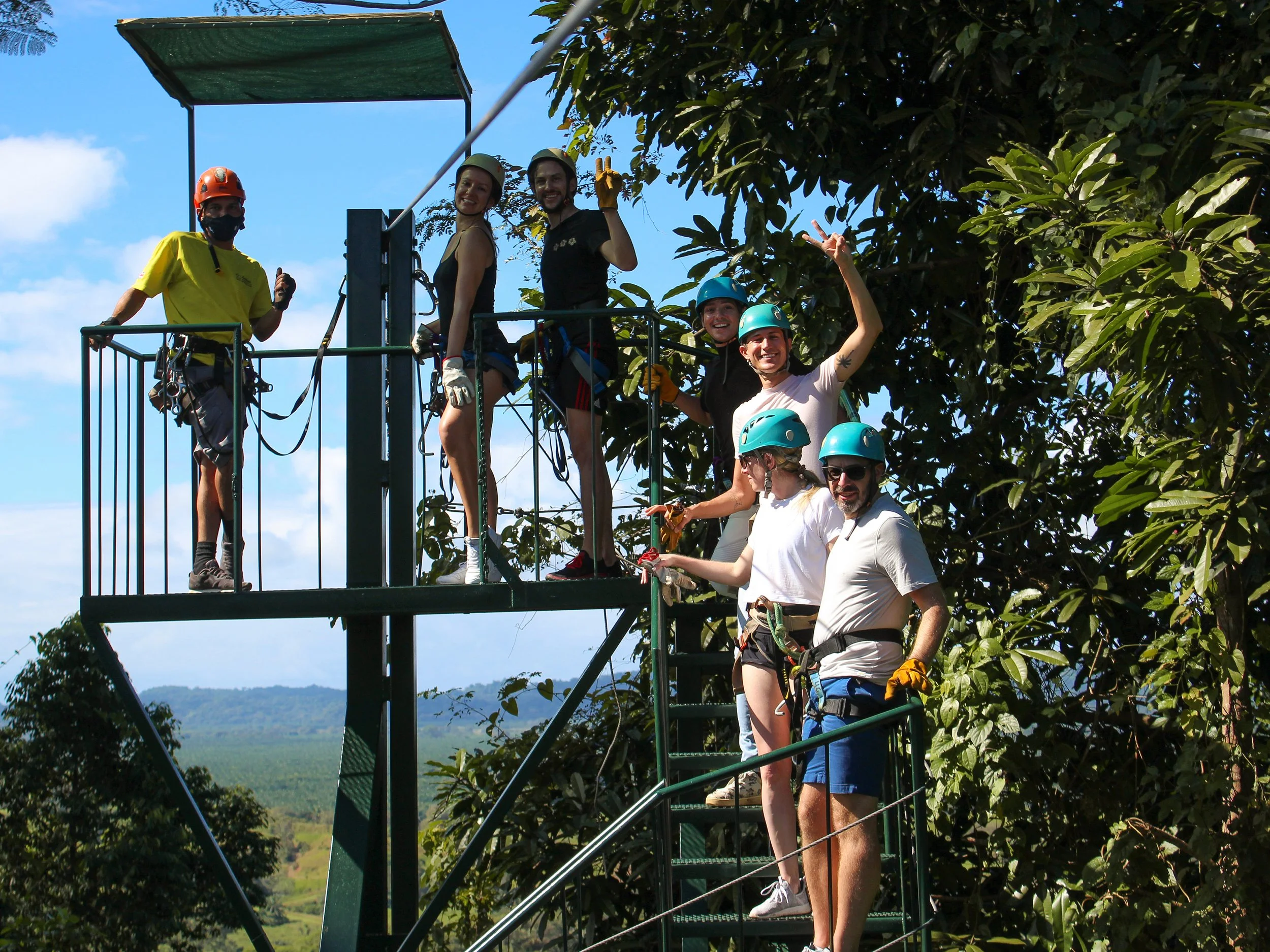
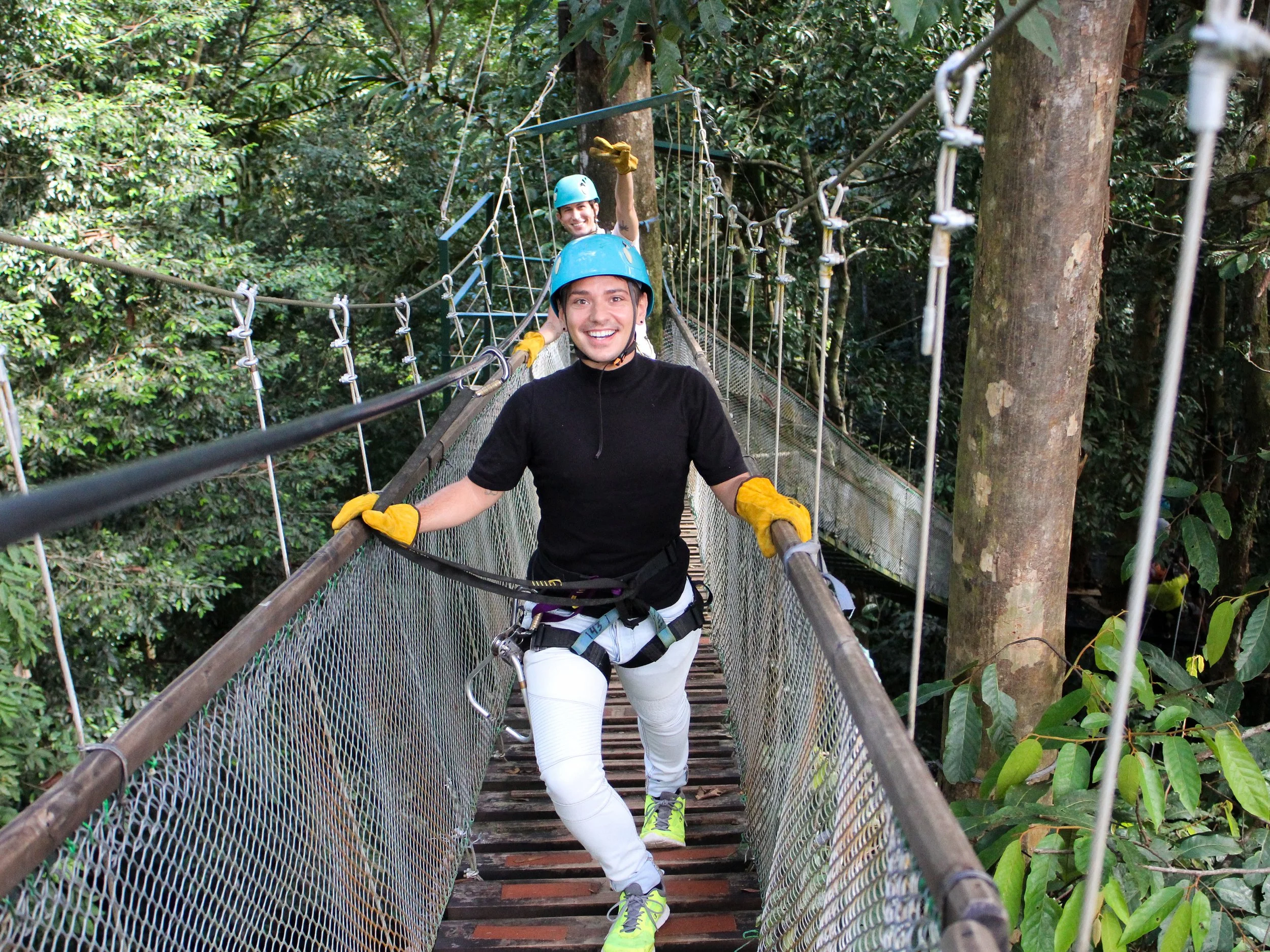
Mistico Arenal Hanging Bridges Park
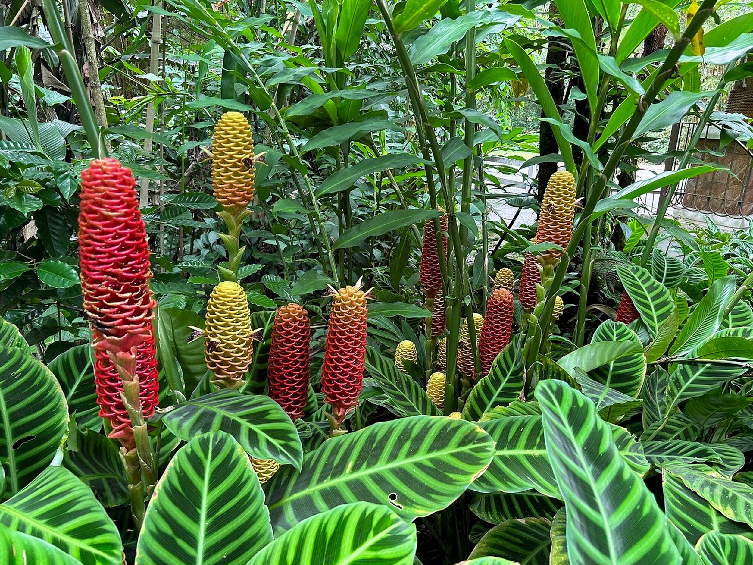
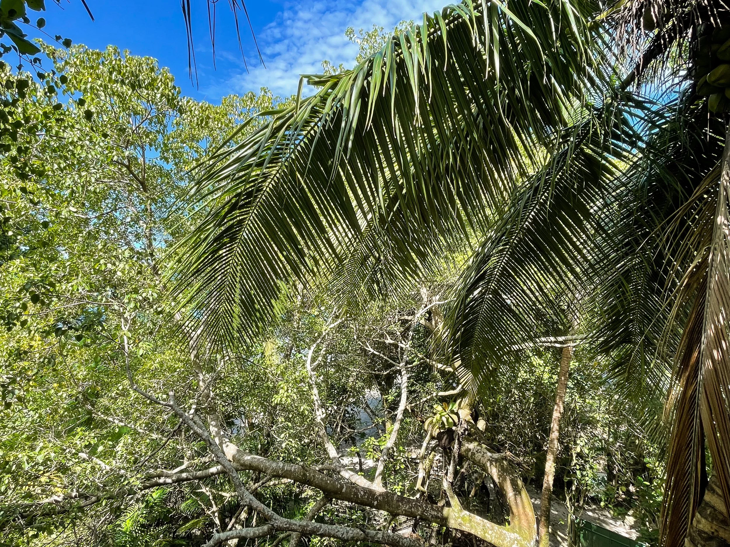
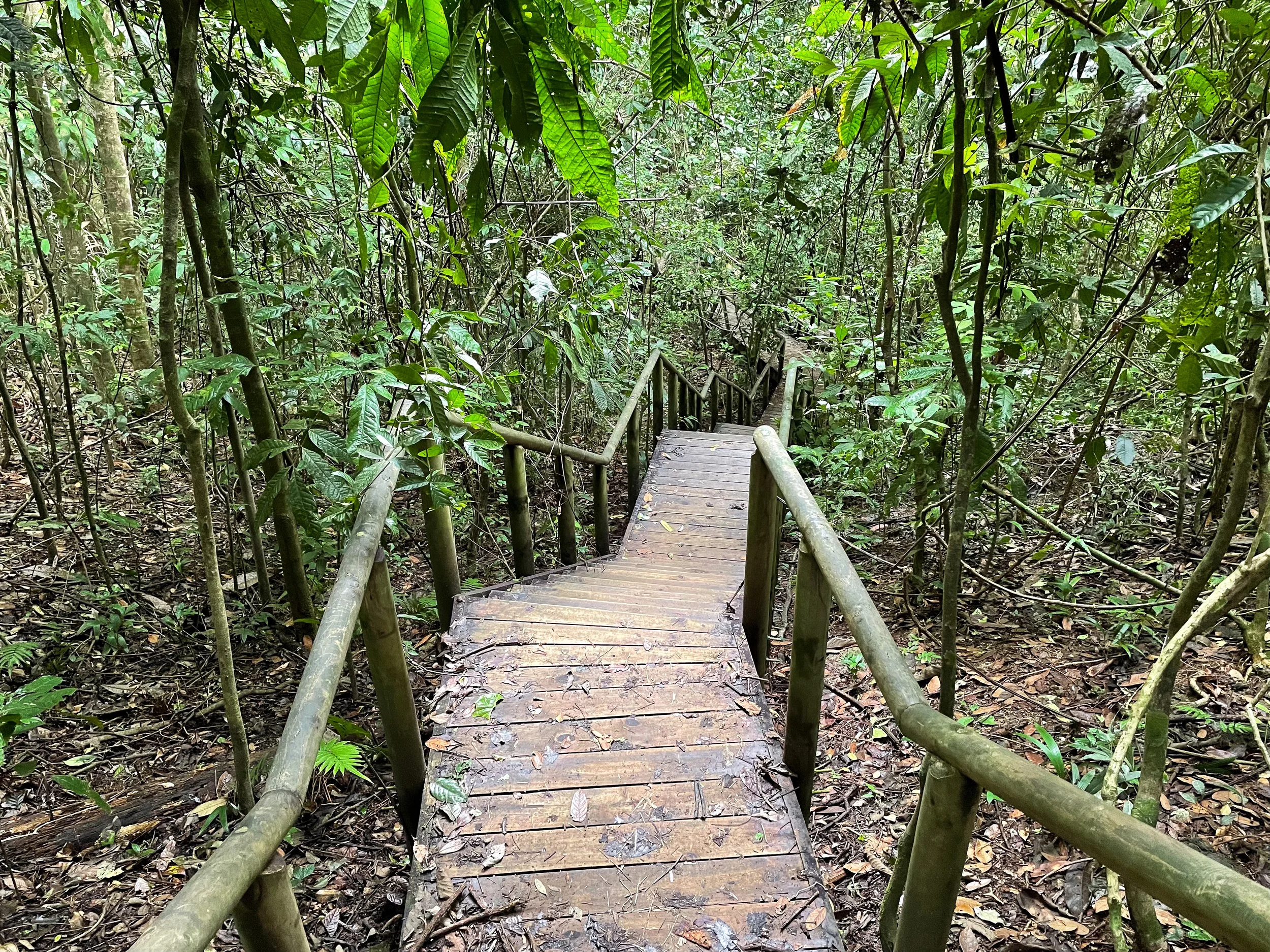
The Mistico Arenal Hanging Bridges Park is an eco park with 16 suspension bridges and nature trails weaving through the rain forest. The largest bridges are suspended over ravines and cut through the tree top canopy. The smallest bridges cross narrow streams and crevices. Massive trees, some hundreds of feet tall, line the trails alongside vibrant flowers and a small waterfall. The nature walk takes up to 3 hours at a leisurely pace while watching for wildlife and animals. The eco park has a restaurant overlooking the Arenal Volcano and verdant landscape.
Pro Tips. Arrive at 8am before the large tour groups to experience the trails and bridges mostly on your own. We bought tickets online and ahead of time to secure the earlier time slot. Book here.
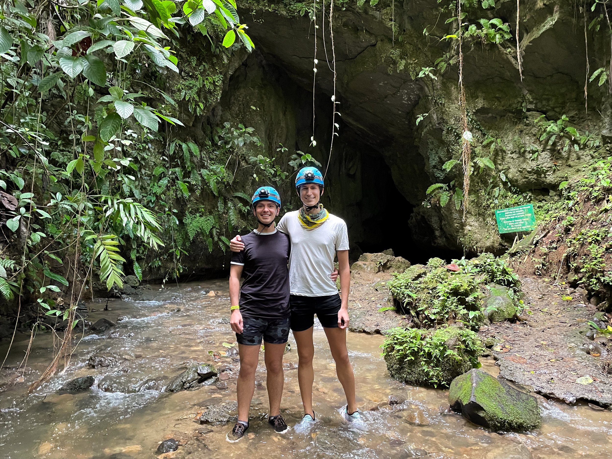
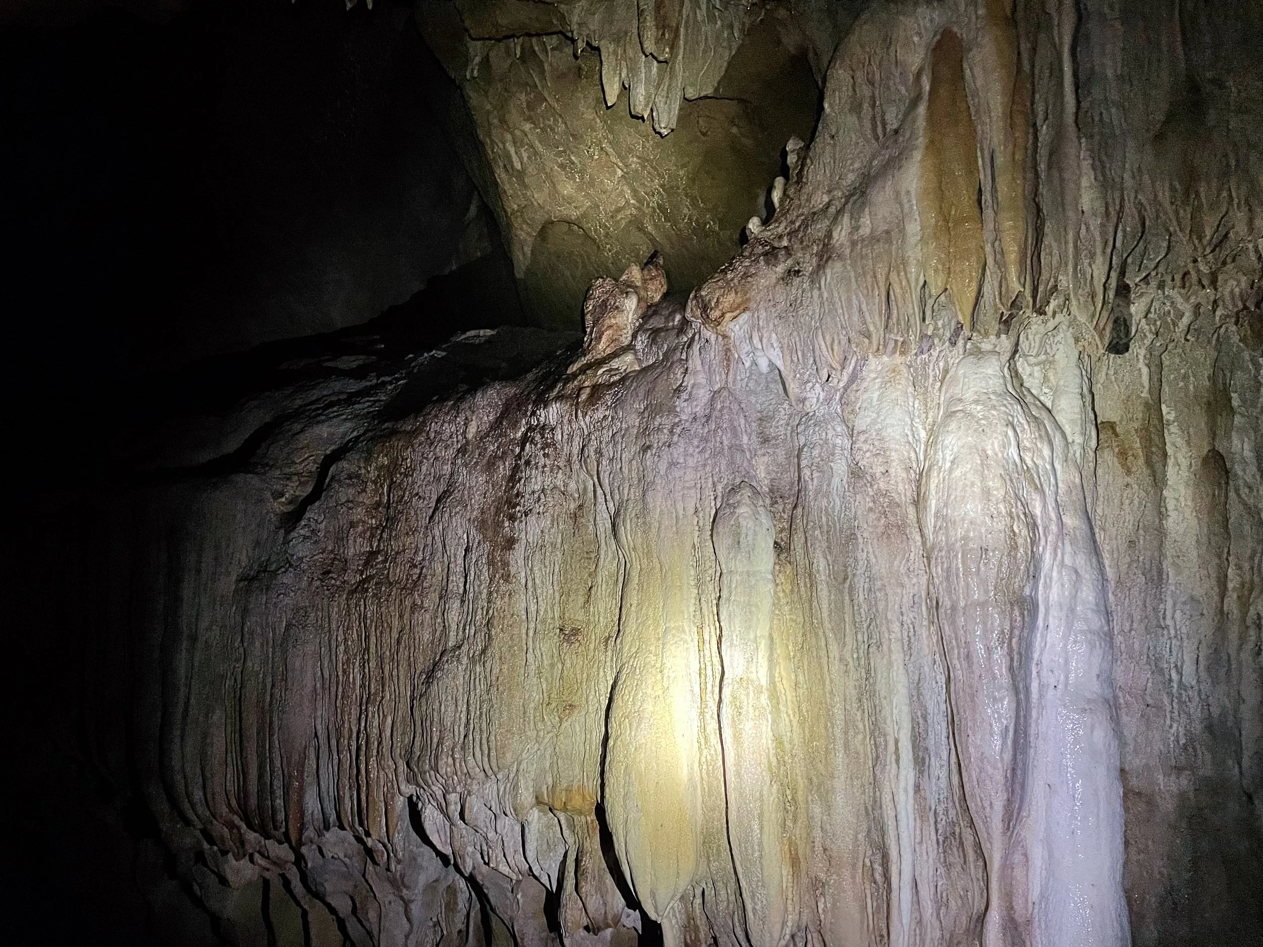
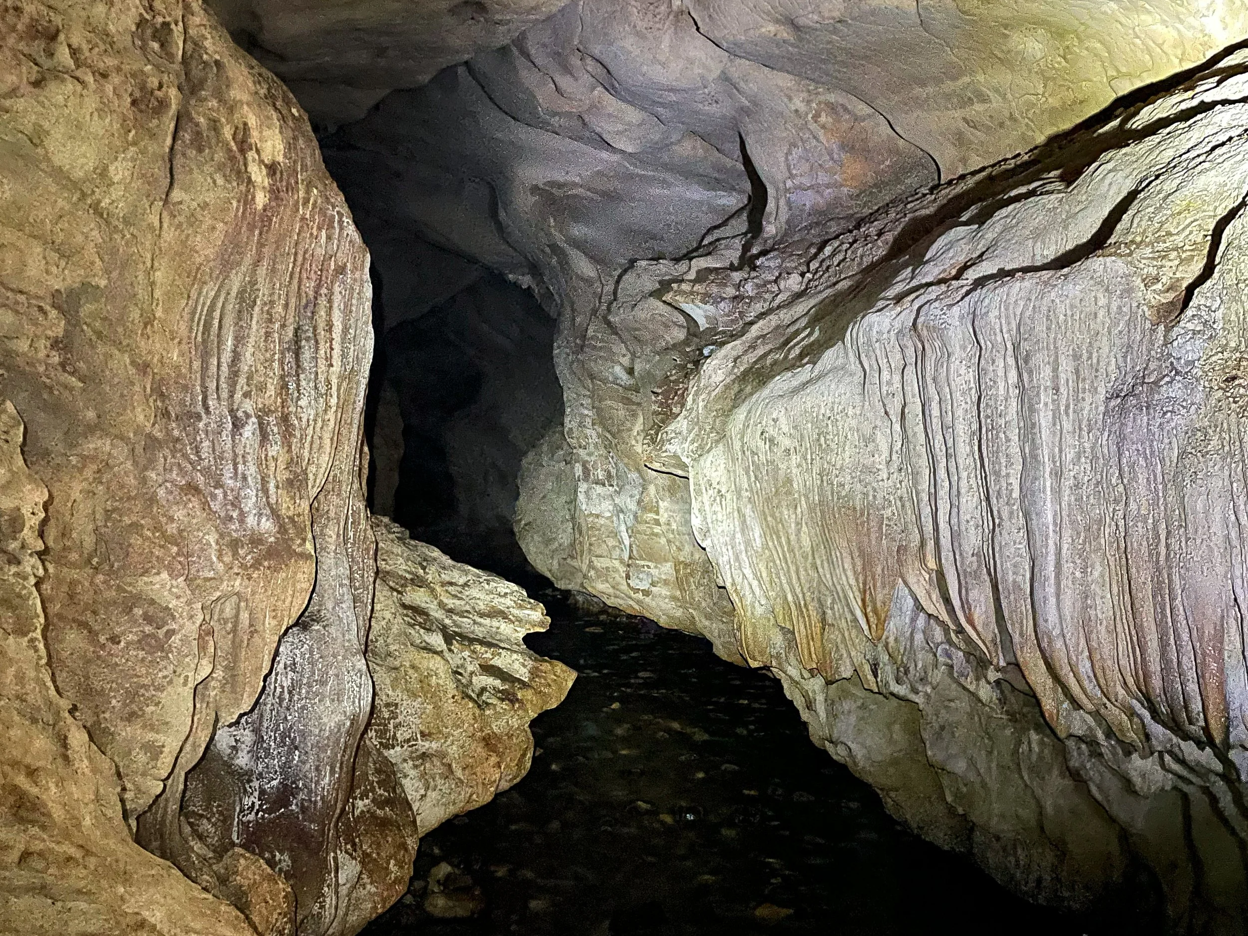
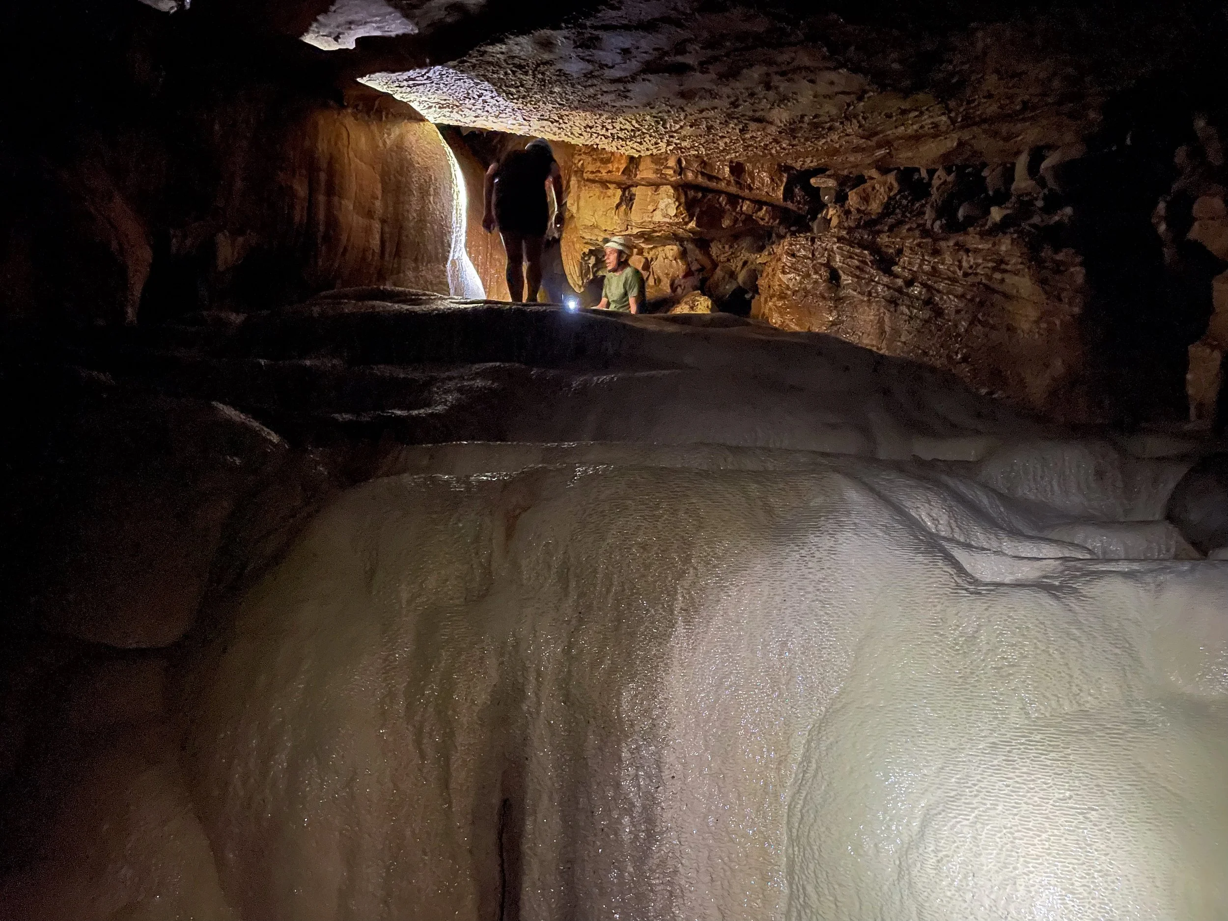
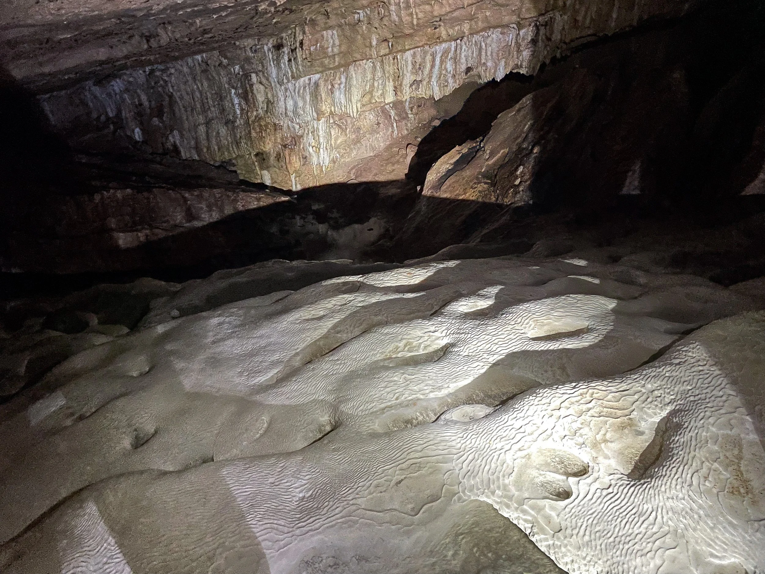
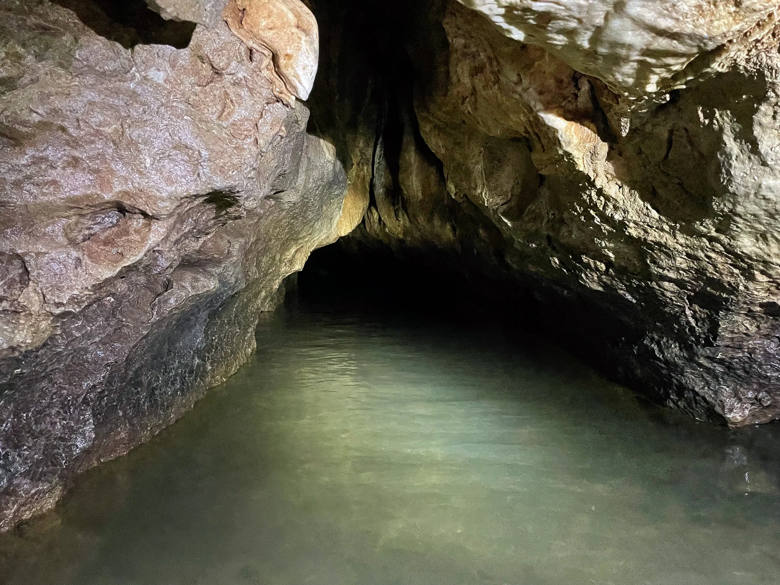
Venado Caves
The Venado Cave system is an underground network of dark chambers, flooded passageways and crystalline rock formations. Fitted with headlamps and helmets, a guide led us into its depths of its main chamber and sub chambers. Book with Ecoterra Costa Rica on Viator.
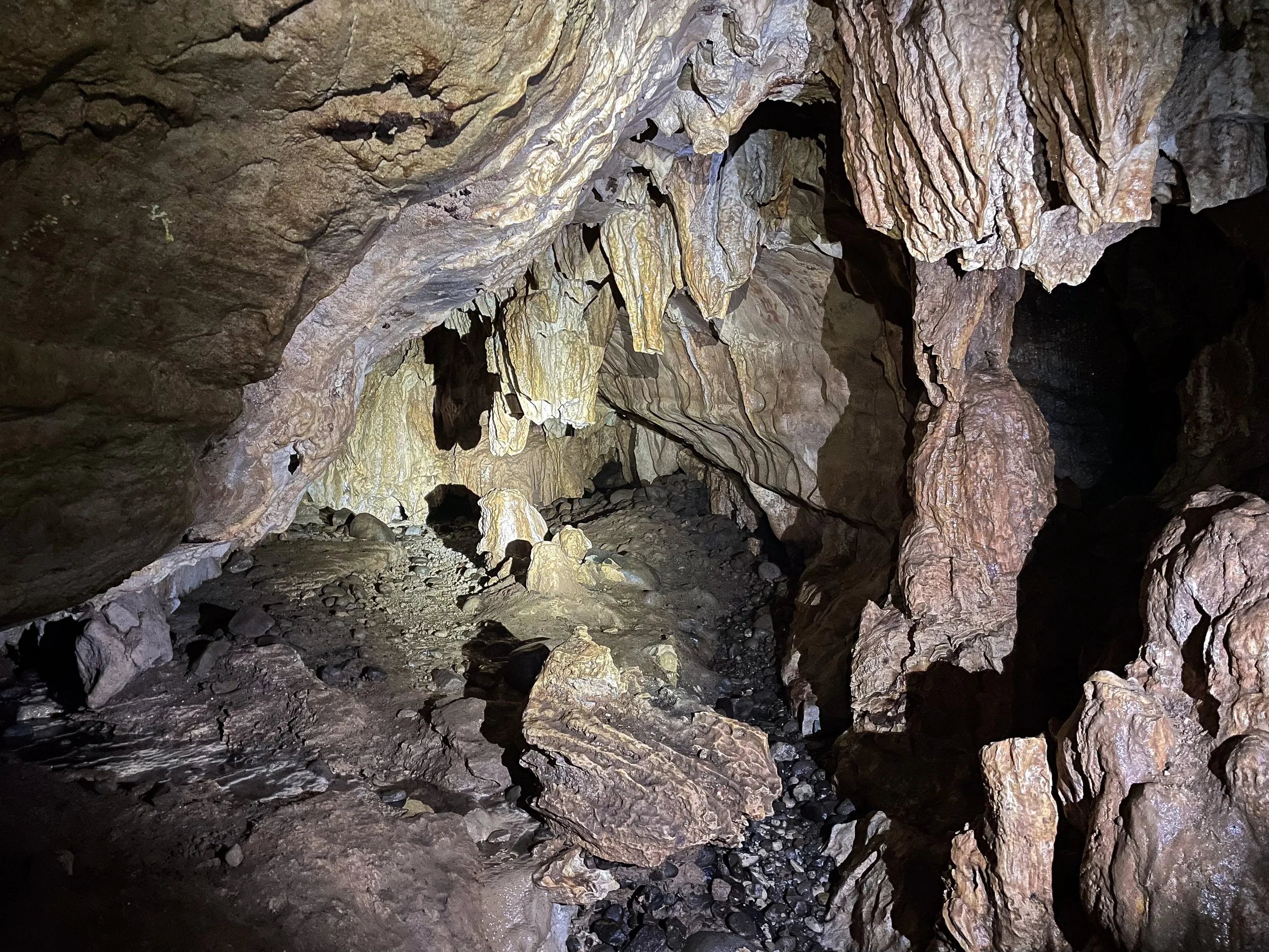
The Main Chamber. A river leads upstream into the mouth of the cave and its main chamber. The underground river continues deeper into the cave and its numerous sub chambers.
The Raining Room. A narrow passageway led through an 18 inch wide crevice to the “Raining Room.” Water dripped from the ceiling and down the chamber walls as if raining underground. We shimmied and climbed 10ft vertically back into the main chamber.
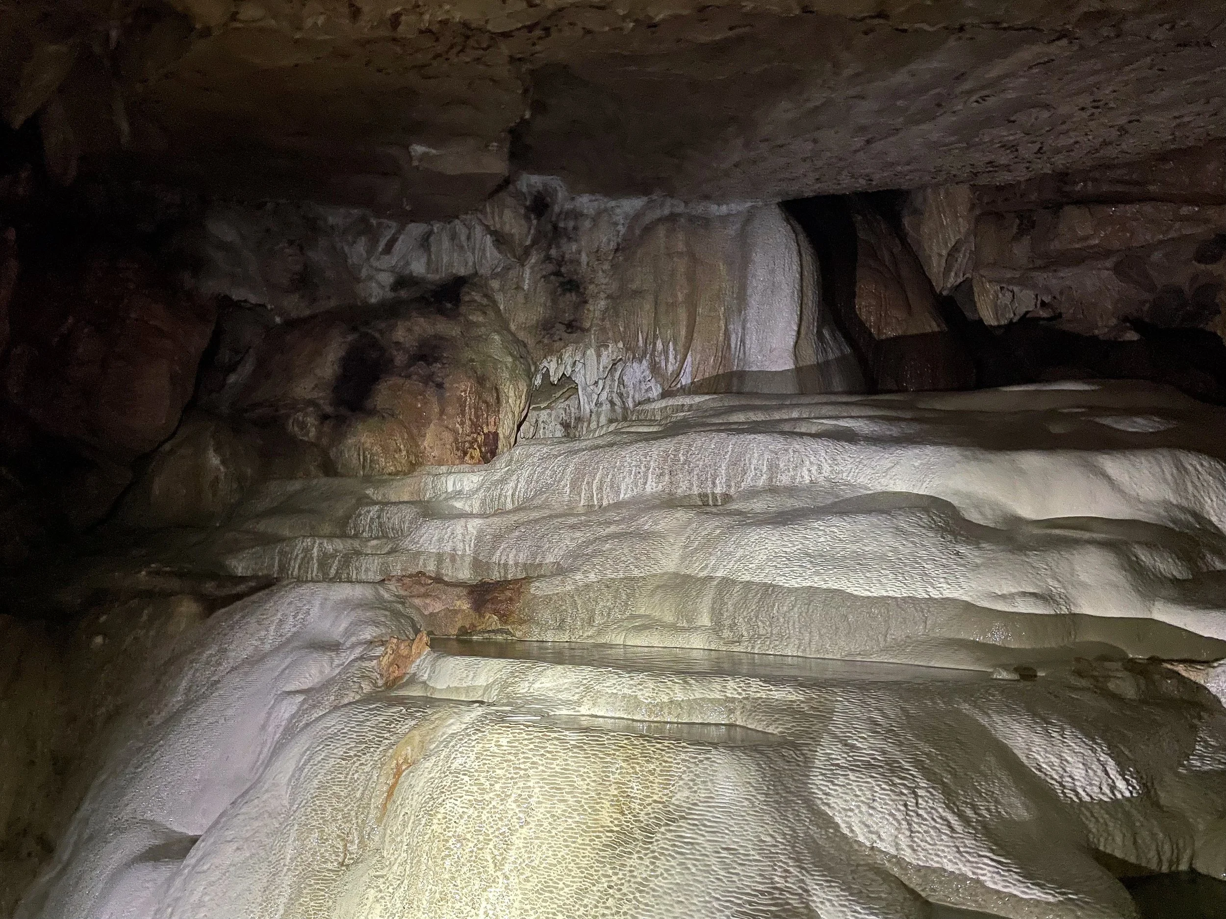
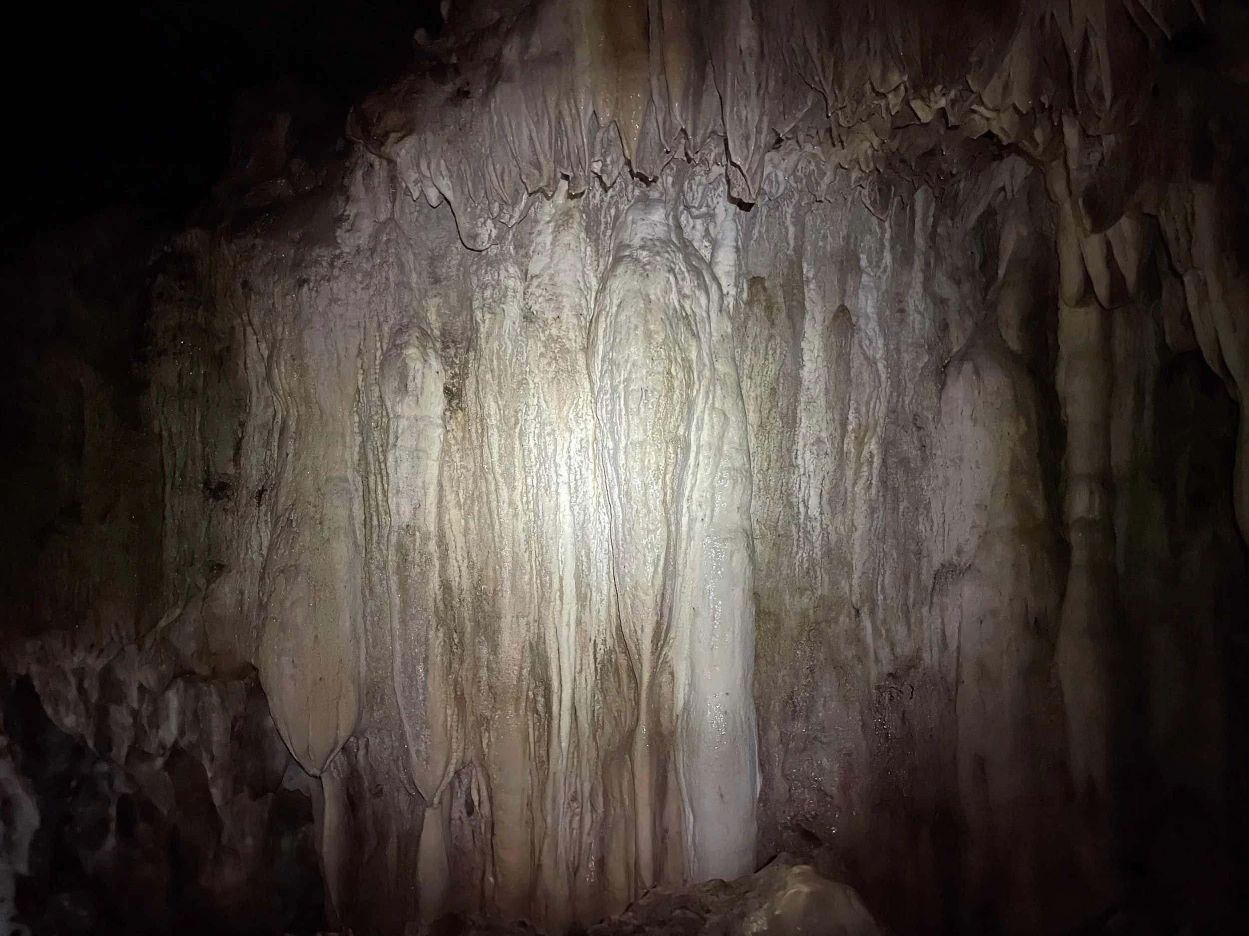
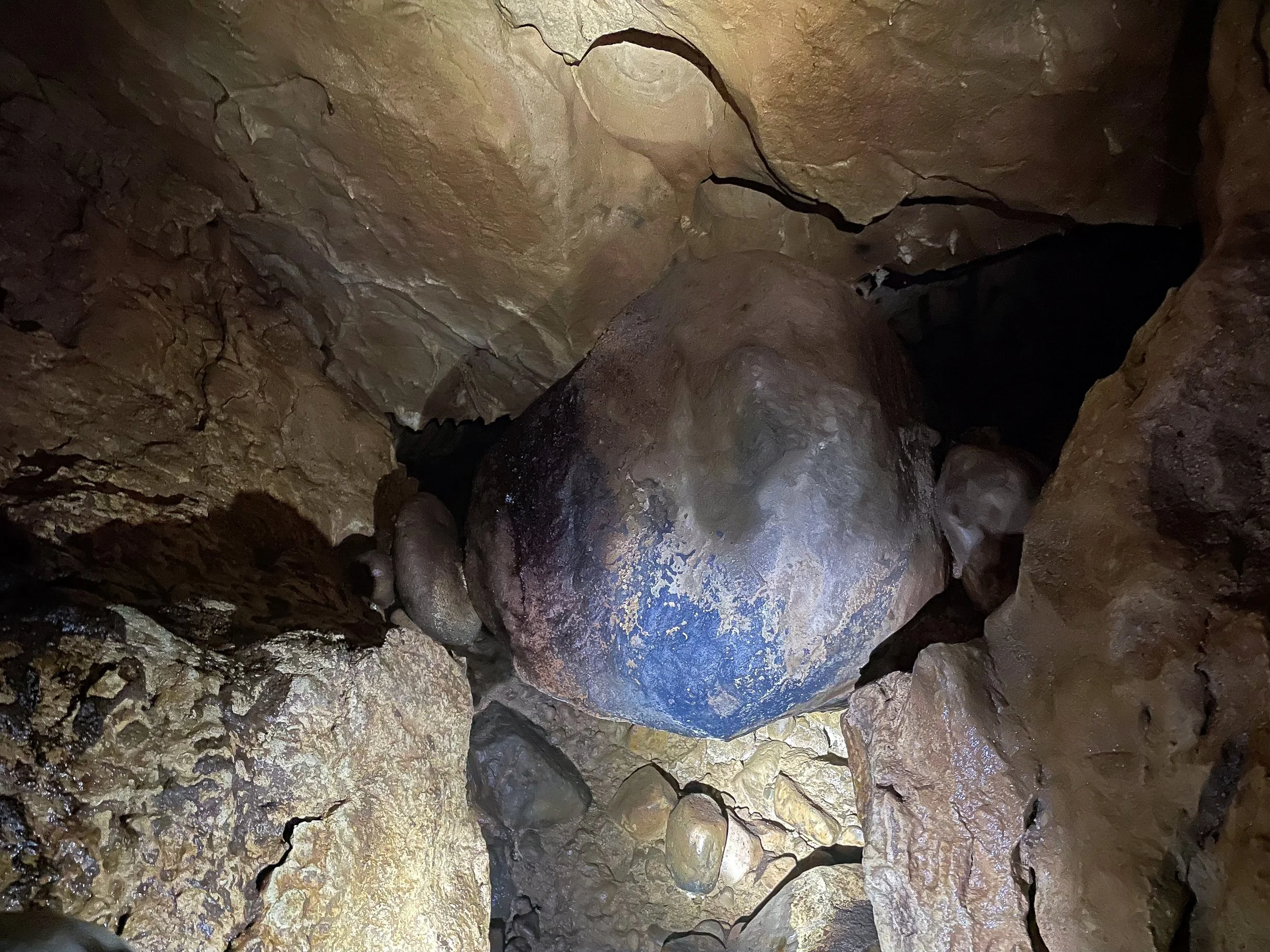
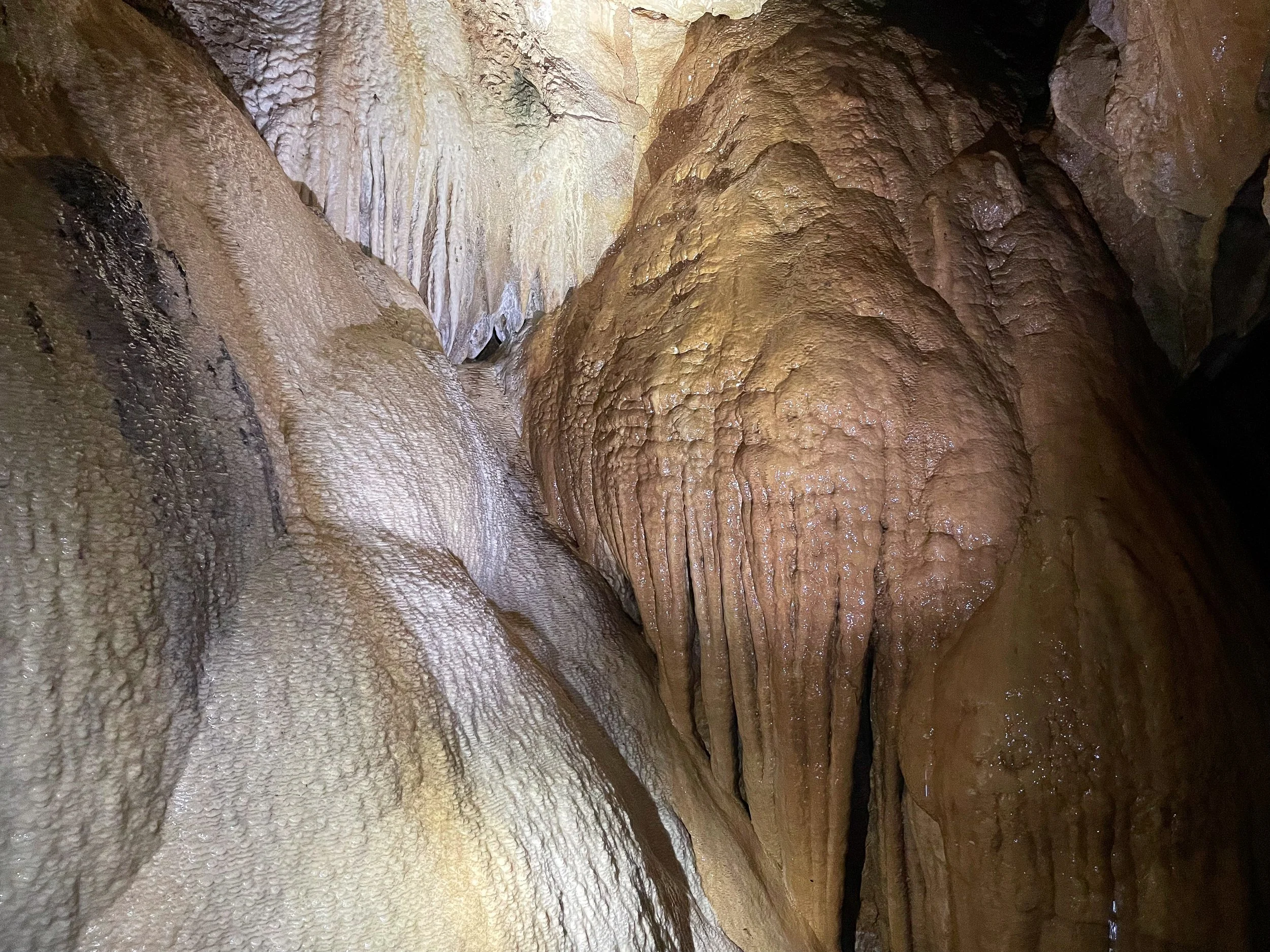
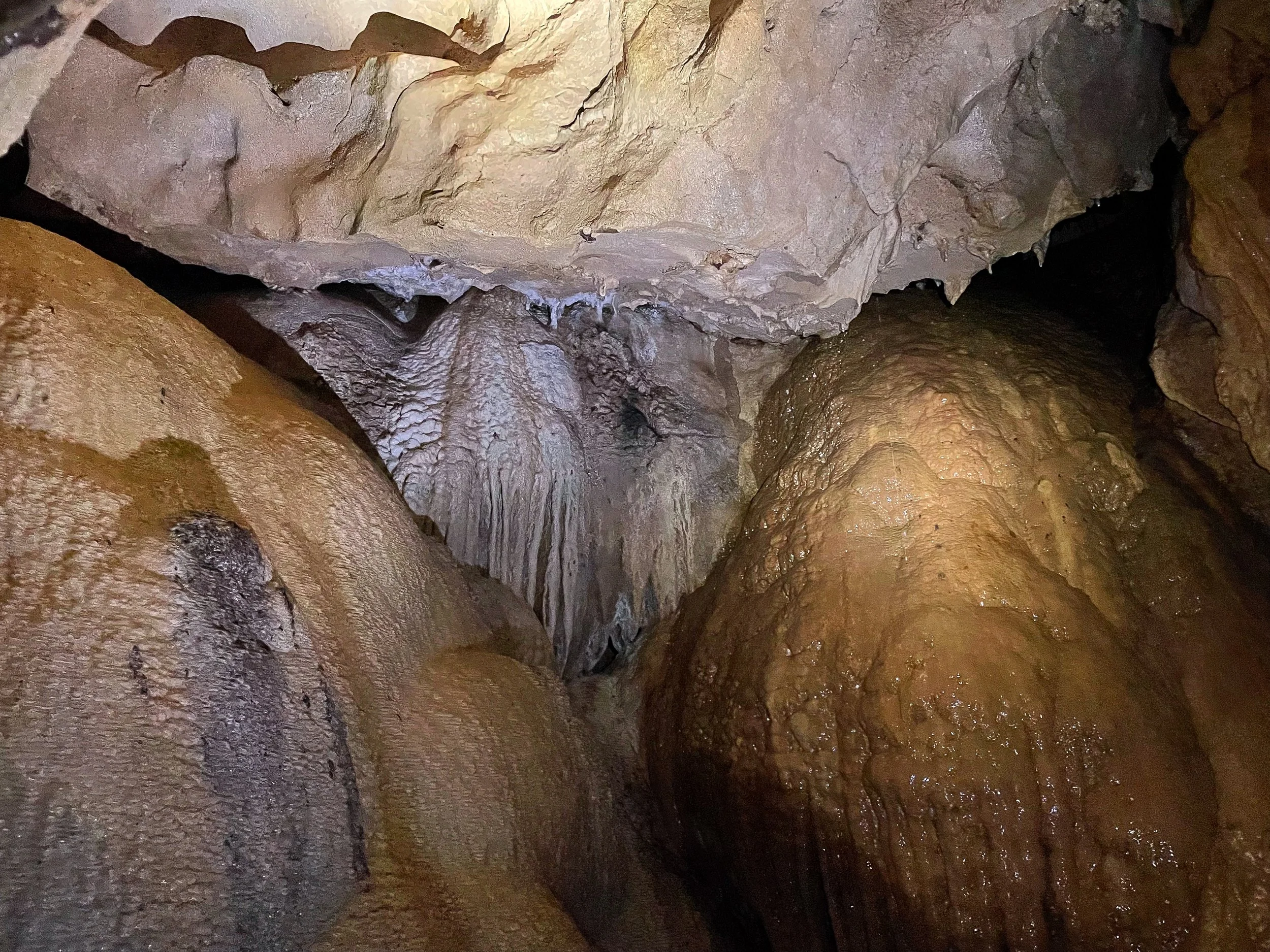
The Waterfall Room. The main chamber led to an underground waterfall with a secondary chamber hidden behind it. The room beyond is covered in a tiered flow stone comprised of sparking and rippled layers of sediment.
The Papaya Room. A chamber accessible by ladder from the “Waterfall Room” with a several million year old flow stone that resembles the shape of a papaya.
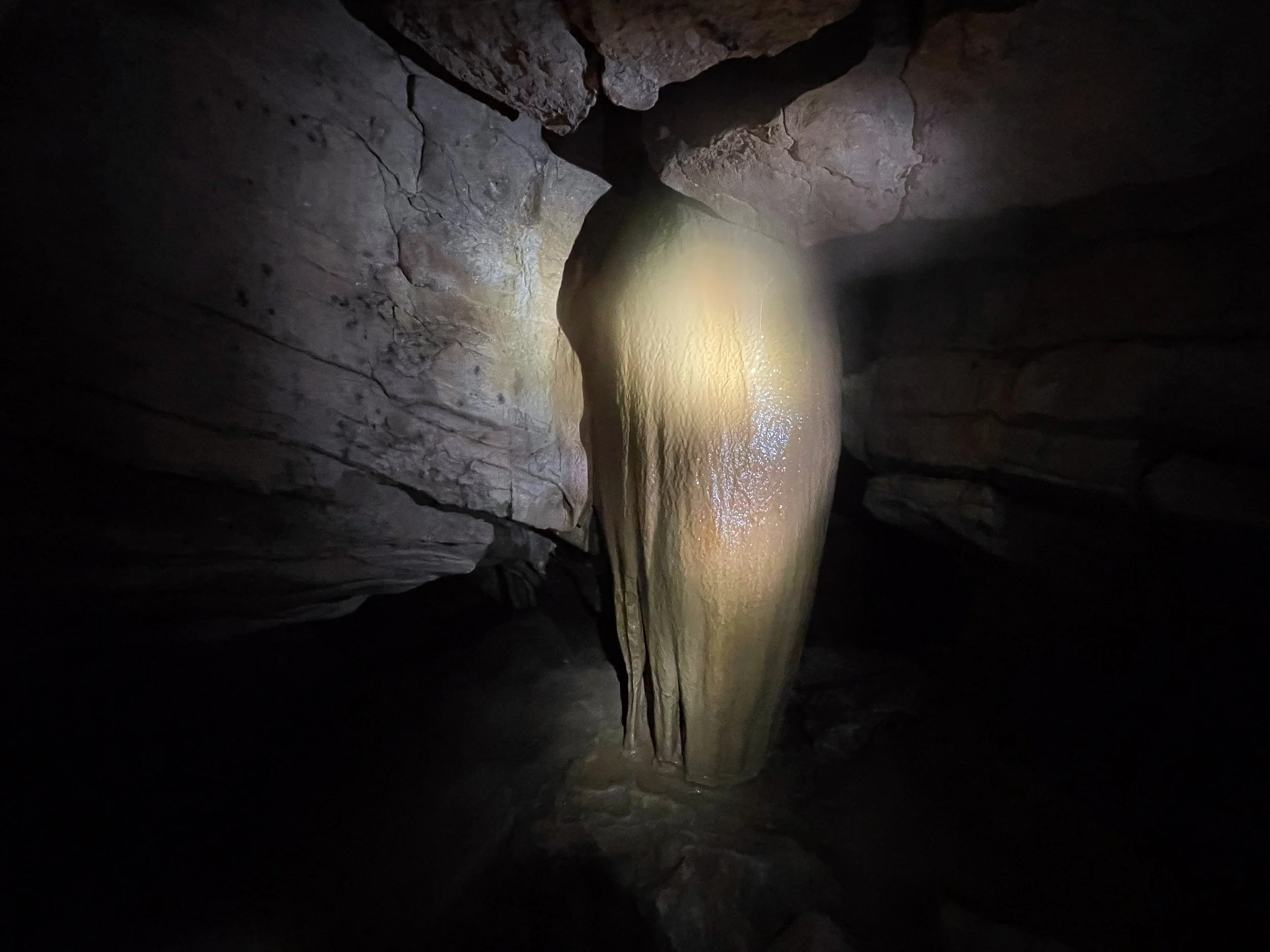
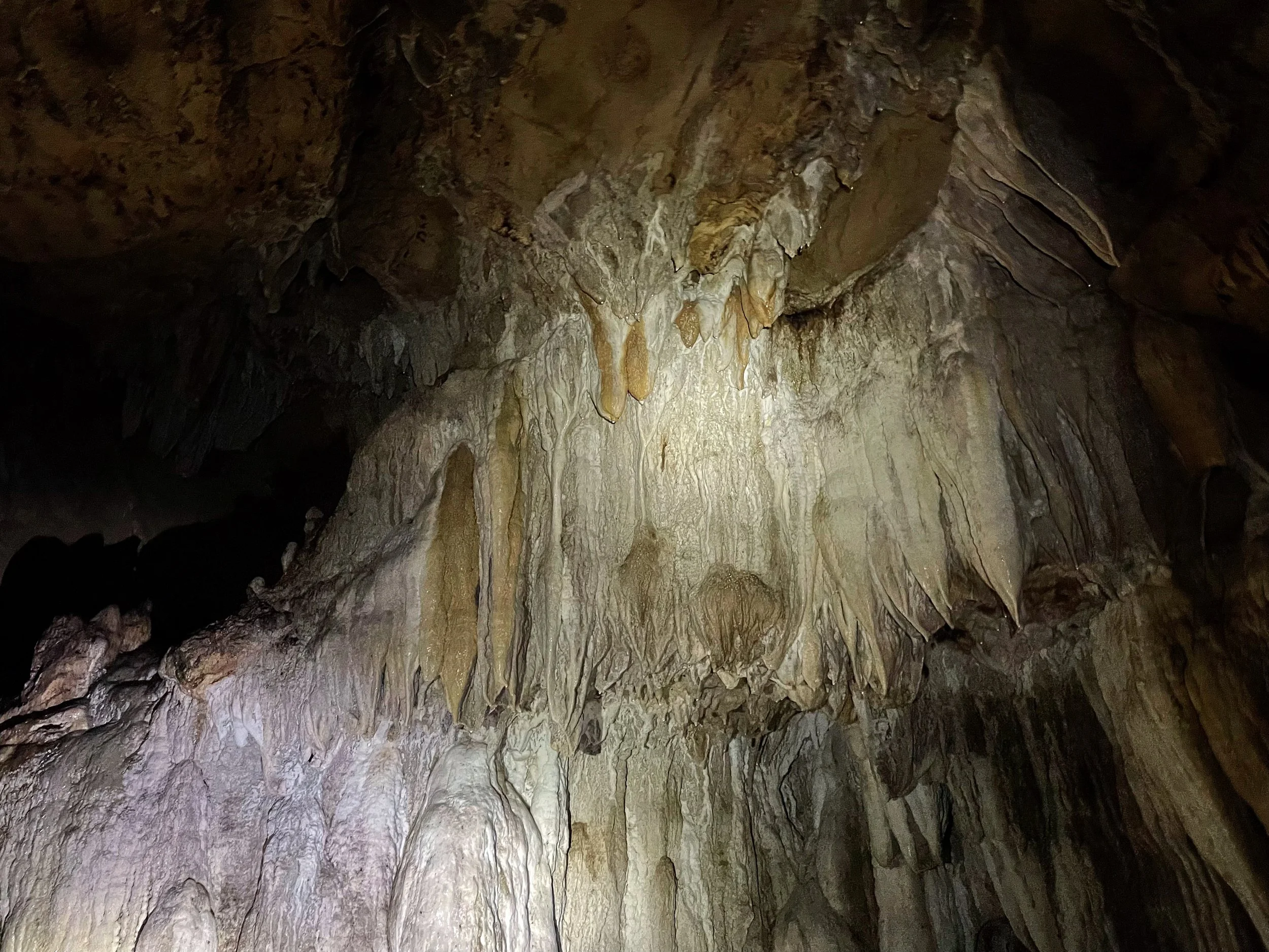
The Flooded Tunnel. The sub chambers continued deeper into the cave past stalactites and stalagmites to a “Flooded Tunnel,” only large enough to crawl through with our heads above the surface of the water.
The Indiana Jones Room. The “Flooded Tunnel” continued into a narrow crevice only wide enough to fit through sideways. It led to the “Indiana Jones Room,” a chamber with a rushing waterfall and round boulder suspended between two rocks.
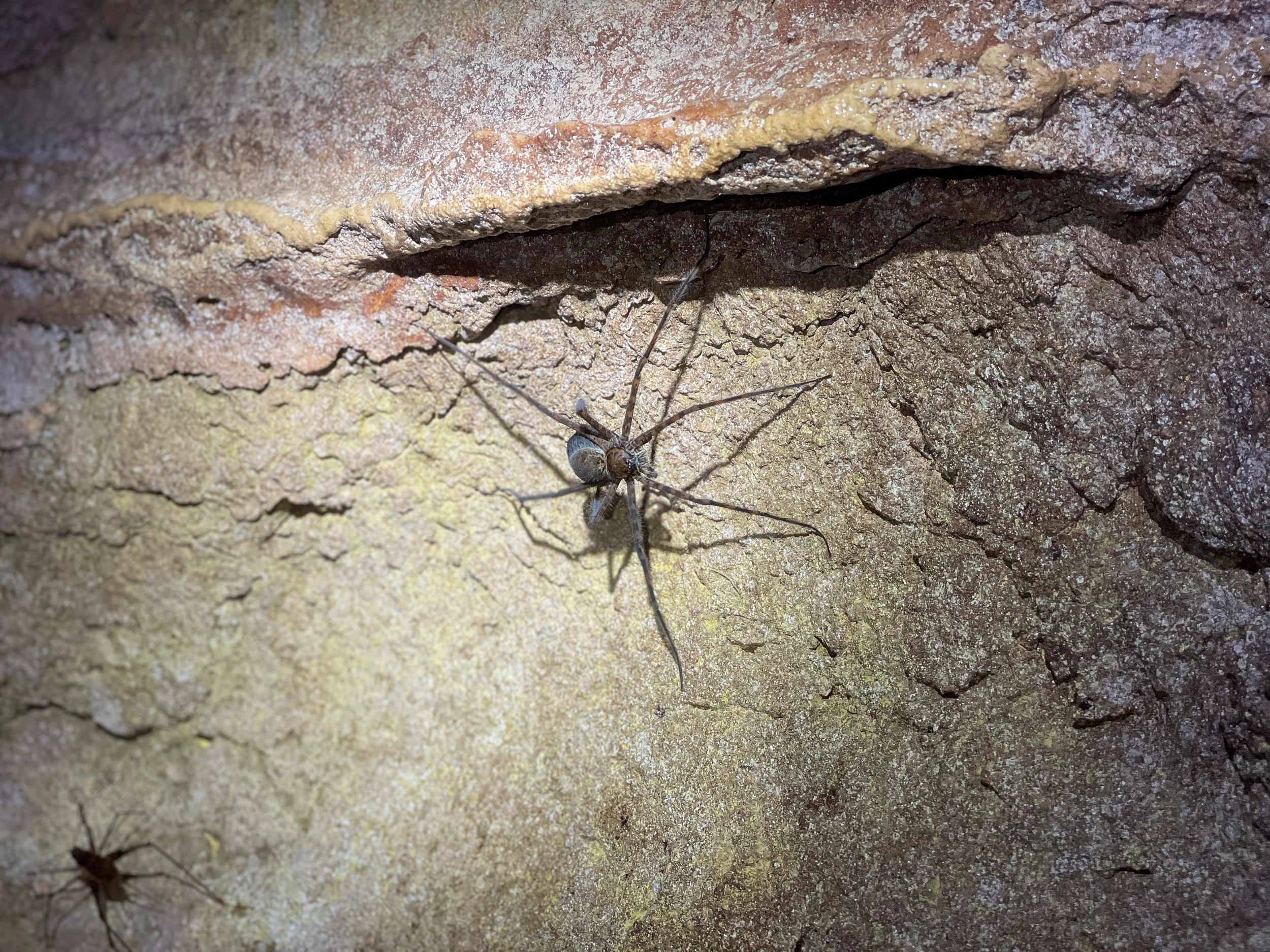
An Underground Ecosystem. The cave is home to an underground ecosystem of cave dwelling creatures. Fruit and vampire bats hung from the ceilings and fluttered around its chambers. Large cave crickets, cockroaches and scorpion spiders lurk on cave walls. Catfish swim downriver and between chambers.
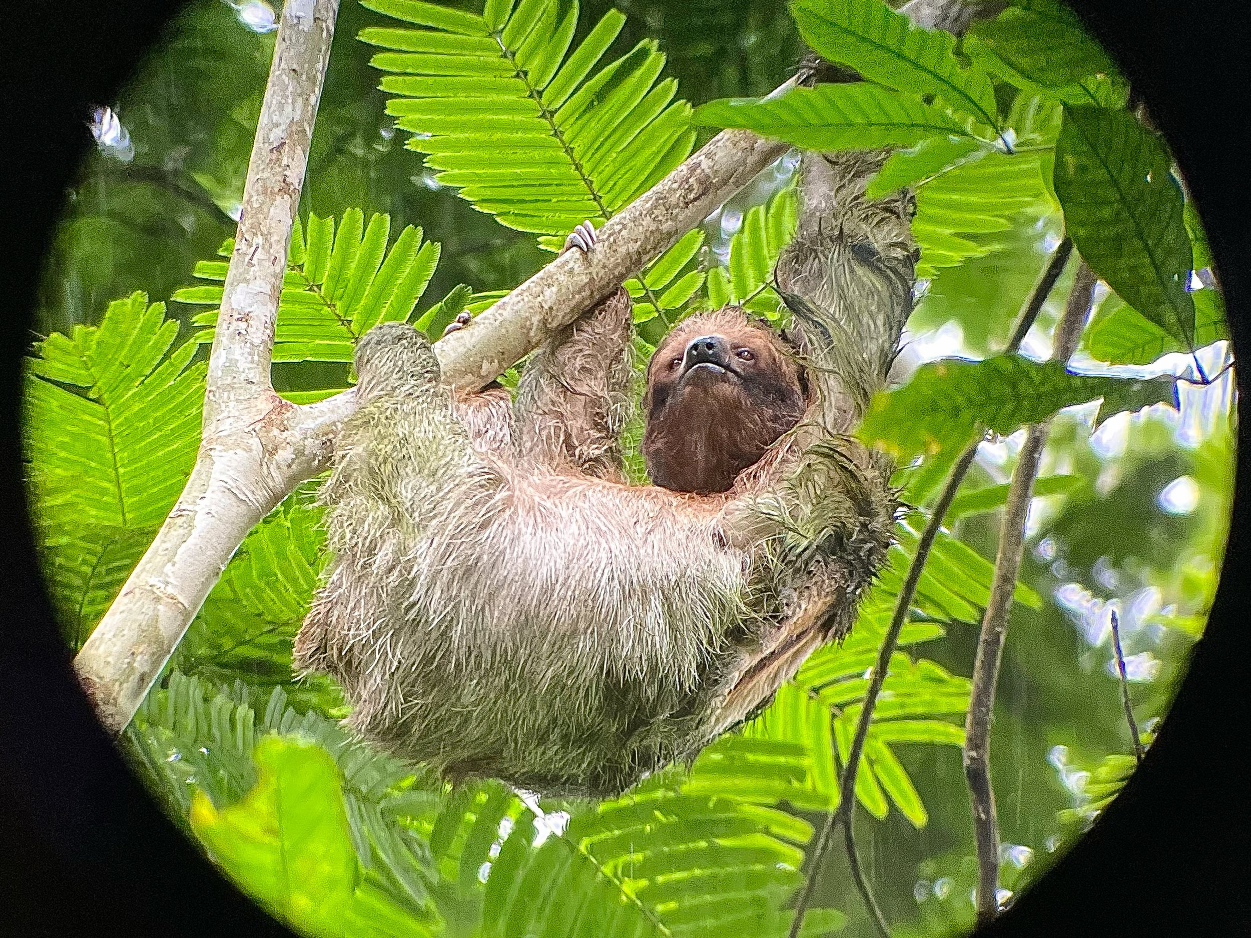
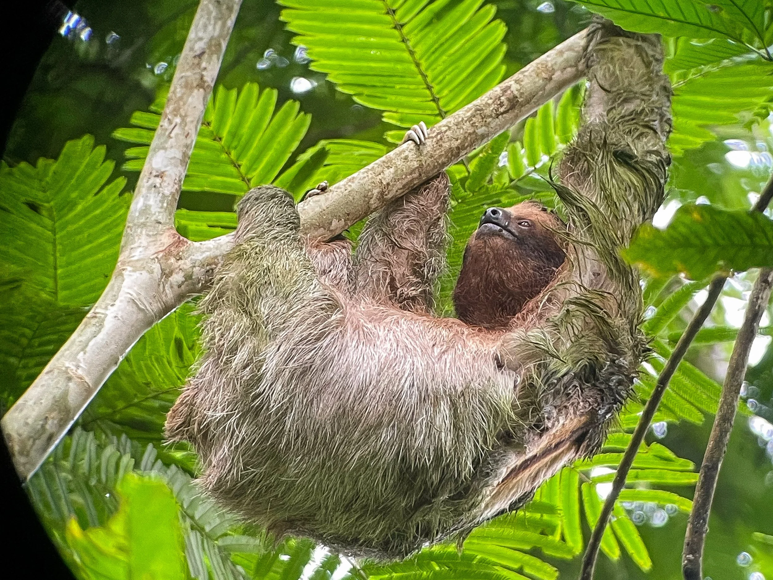
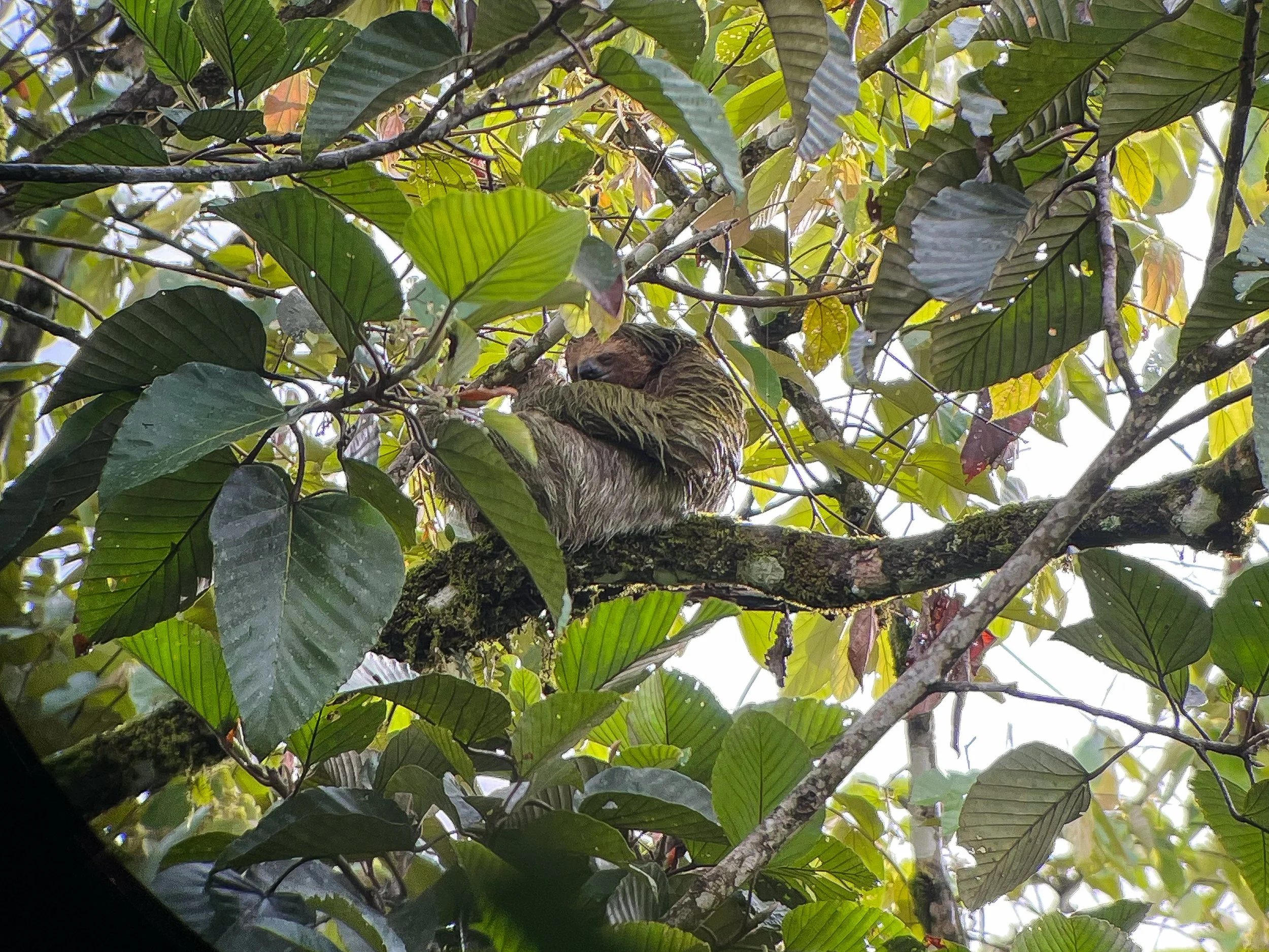
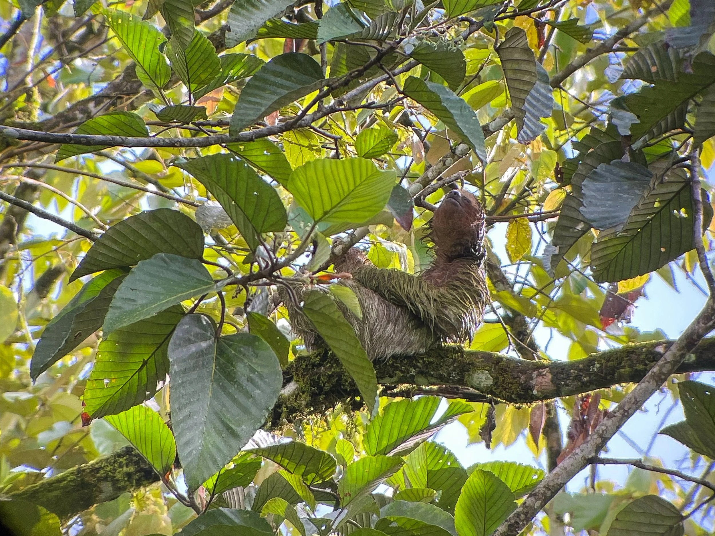
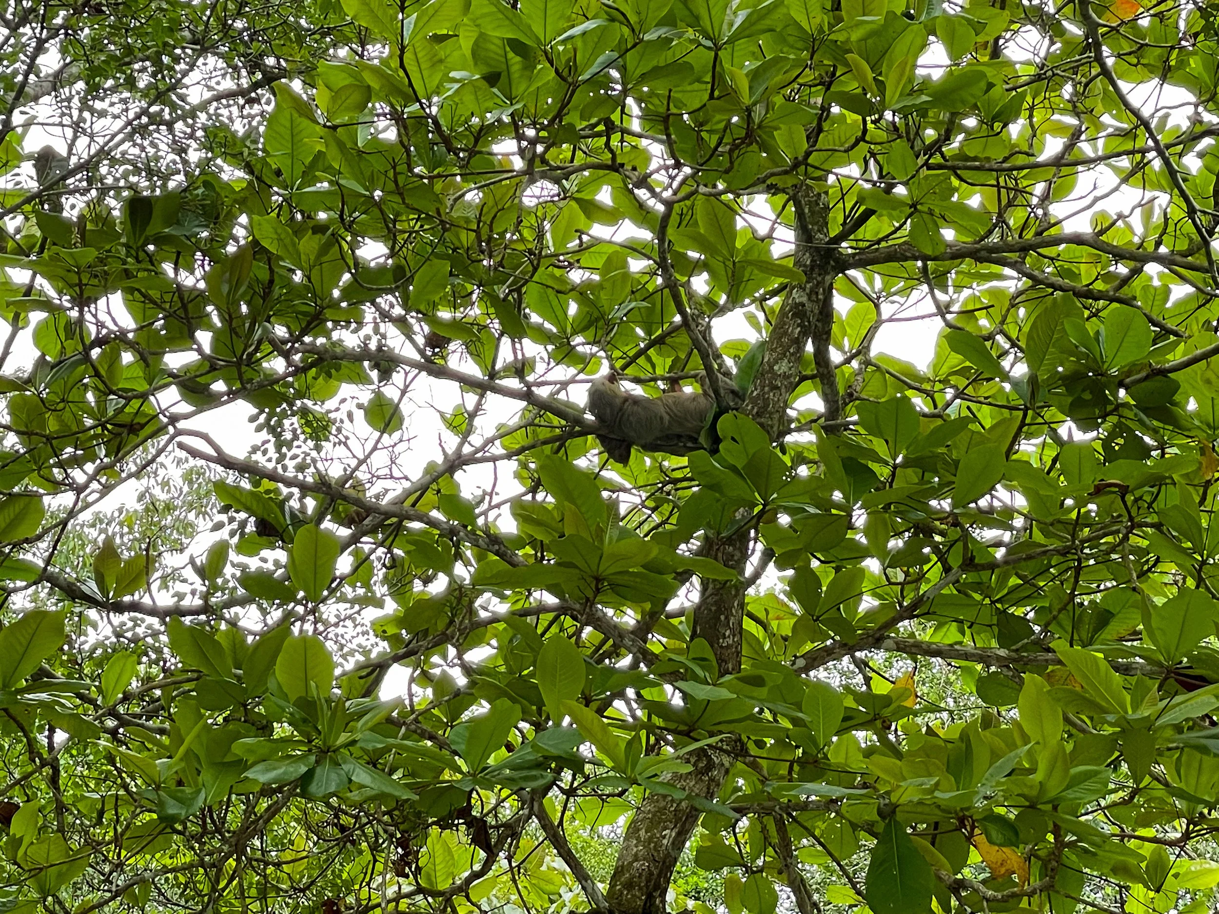
Sloth’s Territory
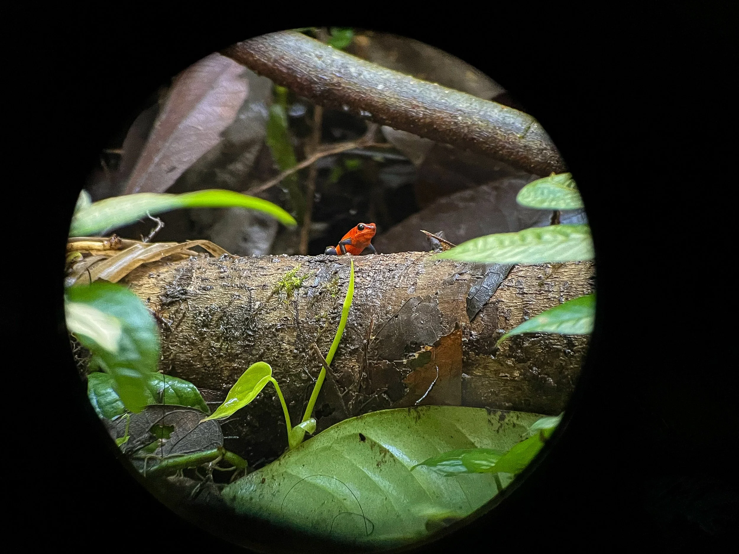
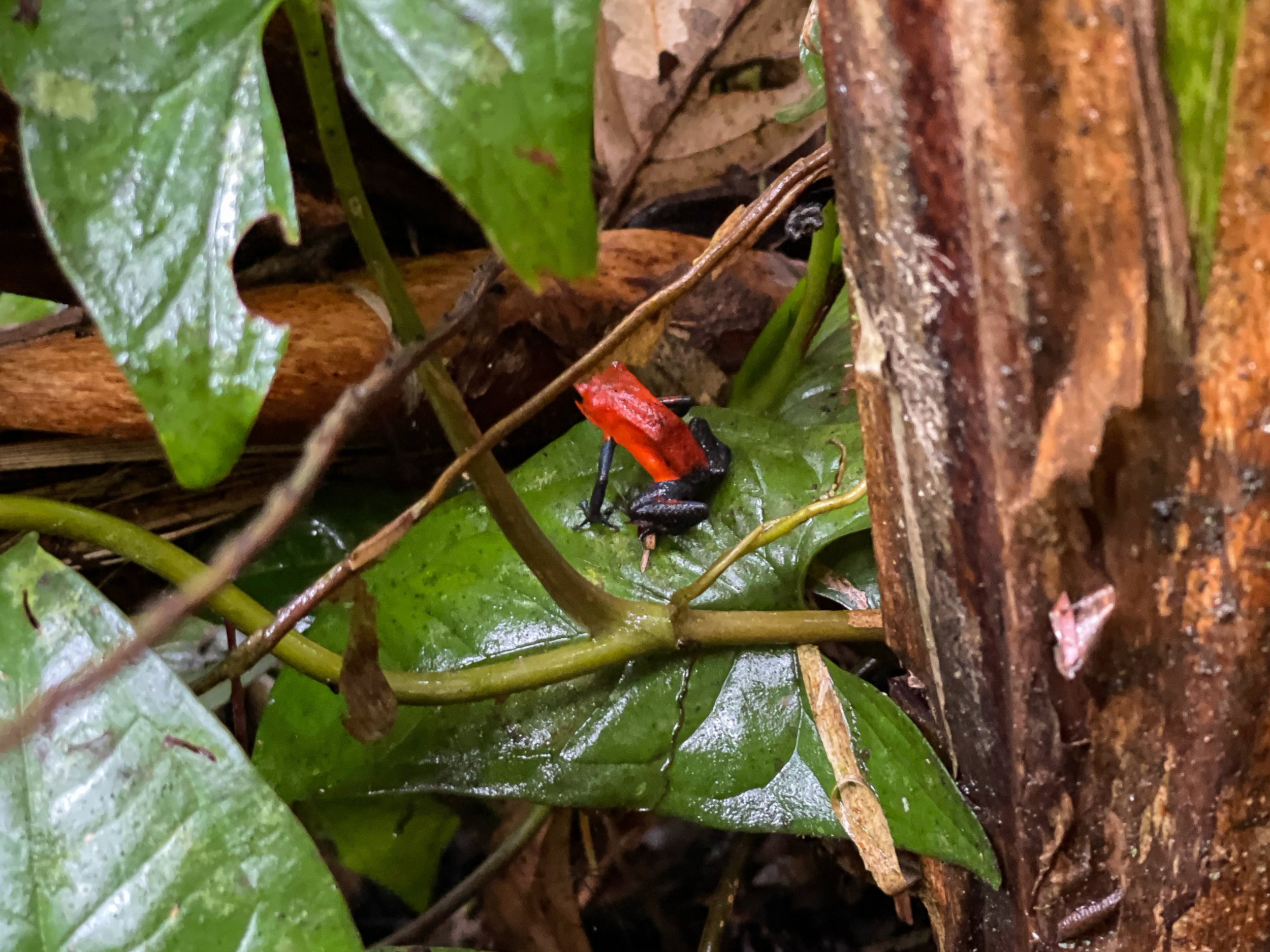
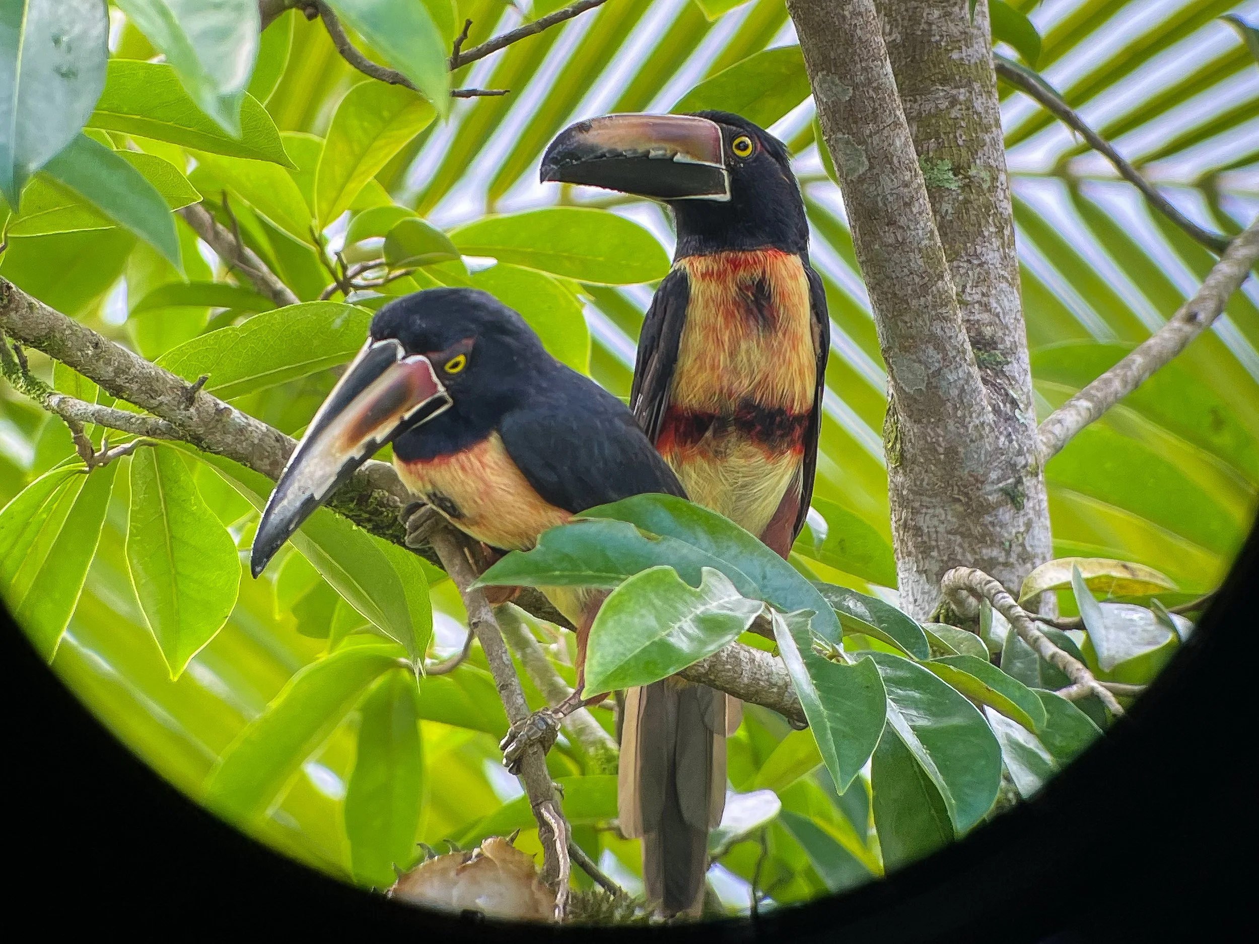
Sloth’s Territory is a nature preserve and protected habitat where sloths freely roam. Led by a guide, we walked through the preserve’s trails spotting several sloths climbing trees, sleeping in the sun and eating leaves. We even spotted a baby sloth slowly climbing alongside its mother. In addition to sloths, we spotted toucans and tiny red and blue poison dart frogs.
Sloth Spotting Tips. Look for trees with large 5 pointed leaves that resemble stars. These trees are tall and thin with white and brown bark. Look for dark masses sitting on tree branches. They are often sloths curled up and sleeping.
La Fortuna
A small town at the base of the Arenal Volcano with restaurants, hotels and souvenir shops. We stayed here while exploring the nearby sights.
Brisas Arenal Hotel. An eco-hotel with individual wooden cottages, nearby nature trails and views of the Arenal Volcano. The main guest house has a restaurant that delivered us fruit bowls and coffee for breakfast and a fridge to buy beers from during the evening. Book here!
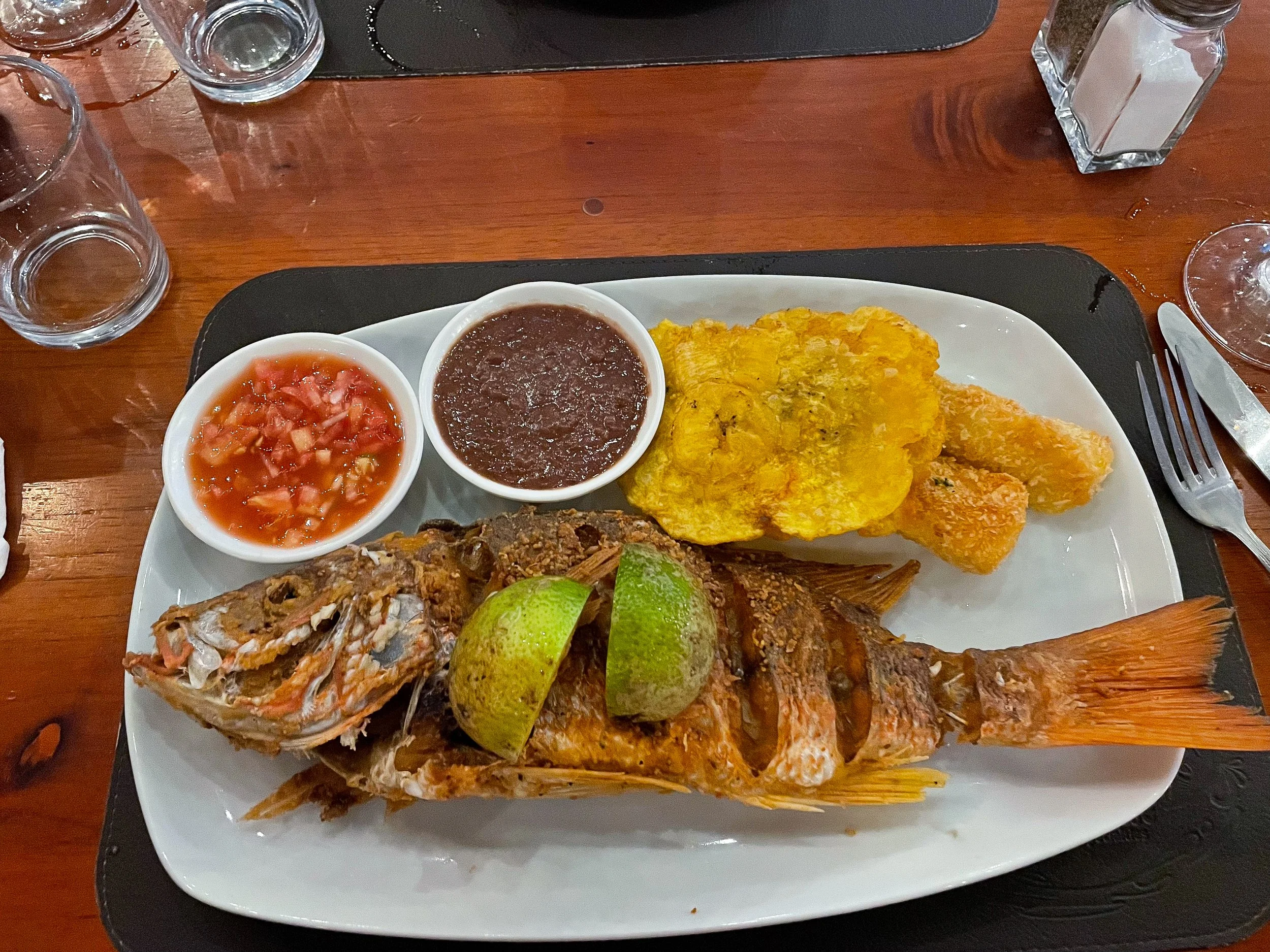
Snapper. A seafood restaurant with a tasty menu. We ordered volcano margaritas (spicy margs), seared tuna, baby shrimp arepas, a whole fried snapper, coconut seafood stew and tres leches.
On The Road
After leaving La Fortuna, we began our drive to Manuel Antonio stopping at a scenic overlook for lunch, to see a crocodile infested river and for a sunset dinner on the beach.
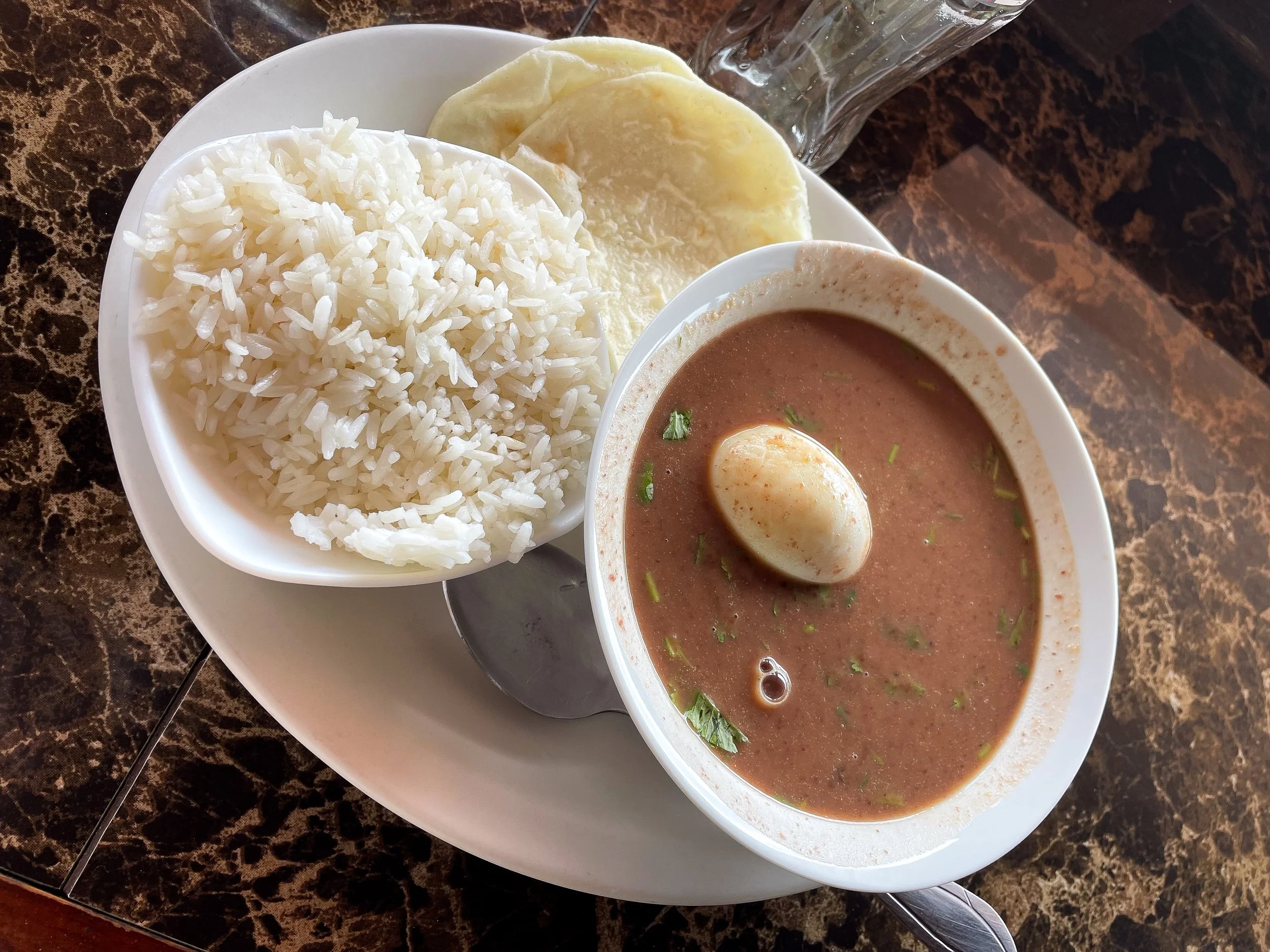
La Casita del Café. A roadside restaurant perched on a cliff with panoramic views of the lush and rugged mountainous landscape. We shared two common Costa Rican dishes, Sopa Negra and Casado.
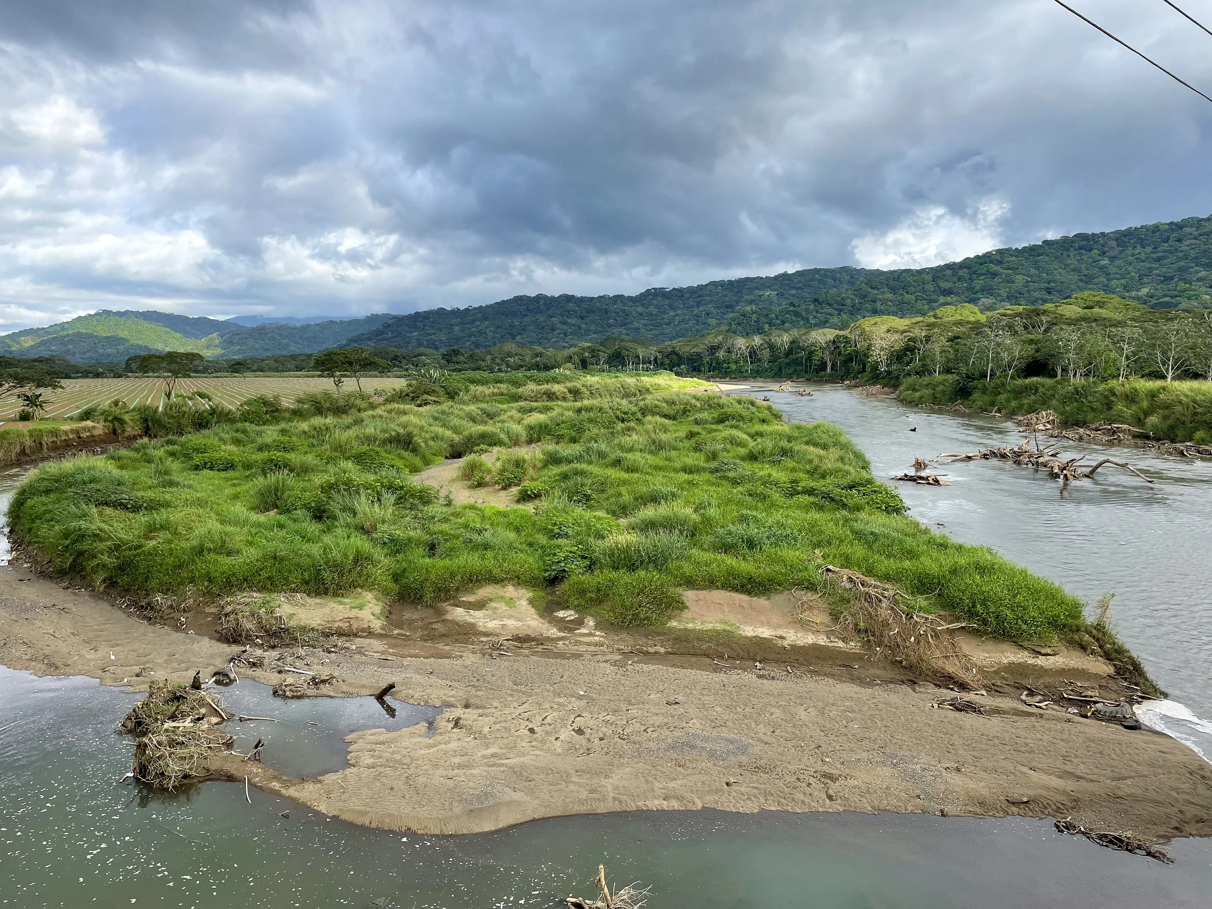
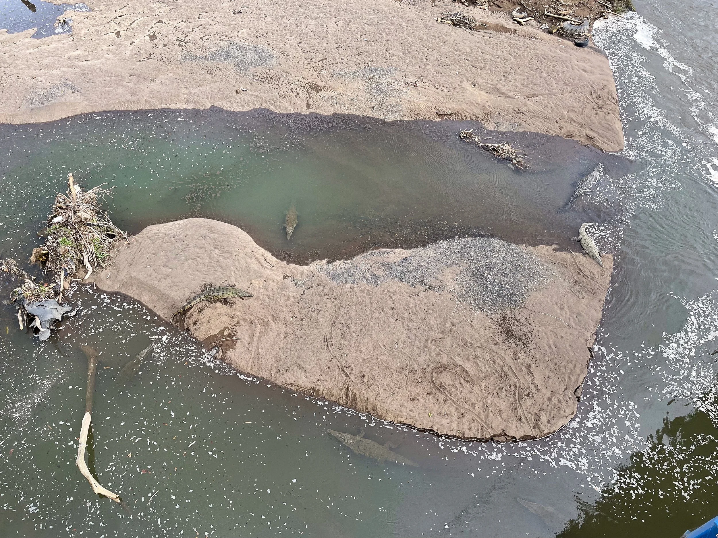
Río Tarcoles. A river on the route to Manuel Antonio known for its massive crocodiles. We parked at a souvenir stand and walked to the bridge overlooking the river. From here we saw dozens of 12ft long crocodile swimming and resting along the islands and banks of the river.
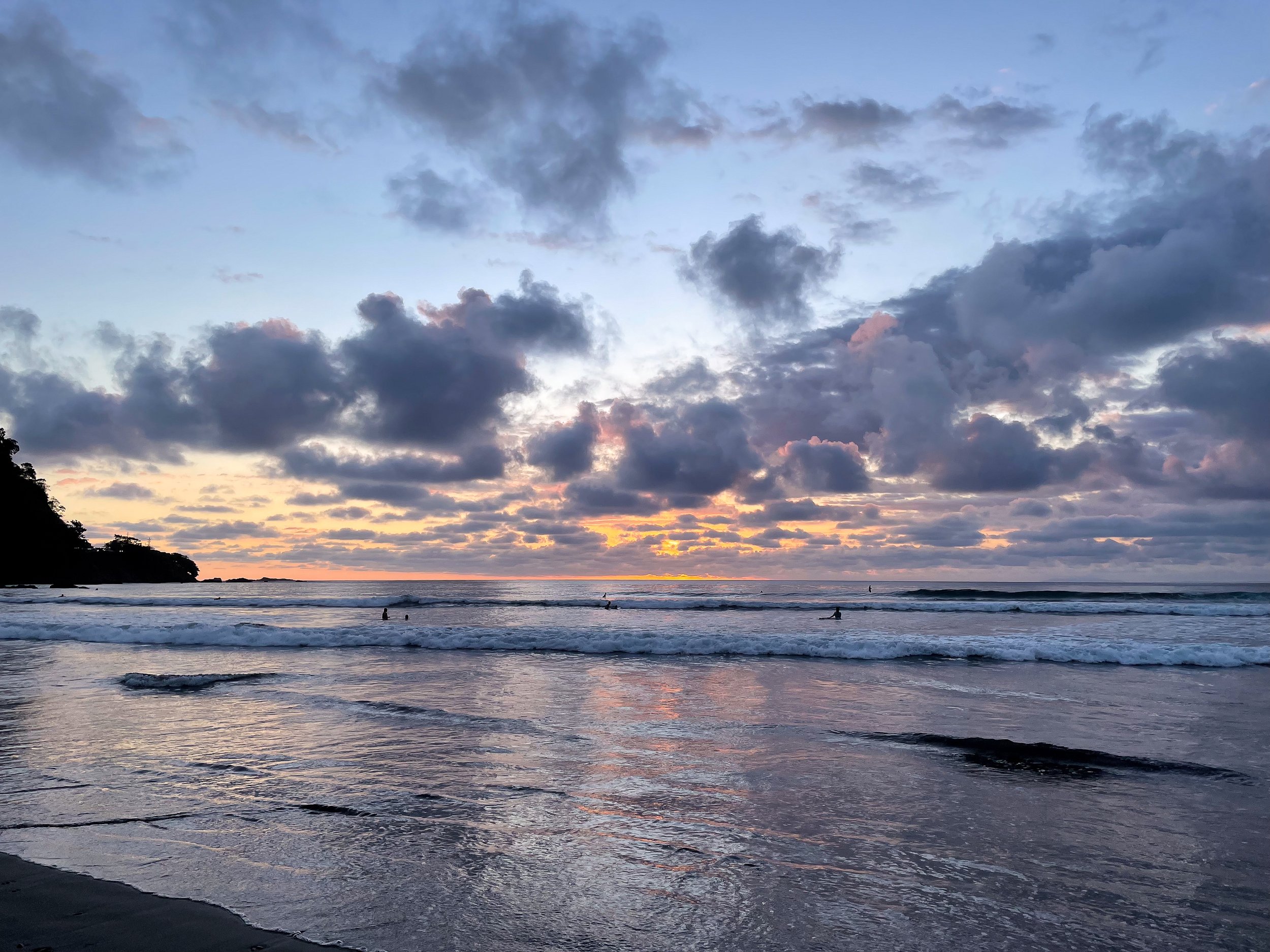
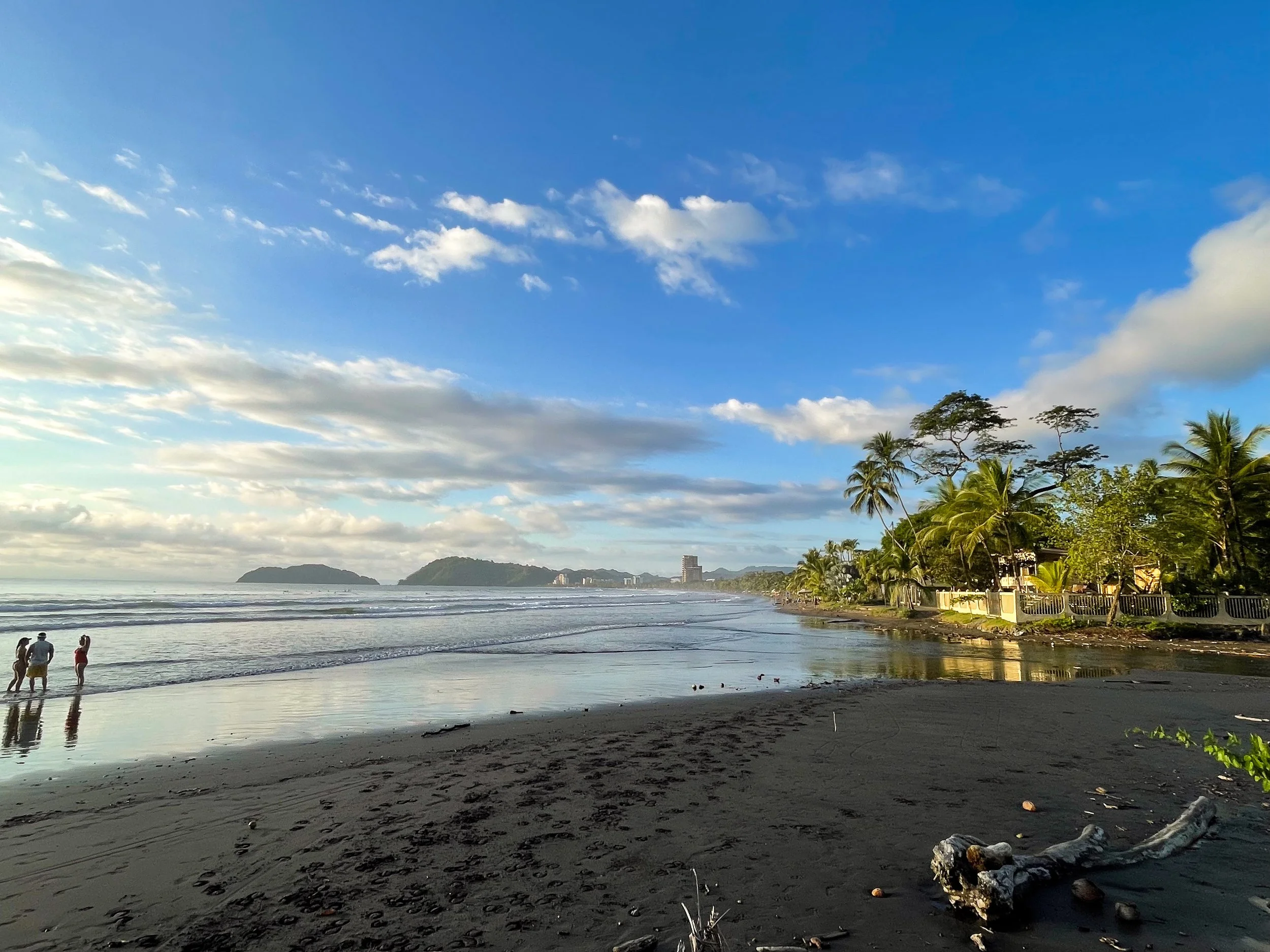
Jacó Beach. A beach town with a lengthly palm lined beach with a dark sandy shore, surf schools and waterfront restaurants. We enjoyed a sunset dinner at a spot called Tiki Bar. Come for the fish tacos, shrimp skewers and tropical cocktails.
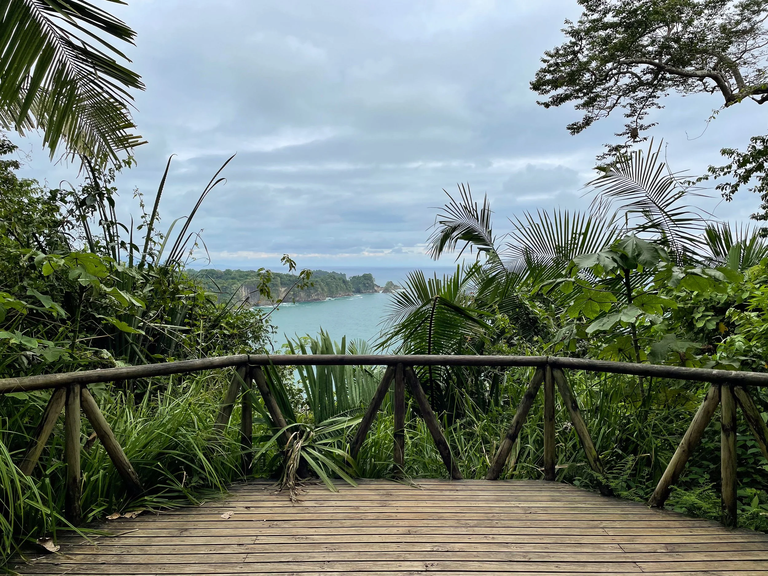
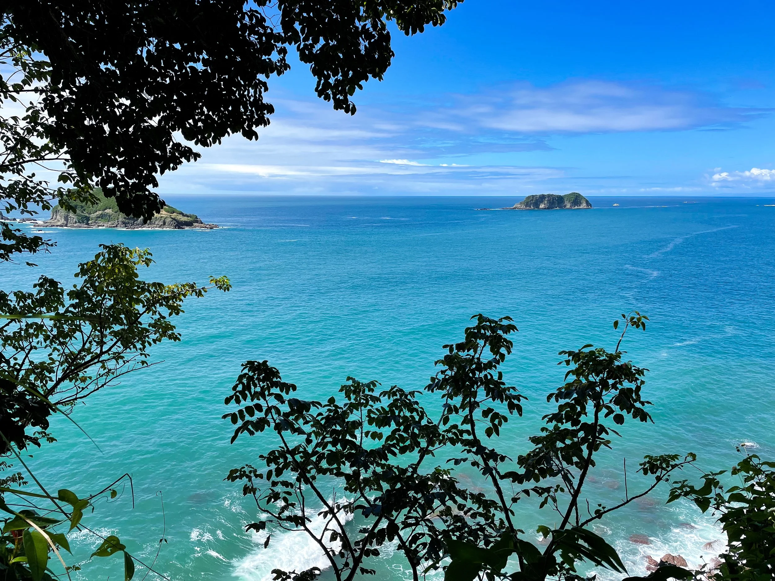
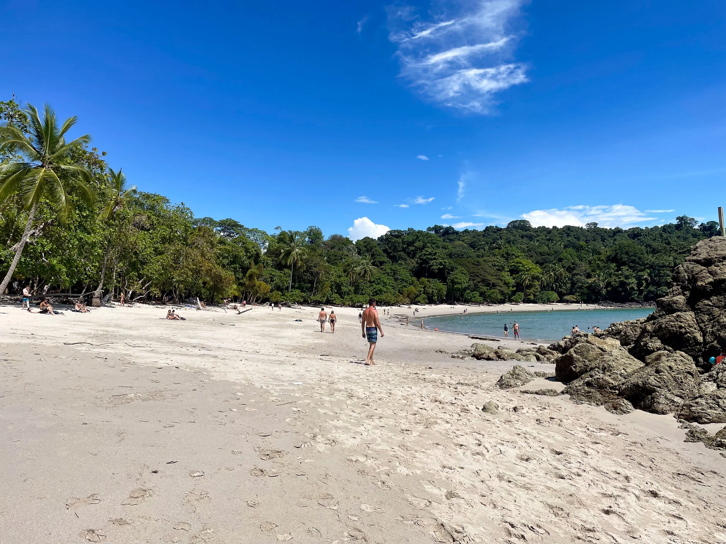
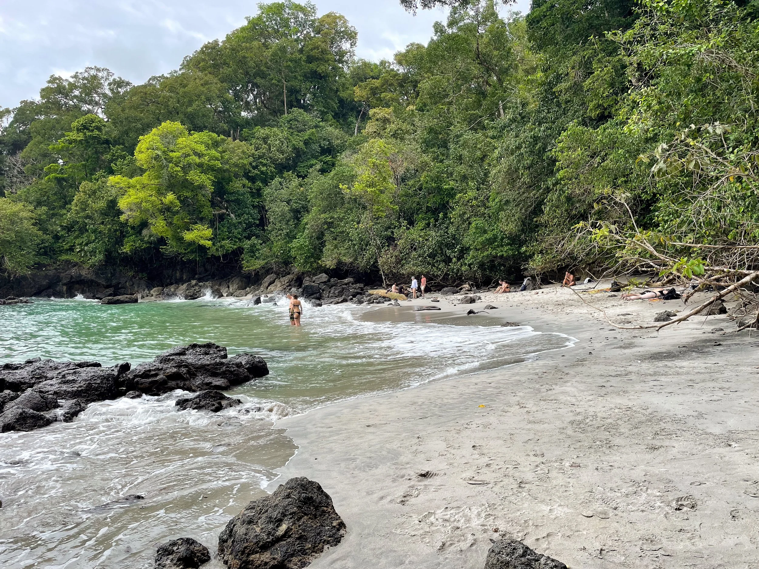
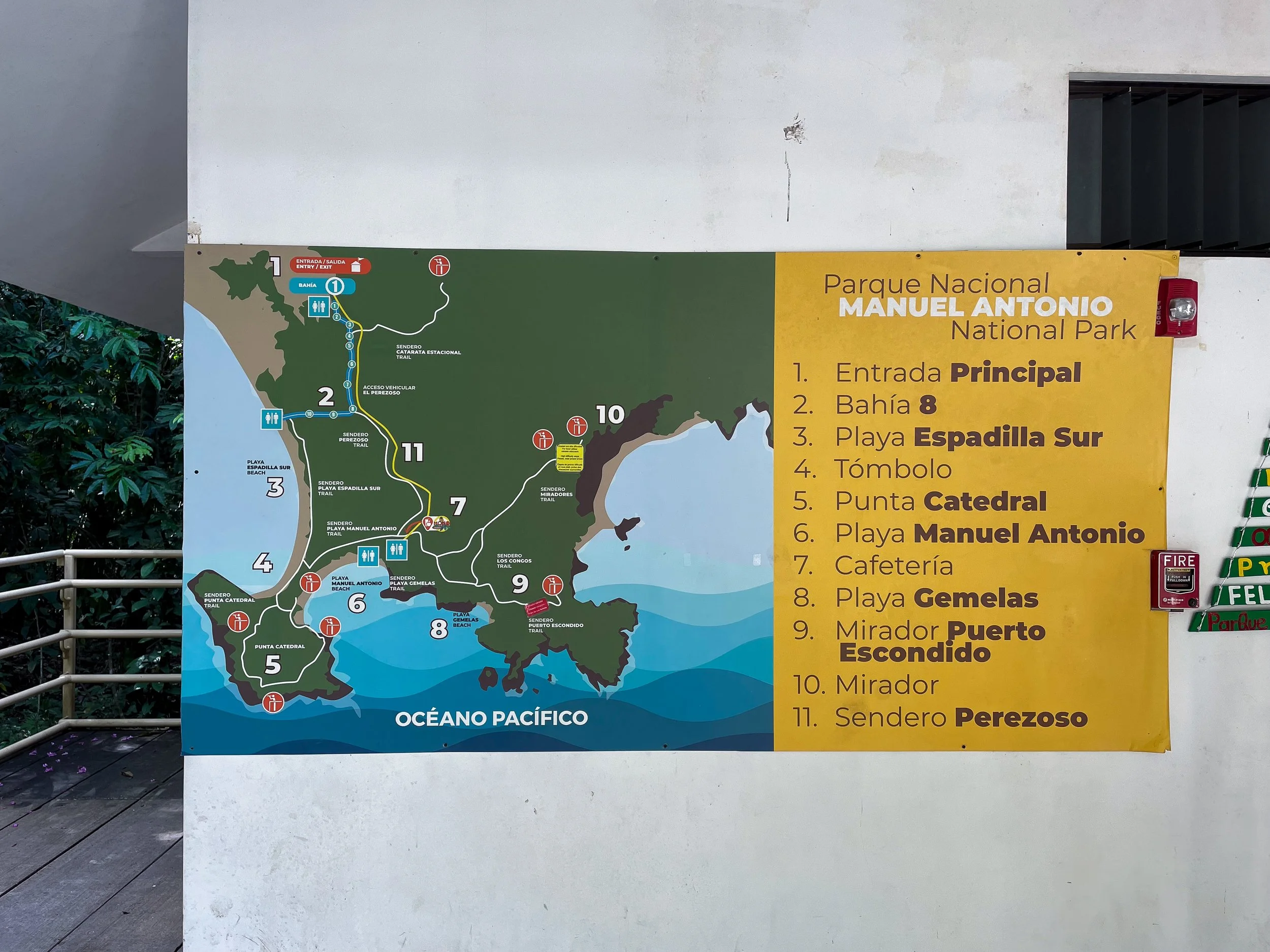
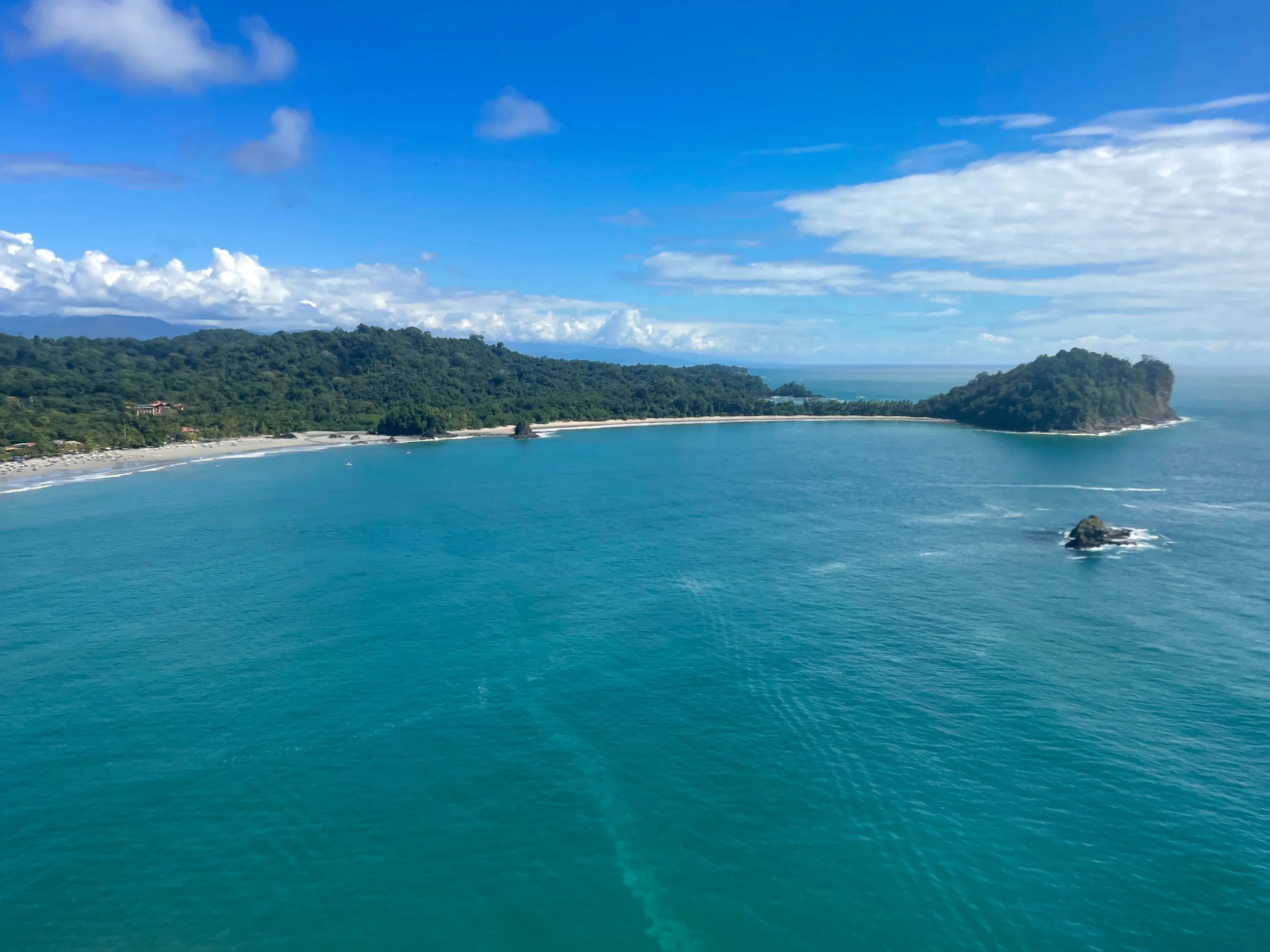
Manuel Antonio National Park
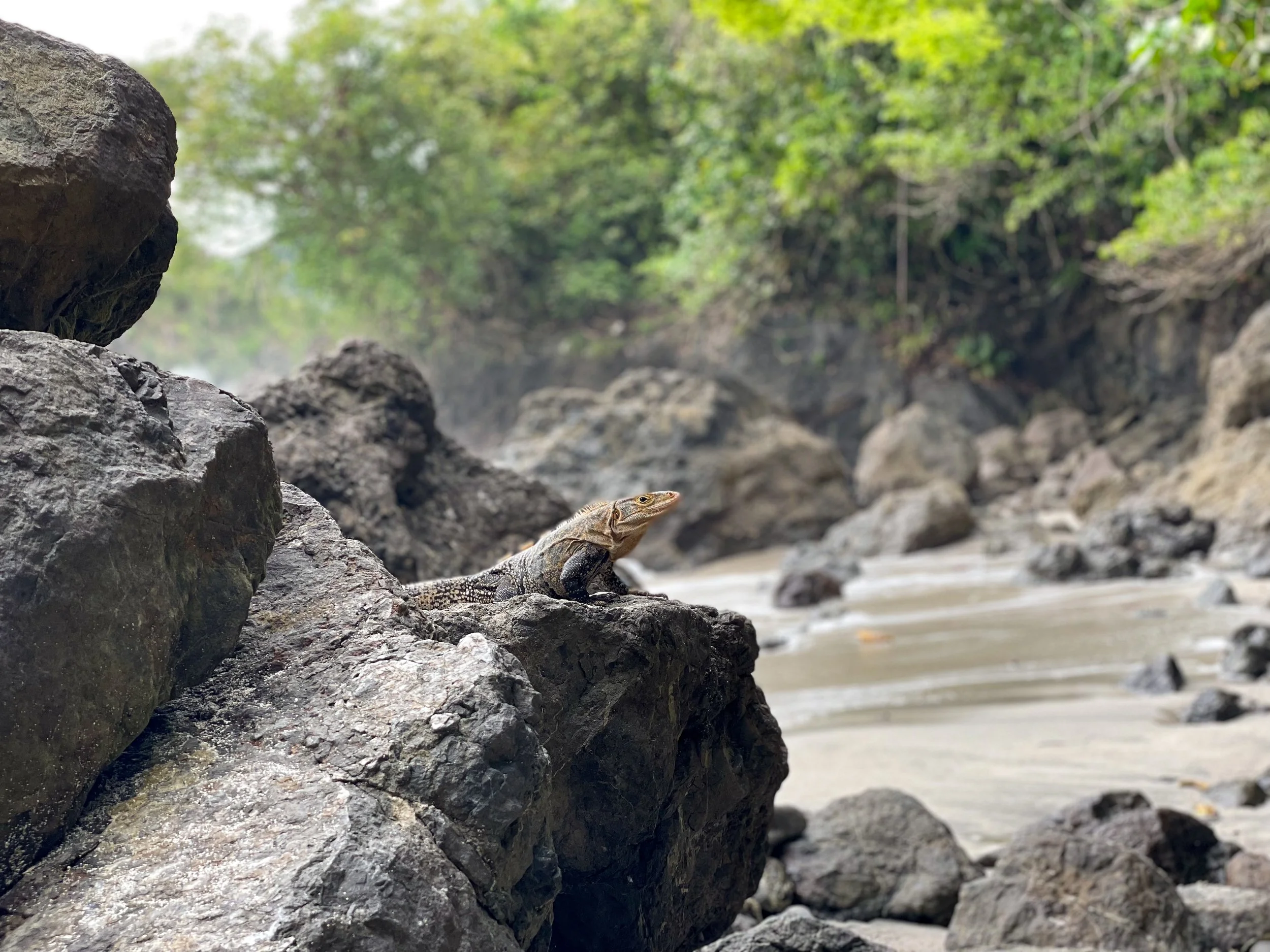
Manuel Antonio National Park is a nature preserve known for its biodiversity, rainforest, beaches, coral reefs, sloths, iguanas, spider monkeys, howler monkeys and hermit crabs. We spent an entire day in the park from opening until close hiking through the trails, visiting the beaches and spotting wildlife.
Manuel Antonio Trails
Sendero Principal. The park’s main trail. A 2.2km path that leads from the park entrance to Manuel Antonio Beach. Many guides spot sloths from here.
Sendero Perezoso (Sloth Trail). A 1.2 km trail that leads into the rainforest alongside Sendero Principal. It’s a good place to spot 2 and 3 toed sloths.
Sendero Punta Catedral. A 1.4km loop along the Tómbolo land bridge leading to the Punta Catedral Point lookout. We heard and spotted several howler monkeys here.
Sendero Playas Gemelas (Gemelas Beach Trail). A 1.6km trail off of Sendero Principal that leads to Gemelas Beach and the Escondido Beach lookout.
Sendero Mirador. A 1.3km cliffside trail that leads to Escondido Beach. It is an extension of Sendero Playas Gemelas. We couldn’t finish the trail because the boardwalk was badly damaged.

Manuel Antonio Beaches
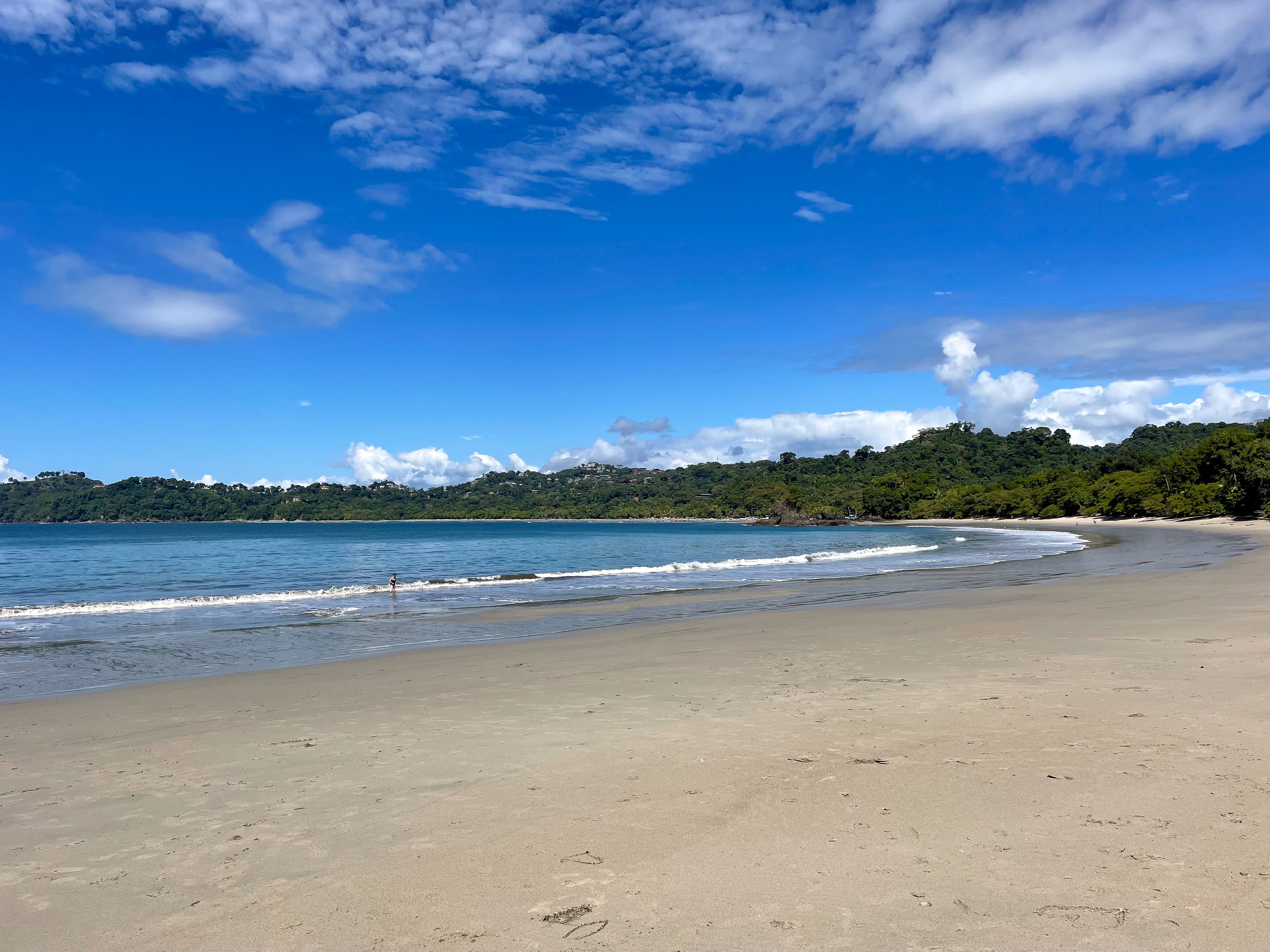
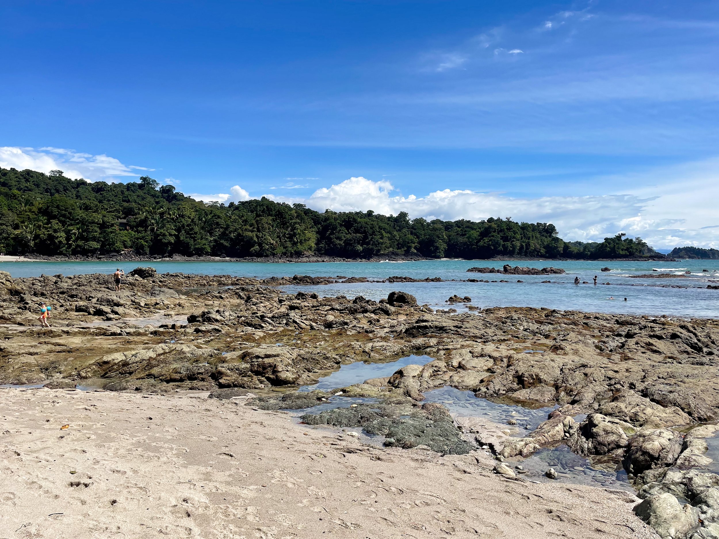
Espadilla Beach South. A long bow shaped beach with a narrow shoreline in Manuel Antonio Park. It’s a continuation of the city beach.
Manuel Antonio Beach. The park’s main beach with a white sand shore hugging the tree line of the lush rainforest.
Playa Gemelas. A small natural beach reachable by the Sendero Playas Gemelas.
Hiring a Guide or Not?
Hiring a naturalist guide guarantees you will spot a sloth in Manuel Antonio however, it’s not necessary. Guides will stay along the main road because it’s easier to spot sloths and other animals from. We opted out of hiring one and walked the Sloth Trail adjacent to the main road. It’s less traveled and equally as easy to spot sloths. We created a rag-tag group with other travelers on the trail and used our combined eyesight to spot sloths, monkeys, toucans, crabs and poison dart frogs.
Pro Tip 1. Guides can be hired at the entrance to the park for a negotiable fee depending on the length of hire.
Pro Tip 2. If without a guide, do not trail too closely behind them. They can get aggressive if they hear you listening in or watching sights they point out.
Pro Tip 3. If you don’t hire a guide, bring a good pair of binoculars view wildlife with.
Helpful Park Information
Hours. The park is open from 7am - 4pm daily (closed on Tuesday).
Tickets. You need to book tickets online ahead of time.
No Plastic or Food. Single use plastic, alcohol or food is forbidden in the park, except at park restaurants.
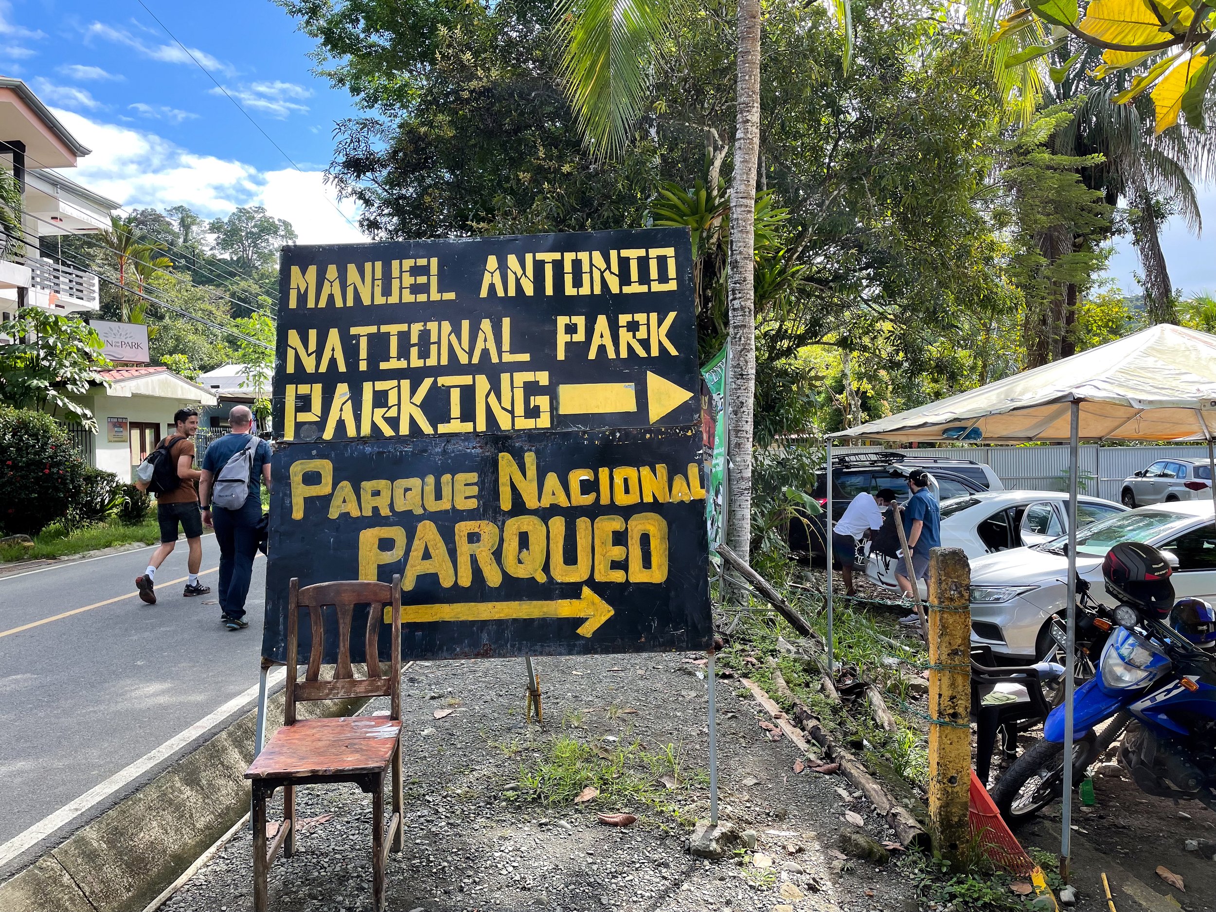
Parking. Arrive early and look for parking at the park entrance past all the scammers pretending to be park staff along the roadside. Parking should cost no more than 5,000 Colones.
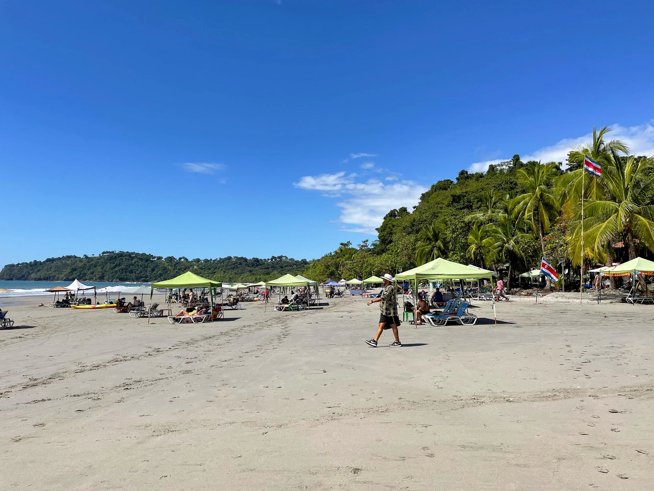
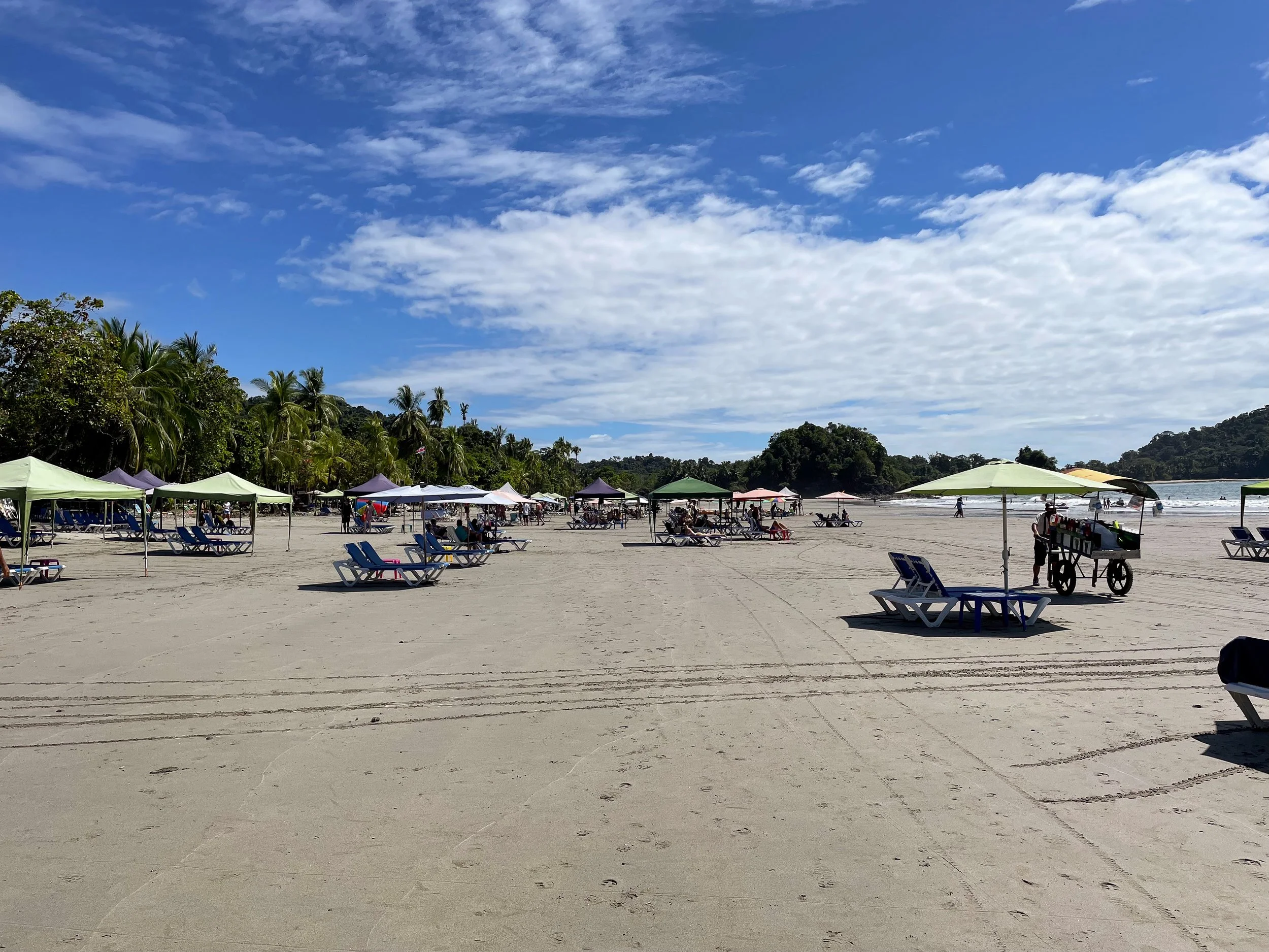
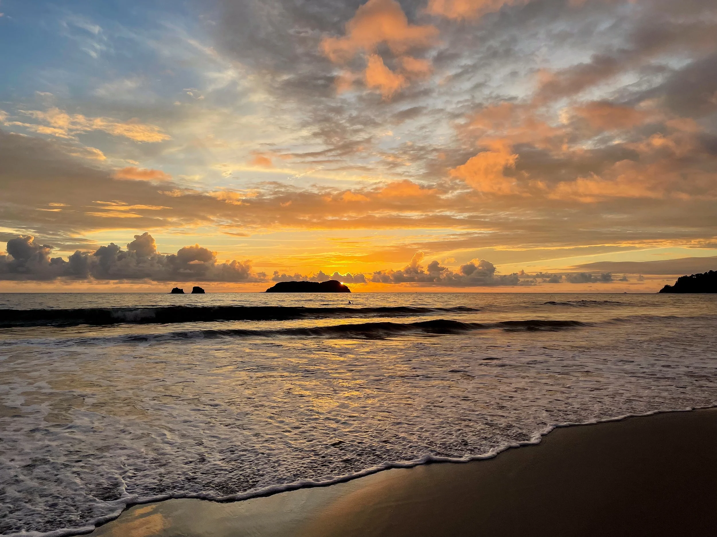
Espadilla Beach North
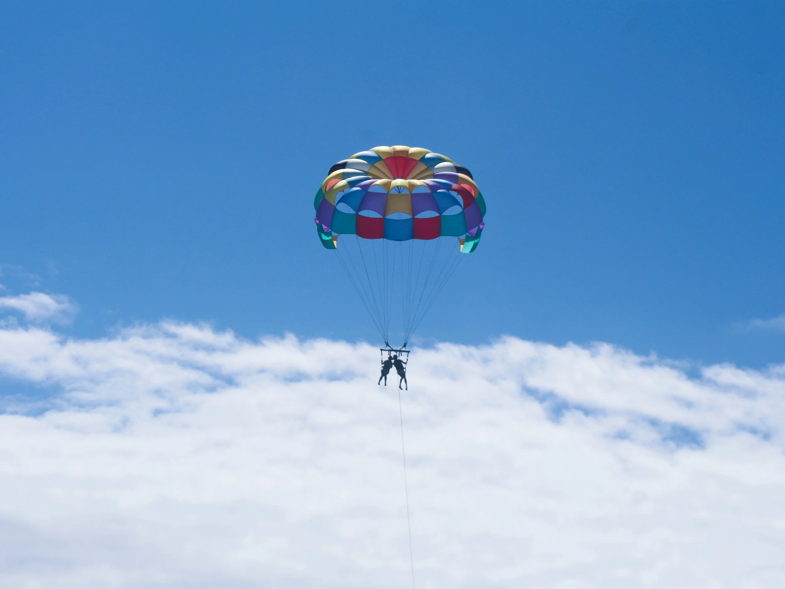
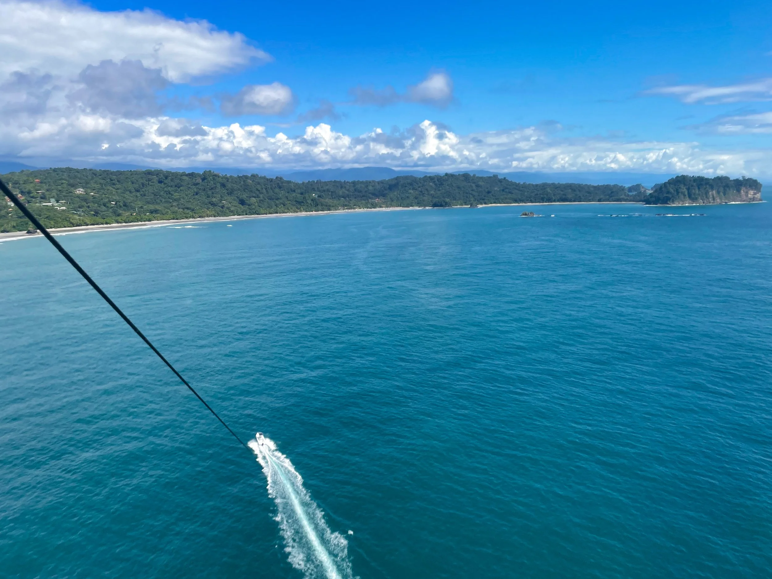
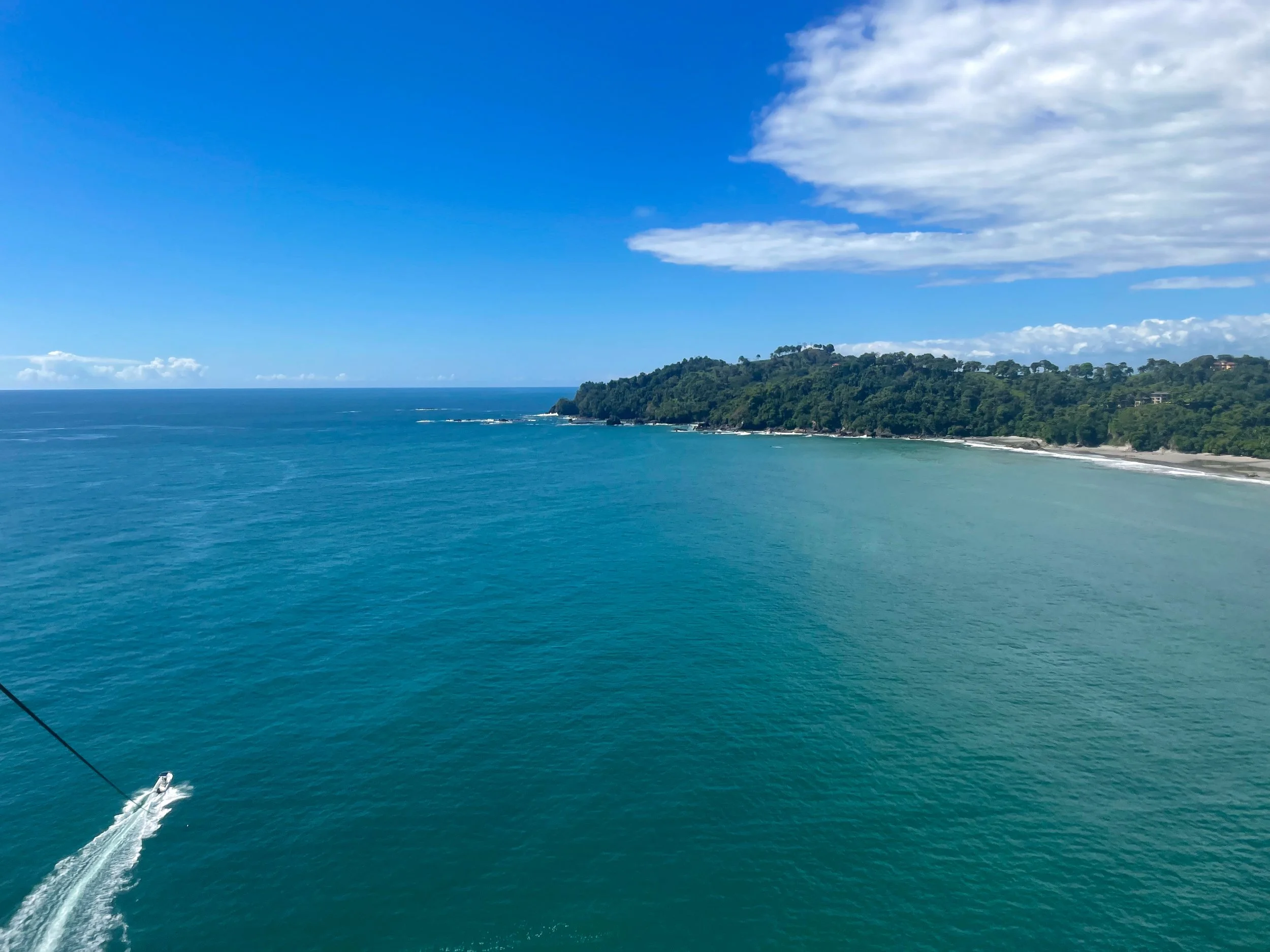
A lengthy beach extending outside of Manuel Antonio park with soft sandy shores and swimmable waters. There are nearby restaurants, beach bars, souvenir shops, surf schools and chair & umbrella rentals. Visit Aguas Azules for parasailing tours above Manuel Antonio’s deep blue bay, sandy coastline, rocky outcrops and lush jungle.
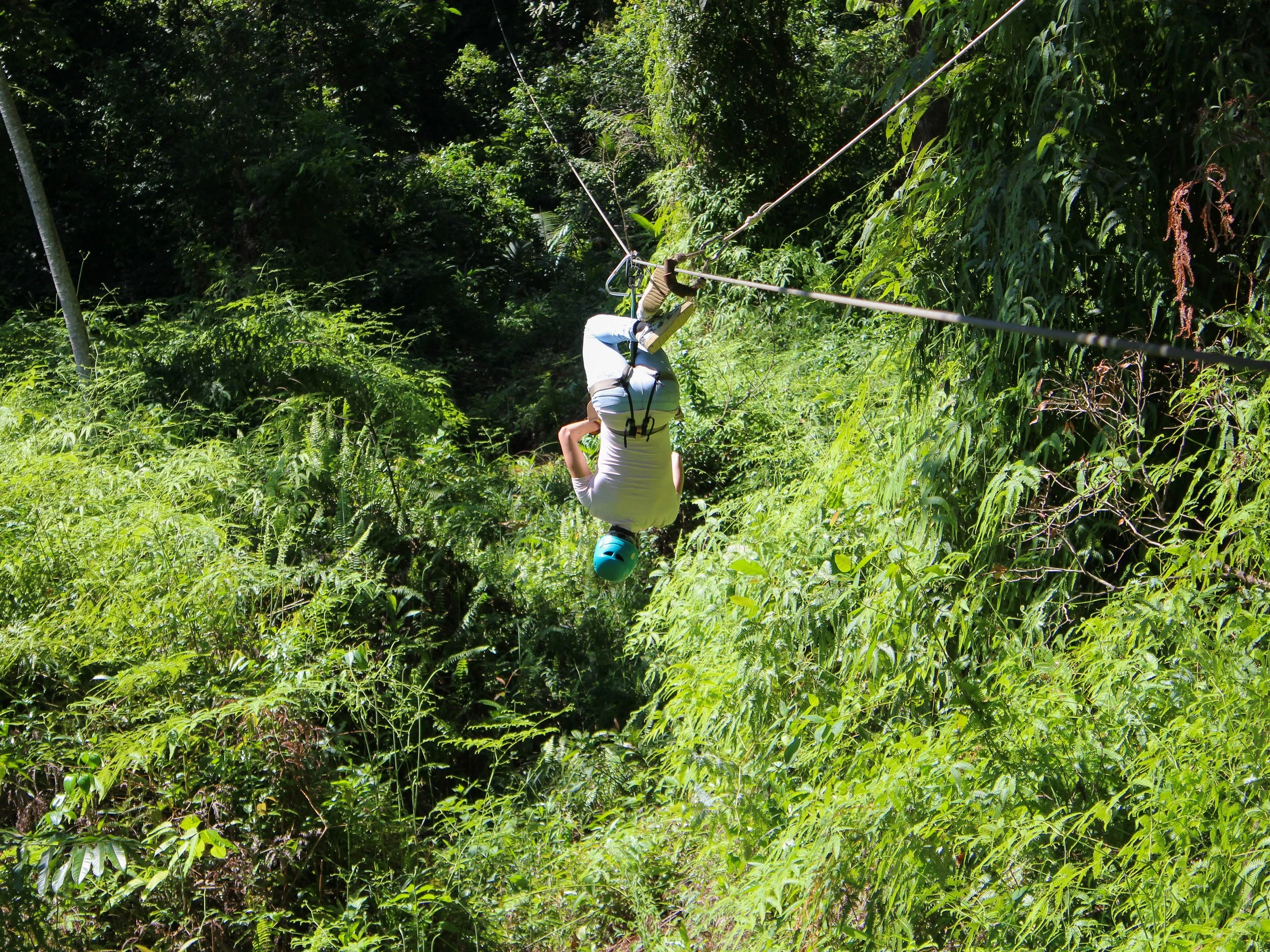
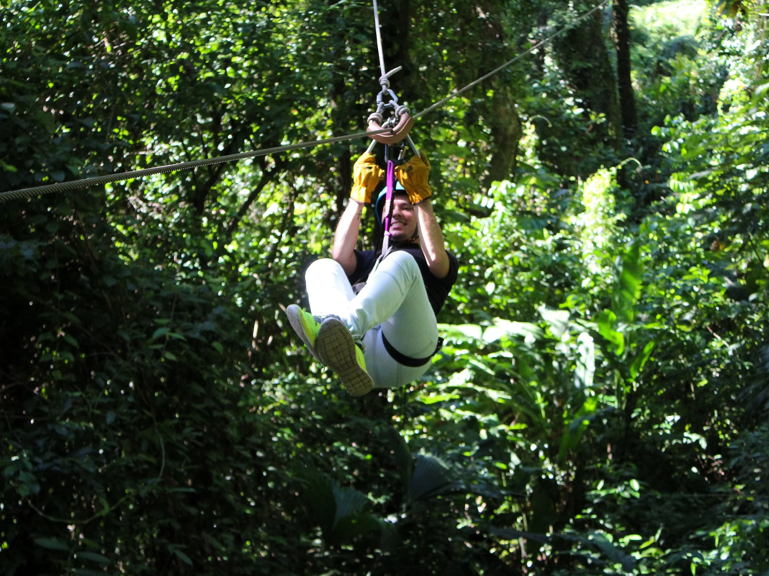
El Santuario Canopy Adventure Tour
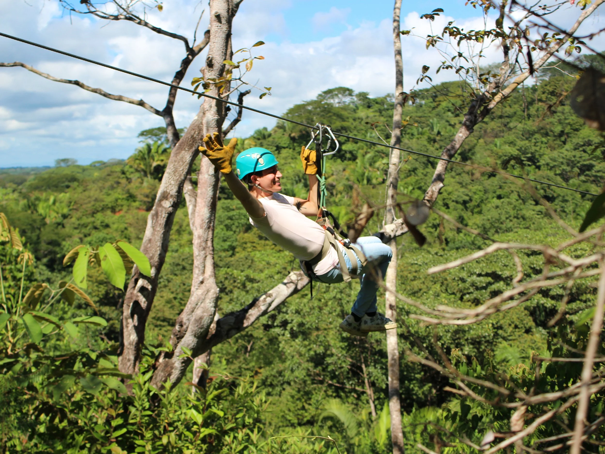
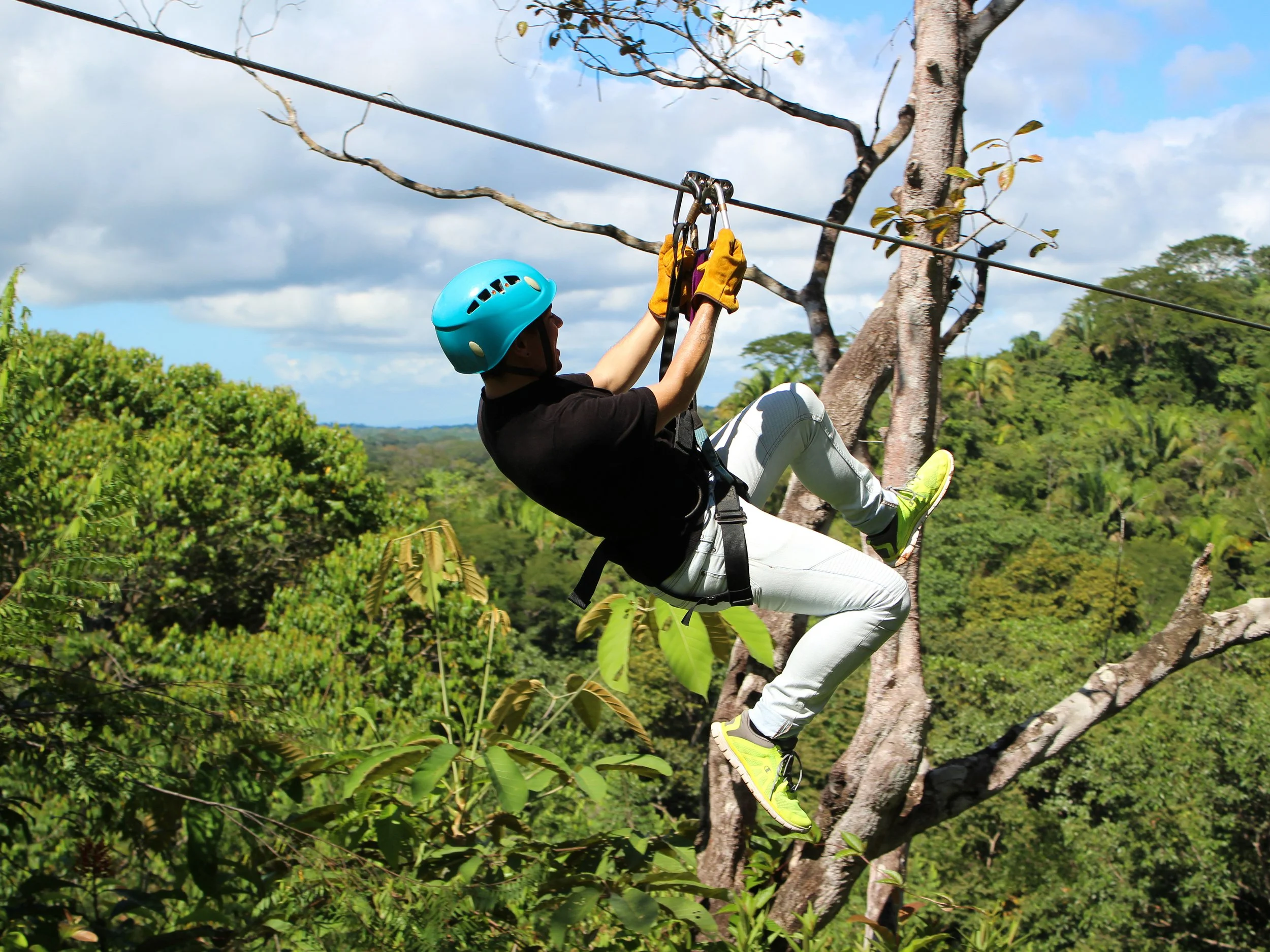
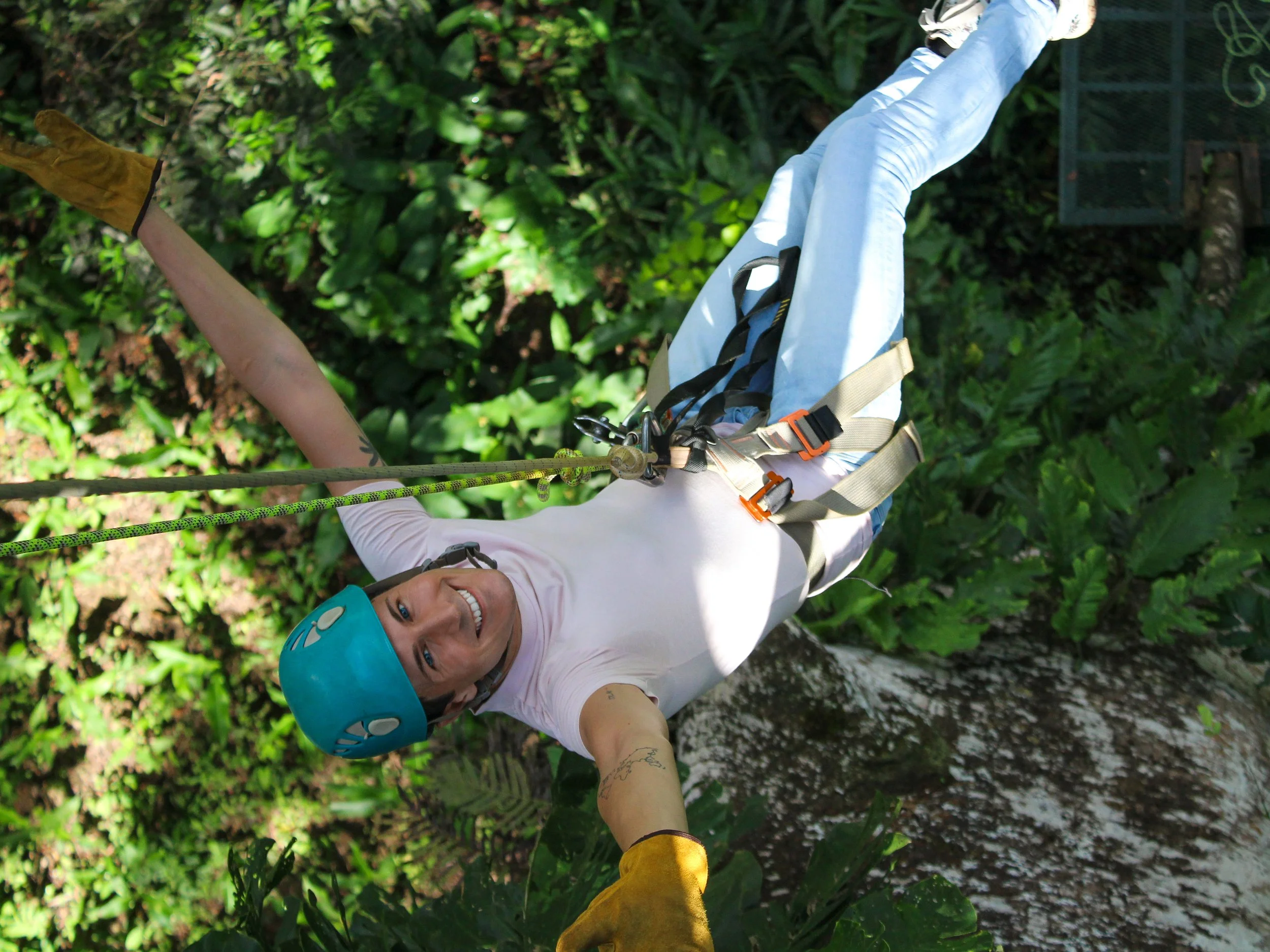
A semi-remote adventure park nearby Manuel Antonio. The course includes 10 zip-lines, 6 canopy bridges, 3 nature walks and 1 rappelling challenge through the forest. It includes Costa Rica’s longest zip-line at 4,300 ft. We got to ride a shorter one upside down. They offer two morning tours lasting about 4 hours each. Both include a fruit breakfast and lunch. Pictures cost $20 extra. Book here!
Manuel Antonio Finca
A town located outside of the Manuel Antonio National Park on the Pacific Coast. It’s a jungly beach town with hotels, restaurants, bars and nearby adventure activities.
Places to Eat & Drink
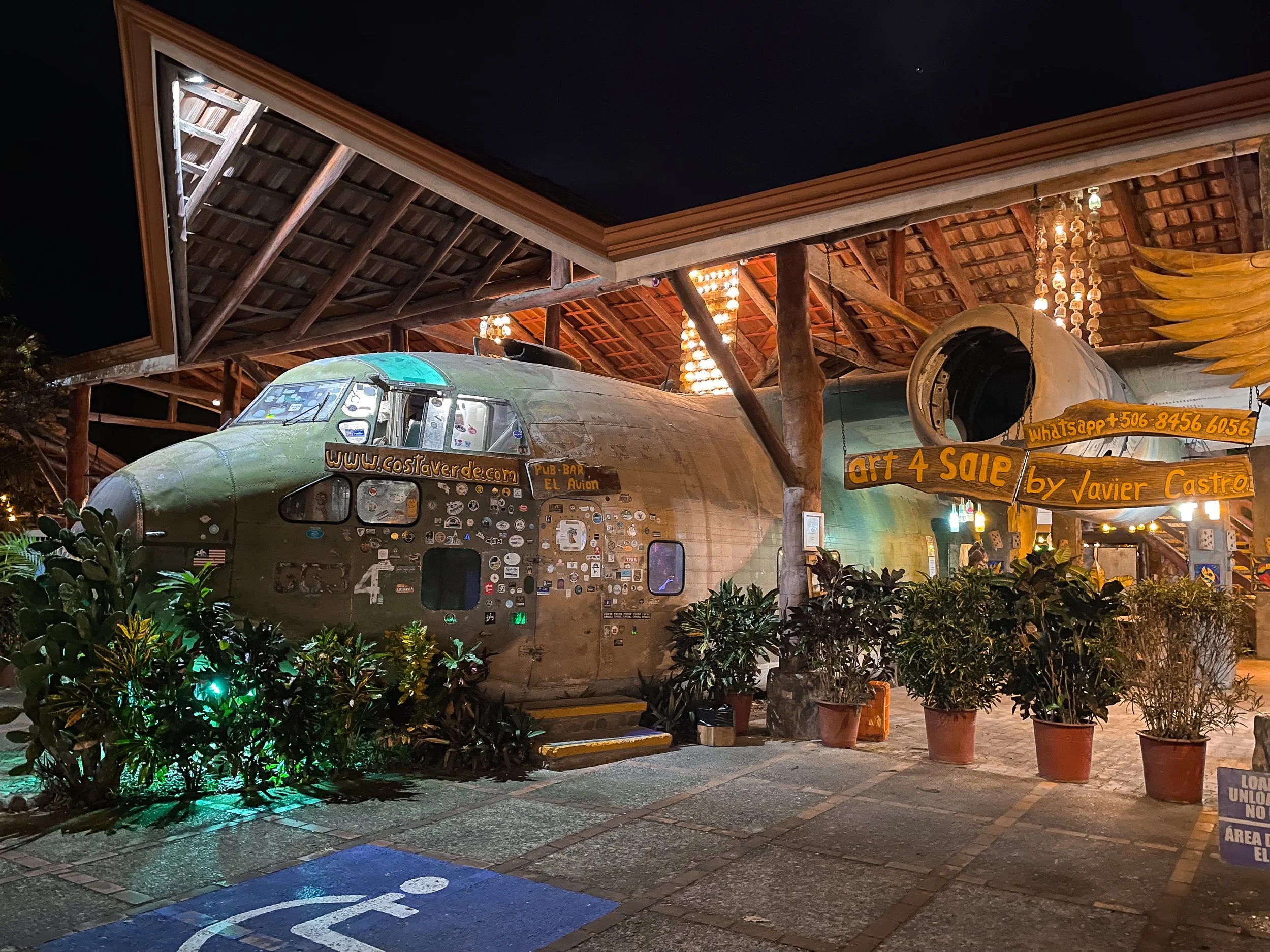
El Avión. An open air restaurant with wooden furniture built around an abandoned US military cargo plane. We ordered the crispy fried whole red snapper.
Contra Bar. A bar within the cargo plane at El Avión. We ordered a round of drinks and enjoyed them in the cockpit.
Café Milagro. A cafe in a tropical garden with house roasted coffee and breakfast dishes like guava and cheese crepes, banana pancakes and fresh fruit.
Restaurante Buru Seaside Manuel Antonio. Stop here for 2 for 1 happy hour cocktails from 3-6pm and sunset views after spending the day in Manuel Antonio park.
Meduza Restaurant. A hotel restaurant with a limited menu. We ordered and shared the seafood rice with a bottle of Imperial, Costa Rica’s most popular beer.
Where to Stay
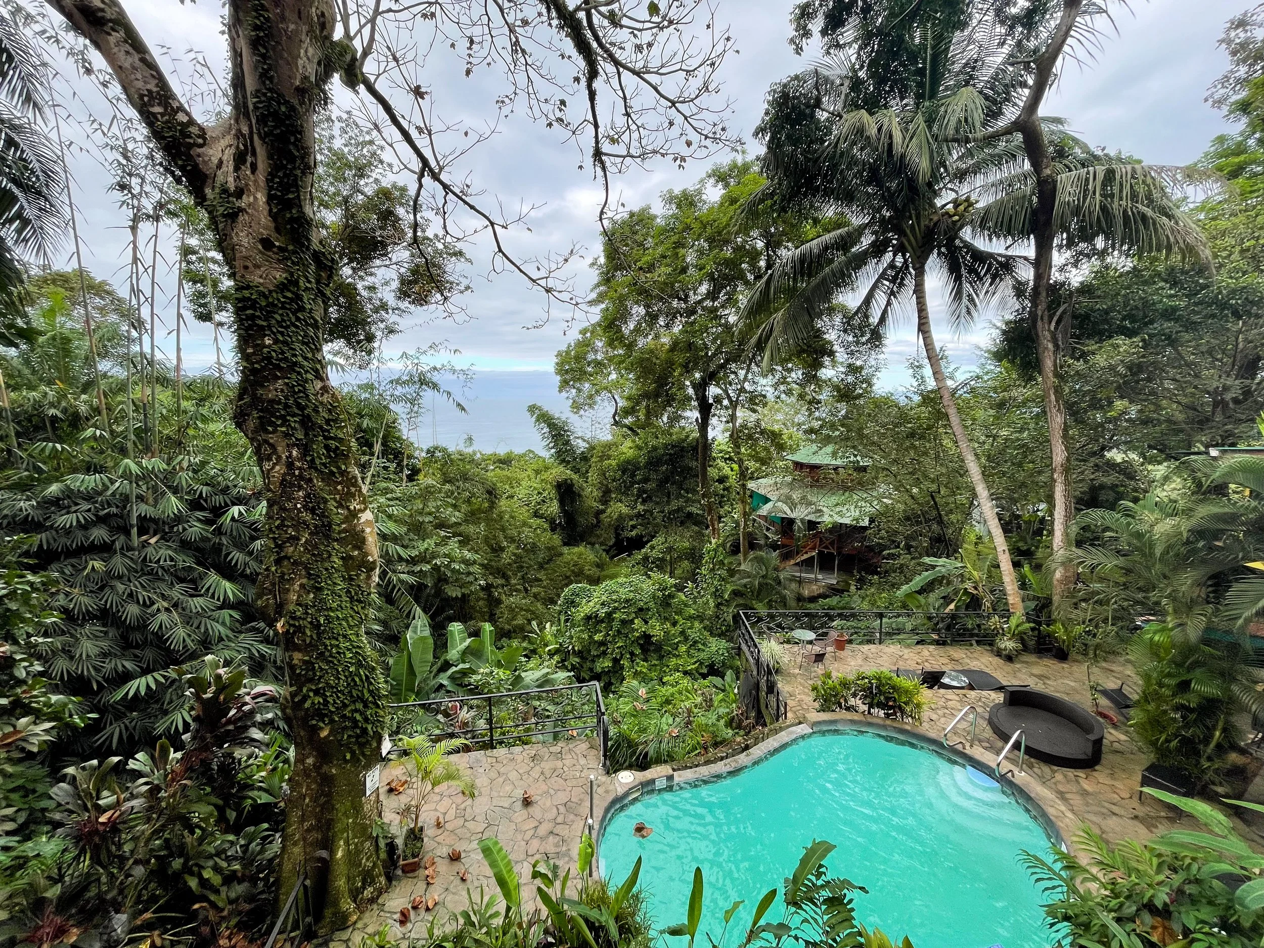
We stayed at Mango Moon Villa, a boutique hotel located near Manuel Antonio National Park. The hotel has views overlooking the Pacific Ocean. We stargazed in the evening and watched toucans and monkeys move between trees during the day. It includes a restaurant and bar with breakfast and dinner service.

Costa Rican Cuisine
When it comes to cuisine, Costa Rica is the land of tropical fruit, rice and beans.
Tropical Fruits. Tropical fruits are grown, sold and served across the country. Fresh papaya, watermelon, pineapple and banana are regularly served for breakfast alongside a glass of freshly squeezed orange juice.
Gallo Pinto. A rice and bean mixture served with a slice of fried plantain, scrambled eggs, queso palmito (fried cheese) and tortilla. It’s a common breakfast dish.
Sopa Negra. A black bean soup with cilantro and a hard boiled egg. Typically served for lunch or dinner.
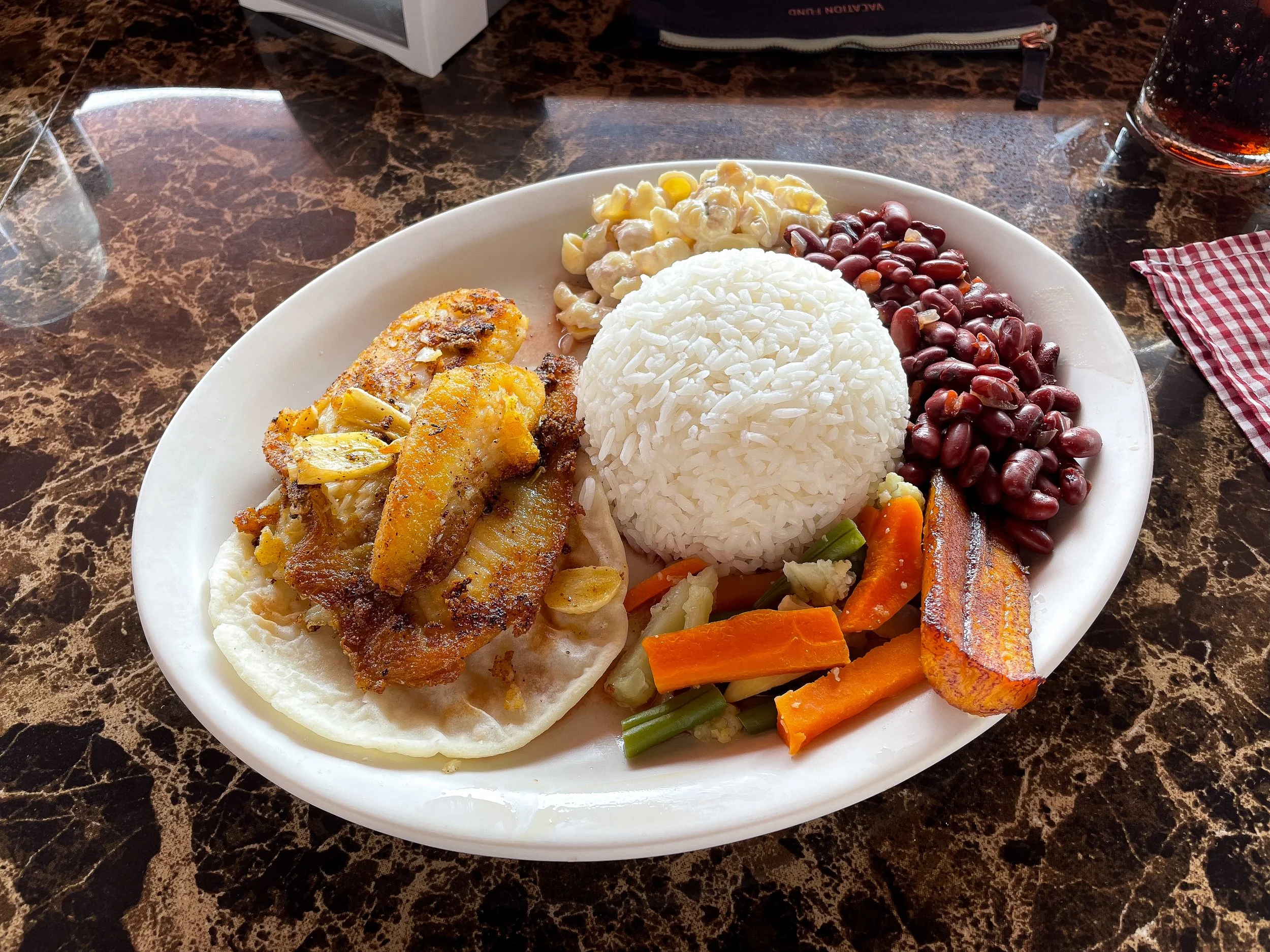
Casado. The national dish, a plate with rice, beans, grilled veggies, pasta salad, fried fish (or any meat protein), tortilla and sweet plantain. It’s typically served for lunch or dinner.
Imperial. Costa Rica’s national beer served almost everywhere. Order one at a bar or a bucket at the beach.
Driving in Costa Rica
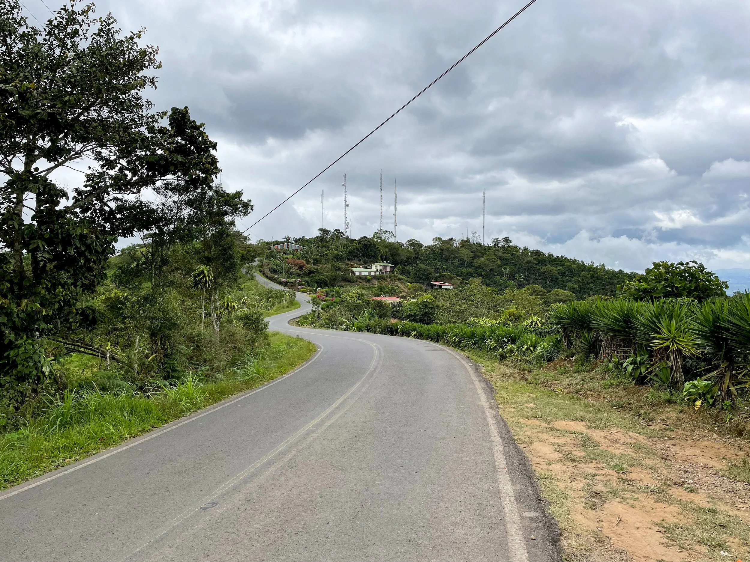
Driving in Costa Rica is very scenic and one of the best ways to explore the country. Curvy roads snake through valleys and along mountain ridges with steep sections and roadside lookouts.
Visibility. Rain and fog drastically reduce visibility the higher we drove in altitude.
Road Conditions. Main roads are well maintained while back roads are often unpaved or in need of repair.
Rent a 4WD. A 4 wheel drive is necessary to navigate the roads.
Narrow Lanes. Many roads outside of the cities are 2 lanes wide with the occasional 1 lane bridge.
Traffic Jams. Traffic within and into San José was congested.
Refueling. Gas station attendants pump gas for you.
Speed Bumps. There are speed bumps in towns often with vendors set up selling snacks, fruit and juice.
Falling Fruit. Don’t park under any fruit trees. Coconuts, papaya or other falling fruit can badly damage your car. This is often not covered by rental insurance.
For Next Time…
Costa Rica is one of the most incredible places we’ve had the pleasure to travel to. From its biodiversity to breathtaking landscapes, it’s a destination that has left us wanting to return and explore more. When we do, some locations at the top of our list are:
Poás Volcano National Park. The largest and most active volcano in Costa Rica with a gaseous crater, hot springs and hiking trails.
Guanacaste. A Province in the northwest of the country with surfing beaches, nature reserves, volcanoes, hot springs, waterfalls and wildlife.
Refugio Nacional Gandoca-Manzanillo. A marine reserve on the Caribbean side of the country with white sand beaches, coral reefs, mangrove forests and wetlands.

Morocco Road Trip Guide: Sahara Desert, Kasbahs & Berber Culture
Road trip across Morocco's dramatic landscapes where palm oases, ancient kasbahs, towering dunes and Berber camps create an unforgettable Saharan adventure.

From The Atlas Mountains to The Sahara Desert
Morocco is a mesmerizing country with scenic landscapes, enchanting kasbahs and rich cultural influences. We spent a week roadtripping between the historic medinas of Marrakech and Fez. The journey led us through the Atlas Mountains to desert towns, crumbling ksars, palm covered oases, steep gorges, sprawling sand dunes and Berber camps of the Sahara Desert.
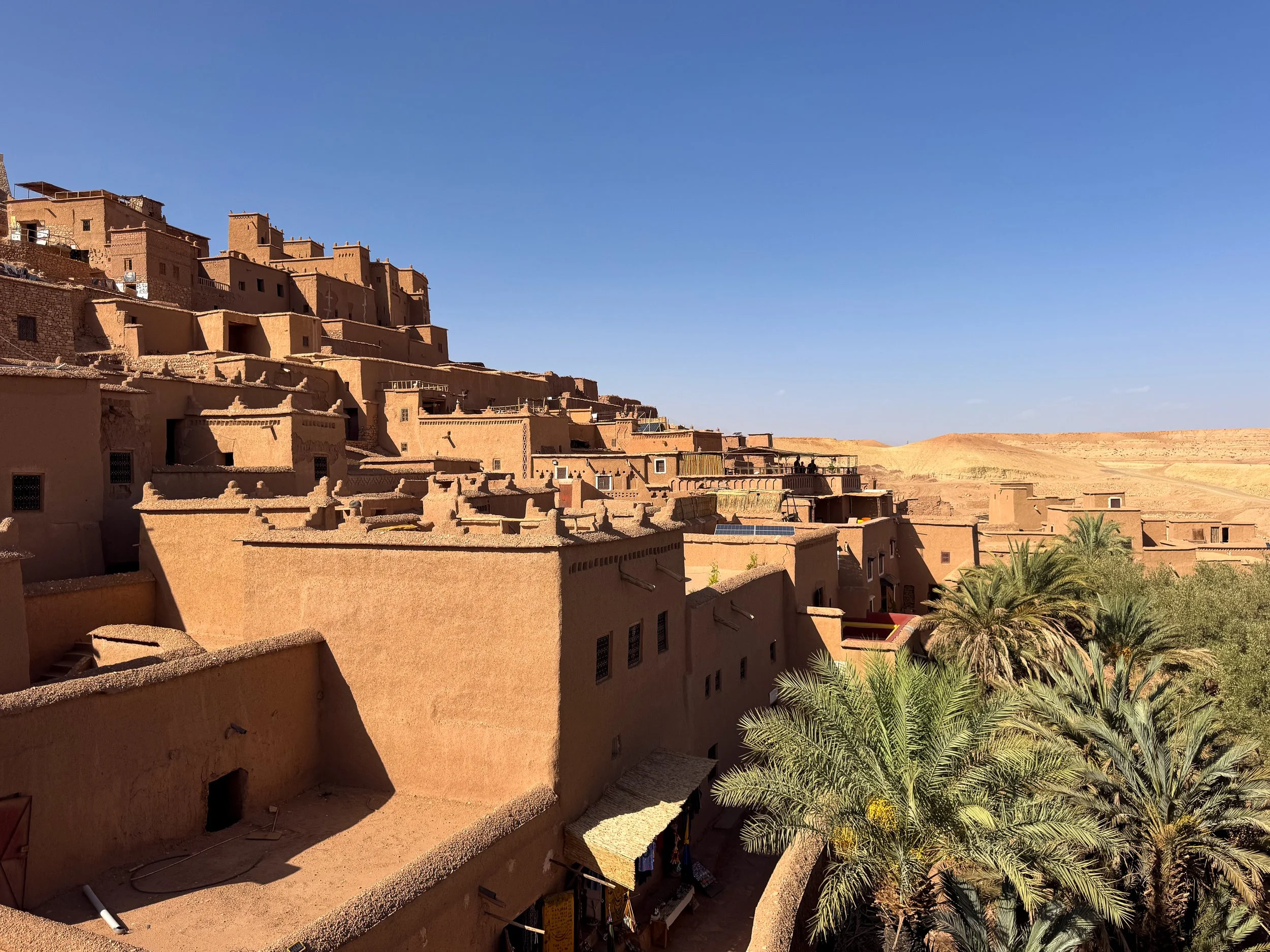
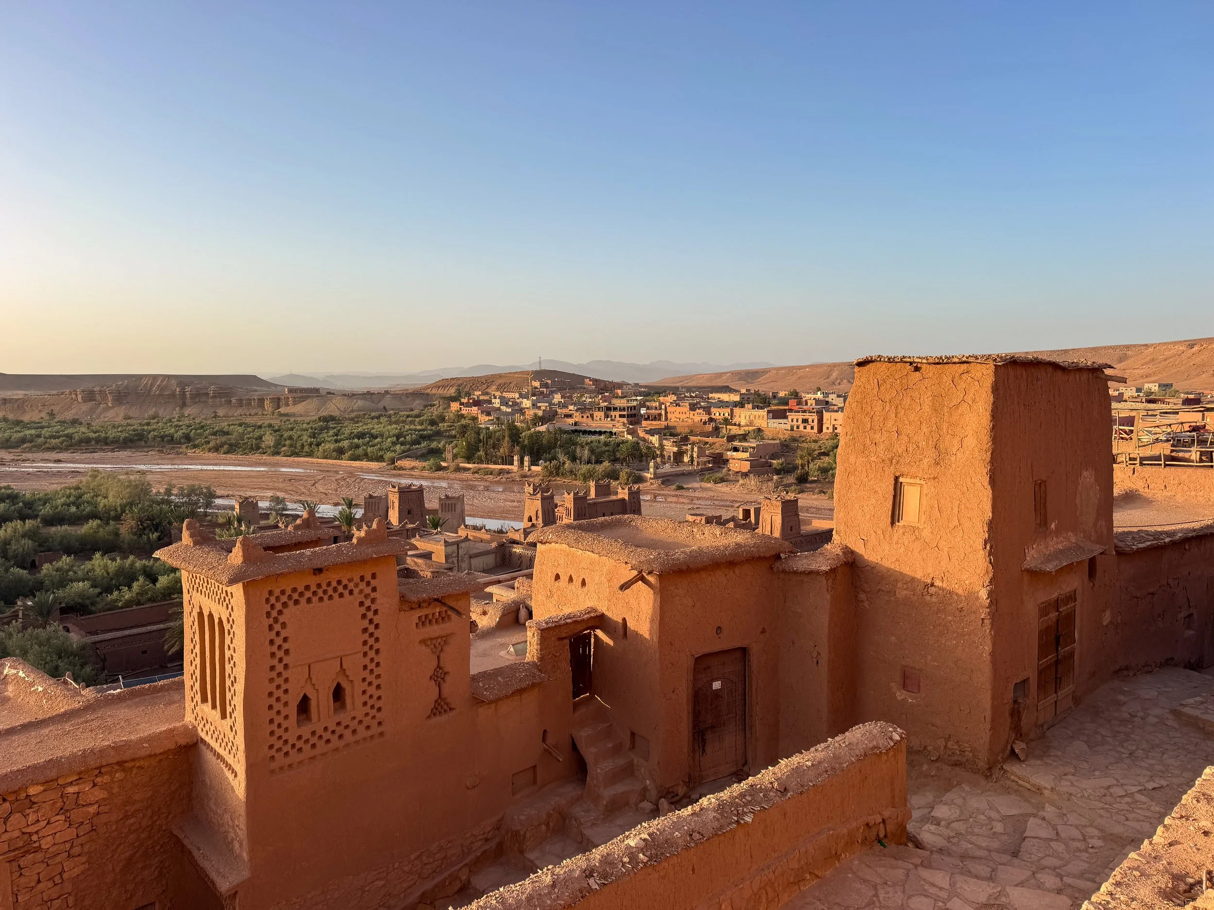
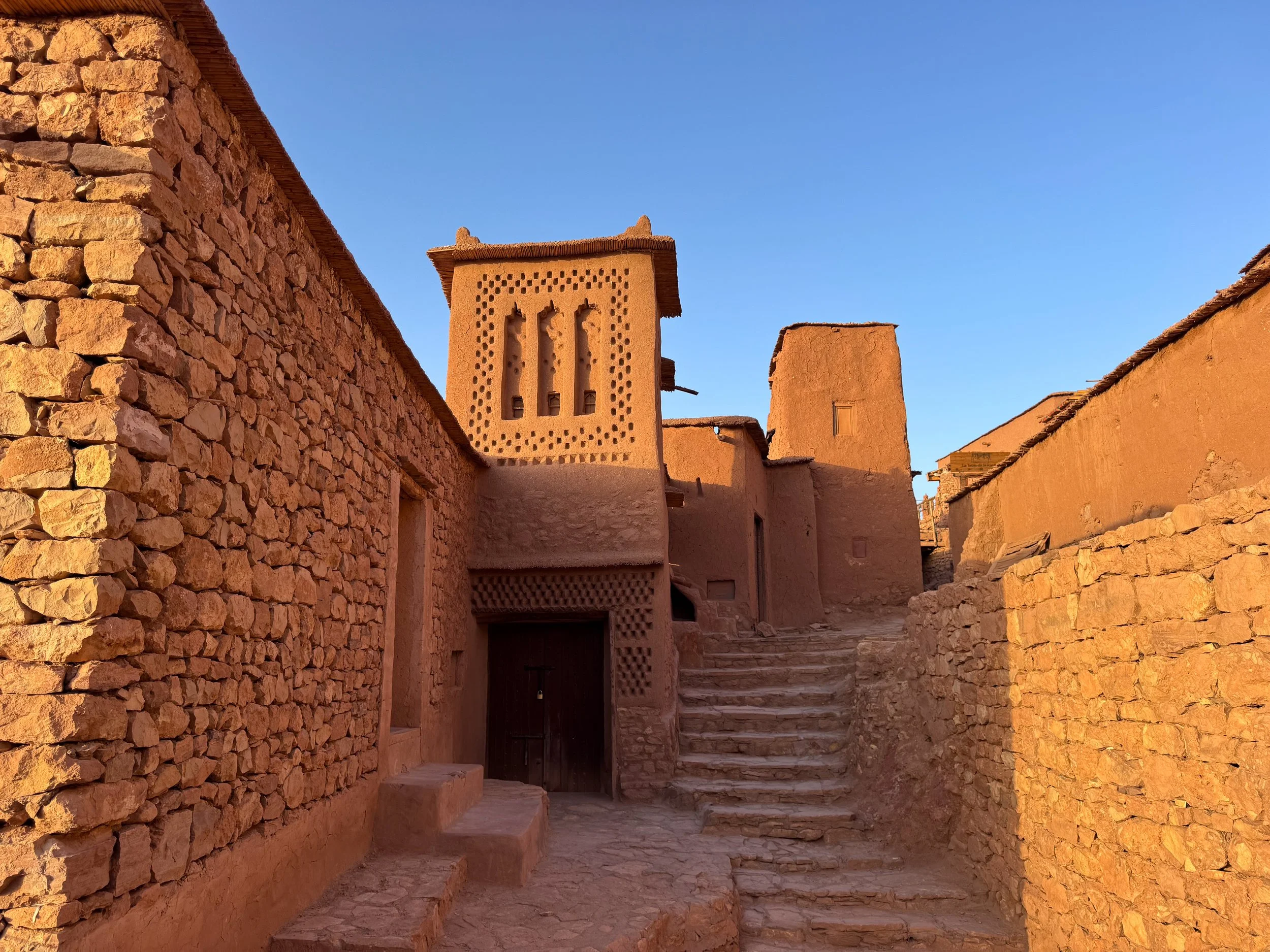
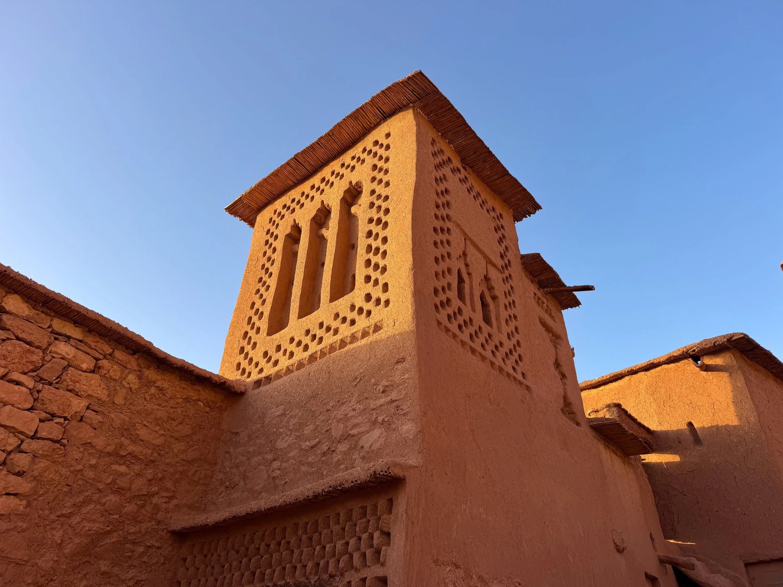
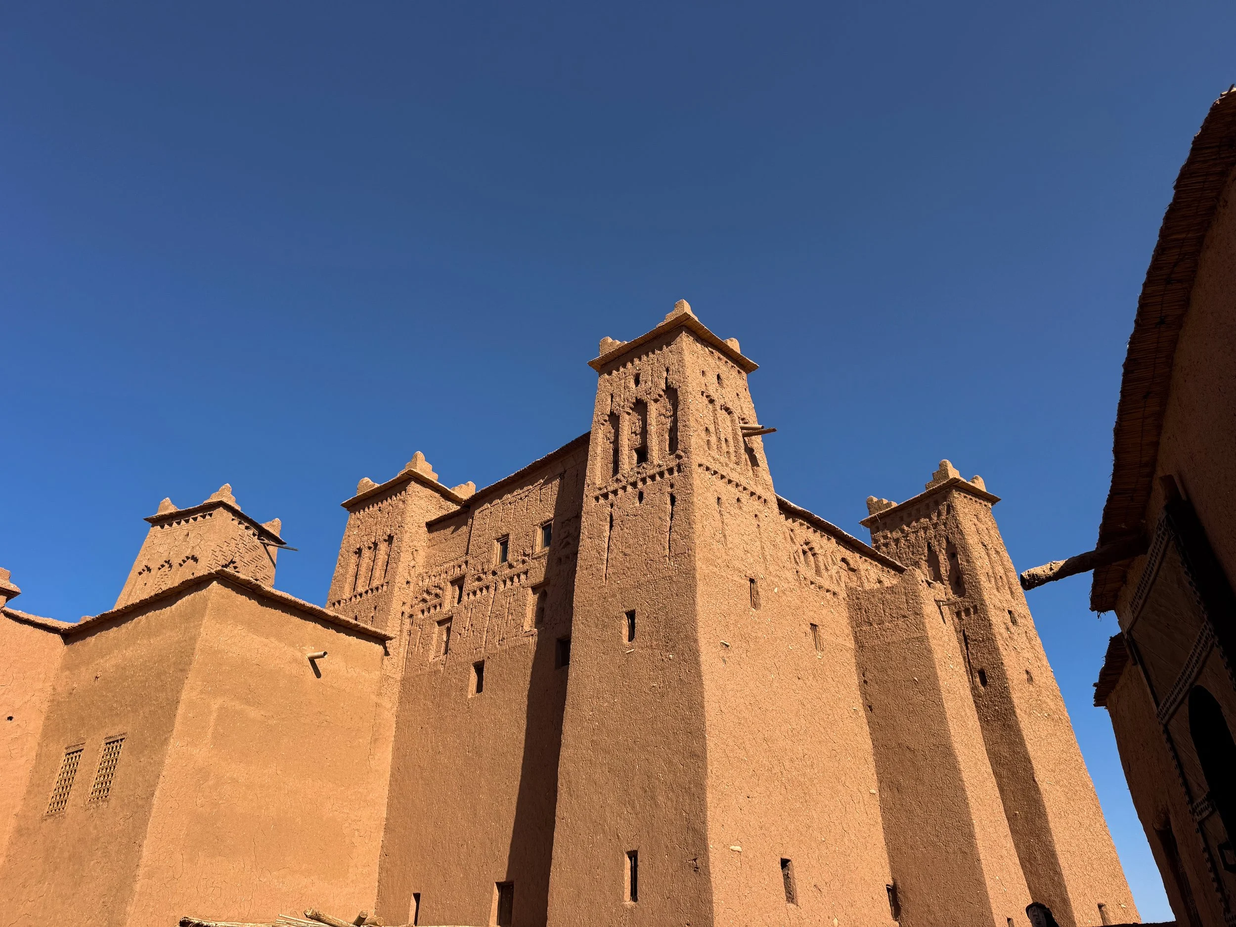
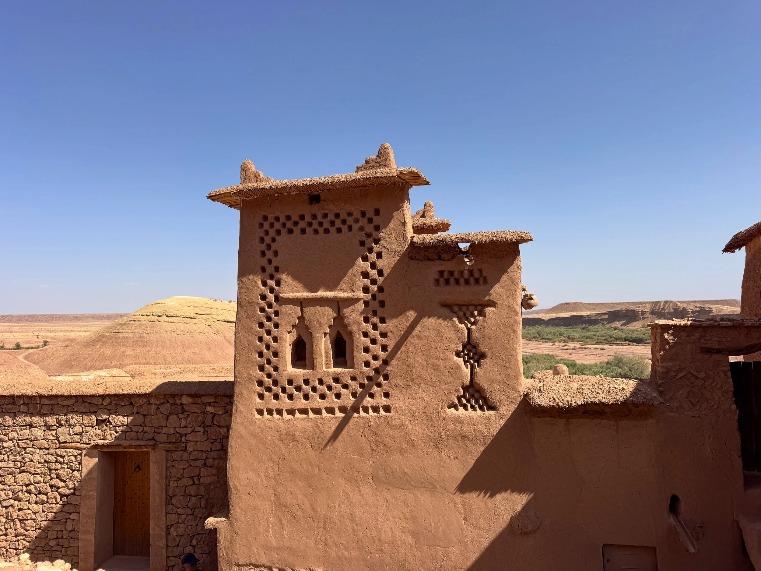
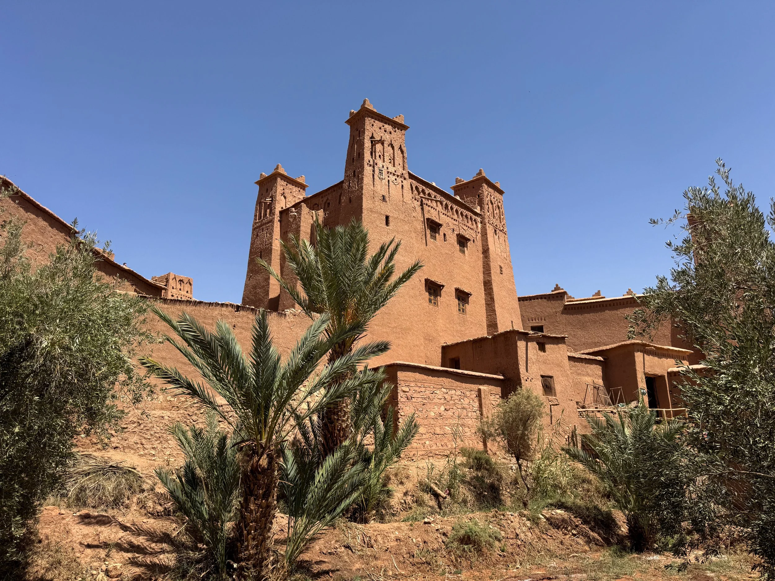
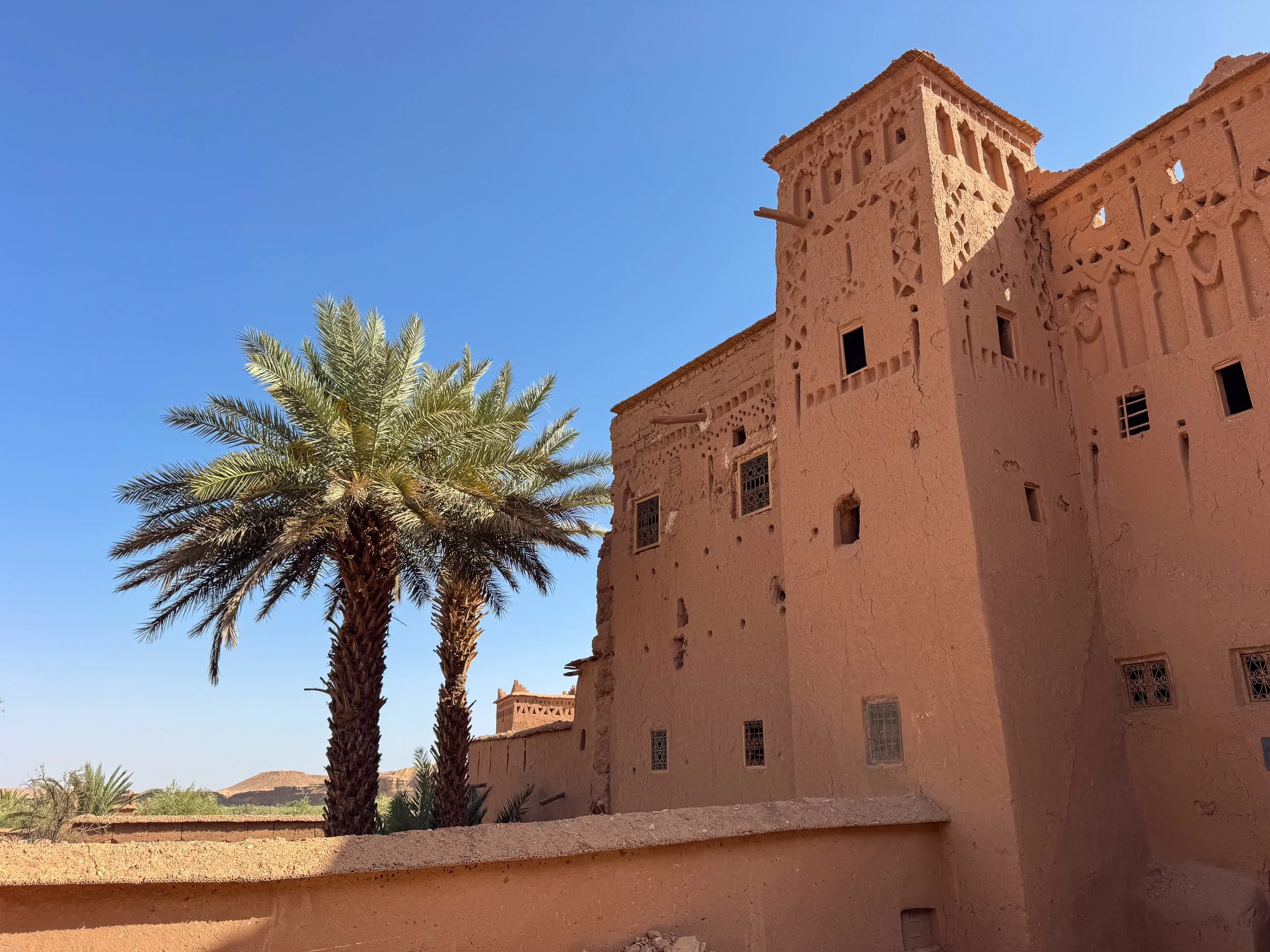
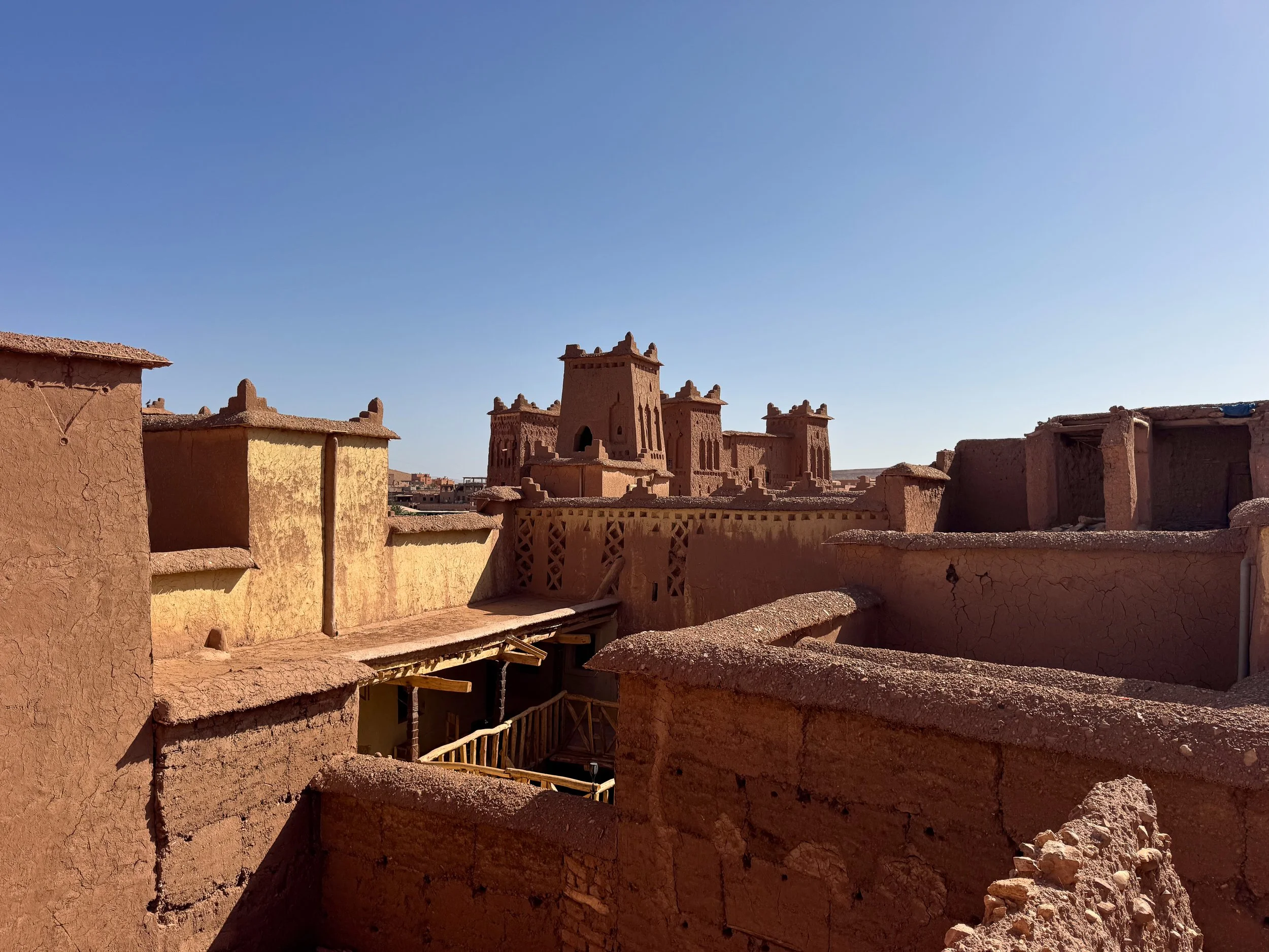
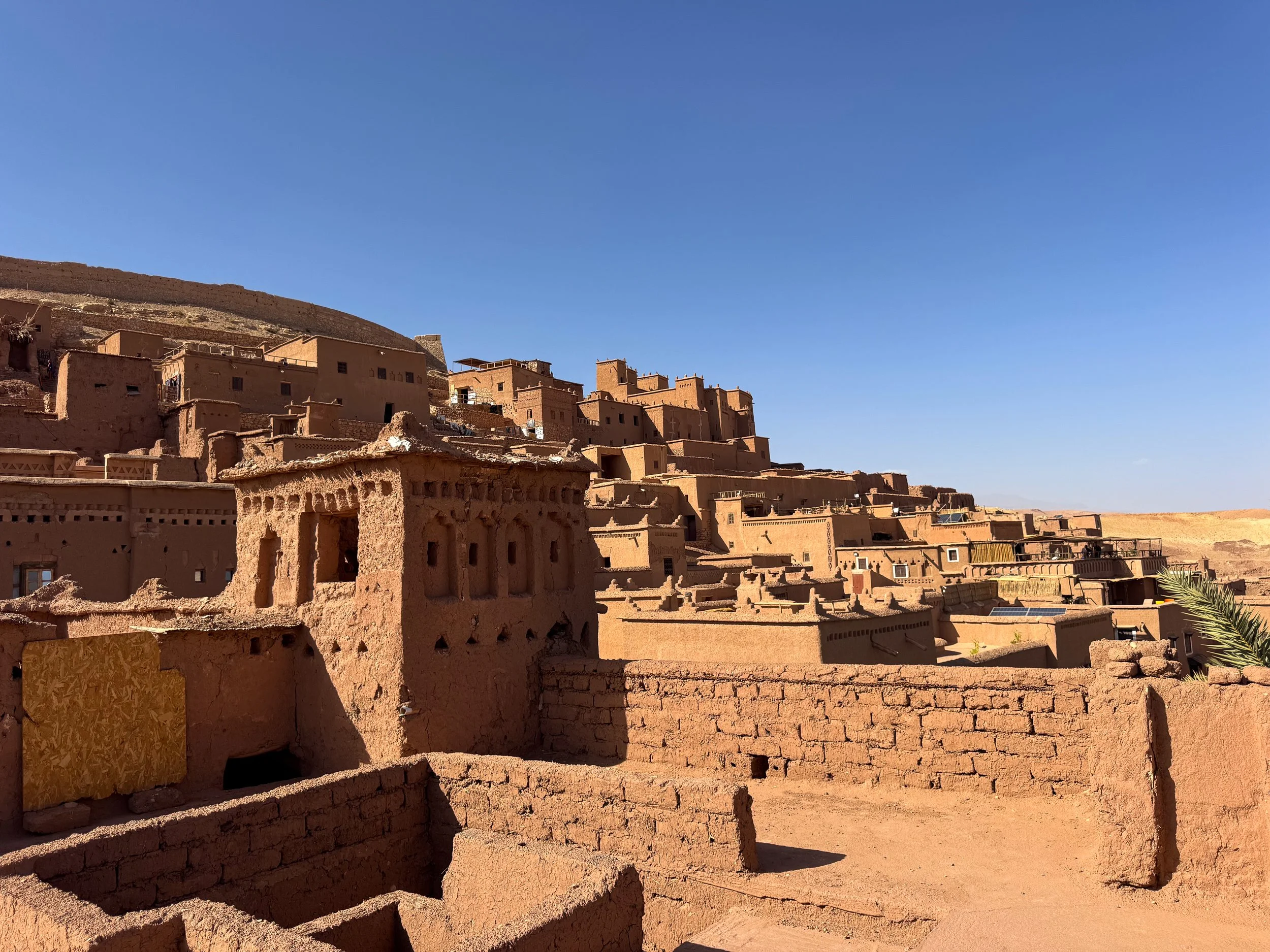
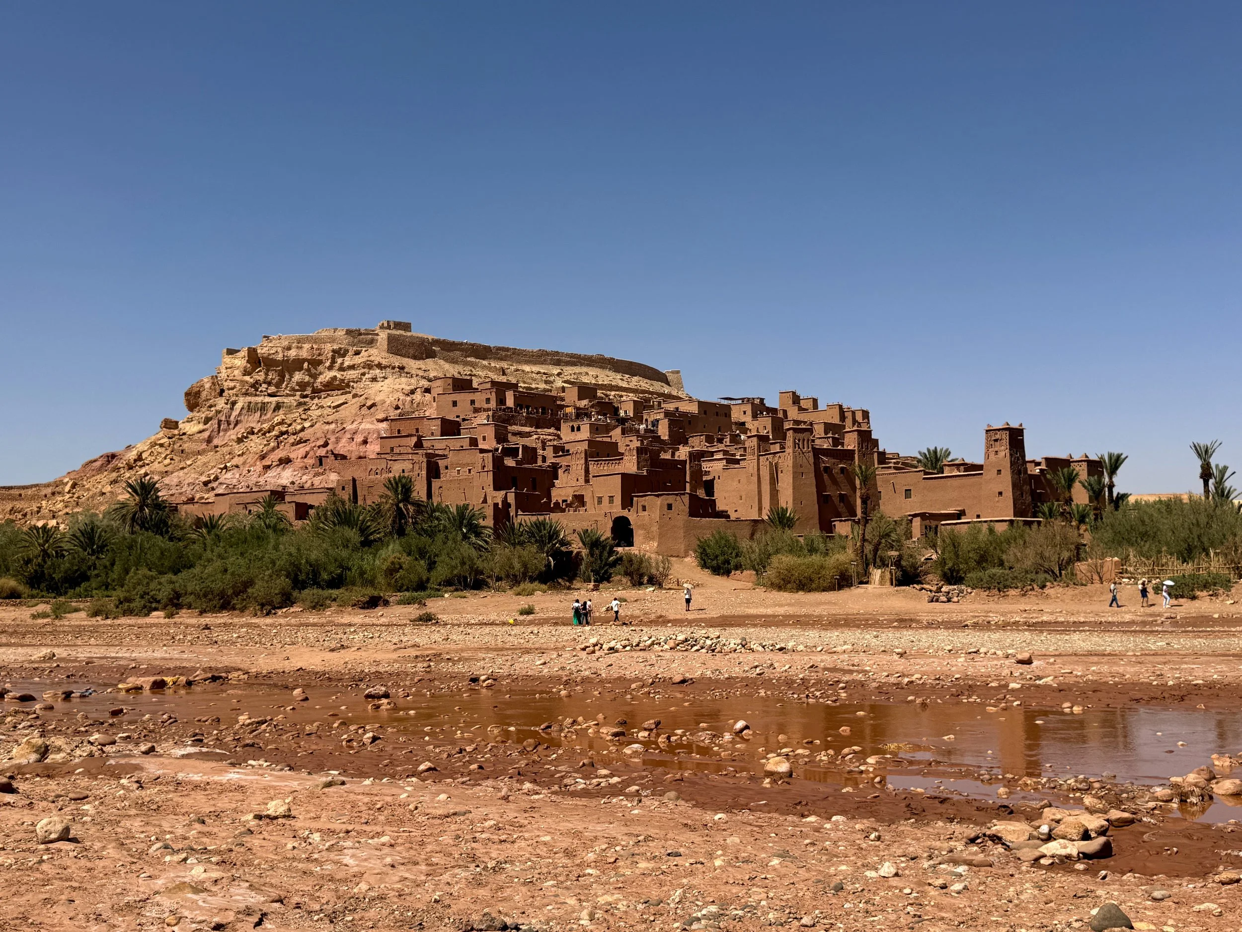
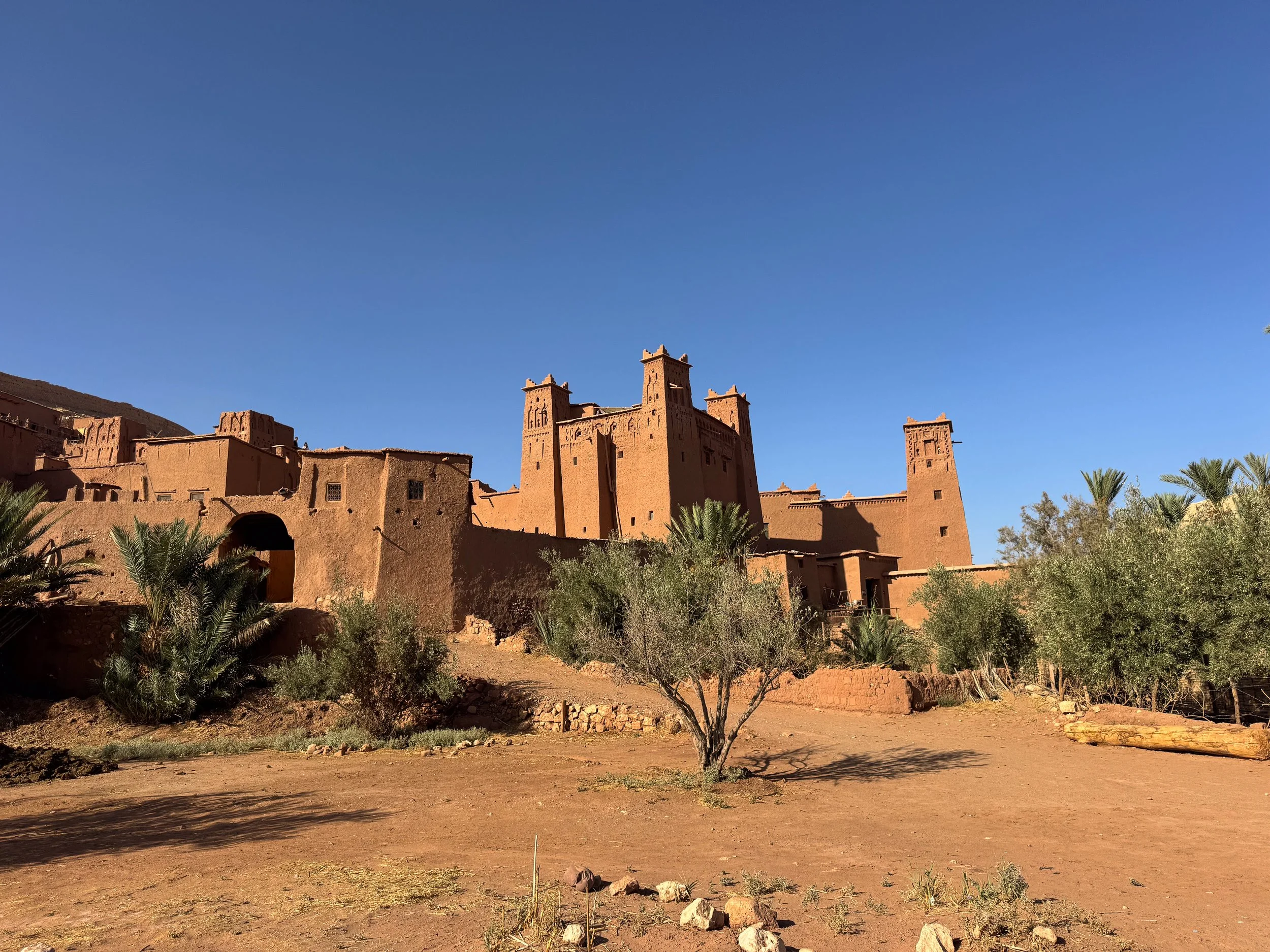
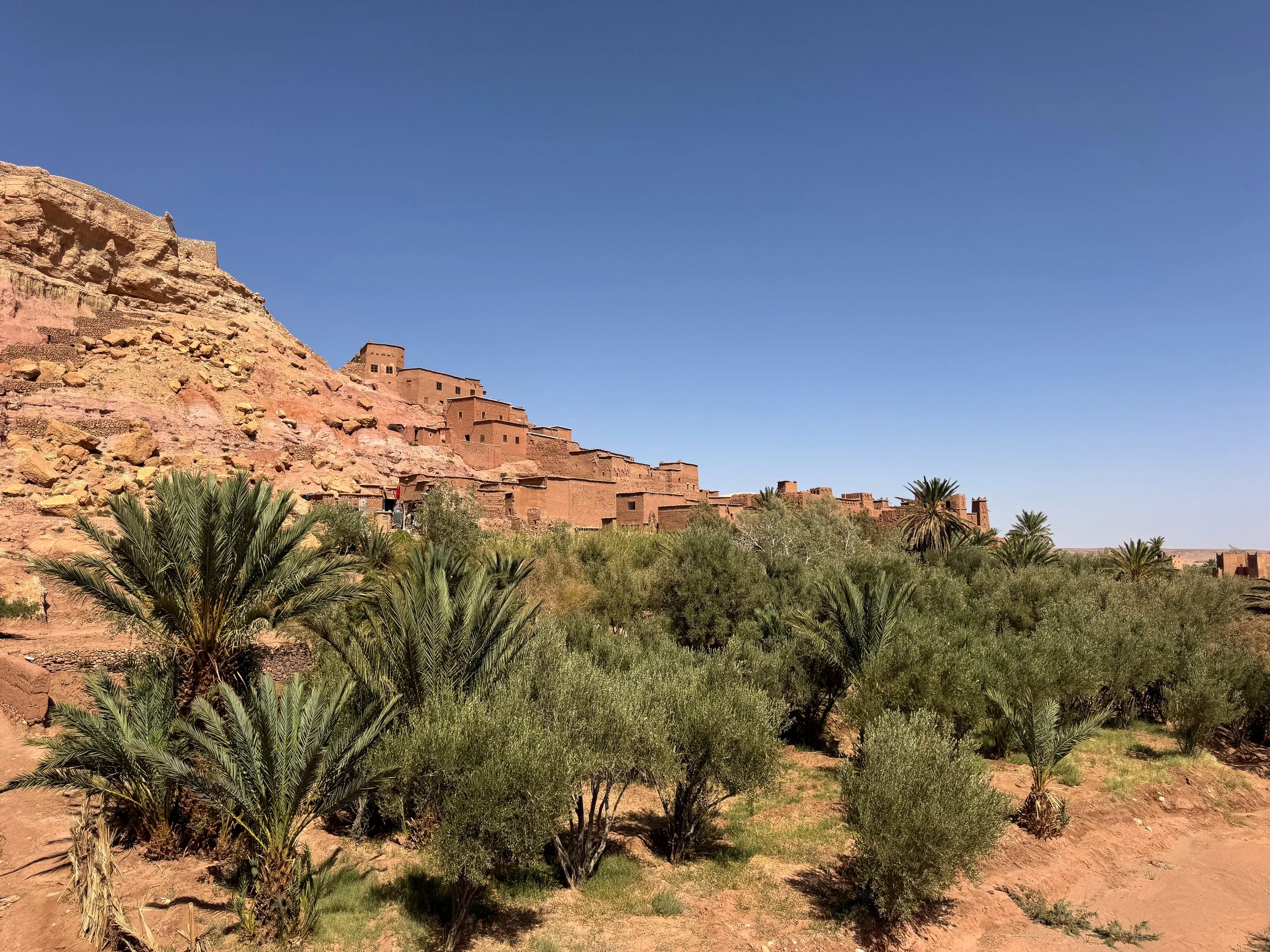
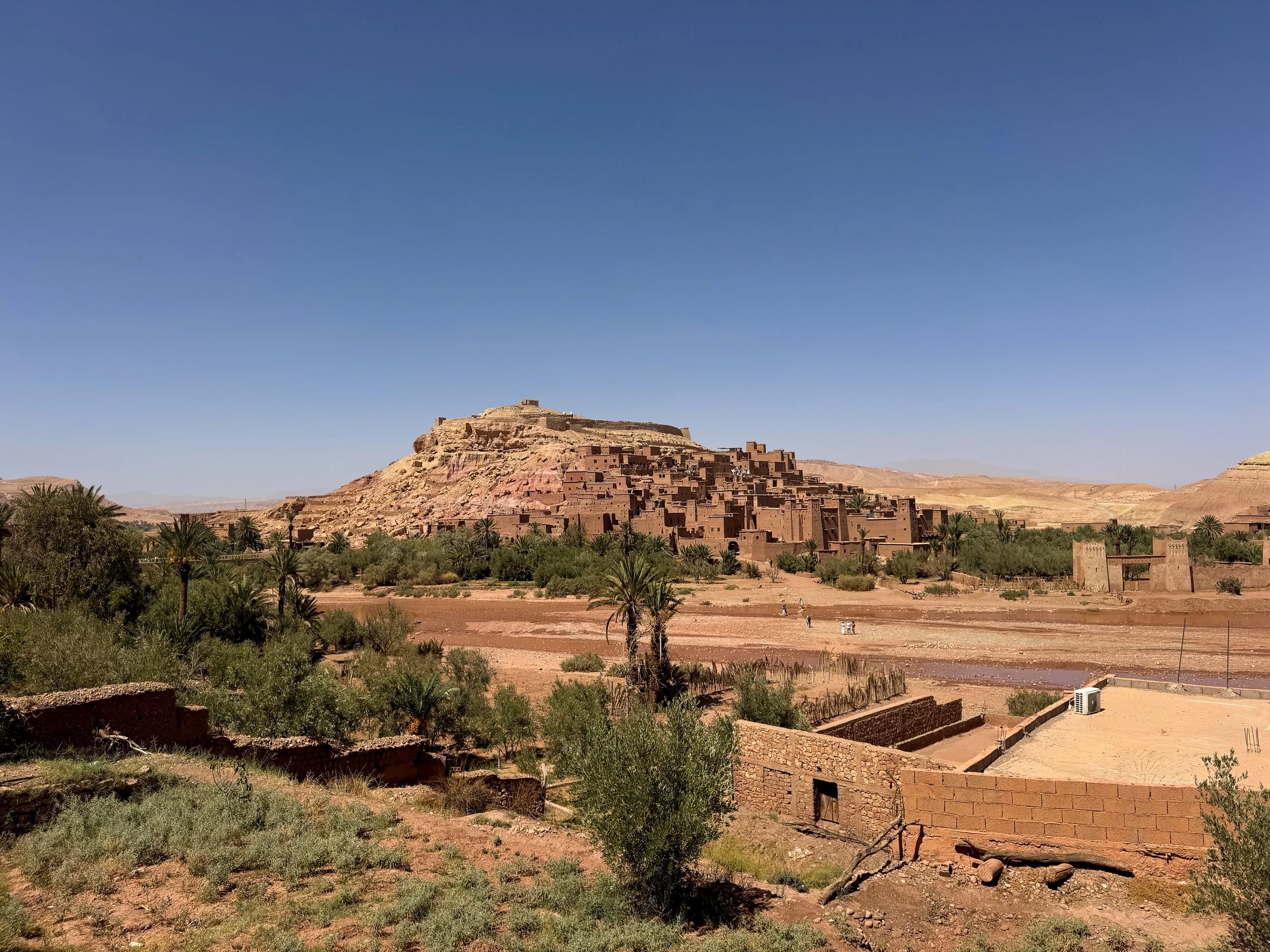
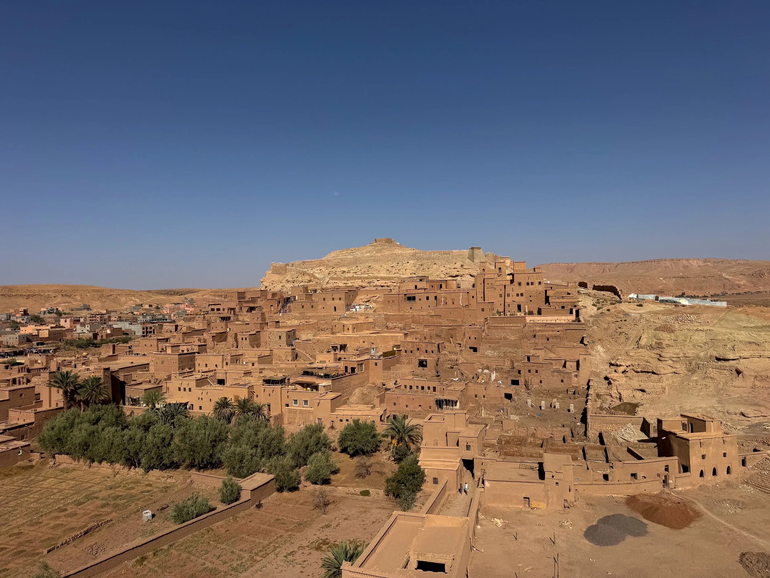
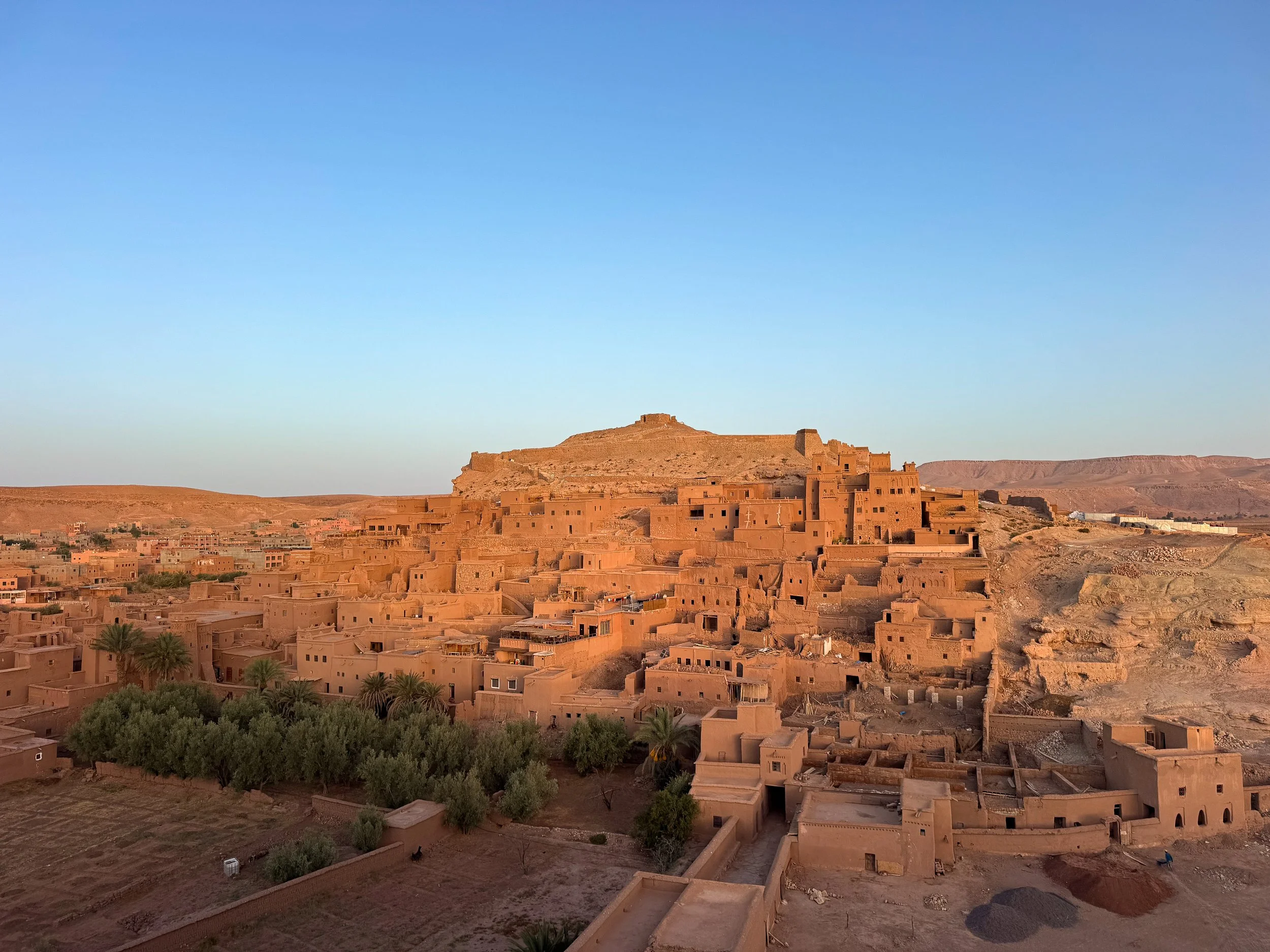
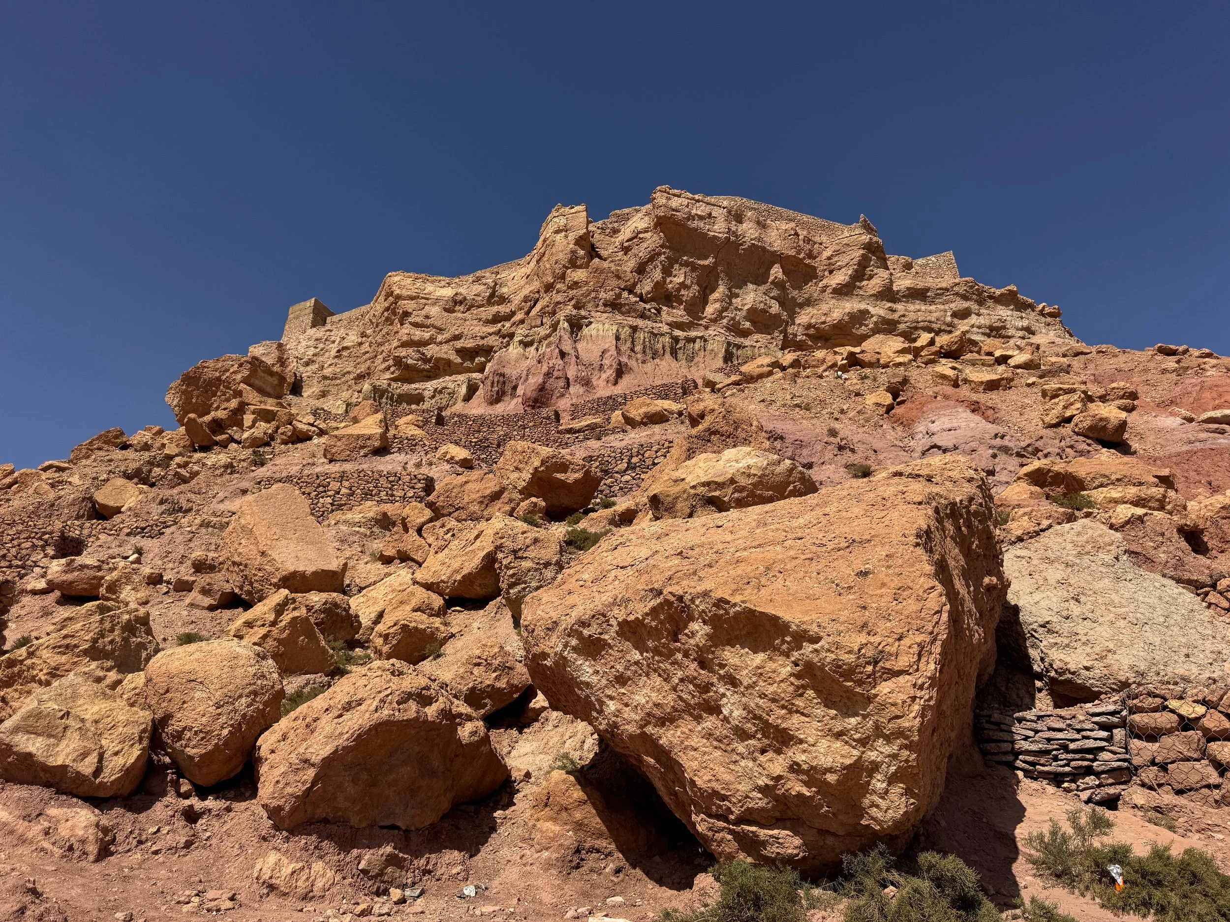
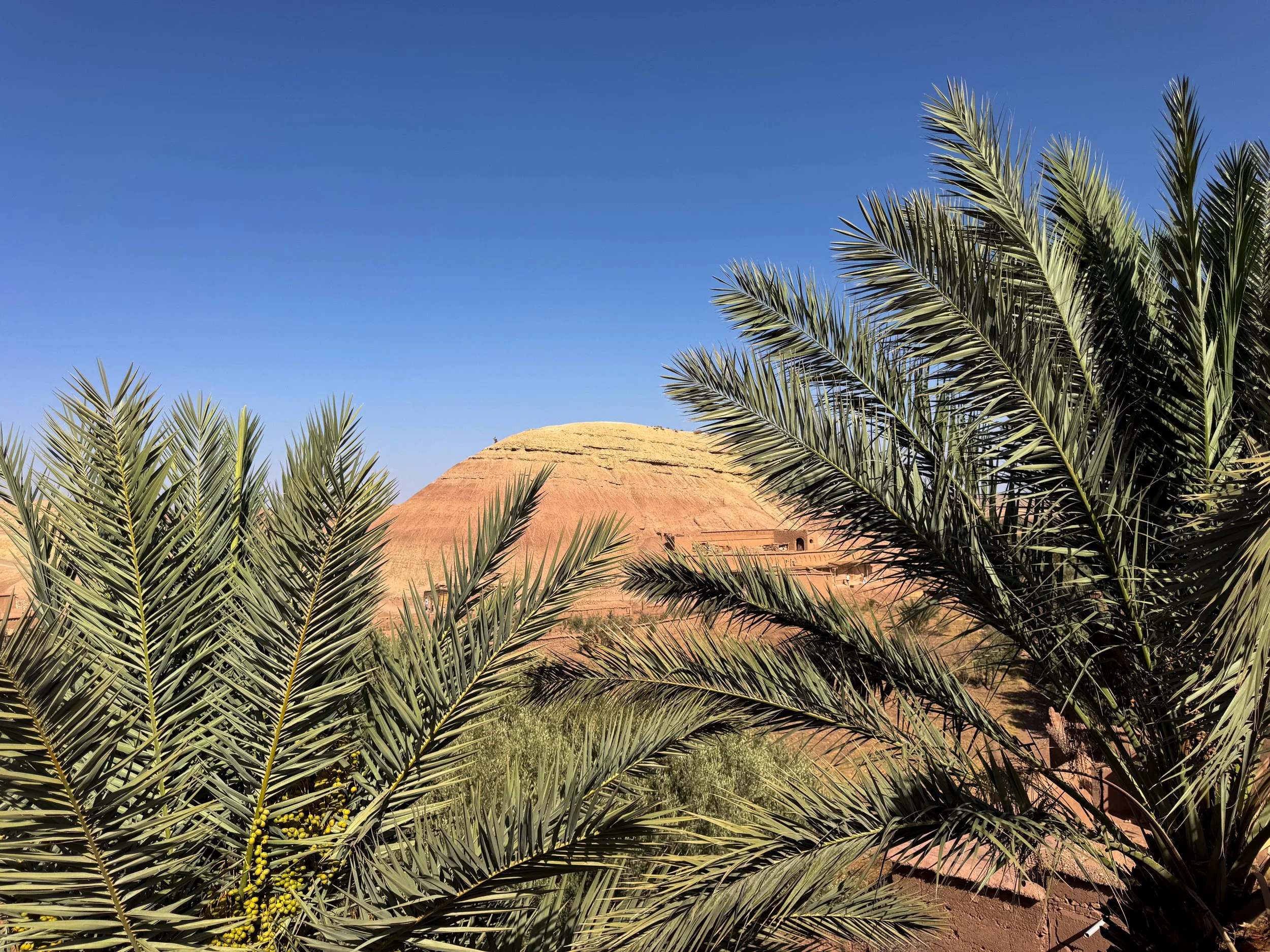
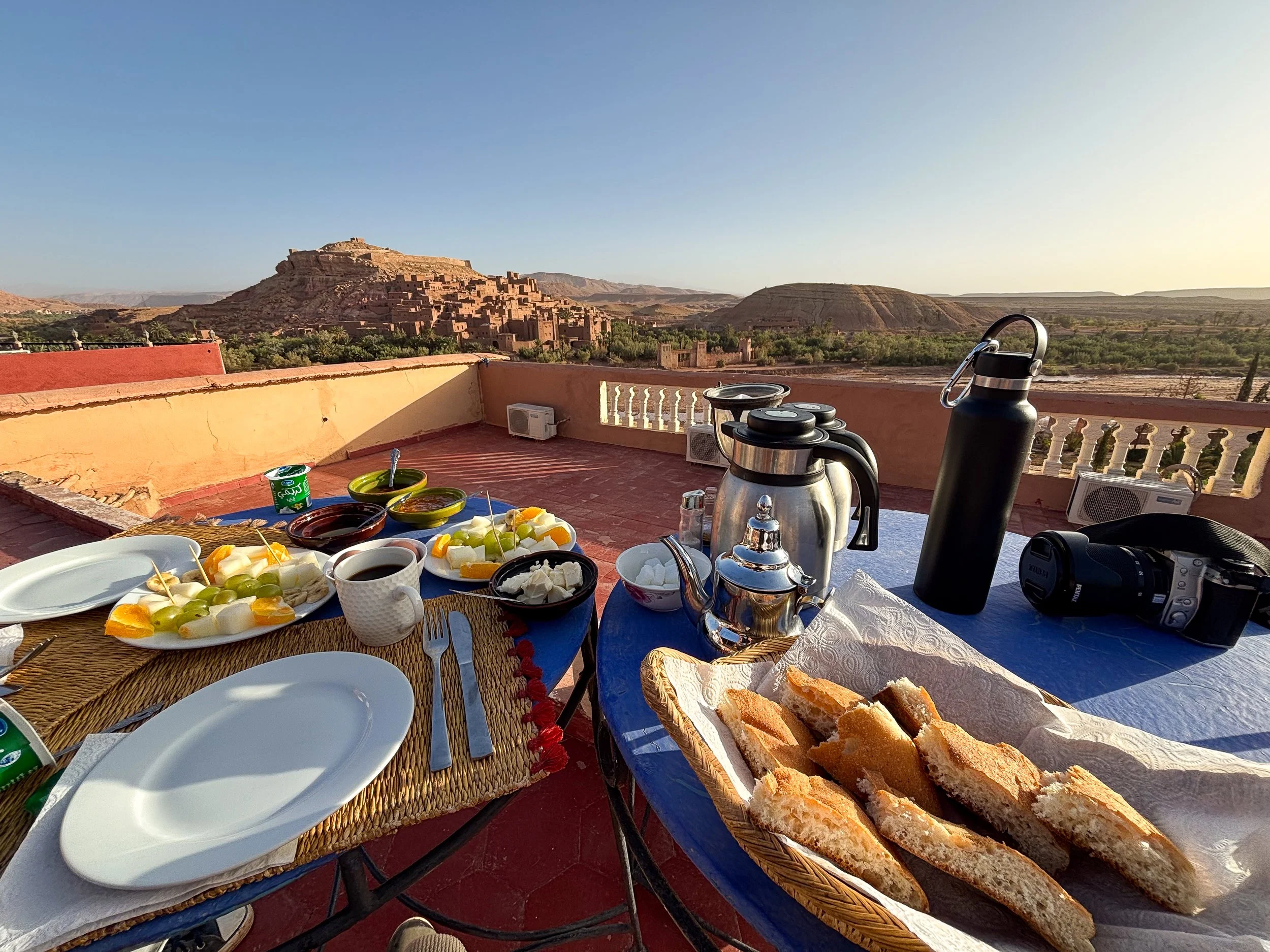
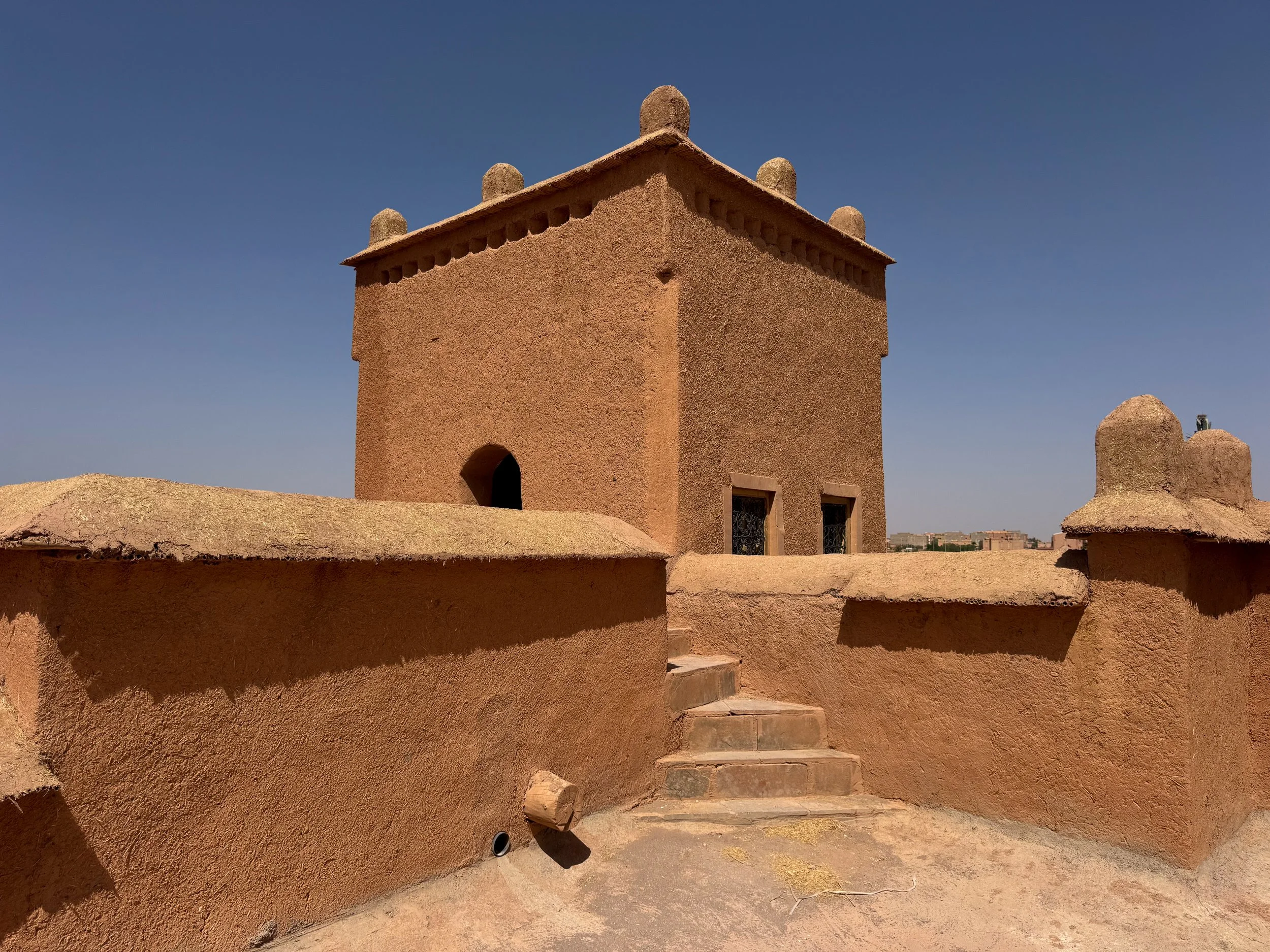
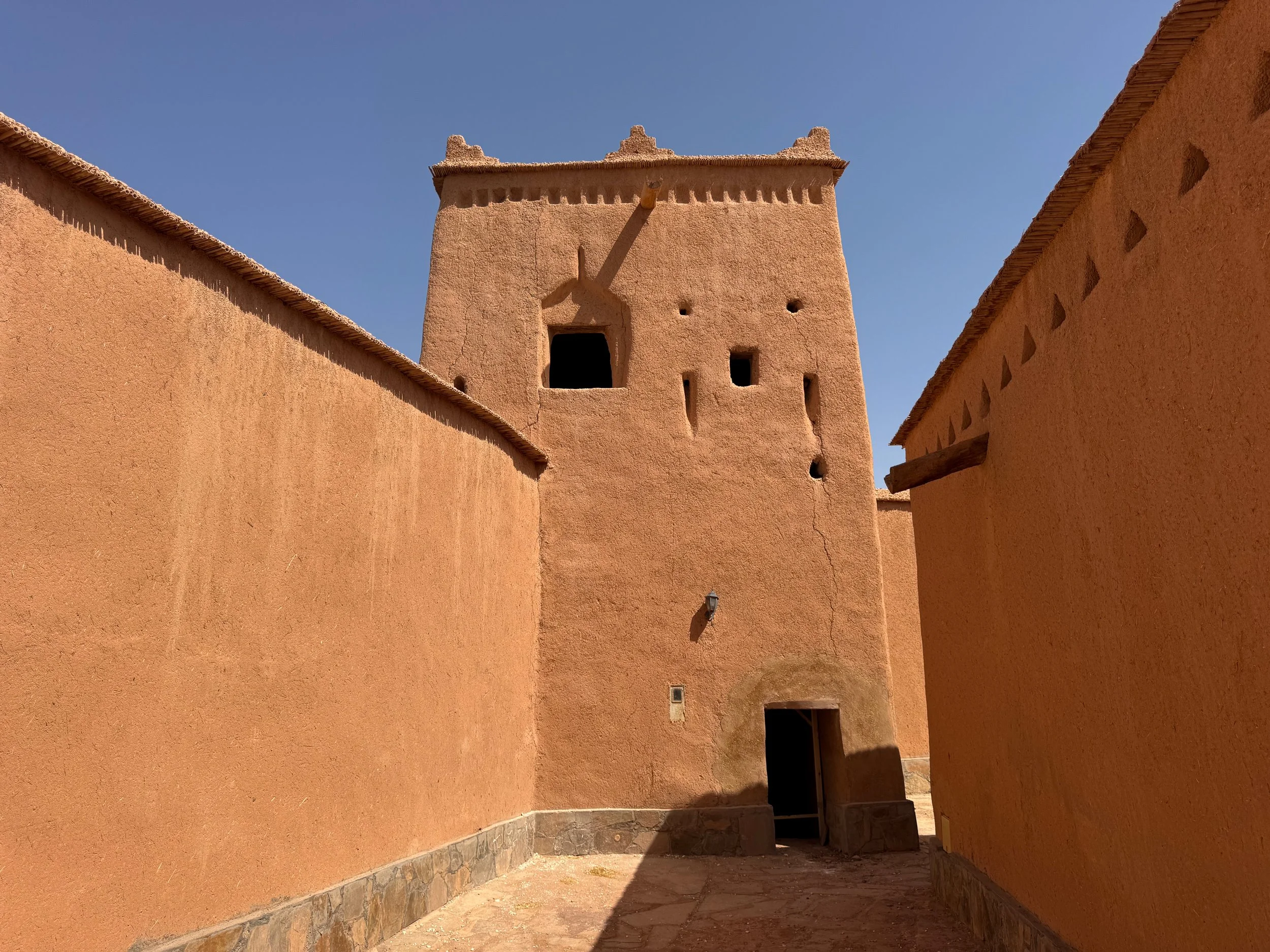
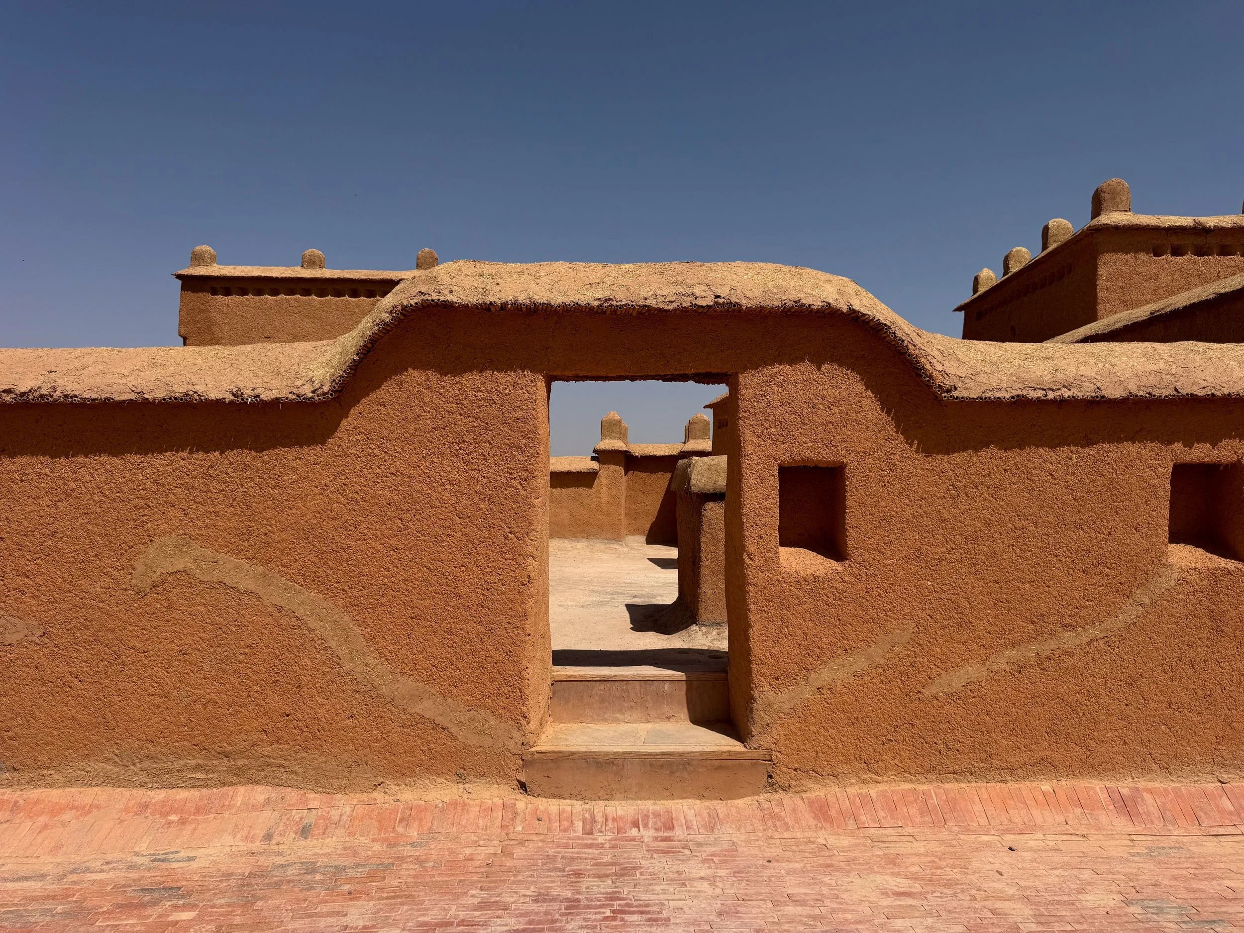
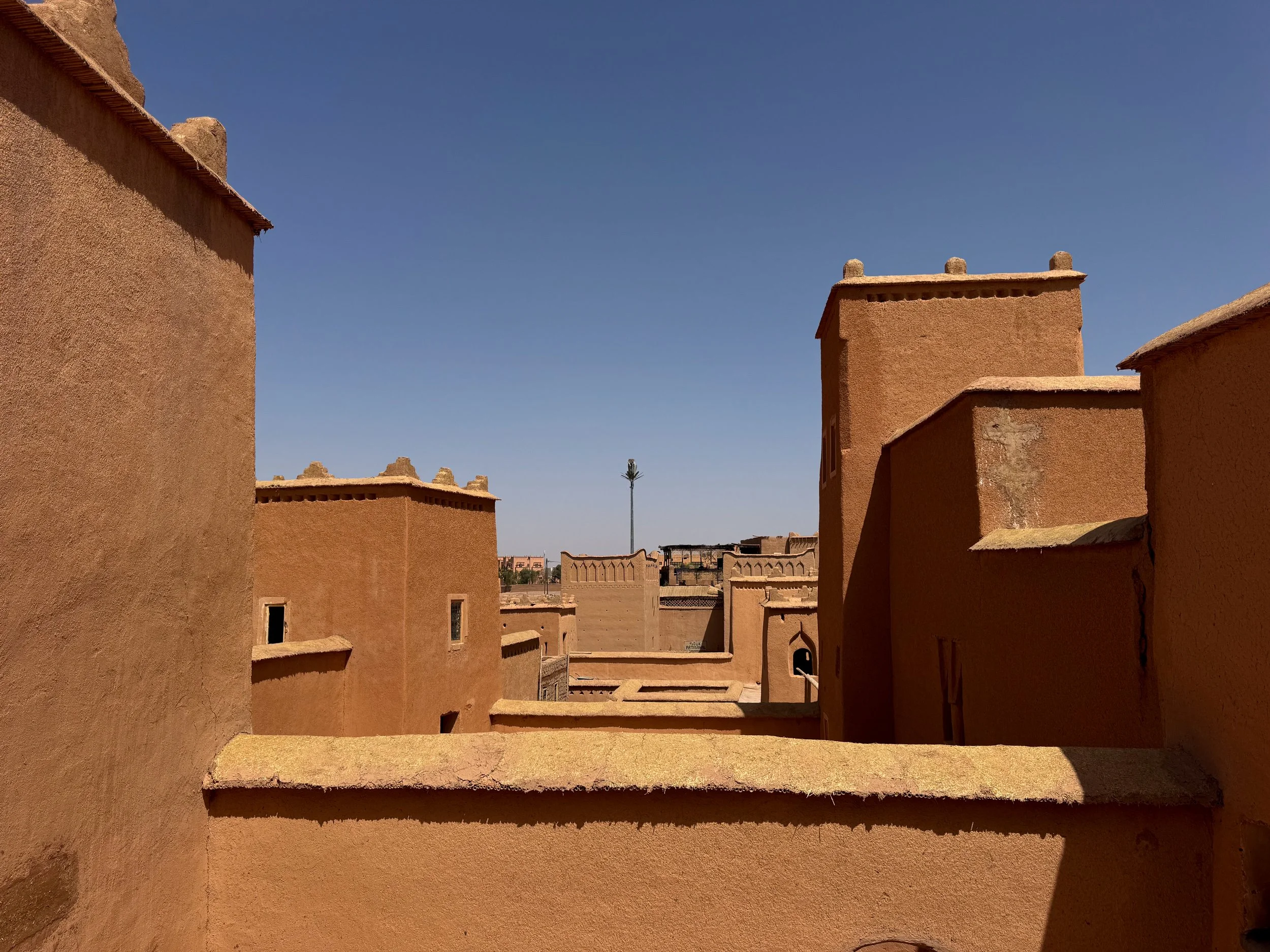
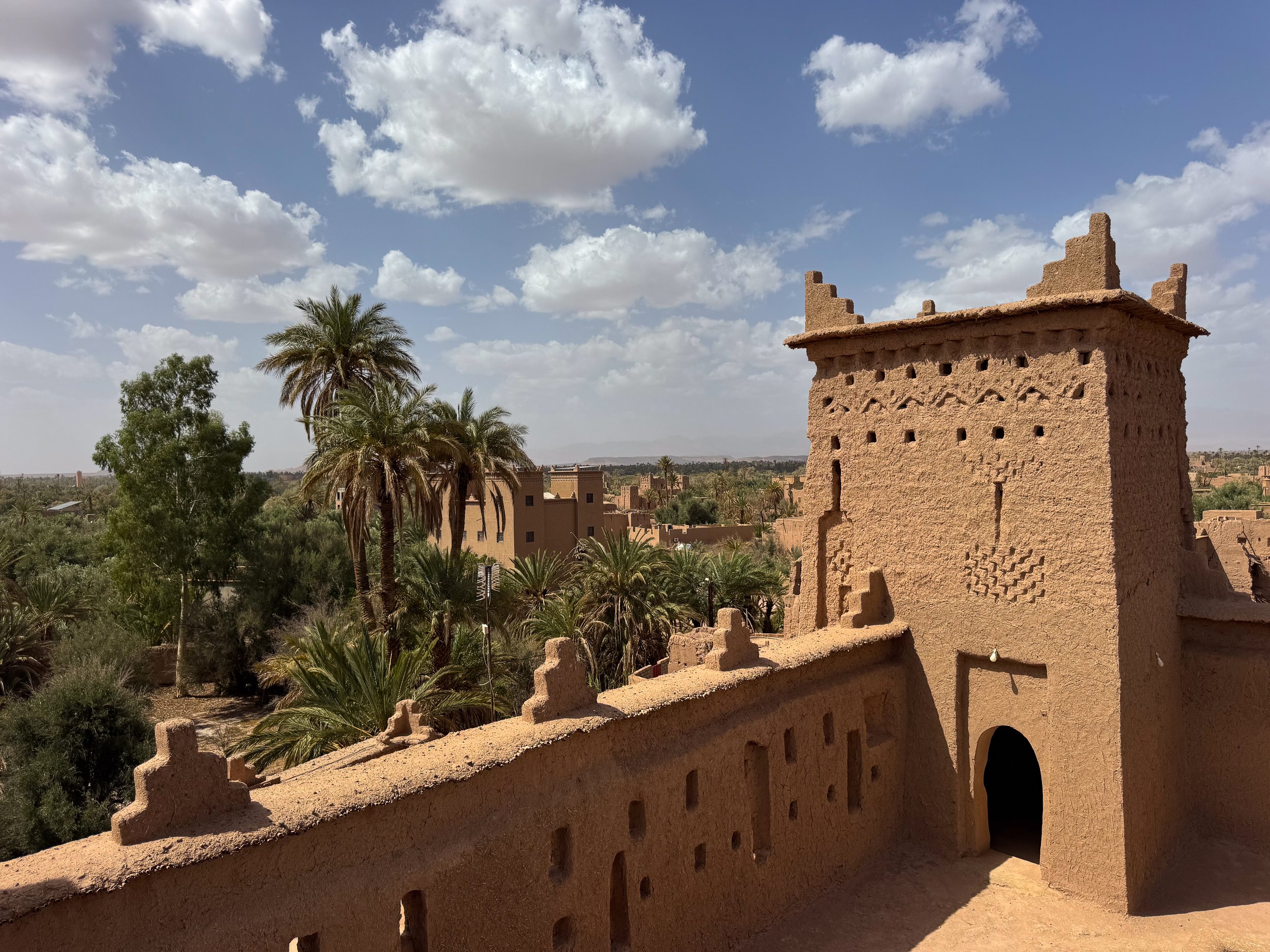
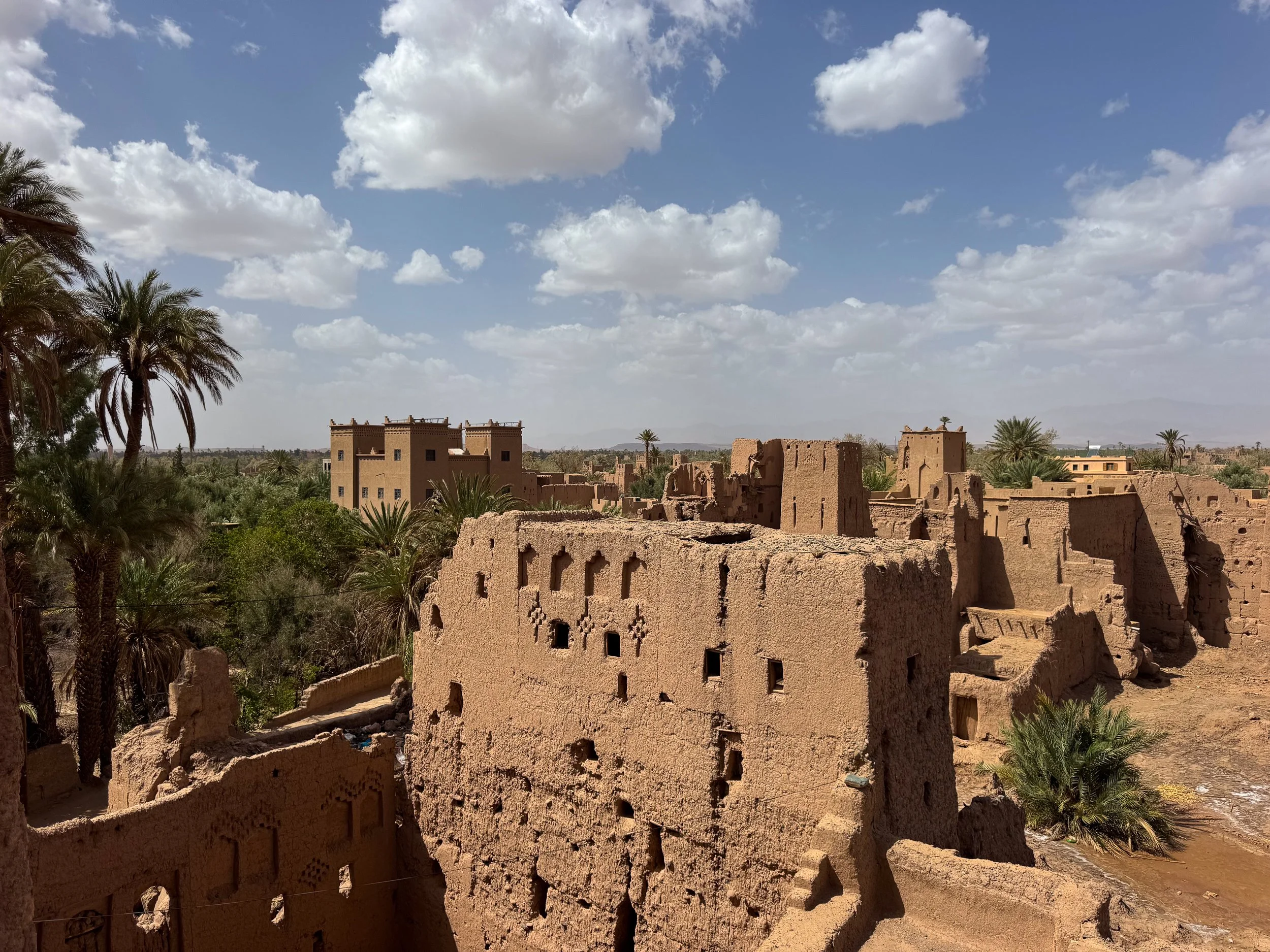
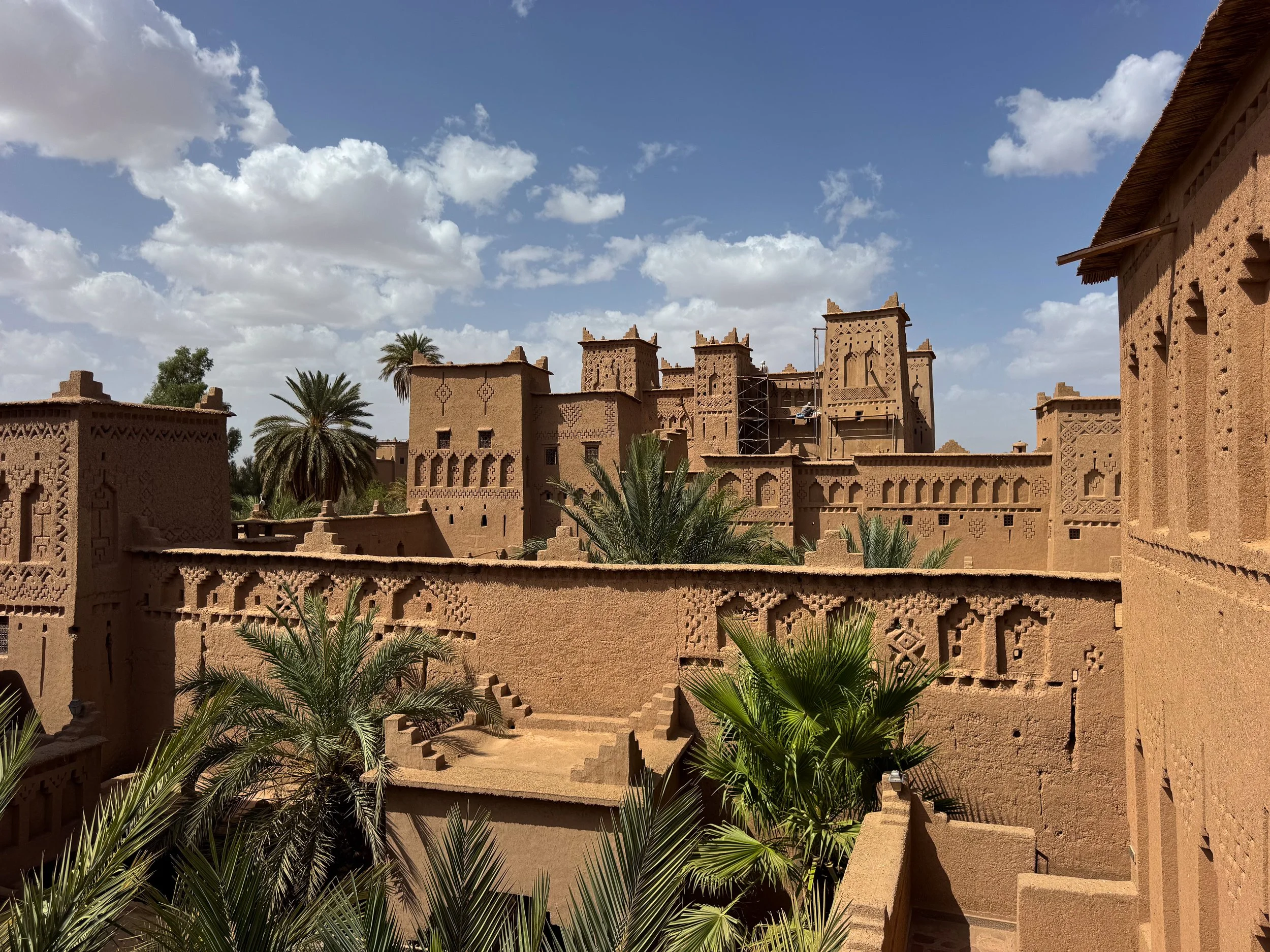
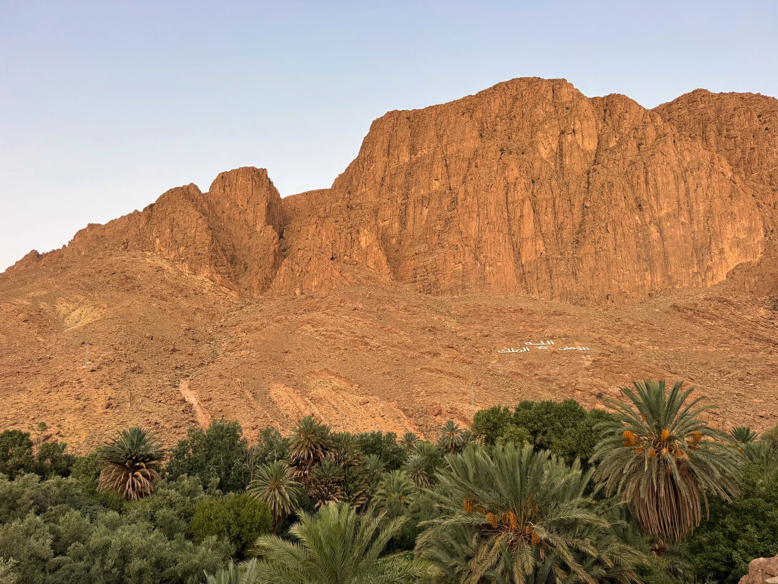
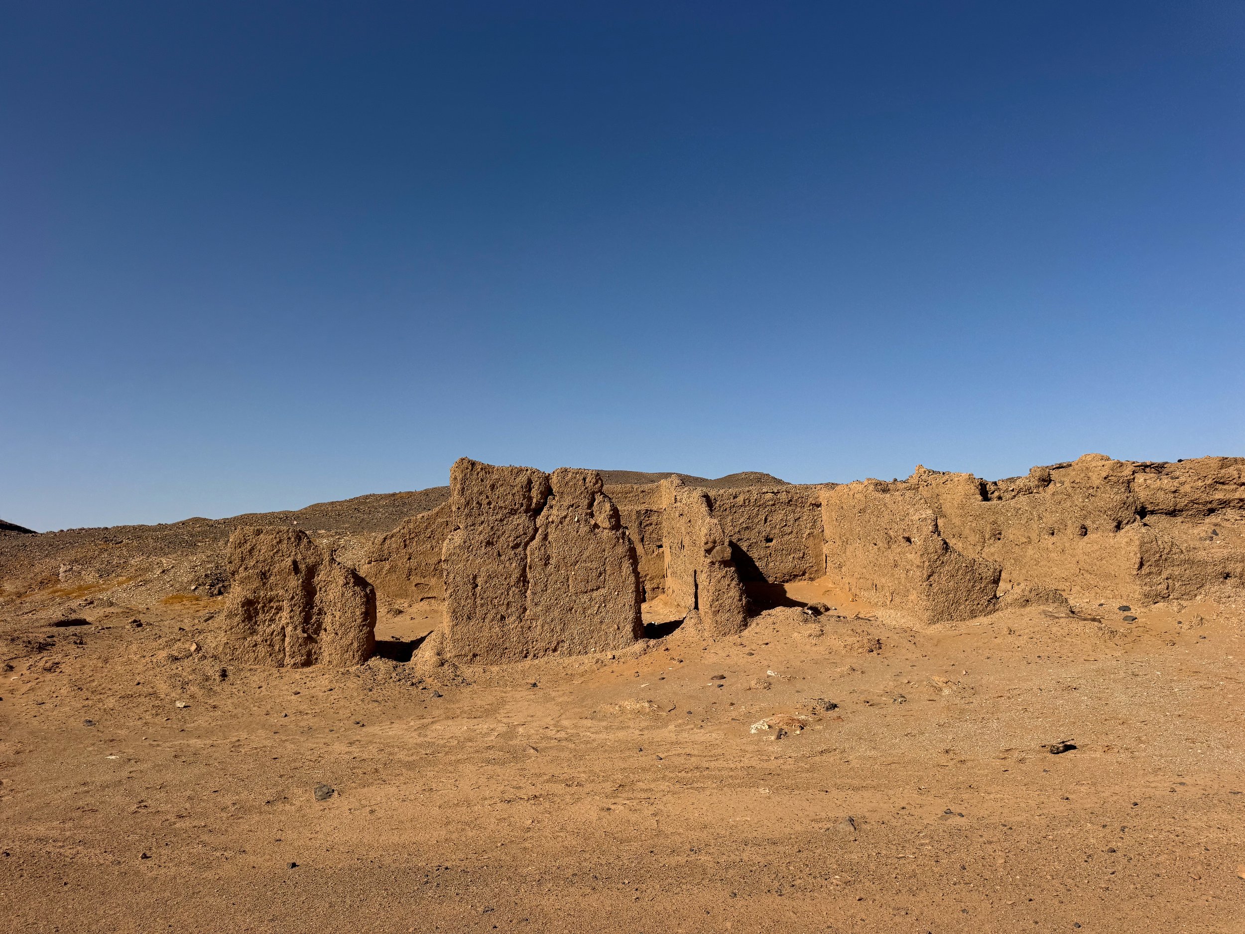
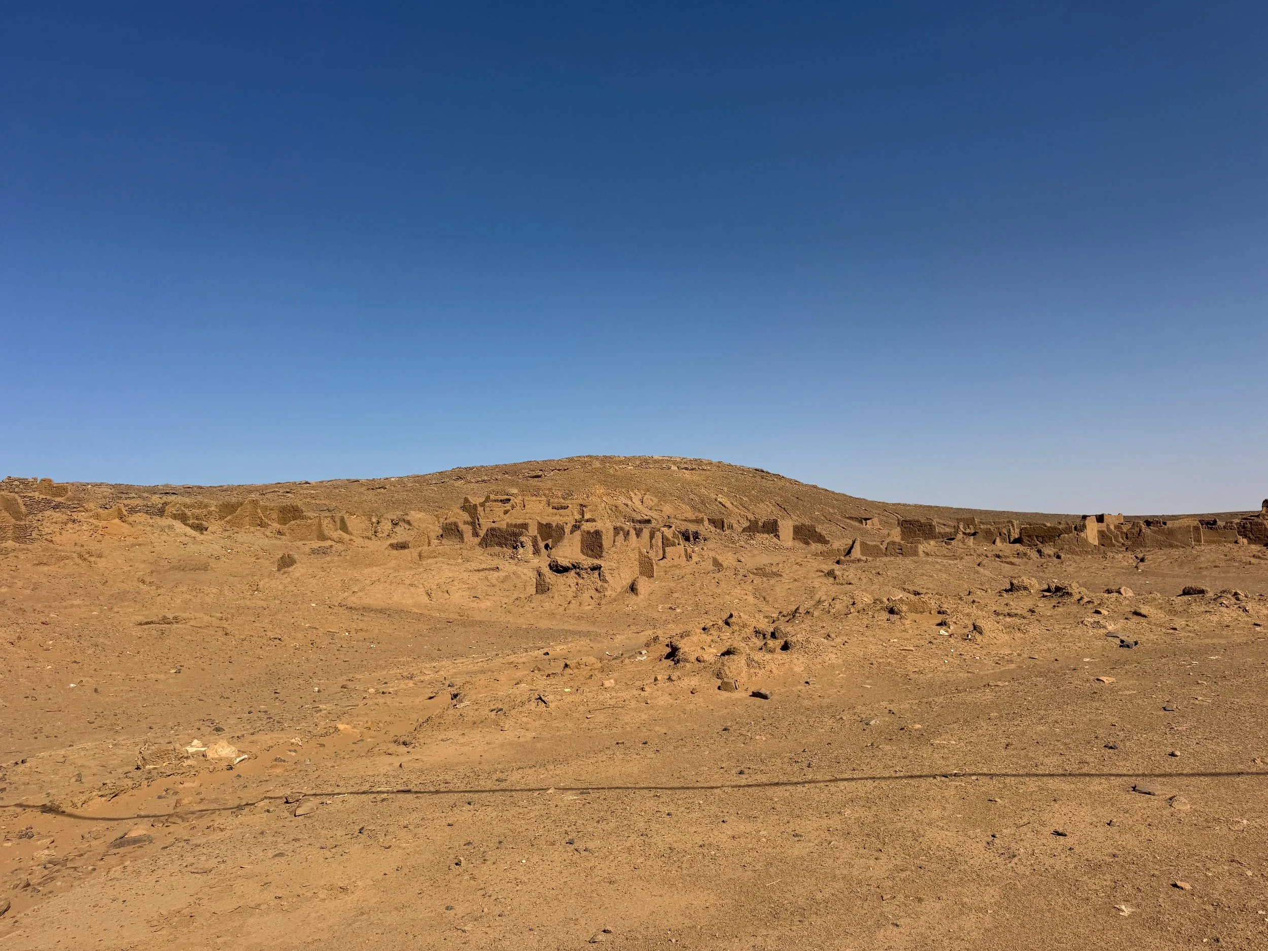
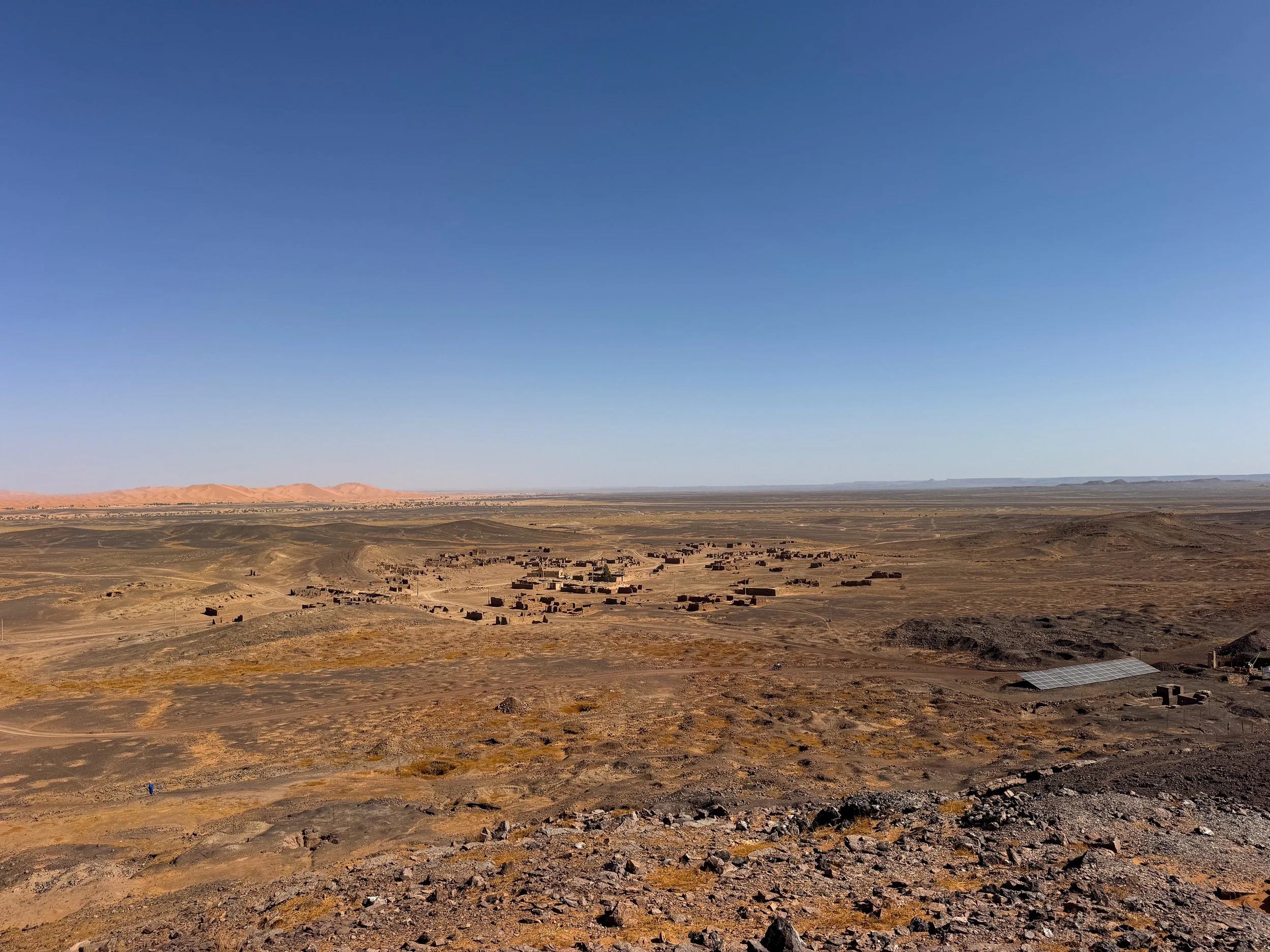
Ait Ben Haddou
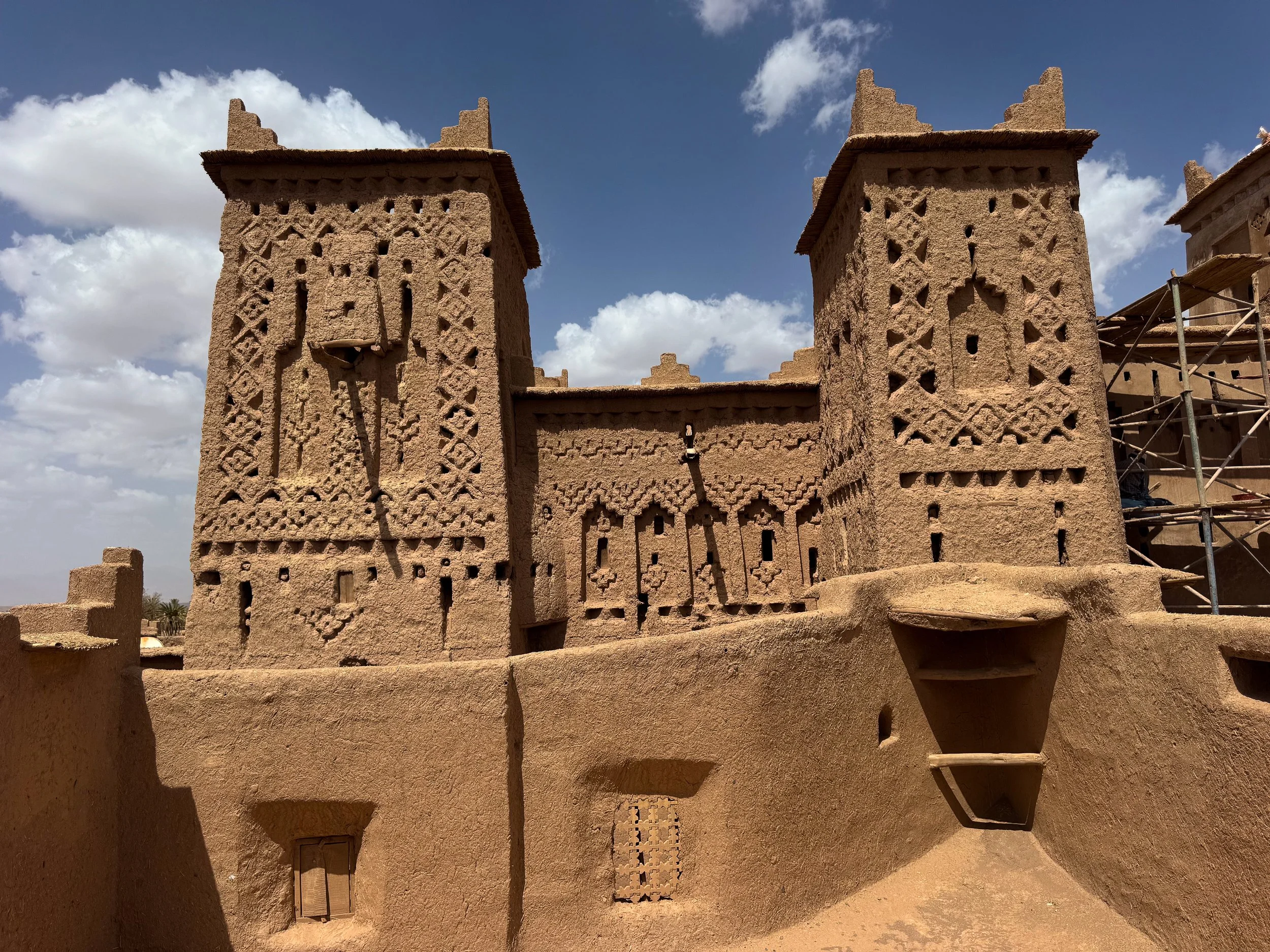
Ait Ben Haddou is a desert town famed for its ancient ksar, towering kasbahs and Berber culture.
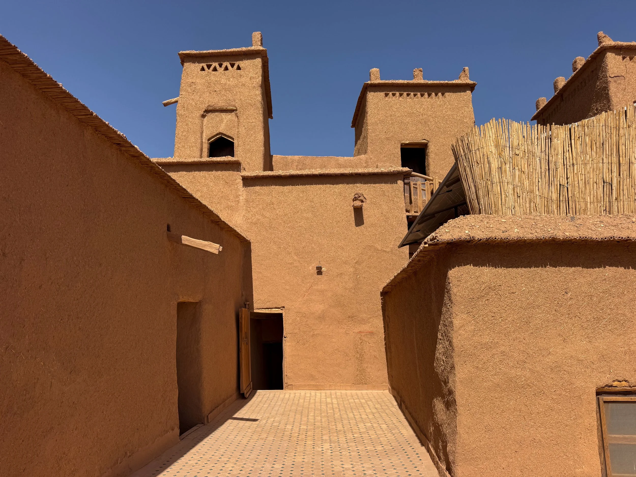
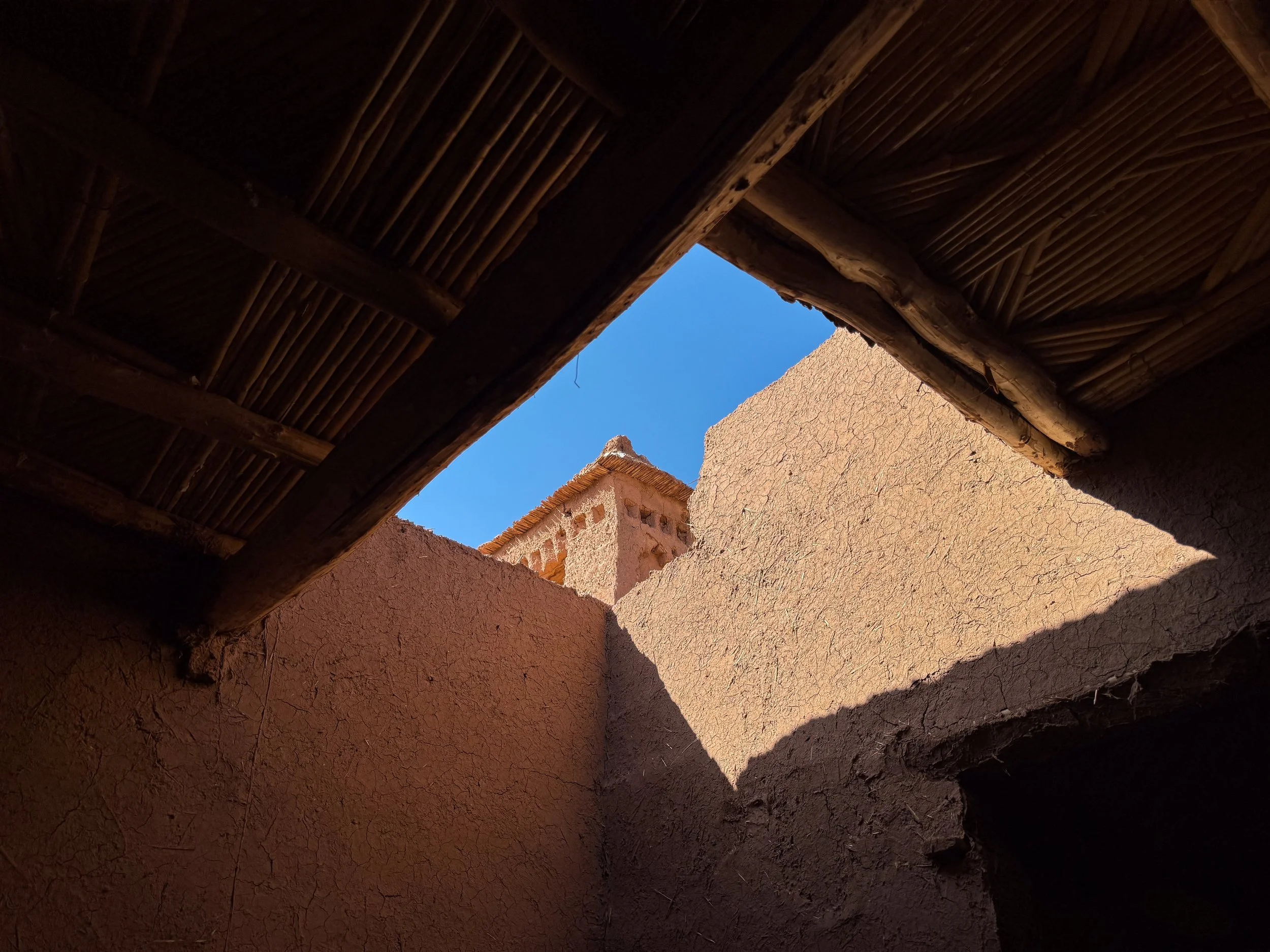
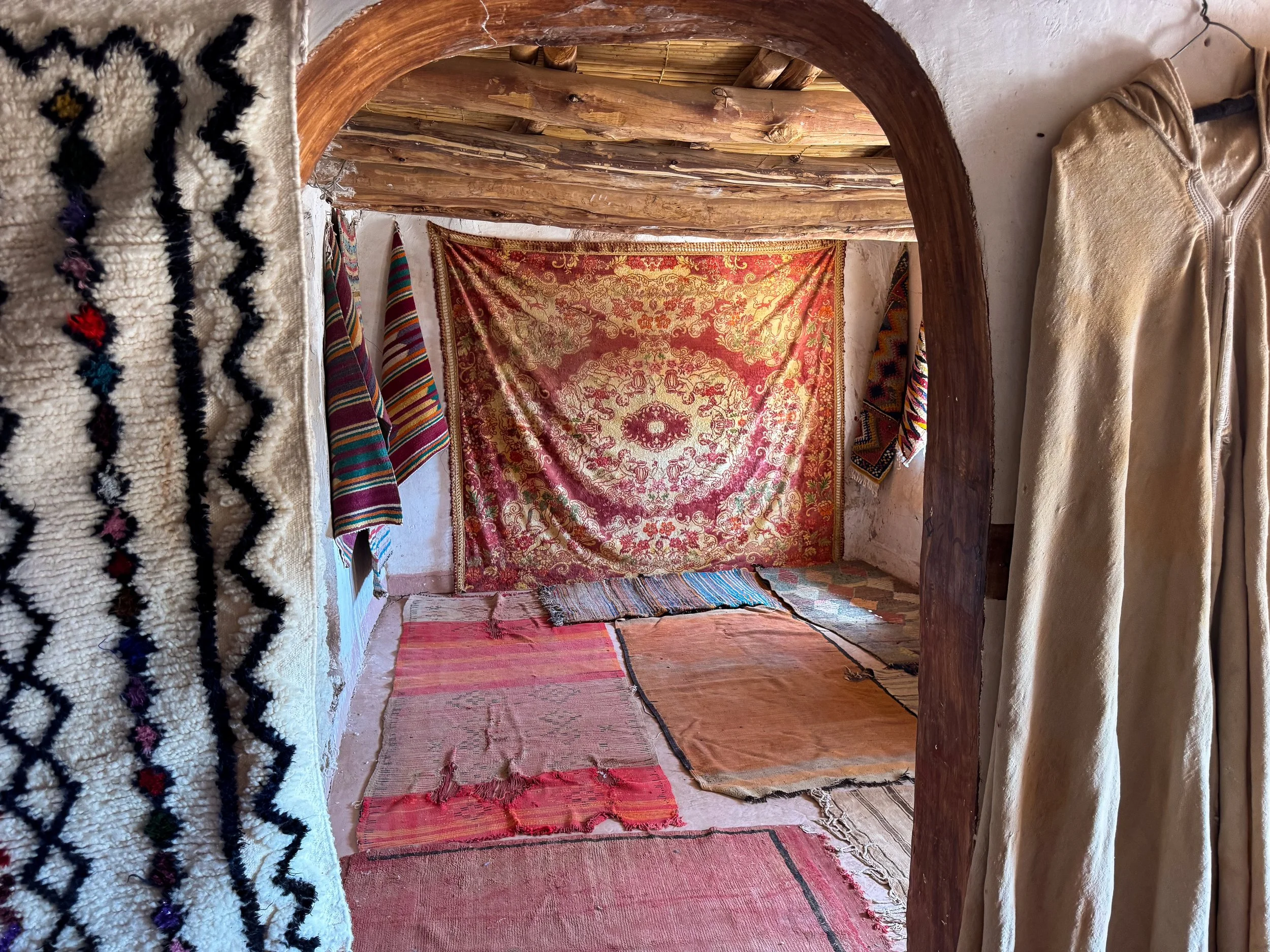
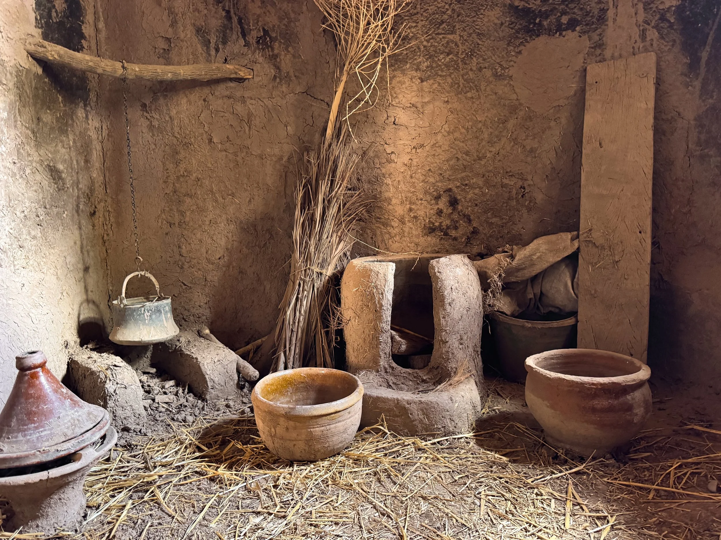
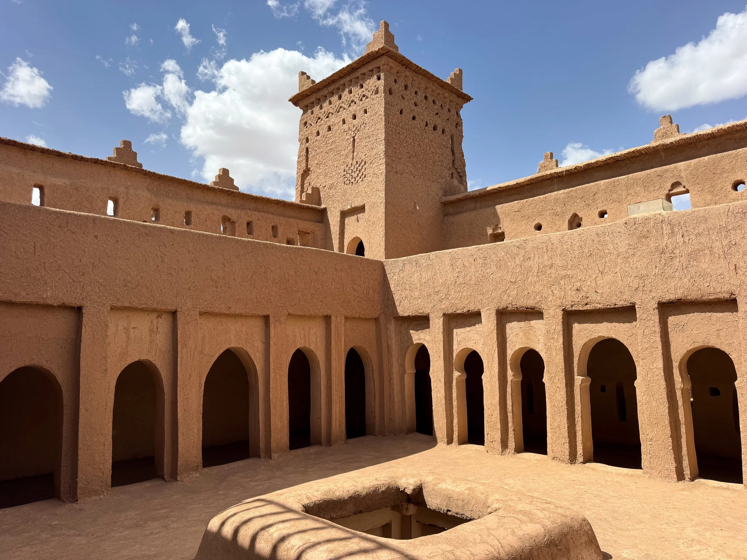
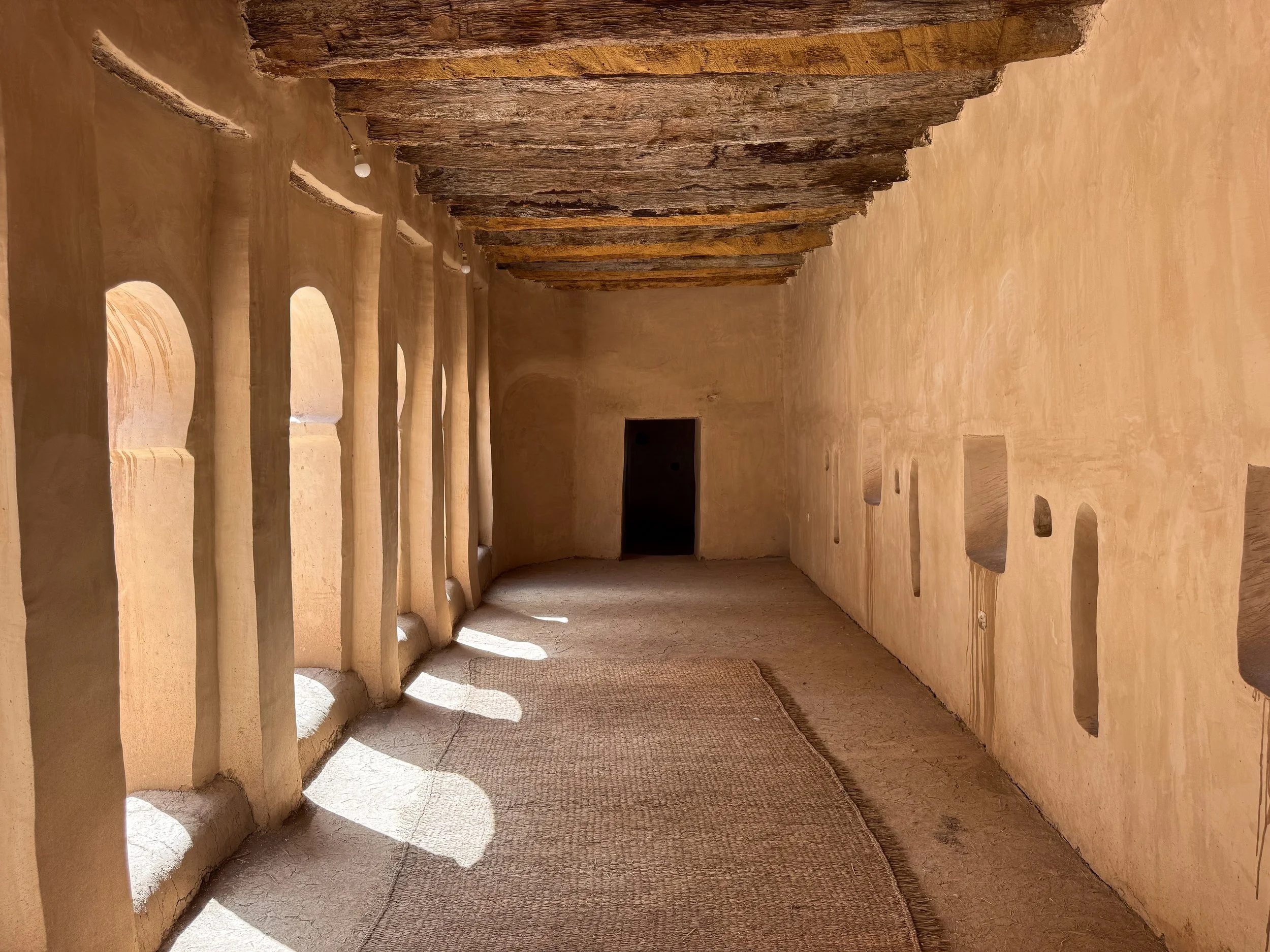
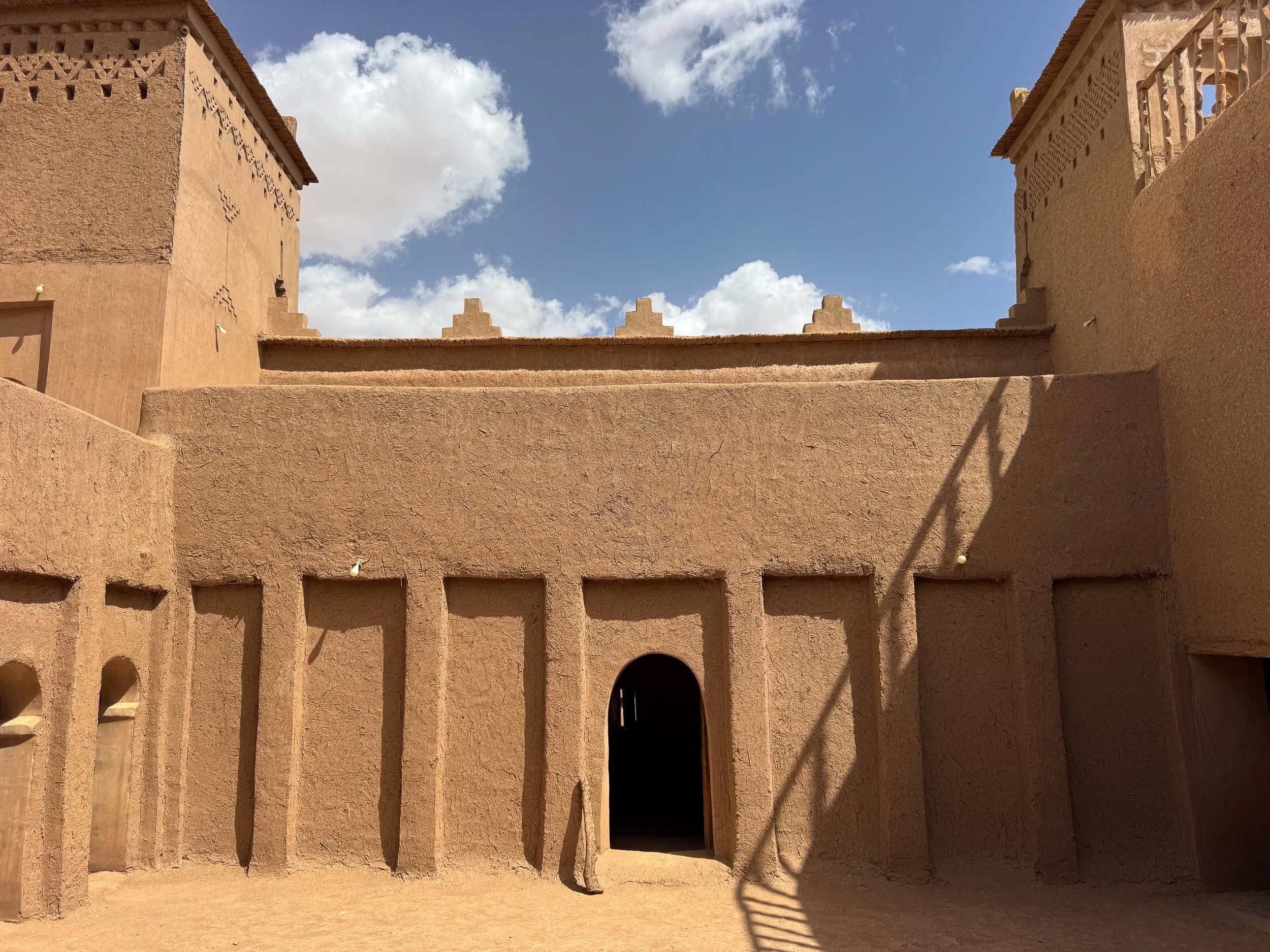
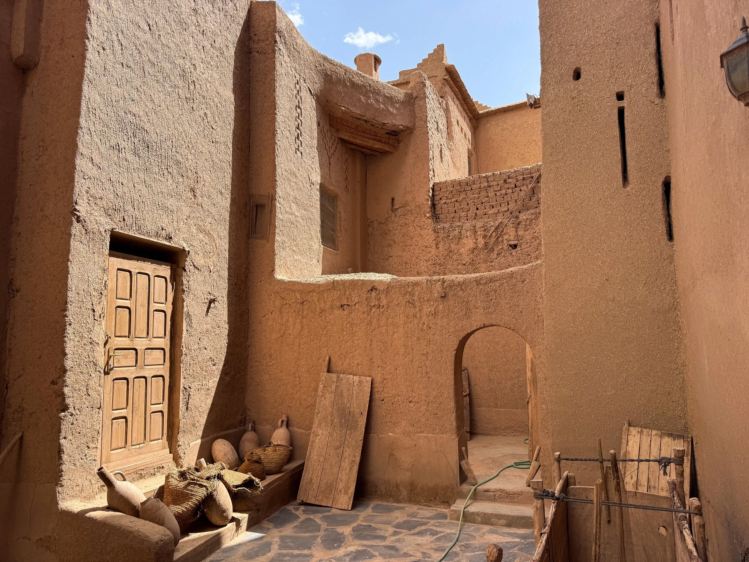
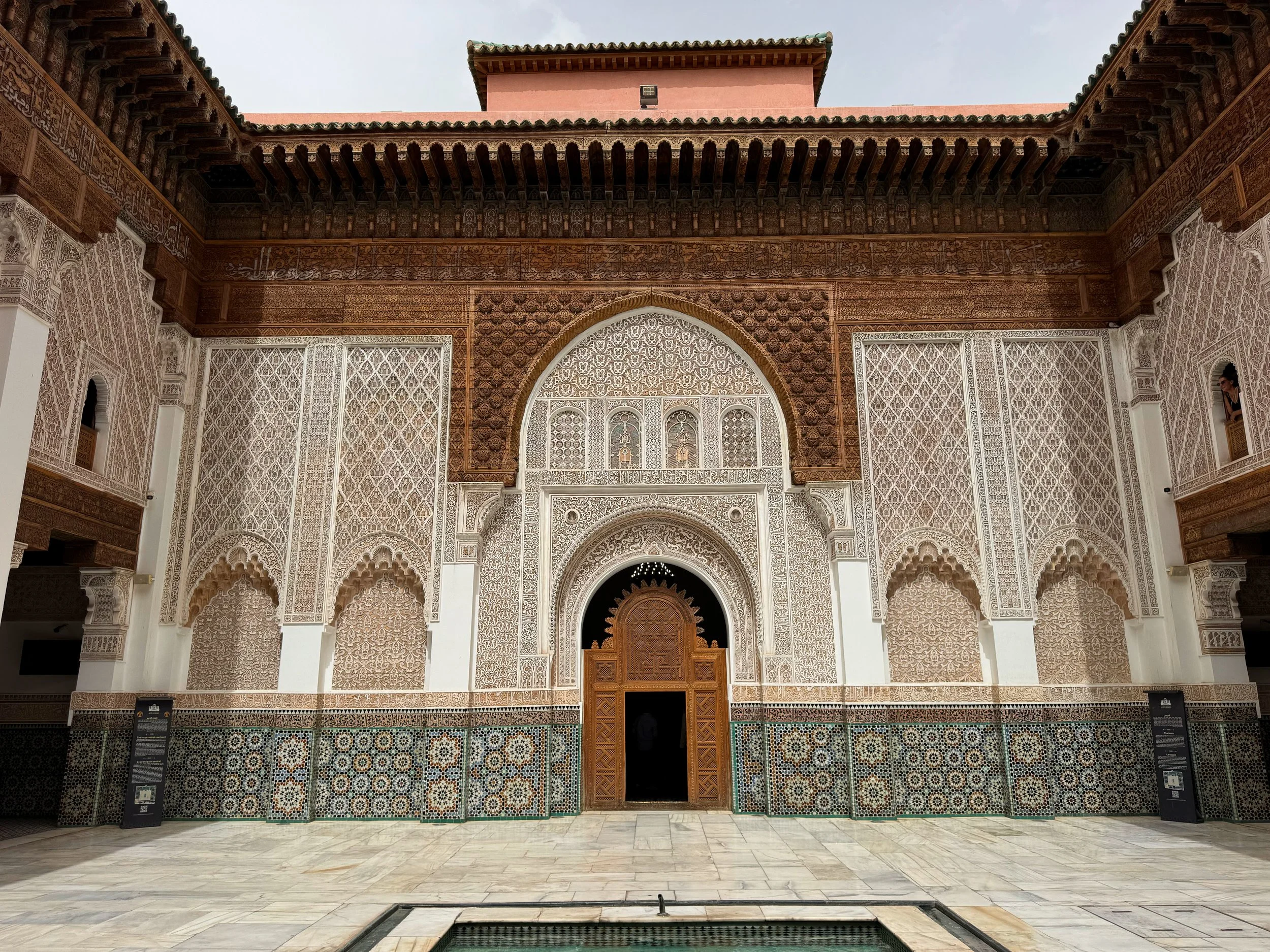
The Ancient Ksar. Adobe buildings and four towered kasbahs rise from the hillside of the ancient ksar. Their sand hued facades blend in with the desert landscape. Berber patterns and geometric designs decorate their outer walls. Narrow streets and passageways meander past cafés with rooftop terraces and vendors selling Berber goods.
Pro Tip. Walk through the empty streets of the ksar after the sun rises.
The Modern Village. A contemporary expansion of the ancient ksar. Its sand hued buildings are home to local residents, tourist hotels, Moroccan restaurants and artisans. Rooftop terraces overlook the ancient ksar offering panoramic views of its grandeur and the surrounding landscape.
Tour The Kasbahs. Ait Ben Haddou’s kasbahs are worth visiting to experience local life and traditions. Their owners typically charge a small fee to enter.
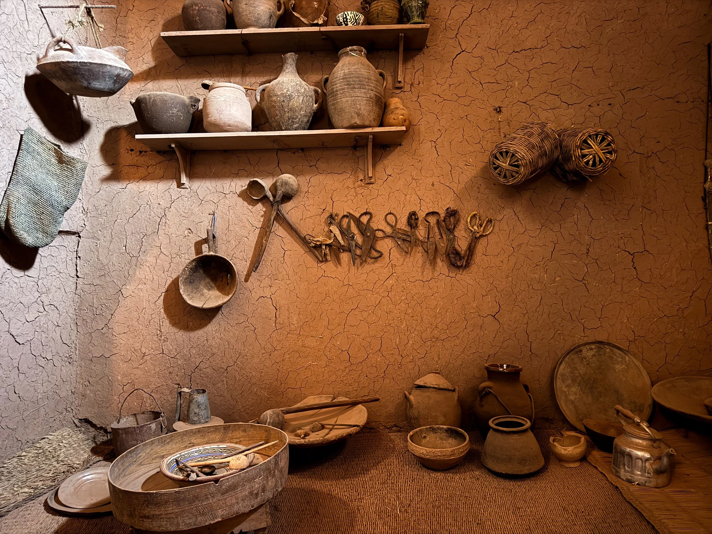
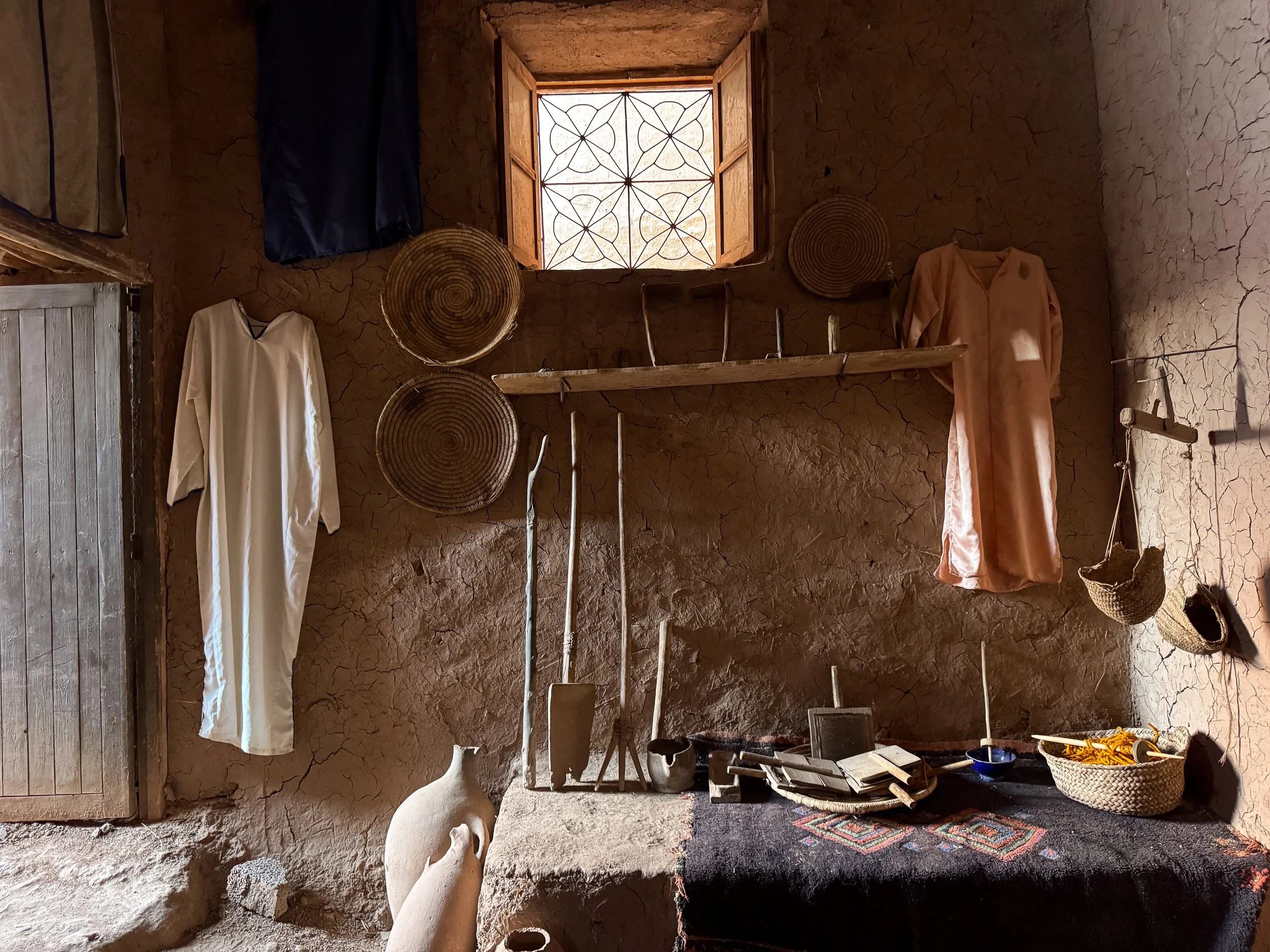
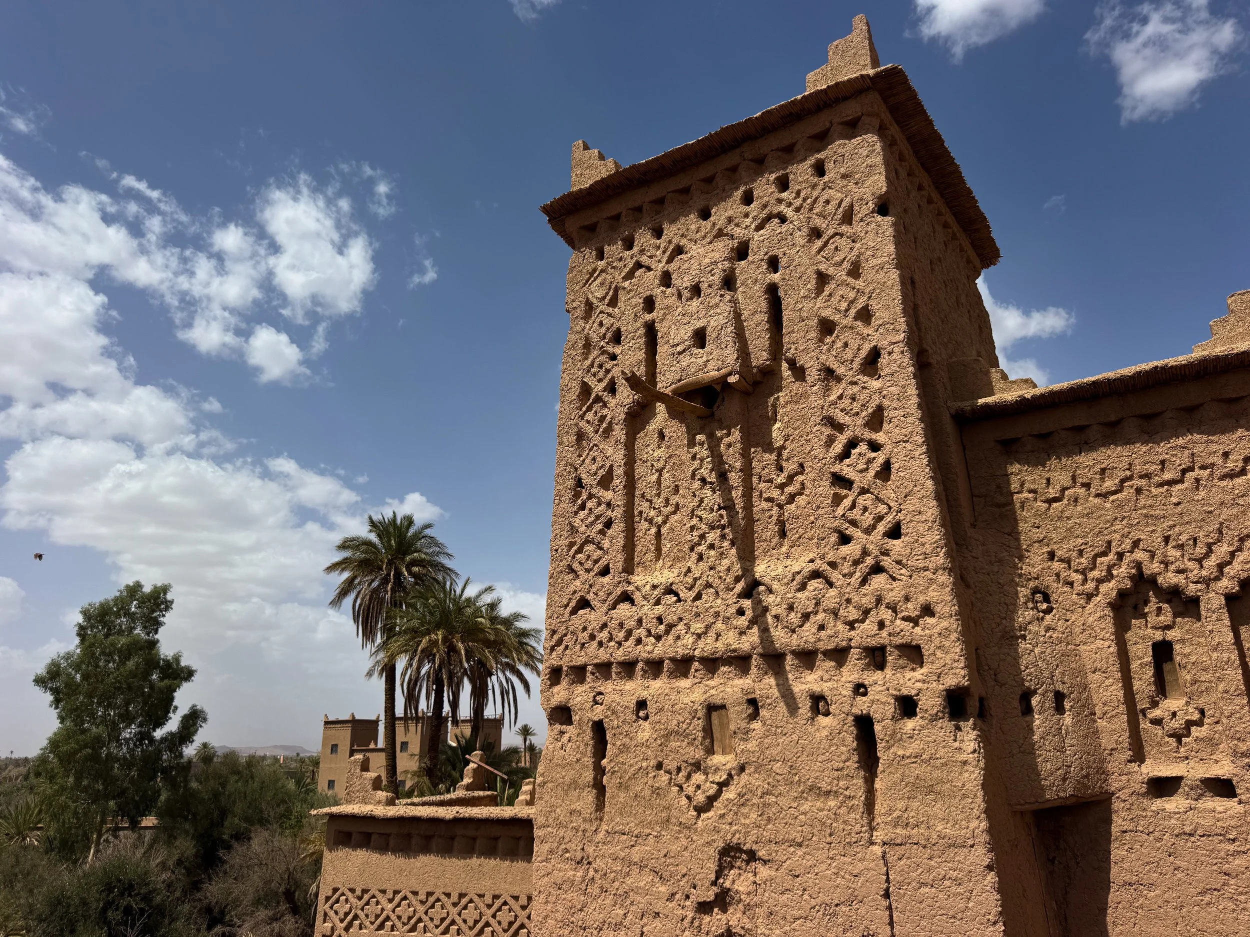
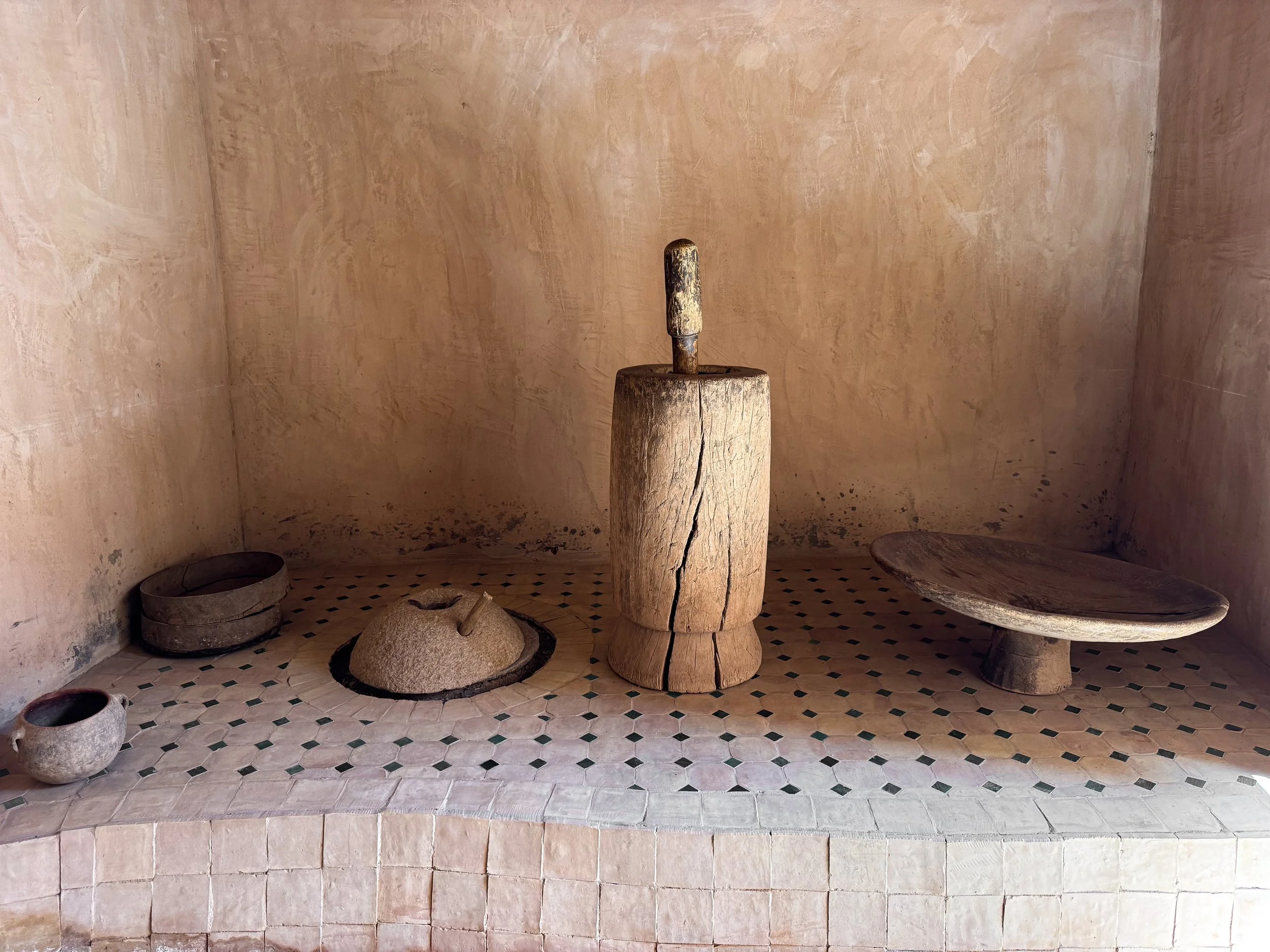
The Museum Kasbah. A large kasbah with several connected rooms and a central staircase leading to the upper floors and the roof. Traditional tools, ceramics and textiles are displayed on interior walls. The roof offers views of the ancient ksar, its neighboring kasbahs and adobe houses.
The Widow’s Kasbah. A crumbling kasbah still inhabited by an older woman. She toured us through the ground floor, showing us her kitchen, bedroom and living area where she weaves. She let us explore the abandoned upper floor.
Maison de l'Oralité. A large kasbah converted into a museum and cultural center dedicated to Berber arts, language and traditions. Its exhibits feature traditional musical instruments, weaving tools and looms, historic photos and stories of local folklore. The kasbah is one of the best preserved and still half occupied by a local family. Visit its rooftop for views of the ksar and surrounding landscape.
Ksar vs Kasbah. Two terms used to describe the architecture of desert villages like Ait Ben Haddou.
Ksar refers to the walled city or fortified village made up of one or multiple kasbahs and surrounding houses.
Kasbah is a wealthy family’s house, often built within a ksar. They’re larger than surrounding houses and defined by their four cornered towers.
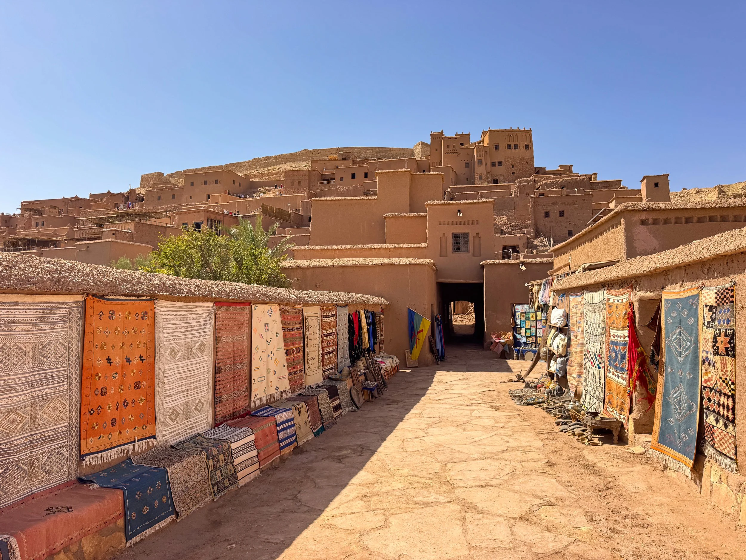
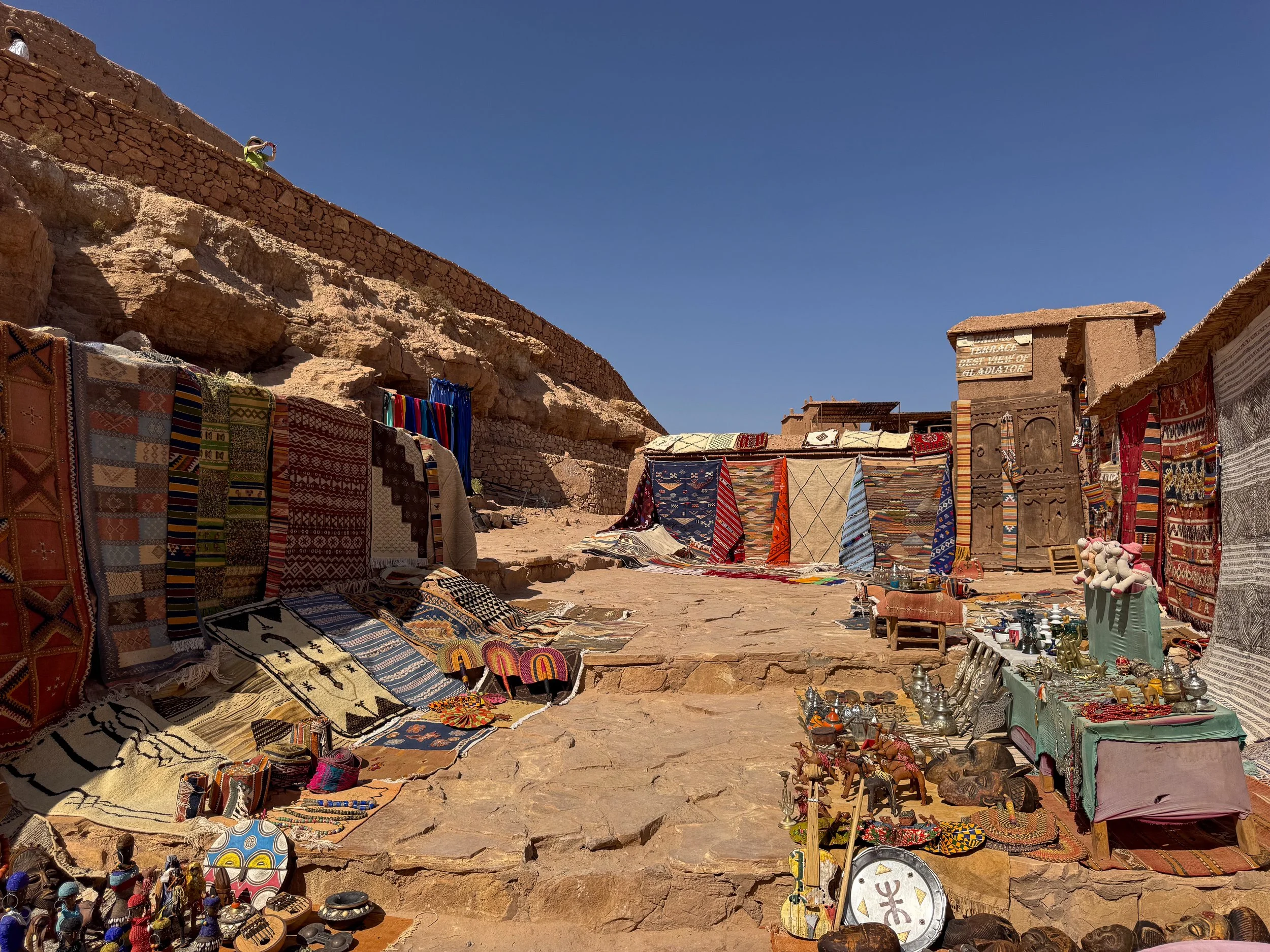
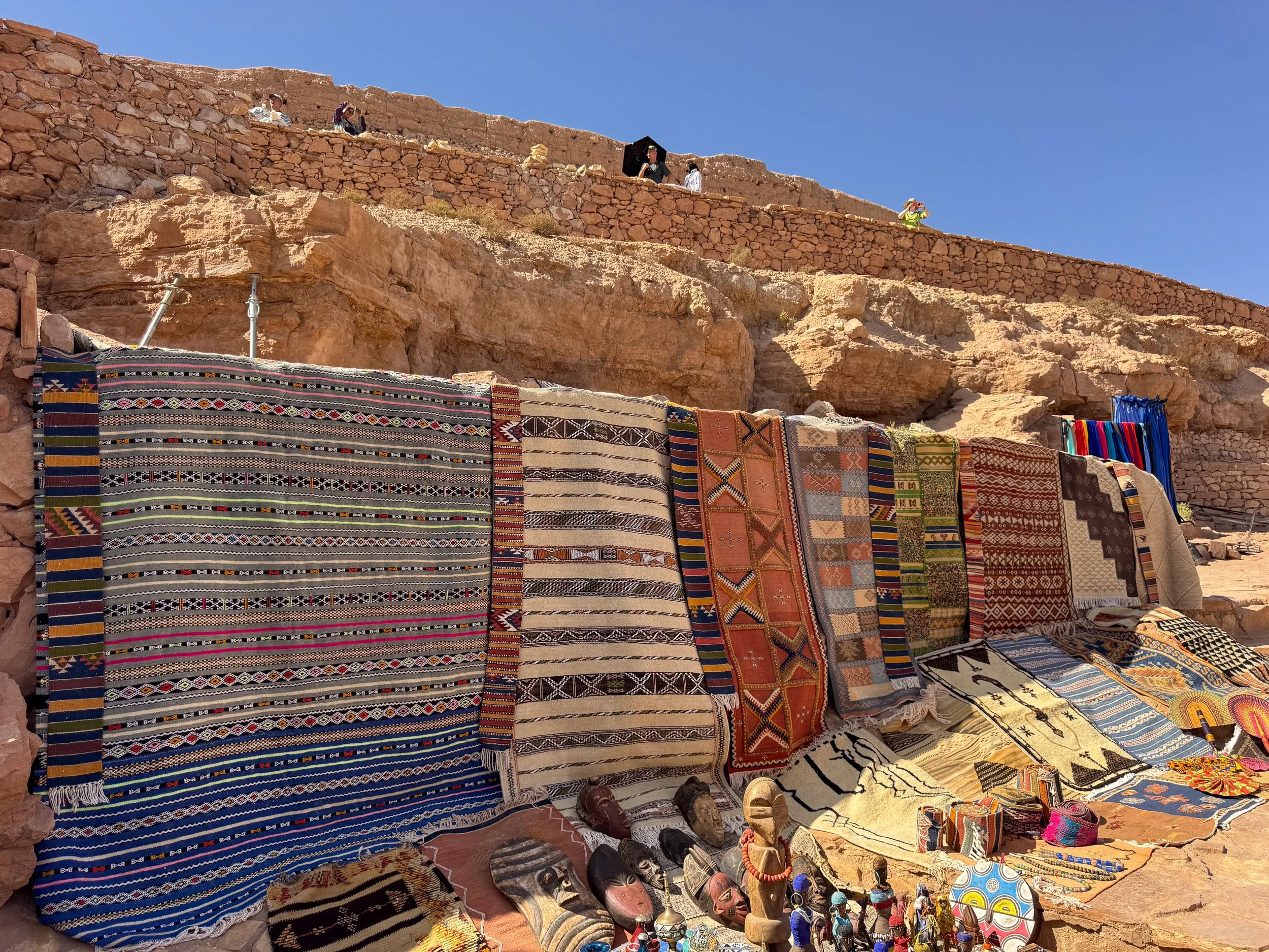
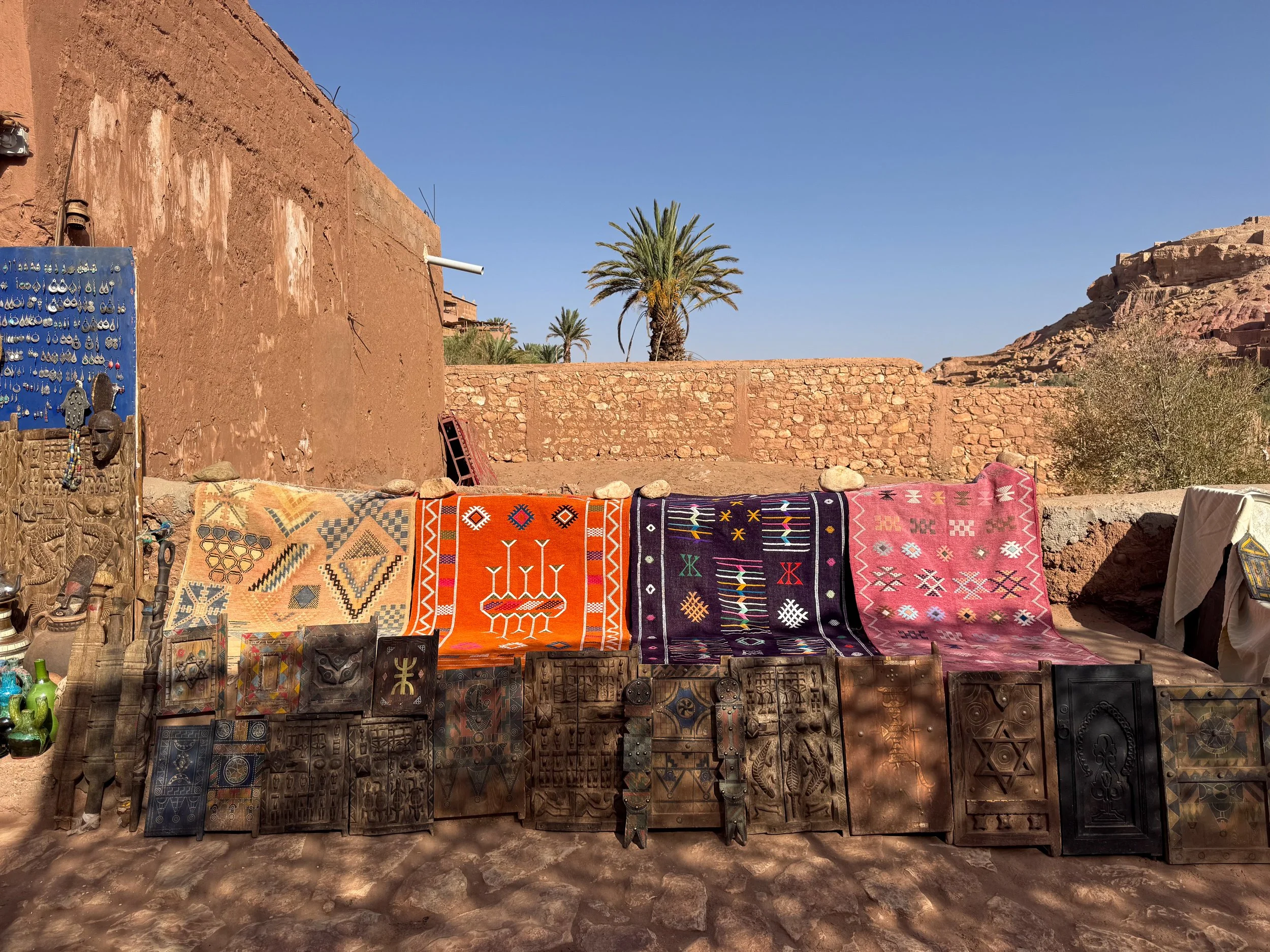
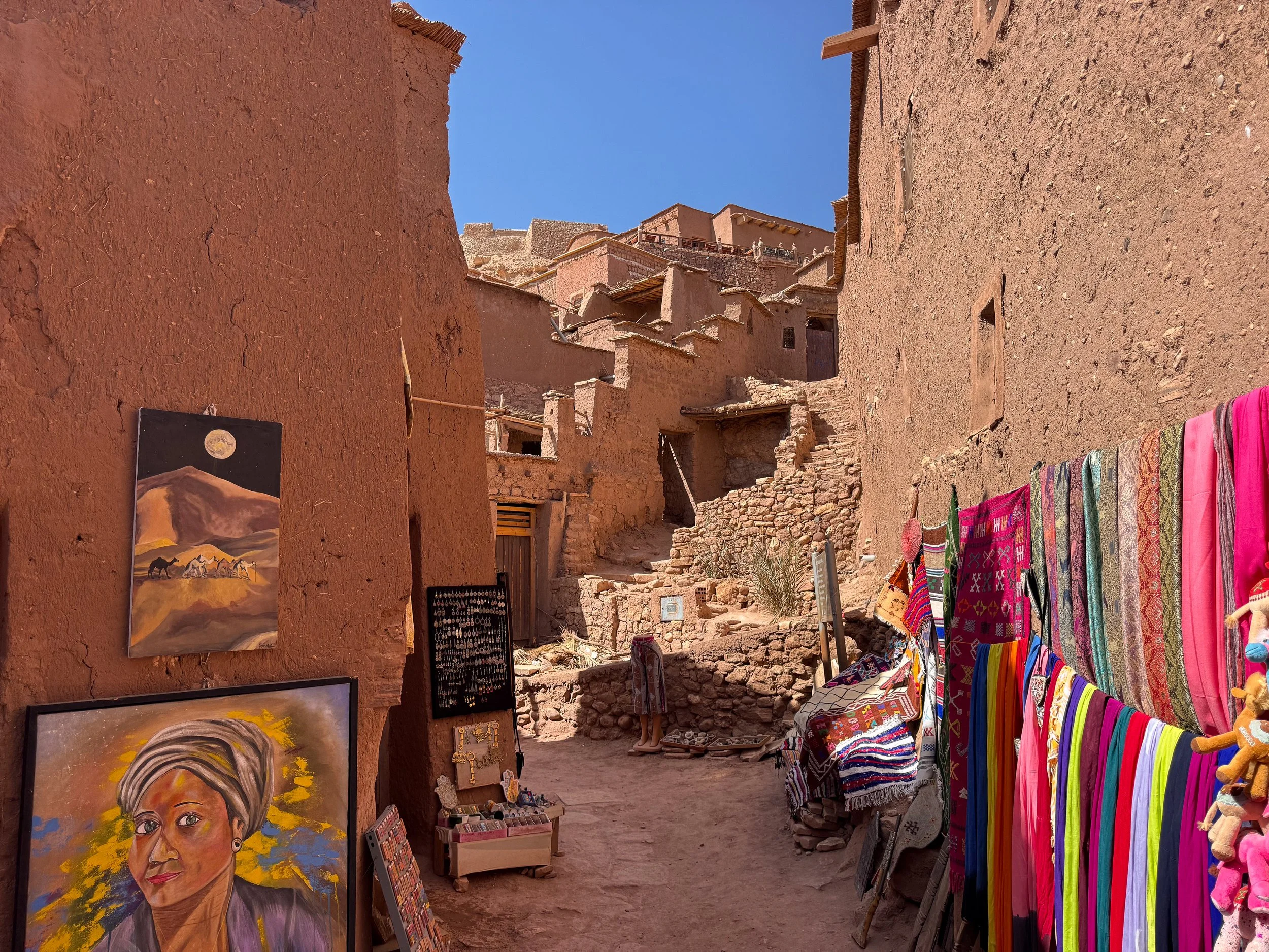
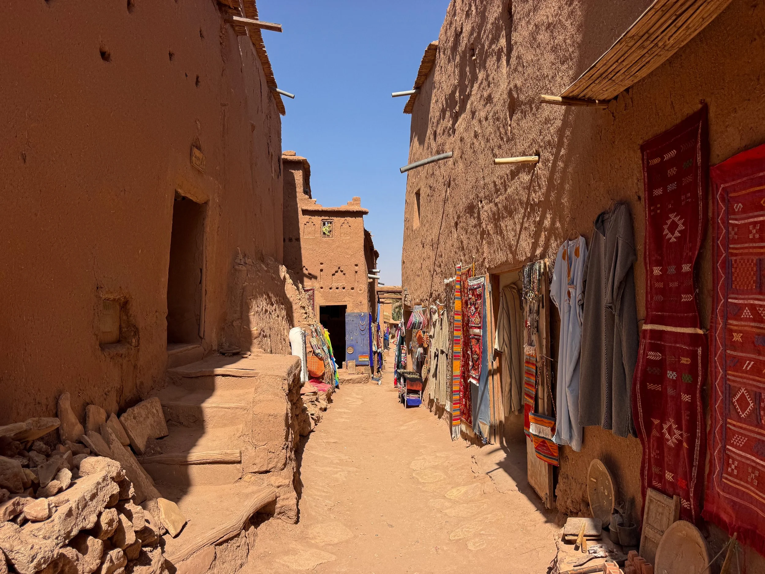
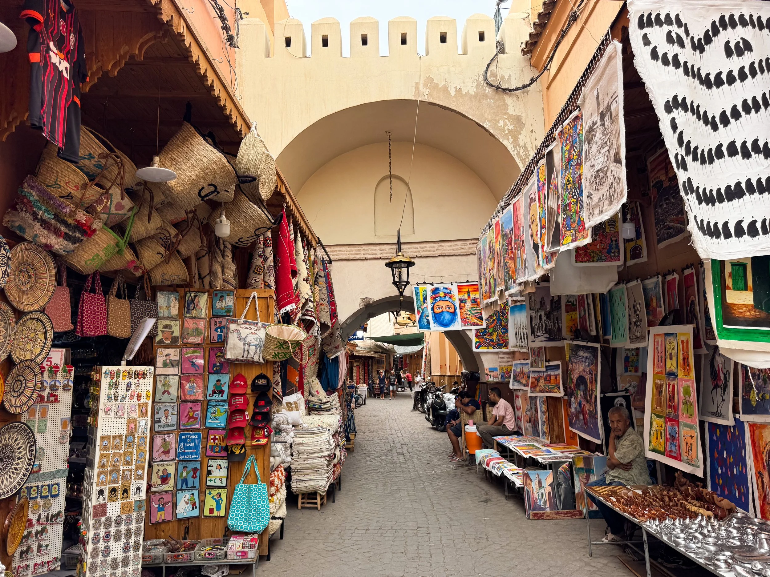
Berber Souks. Ait Ben Haddou was built along an ancient Berber caravan route. Berber craft and culture continues to prosper in souks of the ancient ksar. The narrow alleyways are lined with vendors displaying traditional goods and antiques. Shops sell metal jewelry, patterned rugs, colorful scarves, desert knives, brass lamps, clay pottery, carved wooden locks and paintings.
Good to Know. Accept mint tea if offered by a shopkeeper'; it’s Berber hospitality. Sit down and chat for a few minutes. Leave when ready and don’t feel pressured to buy anything.
Pro Tip. Ait Ben Haddou is a good place to buy Moroccan and Berber made items. Vendors are less aggressive than in larger cities and prices are often reasonable.
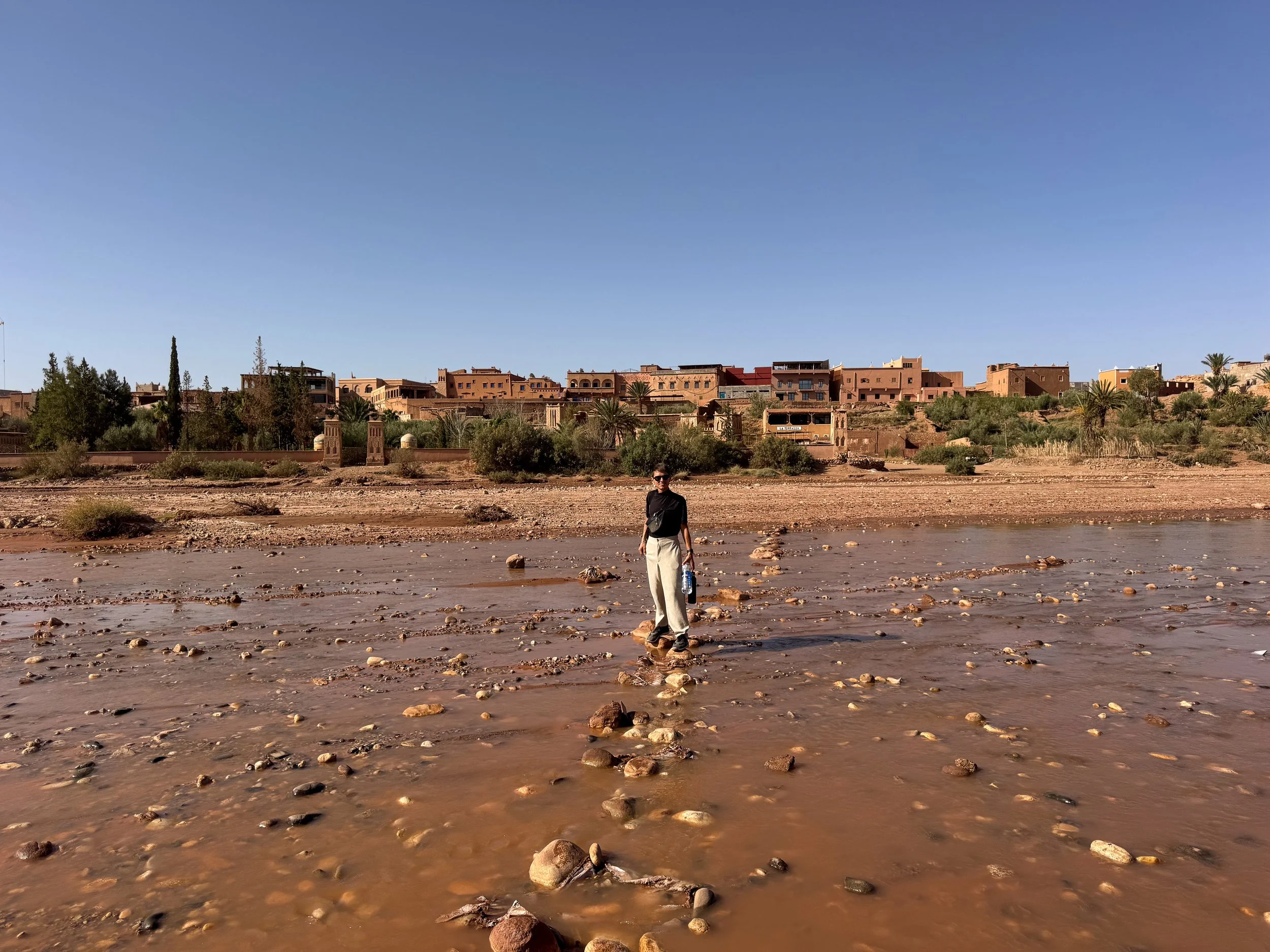
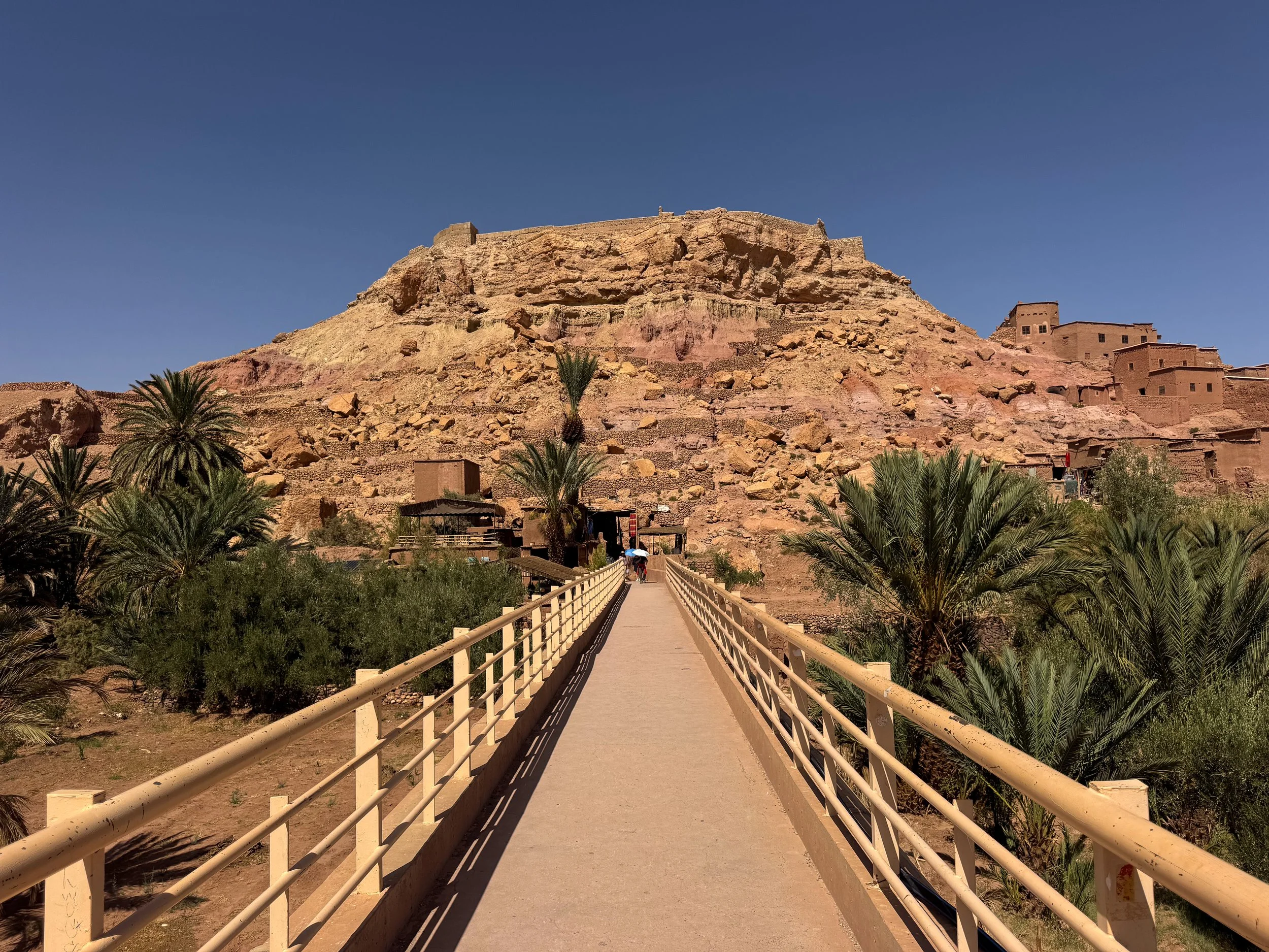
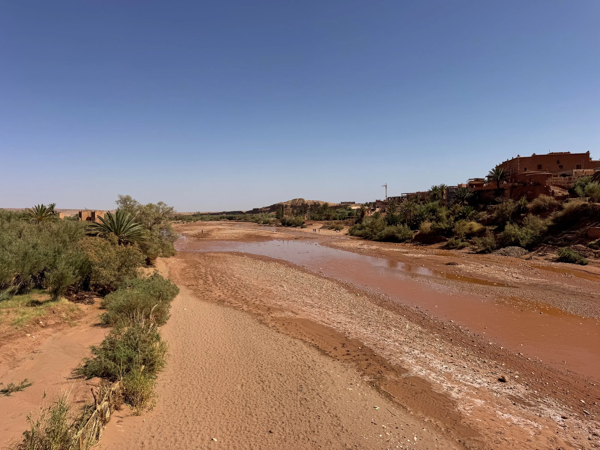
The Ounila River. A river separating The Ancient Ksar and Modern Village. Walk across its foot bridge or the stepping stones to transit in-between.
Foot Bridge. A pedestrian bridge leading directly between the modern village and ancient ksar. It’s free to cross and flanked by local restaurants and vendors.
Stepping Stones. During the dry season, stepping stones and sand bags create makeshift paths across the muddy river. This route offers scenic views of the ksar and its kasbahs.
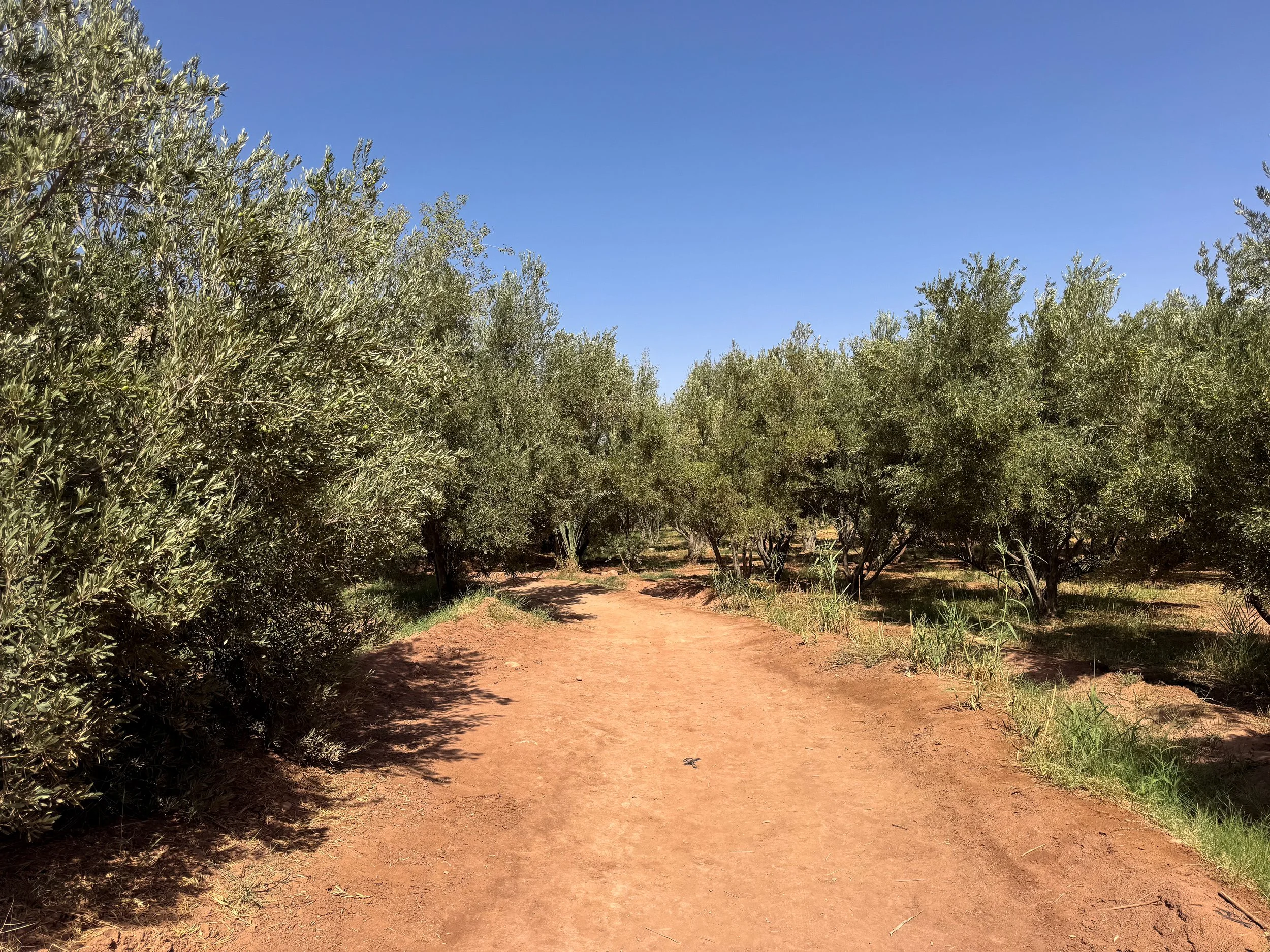
Pro Tip. Follow the stepping stones across the river and walk downstream to the olive groves. A trail passes through them leading to the ksar’s eastern gate. This route avoids paying to enter or exit through the kasbahs.
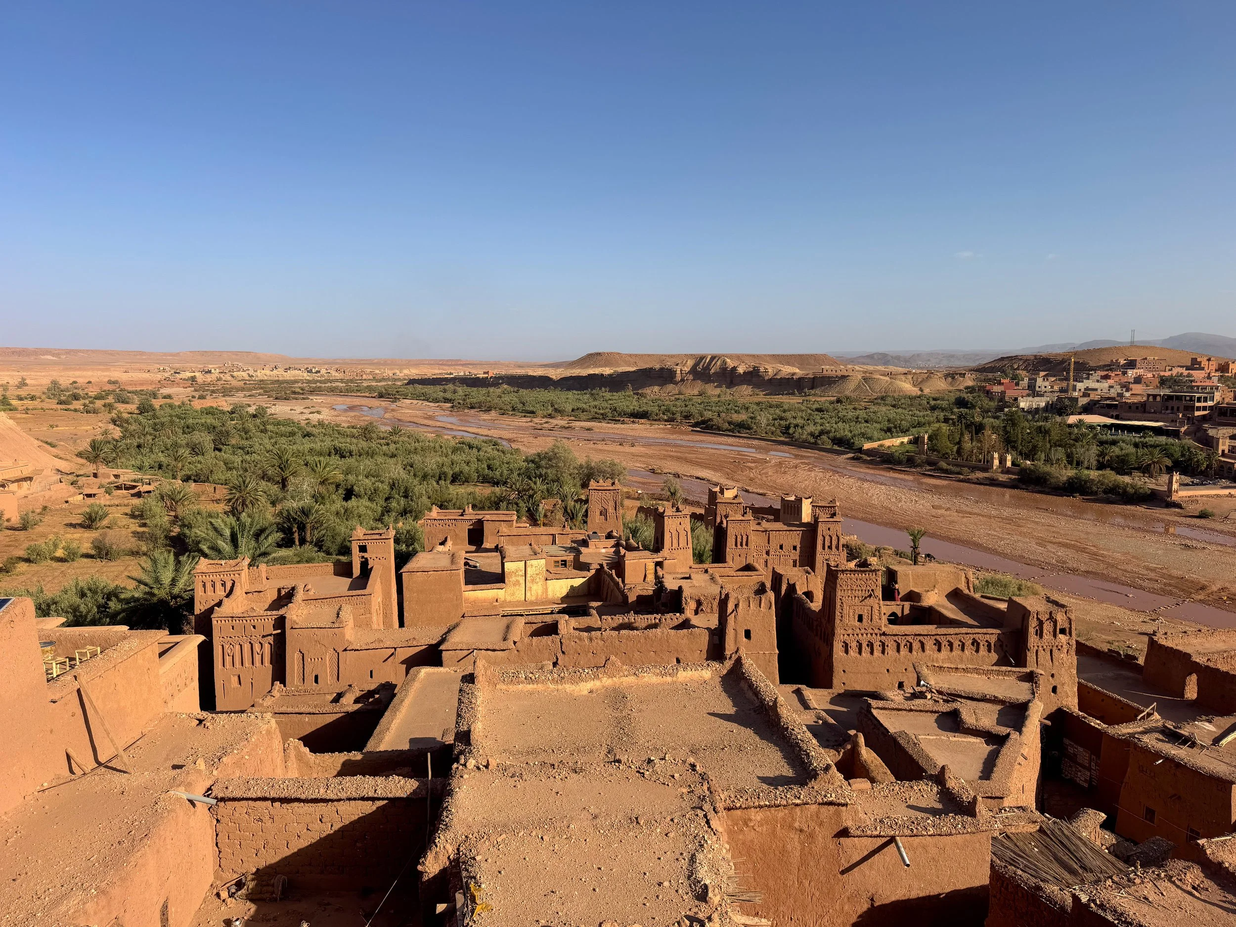
Ait Ben Haddou Viewpoints. The ancient ksar is surrounded by different photogenic viewpoints from hilltop lookouts, rooftop terraces and street scenes.
Ksar d'Aït Ben Haddou Sunset Point. A viewpoint on the narrow road near the top of the ksar. It offers panoramic views of the city and desert landscape. It’s especially popular at sunset but good to visit at any time of day.
Viewpoint Ait Ben Haddou. A hilltop viewpoint with panoramic views of the ancient ksar and its adobe buildings. Visit at sunrise to see the sand hued city illuminated in an orange glow. Revisit during the mid morning to admire all of its intricate designs and details in full daylight.
Street Viewpoint for Aït Benhaddou. A sandstone roadway in the modern village leading towards the Ounila River and ancient ksar.
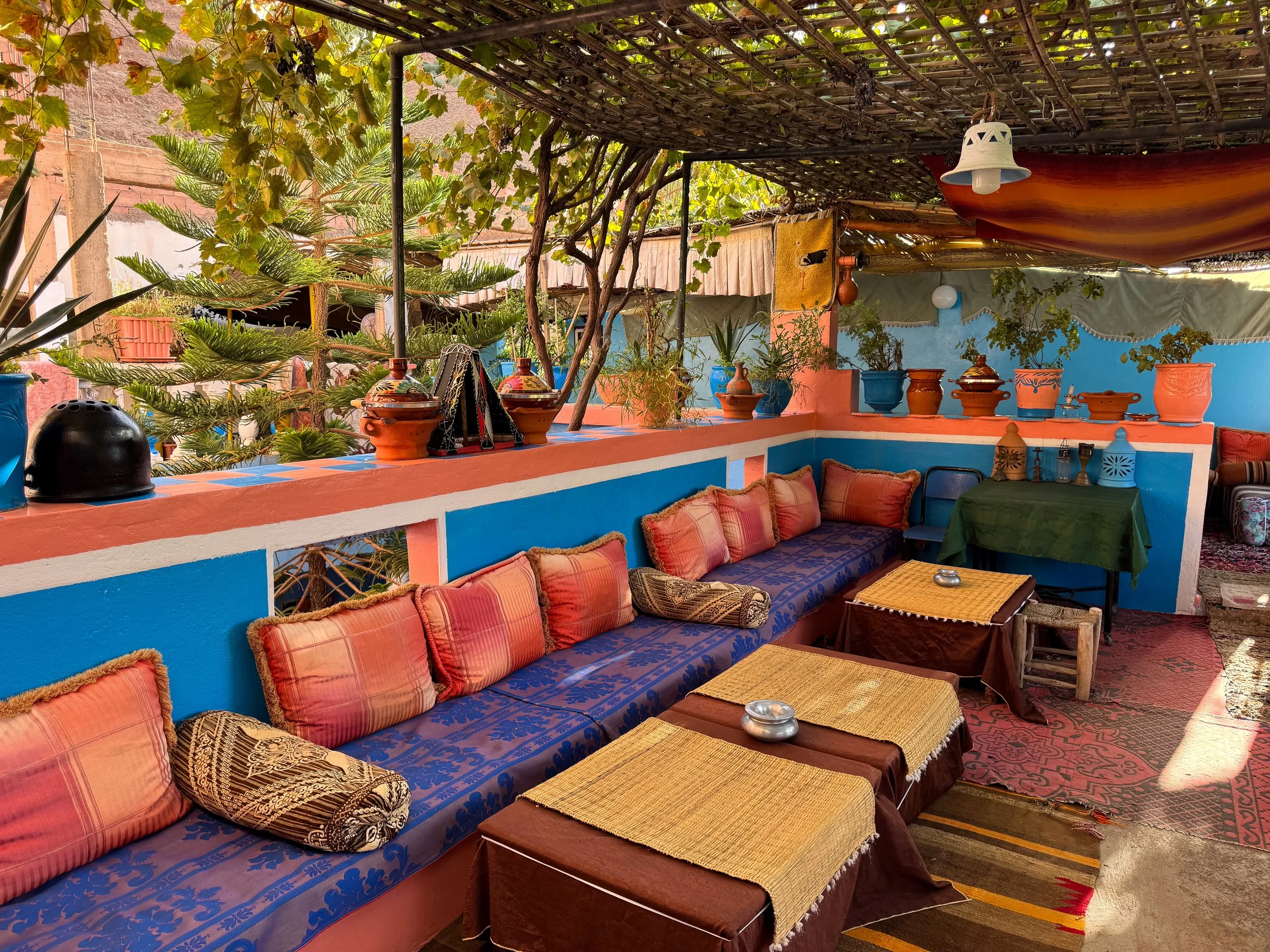
La Table de la Kasbah Ait Ben Haddou. A rooftop café in the ancient ksar with views of its adobe kasbahs and the desert landscape. The stylish terrace is decorated in Moroccan poofs, rugs and pillows. Visit during golden hour or sunset to enjoy a pot of mint tea with Moroccan pastries.
Places to Eat, Drink & Stay
La Terrazza. A restaurant with Moroccan style pizzas topped with local ingredients like olives, eggplant, tomato and zucchini. It’s one of the few restaurants that offers alcoholic drinks.
Tawesna Salon de Thé. A bakery and tea house in the ancient ksar next to the bridge. Come here to enjoy a pot of mint tea with a spread of sweet and buttery Moroccan cookies.
La Fibule Dor Ait Ben Haddou. An adobe style hotel in the modern village. Its rooms are decorated with Moroccan lamps, Berber textiles and handmade artwork. Its rooftop and many rooms boast panoramic views of the ancient ksar. Our stay included a Moroccan breakfast with a spread of cheeses, jams, dates, olives, eggs and bread. We booked on Airbnb.
Tips for Visiting Ait Ben Haddou:
Stay Overnight. Plan to stay at least one night in Ait Ben Haddou to get the most out of visiting the ancient ksar.
Visit Solo. Avoid group tours and visit on your own. You’ll have more time to explore freely.
Time of Day. Visit before 8:30am to avoid crowds.
Cash vs. Credit. Carry cash and small coins for most payments. Credit cards are not commonly accepted.
Drink Water. Stay hydrated and carry water when walking around, especially during the afternoon heat.
Getting Here. Ait Ben Haddou is reachable from Marrakech by car. The scenic drive leads 3 hours through the foothills of the Altas Mountains.
Ouarzazate
Ouarzazate is a desert city renowned for its movie studios and historic kasbahs. It’s often referred to as “The Moroccan Hollywood” and “The Gateway to the Desert.”
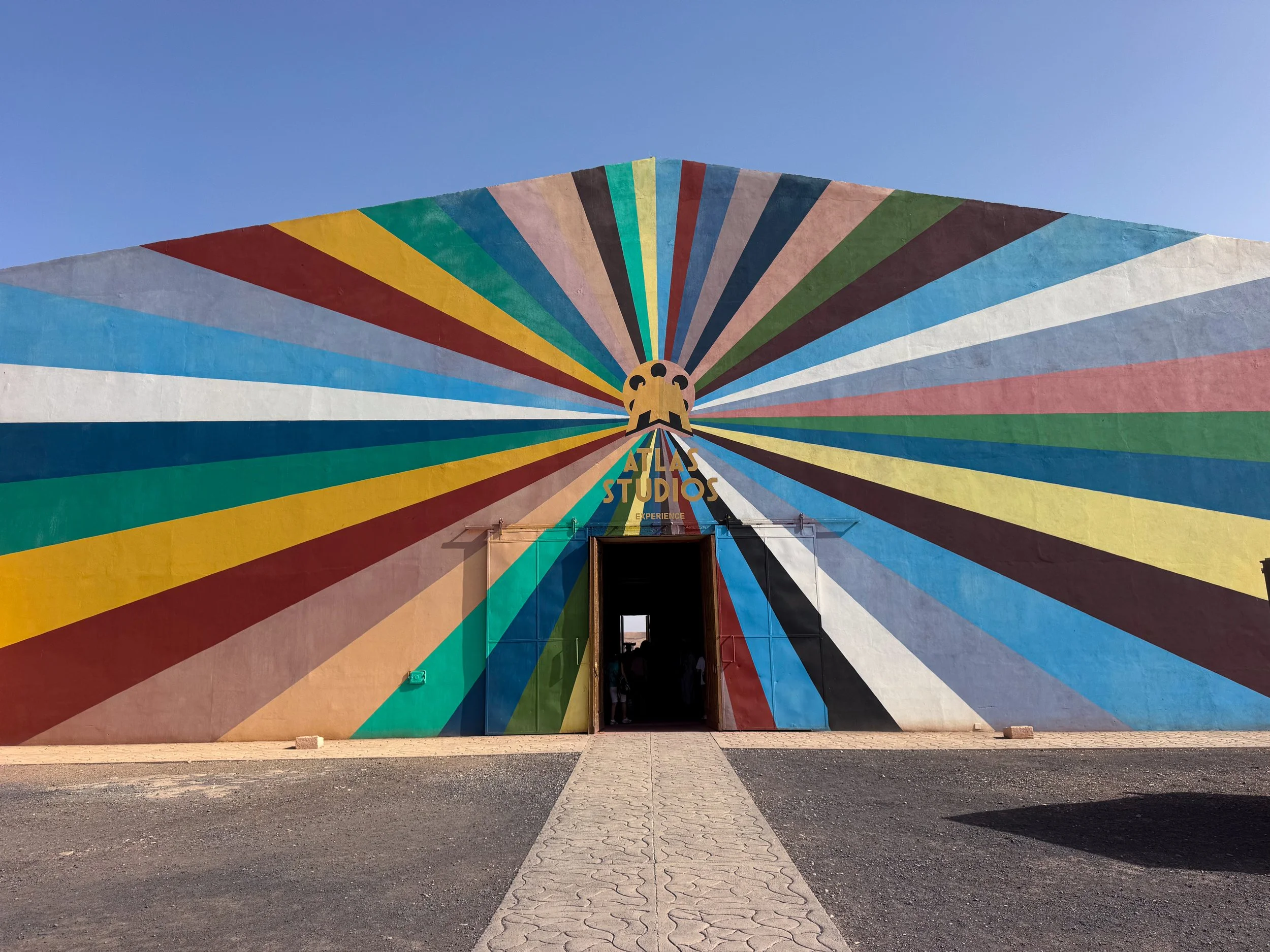
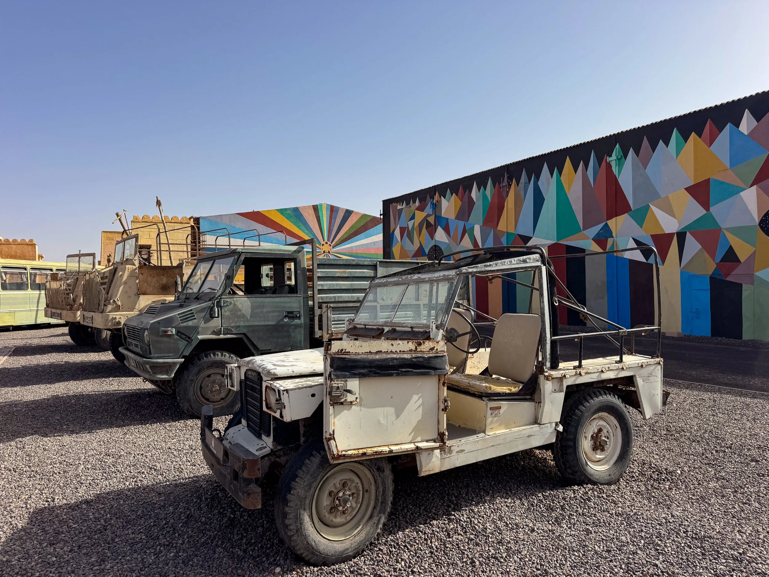
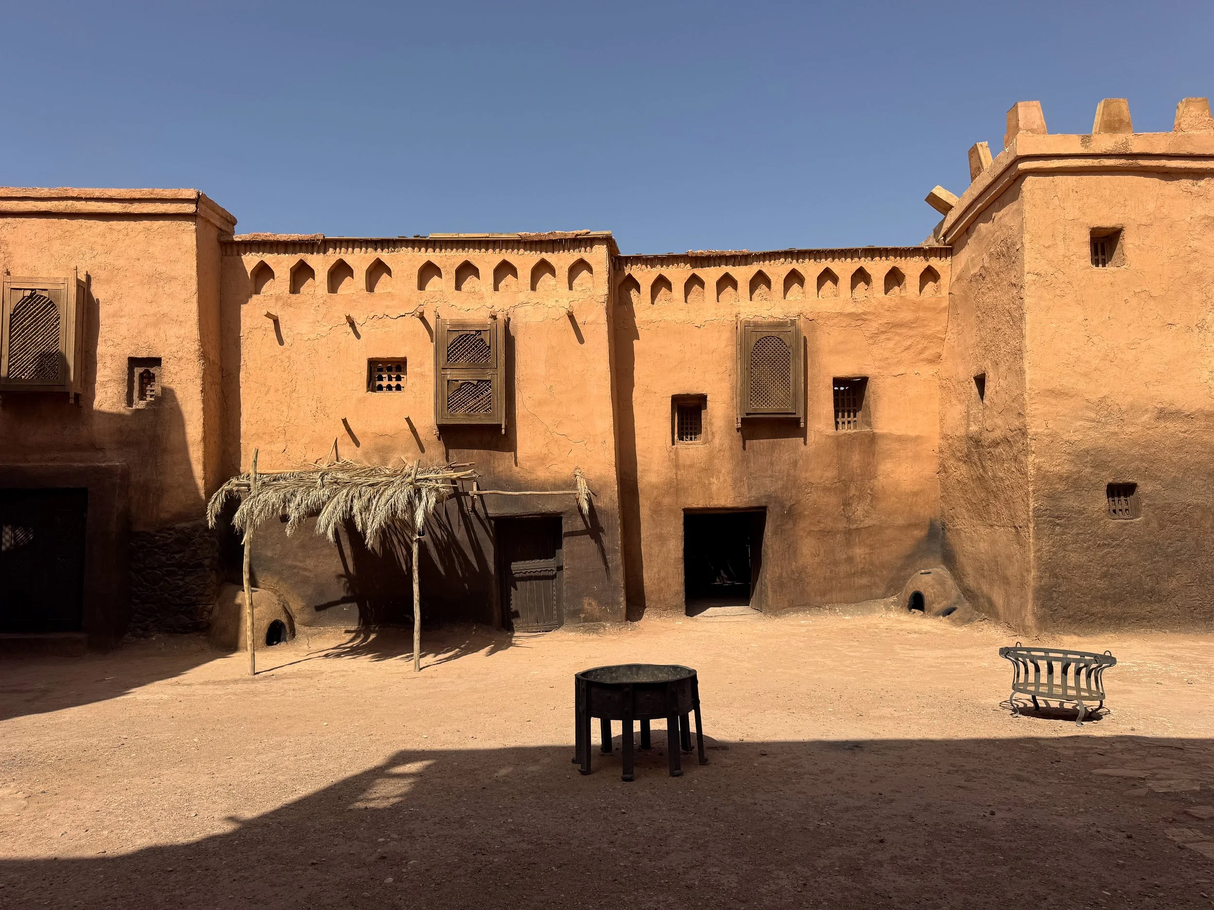
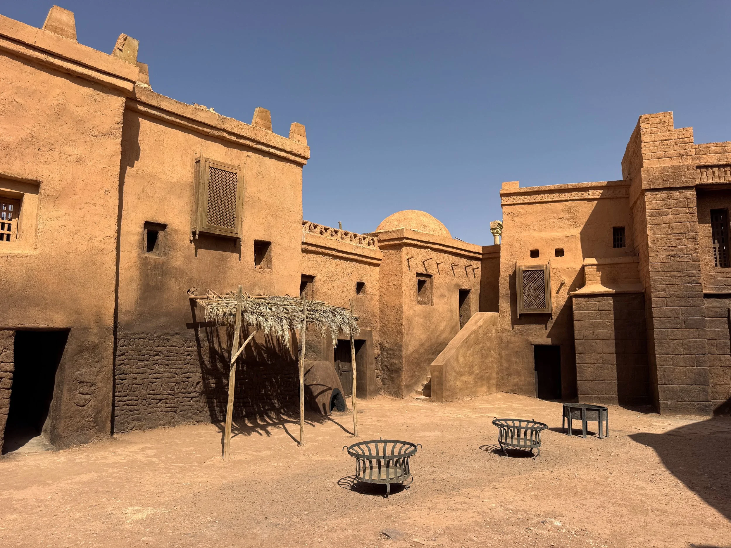
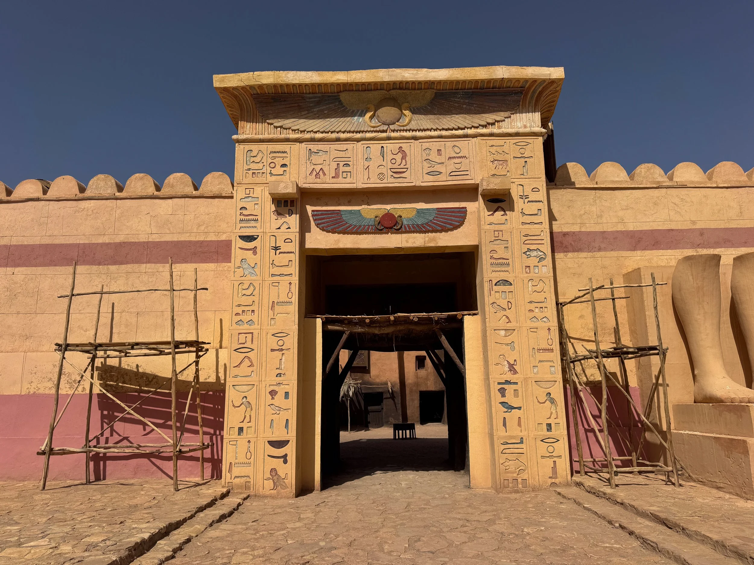
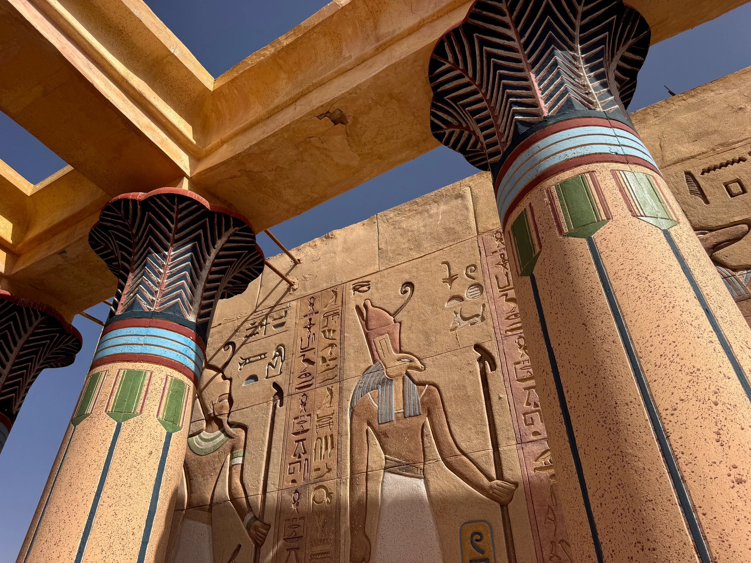
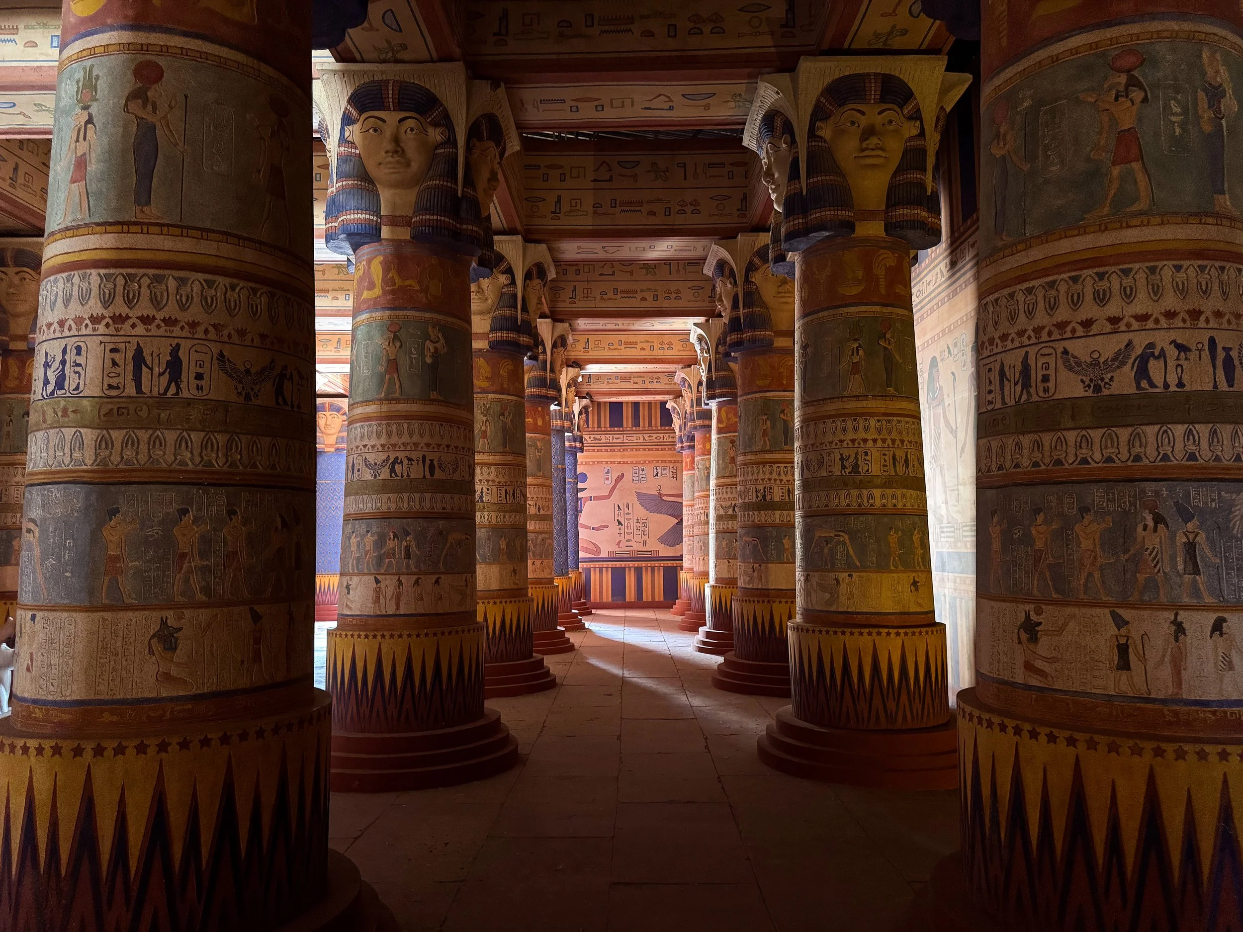
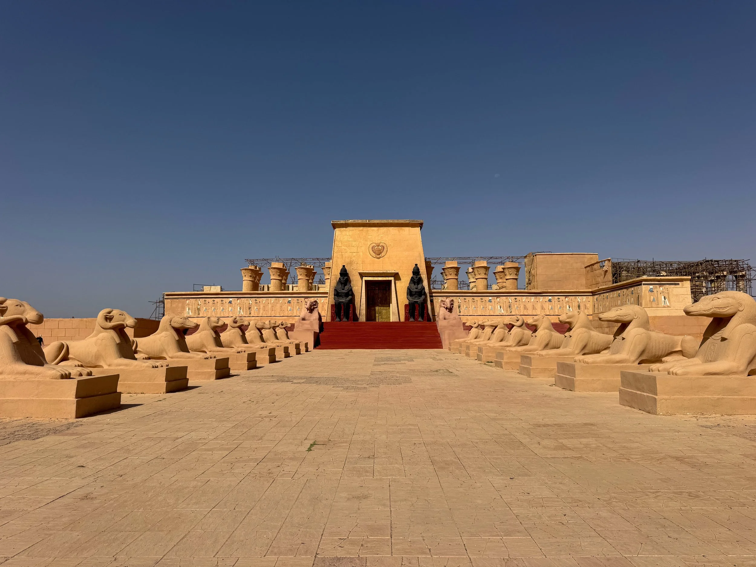
Atlas Studios. A vast film studio and one of Ouarzazate’s most famous with sets dating back to the 1960s. It’s particularly eye catching for its large scale Egyptian sets comprised of colorful temples, tombs and statues. Sets blur into one another, transitioning between Egyptian, Roman, medieval and desert towns. Vehicles like gladiator chariots, military trucks, replica sports cars, viking ships and aircraft are displayed throughout. Scenes from The Mummy, Gladiator and James Bond have all been filmed here. Tickets include guided tours of the sets with movie references, photo opps and free time to explore at your own pace afterwards.
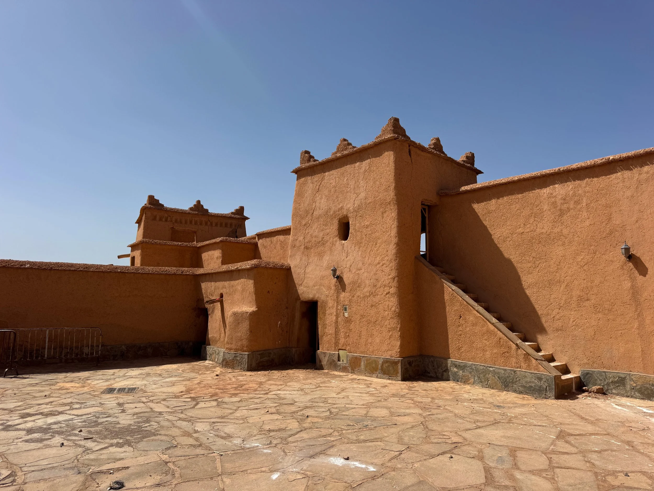
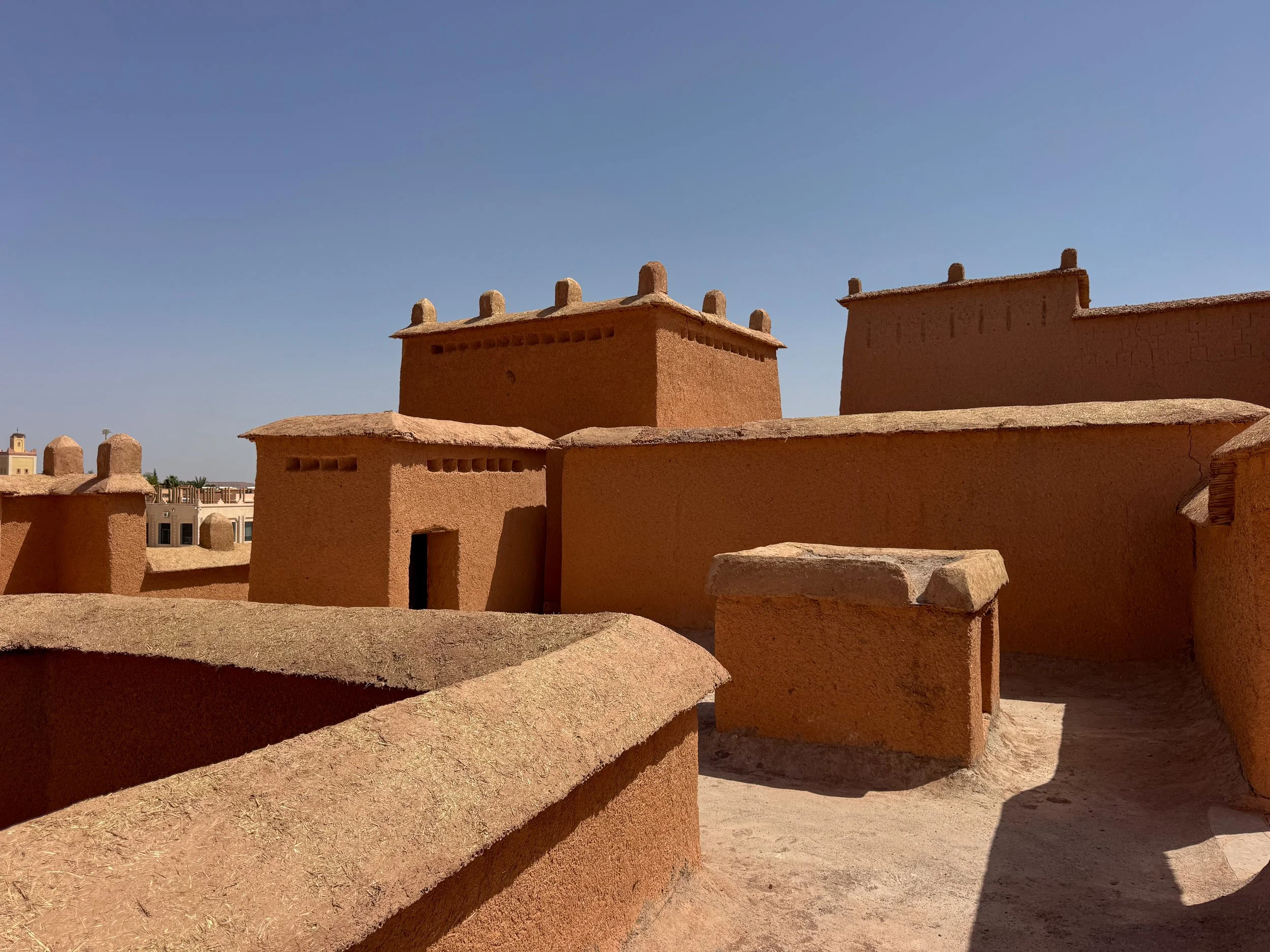
Taourirt Kasbah. A large and once prosperous kasbah in the center of Ouarzazate. It’s comprised of orange hued adobe buildings embossed with Berber patterns and geometric shapes. Their maze-like interiors are comprised of staircases and passageways that lead between disparate rooms, multiple levels and rooftop terraces. Repairs have been ongoing since the 2023 earthquake. Workers mix piles of mud, straw and water to create adobe bricks and plaster.
Getting Here. Ouarzazate is reachable from Ait Ben Haddou by car. It takes less than 1 hour to reach if driving.
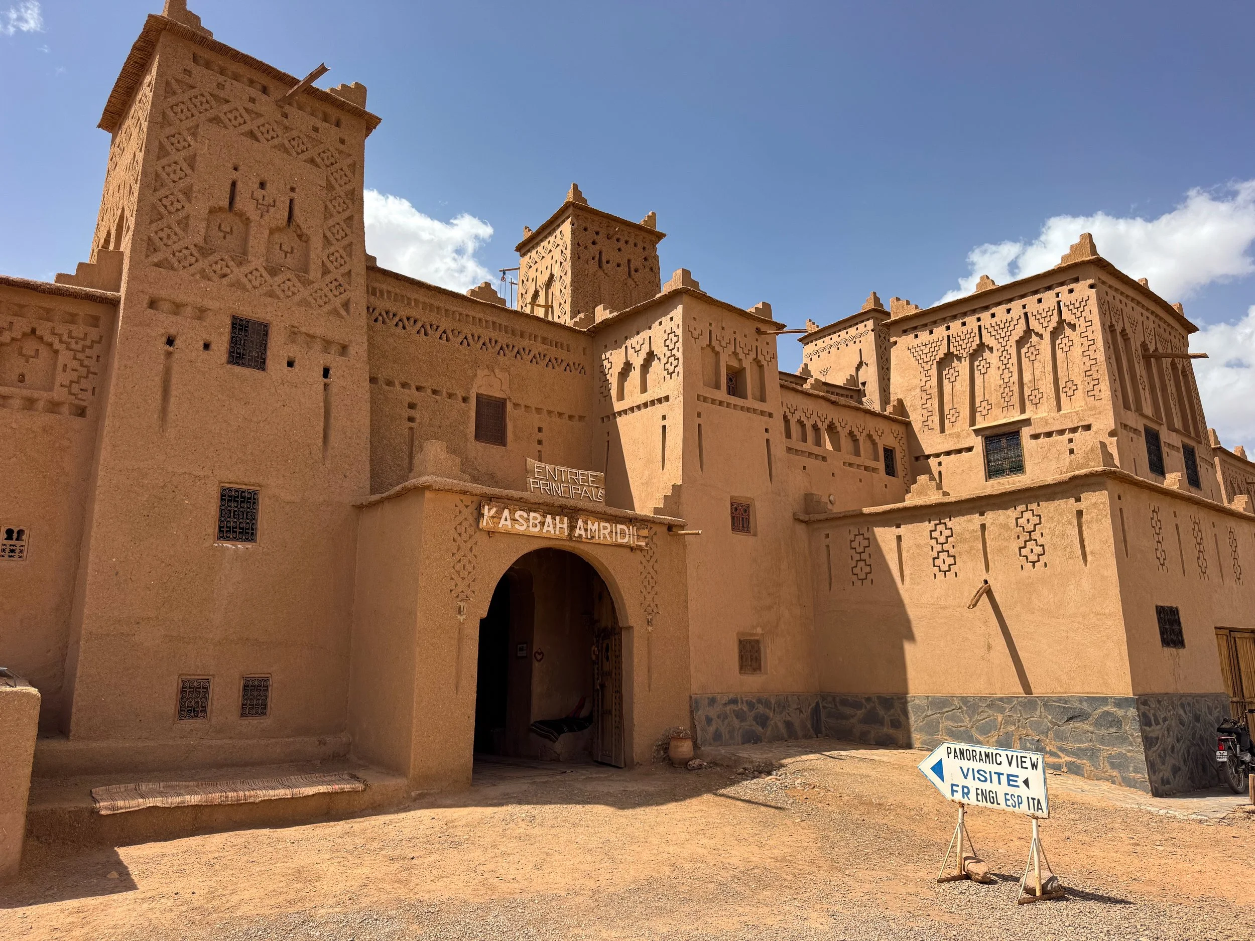
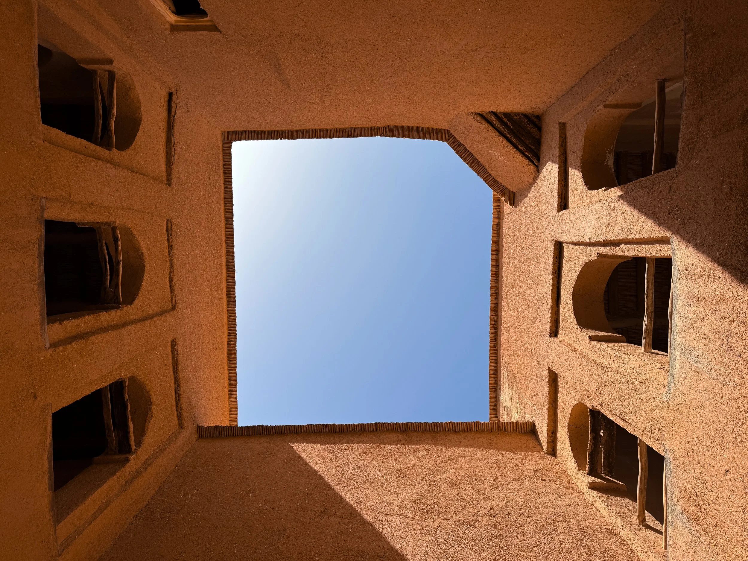
Kasbah Amridil
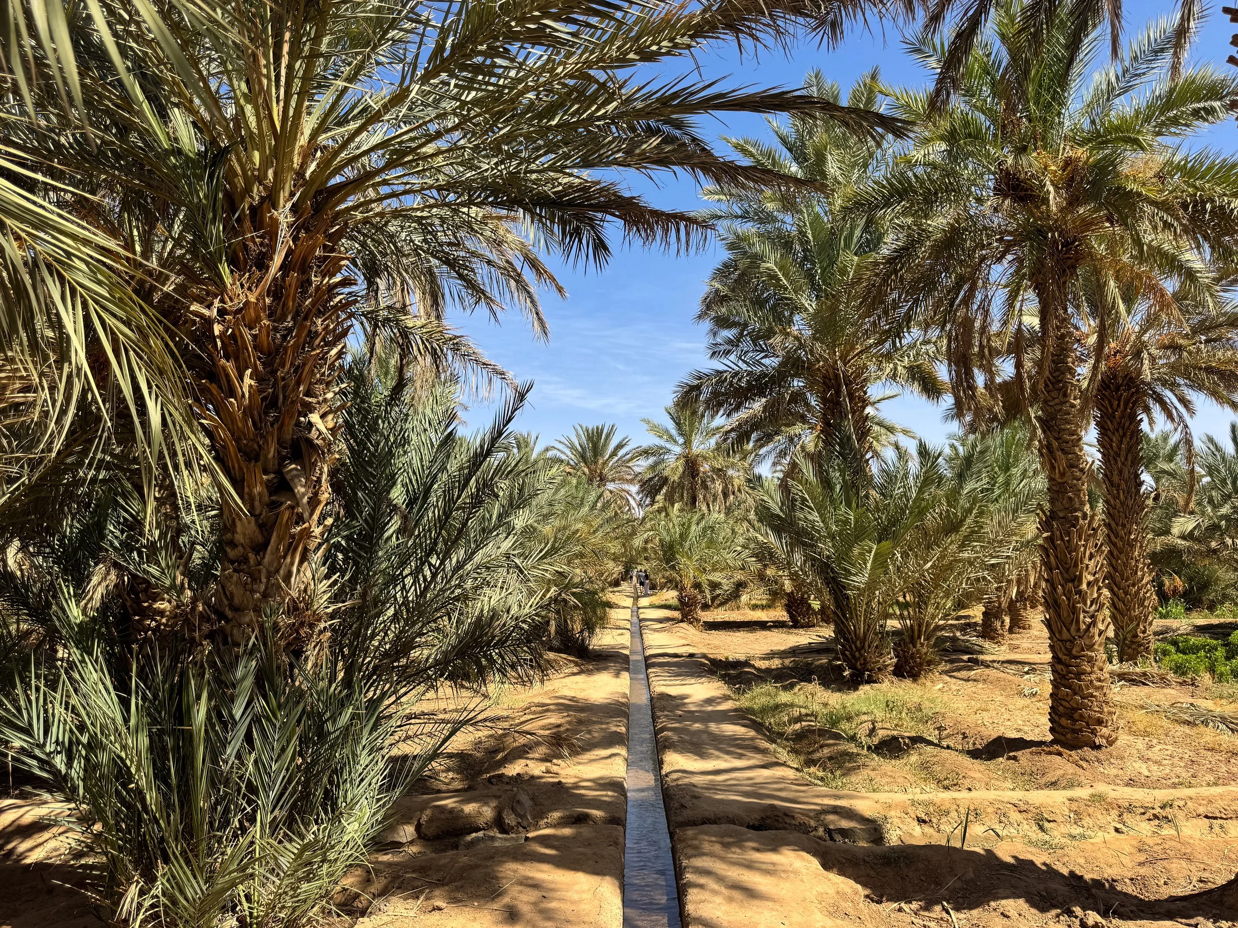
Kasbah Amridil is one of the largest and best preserved kasbahs in Morocco. Its sprawling structure is situated in the middle of the Skouras Palmerie, a palm covered oasis home to dozens of historic kasbahs and crumbling adobe ruins. The kasbah’s sand colored facade and adobe towers are decorated in intricate Berber patterns. It’s divided into three sections including two museums and a restaurant.
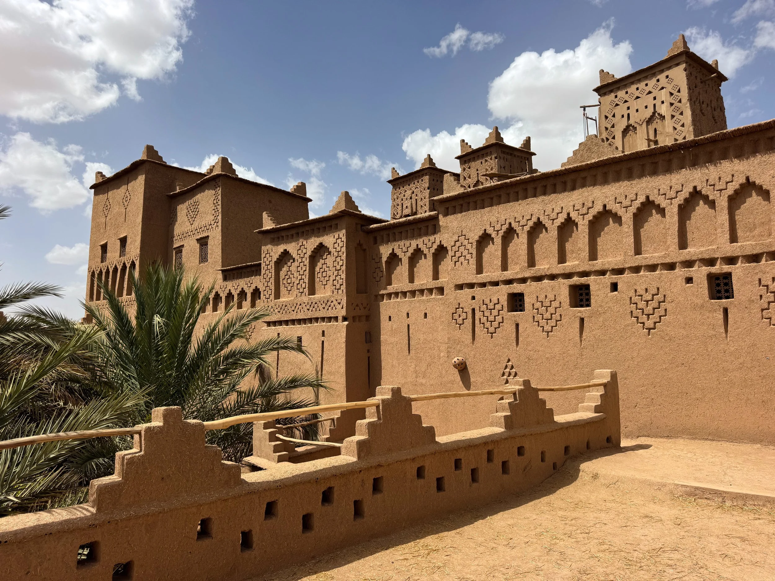
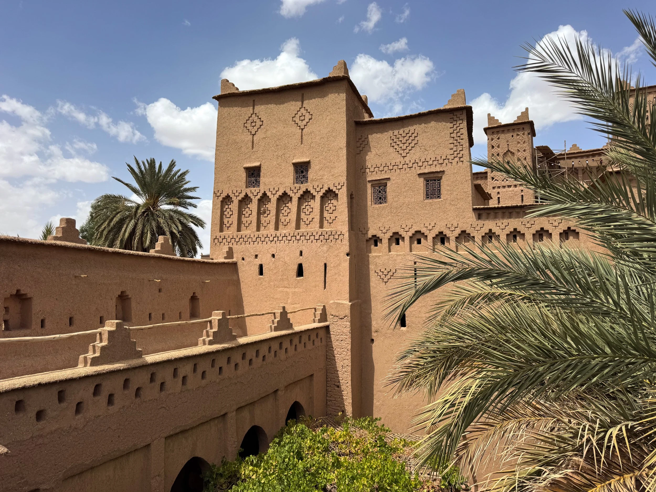
L’Entree Officelle. One of two museum entrances to Kasbah Amridil. Its historic interiors and rooms are restored with beige plastered walls and diamond tiled floors. A light-well illuminates its center while a staircase leads to its floors, rooftop terrace and towers. The upper courtyard features Arab and Moorish style arches. It overlooks the palm covered oasis, neighboring kasbahs and crumbling ruins.
Entree Principale. The second museum entrance to Kasbah Amridil. It’s the most historic and originally maintained section. It features adobe walls, straw and mud floors, kitchens with clay ovens and displays with antique tools. Stairs lead from an open air courtyard to the upper floors and rooms. Rooftop terraces offer views of the kasbah towers and oasis.
Kasbah Amridil Restaurant. The third section of the kasbah is a restaurant. Its second floor terrace has the best views of the entire kasbah and Skouras Palmerie. Visit here last for a light meal and afternoon mint tea.
Tips for Visiting Kasbah Amridil
Tickets. Tickets cost 40 DH per person for each L’Entree Officelle and Entree Principale. If you only have time to visit one section of the Kasbah, visit the Entree Principale.
Getting Here. The Skouras Palmerie and Kasbah Amridil are reachable from Ouarzazate by car. It takes about 1-1/2 hours to reach if driving.
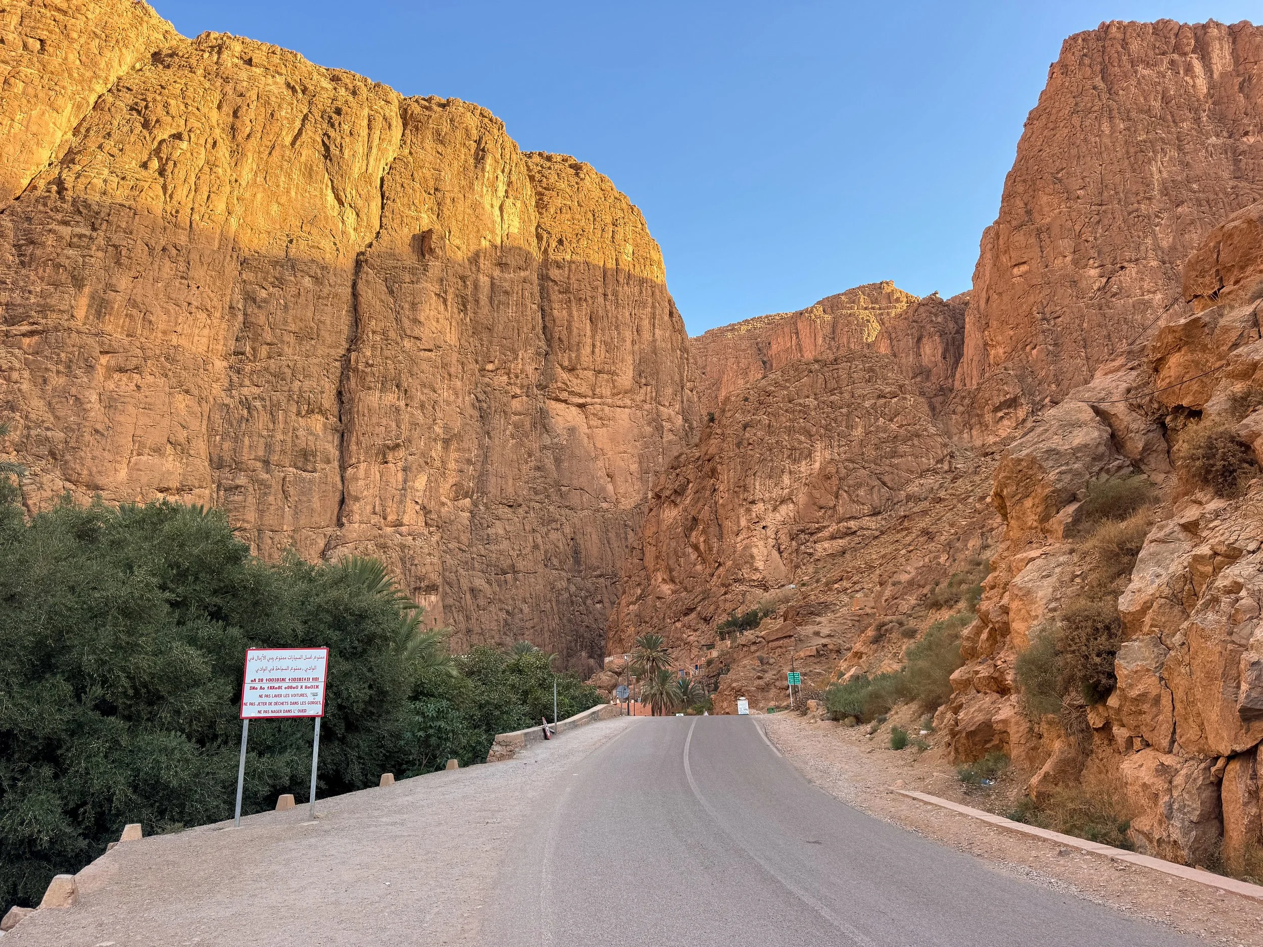
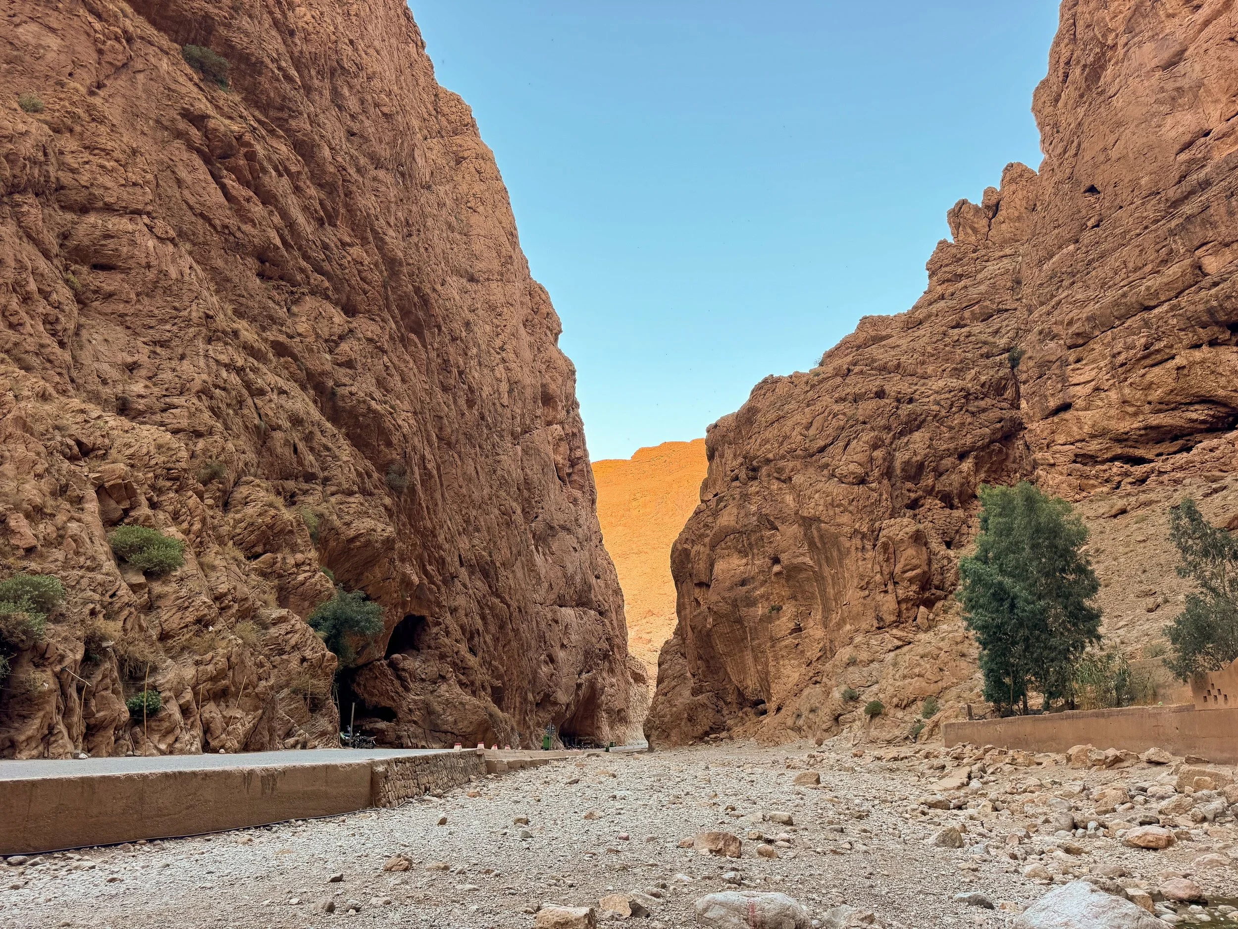
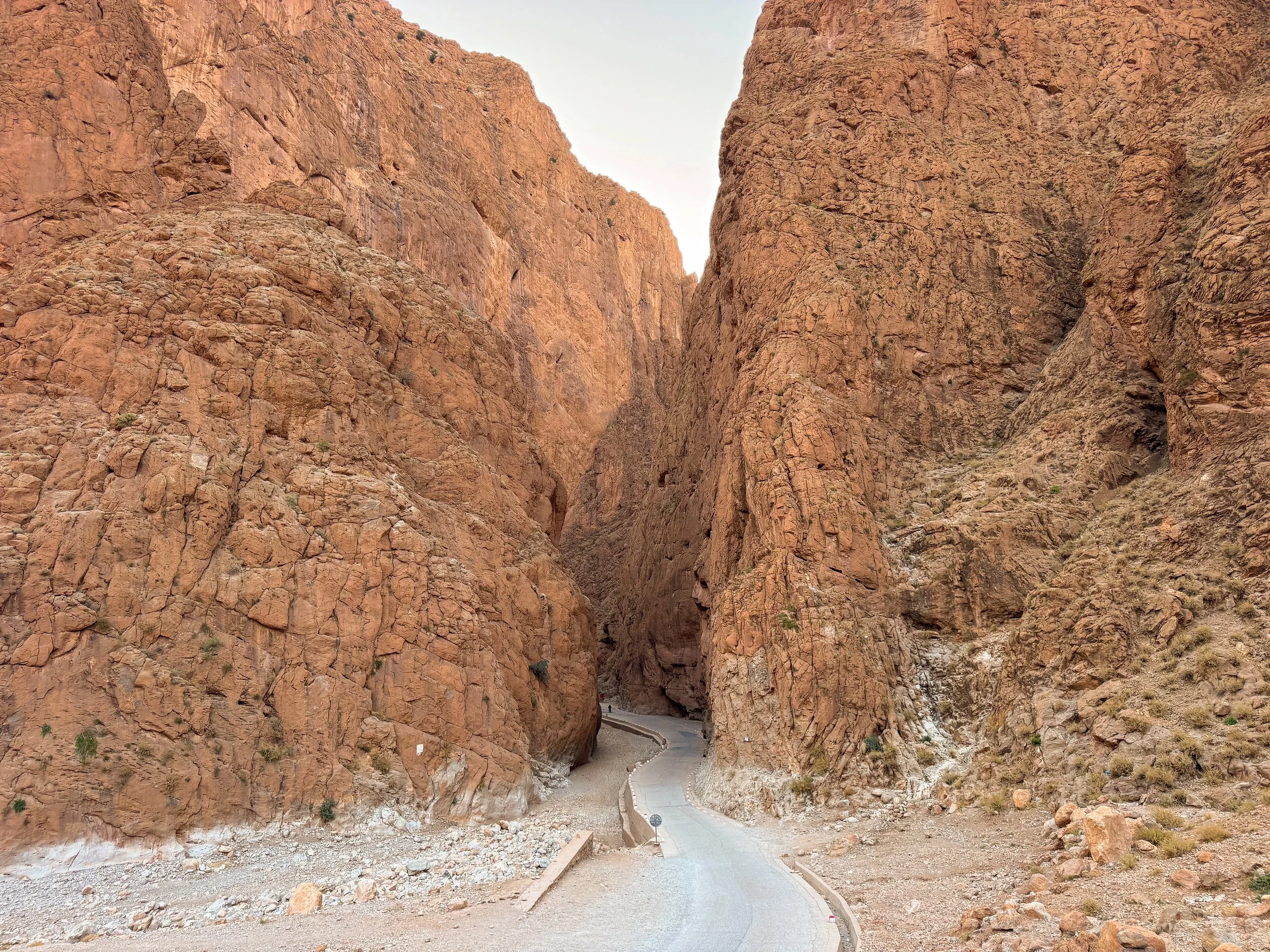
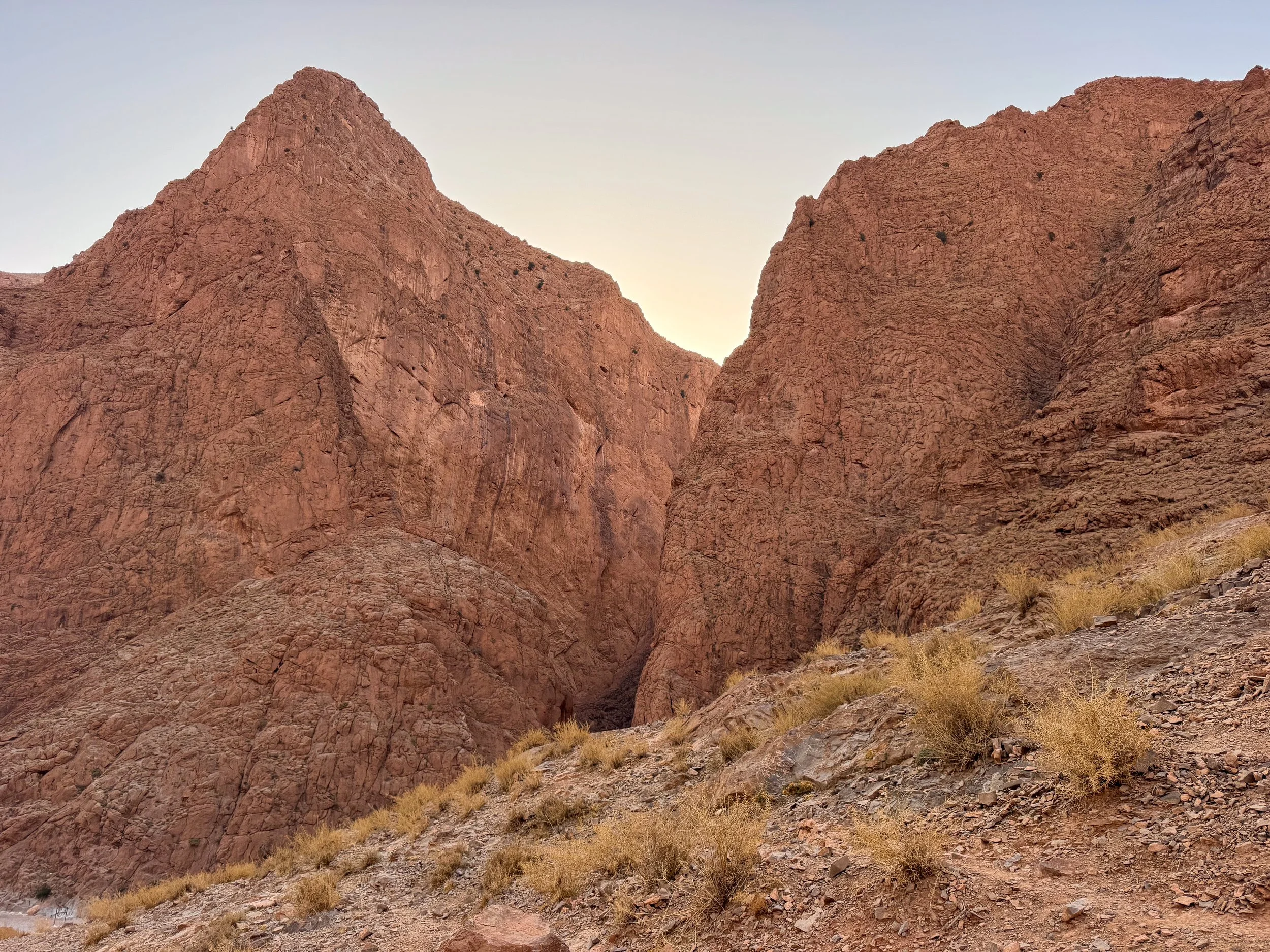
Todra Gorge
The Todra Gorge is a massive river canyon in the High Atlas Mountains with steep walls, a natural spring and a palm oasis. Its orange and brown rock walls rise hundreds of feet above the river bed. A natural spring bubbles from the ground supplying the river and oasis with a continual supply of fresh water.
Hiking and Rock Climbing. A hiking trail begins at the parking lot past the narrowest section of the gorge. It loops 13km across the desert landscape. We only hiked 1km due to lack of time. The walls of the gorge are popular with experienced rock climbers.
La Maison d’Hotes Riad Todra. A small hotel at the mouth of the Todra Gorge. Its rooms are basic but suitable for a single night stay. It has a restaurant with Moroccan lounges overlooking a small oasis. The host prepared a vegetable tagine for dinner and a spread for breakfast. We booked on Airbnb.
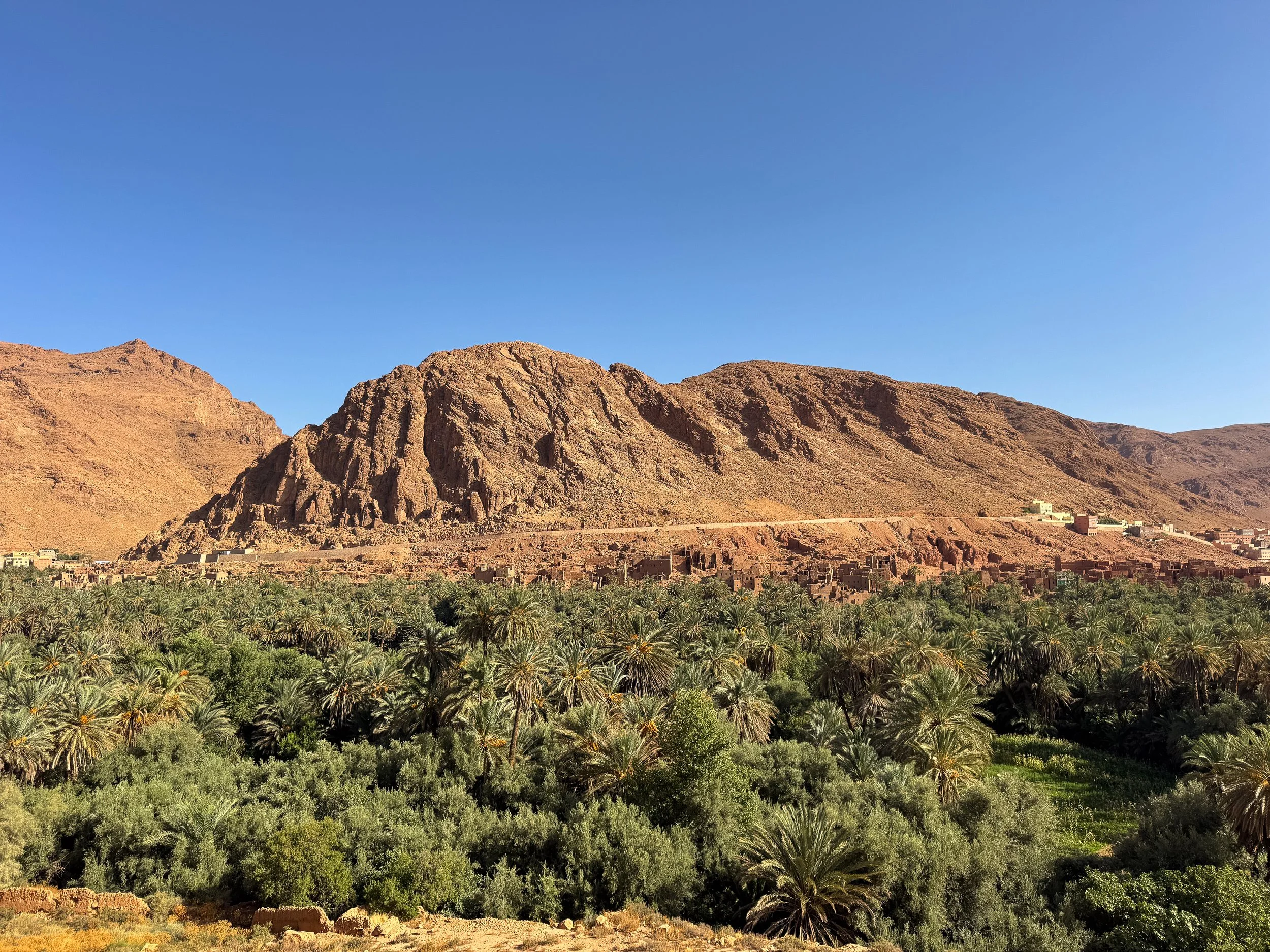
Palmeraie de Tinghir. A vast oasis stretching from the mouth of the Todra Gorge to the city of Tinghir. Groves of fig, olive, date and pomegranate trees grow in the verdant valley. Crumbling ruins of historic kasbahs line its rugged edges. Roadside lookouts offer panoramic views of the surrounding landscape.
Mirador de Palmeraie. A roadside viewpoint of the palm covered oasis, its abandoned adobe kasbahs and the mountainside. Use this Map Pin for the location.
Oasis de Toudgha Vue Panoramique. A lookout point closer to town with sweeping views of the oasis, its farmland and distant mountains. Use this Map Pin for the location.
Tips for Visiting The Todra Gorge:
Visit Early. Arrive in the early morning, just after sunrise to see the gorge in its most natural state without any vendors or tour buses.
Beware of Dogs. Packs of stray dogs can be aggressive. Even if unprovoked, they try to bite at people’s ankles. Raise your hand in a fist and shout at them if they get too close.
Getting Here. The Todra Gorge is reachable after driving 3 hours from the Skouras Palmerie.
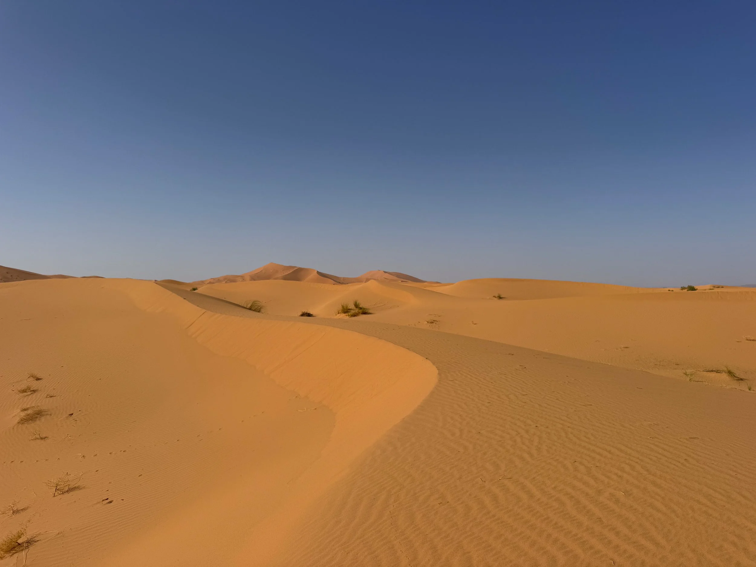
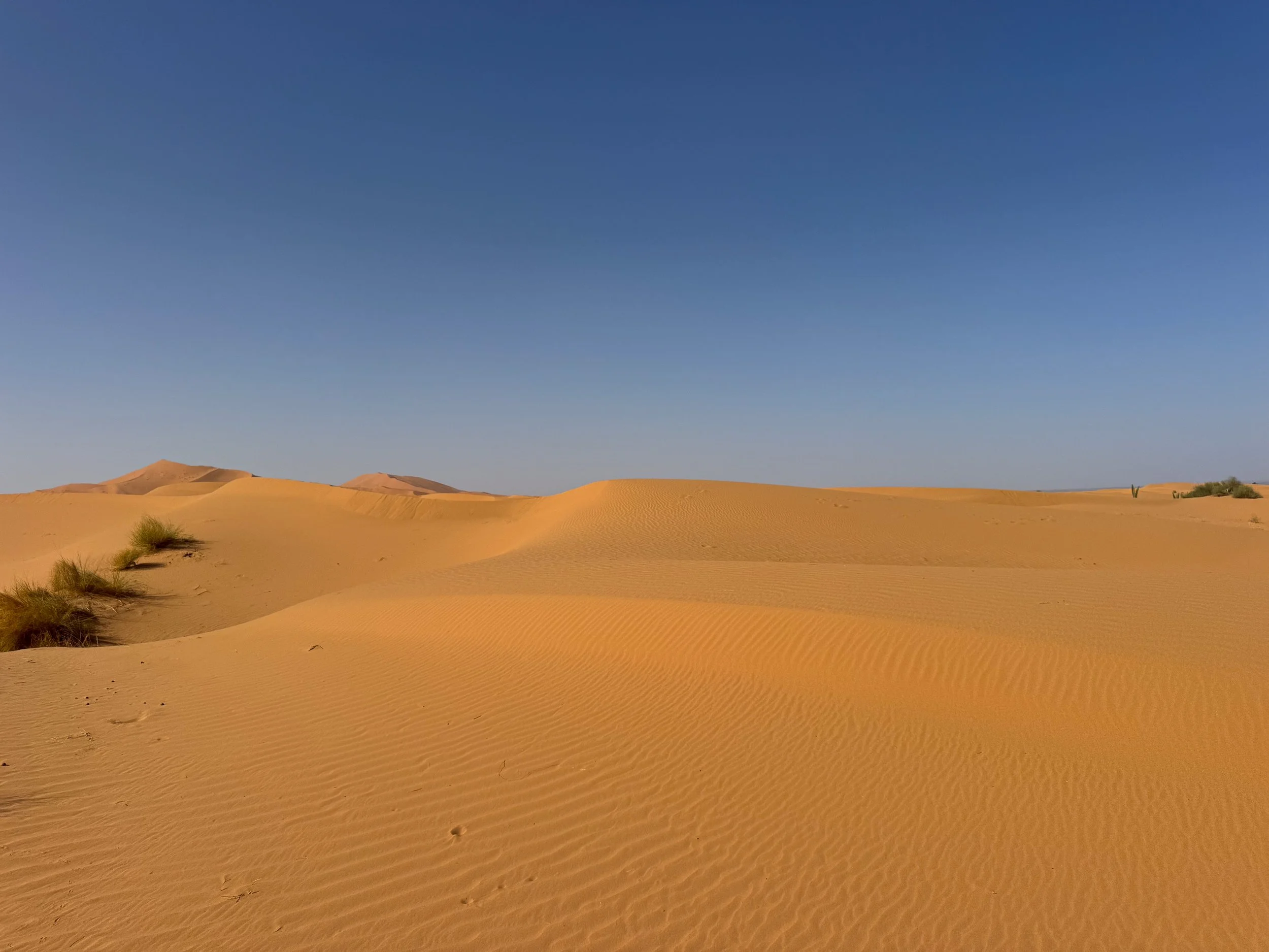
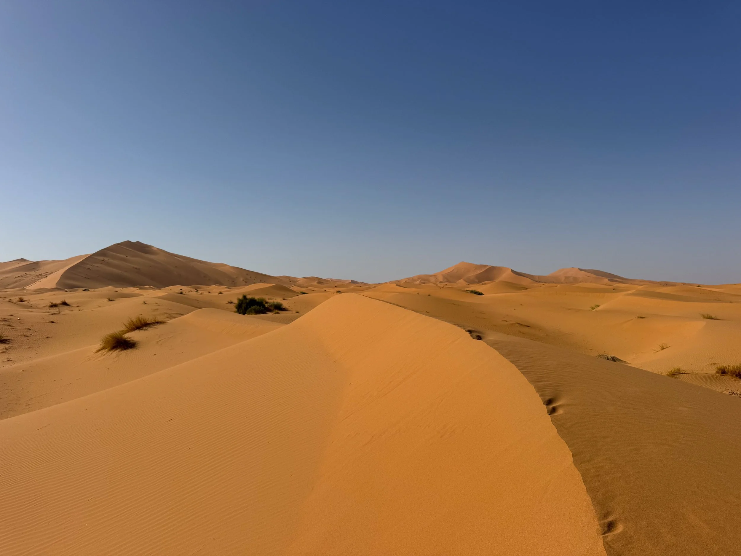
Merzouga Desert
The Merzouga Desert is an expansive area with towering orange dunes and desert camps on the edge of the Sahara. It’s a popular place for camel trekking, dune exploration and stargazing.
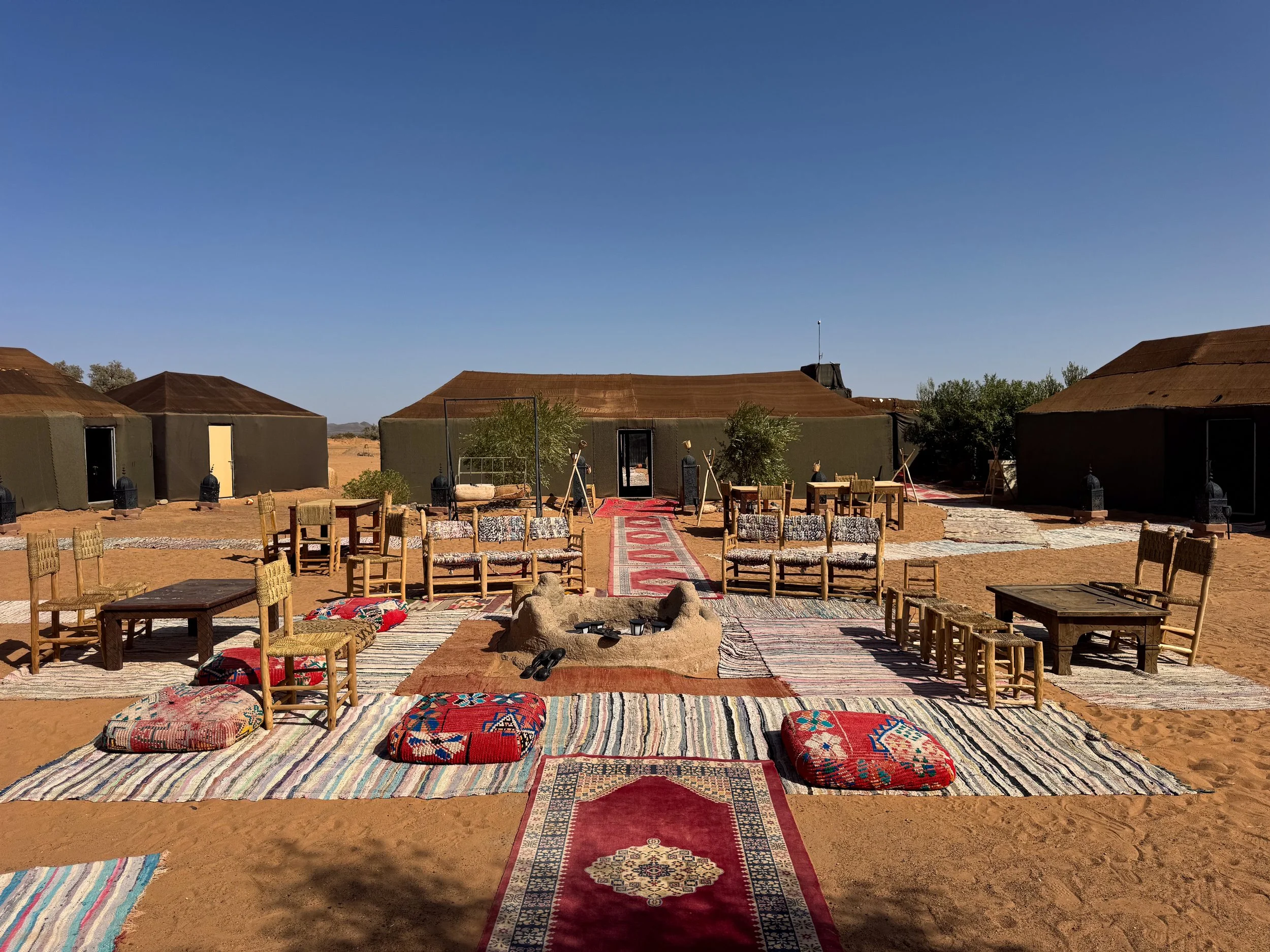
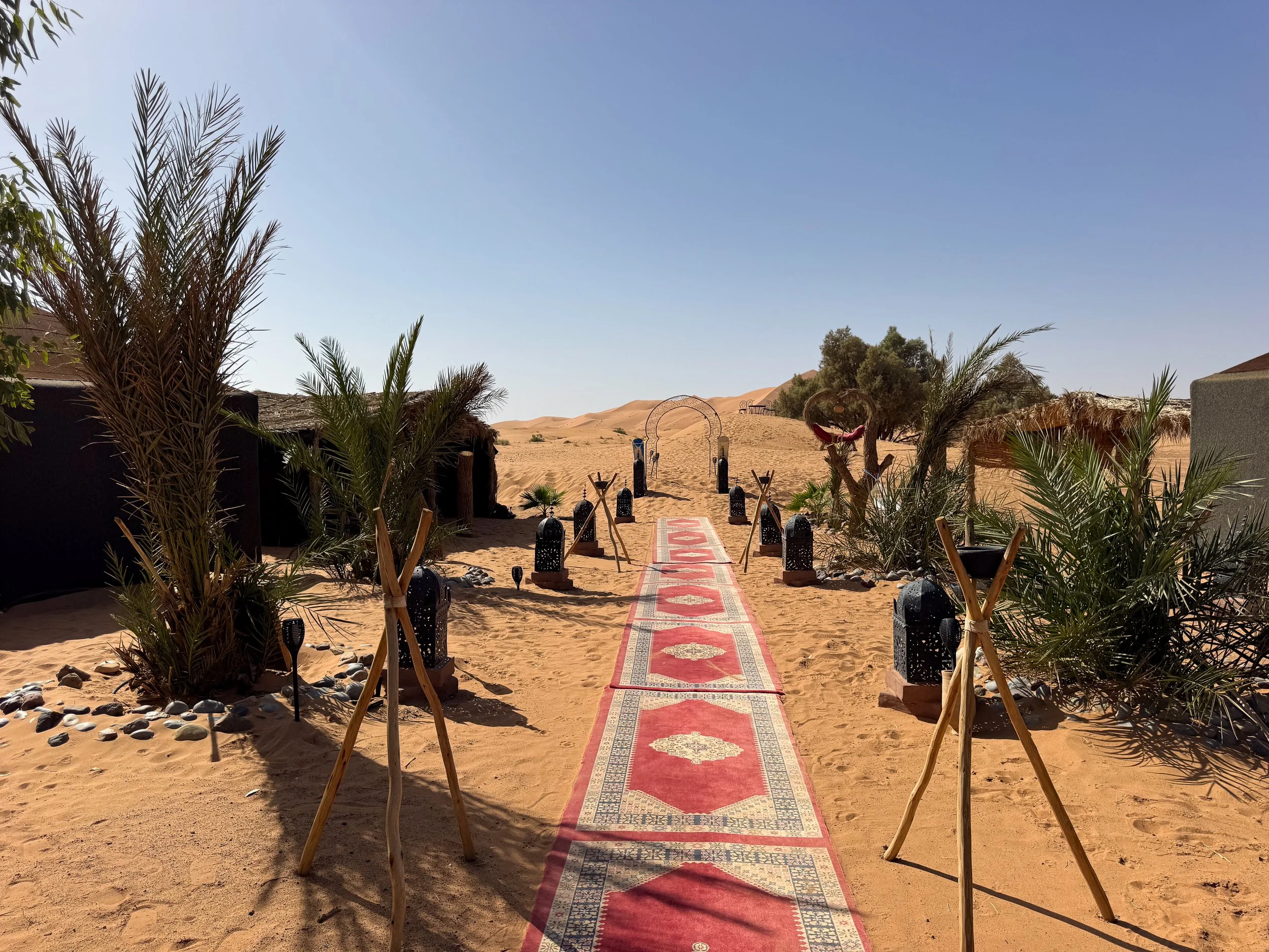
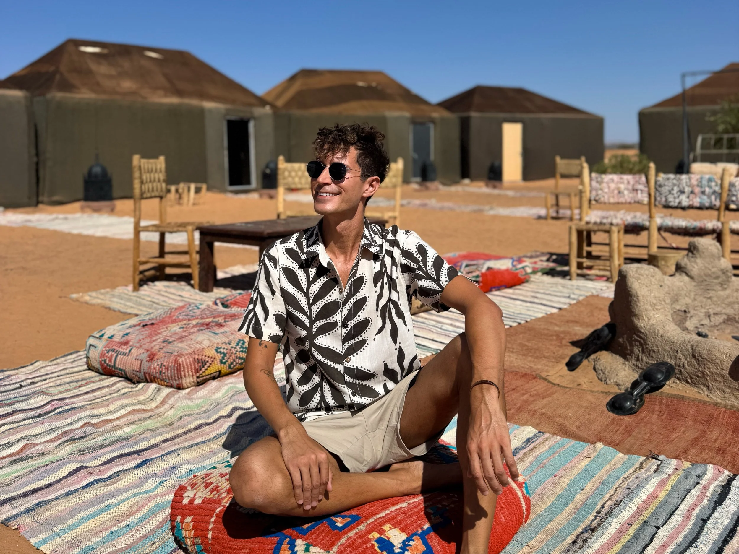
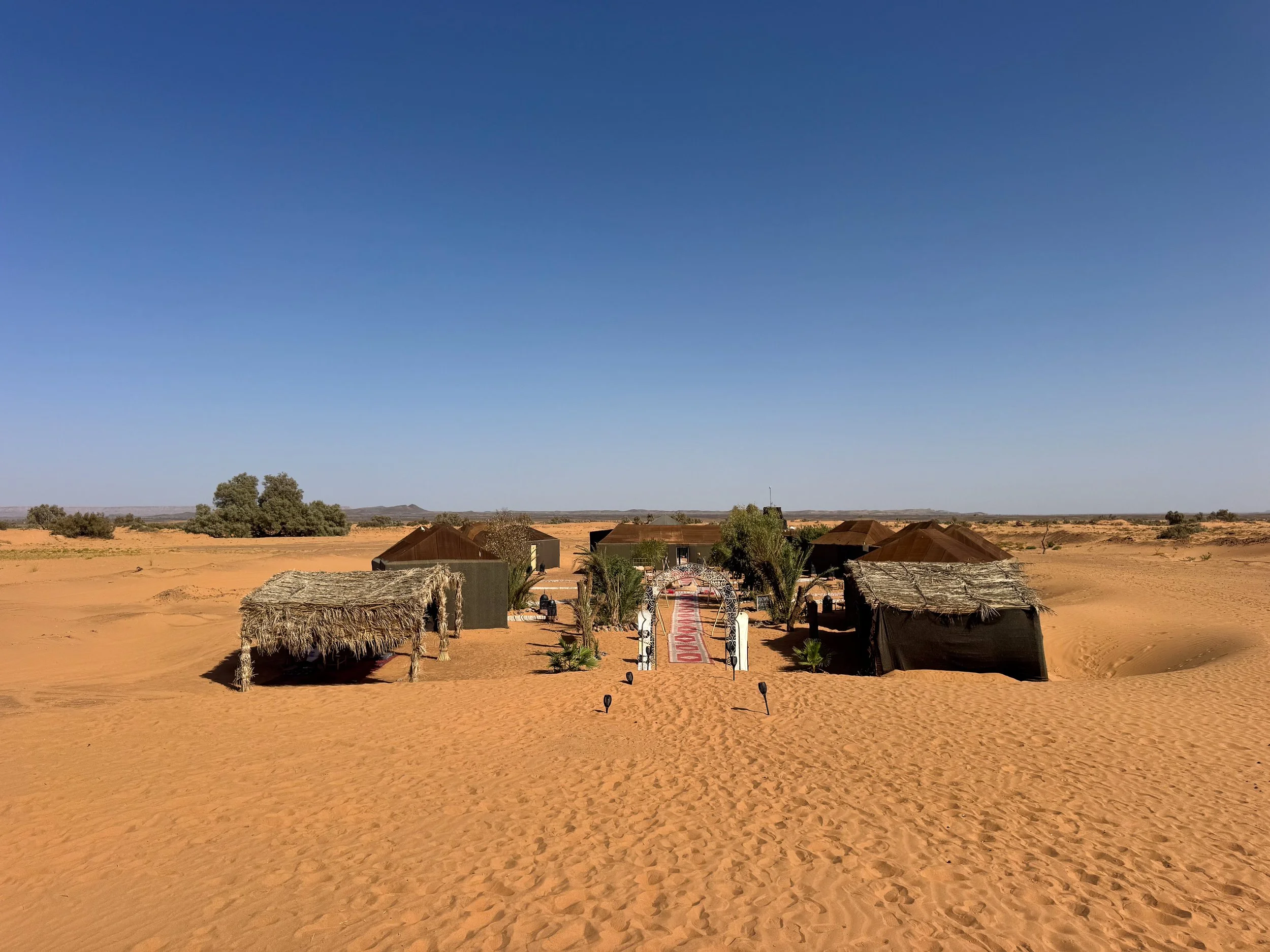
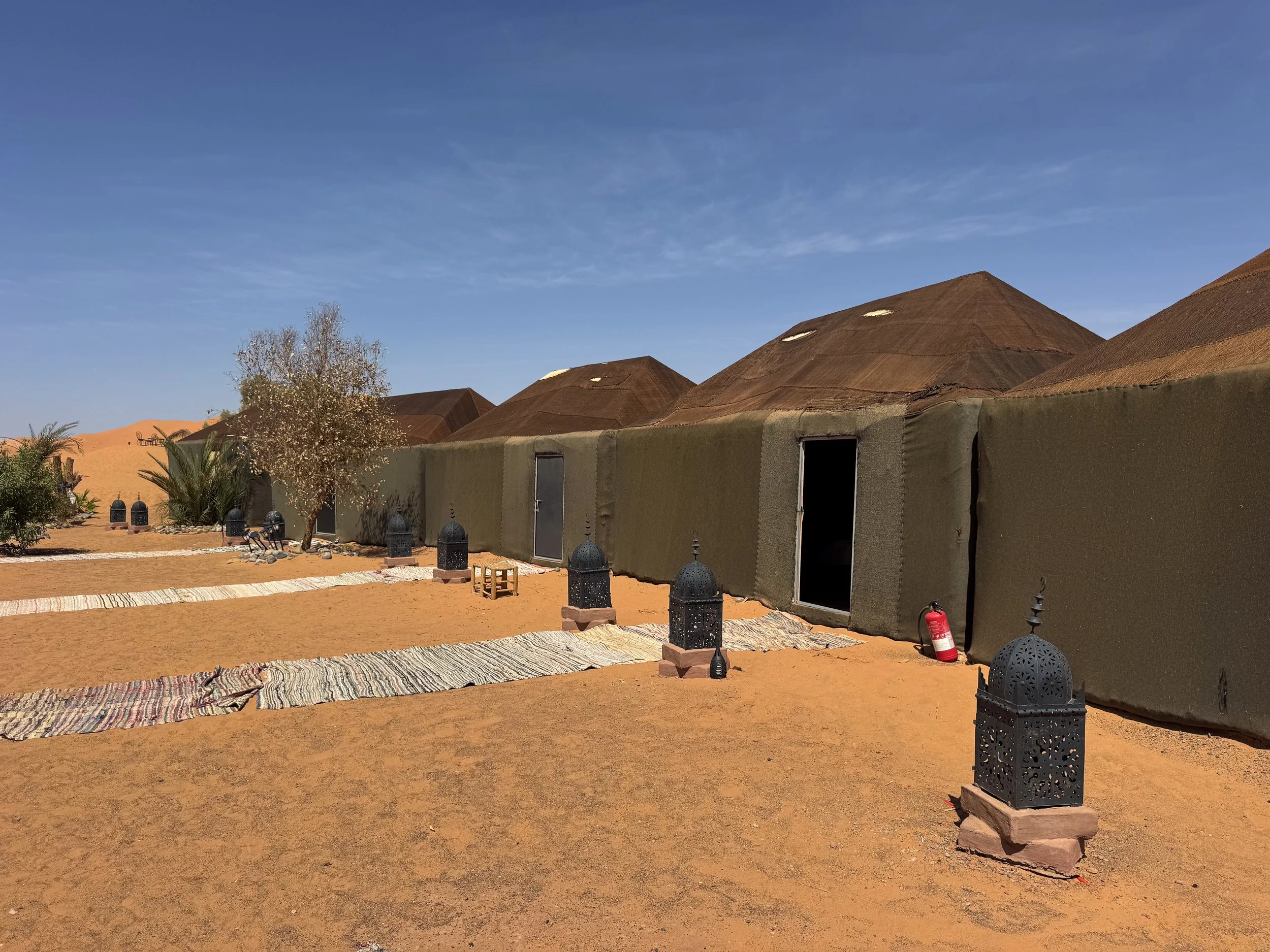
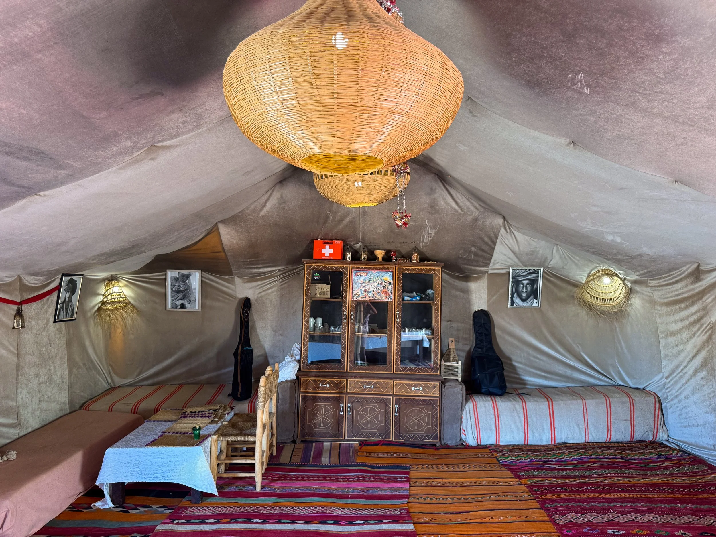
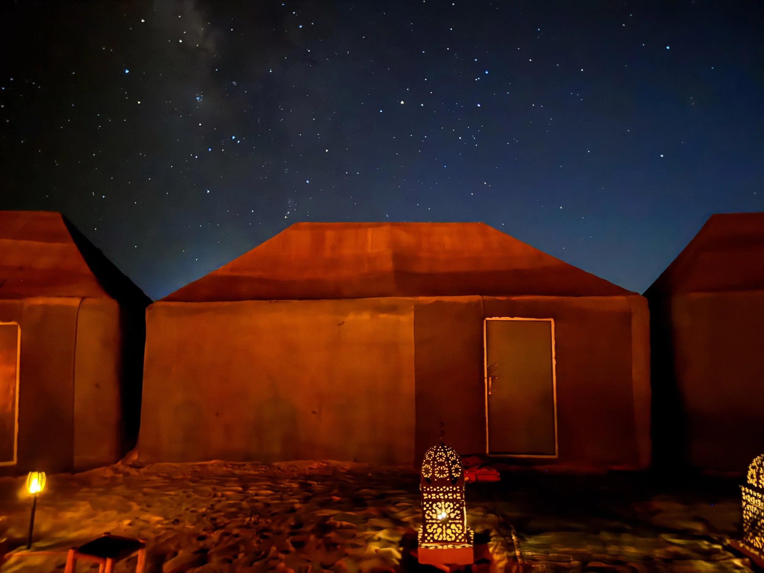
Sahara Wellness Camp
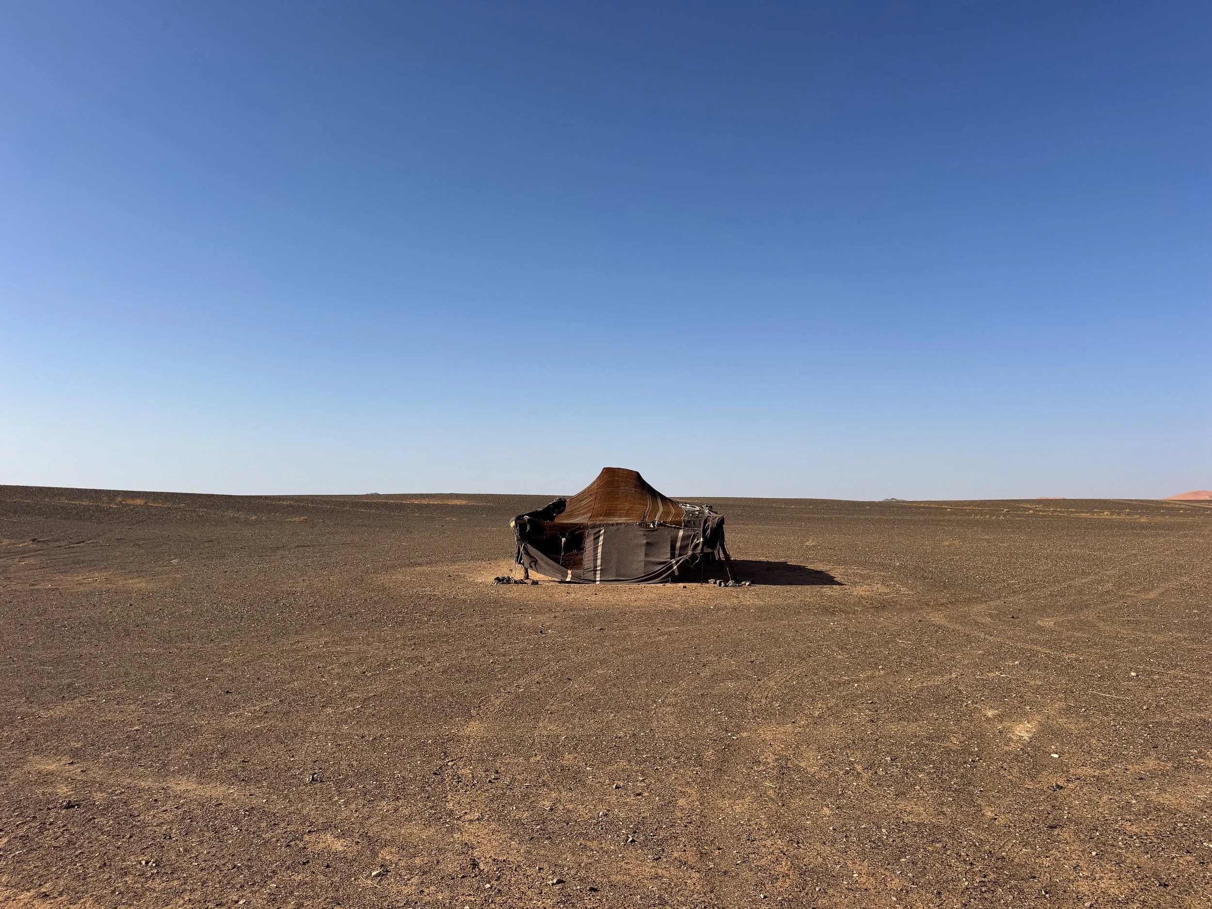
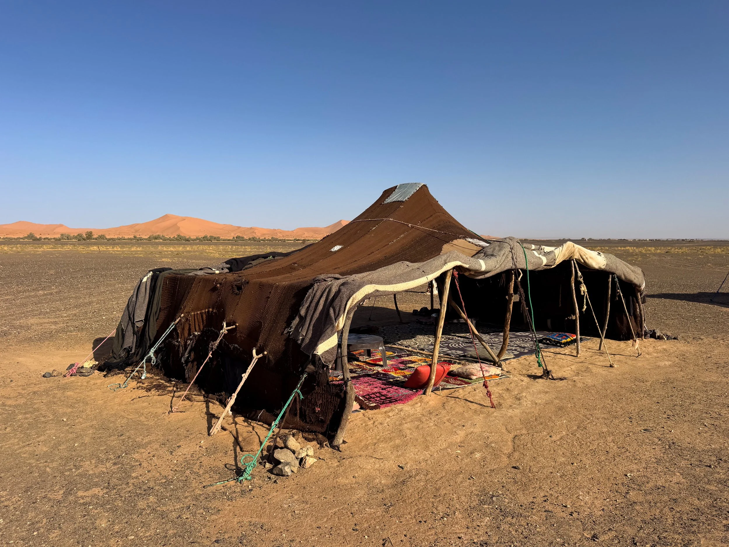
The Sahara Wellness Camp is a Berber style desert camp nestled between sand dunes on the edge of the Merzouga Desert. It offers traditional accommodations, desert excursions and Moroccan meals. Reserve on Booking.
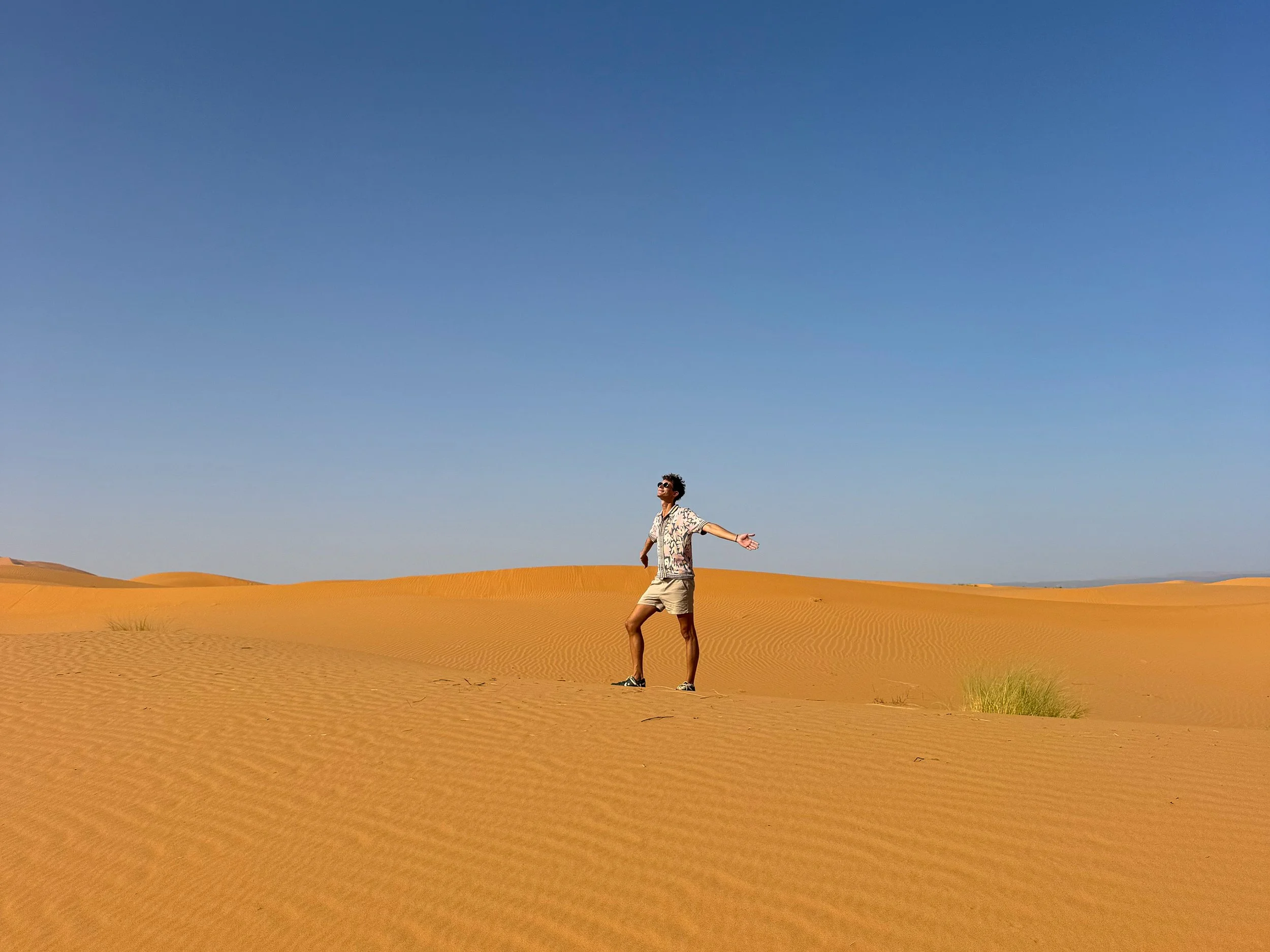
Dune Hikes. Hiking the dunes is one of the best ways to experience the Merzouga Desert. Meander along their sandy crests, steep slopes and shifting terrain. The rippled sand is often covered in signs of life. Look for animal prints from migratory birds, tiny mice and desert foxes. Patches of green grasses flourish from otherwise barren desert after seasonal rains.
Pro Tip. Plan to hike the dunes in the early morning or late afternoon. Bring enough water to stay hydrated. For safety, let the camp know where you’ll be hiking and when you expect to return.
Watch the Sunset. Sunset in the desert is a magical time of day. The sun casts long shadows across the dunes as it slips below their crests. It makes way to the starry night sky and cool evenings. We watched from atop a small dune while sipping on glasses of Moroccan wine.
Stargazing. The Merzouga Desert is a dark sky area with stunning views of the starry night sky. We saw meteors streak across the heavens, watched satellites orbit overhead and spotted planets, stars and constellations. Download Sky Tonight, a free star spotting app utilizing augmented reality.
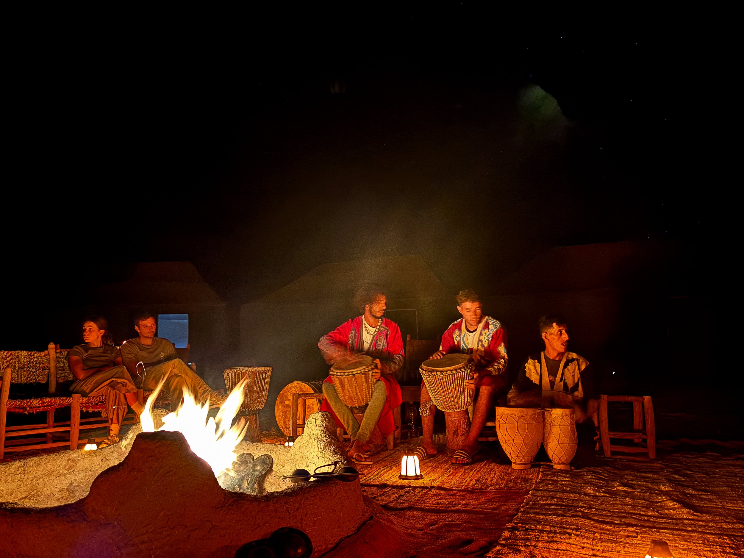
Amazigh Music. On most nights, the camp staff will light a bonfire and perform traditional Amazigh music using drums and tambourines. The beat is very rhythmic, creating a relaxing atmosphere for the end of the night.
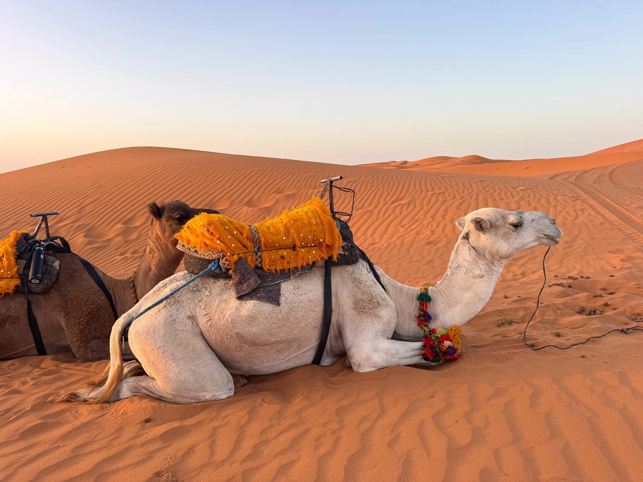
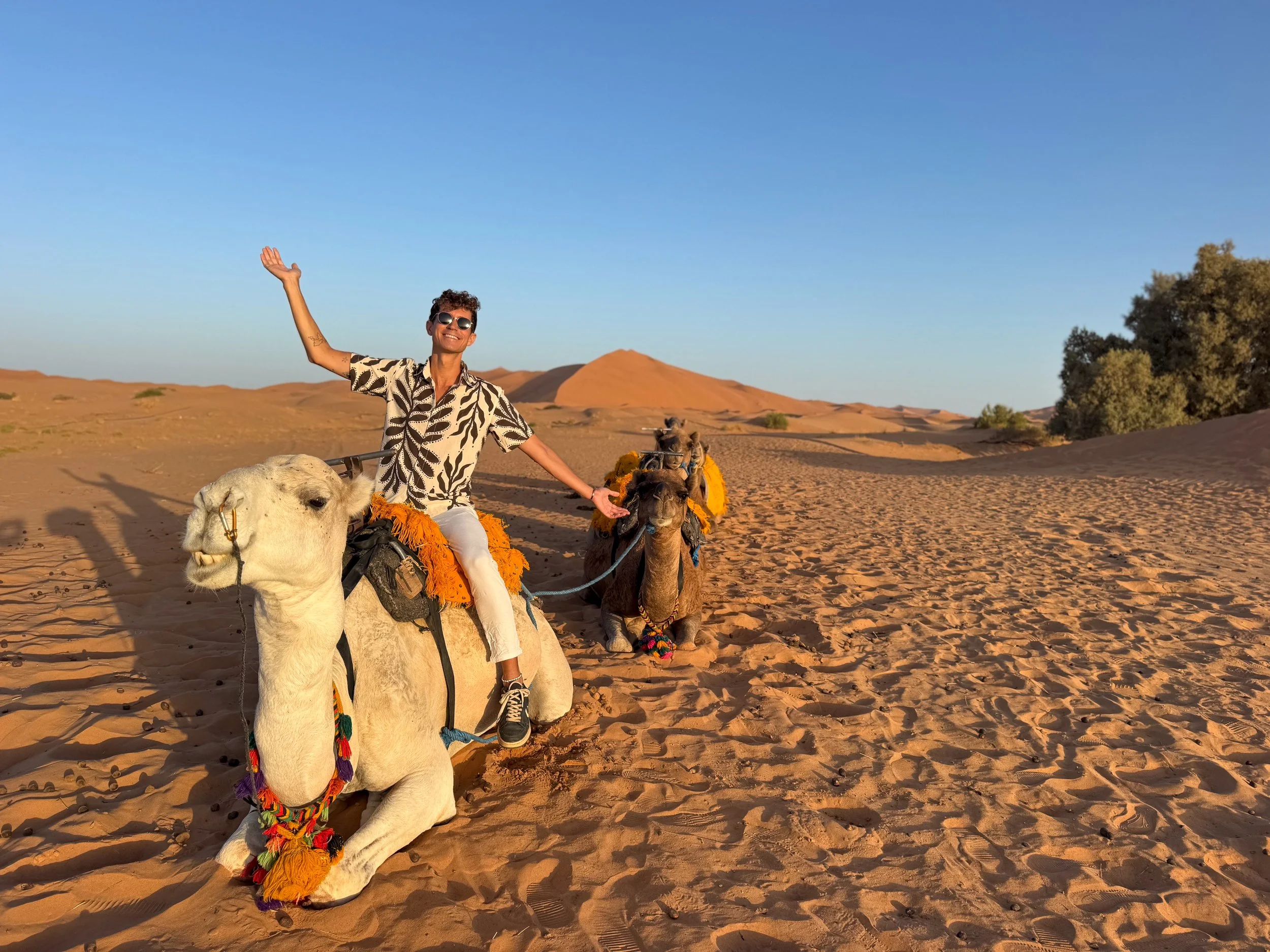
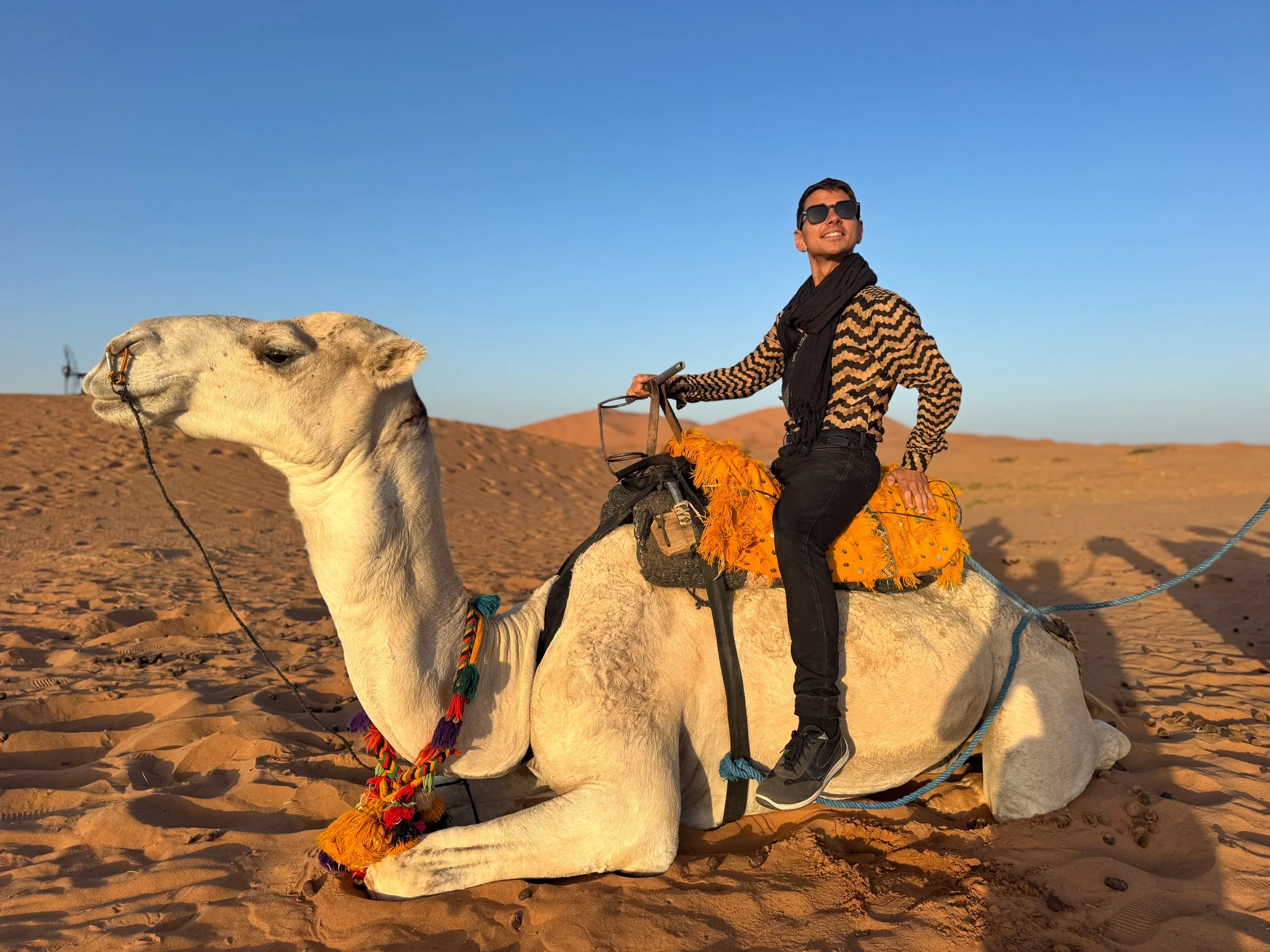
Sunrise Camel Trekking. Berber men lead caravans of camels and campers into the dunes to watch the sunrise. We rode a pair to a scenic point in the desert. The camels steadily paced across the dunes with us on their humped backs. The desert landscape glowed as the warm sun rose across the orange sand.
Good to Know. Berber camels are very well treated, given time to rest, eat and drink between walks.
Merzouga Tour. The camp offers an experience to learn about the local culture, history and nomadic peoples of Merzouga Desert. We started the morning by sipping on mint tea with a Berber family. We listened to the rhythmic drums and chants of a Gnawa musical performance. Our guide brought us to an abandoned mining town to hike and shop for Paleozoic era fossils found in the area. We visited a community farm and harvested fresh dates. The tour ended with an adventurous dune ride back to camp.
Tips for Visiting The Merzouga Desert:
Getting Here. The Merzouga Desert is reachable from the Todra Gorge by car. It takes between 3-4 hours to reach if driving. The camp is reachable by SUV or camel trekking across the dunes.
Camp Fees. Staying at the camp is very inexpensive. Optional activities, meals and transportation cost extra, however prices can be negotiated.
Desert Activities. Once at the camp, what you make of the experience is entirely up to you. Simply relax, explore on your own or book paid activities. For the full experience, plan to stay more than one night.
Camp Meals. The meals are one of the highlights of the desert camp. The chef prepares individually made meals for each guest. We enjoyed Berber omelettes, vegetable tagines and Moroccan spreads.
Daytime Heat. The interiors of the tents get extremely hot during the day. It’s best to relax in the shaded open air tents and enjoy the peacefulness of the desert.
Attire. Wear flowy and light colored clothes during the day. Bring sunglasses. Dress in layers during the cool evenings. Check the forecast ahead of time.

Moroccan & Berber Cuisine
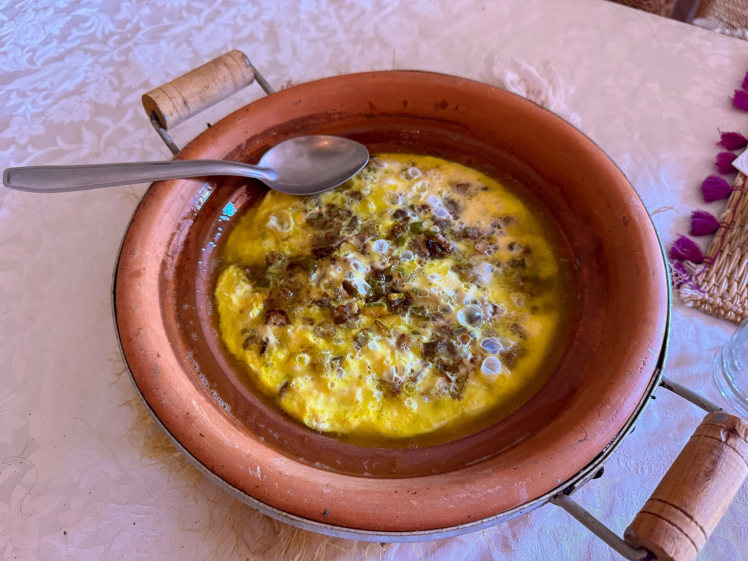
Berber Omelette. An omelette cooked in a tagine with olive oil, onions and spices. It’s common in the Berber regions of Morocco like the desert and mountains.
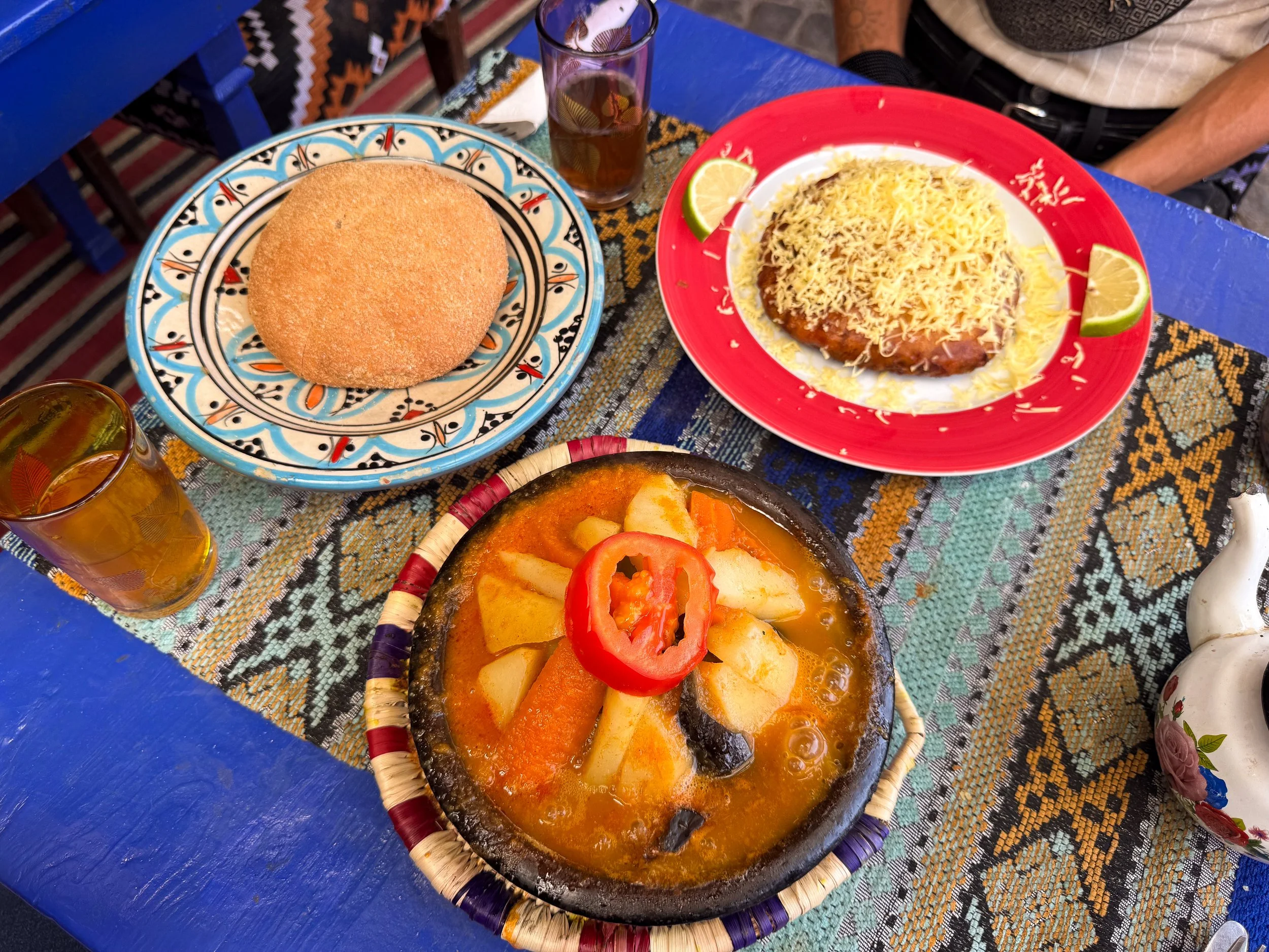
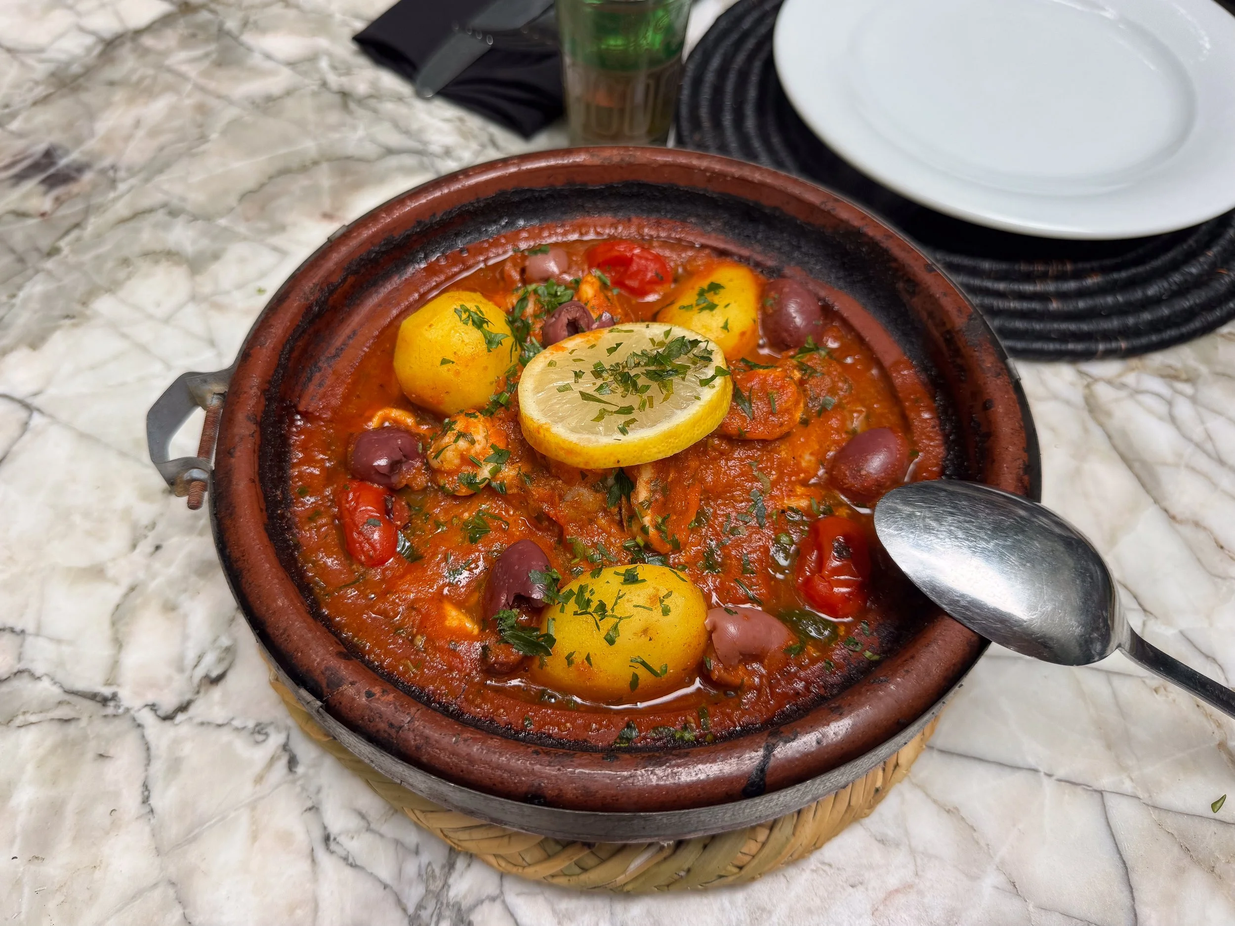
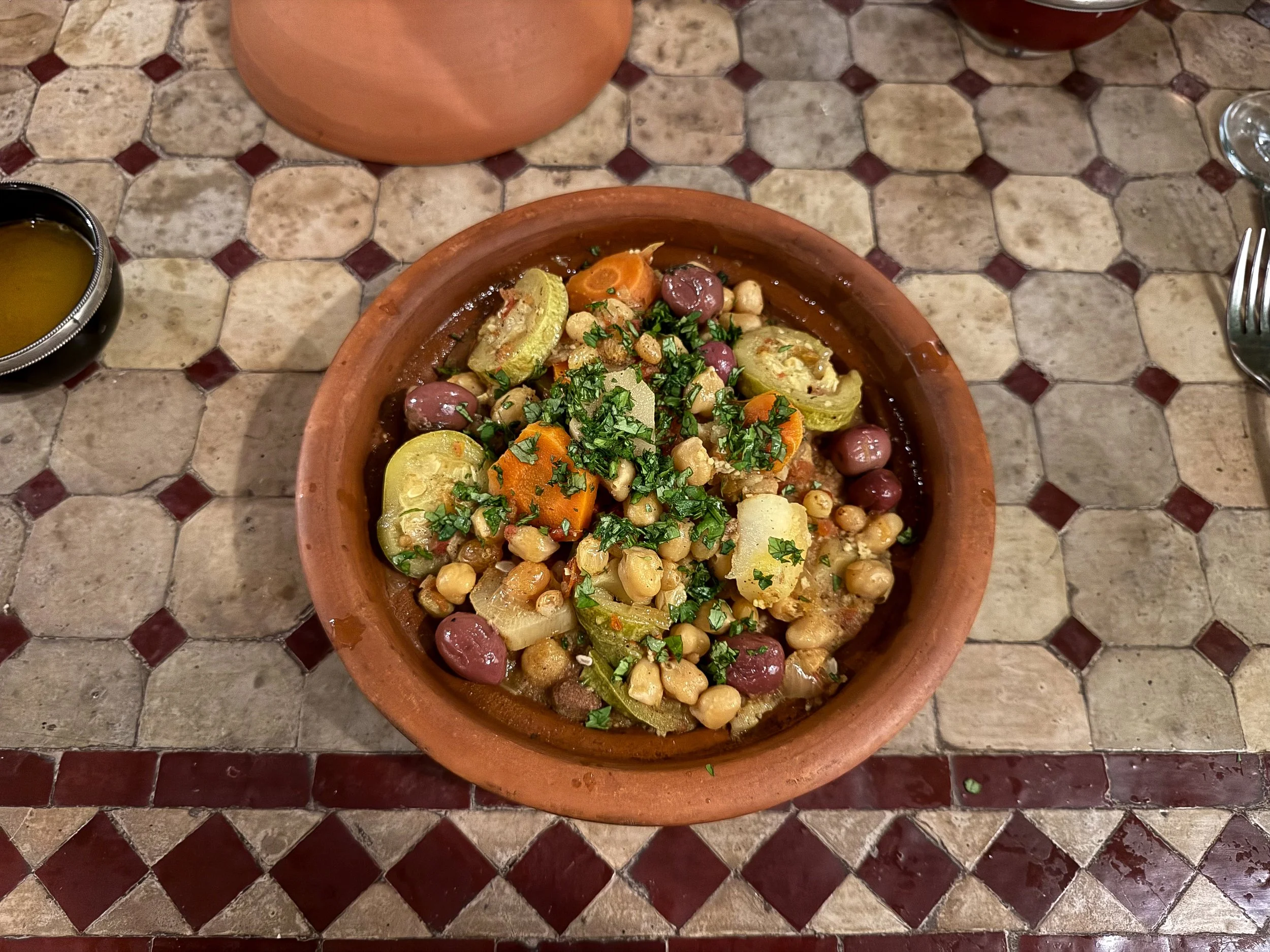
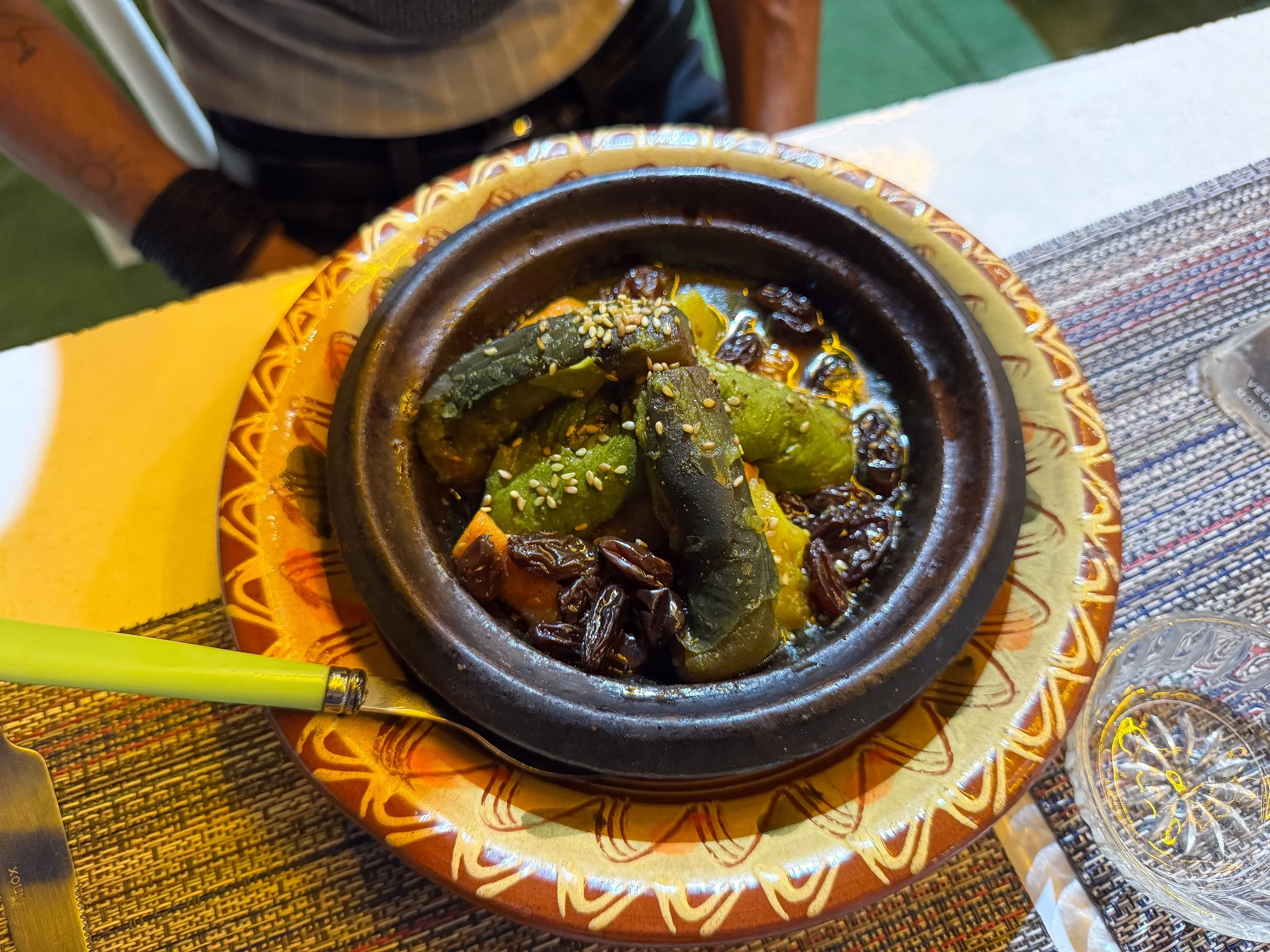
Tagine. A mixture of vegetables, meats, dried fruits and spices stewed together in a conical clay dish. It’s a staple dish of Moroccan cuisine.
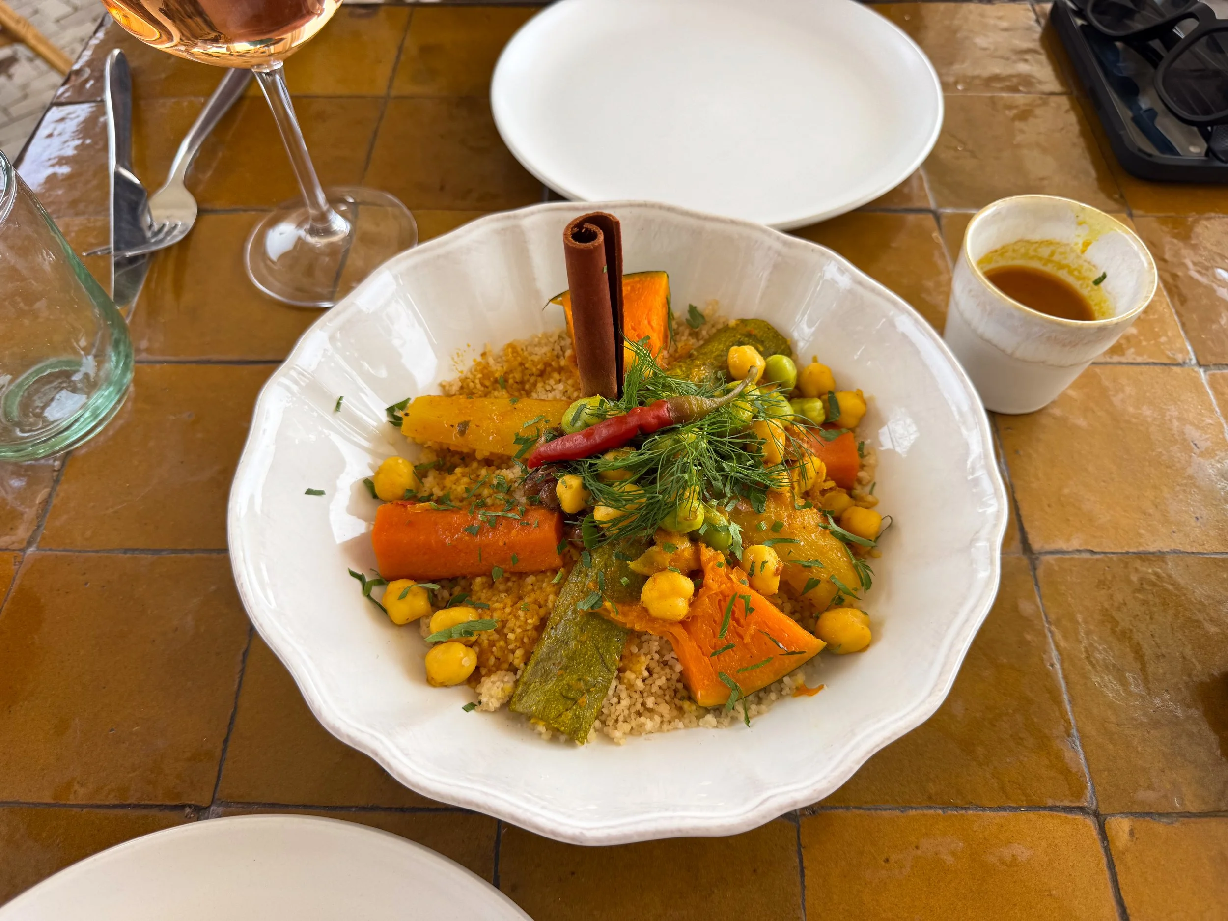
Couscous. A steamed grain covered in a savory broth and garnished with vegetables and meats.
Khobs Bread. A light and airy flatbread served with every meal. It’s fresh baked daily and can be bought for 1 DH from local bakeries.
Mint Tea. Hot tea made with fresh mint leaves and sugar cubes. It’s served as a common welcome drink.
Orange Drinks. Orange is one of the most popular flavors in Morocco. Fresh squeezed orange juice and sodas are commonly drunk. Try Orangina or Hawai.
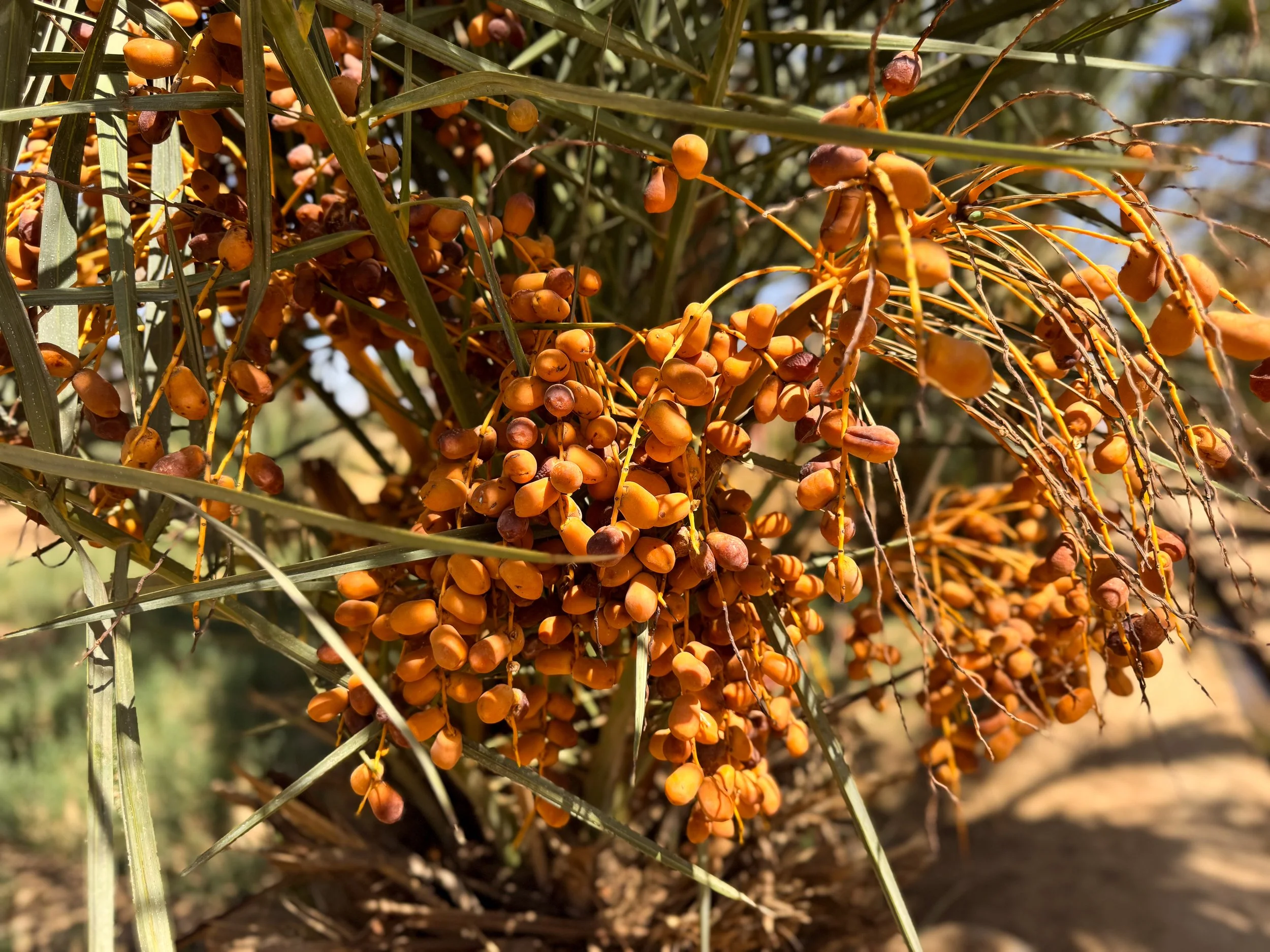
Dates. A dried fruit from the date palm tree. They come in dozens of varieties and can be found across Morocco. They’re eaten at breakfast or as snacks. Try them stuffed with a walnut.
Driving in Morocco
Driving in Morocco comes with benefits and challenges. While we enjoyed our road trip, we have some pros, cons and lessons learned we wish we knew beforehand.
Pros. The roads are well maintained, gas stations are frequent, the landscape is beautiful and you have the freedom of being on your own schedule.
Cons. Fake speed traps, police corruption and reckless drivers make driving in Morocco stressful and difficult.
Where to Rent. We rented from Sixt at the Marrakech airport and returned it at the Fez airport a week later.
Rest Stops. Half the joy of taking a road trip is making unexpected stops when something catches your eye. We stopped several times throughout our journey to check something out including remote roadside cafes, camel crossings, panoramic viewpoints, Berber craft stands and fossil and meteorite shops.
Corrupt Speed Traps
Corrupt speed traps are common across Morocco. If driving, you’re all but guaranteed to be fined by police officers. Patrols of the Royal Moroccan Gendarmerie will signal you to pull over, confiscate your license and passport, then ask you to pay a cash fine for any number of reasons.
Examples of Traps:
Reduced Speed Signs. Police set up a series of rapidly descending speed limit signs spaced mere meters apart hoping to entrap drivers.
Hidden Stop Signs. Police place hidden stop signs directly behind speed limit signs to entrap drivers.
Painted Speed Signs. Police paint over posted speed limit signs to obscure the actual speed.
How to React:
Option 1. Pay the cash “fine.” They typically request 300-400 Dirham. They will not provide a ticket or receipt.
Option 2. Respectfully dispute the “fine.” Push back and ask for evidence as well as a formal written ticket. If legitimate, this needs to be paid in cash on the spot or at a police station.
Option 3. Respectfully dispute the “fine.” Push back and let the police know you did not violate the traffic laws. Mention that you’ve already been pulled over, paid a fine and reported the past incident to your embassy. Corrupt police will back down in fear of being reported at the mention of diplomatic support.
Document Evidence. When approaching a speed trap, immediately slow down to 20km and have a passenger record the speedometer and posted signs. This can be used as proof to dispute the “traffic violation.” Document evidence of the encounter including the time, location, officer names and badge numbers. Be careful not to directly photograph or record the police. This is considered “illegal journalism” in Morocco.
Arabic Words & Phrases
Knowing a few words and phrases in Arabic goes a long way in Morocco when interacting with locals. Some of the most common and easy to remember are:
Hello = Salama
Goodbye = Beslama
Thank you = Shukran
You’re welcome = Marhaba
Location Specifics
When to Visit. September is the best month of the year to visit Morocco. It’s just before peak travel season with hot to moderate temperatures.
Language. Arabic, French and English are commonly spoken by many people, seen on signage and menus.
Cash vs. Card. Cash is the preferred and often only accepted method of payment at many businesses. Confirm before ordering at restaurants or agreeing to services.
Safety. Morocco is a generally safe destination to visit. Be aware of your surroundings and keep hold of personal belongings to avoid pickpocketing.
Drinking Water. Tap water is not safe for consumption or using to cook with. Only use bottled water.
Alcohol. The sale of alcohol is heavily controlled throughout the country. Only some restaurants will serve cocktails, beer and wine.
LGBTQ+ Safety. Moroccan laws and customs are not very accepting of LGBTQ+ individuals. Stay up to date with the latest laws and suggestions while traveling. Refer to our guide on LGBTQ+ Travel Safety for more advice.
Elsewhere in Morocco
From the Sahara Desert and Berber villages to the medinas of Marrakech and Fes, Chefchaouen's mountain streets and Casablanca's coastline, explore more of Morocco through these travel guides:
Marrakech Travel Guide: Medina, Souks & Moroccan Cuisine. Get lost in Marrakech's maze-like alleyways where vibrant souks, elaborate palaces and historic mosques bring centuries of Moroccan culture, cuisine & tradition to life.
Fes Travel Guide: Medina, Tanneries & Islamic History. Step into Fes's ancient medina where Islamic landmarks, historic tanneries, traditional riads and skilled artisans preserve centuries of Moroccan heritage and tradition.
Chefchaouen Travel Guide: The Blue City, Medina & Local Culture. Stroll through Chefchaouen's blue painted medina where historic mosques, fresh juice vendors, Berber artisans and mountain scenery reveal a tranquil side of Morocco.
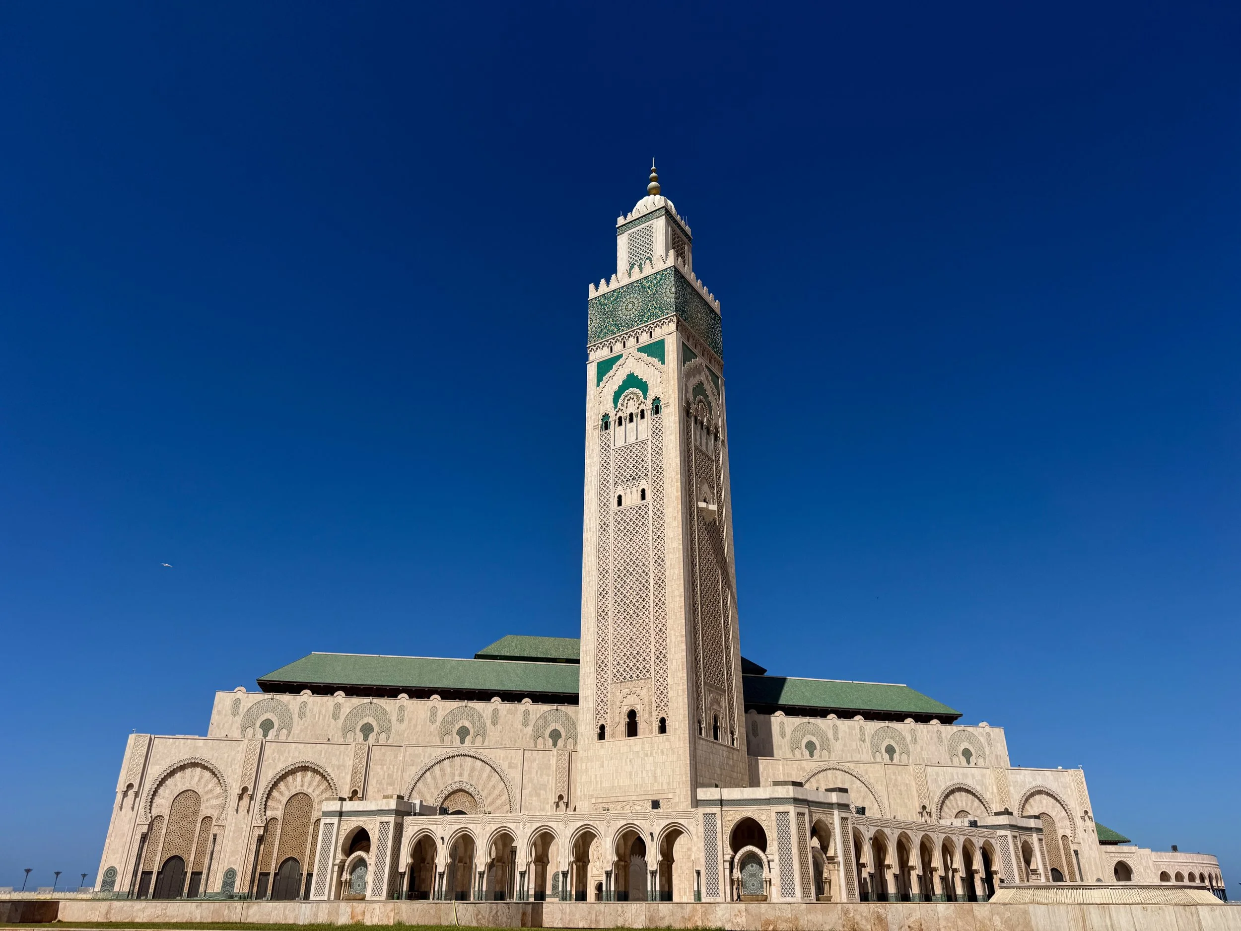
Casablanca Travel Guide: Hassan II Mosque, Local Markets & Moroccan Cuisine. Wander through Casablanca's ancient medina, palm lined avenues and seaside promenades where the Hassan II Mosque and local food markets reflect Morocco's culture.
For Next Time…
The Atlas Mountains and desert landscape of Morocco is a beautiful place, especially with extra time.
Stay in Ouarzazate. We recommend spending at least one night here to experience the town, its souks and movie studios in depth.
Merzouga Lake. A seasonal lake formed during the Merzouga Desert’s August rains. It’s a popular place to spot migratory flamingos.
Ozoud Waterfalls. A series of cascading waterfalls in the High Atlas Mountains. Trails lead up the falls to natural swimming pools.

Rwanda Road Trip Guide: Kigali, Wildlife Trekking & Local Culture
Discover Kigali and road trip through Rwanda's rolling landscapes where local culture thrives and remote forest treks lead to wild chimpanzees and golden monkeys.
Rwandan Roadtrip
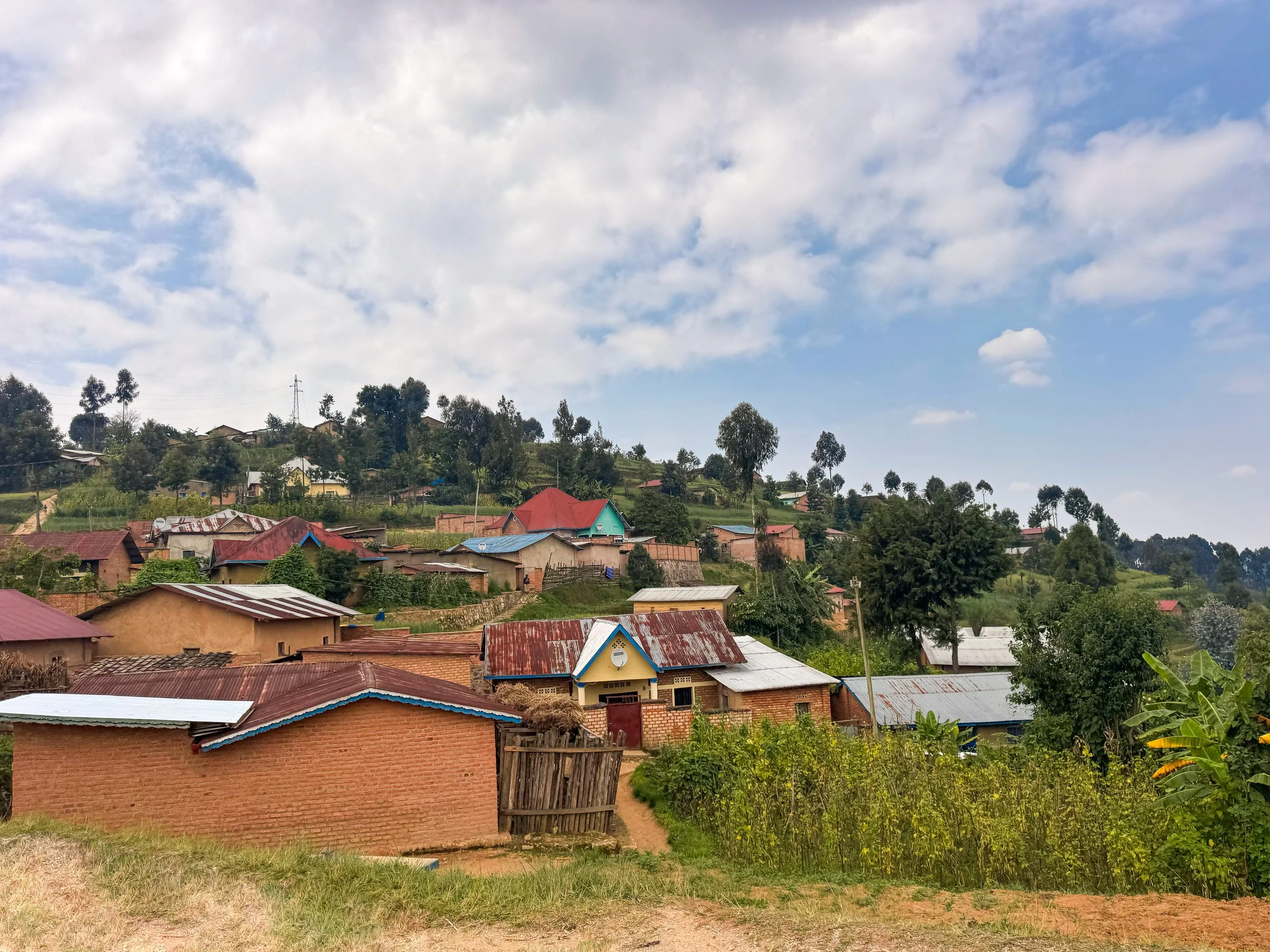
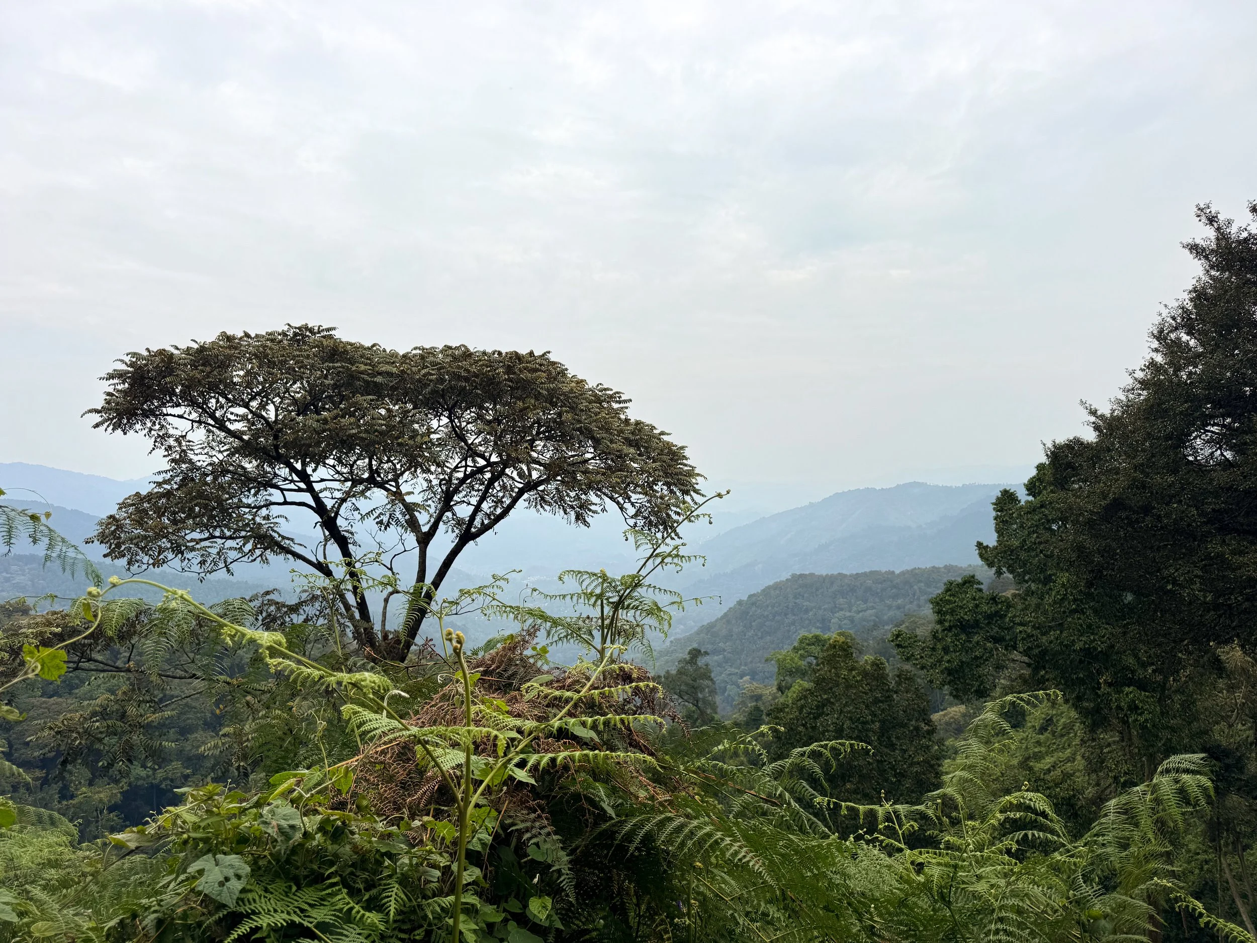
Rwanda is a small East African country known as the land of 1,000 hills. It’s home to lush farmland, mountainous rainforests, sprawling savannas, great lakes and volcanoes. Encounters with endangered primates like gorillas, chimpanzees and golden monkeys attract eco-tourists from across the world. The country’s cultural identity and history are on display at museums, galleries and memorials. We spent a week road-tripping across the country, experiencing its natural beauty, extraordinary animals and local culture.
Observe the Local Culture
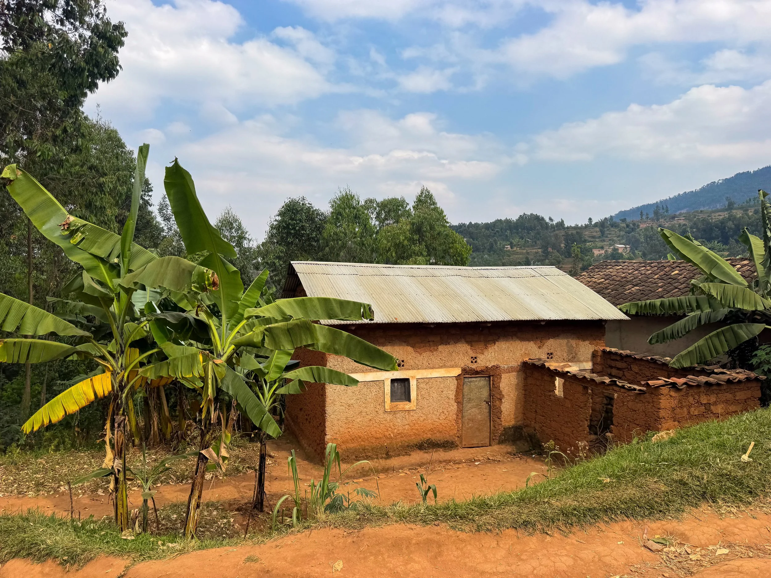
One of the most eye-opening parts about driving in Rwanda was observing the local culture. People work hard cultivating farmland and transporting goods to markets in rural villages. The roadsides are consistently buzzing with people. Women carry bunches of bananas, baskets of produce and sacks of goods on their heads. Men ride and push bicycles overloaded with bundles of sugarcane, silver canisters of milk and bags of goods. Children fill jerry cans with fresh water from wells and roll wheels with sticks for leisure.
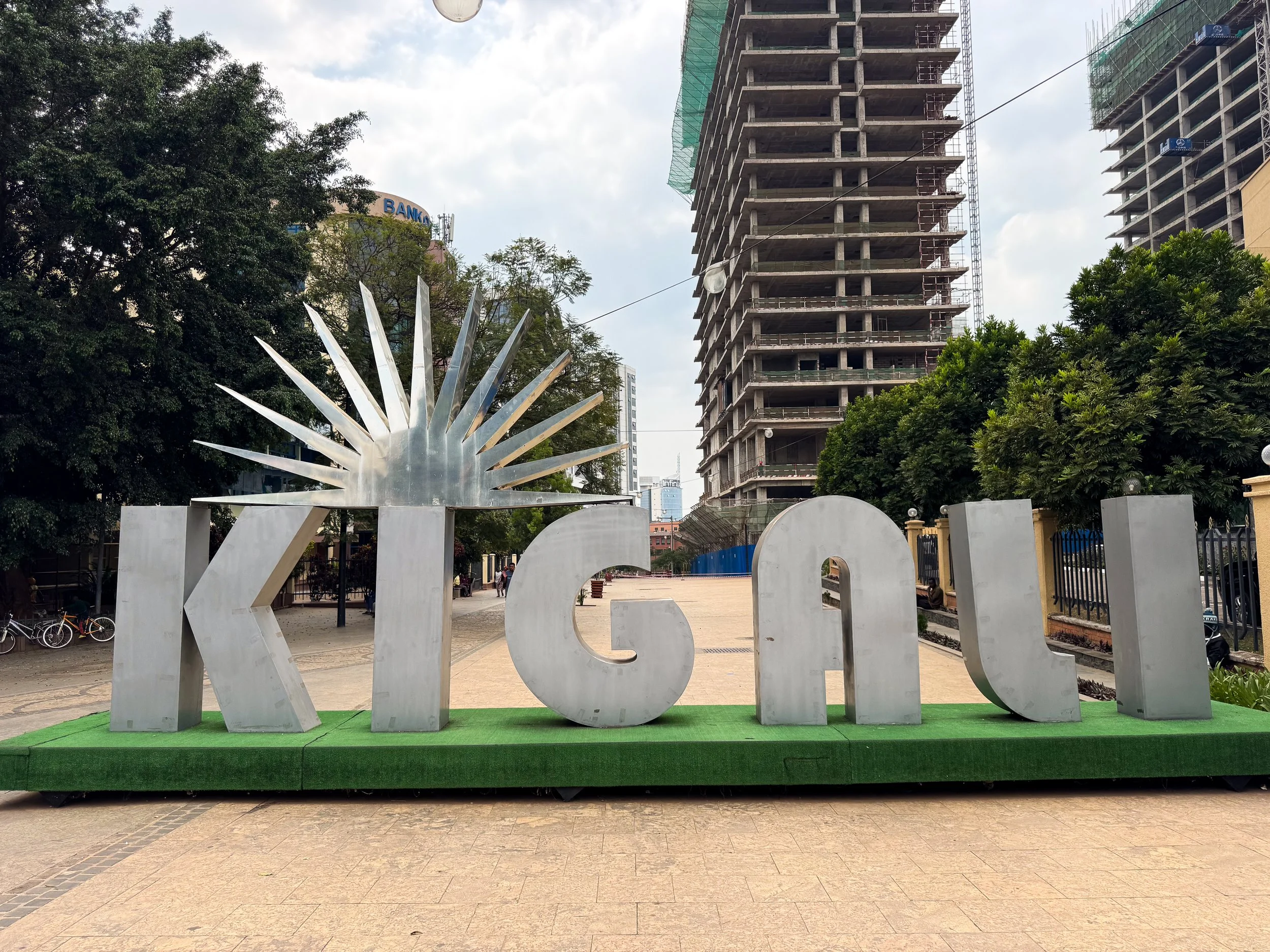
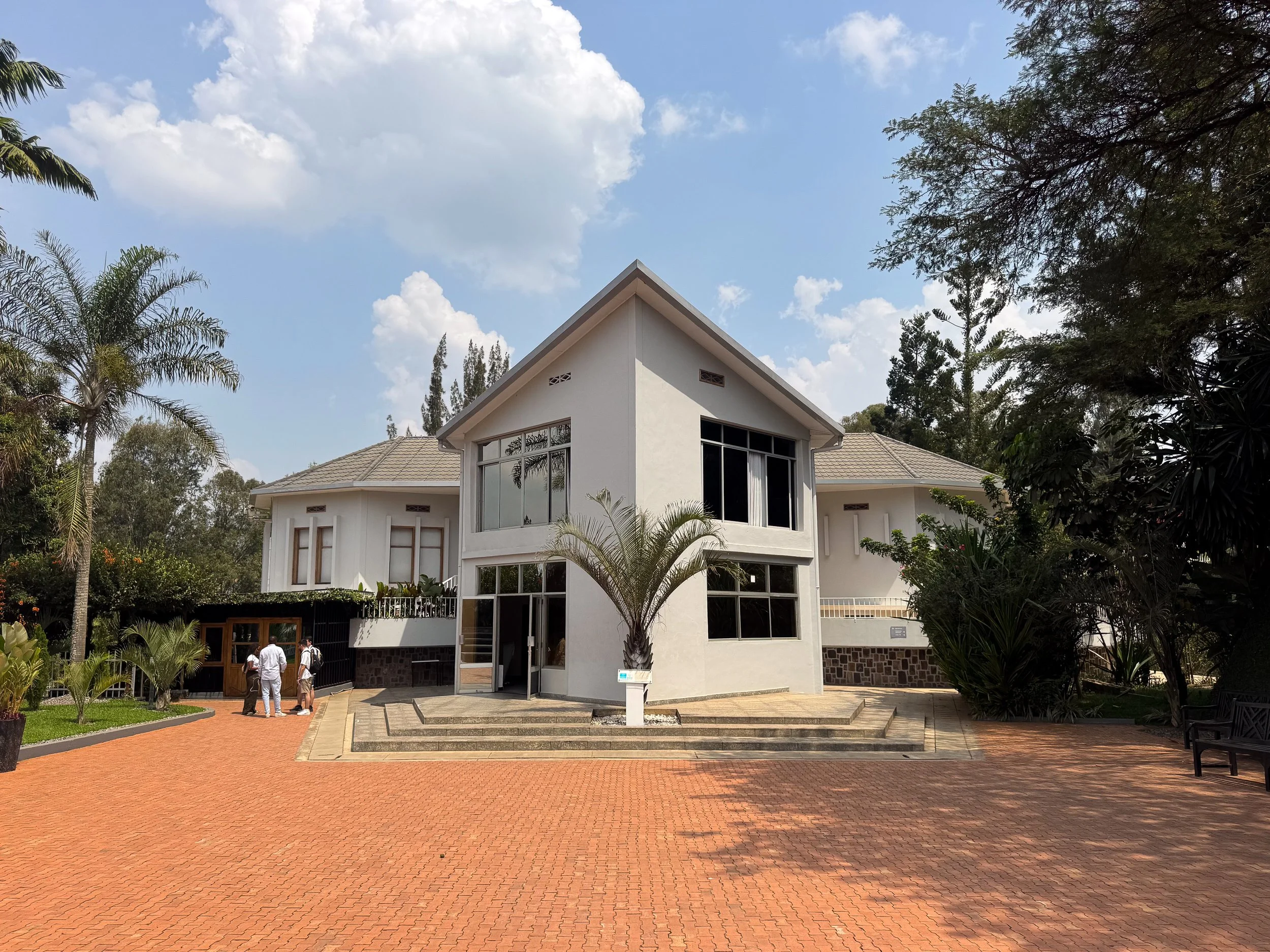
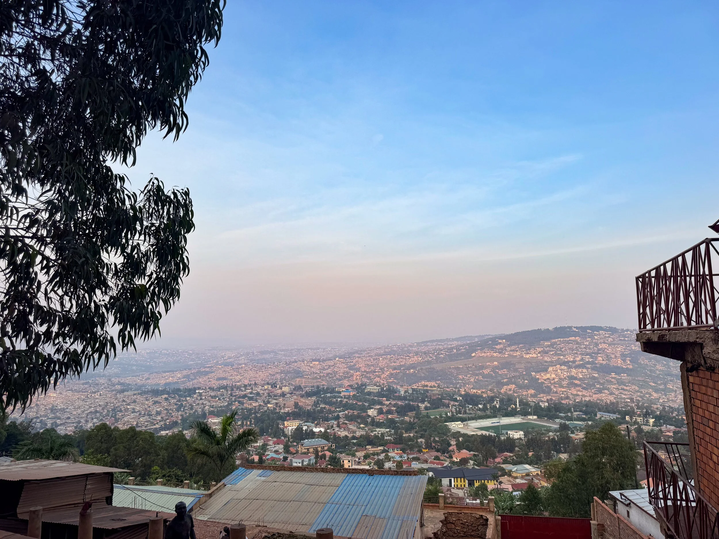
Kigali, Rwanda
Kigali is the vibrant capital city of Rwanda. Its modern neighborhoods and densely populated communities sprawl across the landscape’s rolling hills. Their warm tones glow by day and white lights twinkle by night. It’s a verdant place with palm lined boulevards, flowering trees and manicured bushes. The country’s culture is expressed through its people, goods, cuisine and history. Shops sell handmade crafts and African goods. Seasonally farmed produce is sold at local markets. Women dress in colorfully patterned clothes. Restaurants serve Rwandan cuisine while cafés brew Rwandan coffee. The people look towards the future while remembering the 1994 Genocide.
See the Sights
Kigali Genocide Memorial. A memorial and historical museum dedicated to the victims of the 1994 genocide. The museum is organized by section. It teaches about the root causes and colonial divisions that led to the genocide. It details the history and atrocities prior to and during. It honors the victims and those that stood up to terror as it ensued. It explains the steps post genocide to heal Rwanda and hold accountable those responsible. Lastly, it calls upon humanity to act to prevent future genocides. Mass graves containing the remains of a quarter million people murdered during the genocide are laid to rest here. They’re surrounded by symbolic gardens dedicated to the victims. More than 200 other memorial sites across the country serve as a stark reminder of the atrocities.
Pro Tip. Pay for an audio guide to learn more from the memorial and museum.

Belgian Peacekeepers Memorial. A memorial for 10 Belgian peacekeepers killed during the early hours of the 1994 Genocide. The bullet riddled building is the site of the massacre. It is preserved and partially converted into a museum recounting the timeline of the tragedy. A stone monument honors and remembers the peacekeepers lives. Entrance is by donation.
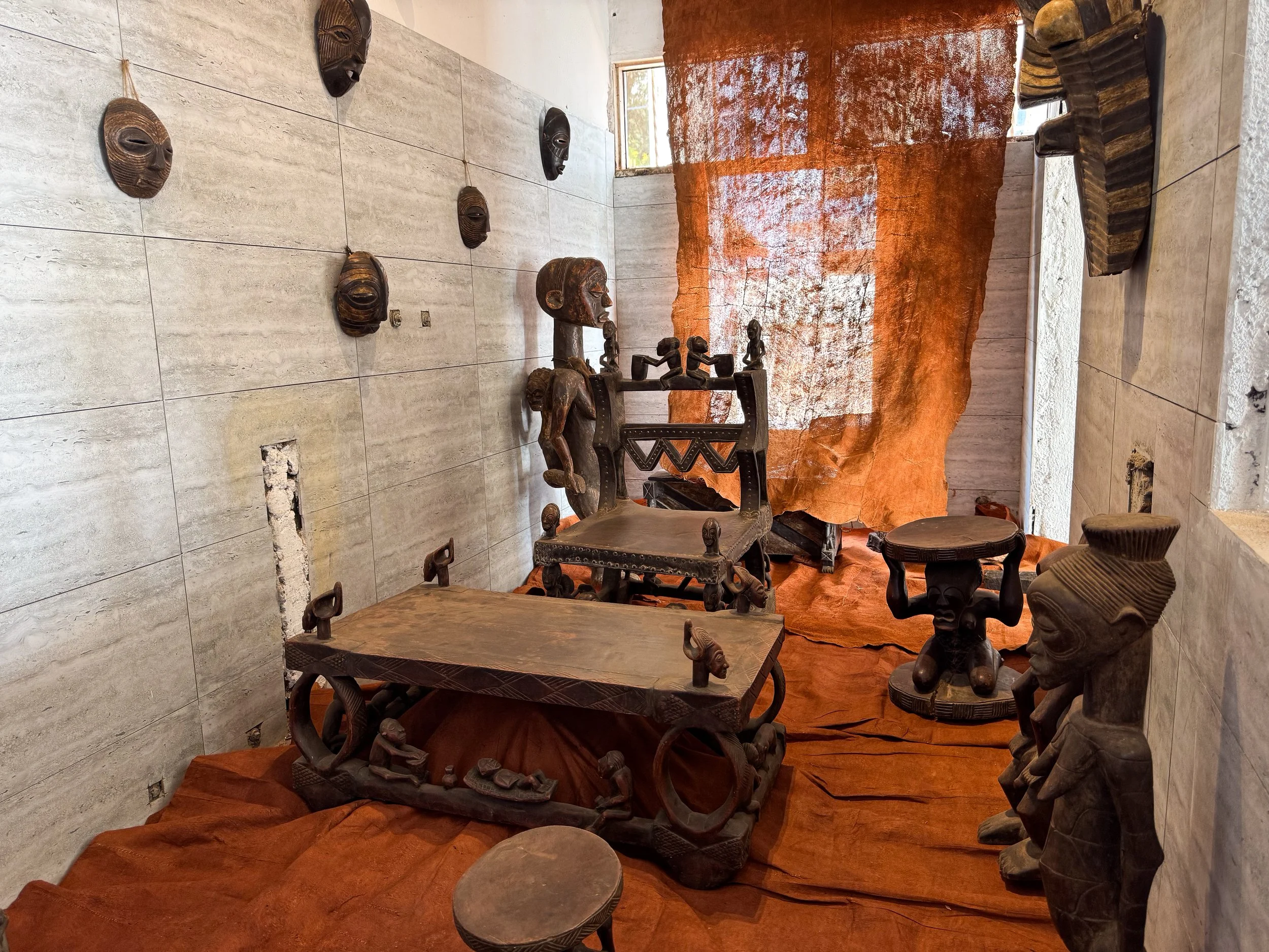
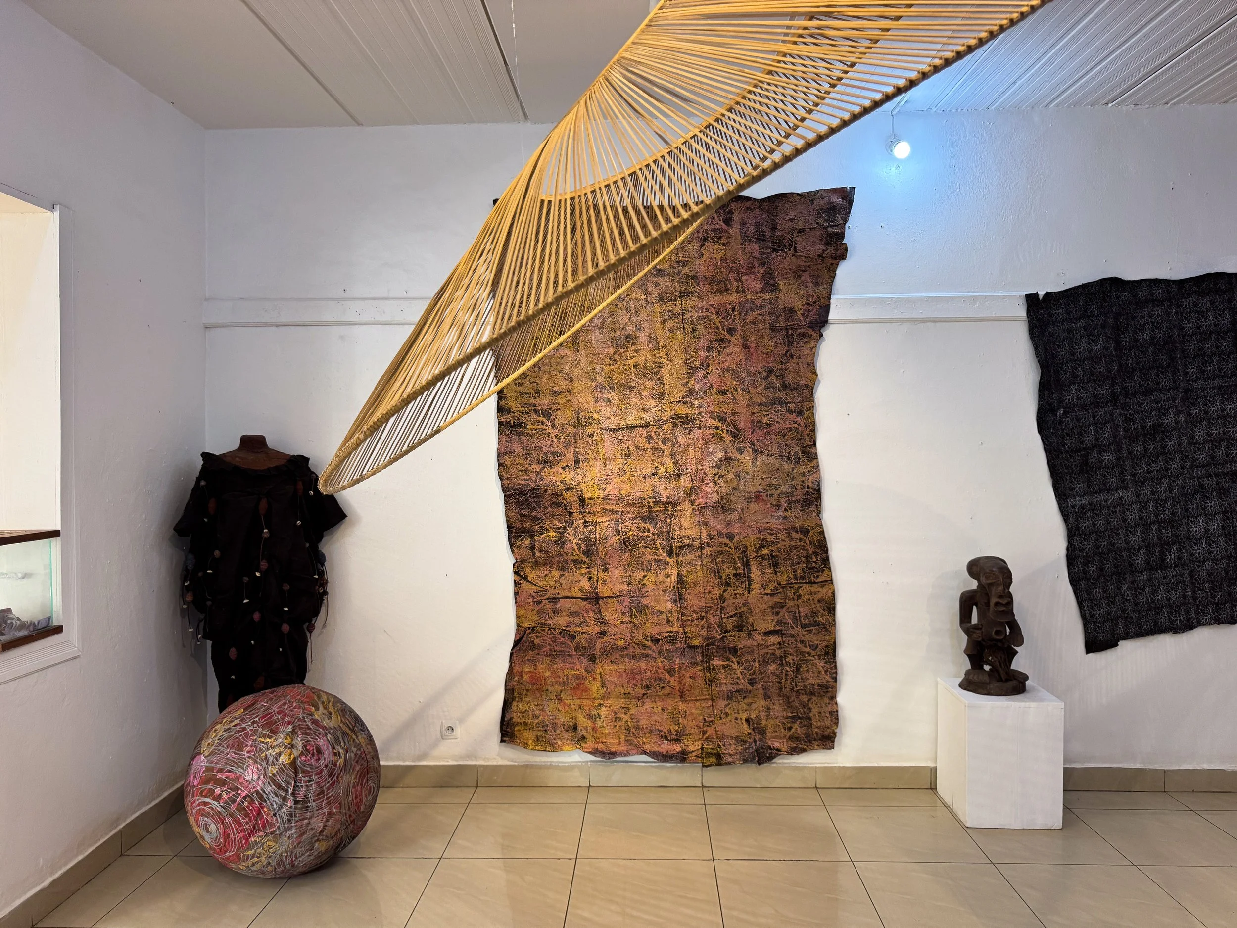
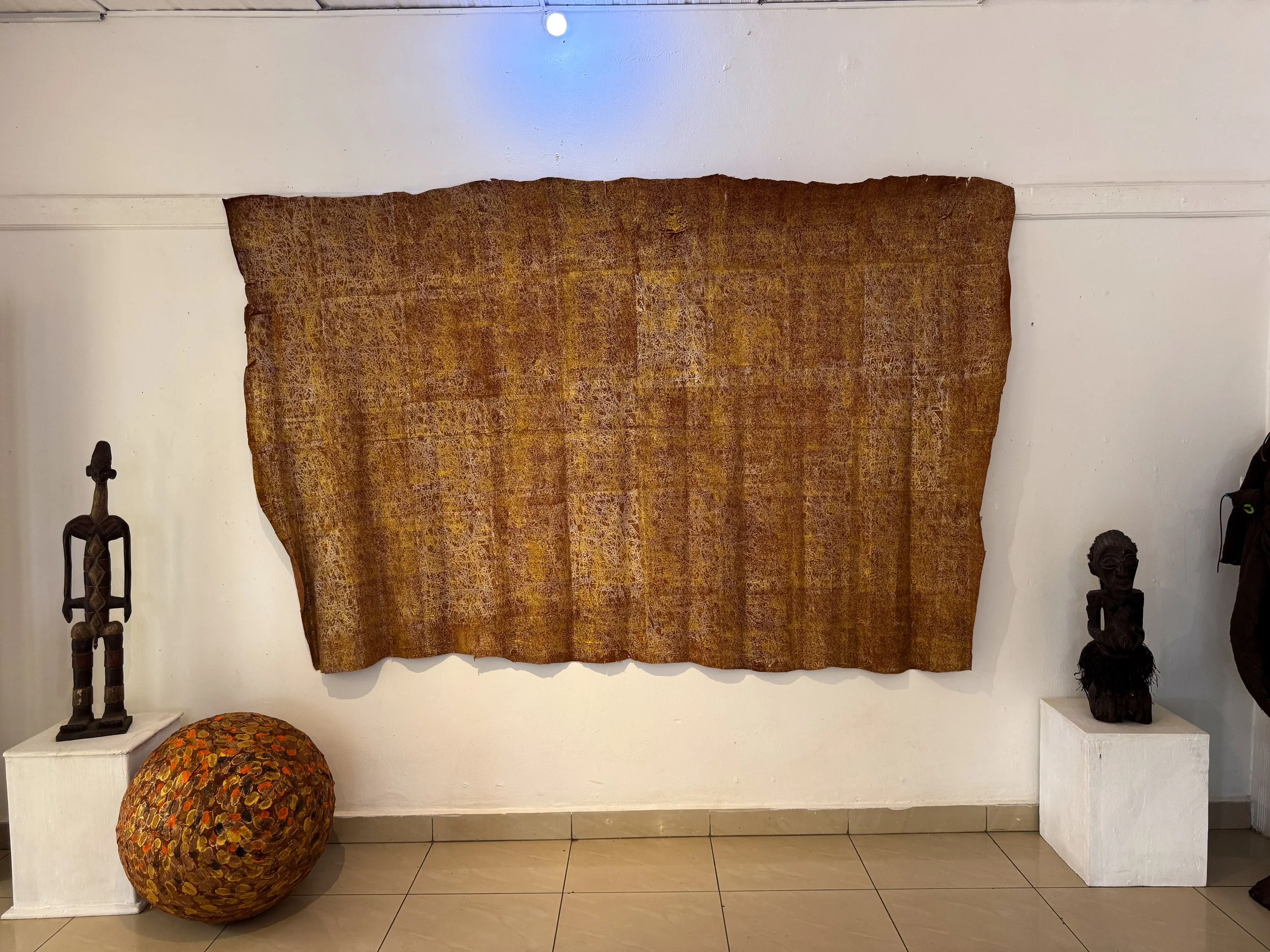
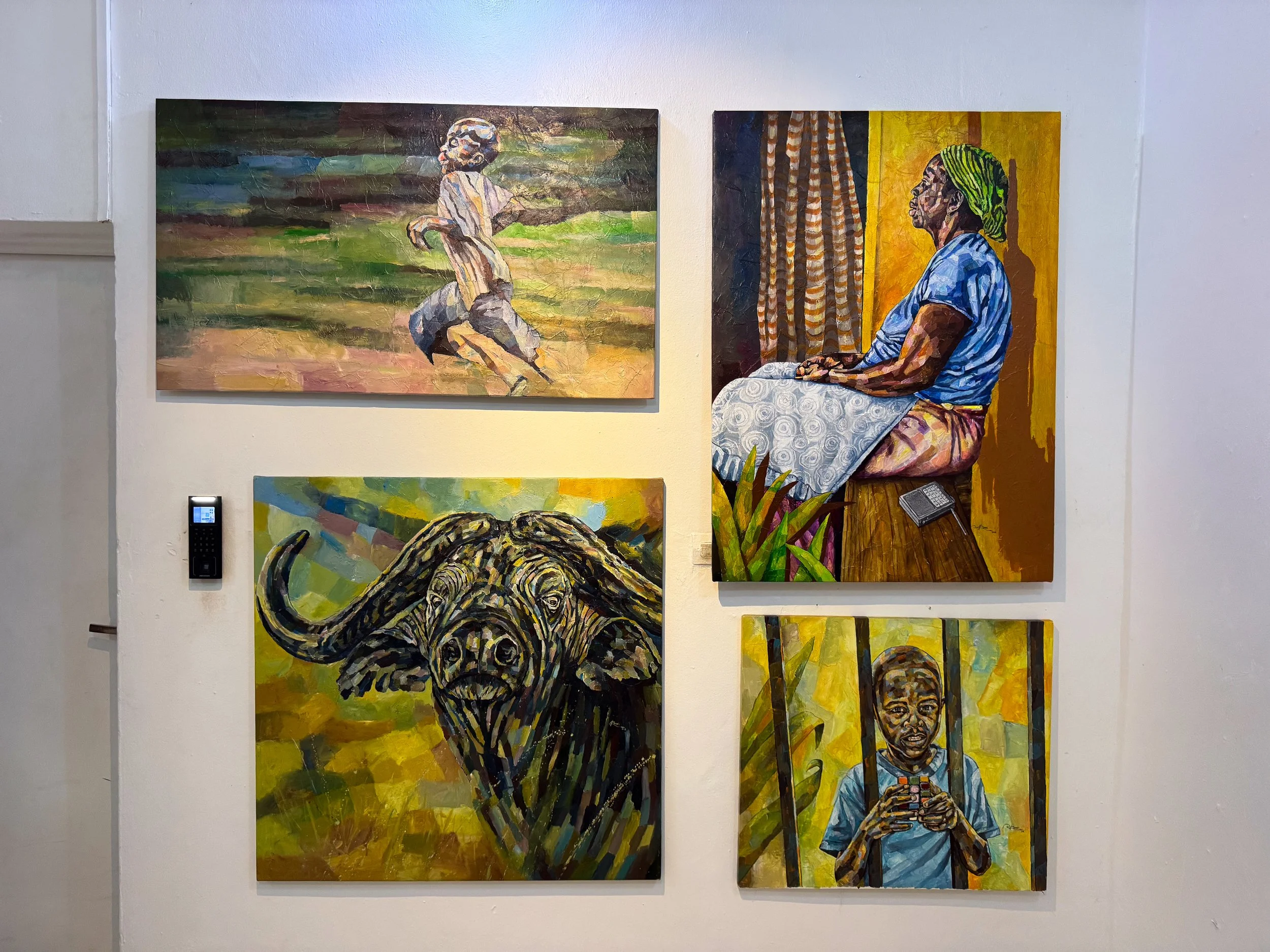
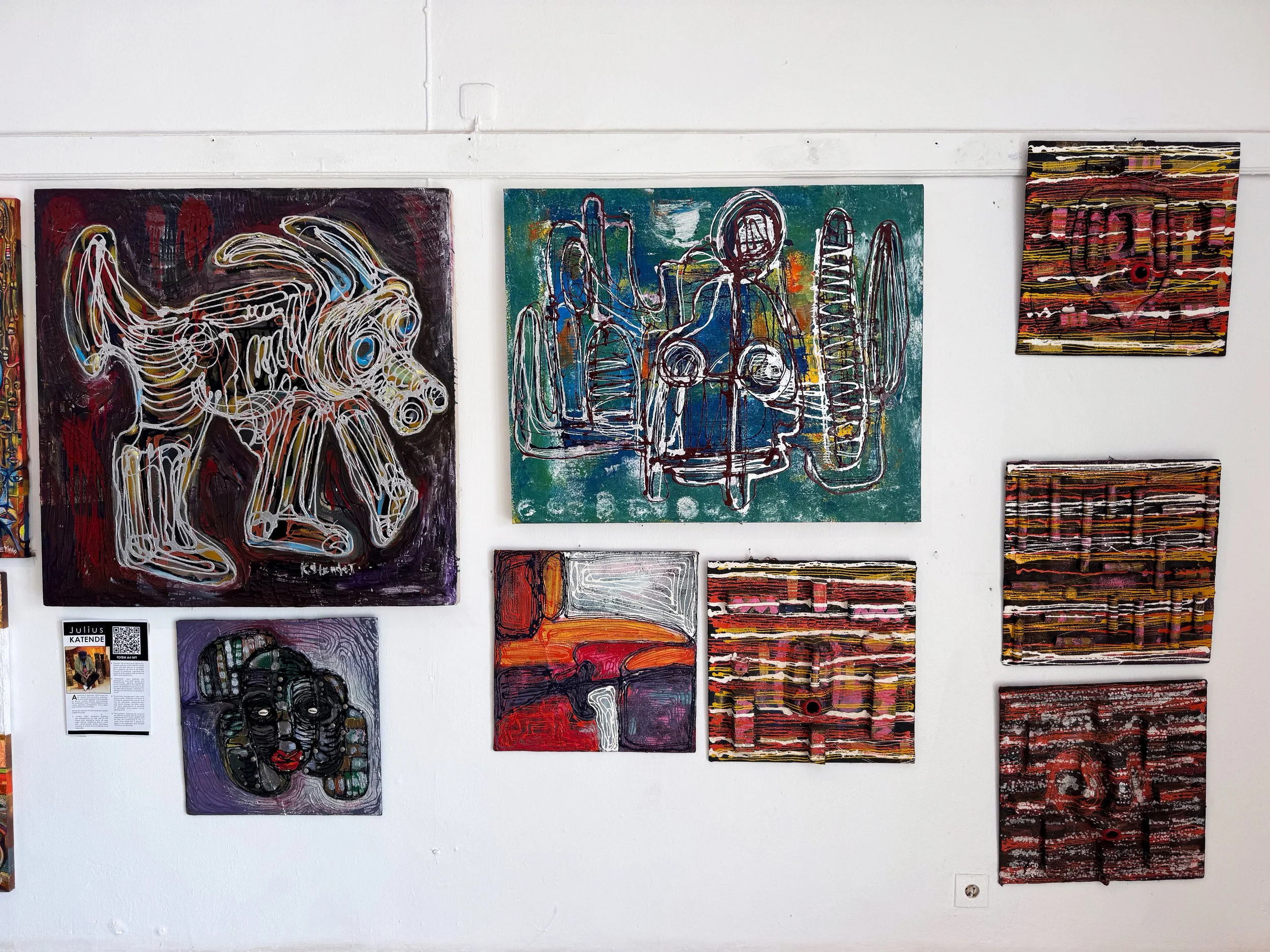
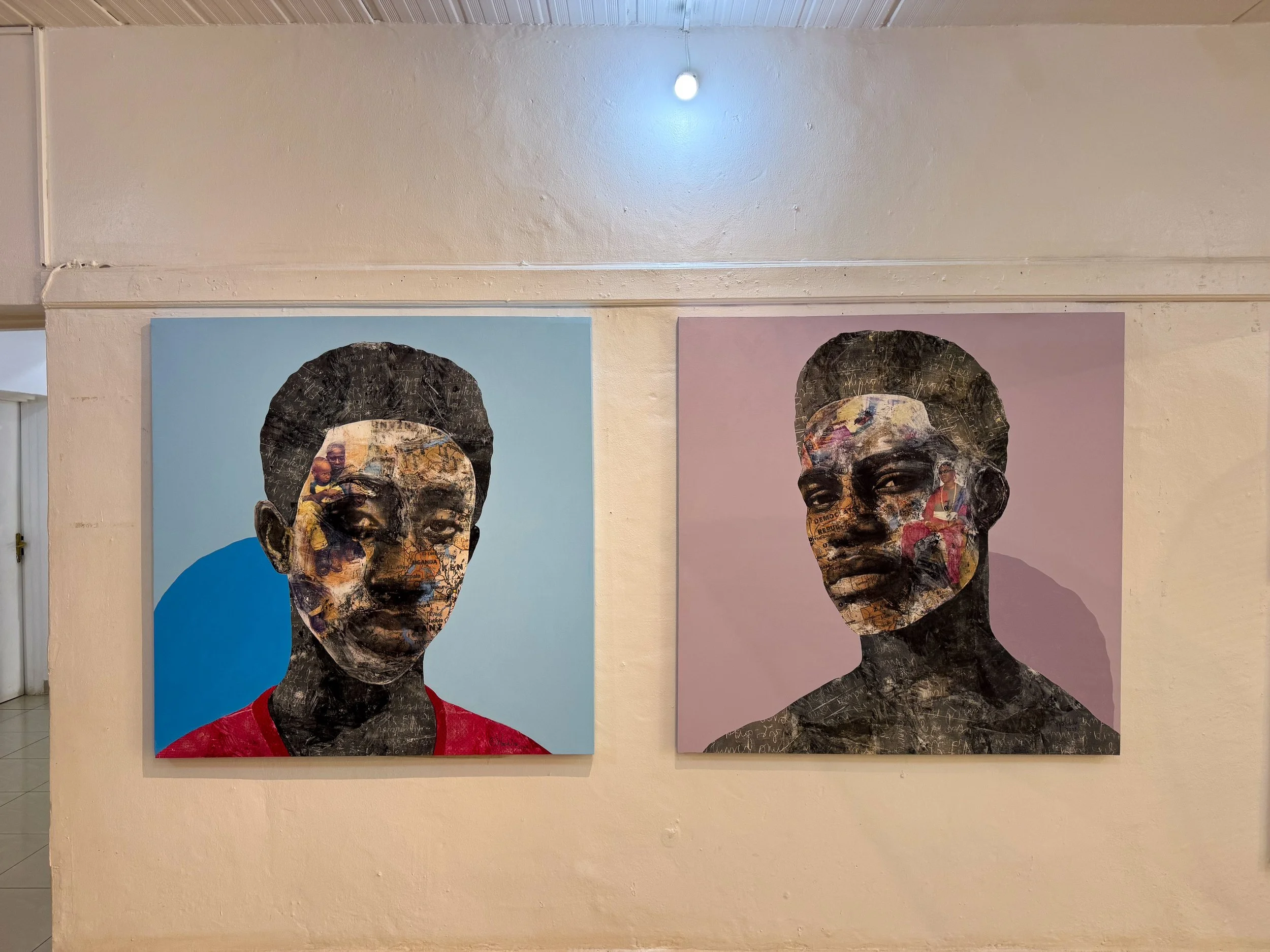
Inema Arts Gallery. A small arts center and gallery with pieces made by East African and Rwandan artists. Many of the works explore cultural identity, ancestry and heritage. Several pieces are made using Bark Cloth, the outer layer of the ficus tree. The gallery also features traditional wooden masks, furniture and sculptures.
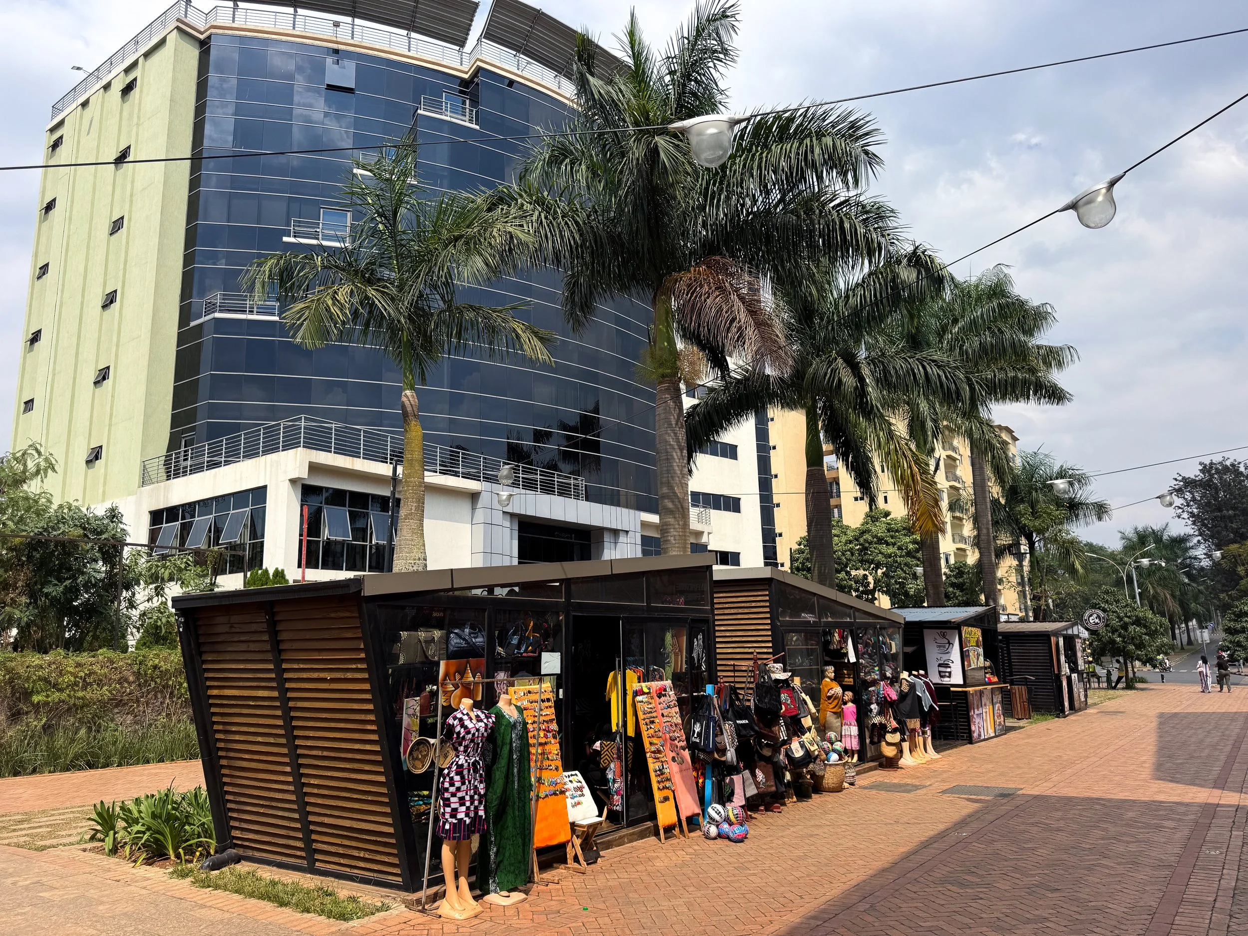
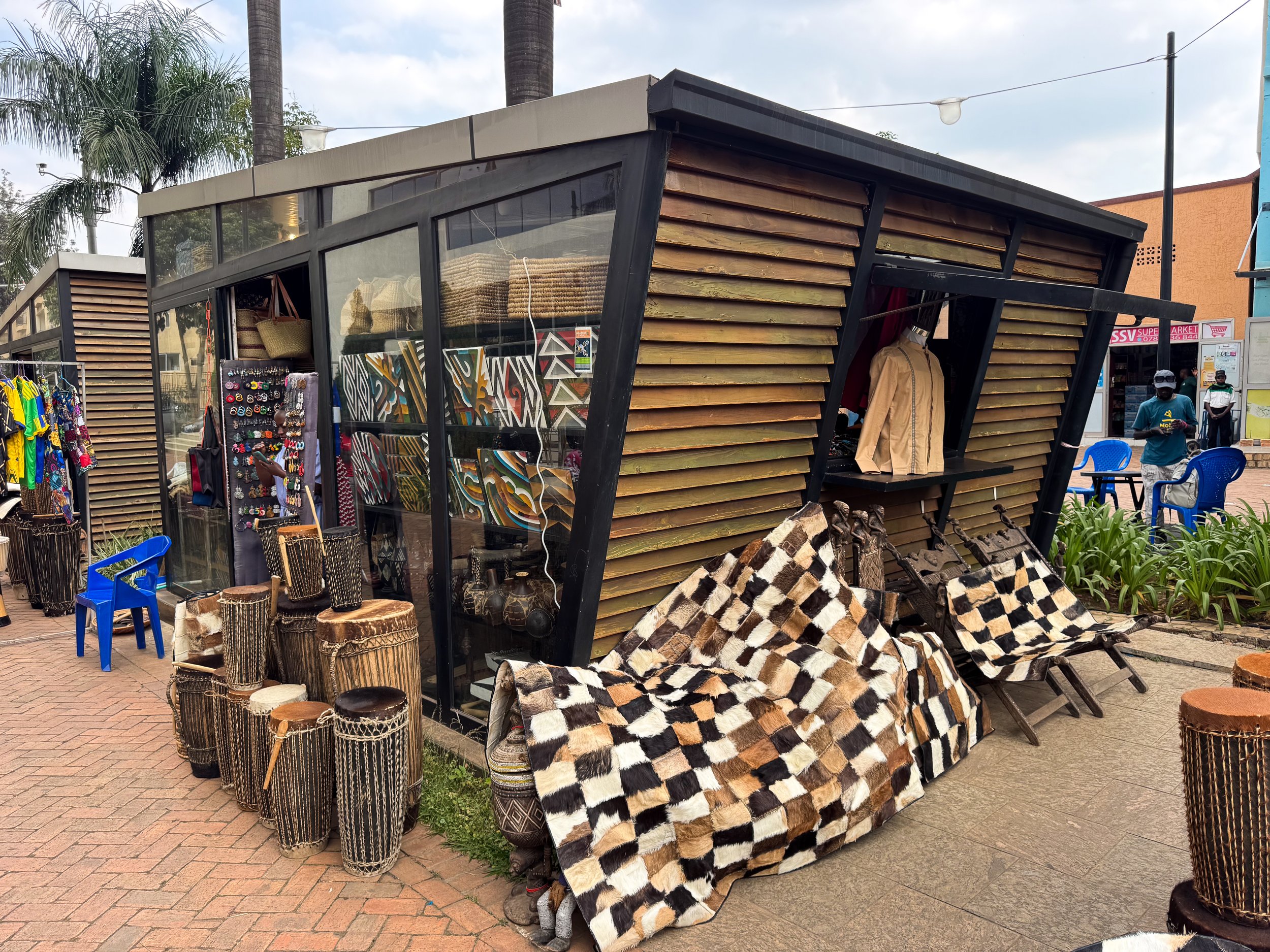
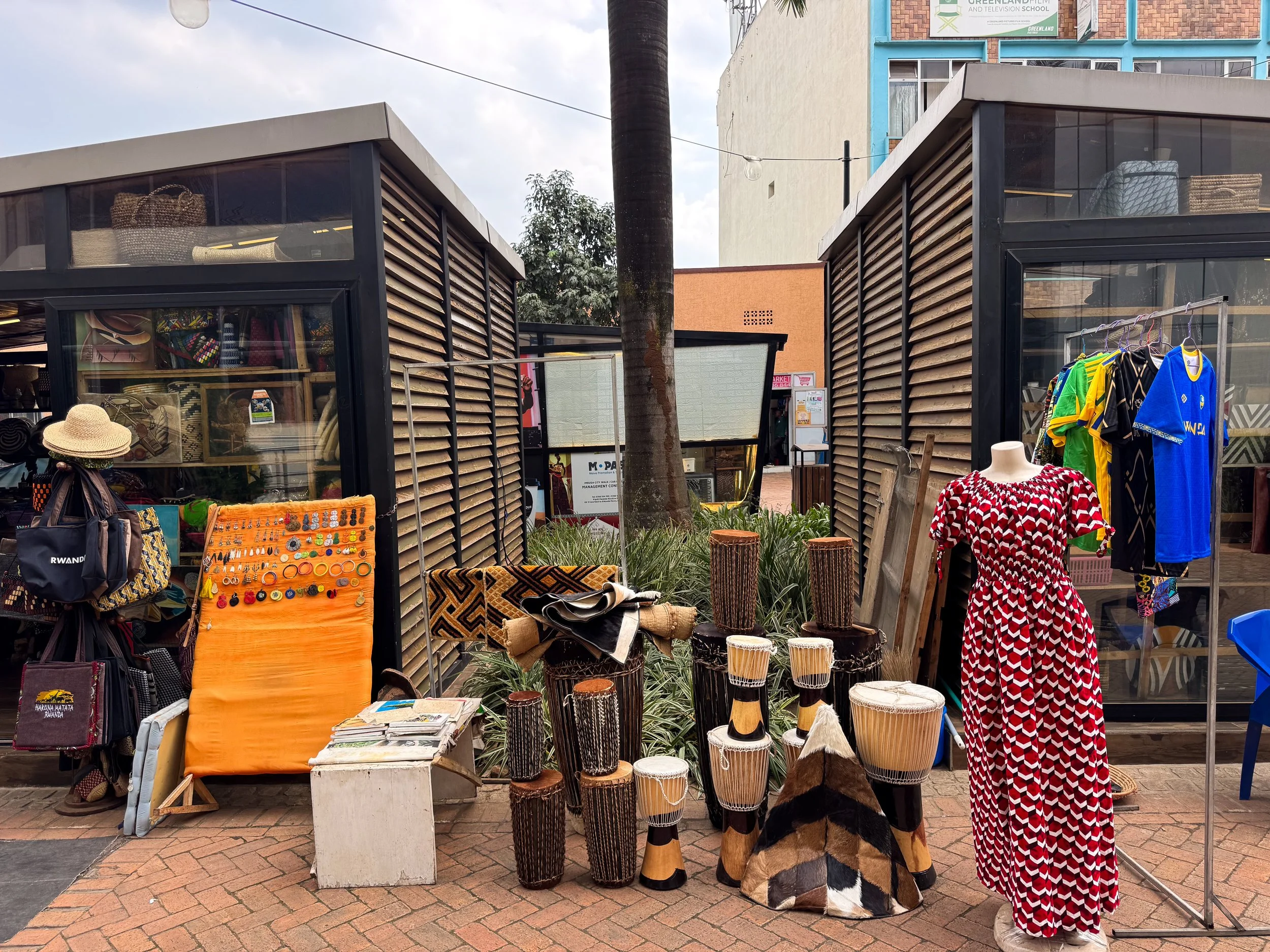
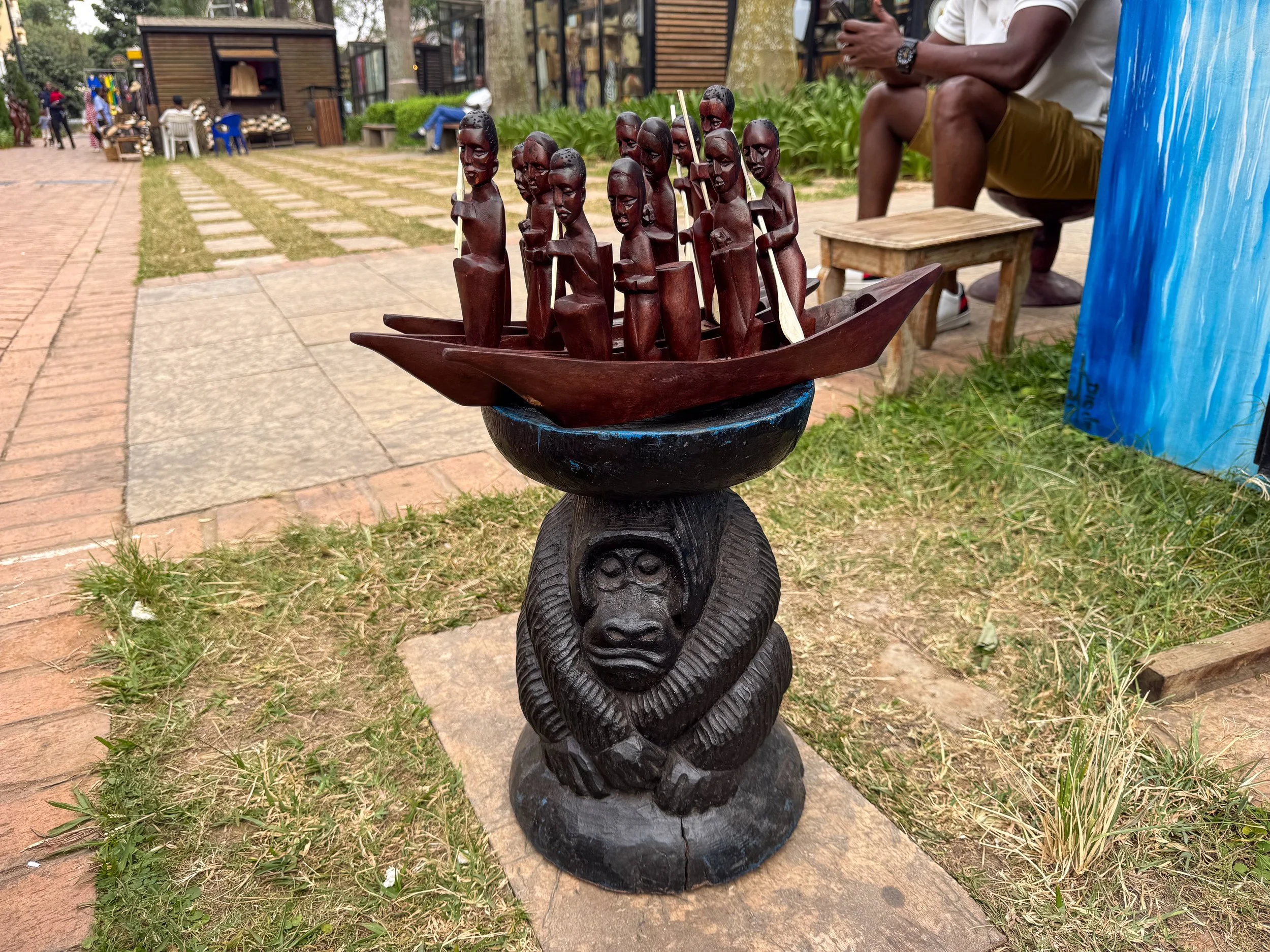
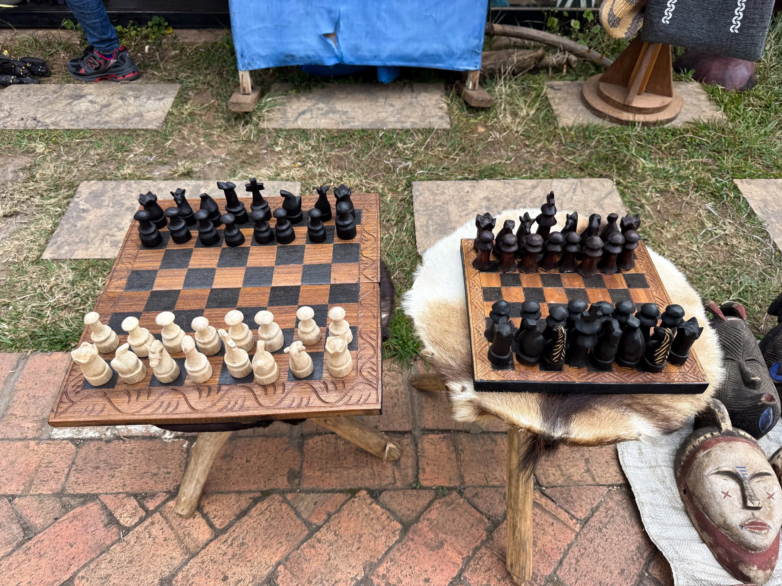
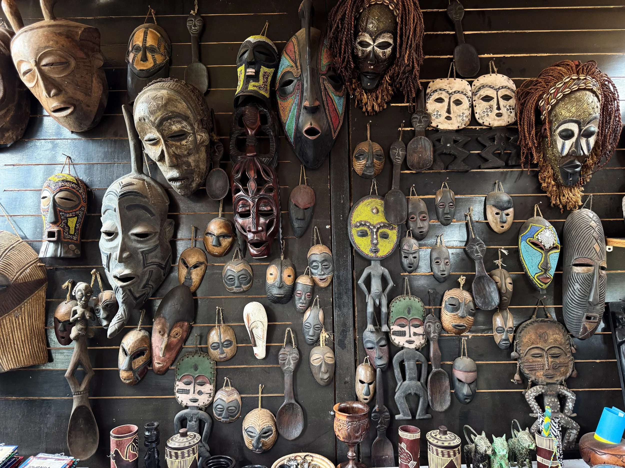
Kigali Car Free Zone. A walking street and plaza lined with kiosks and shops selling Rwandan handicrafts and Rwandan street food. There is no shortage of carved wooden gorillas and similar themed objects like chess sets, walking sticks and furniture. Merchants sell African masks, woven baskets, cow hide drums, colorful handmade jewelry, home decor, patterned clothing and culturally inspired paintings. Cafes serve cups of Rwandan coffee, croissants, chapati rolls and samosas.
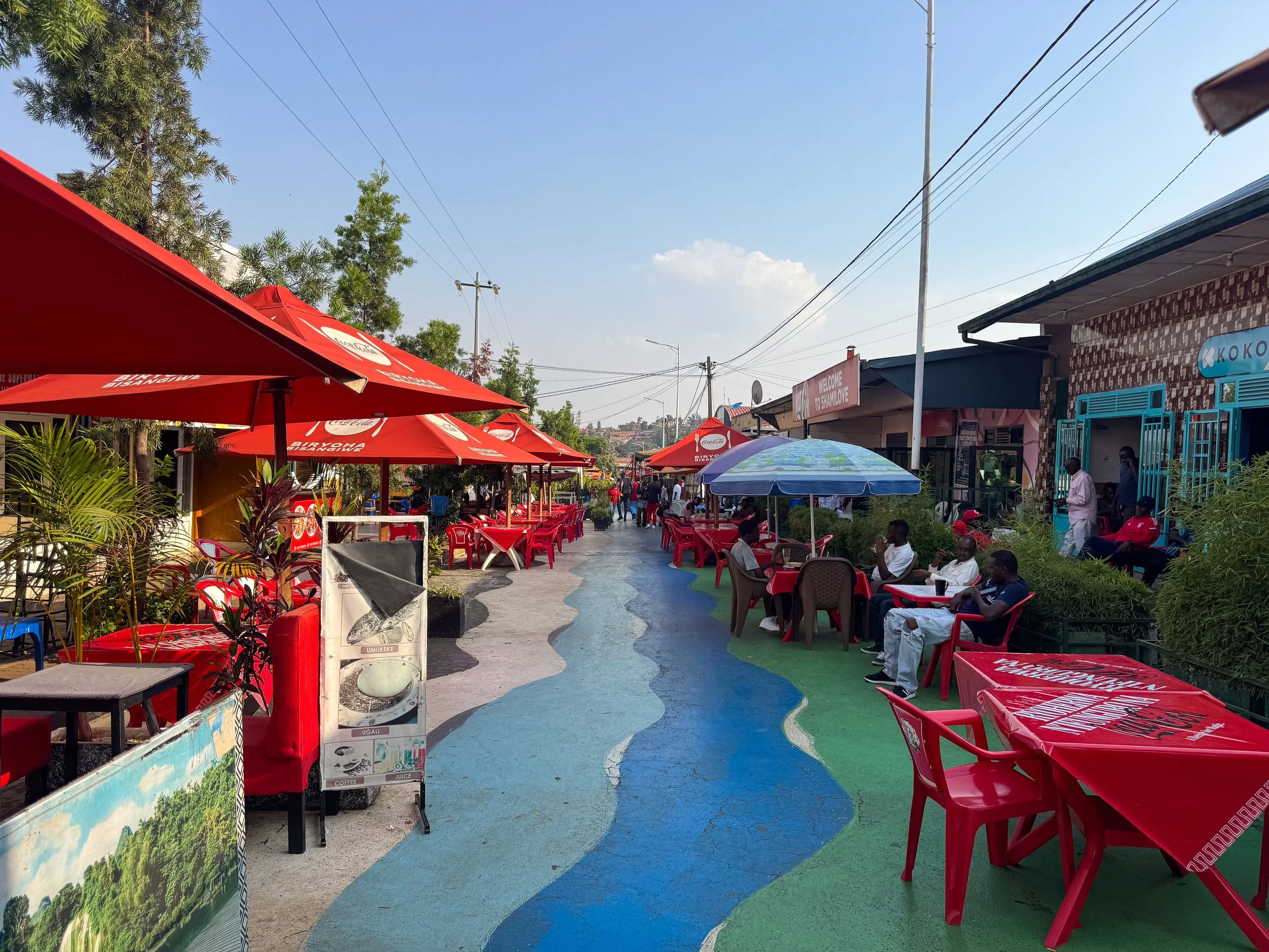
Biryogo Car Free Food Street. A painted walking street lined with dozens of Rwandan, Arabian and South Asian restaurants. Tables, chairs and umbrellas flood the street as hosts advertise and compete for business. It’s a hyper local spot to taste Rwandan cuisine and regional flavors. We ate at Visit Rwanda, a restaurant serving a range of local dishes and fresh fruit juices. We ordered the Nile perch fish brochettes, vegetarian imvange amashaza, spiced rice pilau, tree tomato and passion fruit juices. Visit on Saturday night for the liveliest experience.
Good to Know. Most restaurants are cash only. Vegetarian versions of local dishes are hard to come by. The street is in the Arab Quarter, resultantly, alcohol sales are forbidden.
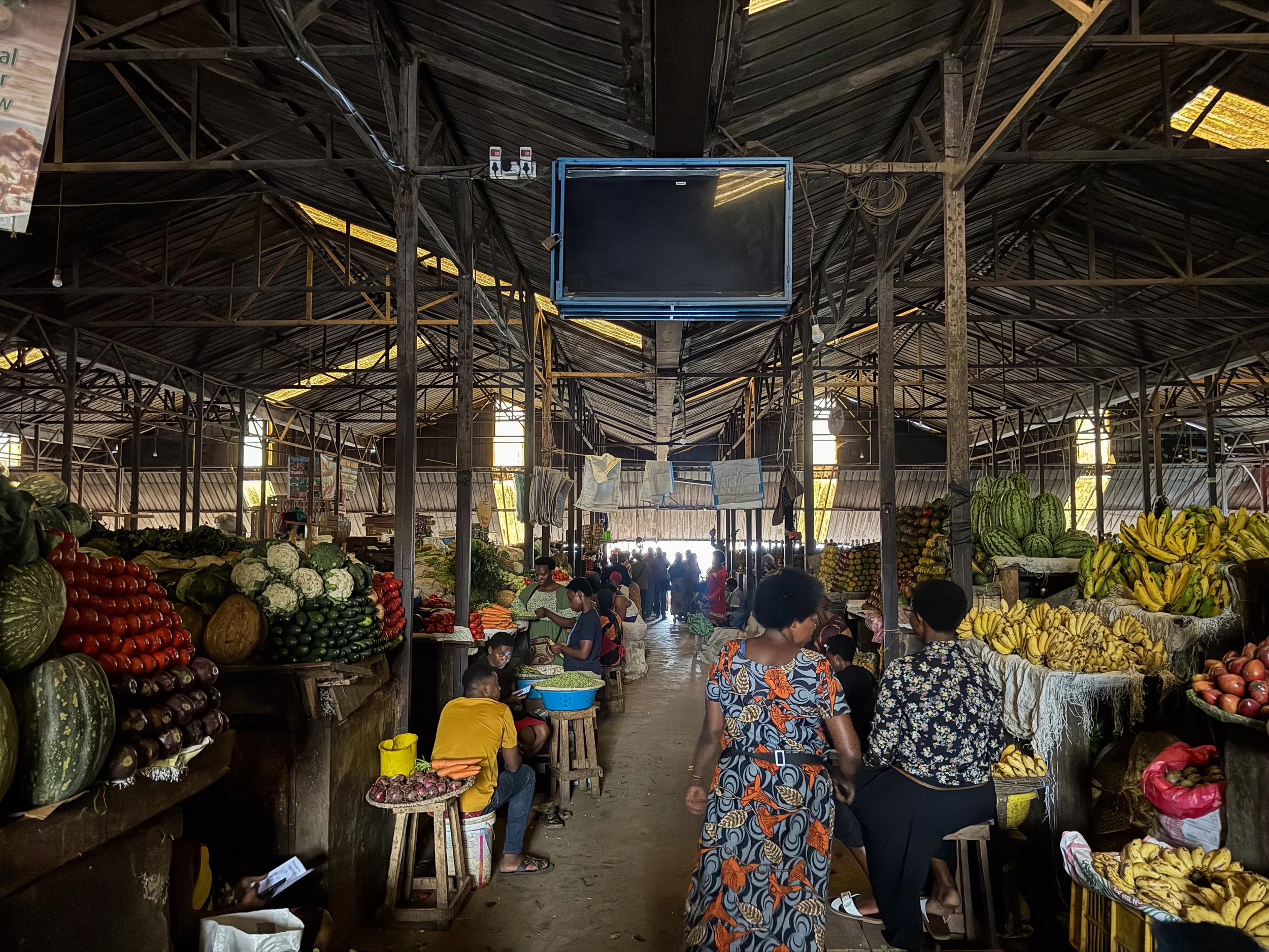
Kimironko Market. Kigali’s central marketplace is a hub for locals and affordable goods. Inside a dimly lit yellow shed is a bustling farmers market with towering piles of vegetables and produce. It took our eyes a few minutes to adjust before truly appreciating the vast selections. Barrels overflow with dried beans and grains. Tables are covered with heaps of carefully stacked fruits and vegetables. Leafy greens and herbs blur into a singular mass. Bunches of bananas and plantains rest at the end of aisles. The smell of dirt wafts from the potatoes and root vegetables. Friendly vendors greeted us with “hello customer, buy something?” The building is surrounded by red dirt roads and stands selling miscellaneous goods like clothes, shoes, furniture, hardware and fabrics.
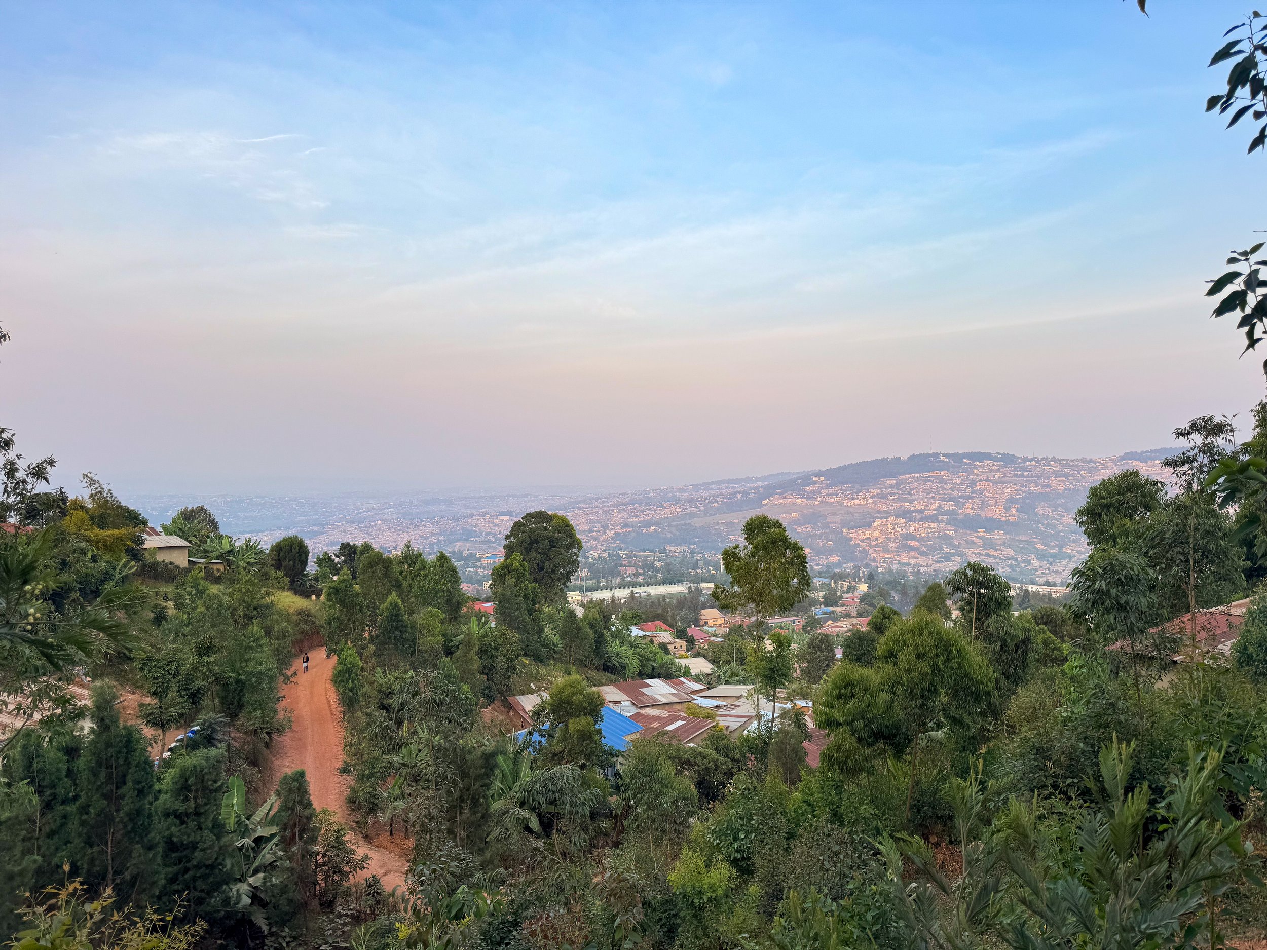
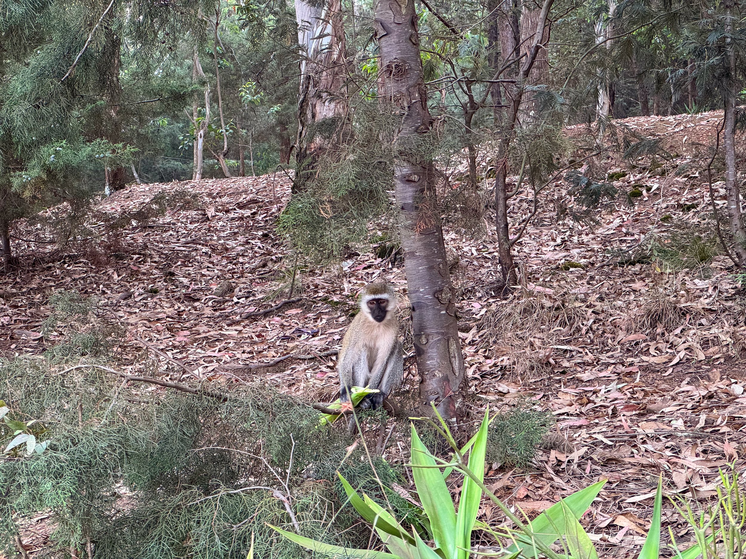
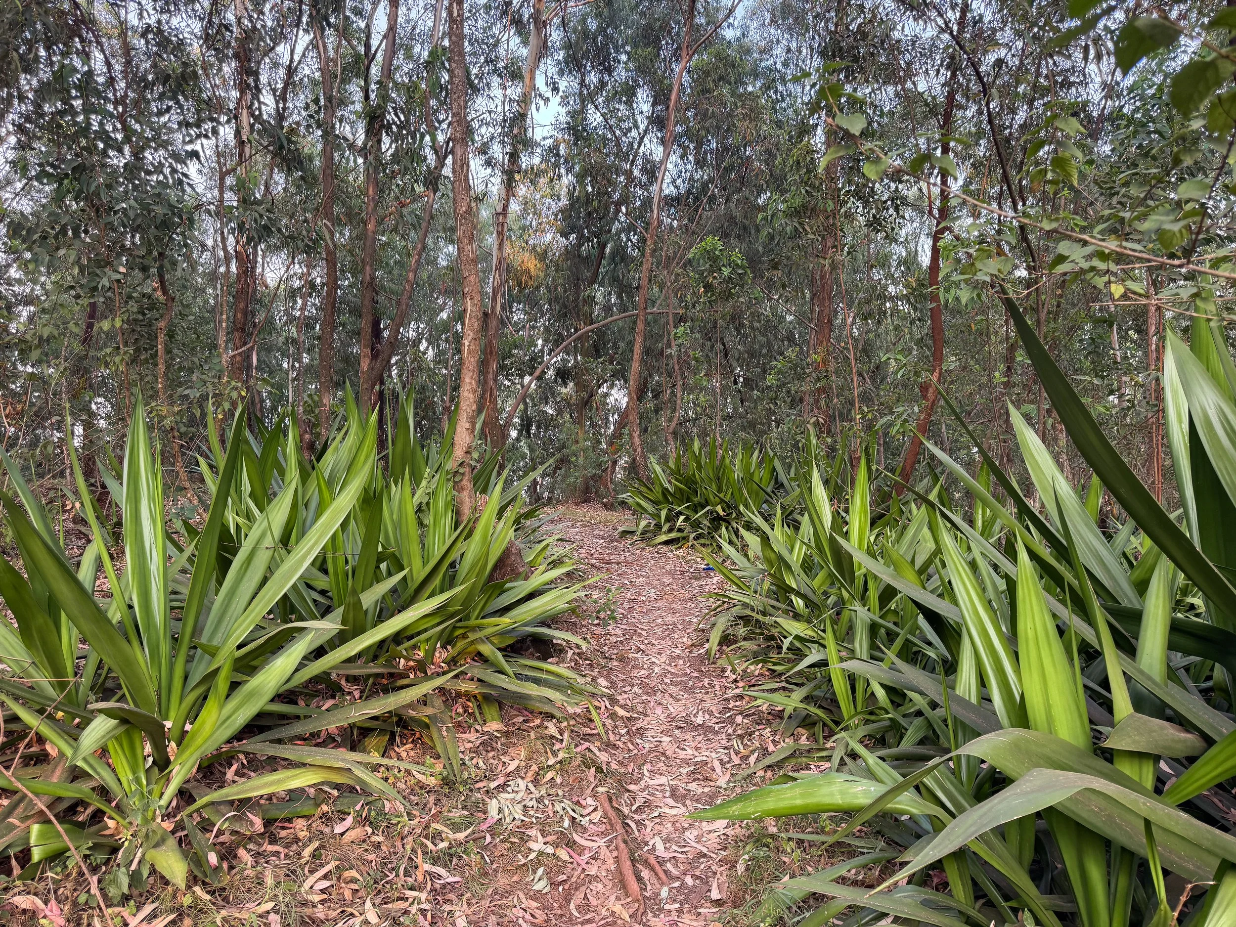
Mount Kigali Forest. A forested mountain in the center of Kigali with nature trails, wild velvet monkeys and partial city views. Dirt roads lead up its hillside through local communities to the entrance of the forest. Unmarked trails weave through the forest while city views are visible from the dirt road between it and the communities below.
Getting Here. Follow KN229 Street to reach the forest. The steep and rocky street is lined with vendors selling home grown produce and charcoal. People were curious about us and very friendly, often smiling in response to us saying Muraho, hello in Kinyarwanda.
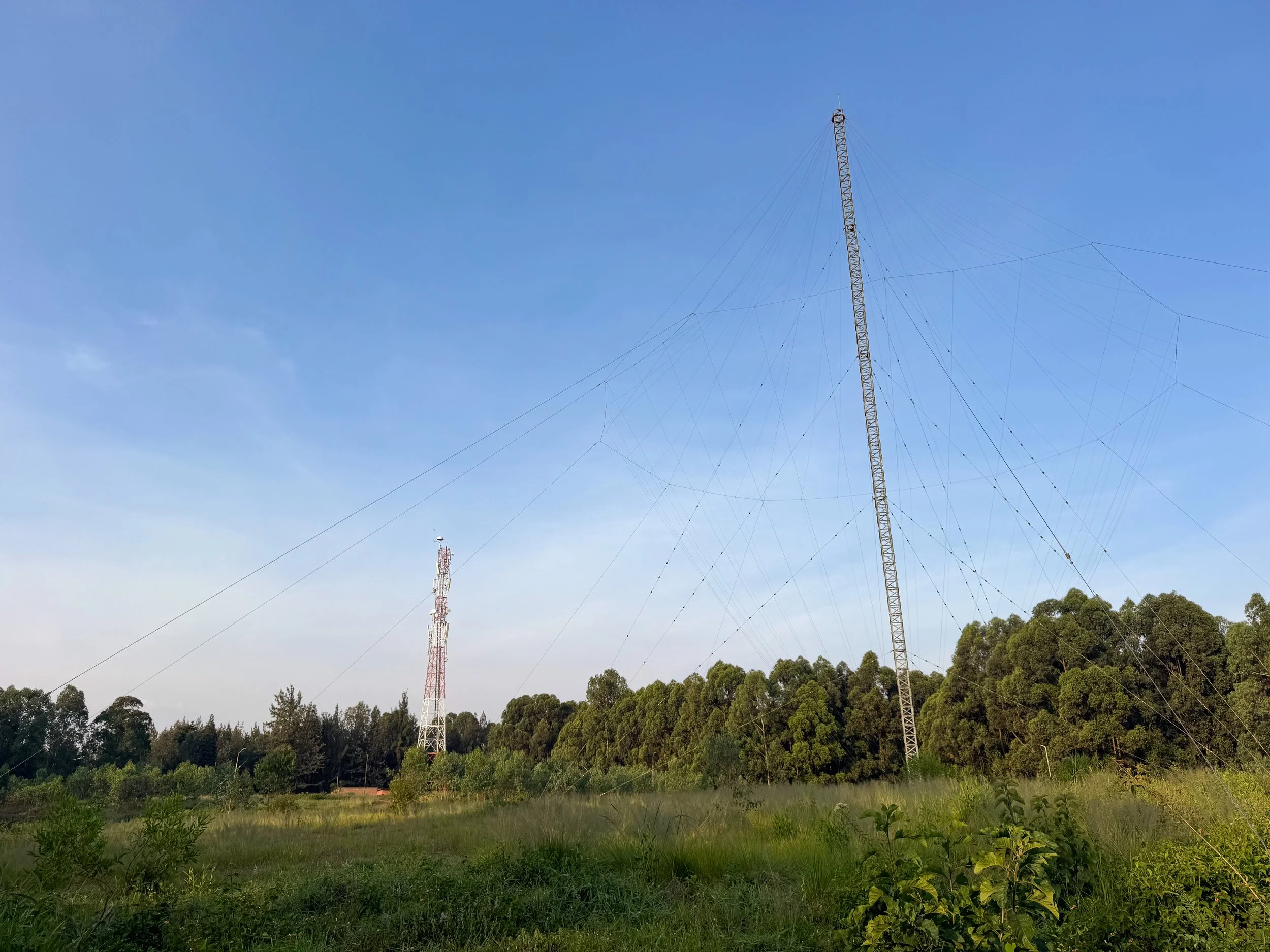
Good to Know. The top of the mountain has a field with communications towers and a military base. We wandered here but were turned around by soldiers. It’s best to avoid.
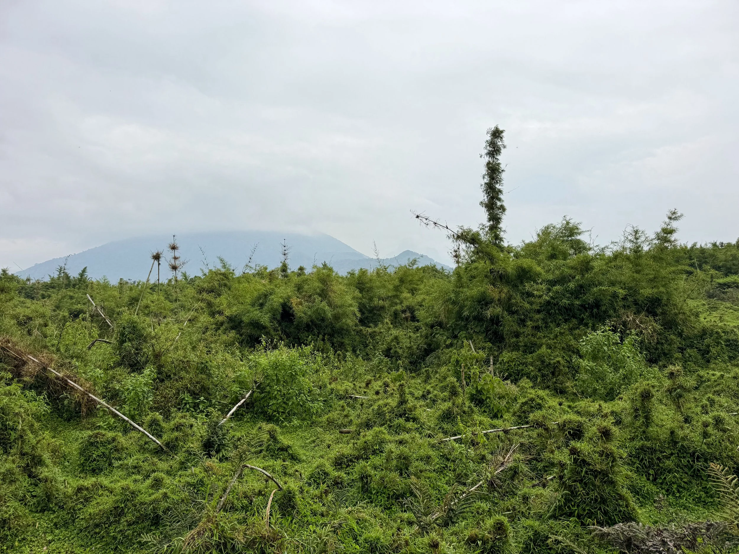
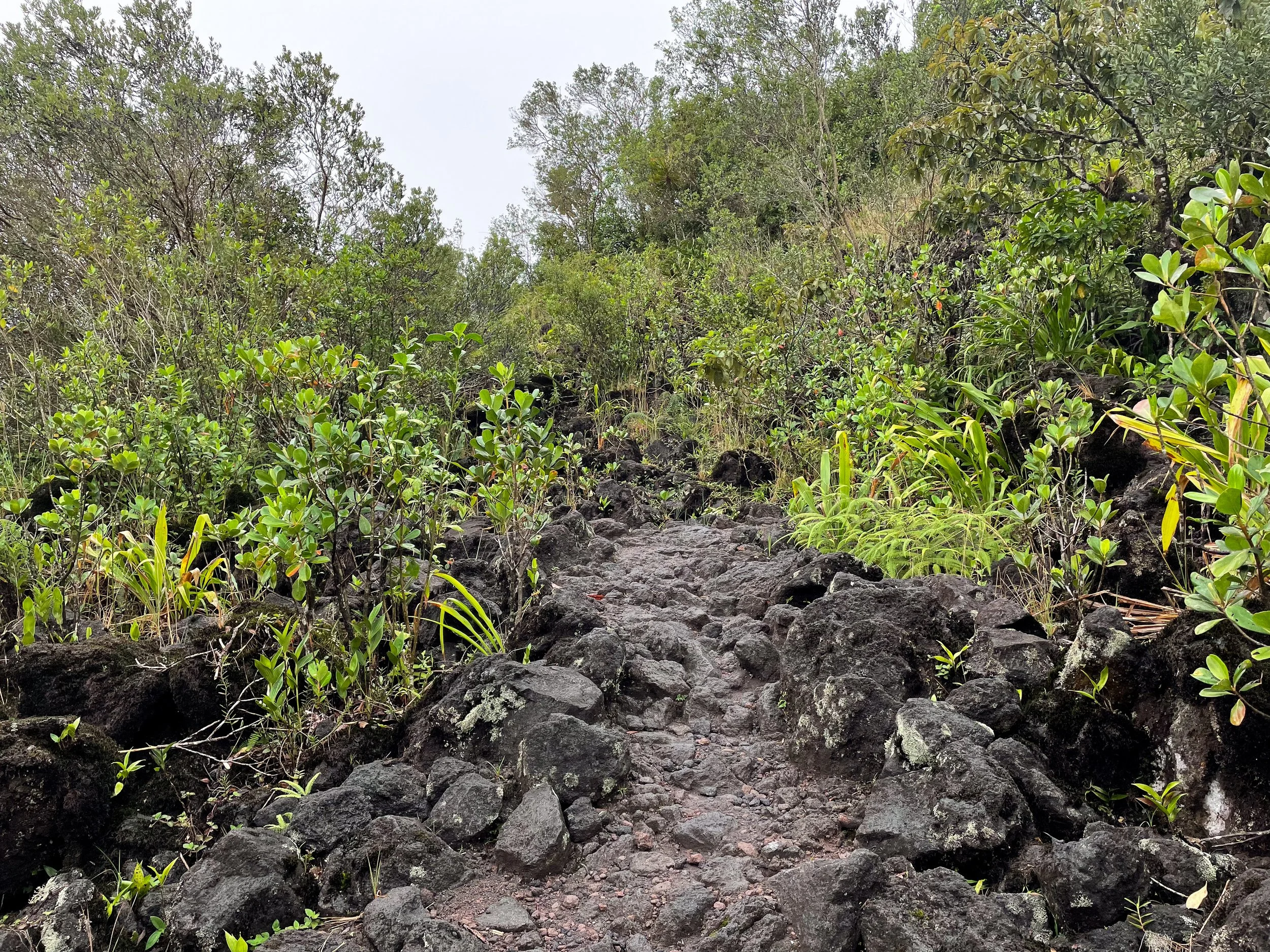
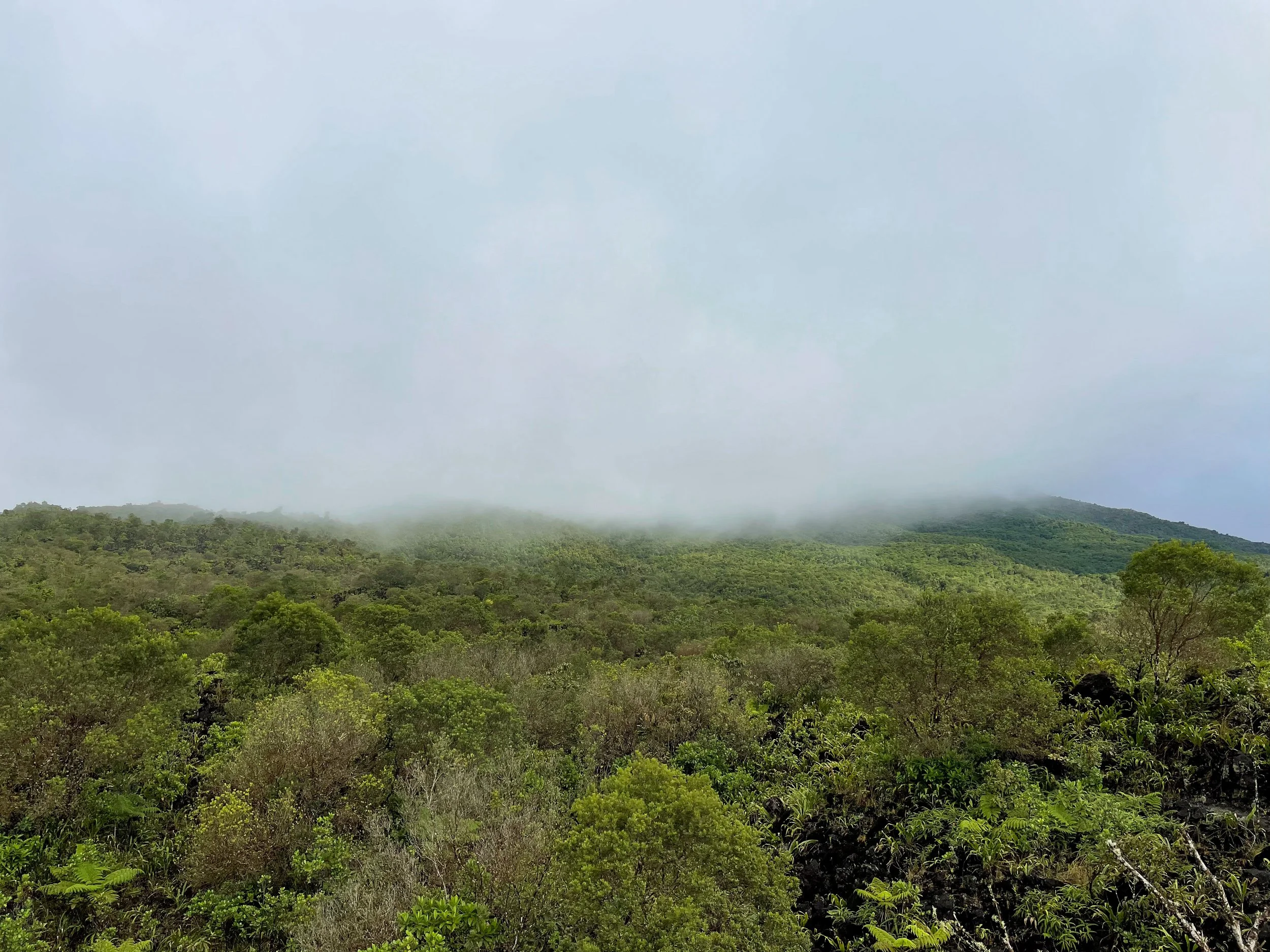
Volcanoes National Park
Volcanoes National Park is the last remaining habitat for the endangered Silverback Gorillas and Golden Monkeys. The park is covered in a crest of tree covered volcanoes, straddling the borders of Rwanda, Uganda and the Democratic Republic of the Congo. Eco hotels are built between farmland just outside of the park. The Rwanda Development Board offers eco tours to see the primates in their natural habitat. They’re highly protected and require an advance permit to visit.
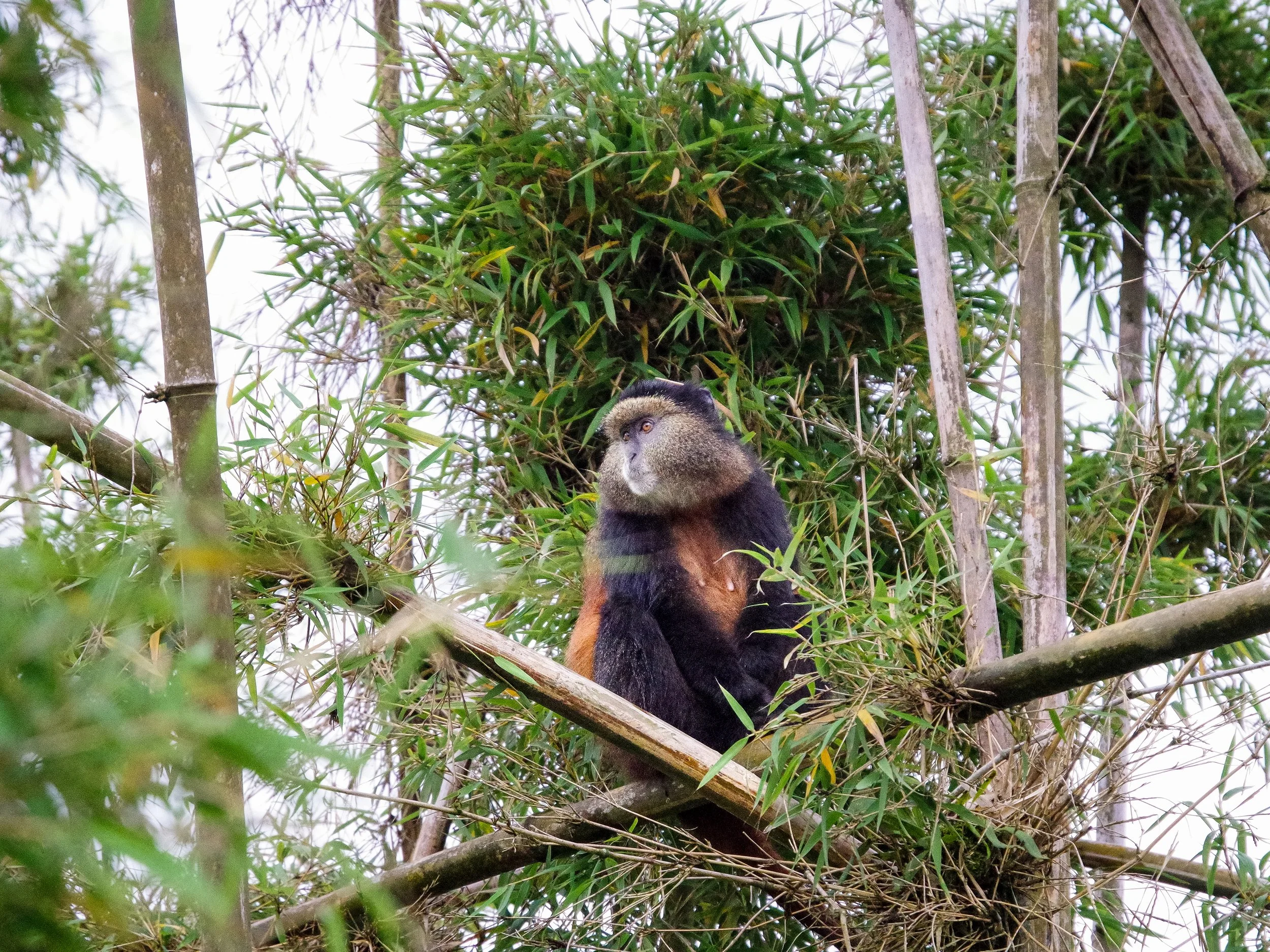
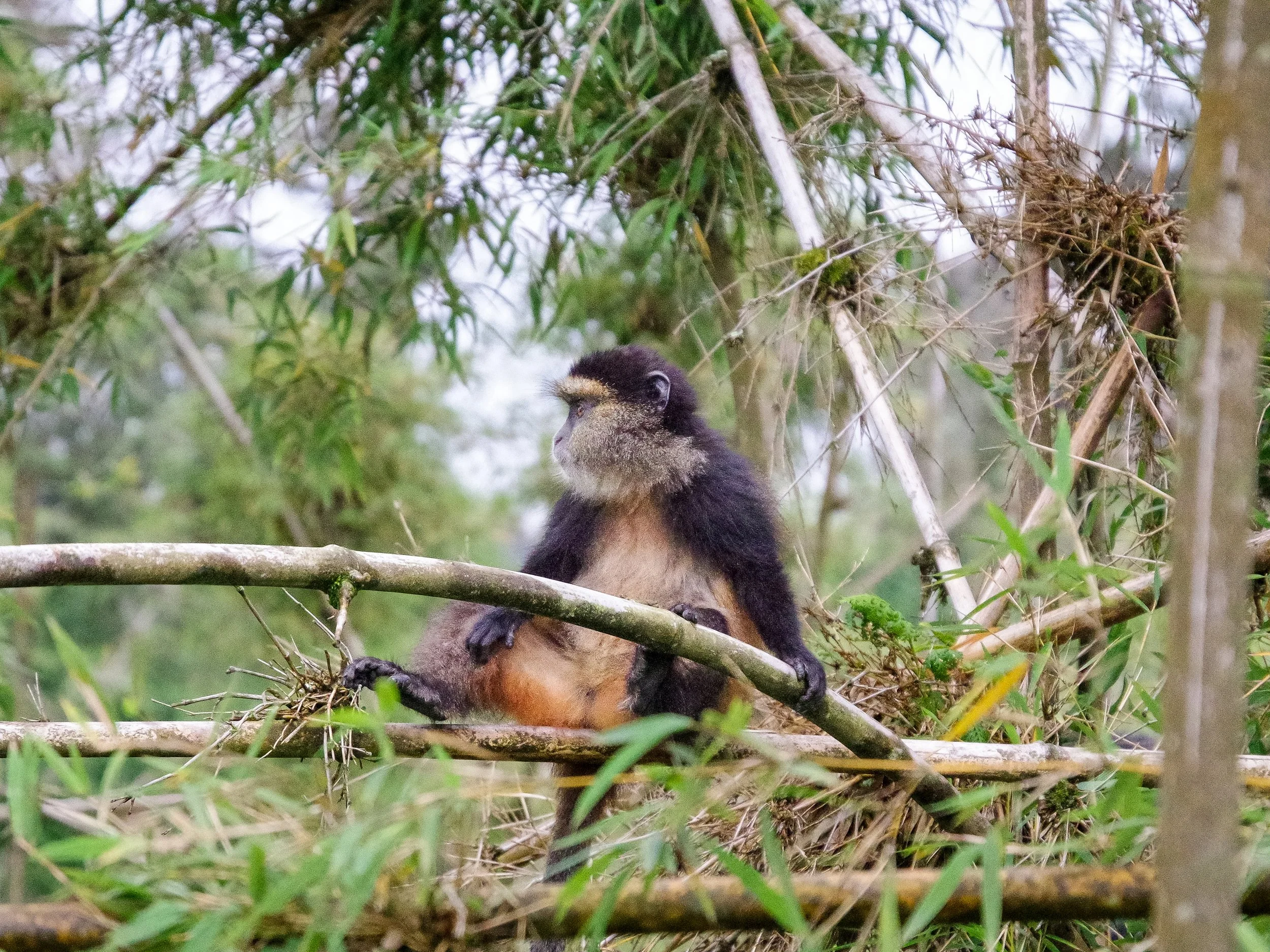
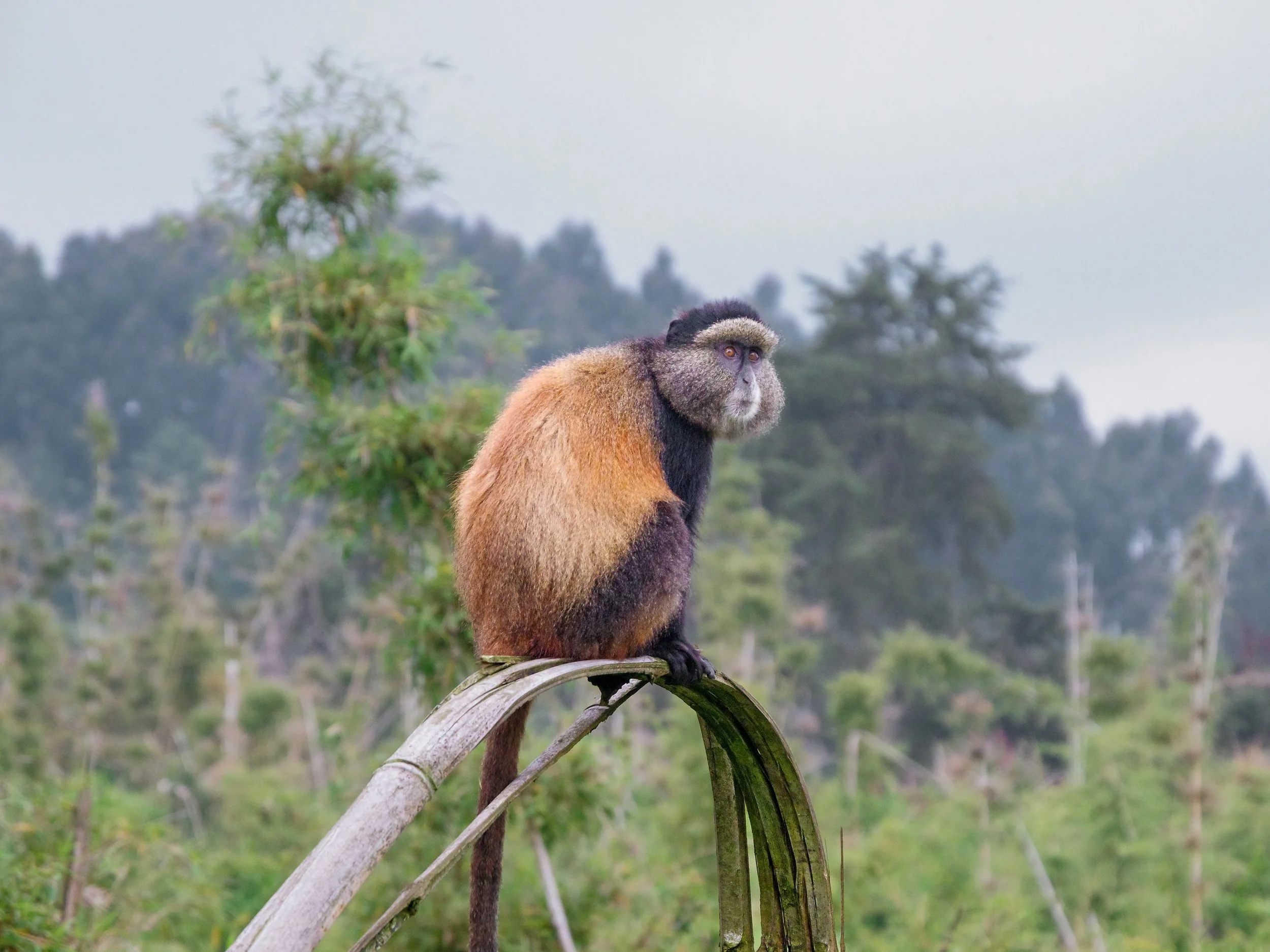
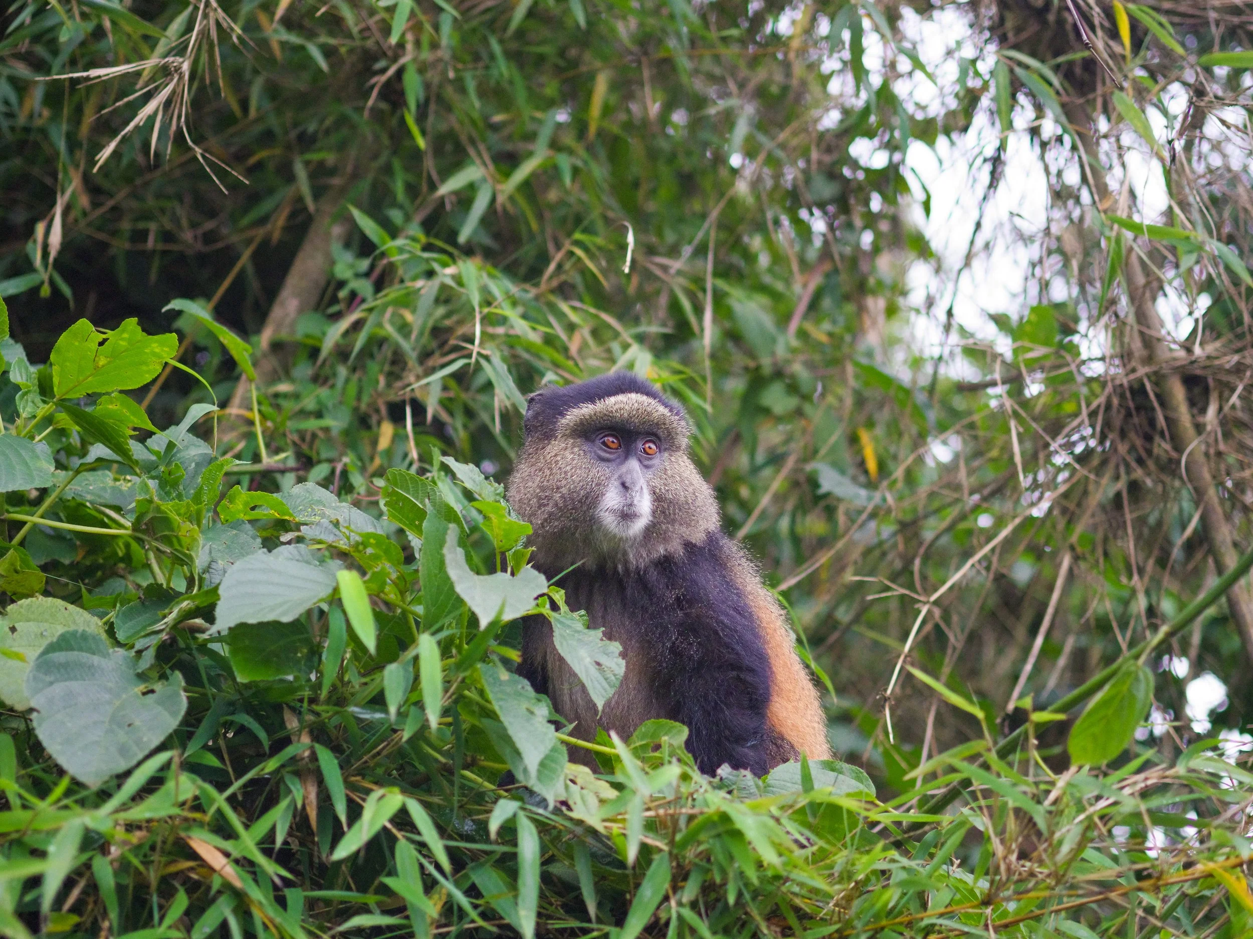
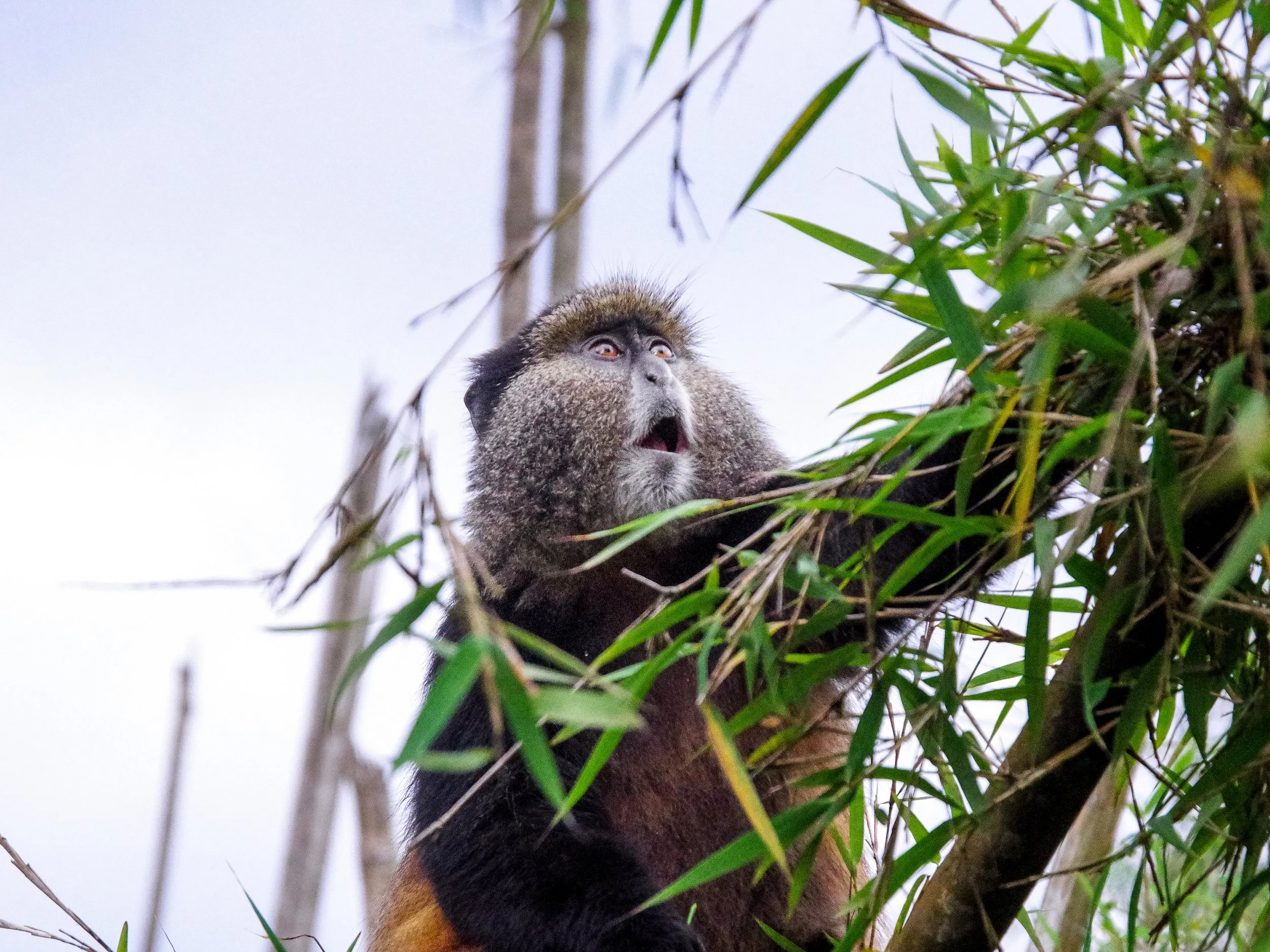
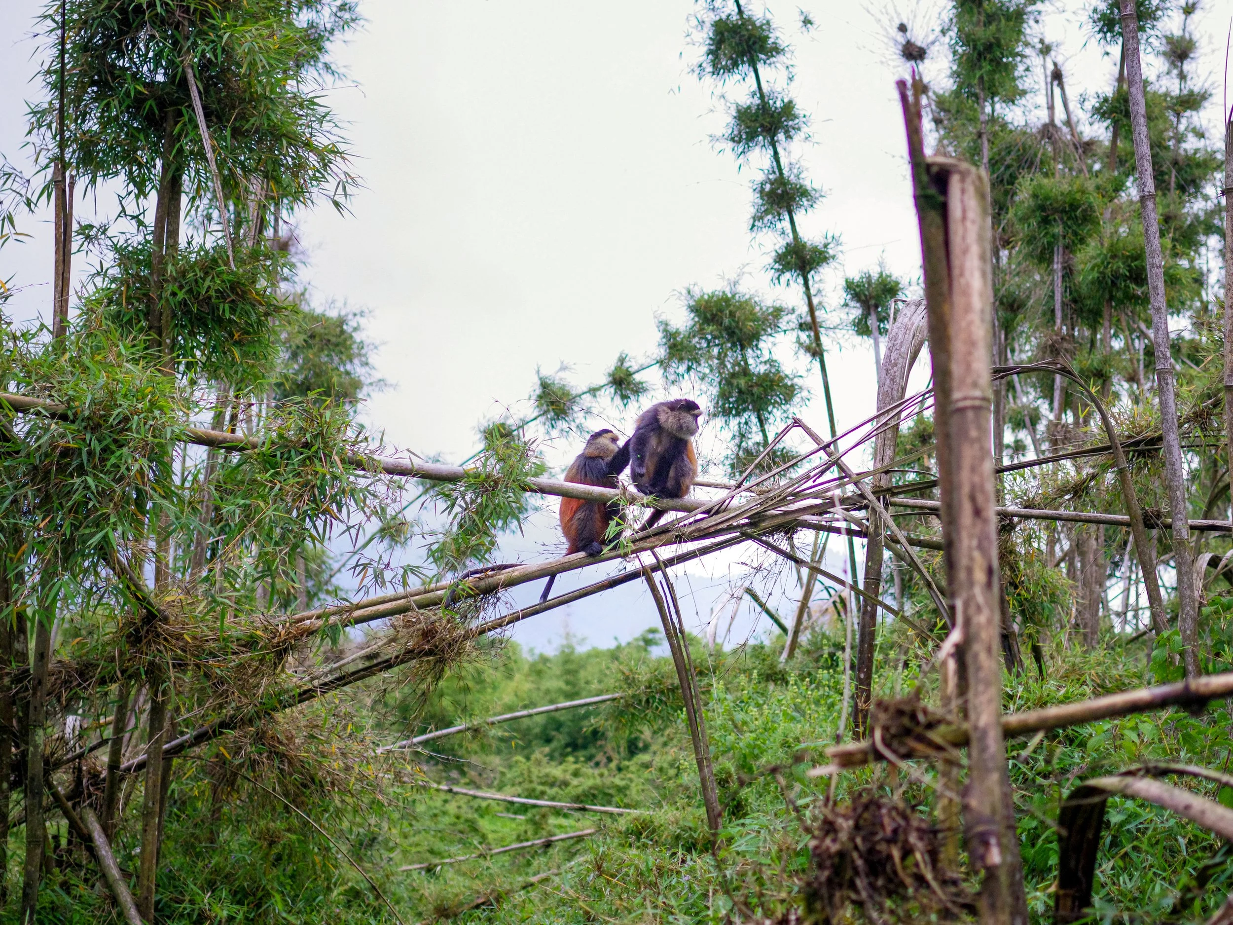
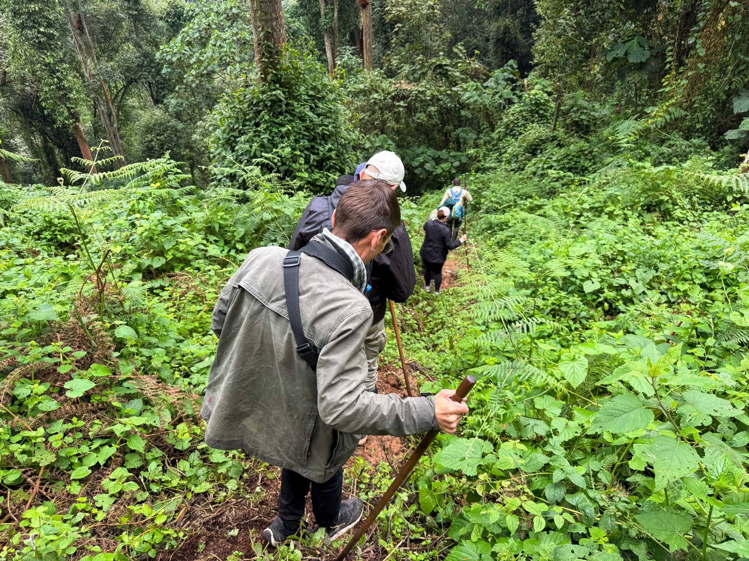
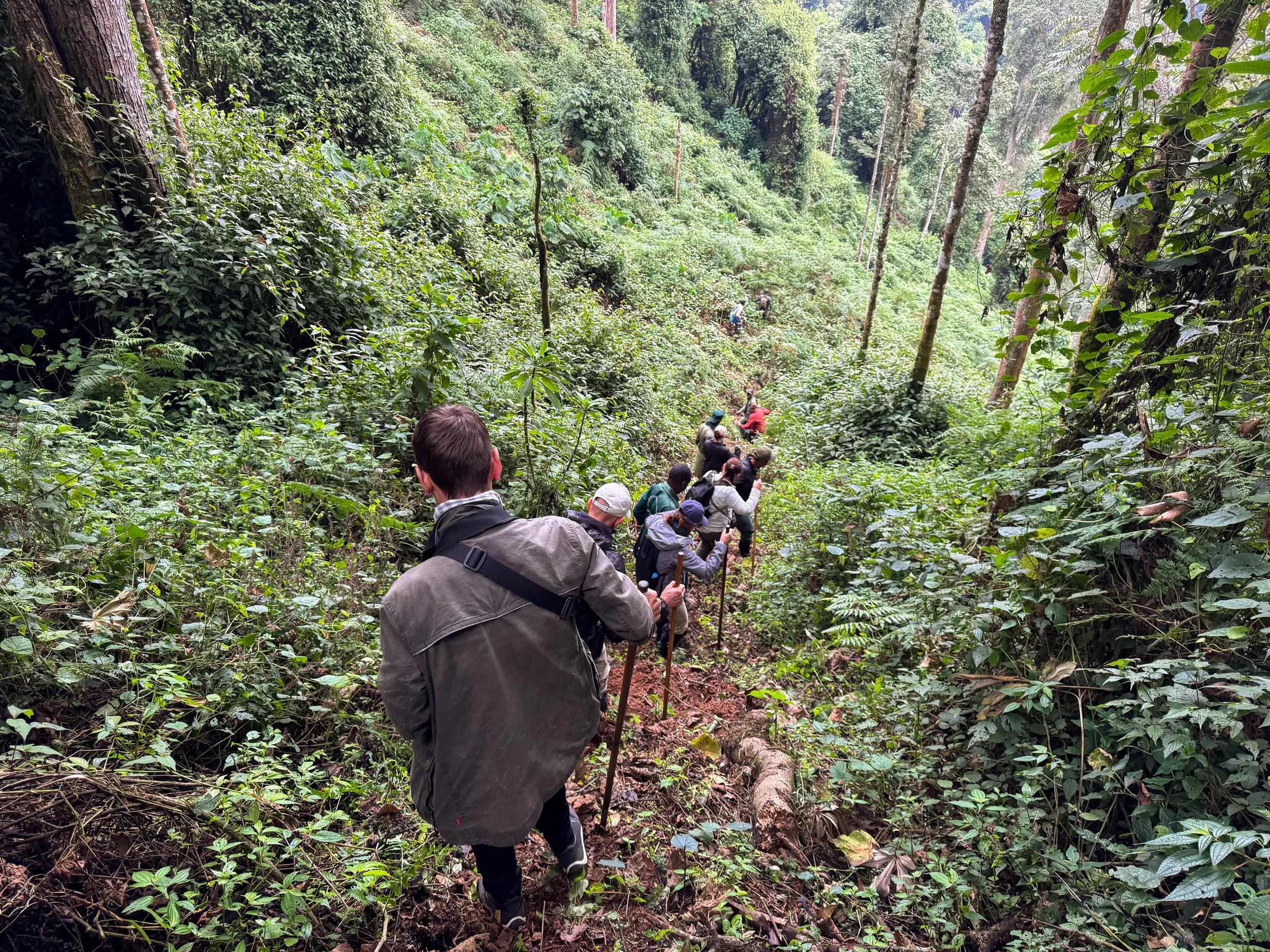
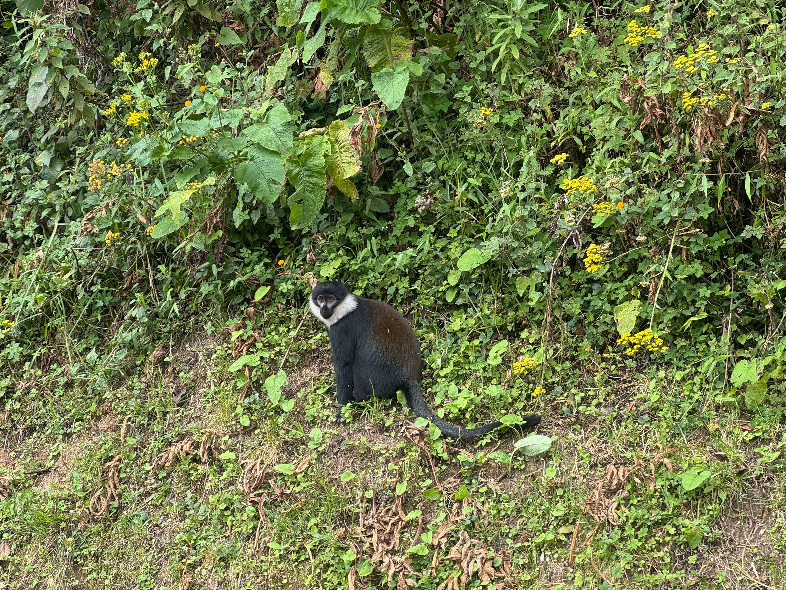
Golden Monkey Trekking. The Golden Monkeys are an endangered species native to the Volcanoes National Park. They live in the forested lowlands surrounding the volcanos and feed on endemic patches of bamboo. Just over 3,000 golden monkeys remain in the wild. Our guides tracked a troop of 70 to an area along the border of the park. We spent over an hour observing them in their natural habitat. Their cute and puffy faces glimpsed at us spying on them. They jumped between bamboo stalks and nibbled on leaves. They showed off their golden backs while grooming each other.
Good to Know. We were required to wear medical masks to prevent spread of disease. Given their border location, trackers and armed guards followed us for added security.
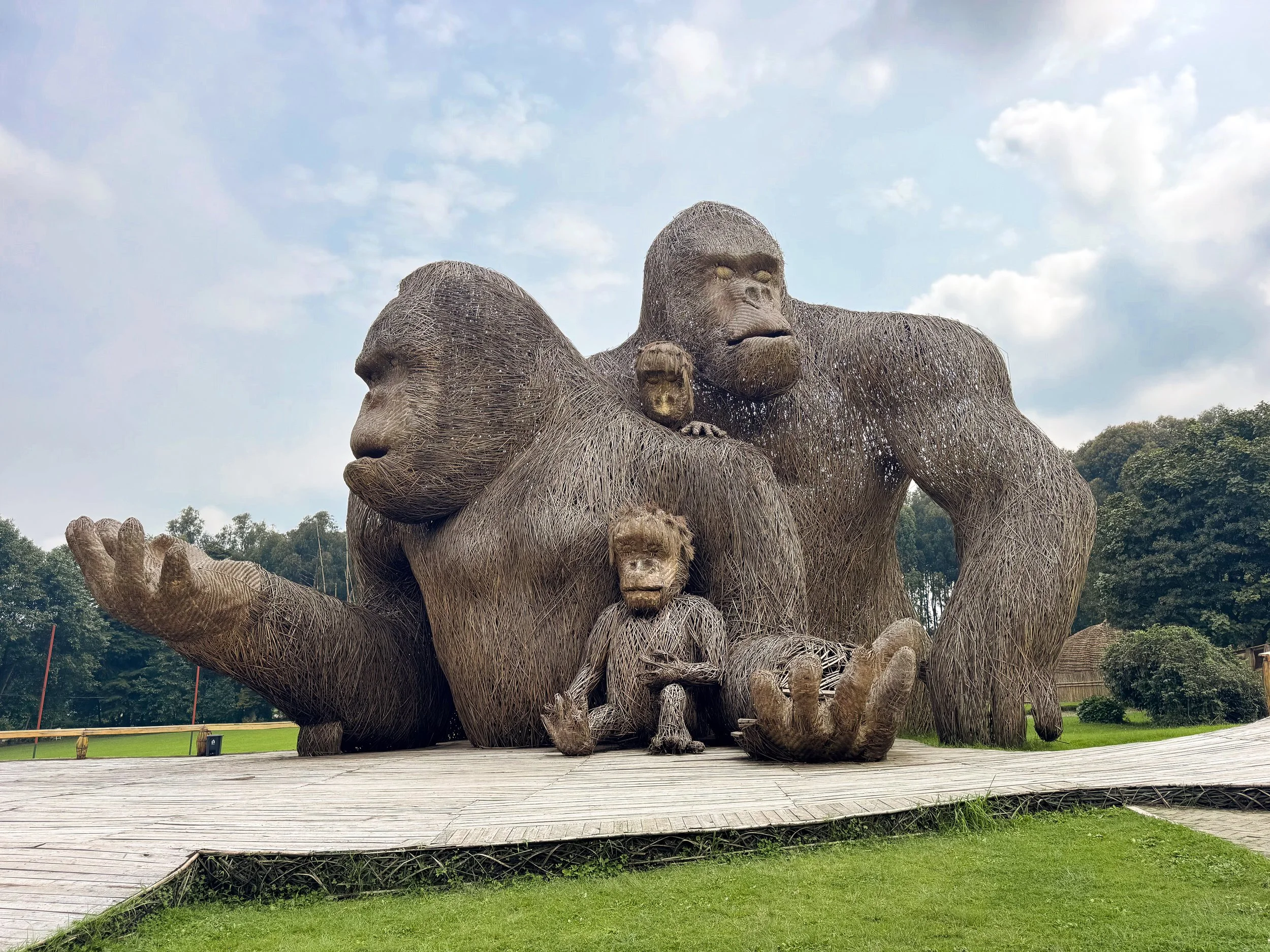
Gorilla Naming Place. A large thatched monument of a family of Gorillas. The largest gorilla’s hands are outstretched, creating a platform for photos. Behind is a replica village with three thatched huts.
Buhanga Eco Park. A historical site used to anoint the past kings of Rwanda. Inside the forested park are moss covered lava rock walkways and platforms. They lead to a small cave where the heir to the throne would descend for the anointment ritual. Servants would cleanse him with water and leaves from the forest. He would be declared king upon exiting the cave. The park is only accessible by permit and guide from the Rwanda Development Board.
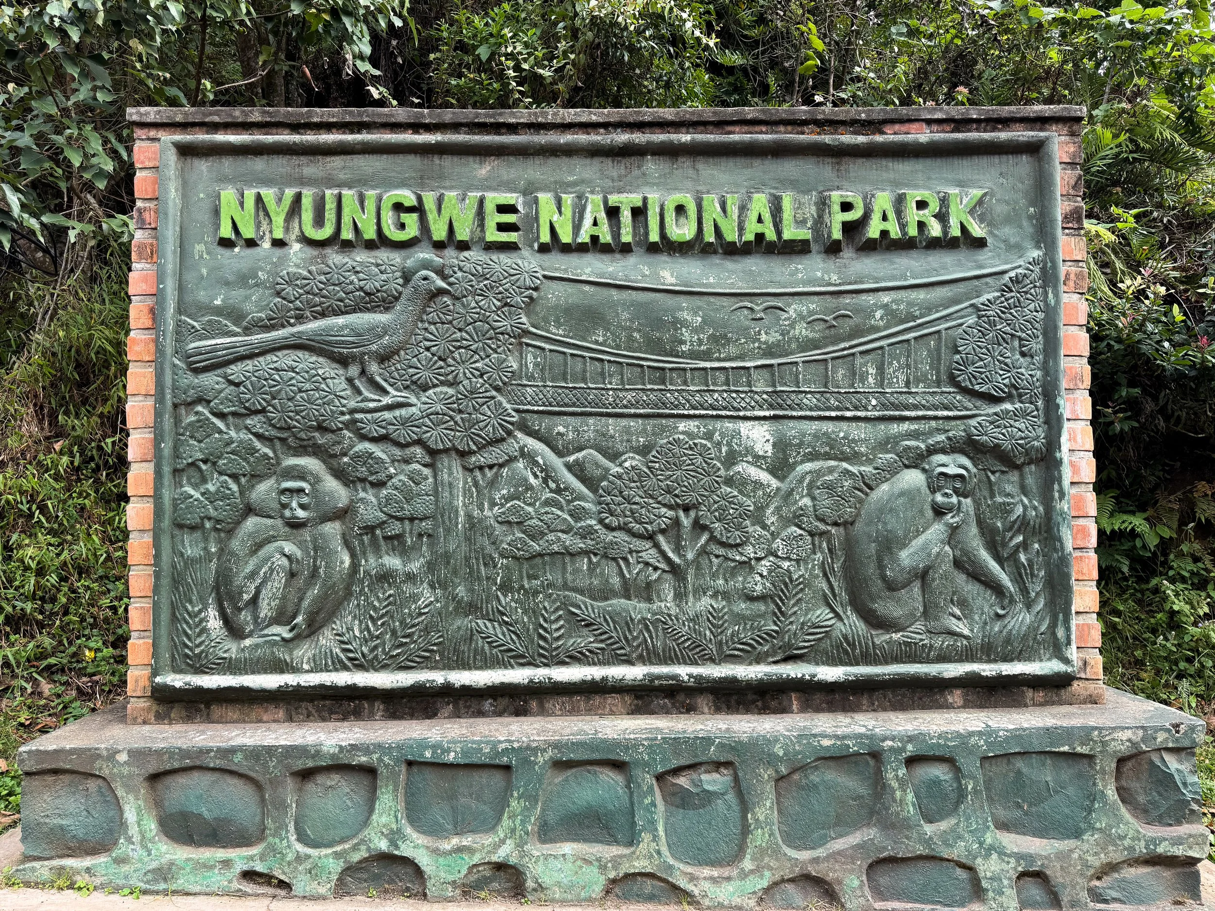
Nyungwe Forest National Park
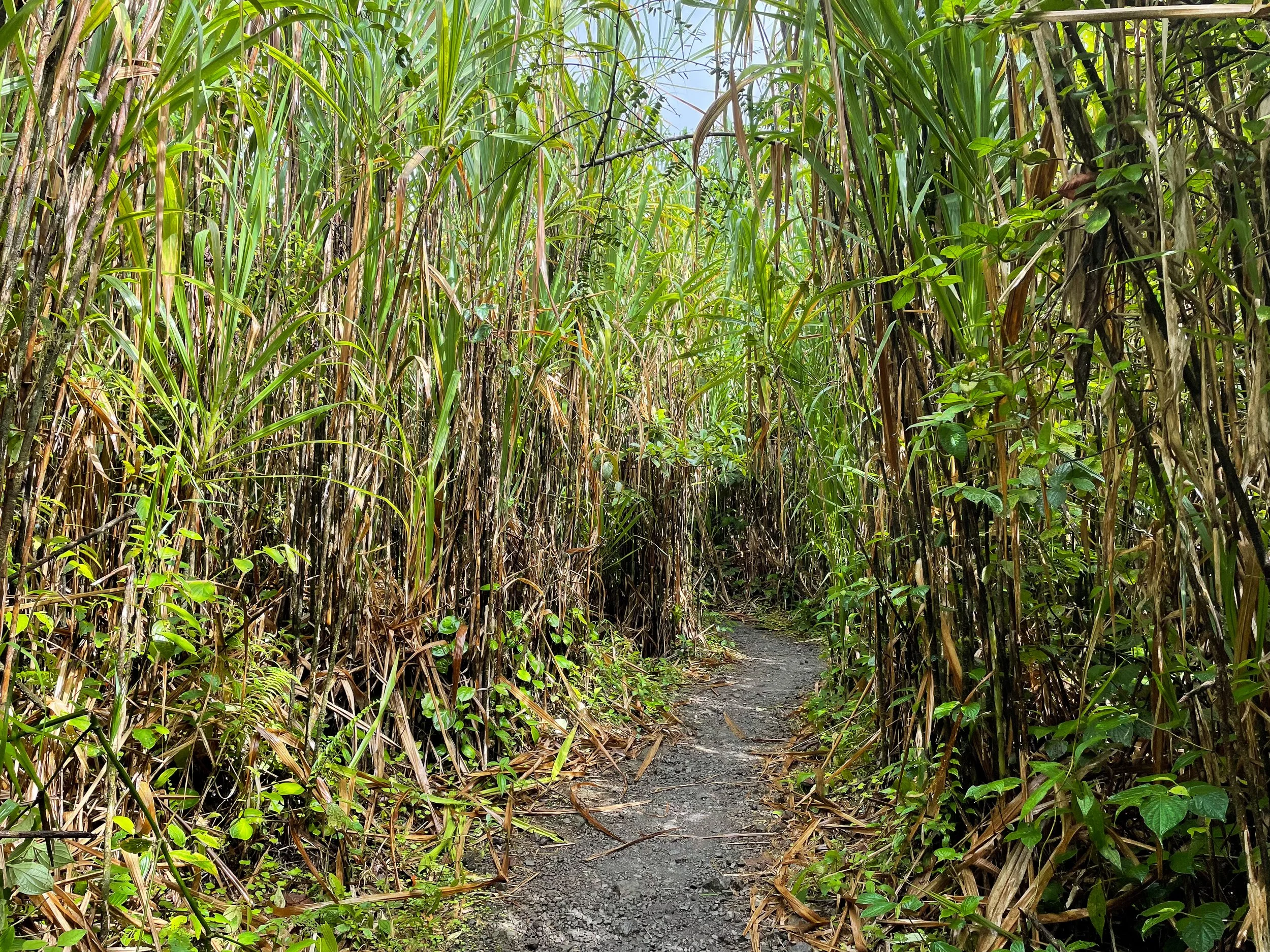
Nyungwe Forest National Park is a tropical rainforest in the high hills of Rwanda. Its lush canopy is home to 20 percent of Africa’s primates including endangered chimpanzees. We spent a couple days here exploring the park and watching for wildlife.
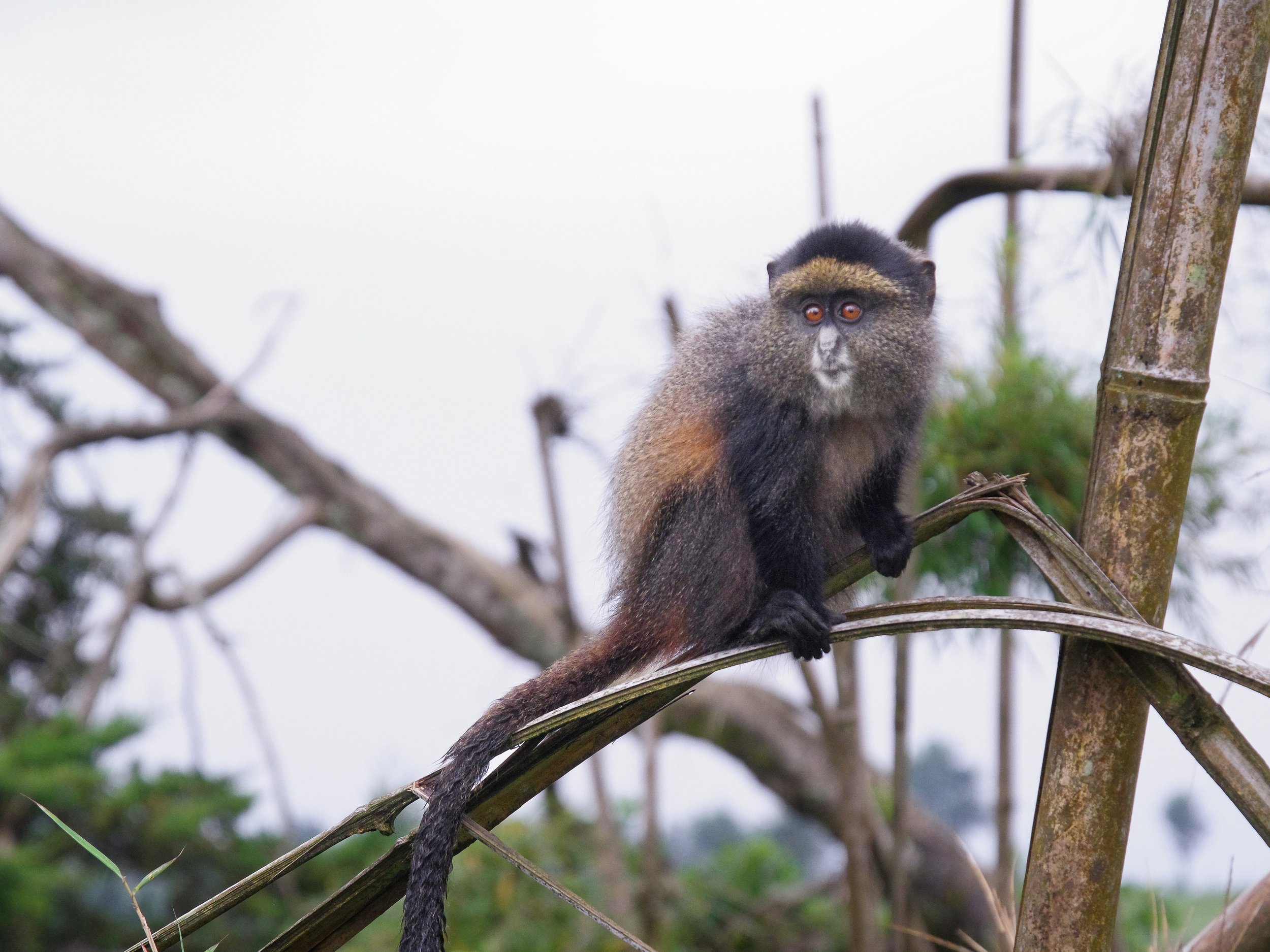
Kivu Belt Road. The single road through the forest and between its visitor centers. It’s a hub for roadside wildlife spotting. We saw chimpanzees, olive baboons, forest antelopes, L'Hoest's and blue monkeys. The road is heavily patrolled by the military in response to conflict with neighboring Burundi and Democratic Republic of the Congo.
Uwinka Visitor Center. A nature center in the middle of the forest with a canopy walk, zipline, coffee shop, eco hotel and hiking trails. It’s the main hub for many of the forest’s activities.
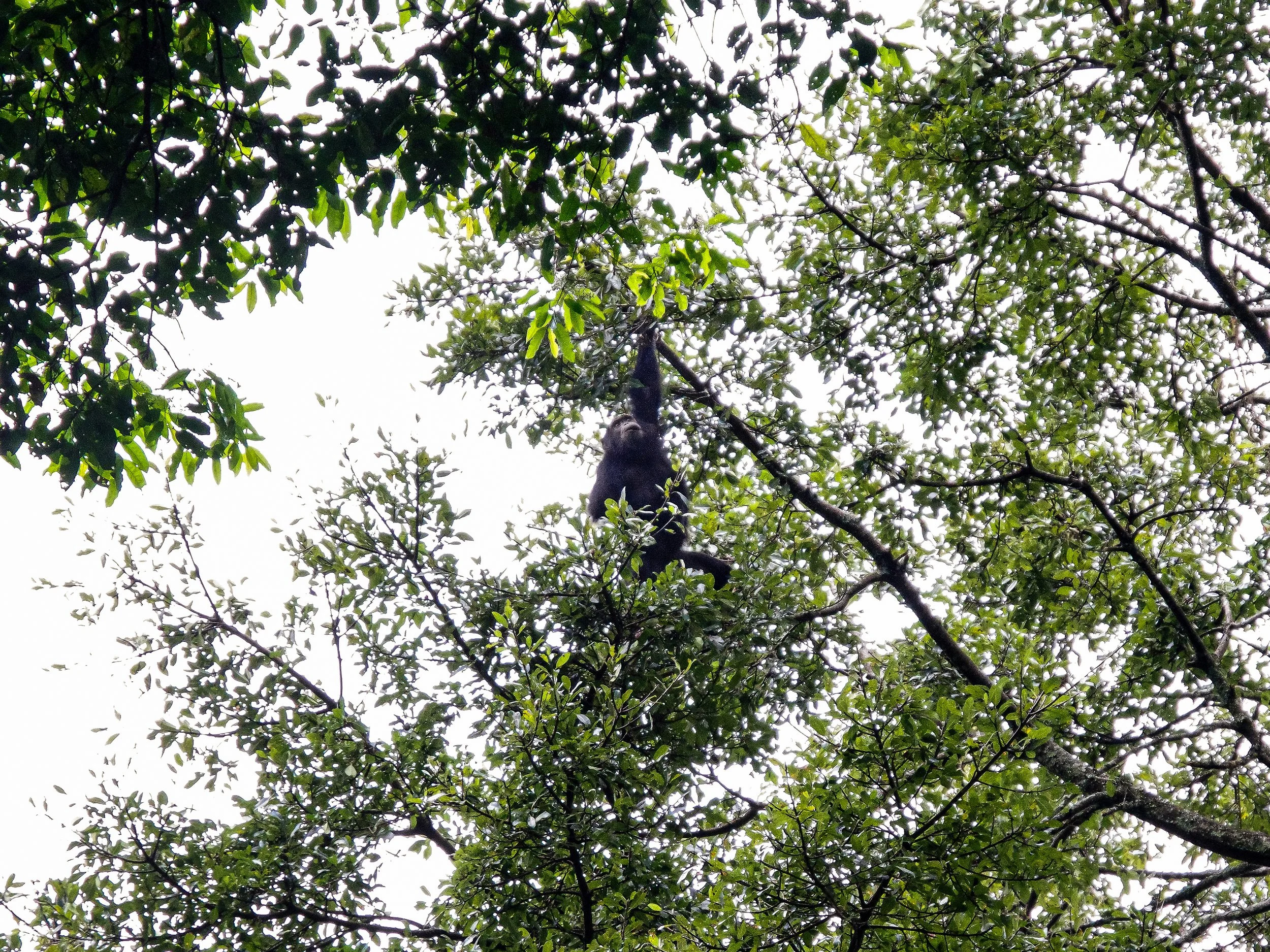
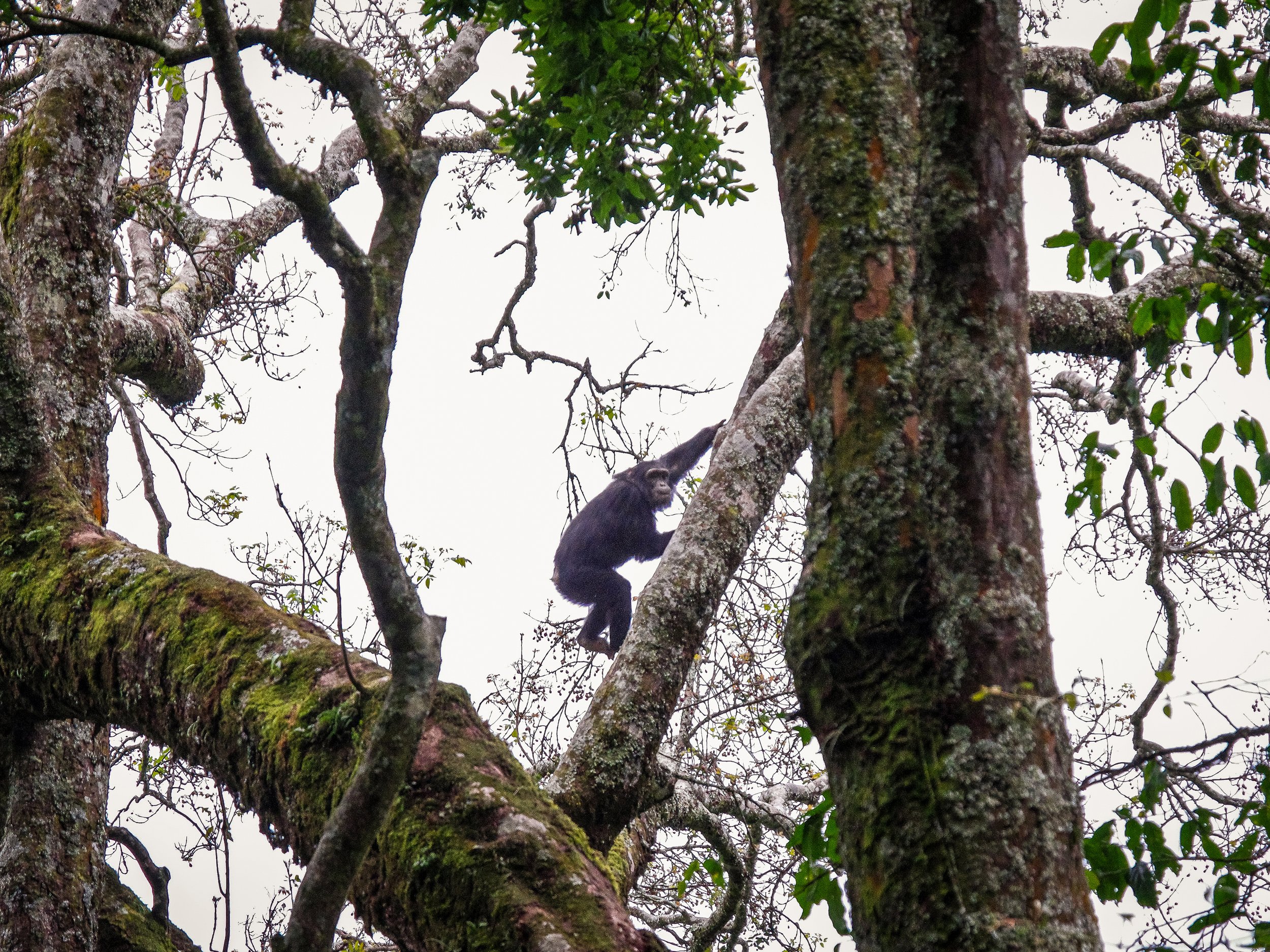
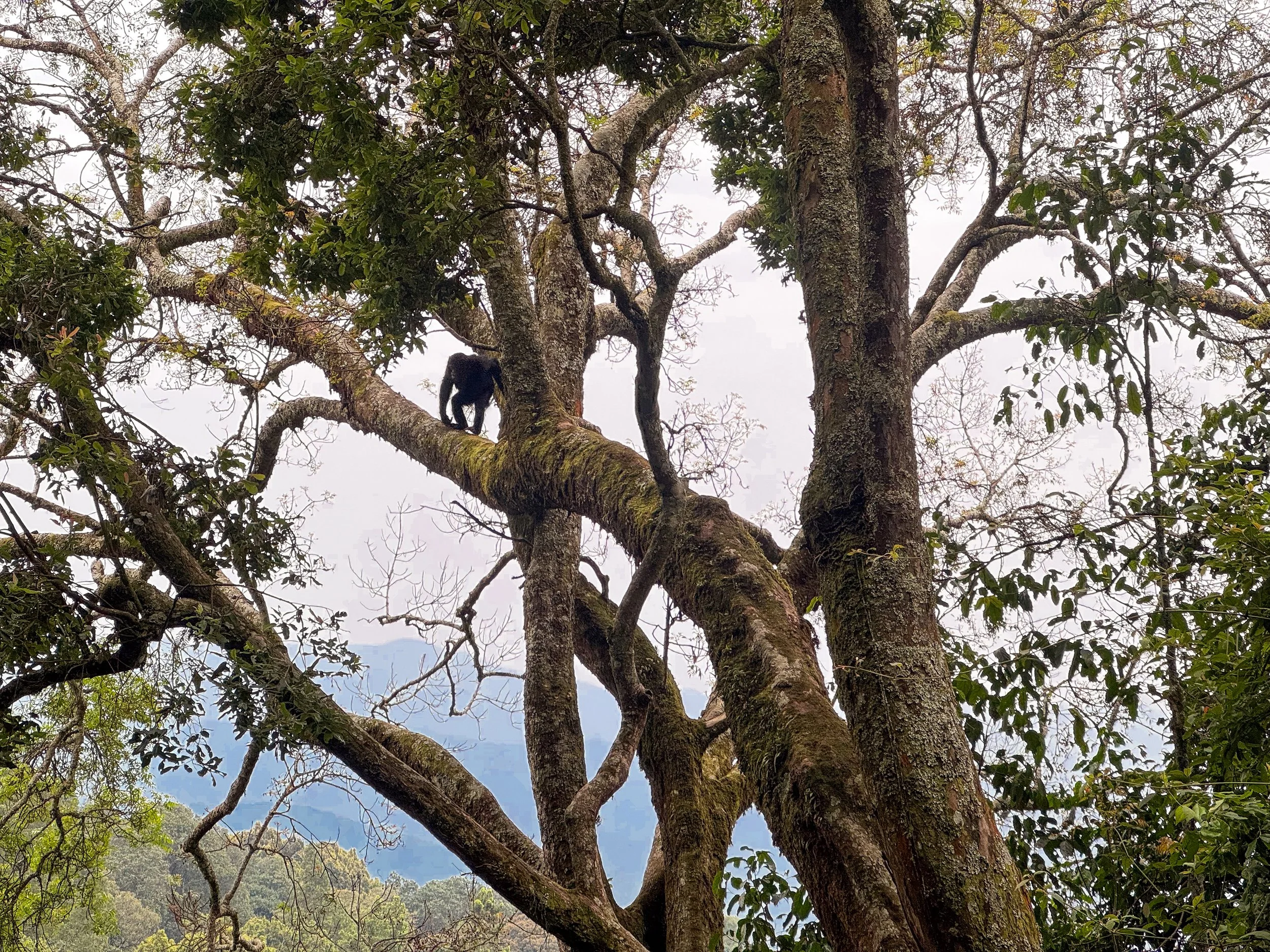
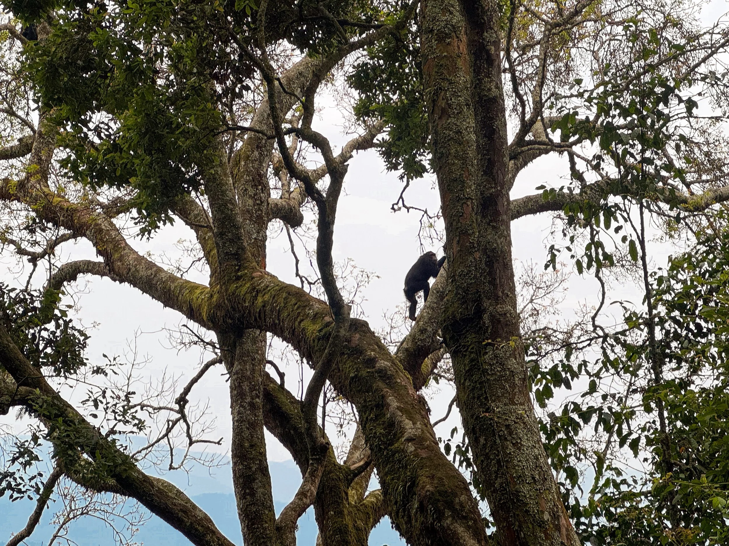
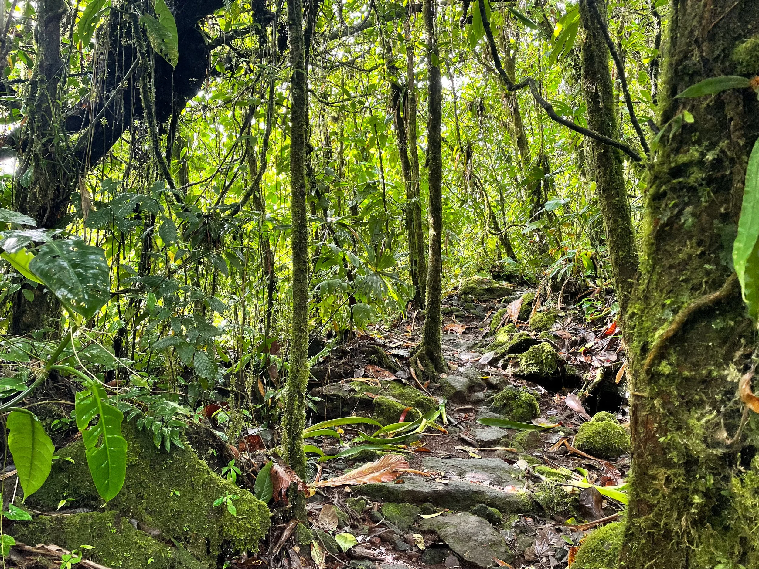
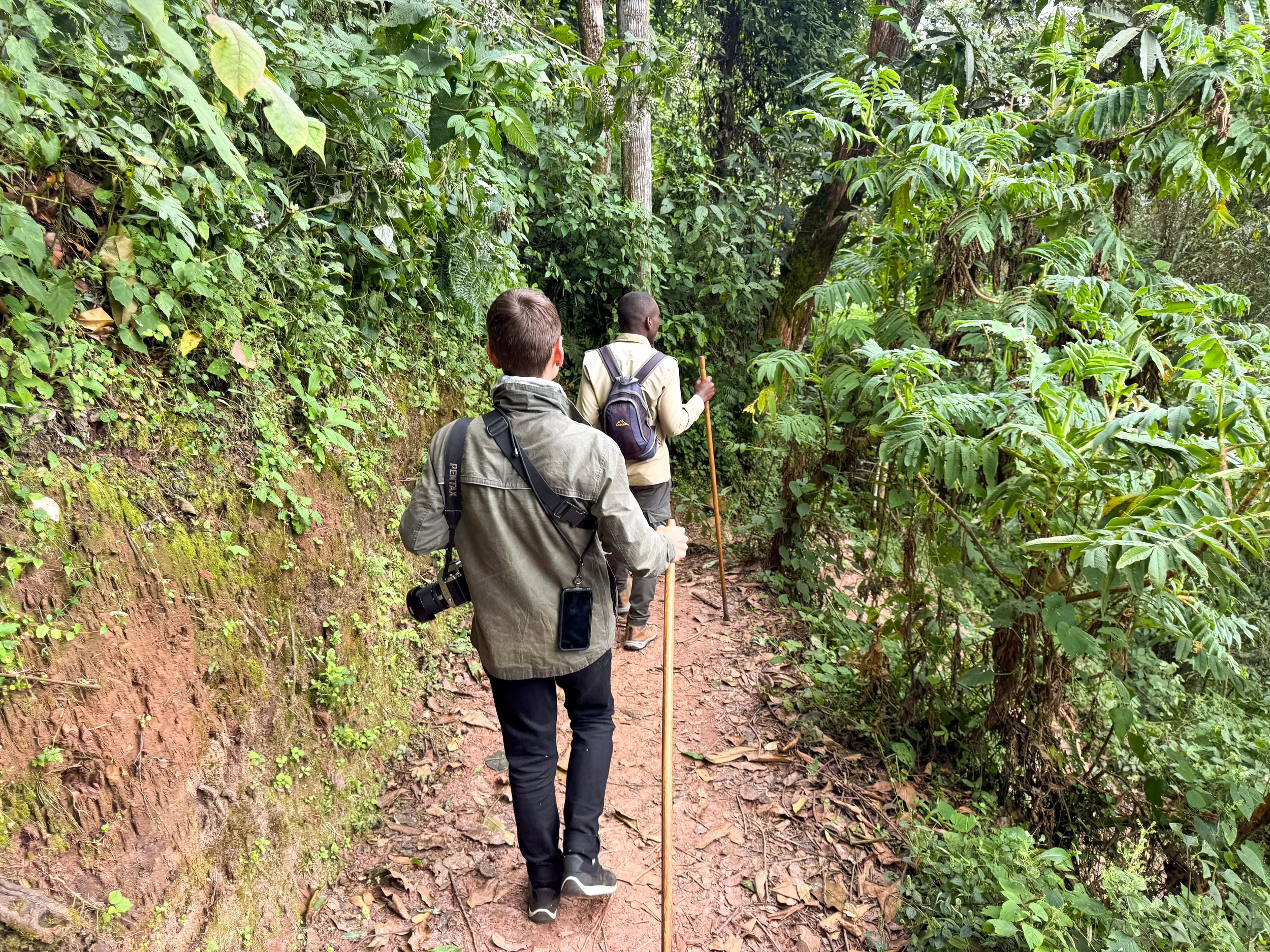
Chimpanzee Trekking. The Nyungwe Forest is home to a growing population of wild Chimpanzees. We trekked beneath its lush canopy to see them in their natural habitat. The sounds of birds singing and insects buzzing filled the morning air as daylight broke. Trackers led the way as we hiked trails, through the thick jungle and down steep slopes. After a couple kilometers, we spotted a family of four chimps in a towering tree. They climbed and swung between branches while feeding on berries. A baby chimp stuck close to its mother while learning to climb on its own. We continued further into the jungle, spotting a tree with several more chimps nomming on its leaves. Tropical birds like hornbill toucans, colorful turacos and vibrant sunbirds appeared around us while we quietly watched.
Pro Tip. Ants are everywhere when trekking through the jungle. Wear hiking gaiters or long socks over your pant legs to avoid painful bites.

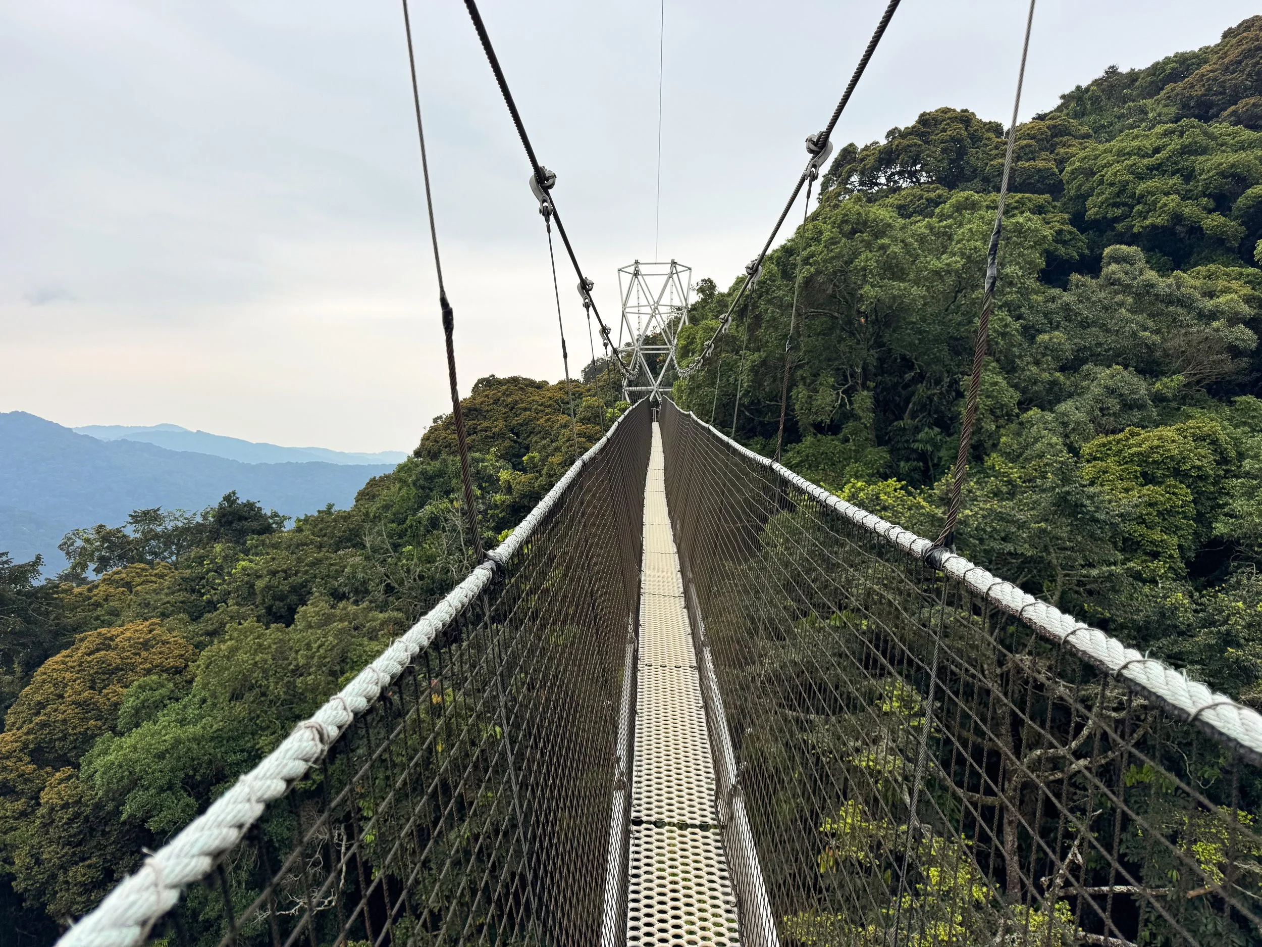
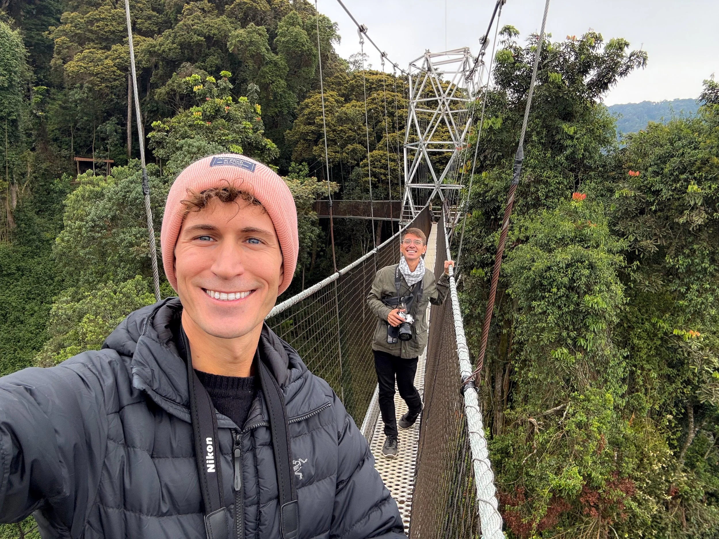
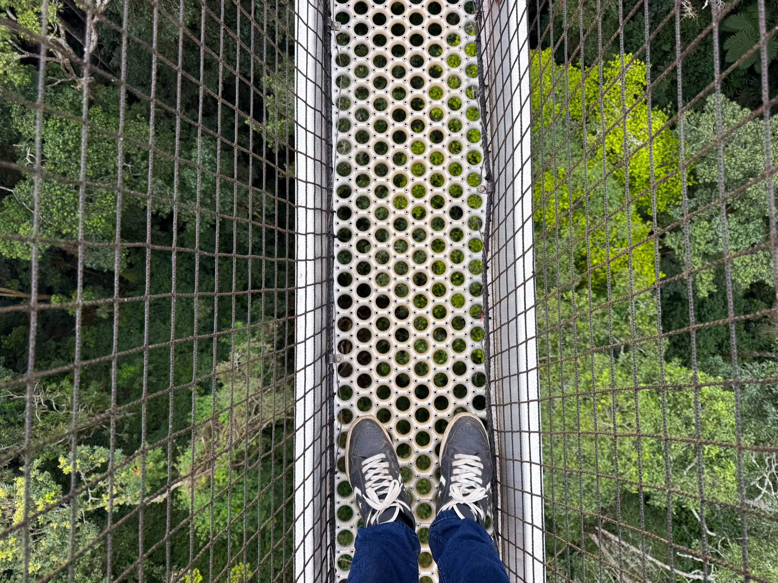
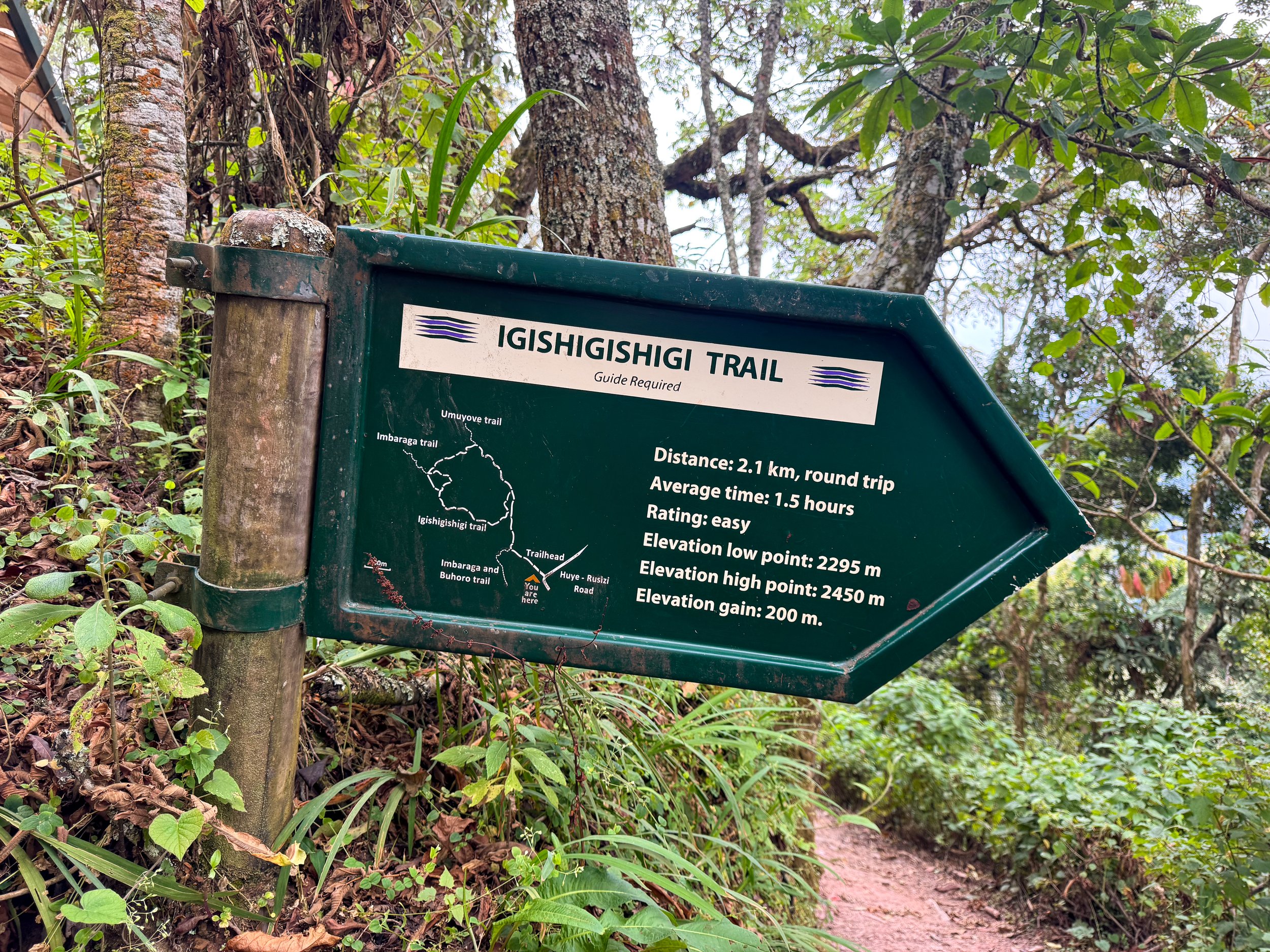
Nyungwe Canopy Walk. A series of three suspension bridges above the treetop canopy. The central bridge has panoramic views of the jungleous forest, parasol trees and layers of hilly ridges. It’s reachable from the Uwinka Visitor Center along the Igishigishigi Trail, a 2.1km loop through the forest.
Nyungwe Night Walk. A two hour nighttime walk through the forest to spot nocturnal animals. We trekked the Igishigishigi Trail with red lamps in hopes of seeing flying squirrels and bush babies. Unfortunately we didn’t have any luck spotting many animals outside of seeing a few bats.
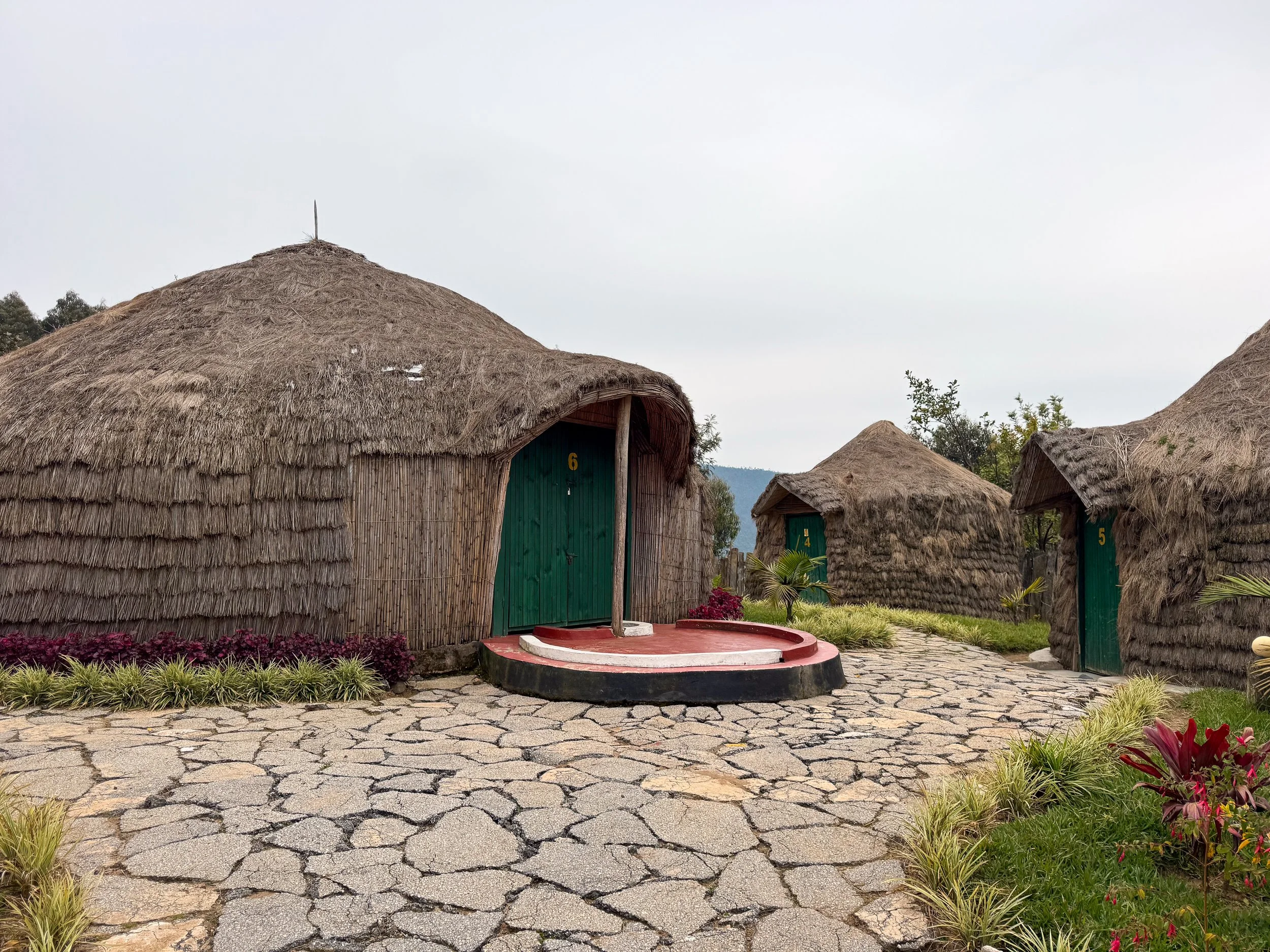
Kitabi Eco Center Hotel. An eco lodge on the edge of Nyungwe Forest with a half dozen thatched huts and a restaurant. The huts have an authentic feeling, designed in the traditional style of the Rwandan king’s palace. The hotel and restaurant overlook steep hills and valleys planted with rows of tea. Our stay included complimentary breakfast each morning: eggs, fruit and the local flat bread. We enjoyed dinner around a coal camp fire and watched European football with a group of locals. Reserve on Booking.
Good to Know. All trails and activities within the forest need to be accompanied by a guide. Park permits and activities can be booked and paid for in advance with Visit Nyungwe.
Pro Tip. Wear layers. It gets cold with temperatures ranging from high 40s F to low 60s F (5C - 15C).
King’s Palace Museum
The King’s Palace Museum showcases the modern and traditional homes of Rwanda’s past kings, the country’s royal cows and cultural board games.
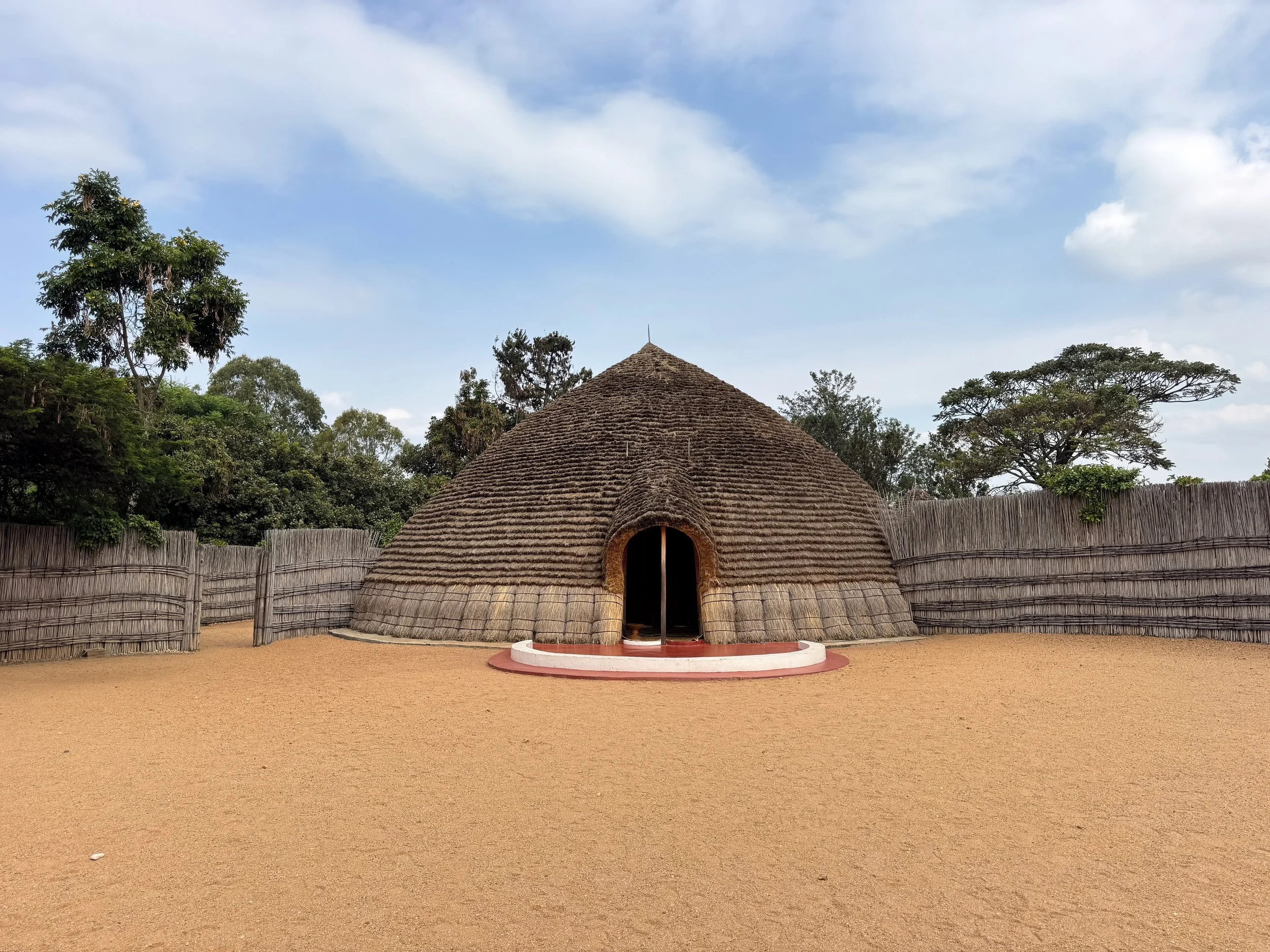
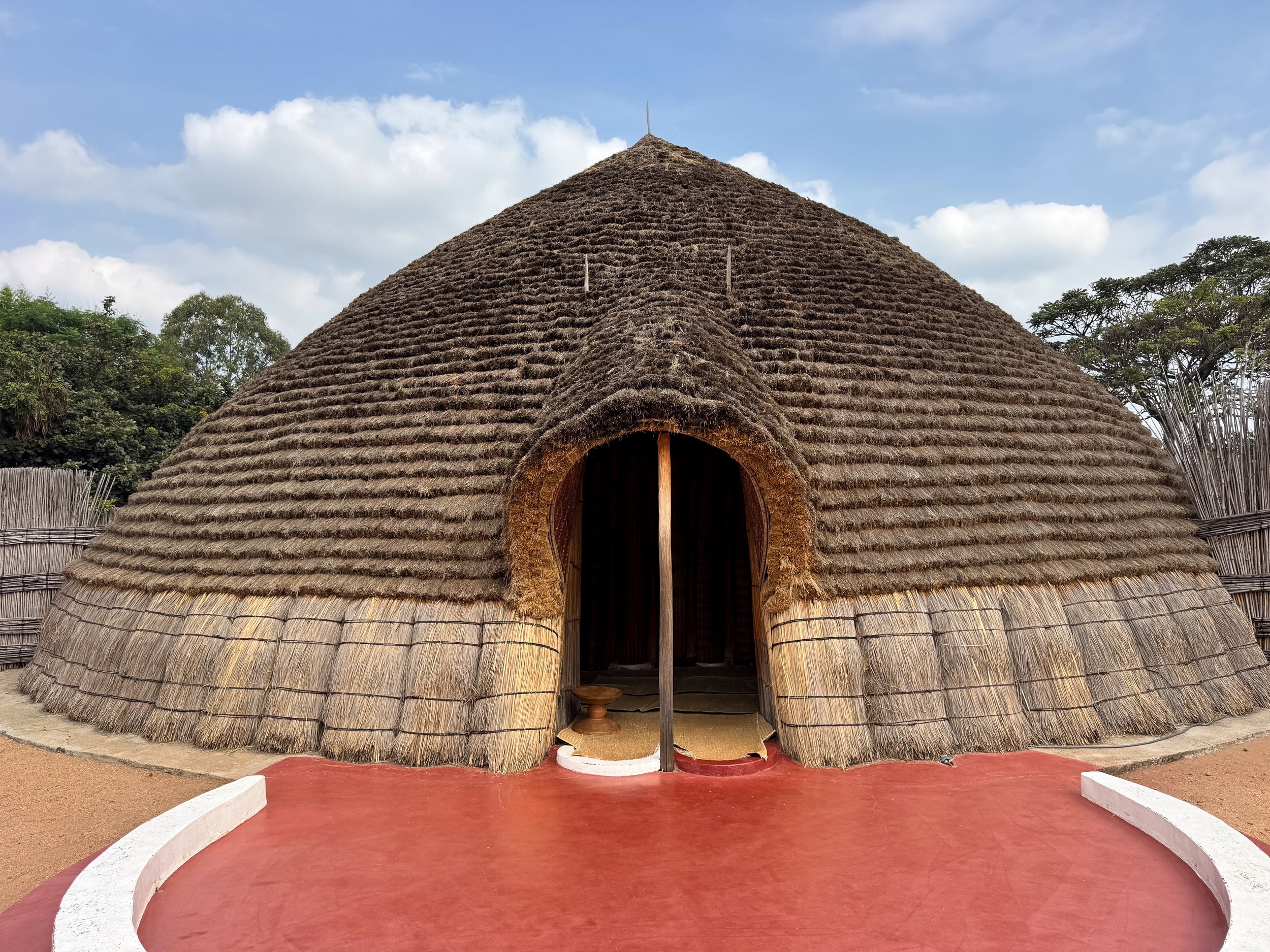
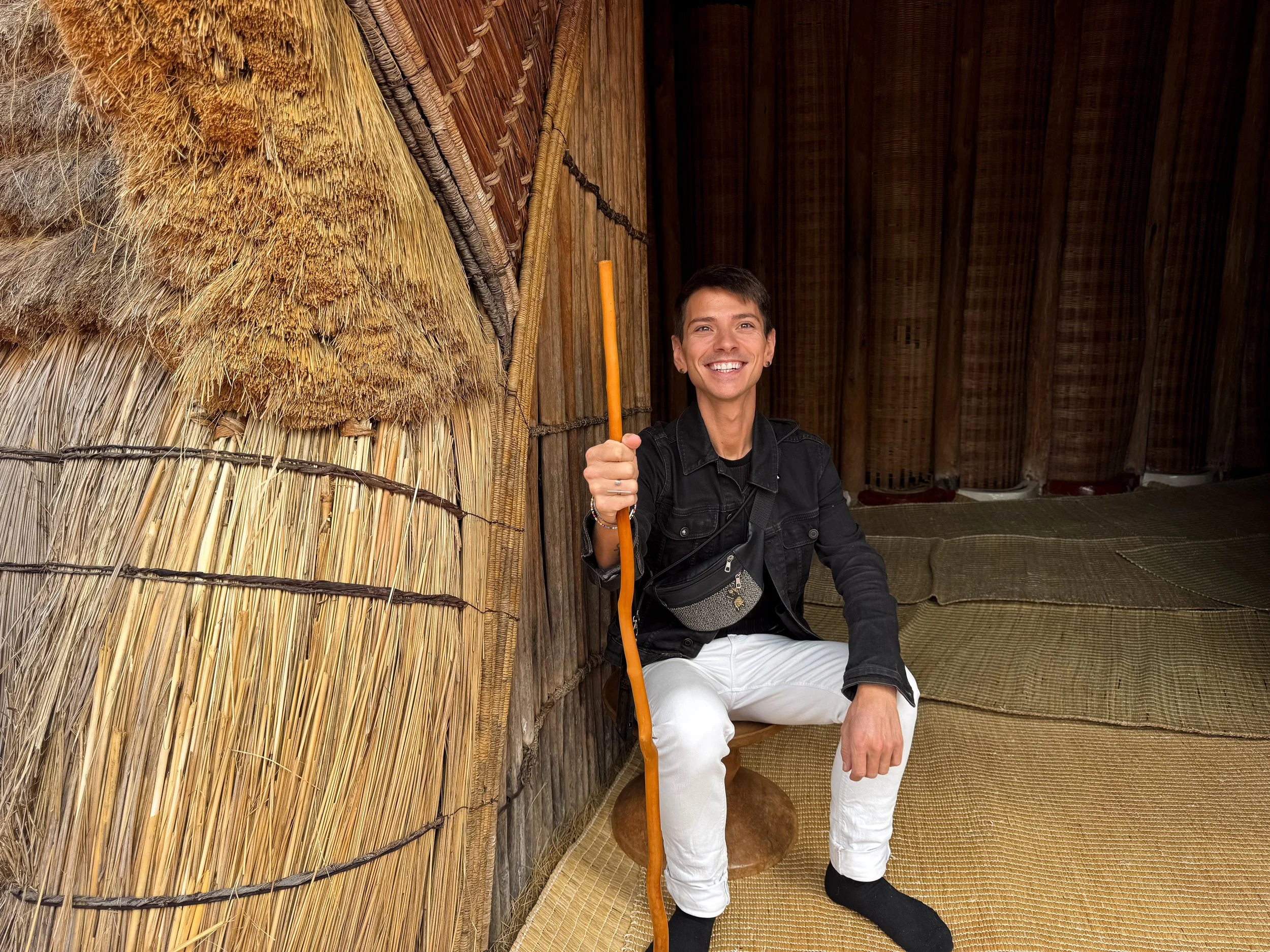
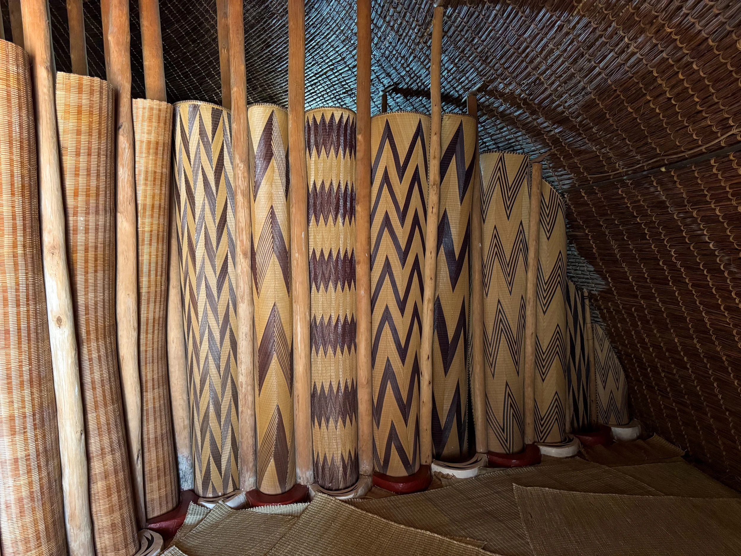
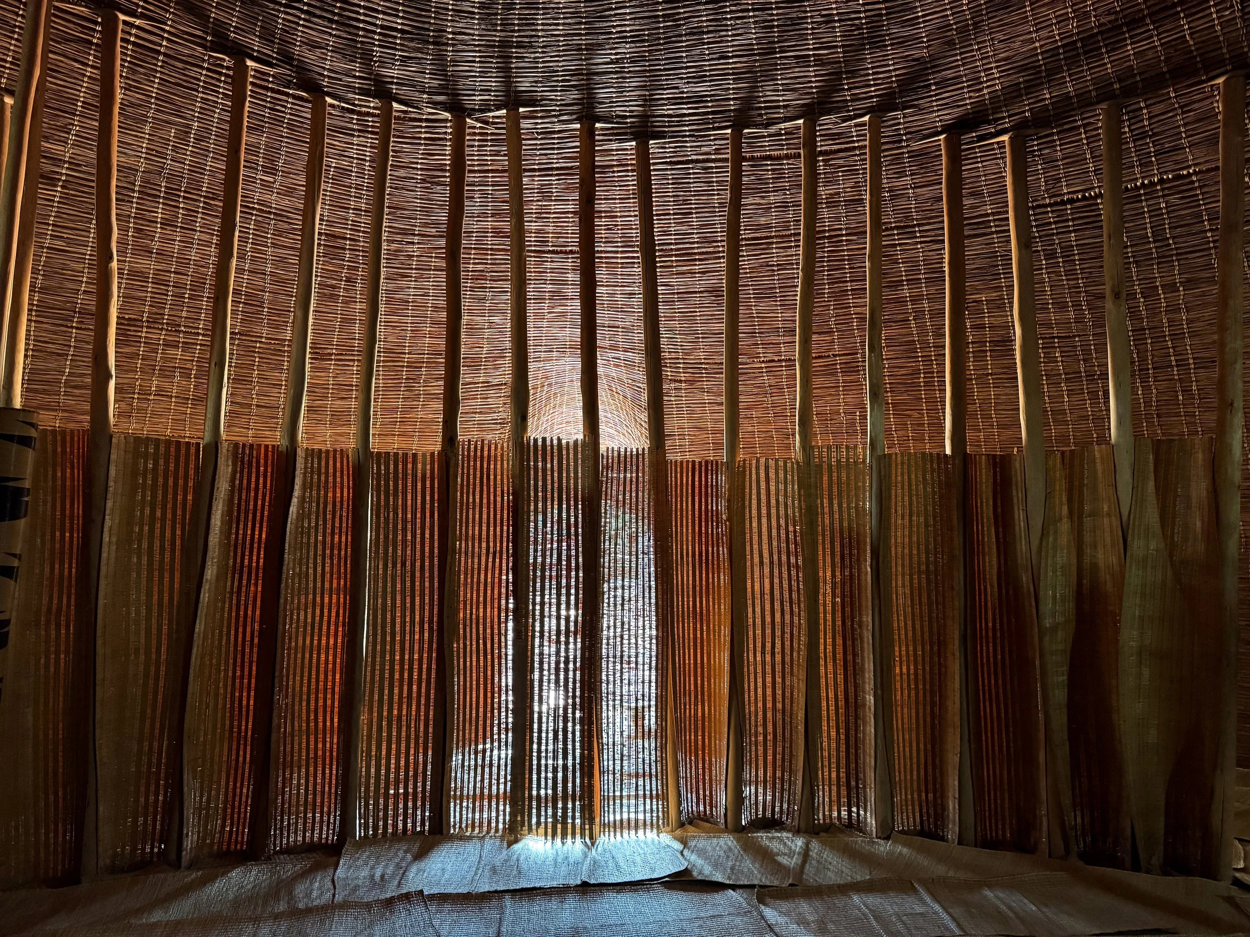
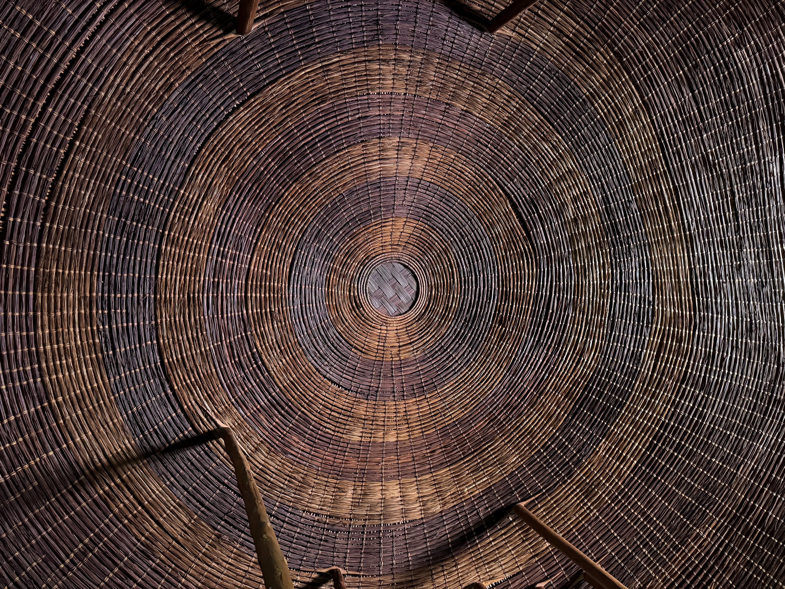
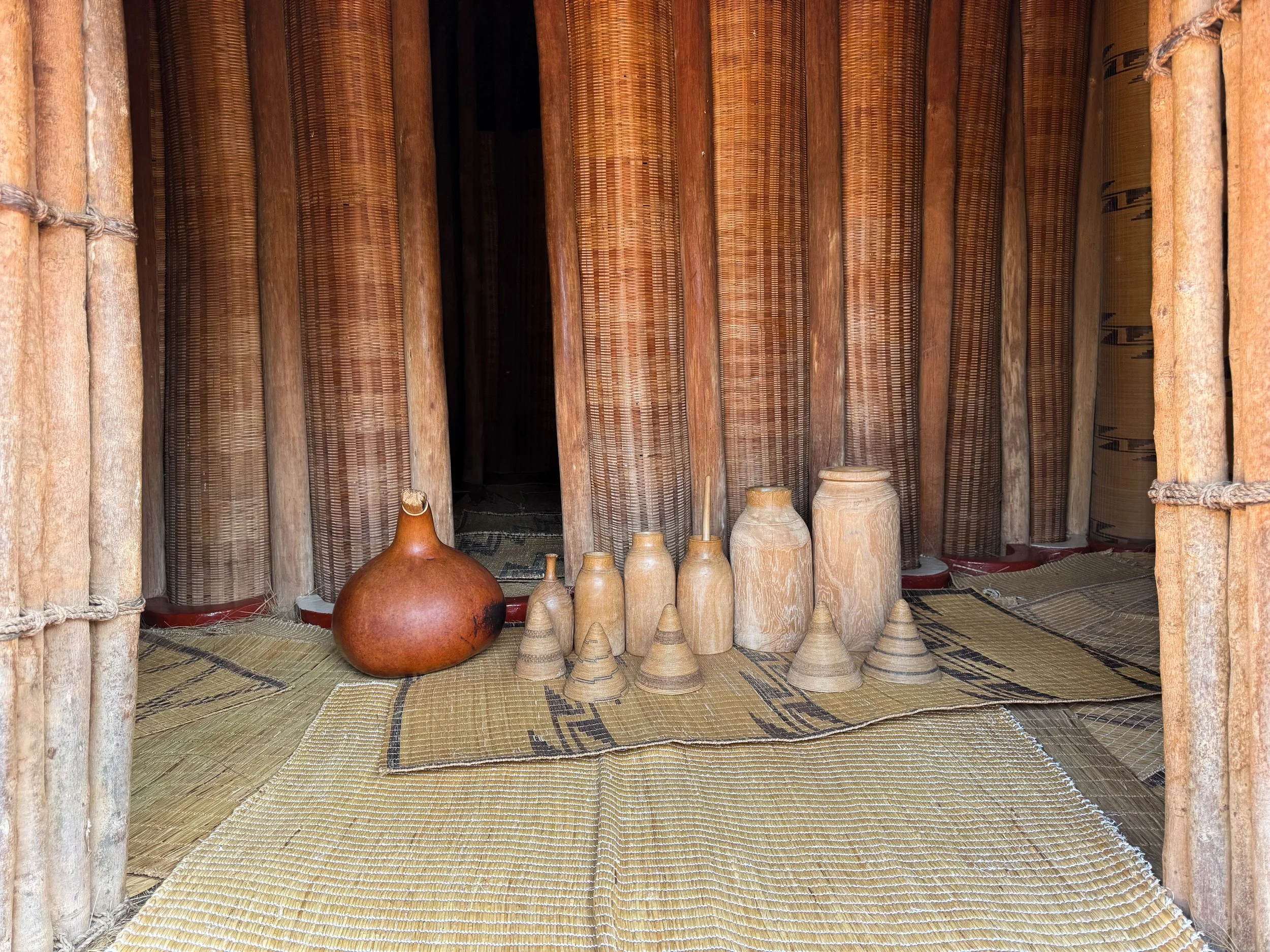
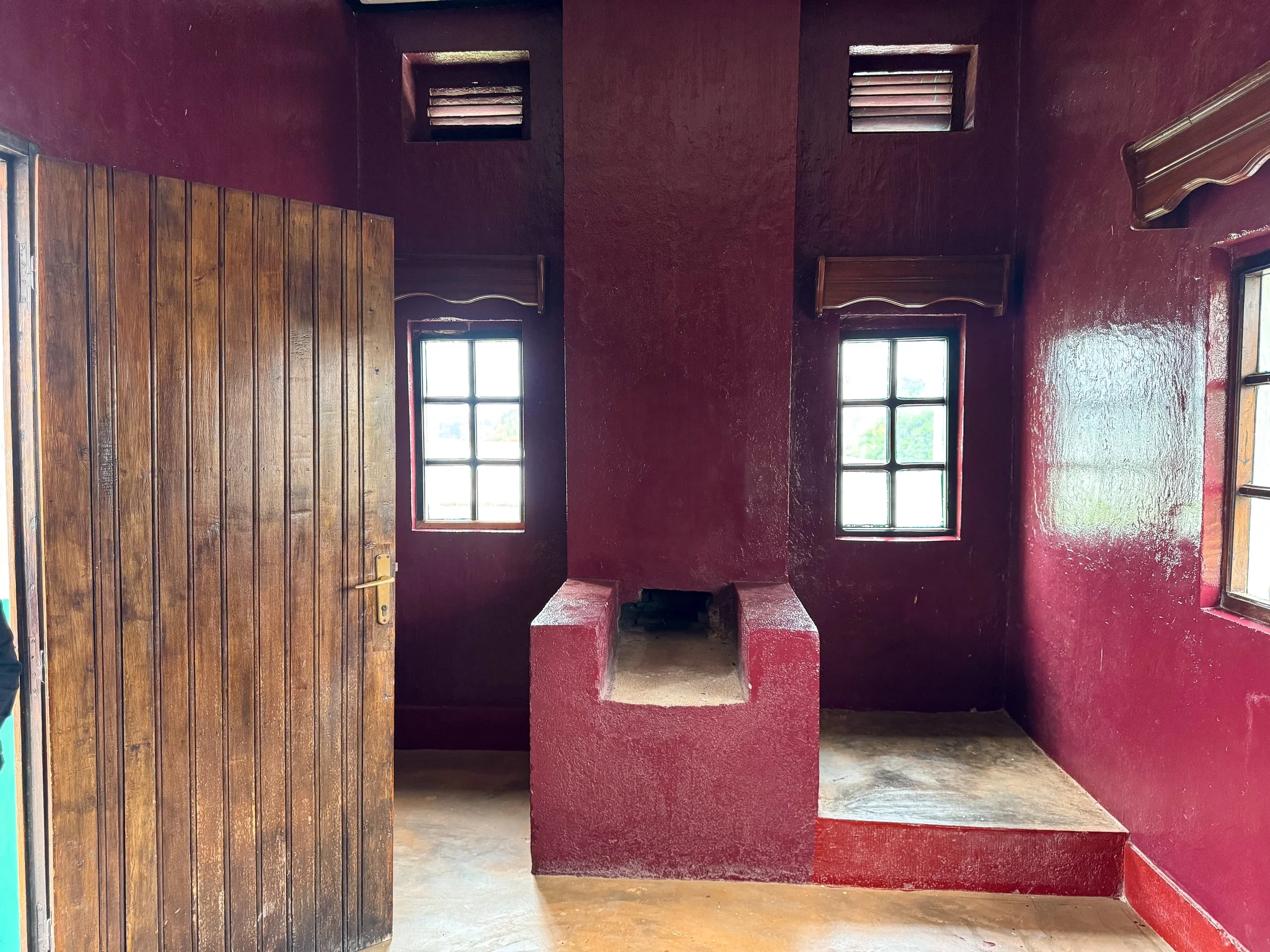
The Traditional Palace. A replica of the royal tribal village. At its center is a large thatched hut made from woven and braided grasses. Its domed interior feels like an upside down basket with rooms divided by wooden columns and woven panels. The floor is layered with dried grasses and thatched rugs. A ficus bark blanket covers an elevated bedroom platform. It’s circled by a reeded fence and multiple small huts. Each surrounding hut had its own purpose such as storing milk or beer.
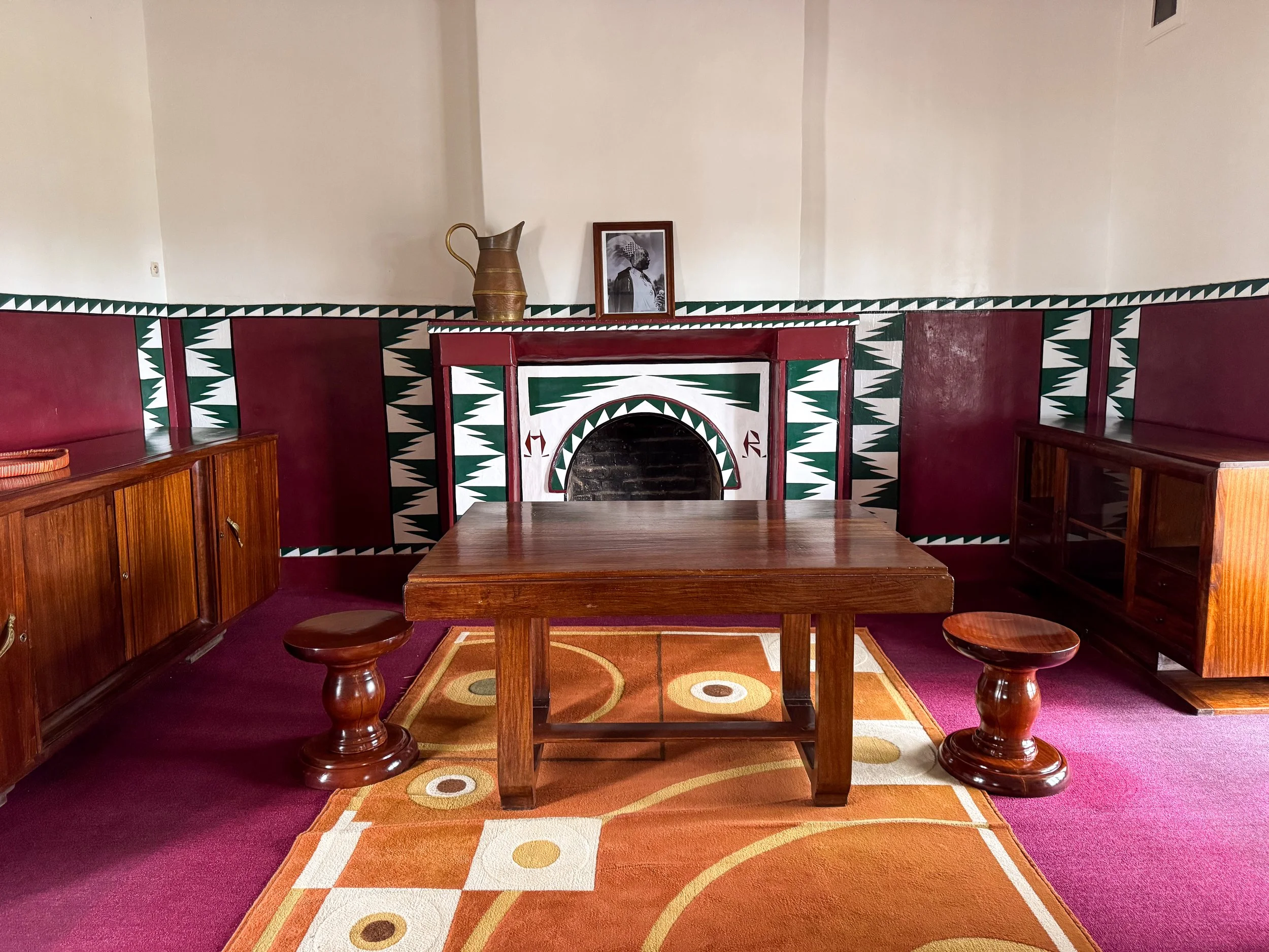
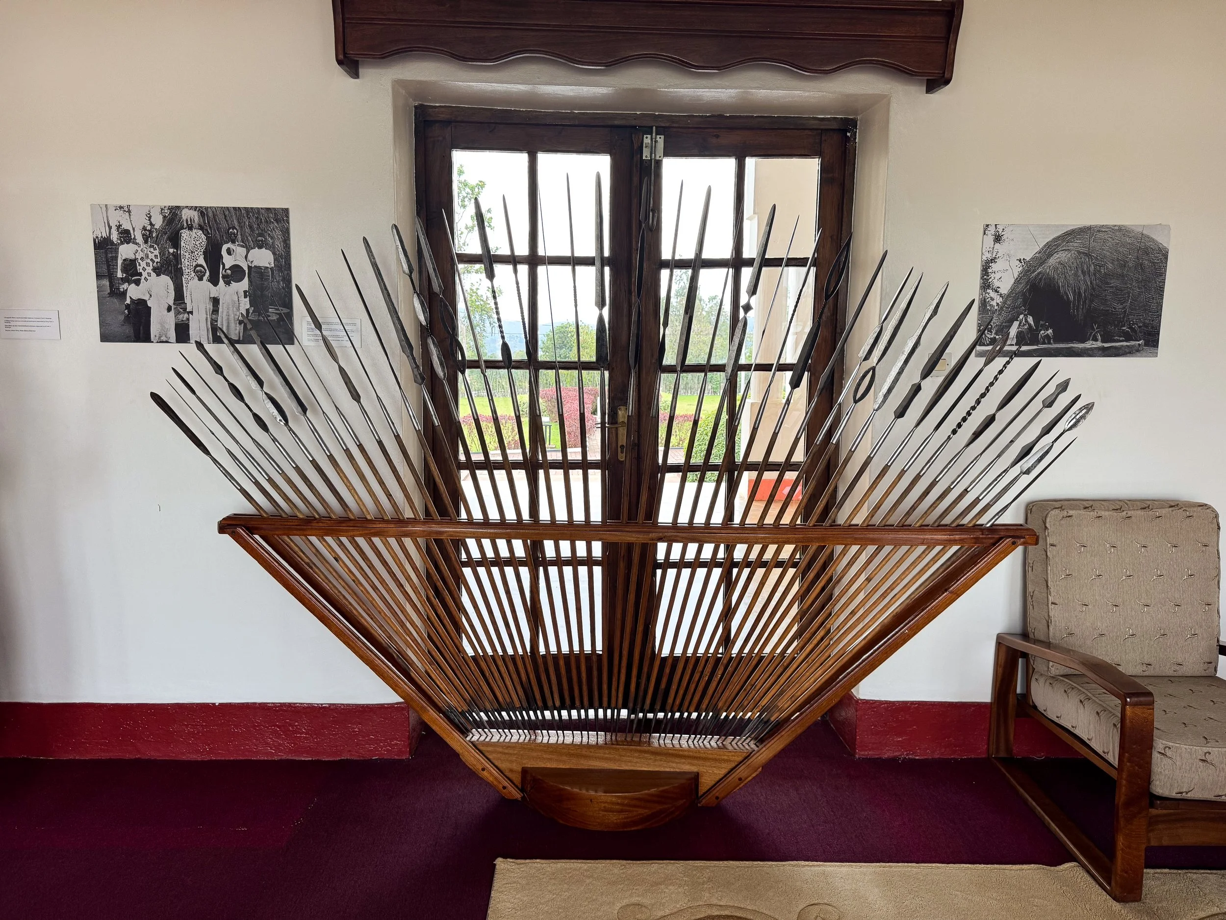
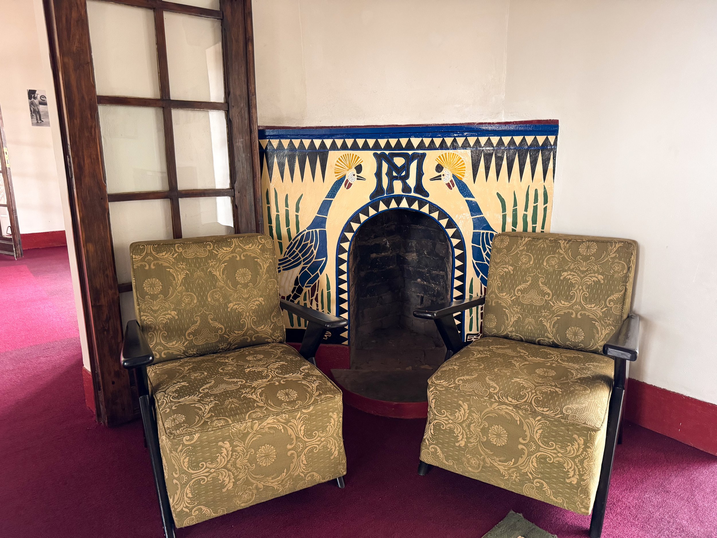

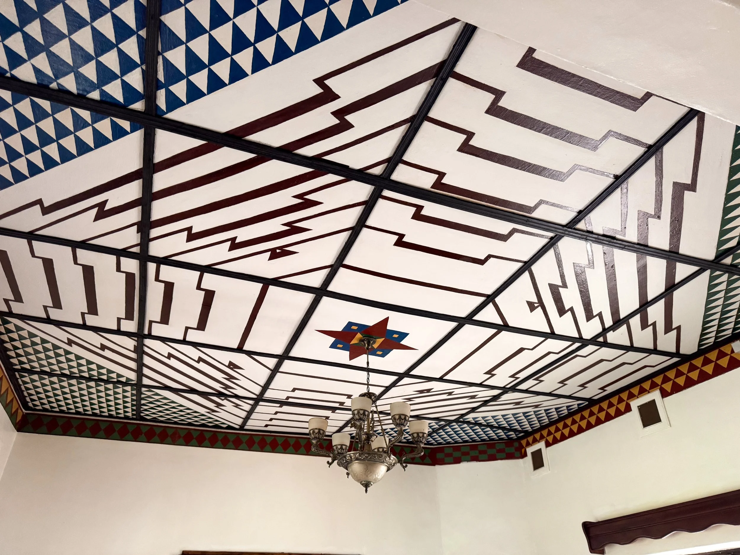
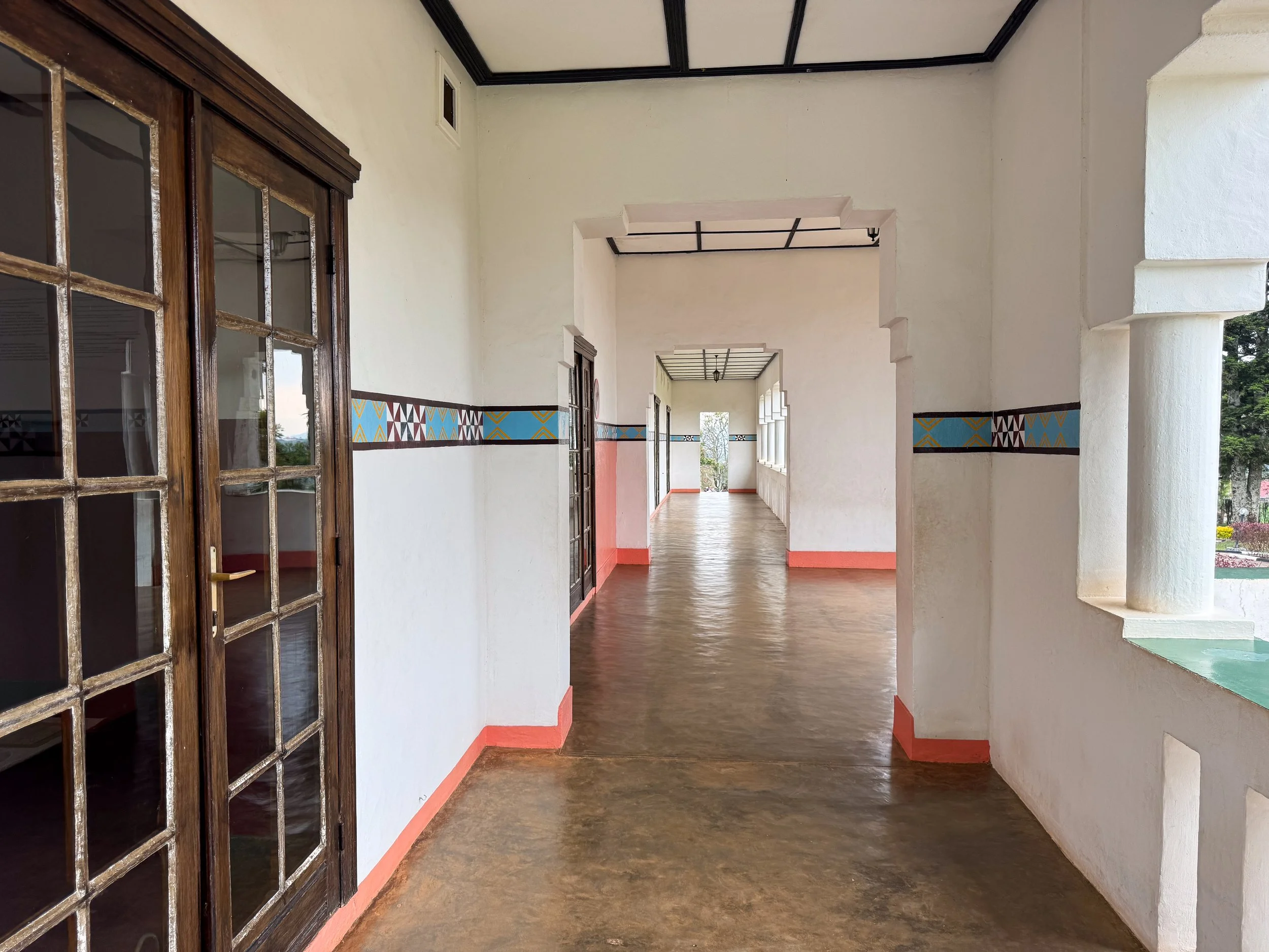
The Modern Palace. A residence built in the early 20th century for the Rwandan King. It featured living quarters and formal rooms decorated with painted fireplaces, tribal patterns, antique furniture, hunting spears and historic photographs.
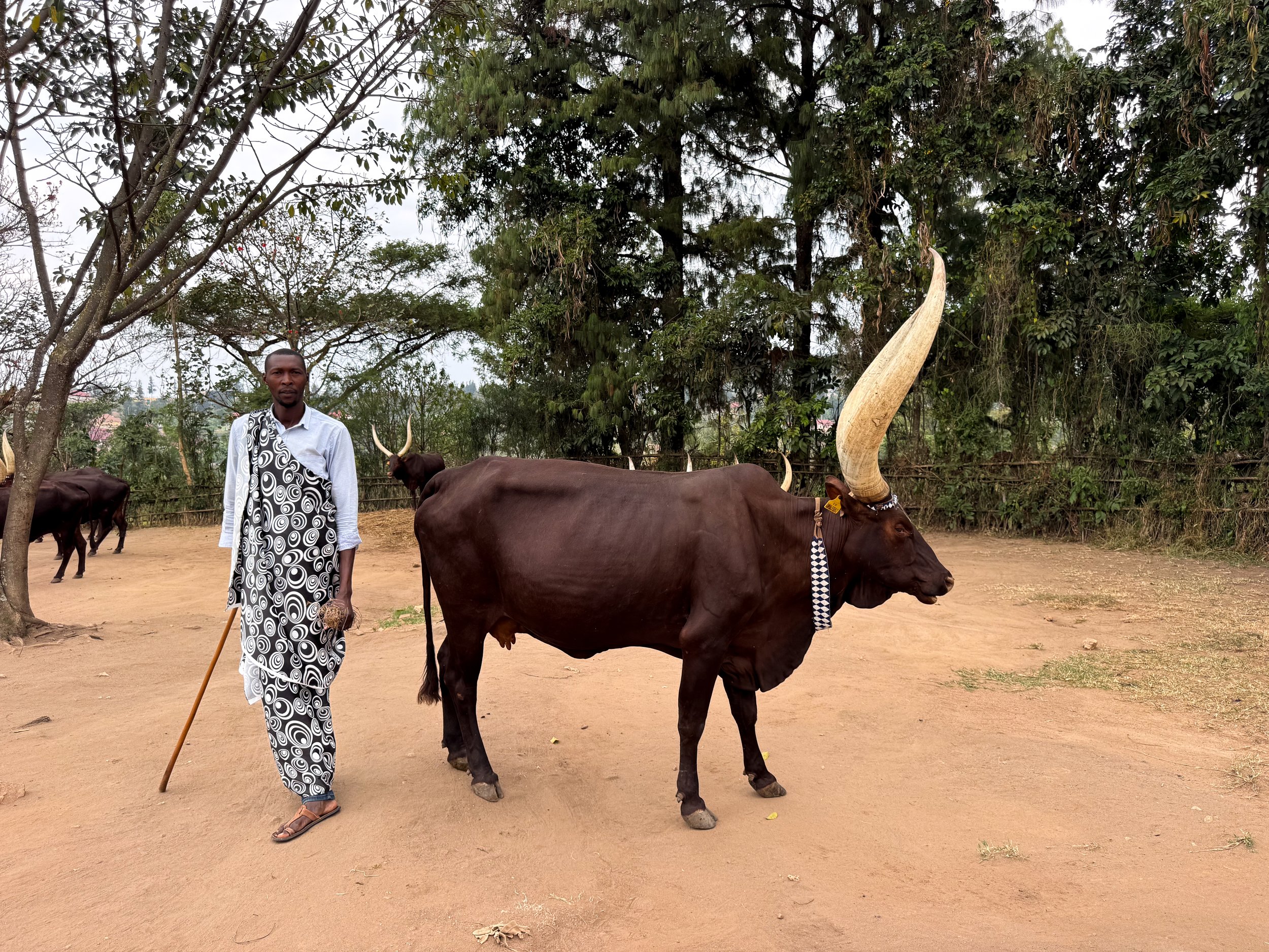
The Royal Cows. An endangered species of cows recognizable by their disproportionately large horns. A handler sang and presented them to us like they would be traditionally done for kings. We pet fully grown and adults and several month old calves.
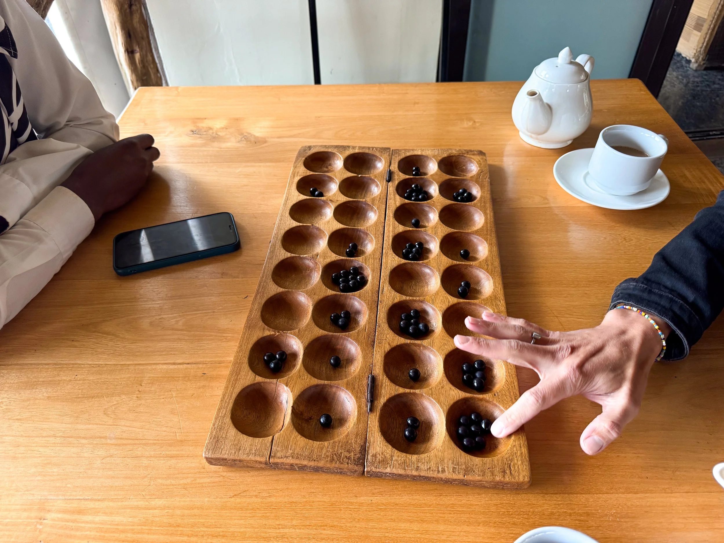
Play Igisoro. A traditional two player strategy game where opponents “eat” or compete for each other’s pieces along a pitted board. We learned to play while sipping on African Coffee.
Getting Here. The museum is located in Nyanza, halfway between Kigali and the Nyungwe Forest.
Coffee Culture
The coffee culture in Rwanda is growing, both figuratively and literally! We visited a coffee farm, roastery and multiple cafés during our time here.
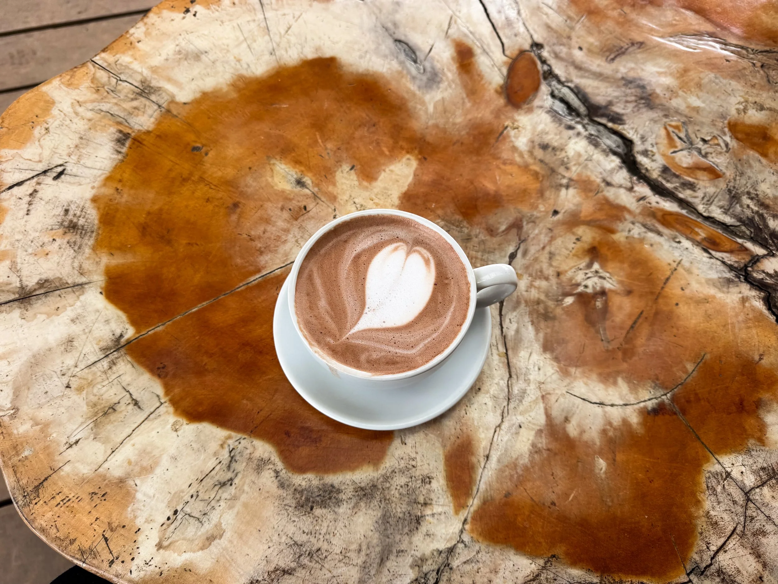
African Coffee. A Rwandan style coffee made with espresso, ginger, steamed milk and occasionally chocolate.
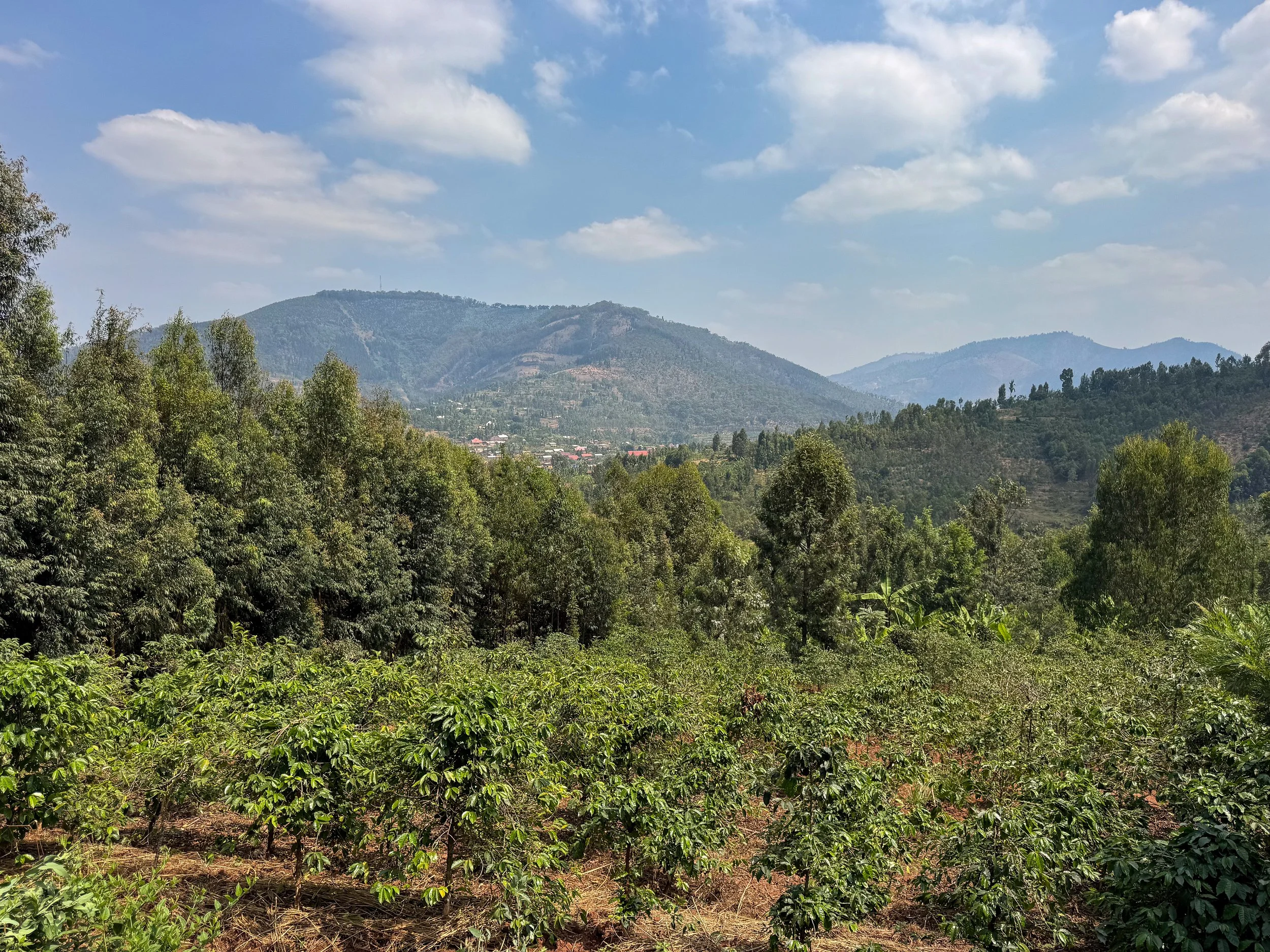
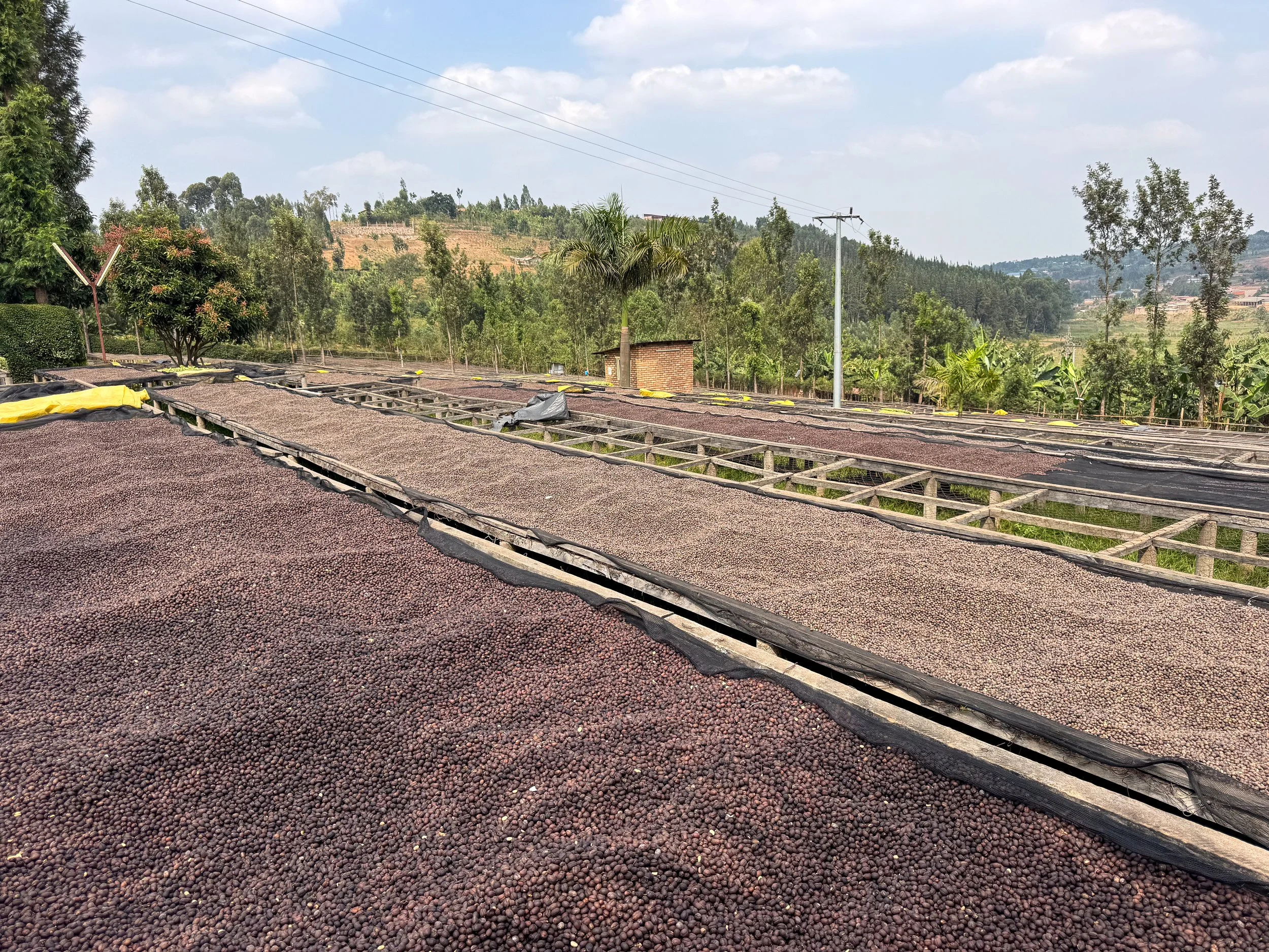
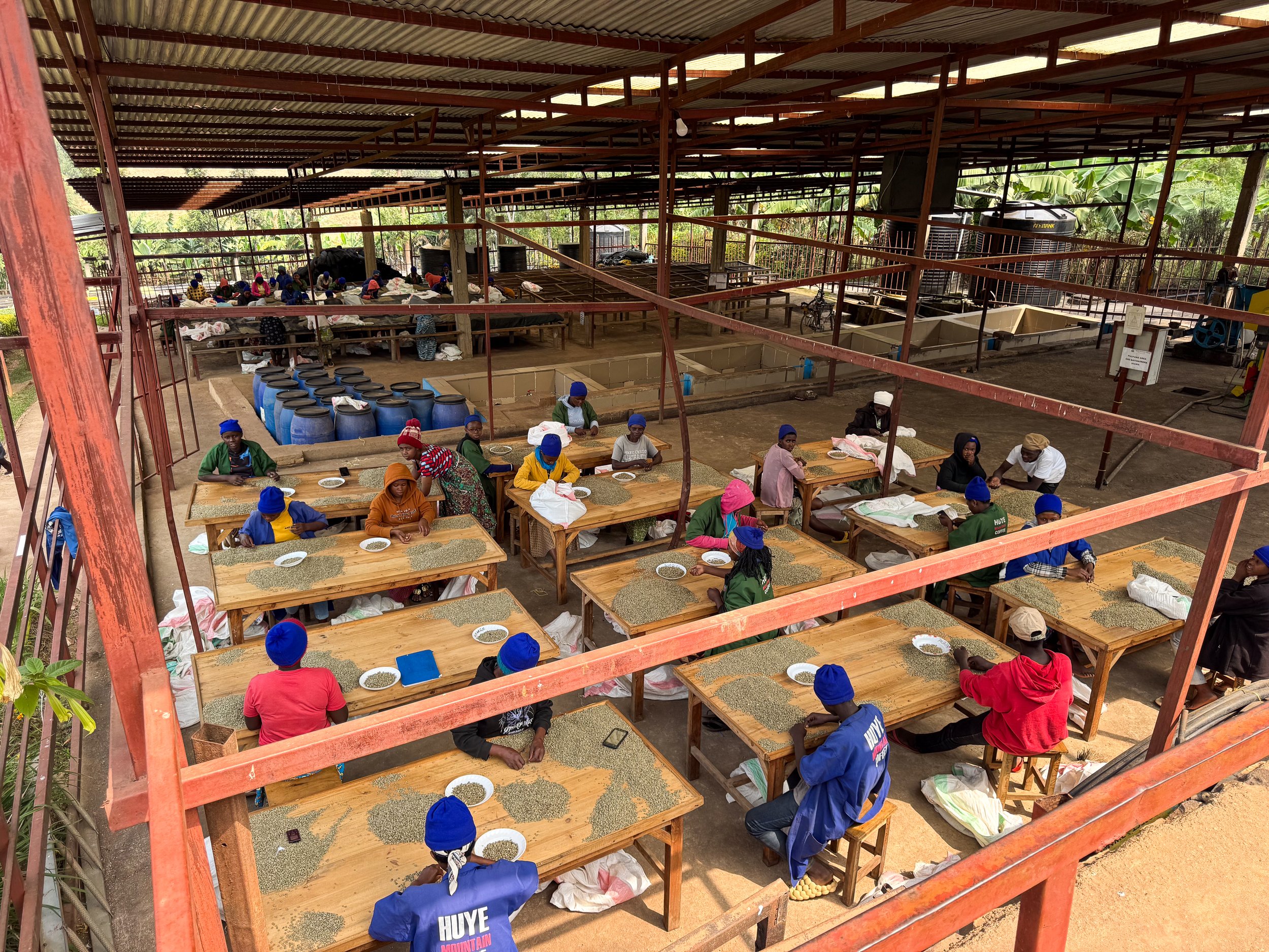
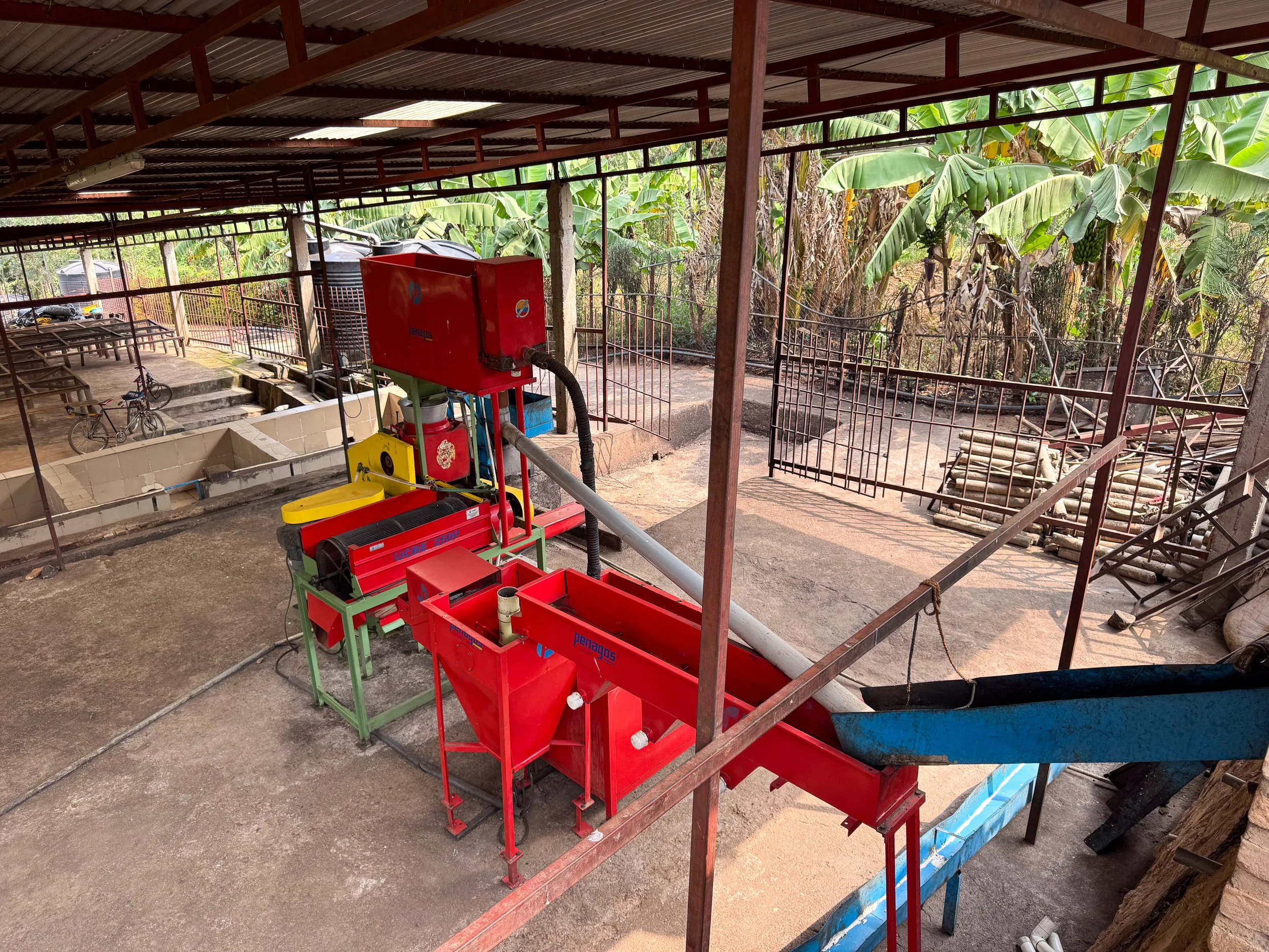
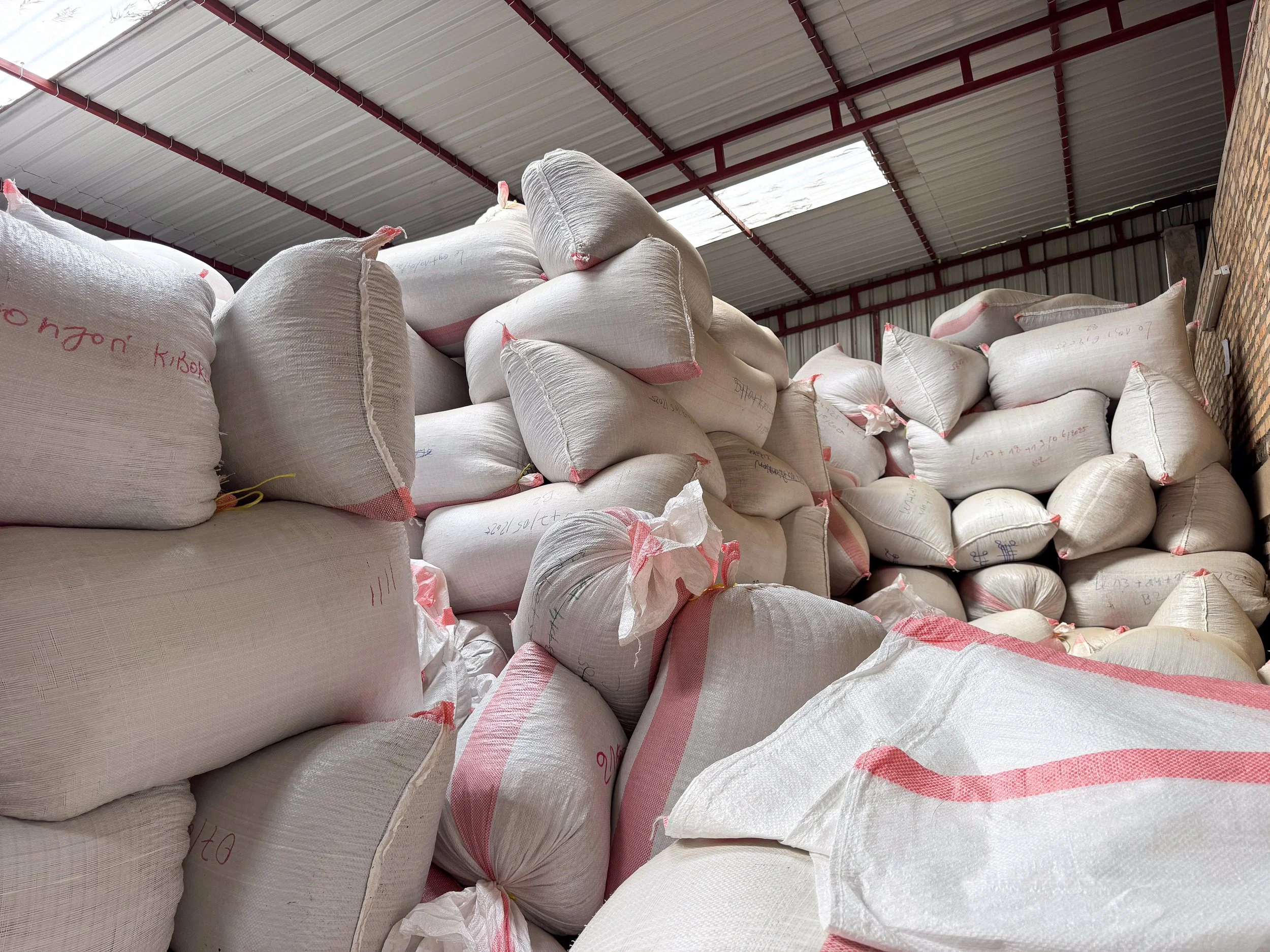
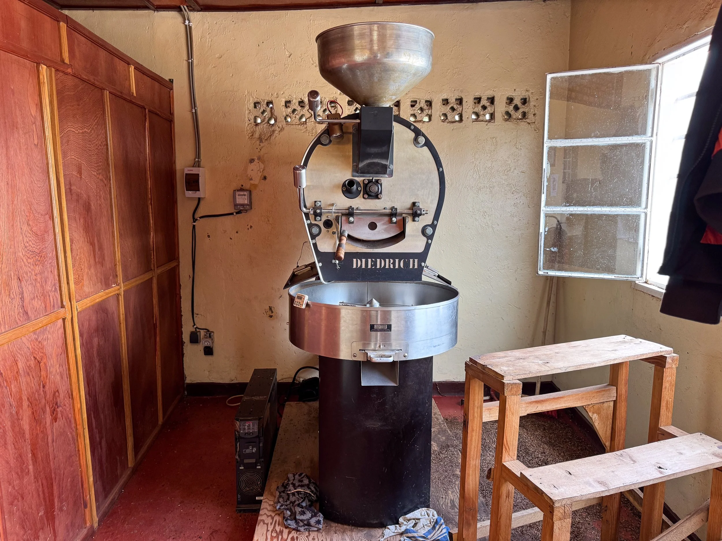
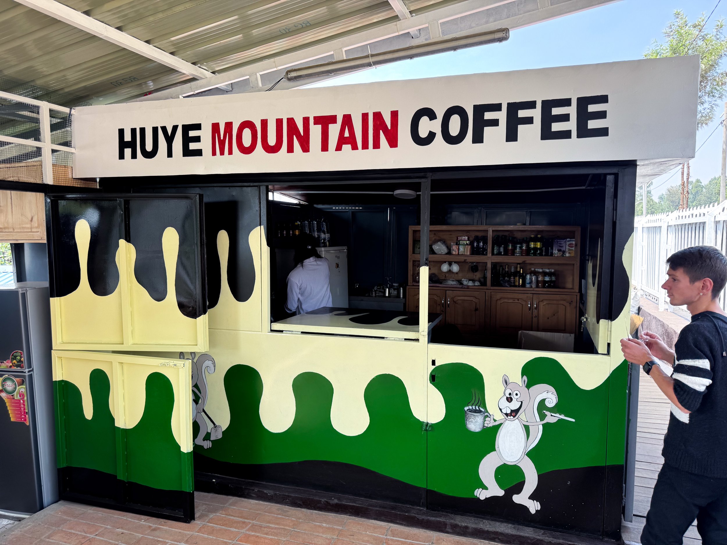
Huye Mountain Coffee. A coffee farm with over 7,000 trees, a processing factory, small roastery and roadside café. We toured the farm, learning more about the history of coffee, the farm’s organic growing methods and hand processing. Once grown and harvested, the fruits are skinned, fermented, dried and sorted into green coffee for export. The roasted coffee is only sold in Rwanda and at their café. We enjoyed a midafternoon caffeine fix before our drive back to Kigali.
Places to Eat & Drink in Kigali
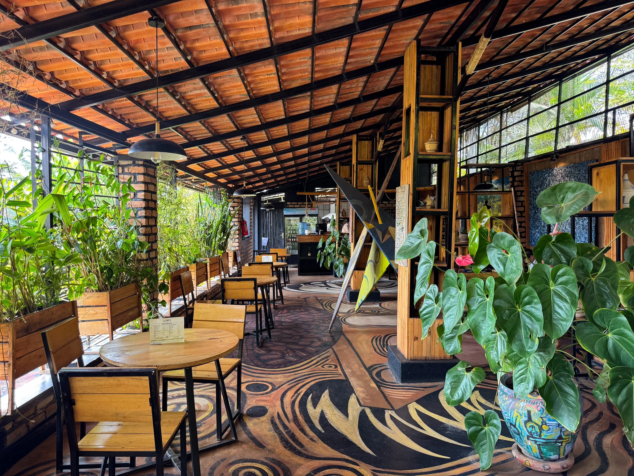
Niyo Art Café. An open air café with vibrant murals spanning the floor from the street to the interior. The dining area is decorated with patterned Rwandan textiles, sculptures, paintings and plants. Come here for coffee!
Restaurant l’Epicurien. A romantic restaurant serving traditional French dishes made using local Rwandan ingredients. The dining room is spread out amongst an atmospheric garden and indoor terrace. We enjoyed the Burgundy snails, a whole grilled tilapia and brochettes (skewers) of Nile Perch along with French wine.
Rwandan Cuisine
Ibihaza. The national dish of Rwanda. It’s a hearty one pot stew made with pumpkin, beans, bell pepper, onions and garlic.
Agatogo. A savory one pot stew made with green bananas, collared greens, spinach, tomato, bell peppers, onions and spices. It’s garnished with avocado and peanut crumble.
Brochettes. Barbecued or fried skewers of meat like beef, goat, chicken or fish.
Imvange Amashaza. Stewed peas mixed with potatoes, carrots, onions and spices accompanied by fresh avocado. It’s typically vegetarian.
Pilau. An East African rice dish cooked with a range of warm spices like cardamom, cumin, turmeric, cinnamon and bay leaves. It’s served as a side or stand alone meal.
Tree Tomato. A deep red egg shaped fruit with a tart flavor similar to raspberry. It’s eaten fresh, blended into juices and baked with pastries.
Ugali. A commonly eaten white corn or cassava flour mash used to scoop stews by hand. Roll a small lump into a ball, press an indentation in the center and scoop using your right hand.
Chapati. A type of roti used to scoop stews and curries by hand. They’re also used to make wraps and samosas.
Chips (French Fries). A common side dish served with most meals made popular by the Belgian and French colonial influences.
Rwandan Beers
Rwanda has a growing beer culture with both traditional and modern brews. We sampled a few pints.
Banana Beer. A traditional Rwandan drink made from banana juice, water, sugar, sorghum flour and yeast. It’s home brewed across the country. It’s often sold at local markets in small villages.
Akarusho. A commercial brand of banana beer. It’s described as a “sweet banana based alcoholic beverage.” It has a malty and semi sweet flavor with a hint of banana.
Virunga. The most popular craft beer in Rwanda. It comes in at least three varieties: Silver, Gold and Mist.
Silver. A light and easy drinking lager.
Gold. A flavorful lager with a subtle sweetness.
Mist. A dark ale with a nutty and aromatic flavor.
Where to Stay
Salama Village Kigali. A small homestay in a lush and quiet neighborhood of Kigali. Its rooms have shaded outdoor patios, access to a communal kitchen and a living room lounge. Reserve on Booking.
Driving in Rwanda
We loved driving in Rwanda due to freedom of exploration and getting to observe the local culture. It’s easy to get used to after the first day but like everywhere it has its pros and cons.
Pros: Most roads are double lane, smoothly paved, well maintained and illuminated at night. Cars are typically automatic. Locals drive on the right side of the road.
Cons: Roadsides become congested with people carrying goods, large trucks can cause delays, and motorbikes can be unpredictable.
Traffic Cameras. Speed limits are strictly enforced by traffic cameras across the country. Permanent cameras are located every few kilometers while hidden cameras are nestled in bushes daily by police.
Refueling. Gas station attendants refuel vehicles for you. Credit cards are typically accepted for payment.
Car Rental. We rented our car from Rent Car Rwanda. The car was dropped off and picked up from our accommodation in Kigali. The prices are very reasonable for a 4x4 SUV with insurance included. Reservations are made through WhatsApp and can be paid by card in person.
Getting Around Kigali
Move. A taxi hailing app similar to Uber or Grab. It’s specific to Rwanda and one of the best ways of getting around Kigali affordably. The app can be glitchy, with issues reaching drivers and processing payments.
Moto Taxi. Moto taxis are the local way of getting around. They’re readily available in groups along the roadsides.
Location Specifics
Language. Most people in Rwanda are trilingual. They speak their mother tongue Kinyarwanda as well as French and English. Some common words and phrases are:
Muraho (mo-rah-ho) = Hello / Bonjour
Murakoze (moo-rah-koh-zay) = Thank you / Merci
Urakoze (oo-rah-koh-zeh) = Thank you / Merci
Murabeho (moo-rah-bay-ho) = Good bye / Au revoir
Muryoherwe (moo-yo-heh-weh) = Enjoy your meal / Bon appetit
Cash vs. Card. Cash is preferred by most businesses. They accept Rwandan Franc and the US Dollar. Most places will accept credits card, but with a transaction fee.
General Safety. Kigali is one of the safest cities in Africa. People are kind, honest and respectful. We had no issues walking around by day or night.
LGBTQ+ Safety. Rwanda is one of the few African countries where homosexuality is not illegal. There are no laws against discrimination and public opinion is generally unfavorable toward same sex relationships. Read more on our article about LGBTQ+ Travel Safety.
Plastic Bags. Rwanda is serious about conservation. Plastic bags are banned across the country with strict enforcement to prevent littering. Hardly a single piece of trash litters the streets or roadsides.
The 1994 Genocide. The genocide is a horrific and recent part of the country’s past. Treat the topic with the utmost care and respect. Avoid conversations regarding people’s ethnic groups.
Pre-Airport Security Check. Before entering the airport, there is a roadside security check. Passengers have to pass through metal detectors while their bags are scanned or sniffed by dogs. It’s common practice in East Africa.
For Next Time…
Gorilla Trekking in Volcanoes National Park. Traveling on a budget, we prioritized seeing Rwanda’s other primates. When we return, visiting the gorillas will be top of mind.
Volcano Hiking. We plan to hike at least one of the volcanoes in the Volcanoes National Park bordering Rwanda, Uganda and the Democratic Republic of the Congo like Mount Bisoke and its crater lake as well as Mount Sabyinyo and the tri-border point.
Lake Kivu. Rwanda may be land locked but it’s flanked by one of Africa’s Great Lakes, Lake Kivu. Its shores are ideal for hiking, bird watching and water sports.
Safari in Akagera National Park. Having gone on safari in Kenya and Tanzania on our trip through East Africa, we opted out of going on safari in Rwanda. Next time we return, we plan to visit Akagera National Park to see its landscapes and wild game.

Western Australia Road Trip: Perth to Ningaloo & The Coral Coast
Road trip along Western Australia's Coral Coast where red desert landscapes, remote gorges, sandstone cliffs and white sand beaches create an unforgettable adventure.

The Coral Coast, Western Australia
The Coral Coast stretches for more than 1,000km along the Indian Ocean in Western Australia. The coast is famed for its remote towns, rugged landscapes, steep gorges, picturesque hikes, white sand beaches, turquoise waters and coral reefs. It’s a habitat for free roaming wildlife like kangaroos and emus as well as marine life like sea lions, sea turtles and manta rays.
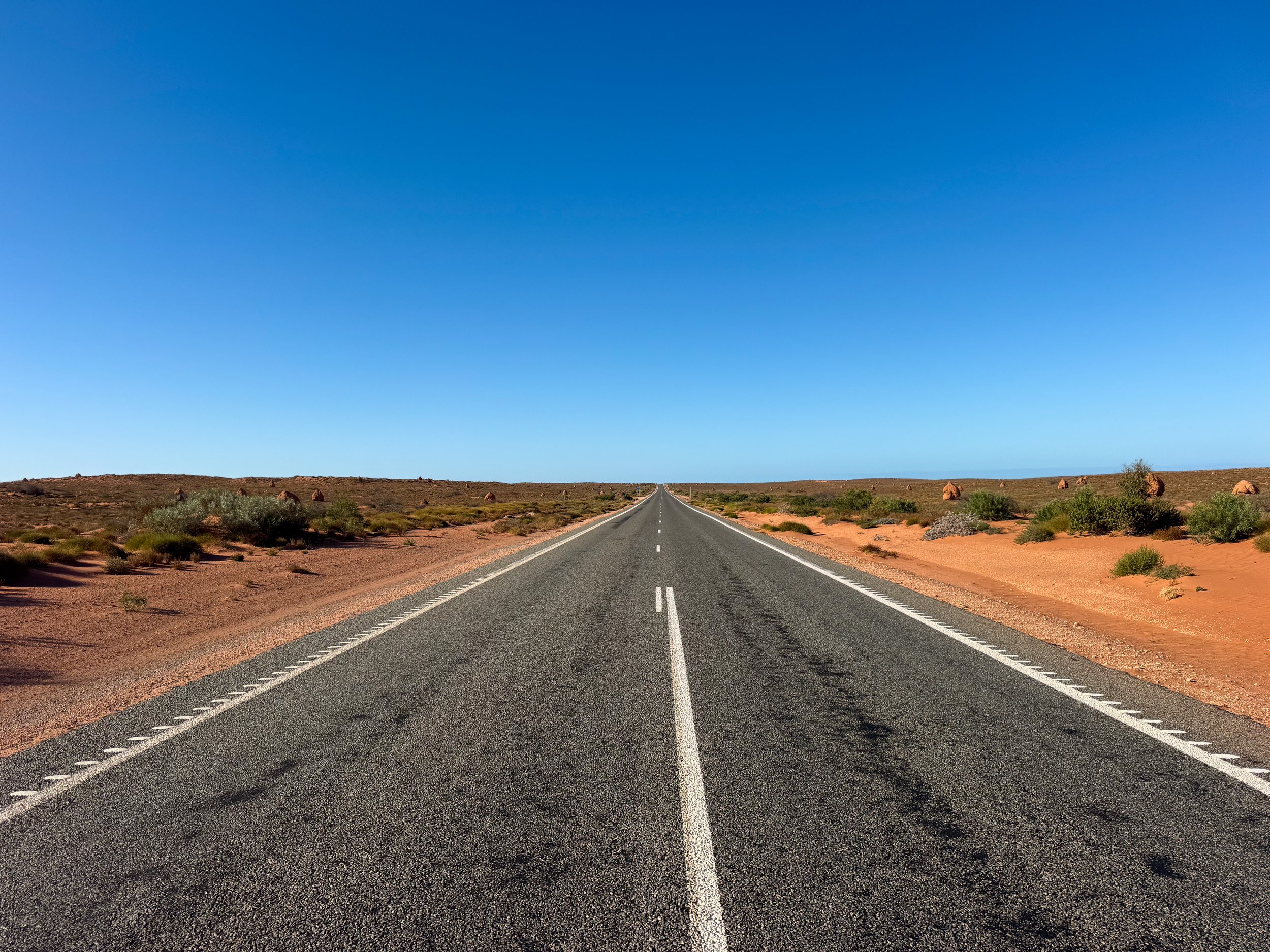
An Aussie Roadtrip
The best way to experience The Coral Coast is by renting a car and roadtripping! We spent two weeks driving from Perth to Ningaloo with stops in Cervantes, Jurien Bay, Kalbarri, Francois Peron, Carnarvon, Geraldton and Yanchep. In total, we covered over 4,000 kilometers there and back.
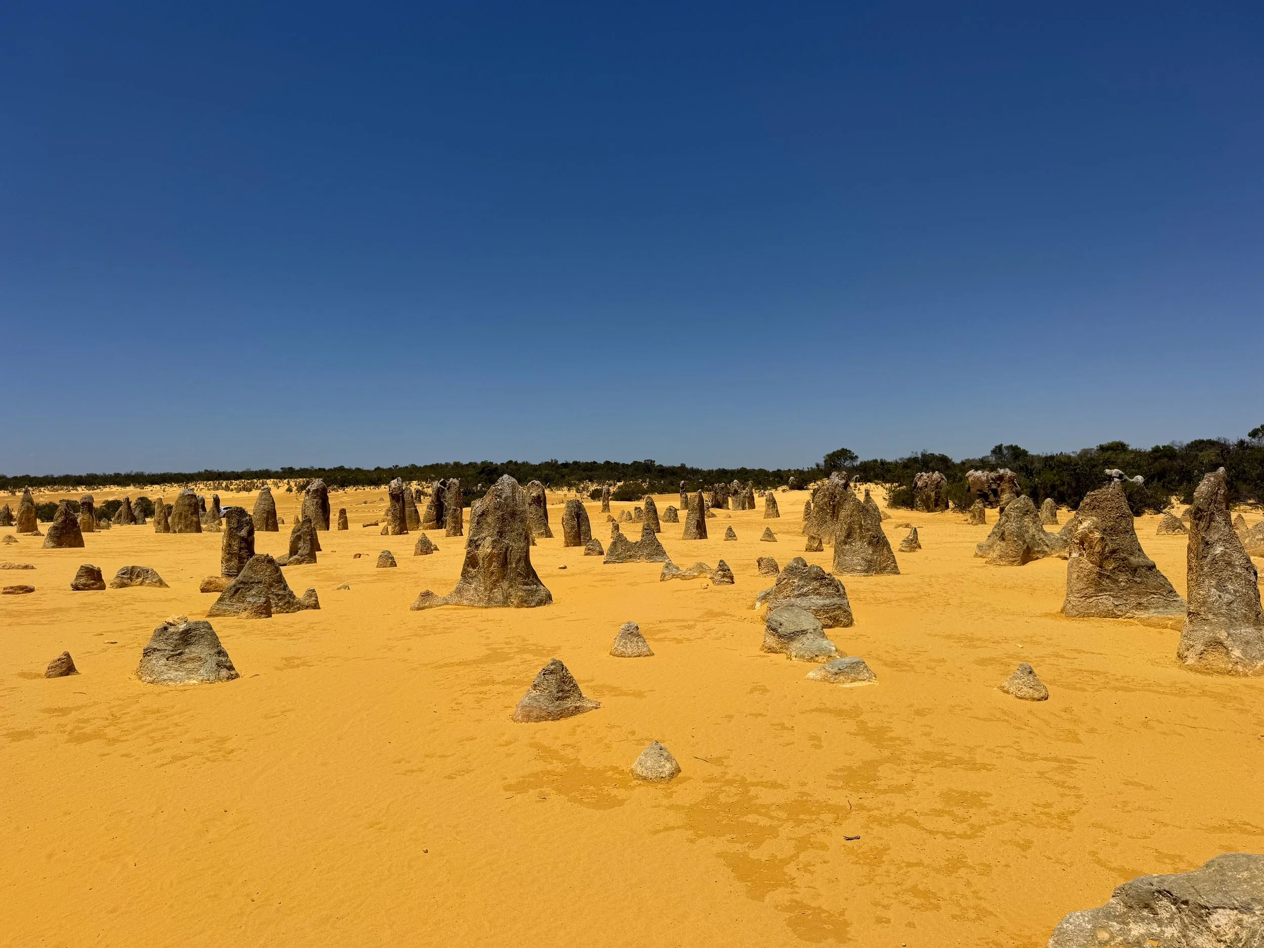
Cervantes (Day 1)
Cervantes is a small village known for its lobster fisheries and natural sights including stromatolites and desert rock formations. It’s located about 200km north of Perth and 25km south of Jurien Bay.
Pinnacles Desert. A bright yellow sand desert covered in vertical limestone rock formations known as The Pinnacles. Foot and drive trails weave through the unusual landscape past the jagged and eroded rock structures. The Desert View Walk loops 1.5km through the desert with close up views of the Pinnacles and lookouts of the landscape. Follow trail markers with an emu footprint stamped on a post. The Drive Trail leads 4.5km through the scenic desert to distant areas. It does not require a 4x4.
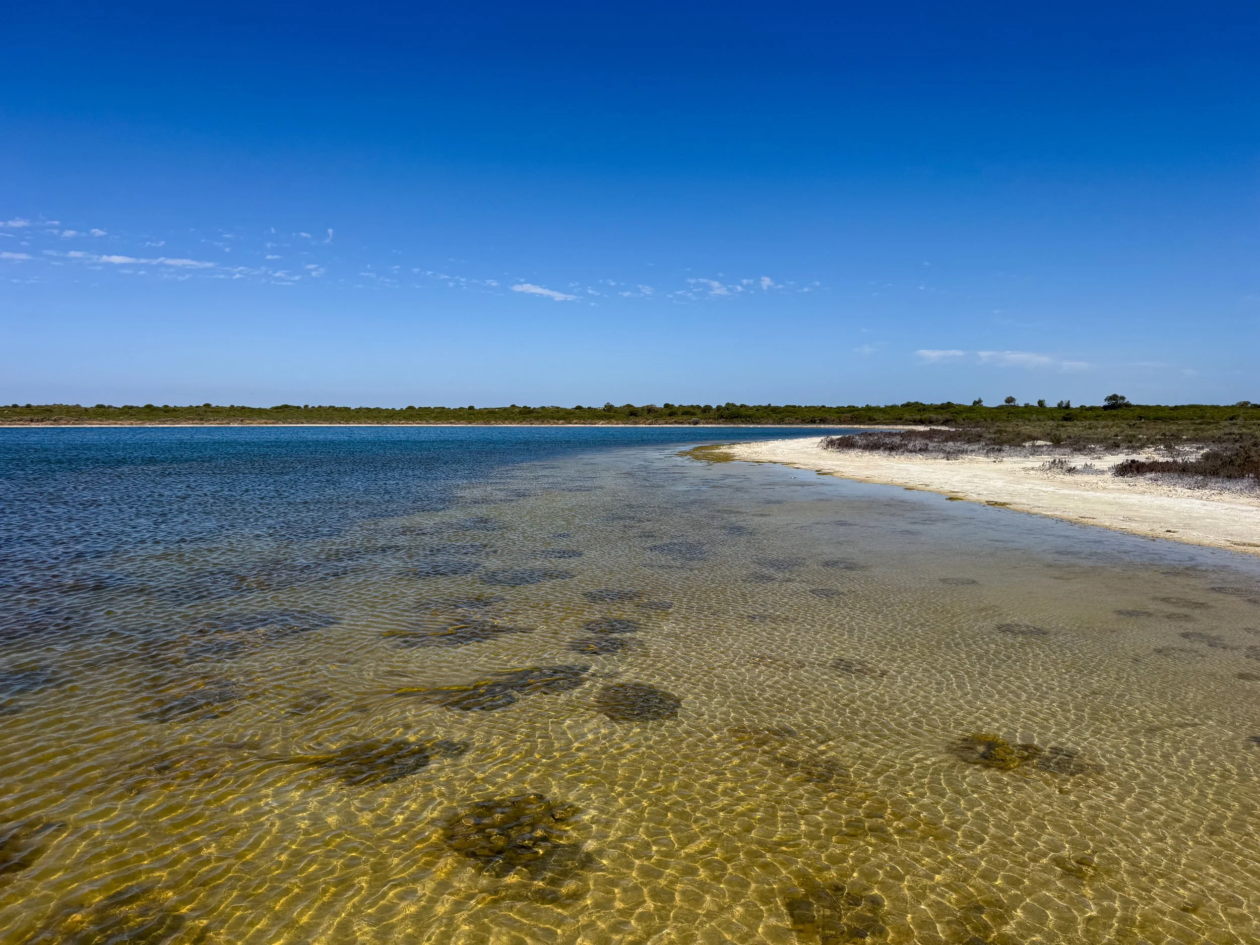
Lake Thetis. A lagoon home to some of the planet's earliest lifeforms, stromatolites. A boardwalk leads to the lake's edges with views of the stromatolites, while a nature trail continues along the bushland around its perimeter. Kangaroos can frequently be spotted lounging in the grasses and curiously looking around.
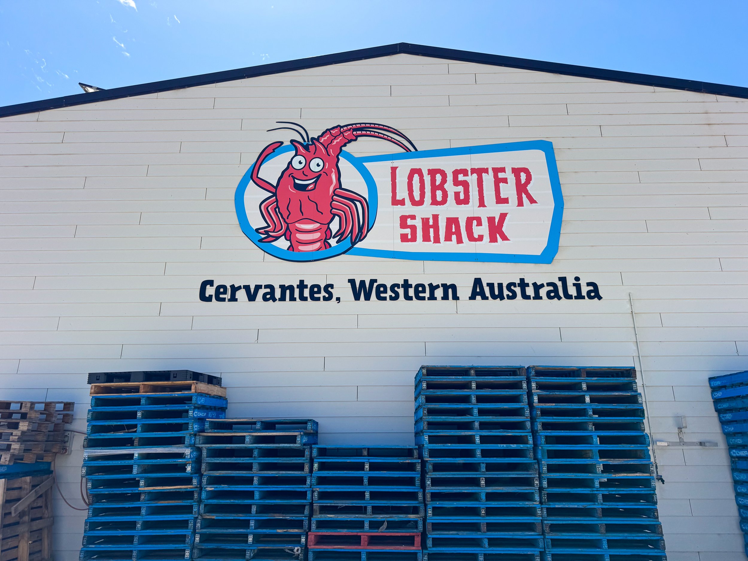
The Lobster Shack. A lobster fishery and restaurant specializing in all types of fresh caught seafood and lobster. It’s recommended as an obligatory stop by locals. Their menu features full or half lobsters, lobster rolls and lobster chowder. Dine in their ocean view patio watching for dolphins.
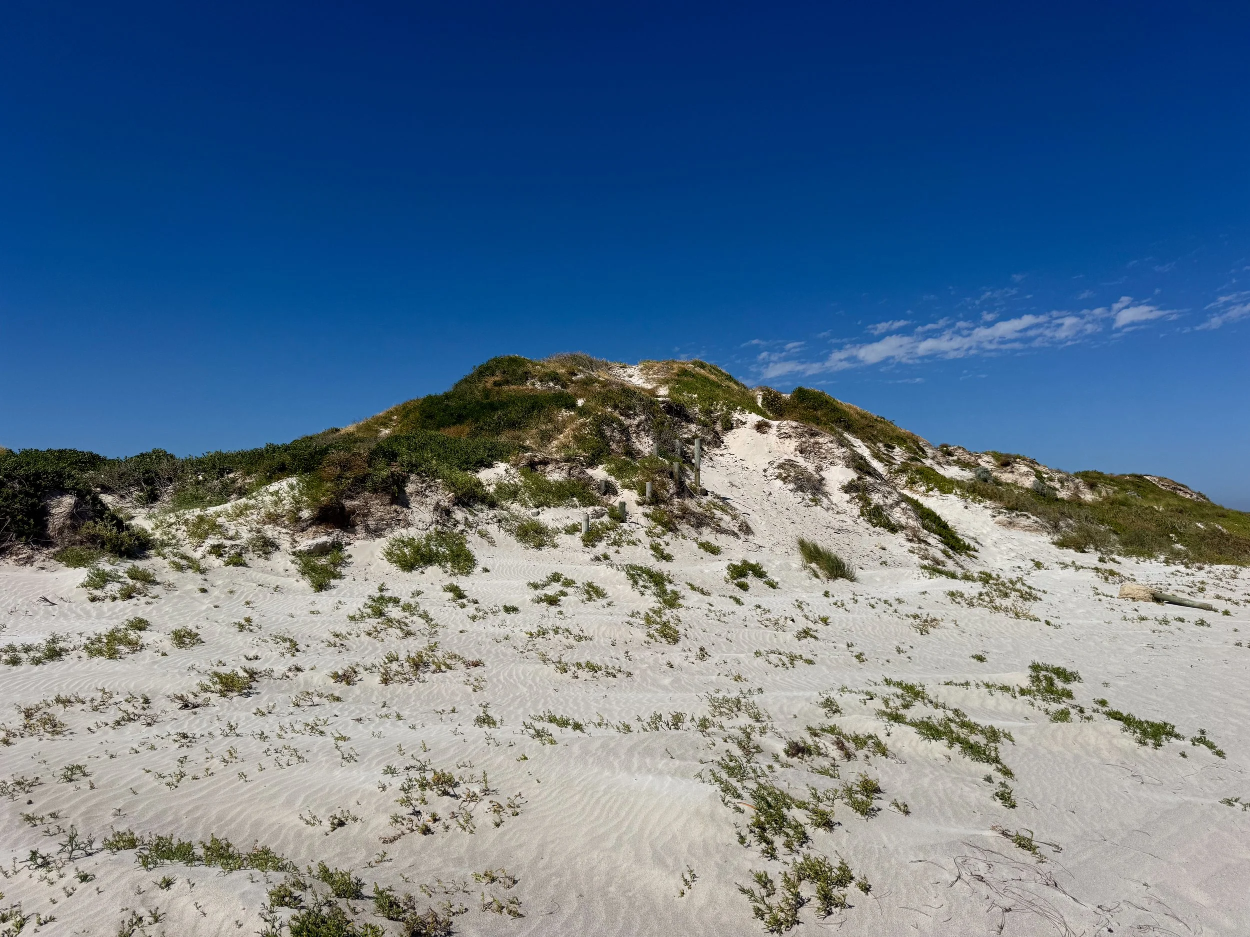
Thirsty Point Lookout. A white sand beach with views of the emerald hued Indian Ocean. A nature walk leads through the point’s grassy dunes.
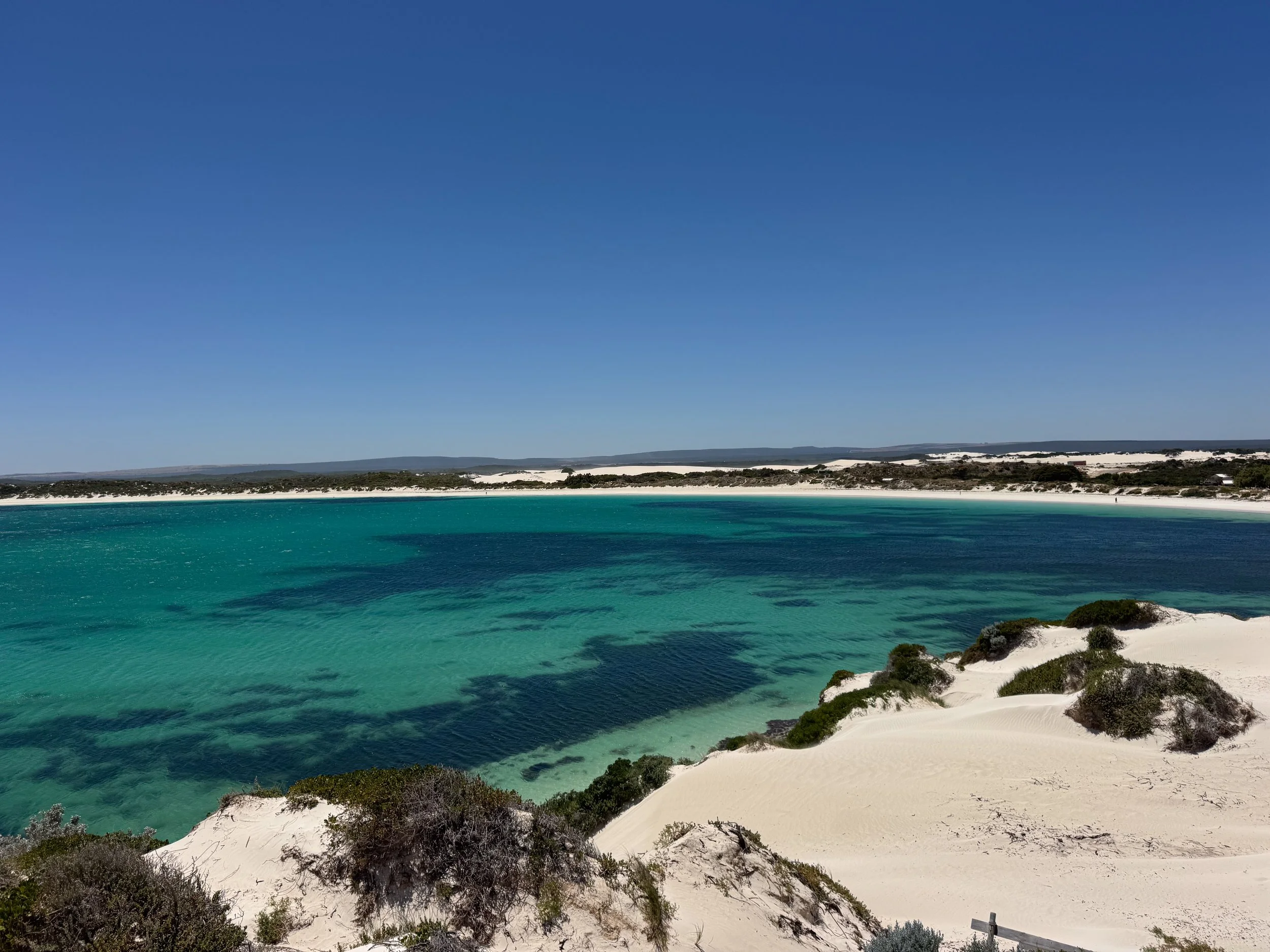
Jurien Bay (Day 2)
Jurien Bay is a coastal town home to colonies of endangered sea lions, crescent shaped white sand beaches and turquoise ocean waters. It’s located about 25km north of Cervantes and 200km south of Geraldton.
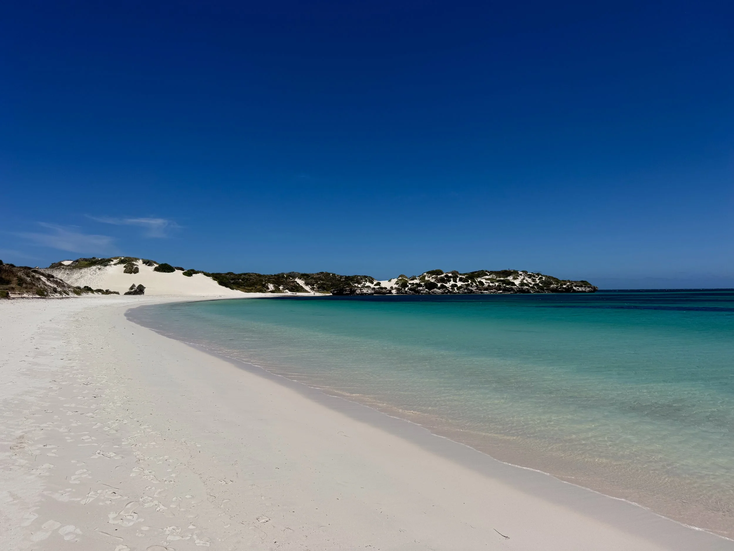
Sandy Cape Beach. A powdery white sand beach hugged by turquoise blue waters. The beach is nestled in a hook shaped cove surrounded by sand dunes and coastal vegetation. A trail leads to a lookout point with views of the coast and ocean. We spotted emus in the nearby bush. There is a popular campground lining the beach. Sites can be reserved using a QR code posted on signs.
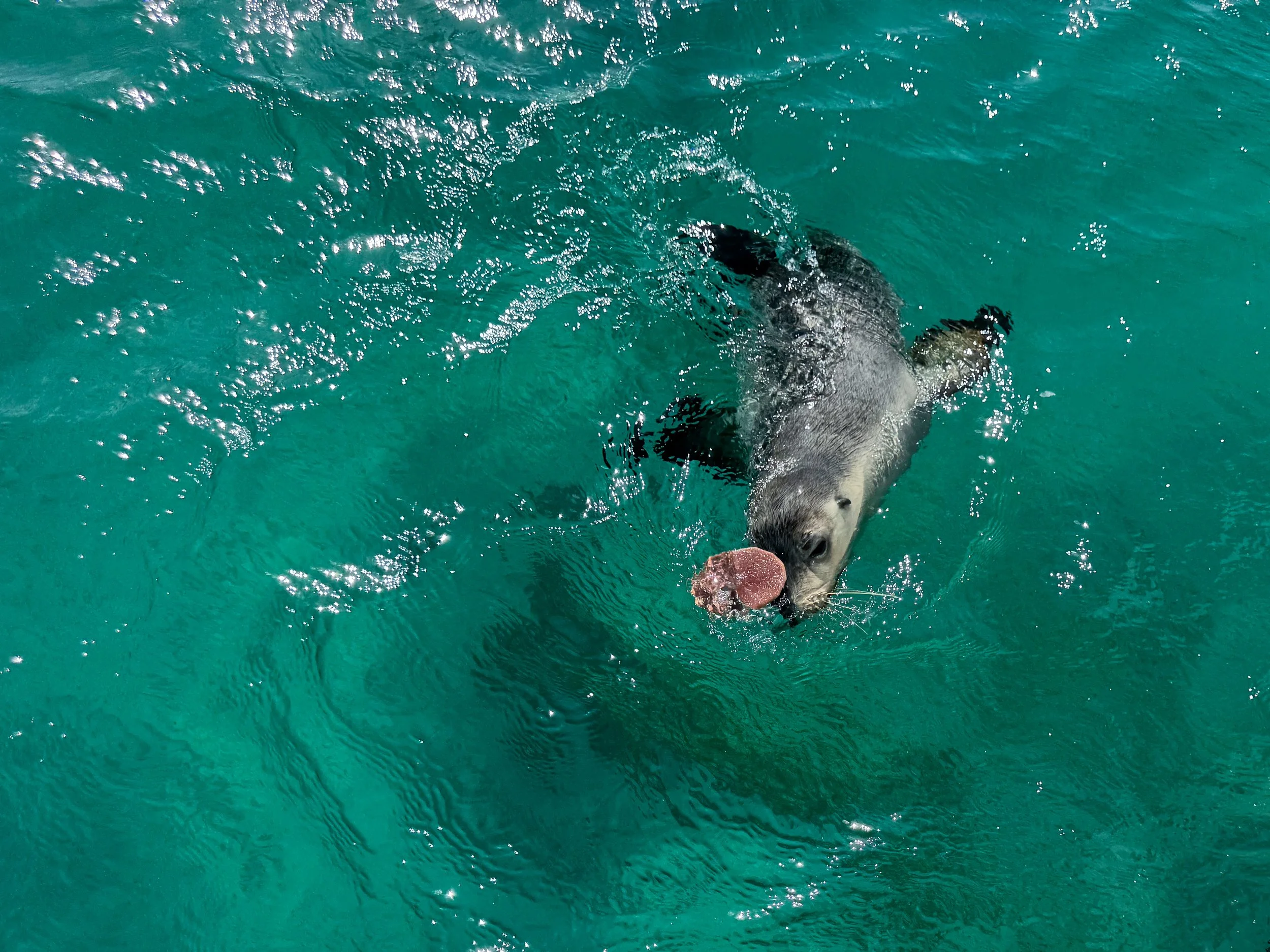
Sea Lion Pup Snorkeling. The protected waters of the Jurien Bay Marine Park are home to colonies of endangered sea lions. We boated out to a shallow reef surrounding a small island. Playful sea lion pups frolicked onshore and dove into the water to greet us. A pup with the zoomies twirled past and later returned with a sand dollar balanced on its head as a present. A giant male swam by, offering us his best side eye. Elsewhere in the reef we spotted starfish, octopus and puffer fish. Book a morning tour with Turquoise Safaris Sea Lion Tours.
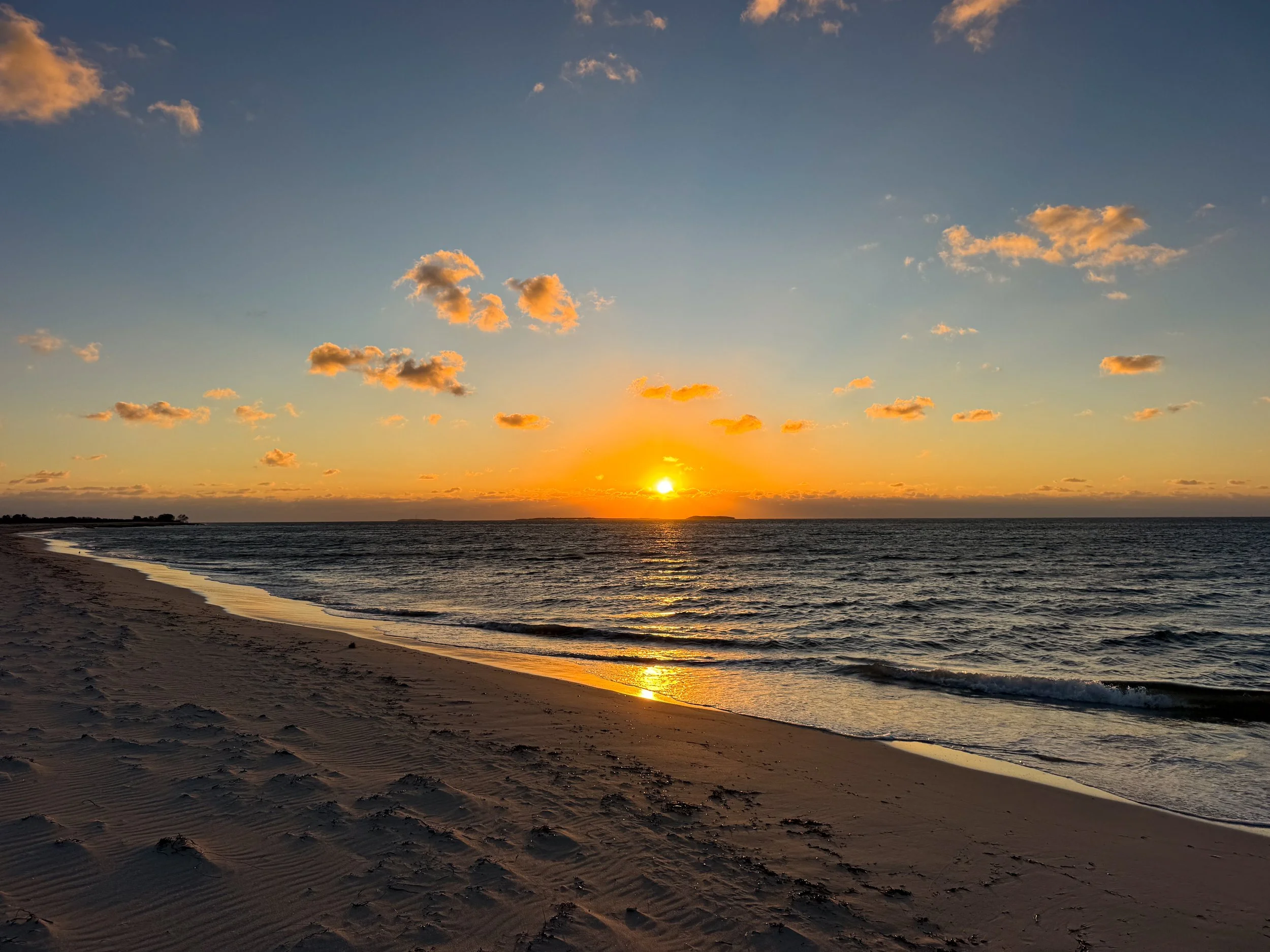
Jurien Bay Jetty. A small oceanfront pier in the center of Jurien Bay with sunset views, coastal walking paths and a beach café.
Places to Eat, Drink & Stay
Jurien Bay Seafood. A seafood restaurant and fish monger with a robust menu and daily caught specials. Come here for everything from barramundi fish & chips to squid burgers or Aussie oysters.
Bay Bakery Café. A local spot for meat pies, vegetarian pasties, sweet baked goods and fresh breads. Come here for an early morning breakfast or afternoon snack.
Jurien Bay Hotel. A hotel with apartment style rooms and sea view balconies in the heart of town. It’s located less than 5 minutes from the beach and most restaurants. Reserve on Booking.
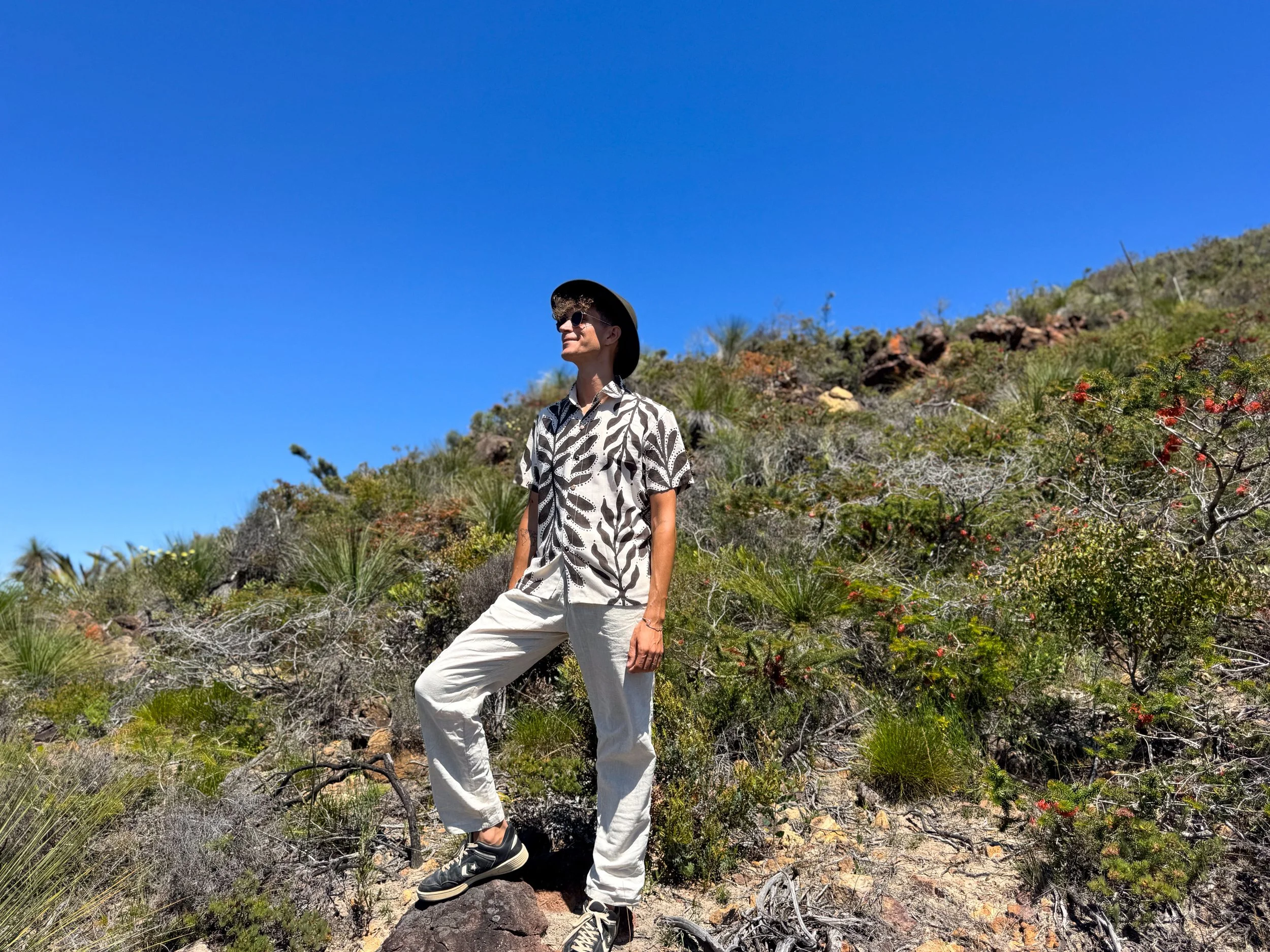
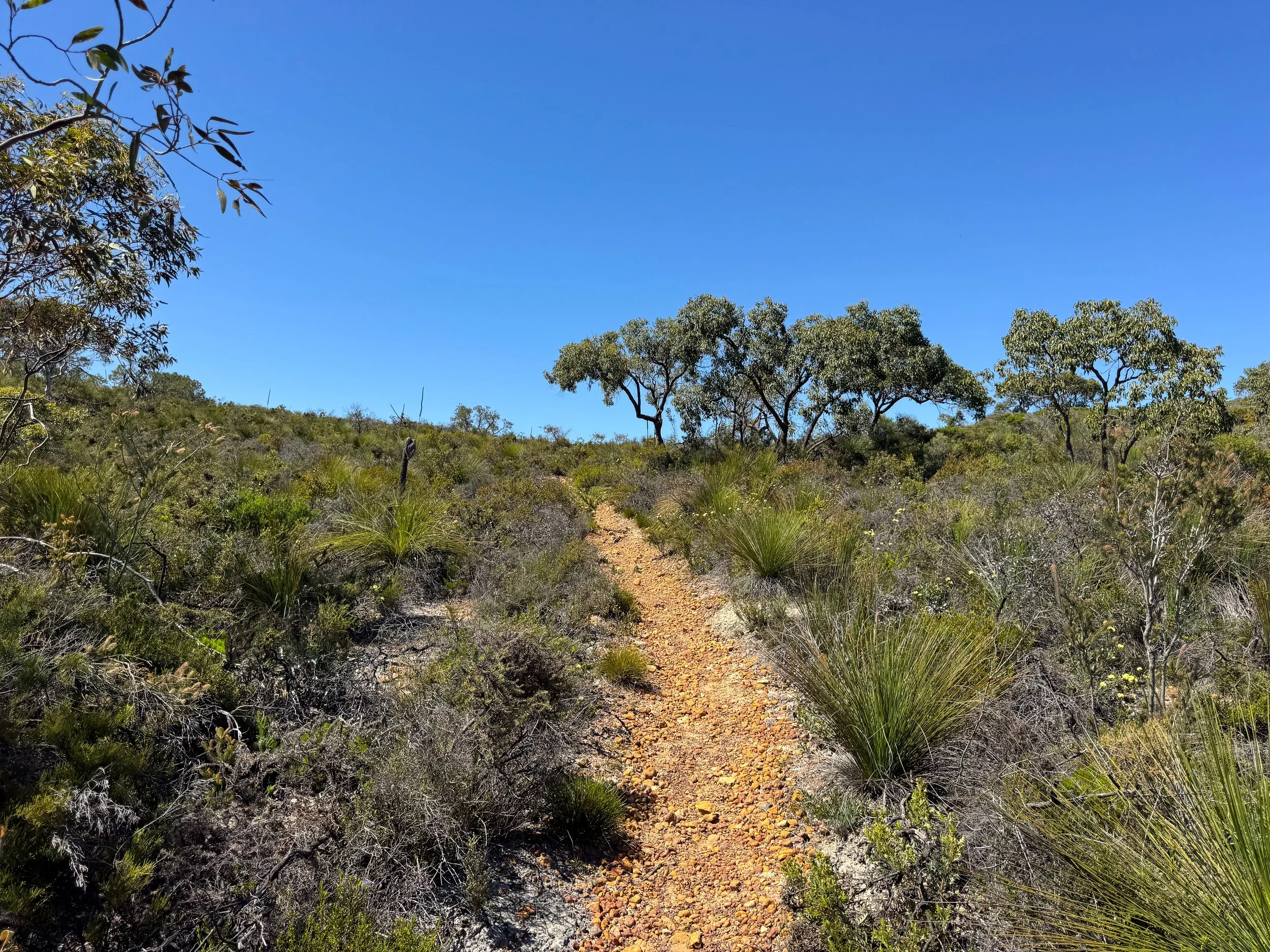
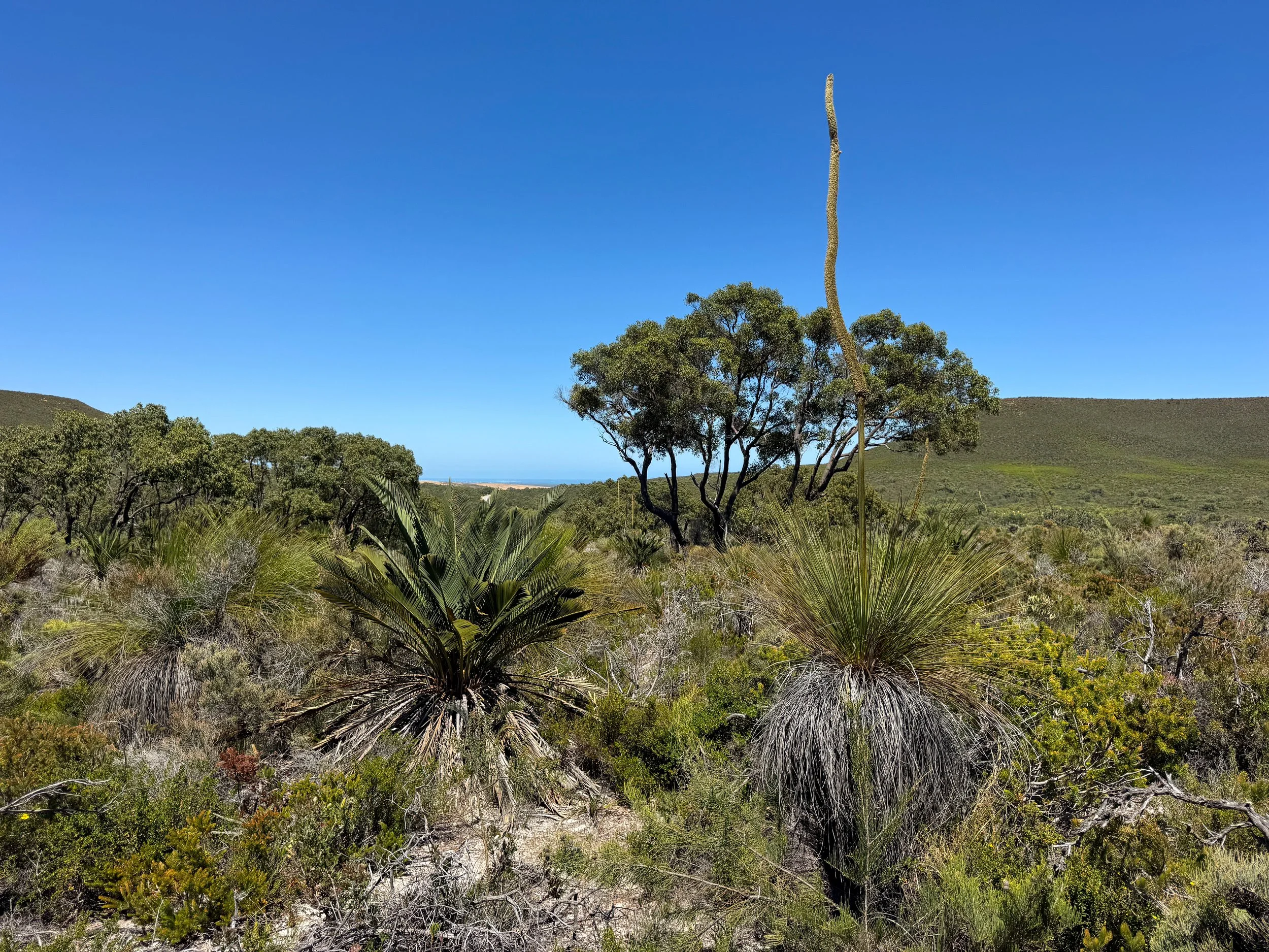
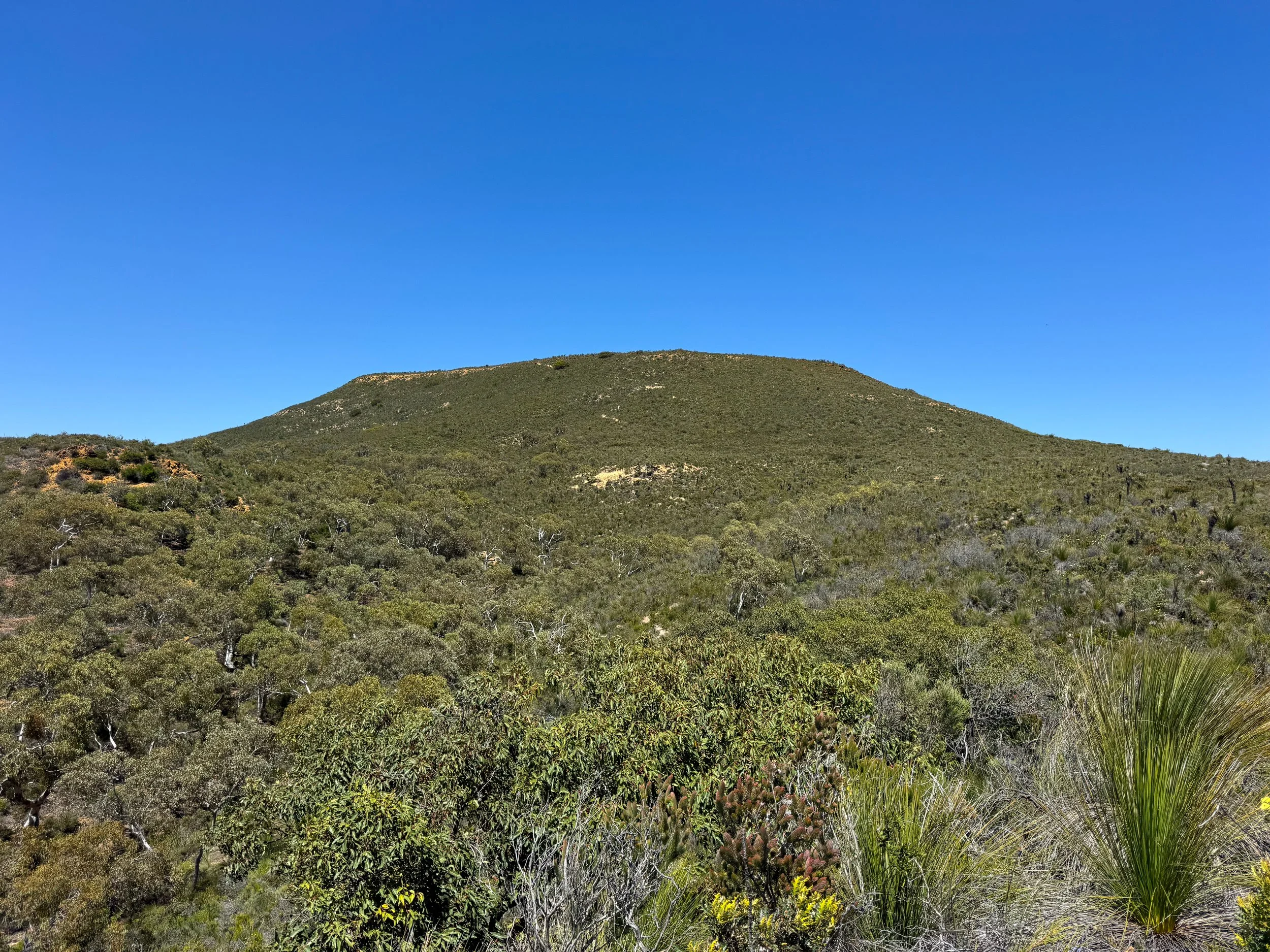
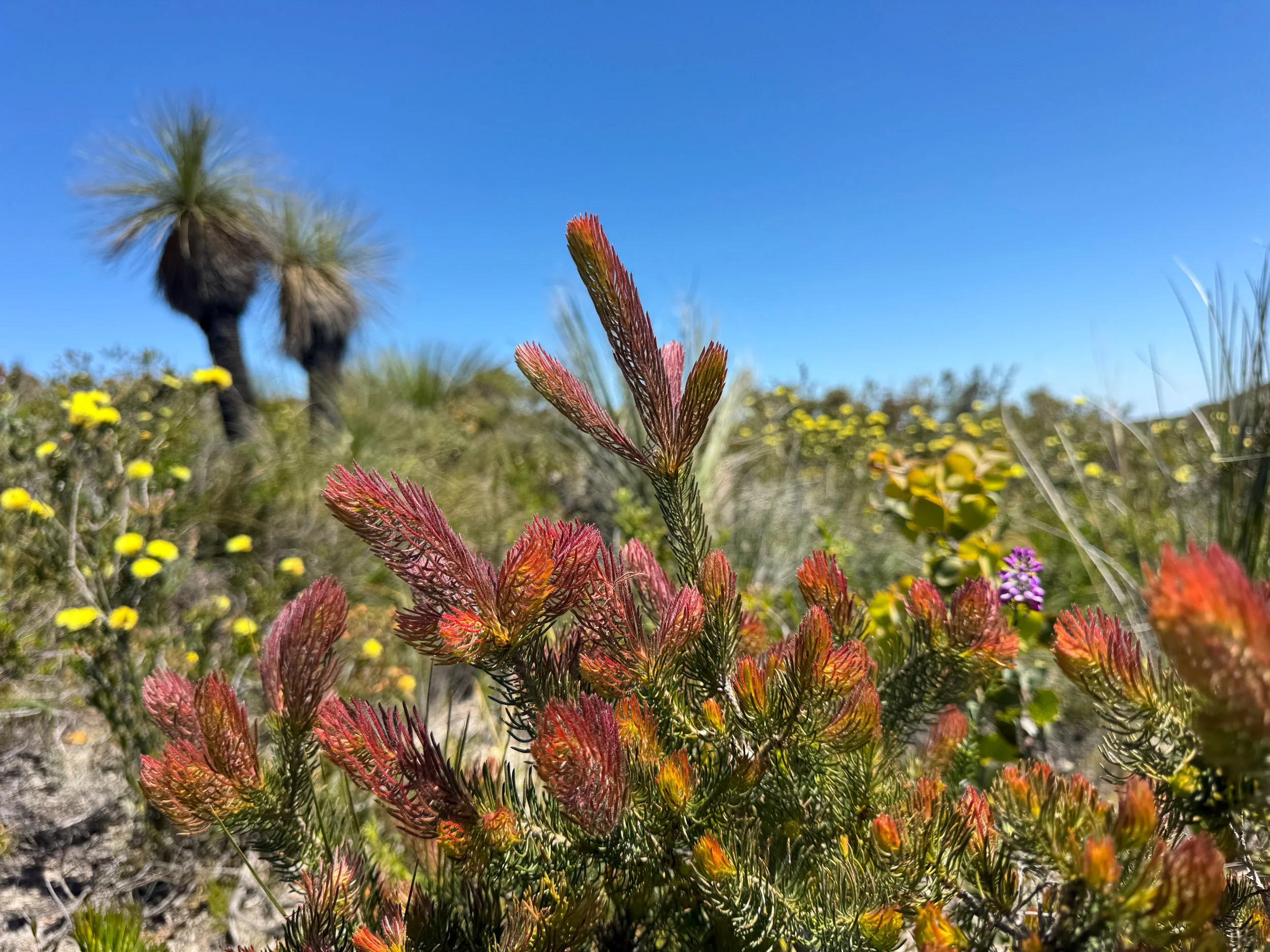
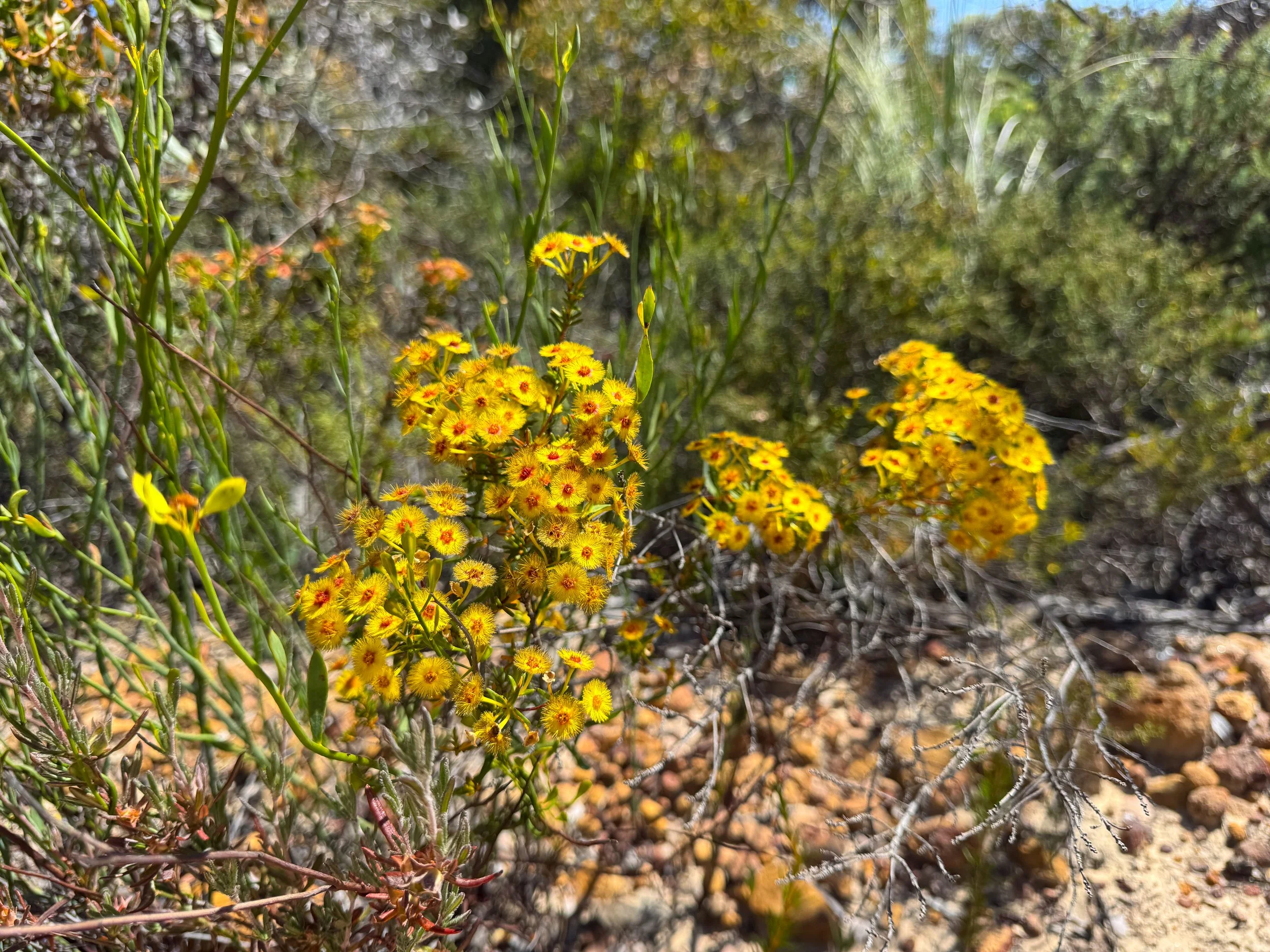
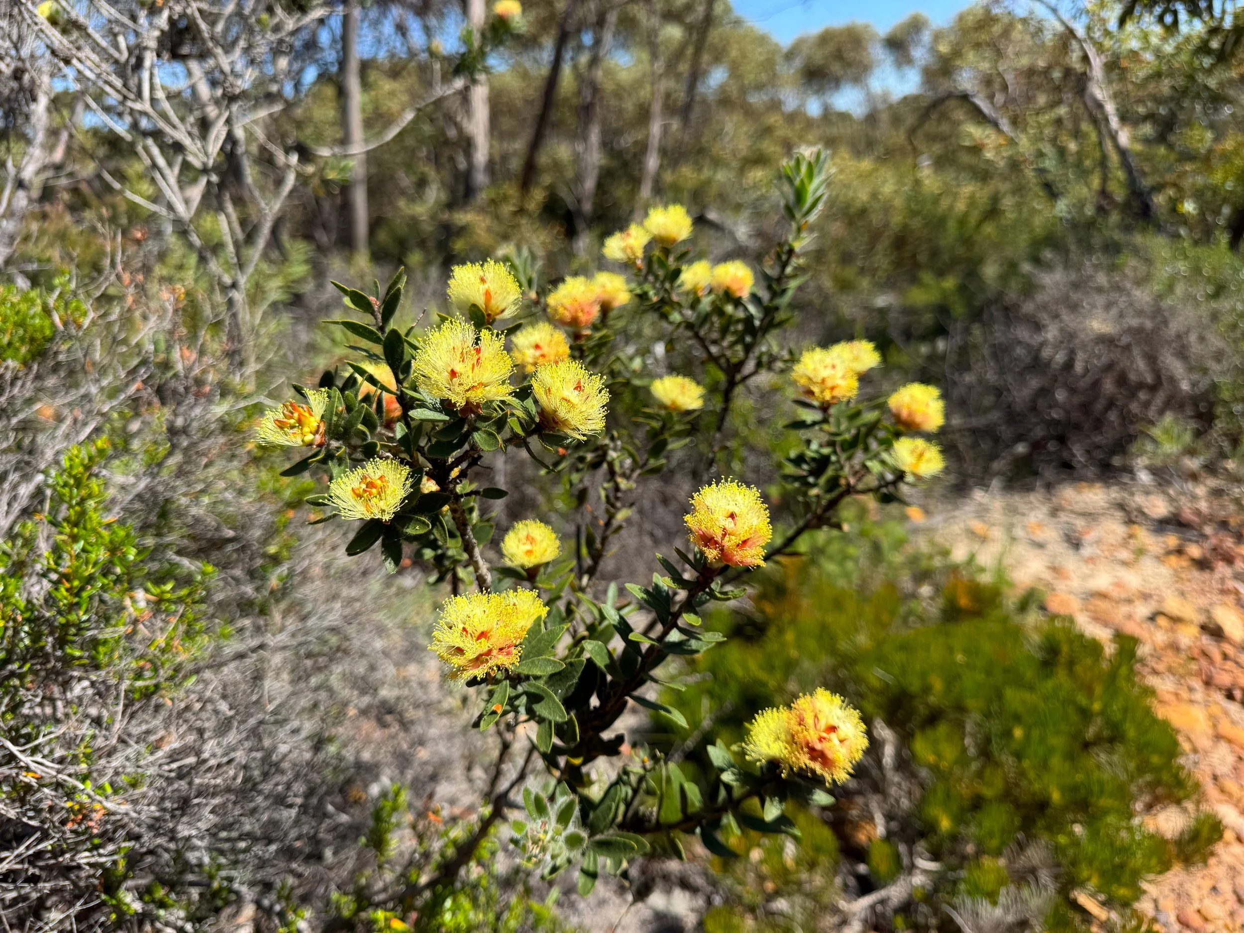
Lesueur National Park (Day 3)
Lesueur National Park is a biodiverse reserve with trails and a scenic drive. It’s famed for its seasonal wildflower blooms between August and November. It’s accessible from Jurien Bay.
Hike the Gairdner Trail, a 5.1km loop trail through the hilly landscape. A white sand and orange gravel trail leads past native grasses, bushes, pines and types of funky shaped and colorful wildflowers.
The Mt. Lesueur Trail forks from the Gairdner Trail leading to the park’s highest point. It’s another great trail to spot seasonal wildflowers with identification placards.
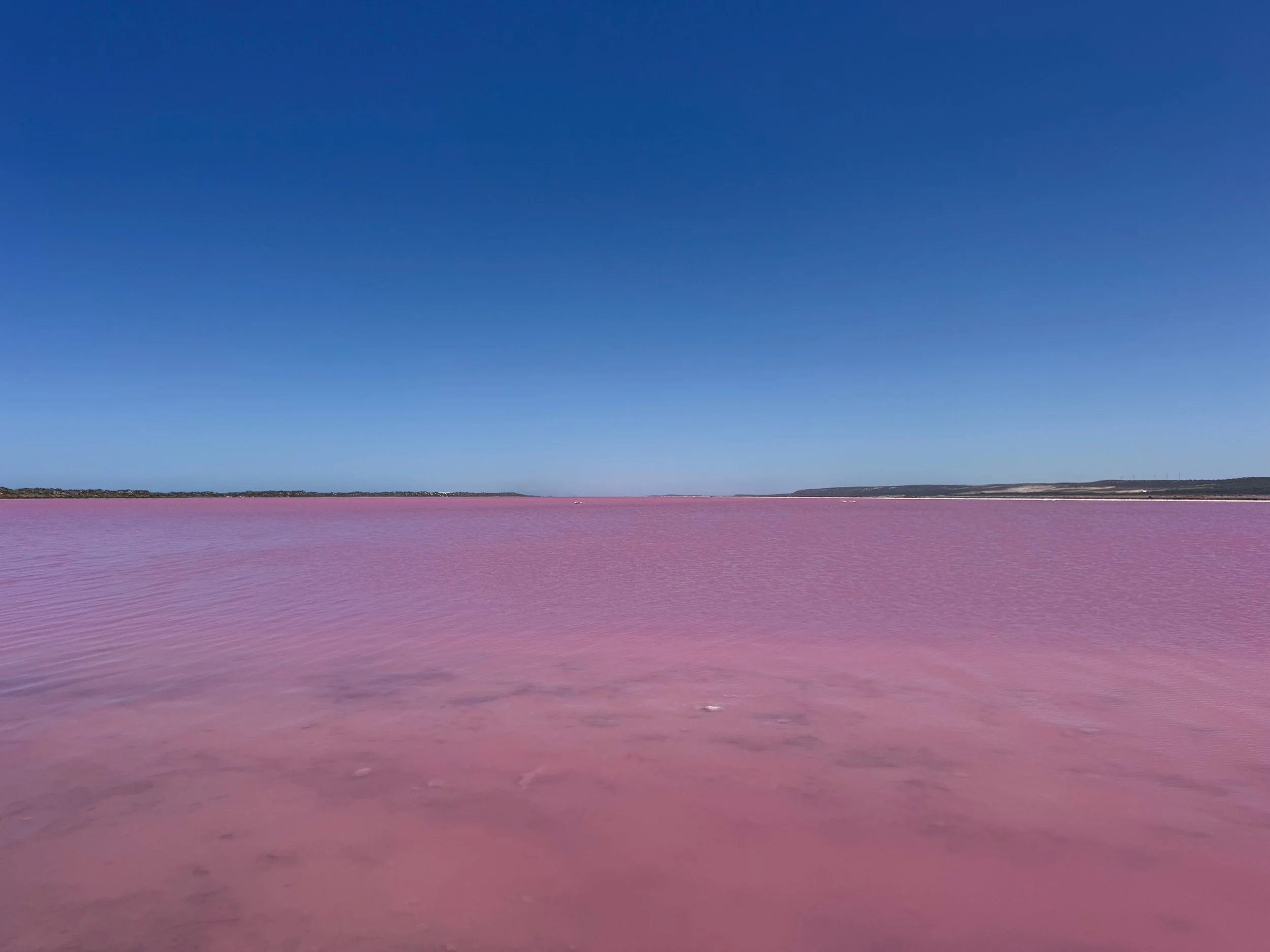
Kalbarri (Day 4)
Kalbarri is a remote region of Western Australia famed for its coastal sandstone cliffs, picturesque beaches, bush hiking trails and dramatic river gorges. It’s located about 350km north of Jurien Bay and 375km south of Denham.
Hutt Lagoon (Pink Lake). A pink saltwater lagoon stretching across the Outback landscape. Its colors range from bubblegum pink to hot pink depending on the lighting conditions. Visit during the middle of the day when the sun is high. It’s located 45min south of Kalbarri. Visit the Pink Lake Lookout.
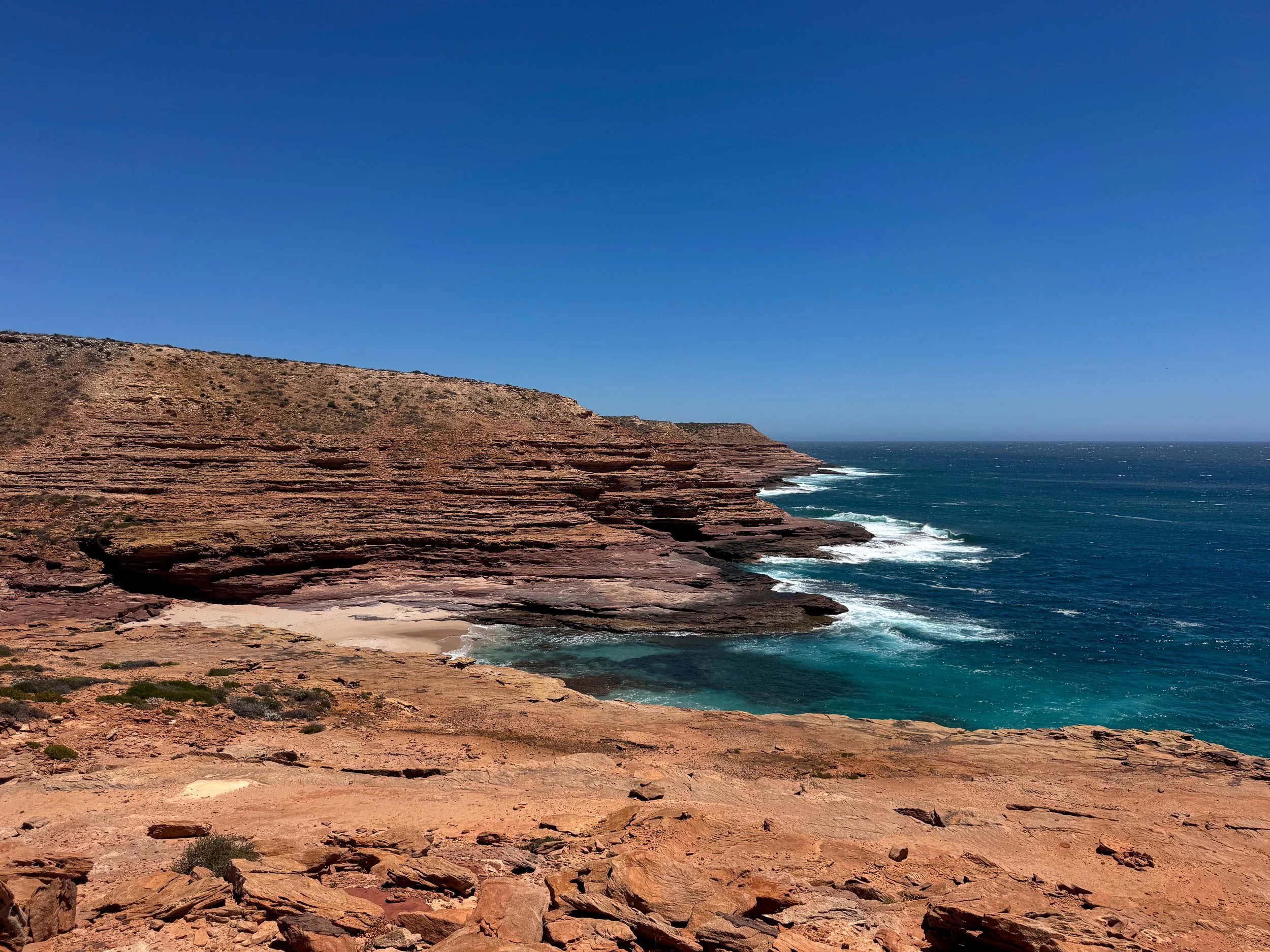
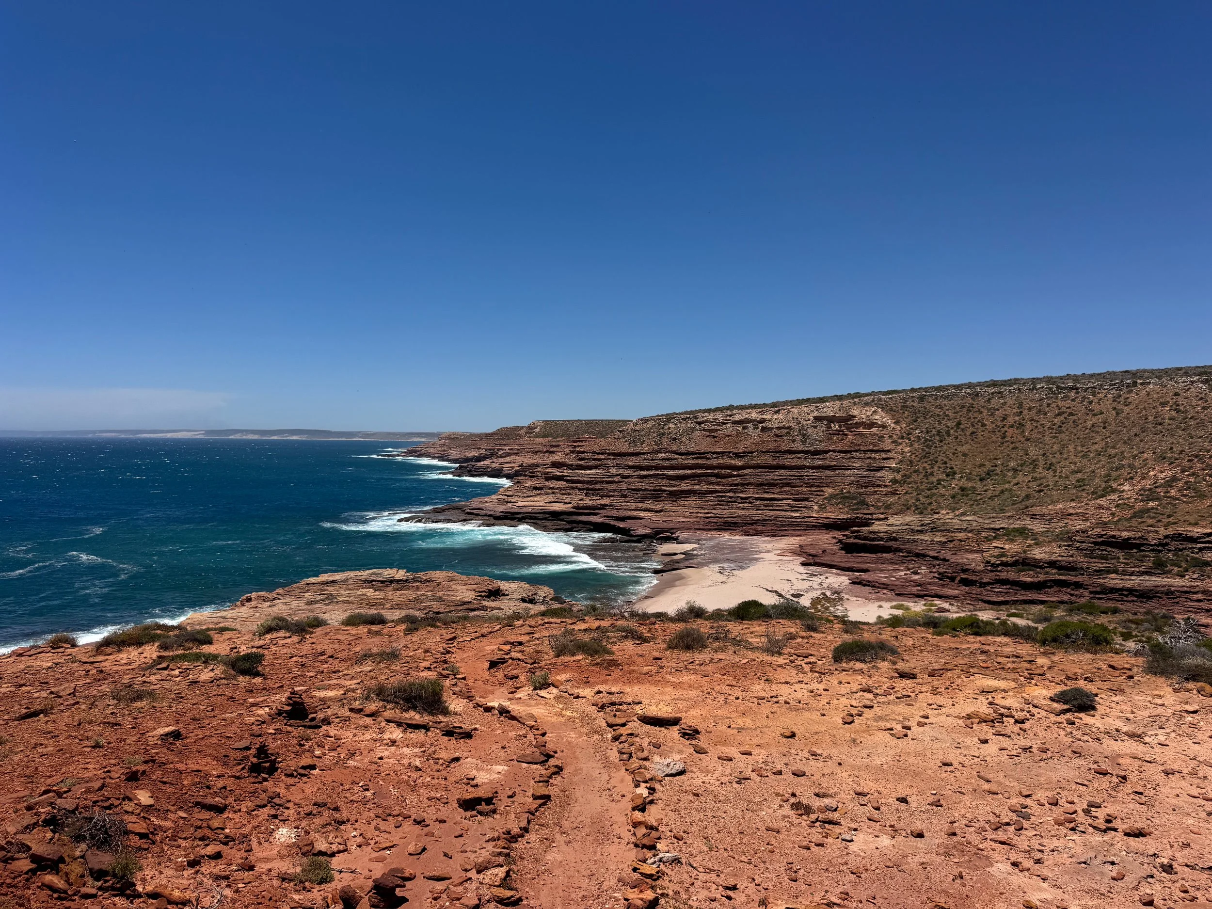
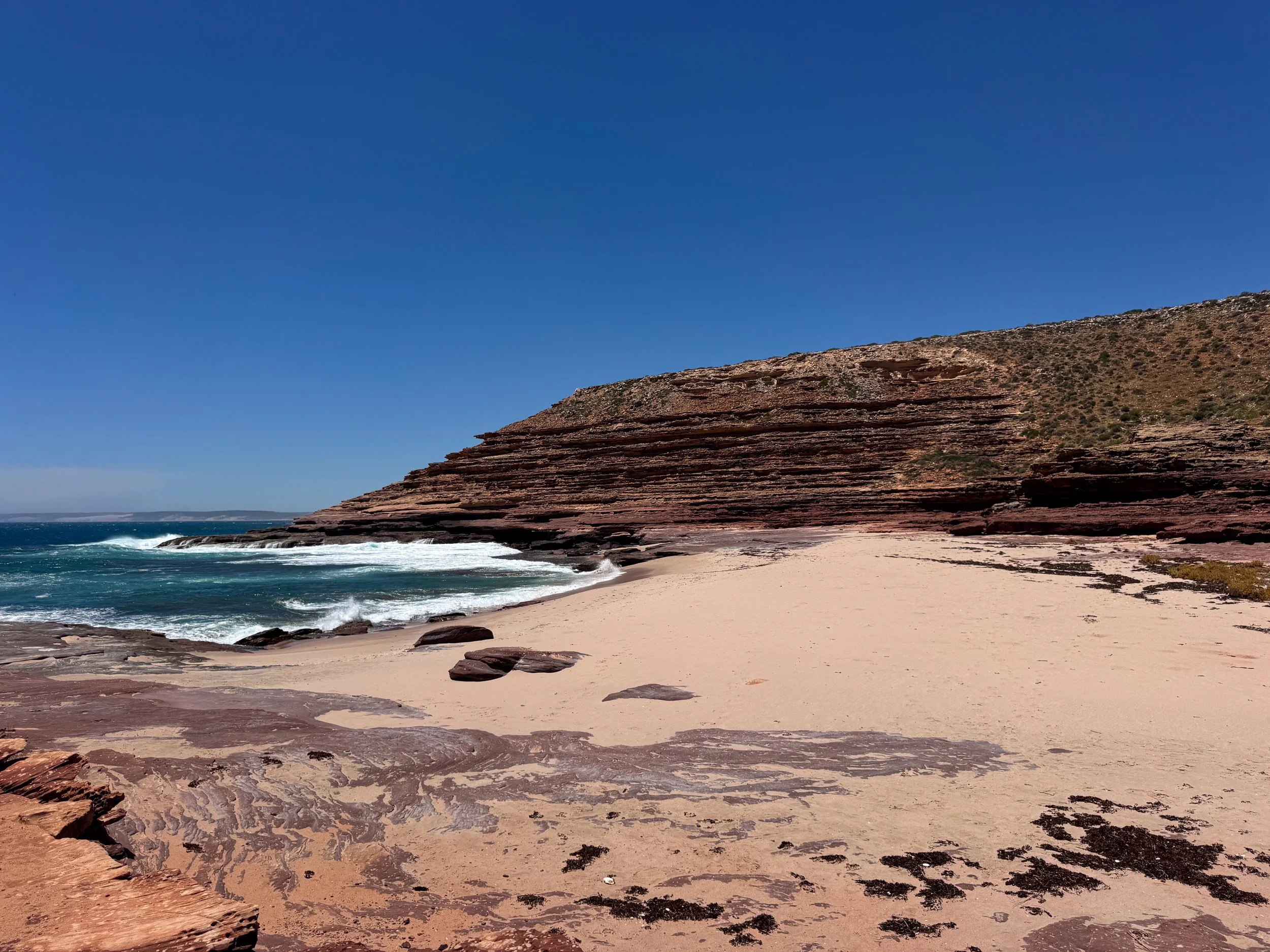
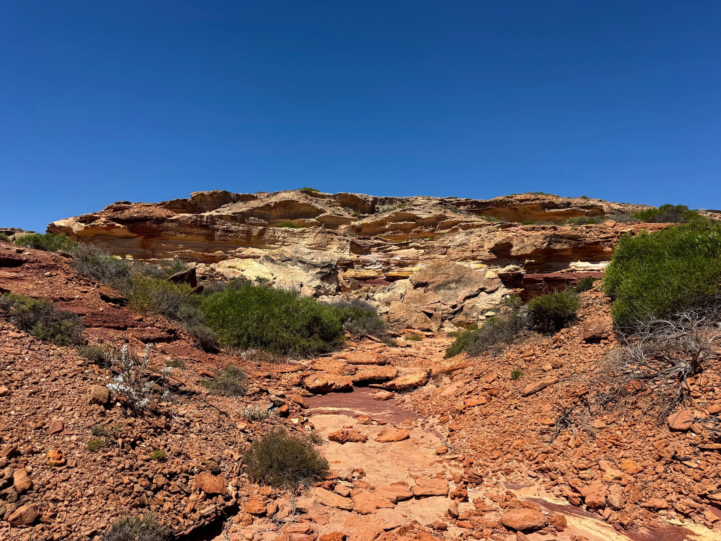
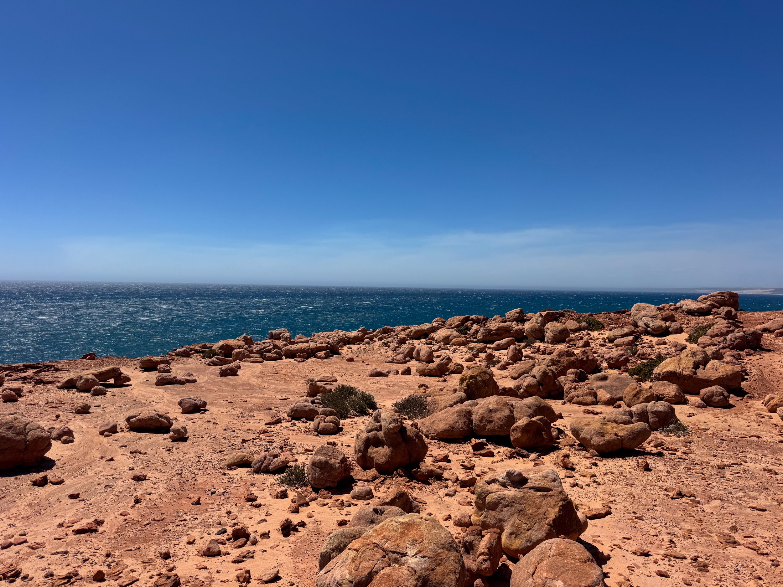
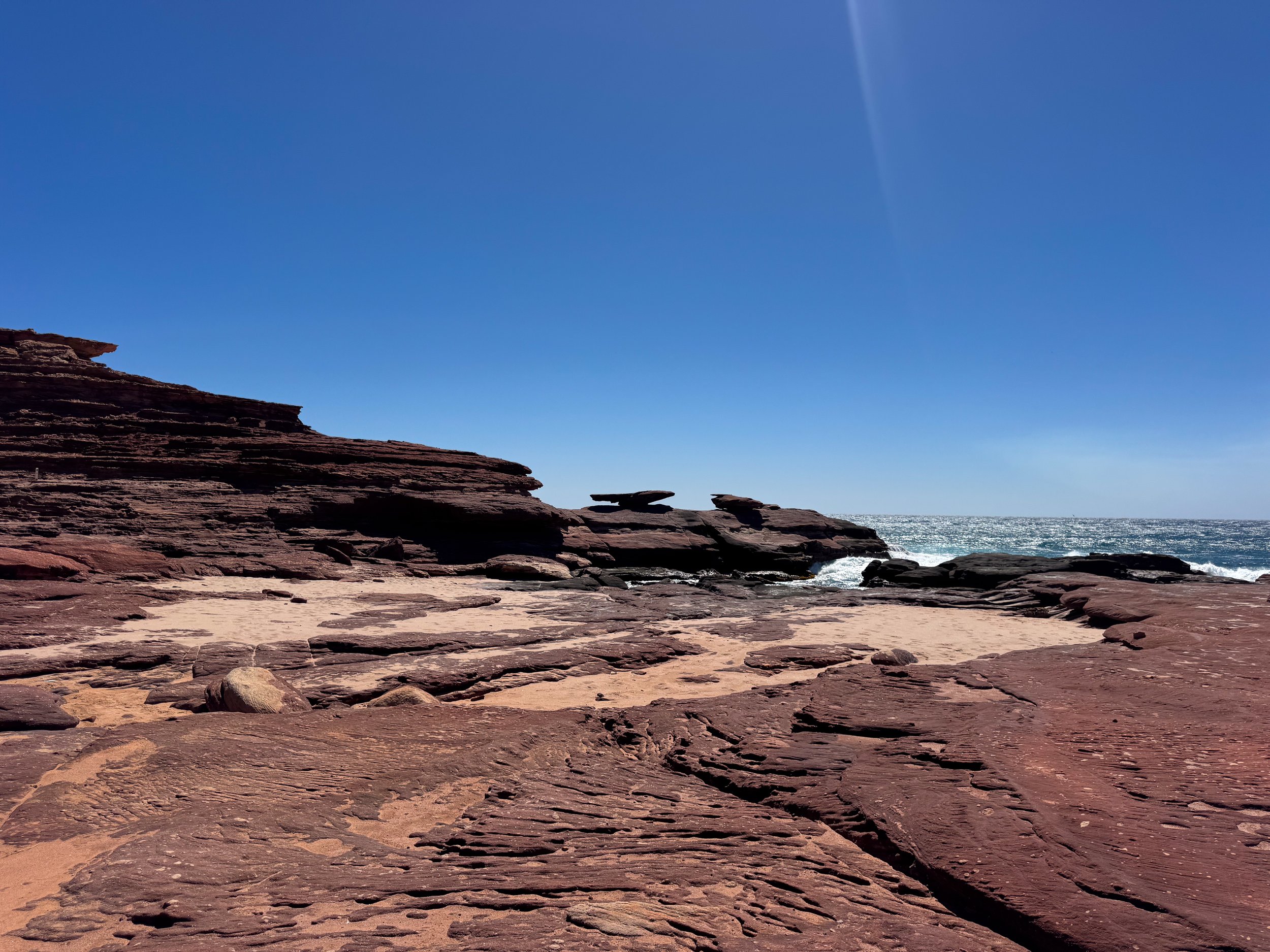

Kalbarri Coastal Lookouts. Kalbarri’s coast is connected by a series of sandstone cliffs, remote beaches, lookout points and hiking trails.
Eagle Gorge Lookout. A coastal lookout of red sandstone cliffs juxtaposed against the deep blue ocean. A trail leads through the bush to the lookout point and continues to a tan sand beach flanked by layered cliffs.
Pot Alley. A coastal lookout with views of rugged sandstone formations, layered cliffs and the turbulent ocean. A trail leads through a rocky gully to a tan sand beach below.
Rainbow Valley Loop Hike. A 1.5km trail looping through the ancient coastal landscape and layered cliffs. The trail passes fossilized pipe rocks created by organisms over 400 million years ago. It’s named after its colorful sandstone formations, varying in shades of tan, ochre, orange, red and maroon.
Mushroom Rock. A flat rock balanced on a narrow stone base resembling a mushroom. It’s reachable midway on the Rainbow Loop Trail and from the Mushroom Rock Carpark.
Red Bluff Lookout. A coastal lookout of the red sandstone coast, ferocious ocean waves and bushland. A trail continues further from the lookout to Red Bluff Beach.
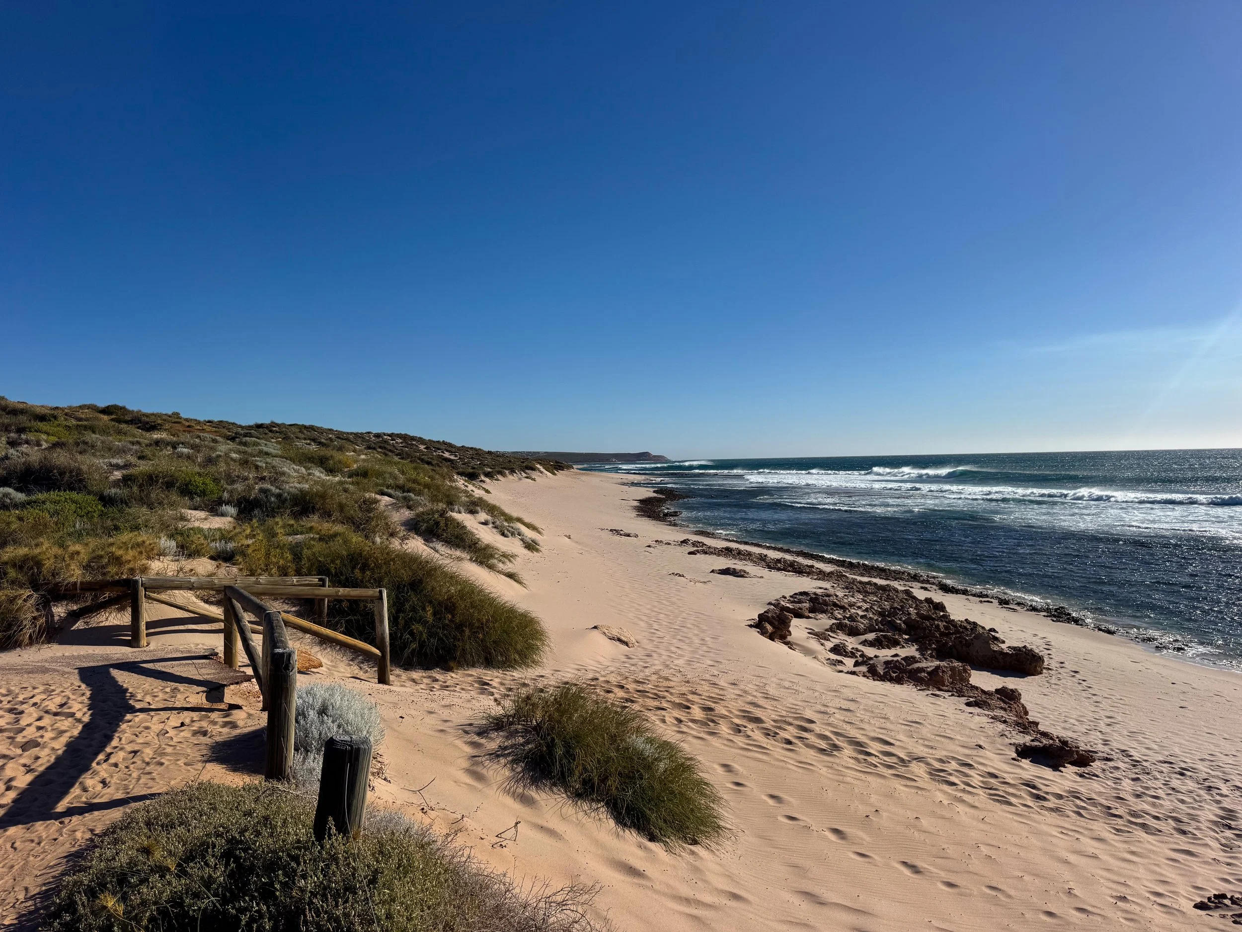
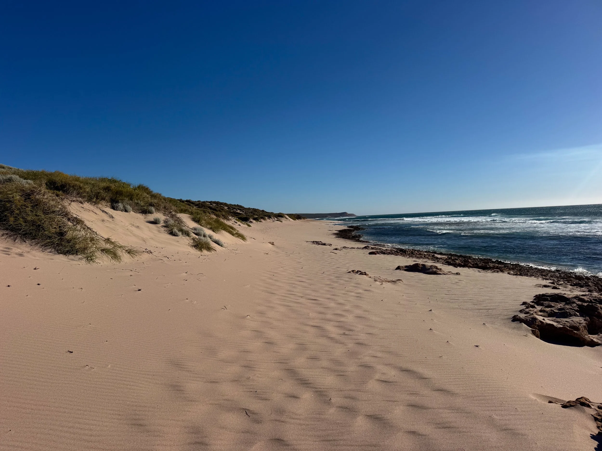
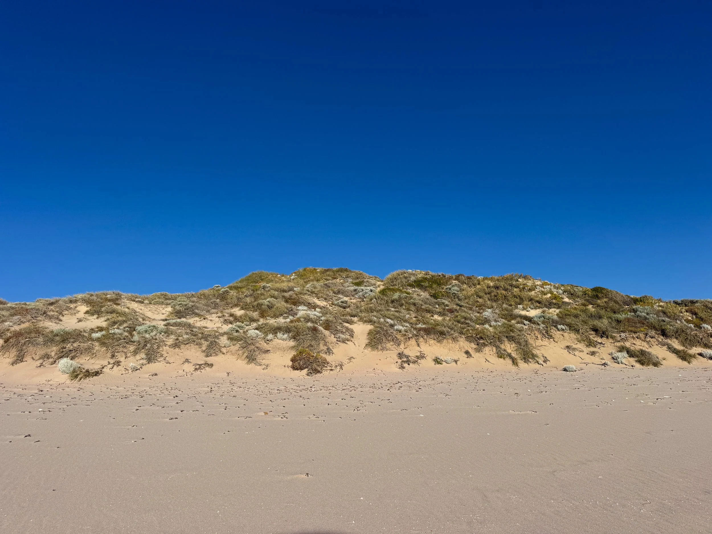
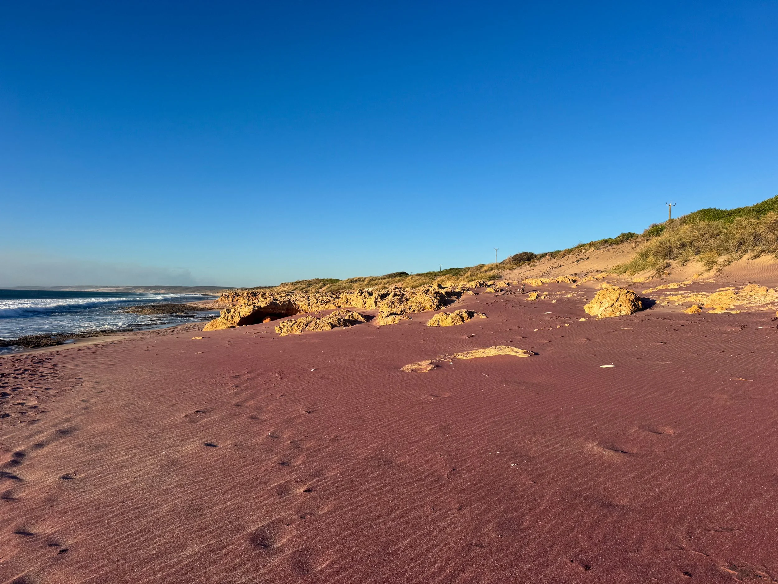
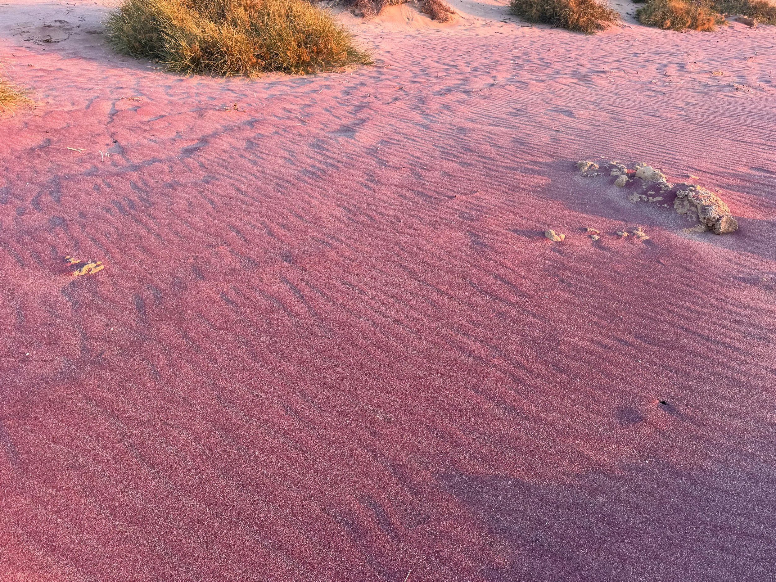
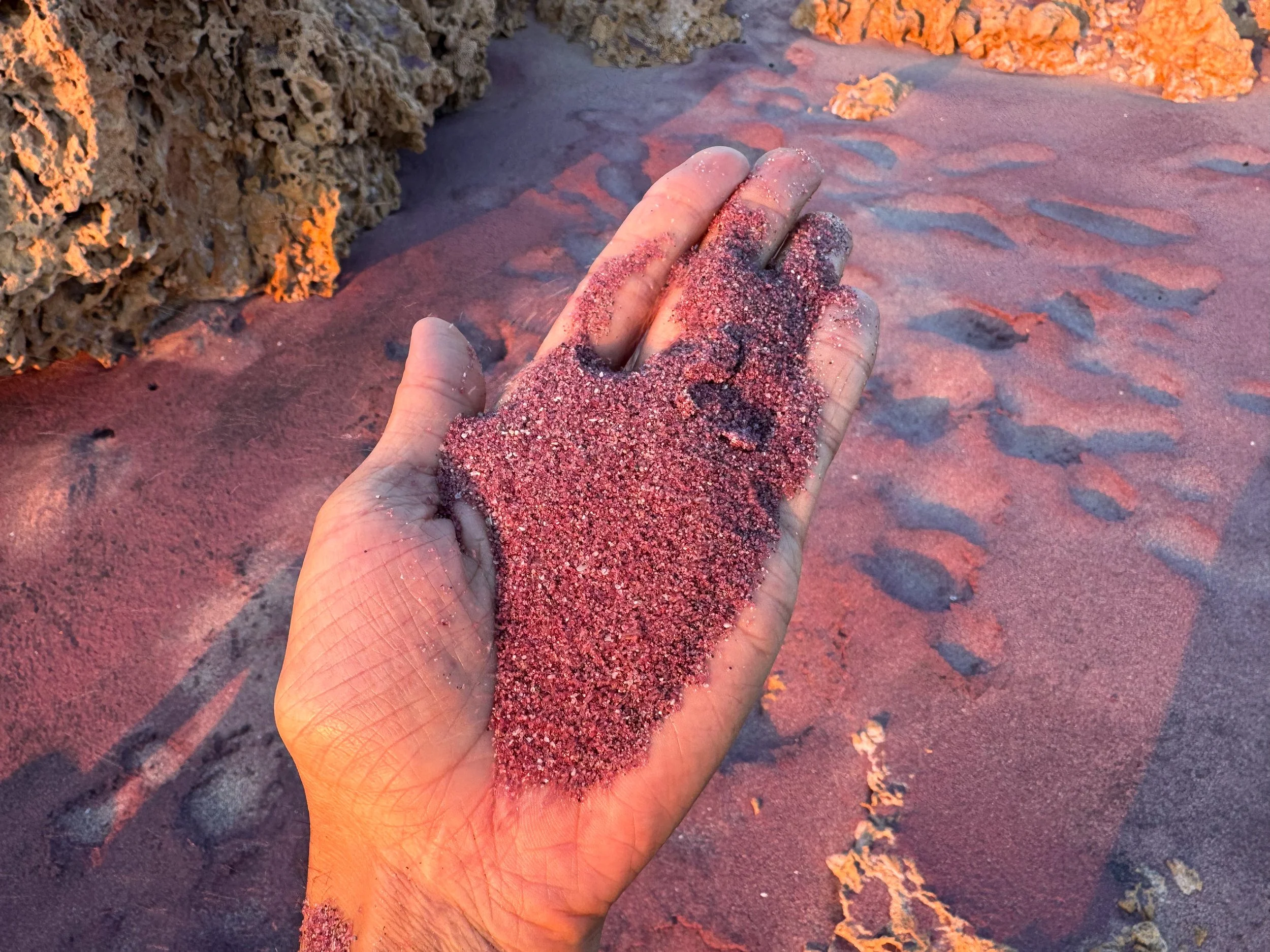
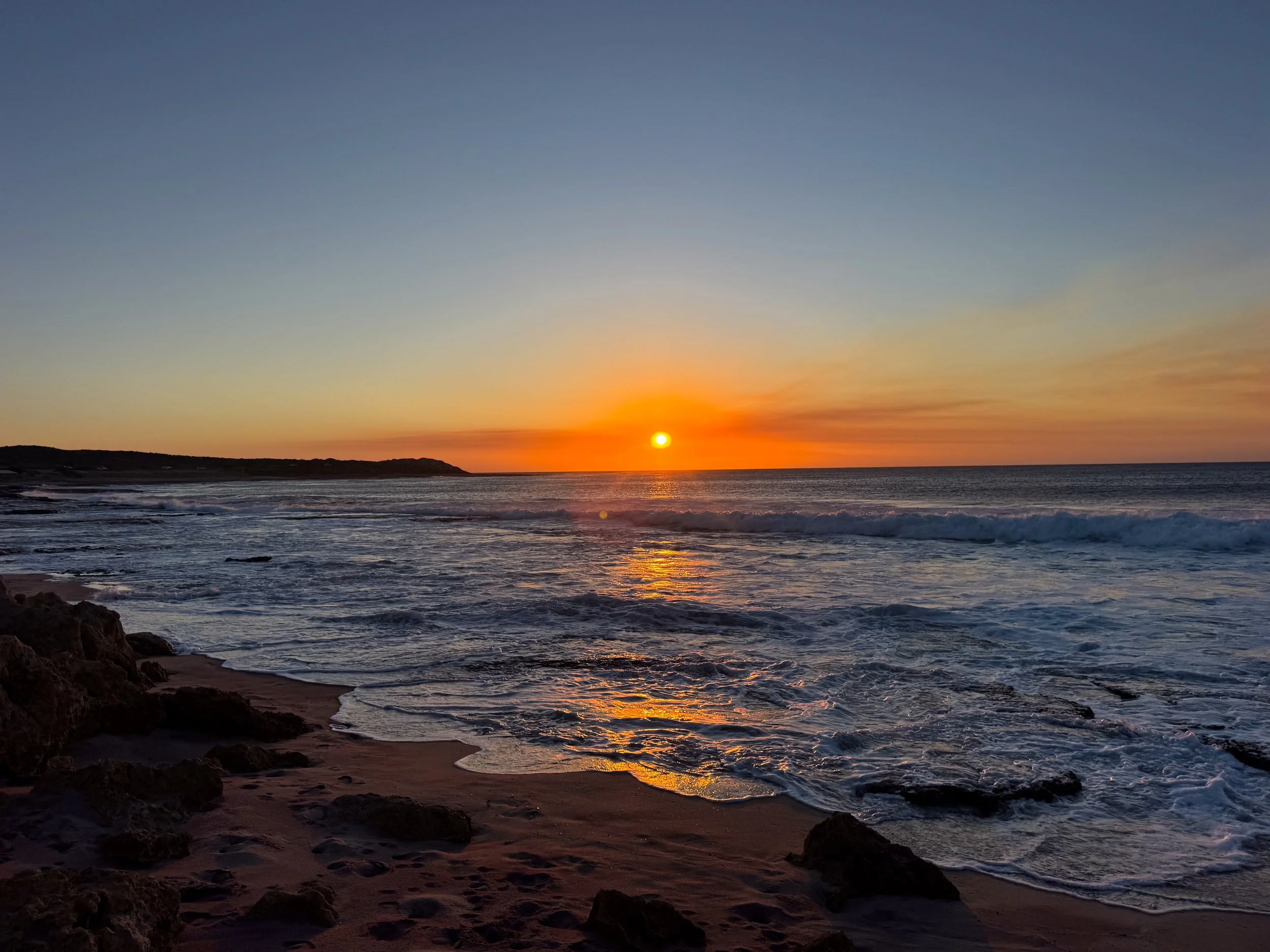
Kalbarri Beaches. Kalbarri has a range of scenic beaches nestled along cliffsides, rivers and oceanfront.
Chinaman’s Beach. A protected beach located where the Murchison River meets the Indian Ocean. Come here for a cooling and refreshing swim on a hot day.
Kalbarri Beach. A calm and swimmable beach in the turquoise hued estuary of the Murchison River. It’s possible to rent kayaks or small boats from here to explore further upstream.
Blue Holes Beach. A lengthy white sand beach with views of the turbulent ocean. Sharp rocks and strong currents make it dangerous to swim but perfect for long seaside walks and sunsets.
Kalbarri Pink Beach. A beautiful pink sand beach with a deep purplish hue. Visit at sunset when the golden light intensifies the color of the sand. Watch experienced surfers riding barrel waves at Jake’s Point.
Melaleuca Trail. A coastal walking trail leading through the bush covered dunes from Chinaman’s Beach to Kalbarri Pink Beach.
Places to Eat, Drink & Stay
Kalbarri Palm Resort. A large motel style resort in the center of Kalbarri. They offer a range of comfortable rooms and outdoor areas like a pool and cricket field. We woke up to kangaroos outside of our apartment. Reserve on Booking.
Buddha Bites. A seafood restaurant at the Kalbarri Palm Resort with South East Asian flavors like coconut, ginger and red pepper. Try the tamarind lime snapper and Australian seafood salad.

Kalbarri National Park (Day 5)
Kalbarri National Park is a sprawling reserve with scenic hiking trails and panoramic lookouts of the Murchison River Gorge, a sandstone gorge carved by the Murchison River and ancient coastline.
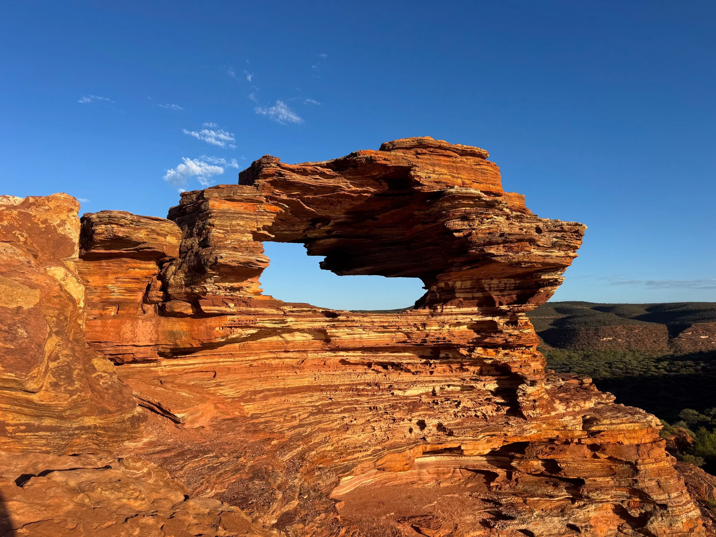
Nature’s Window. A small sandstone arch on a cliffside ridge of the Murchison River Gorge. It’s reachable by following a 500 meter trail from the car park. The trek offers panoramic views of the orange layered sediment, green speckled bushes and winding river gorge.
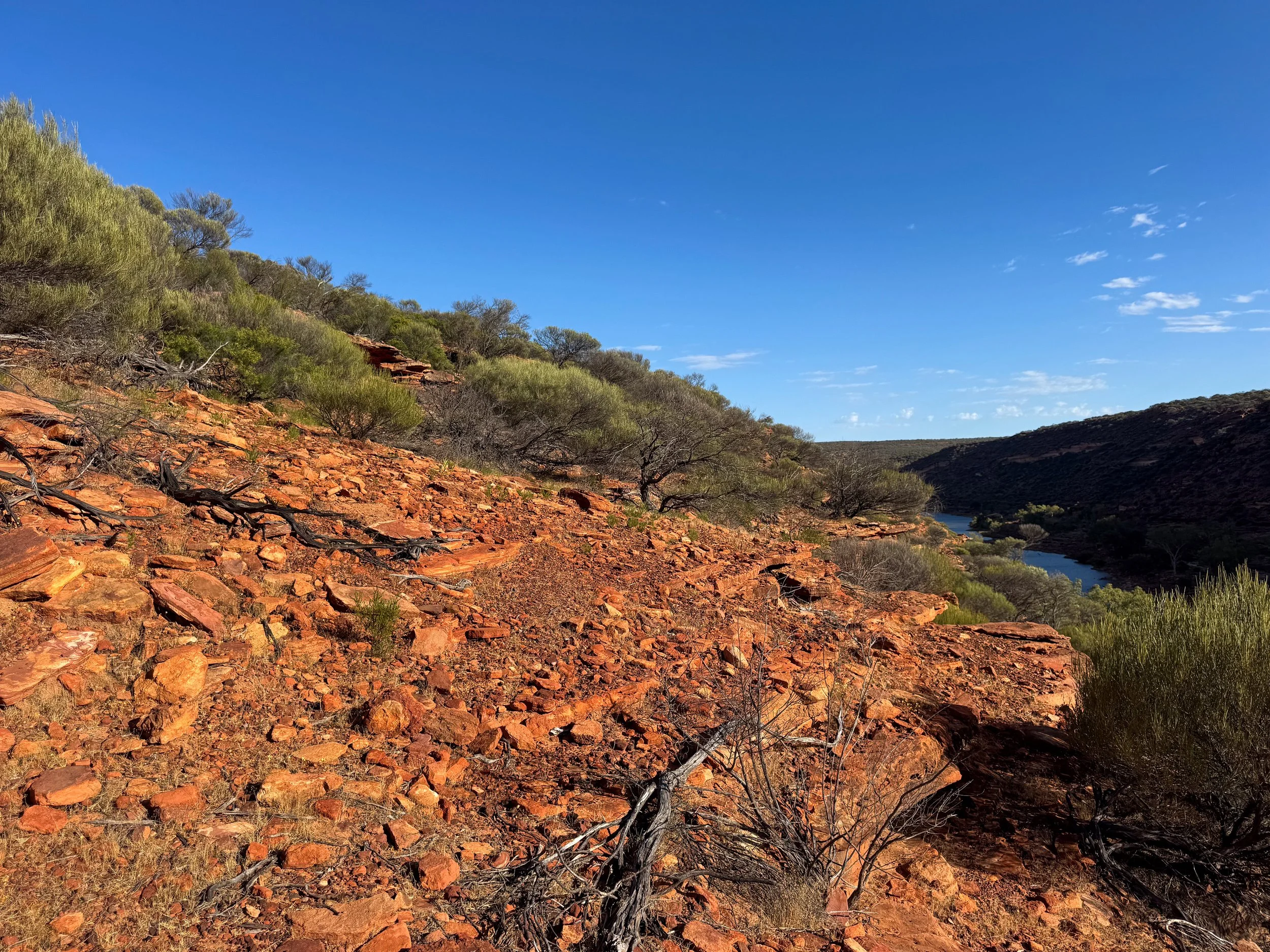

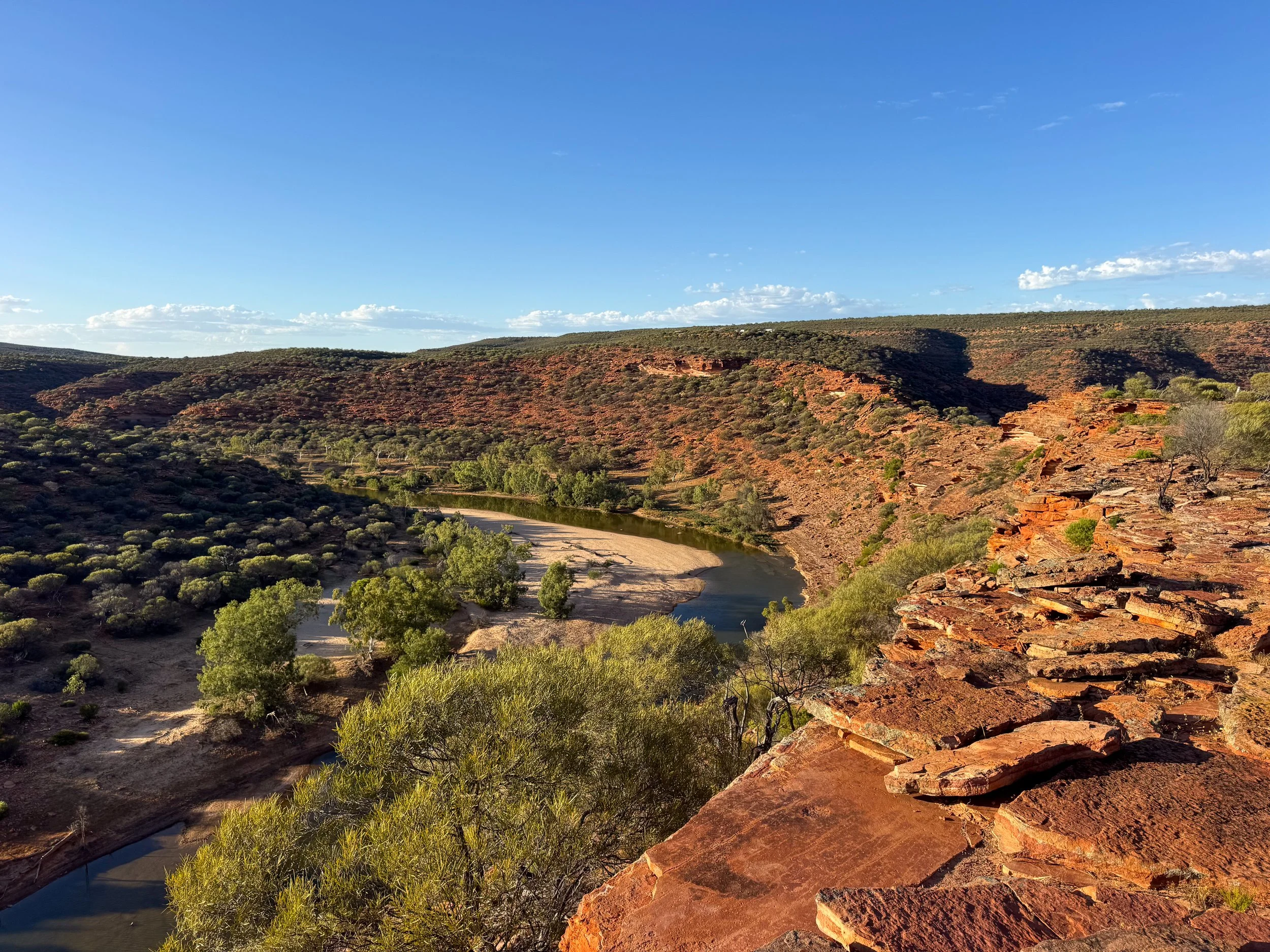
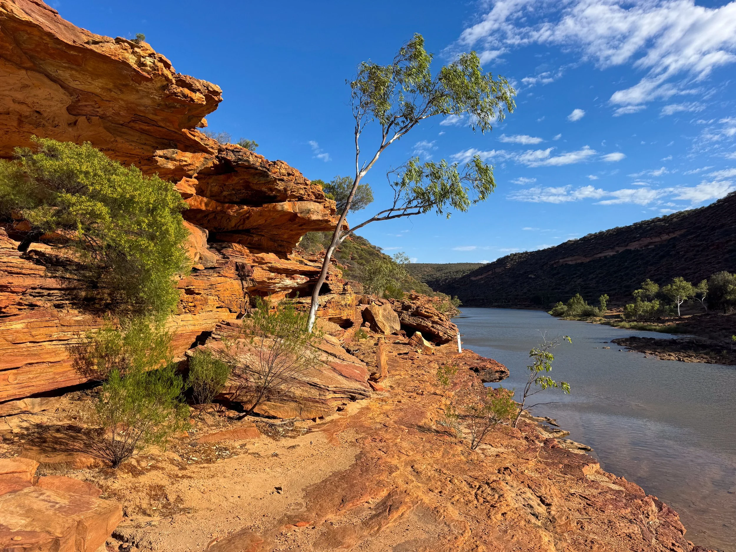
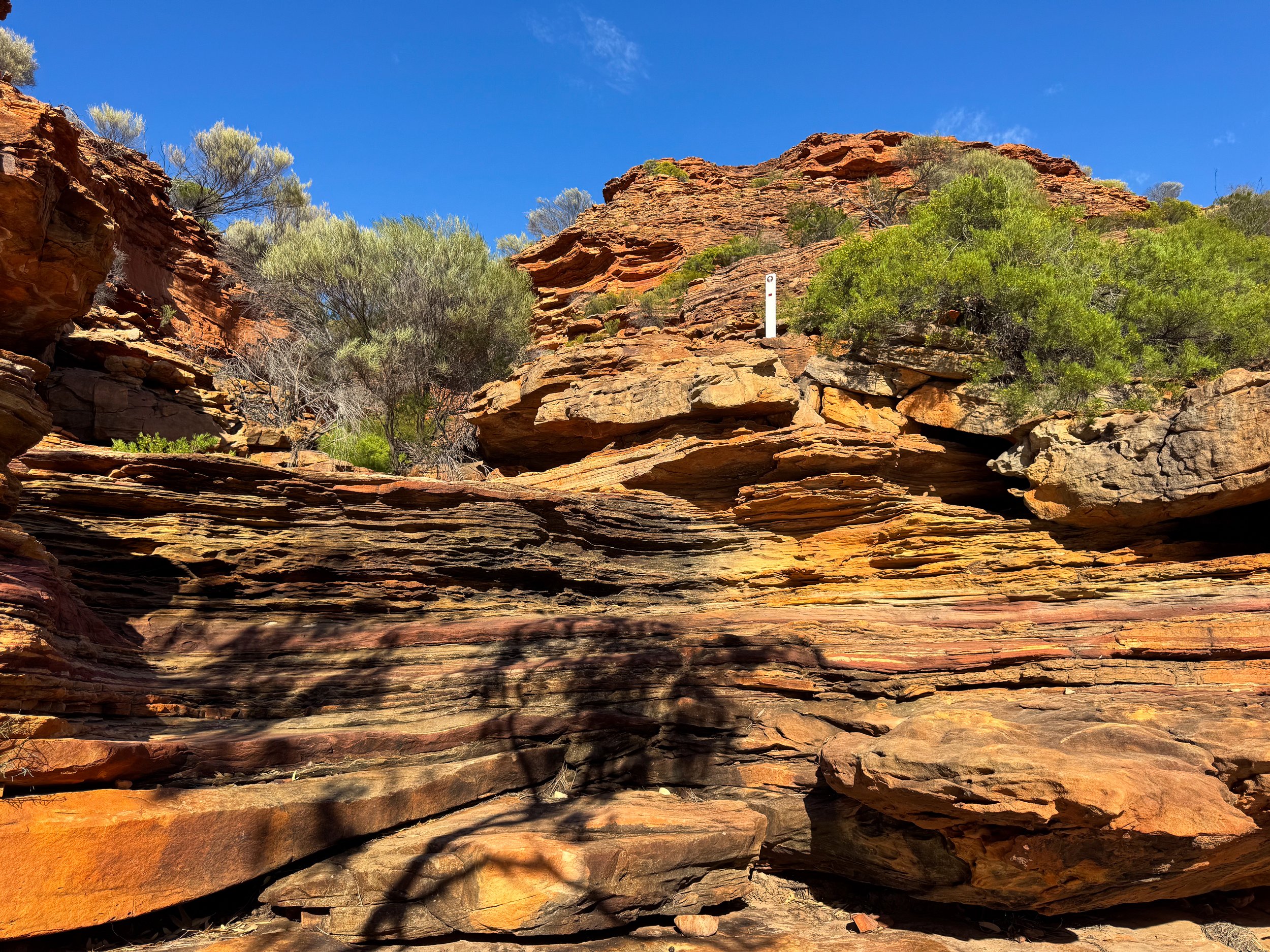
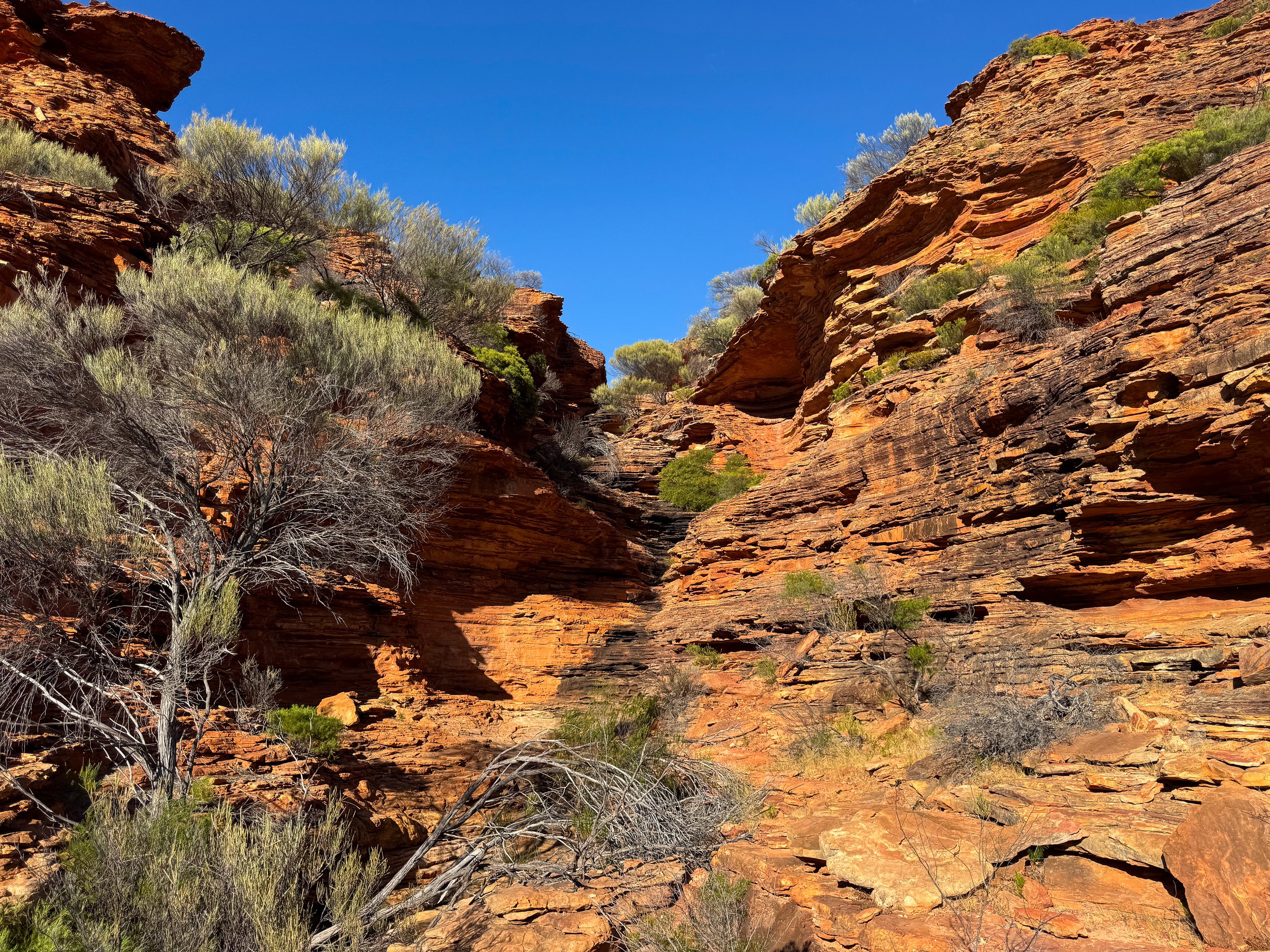
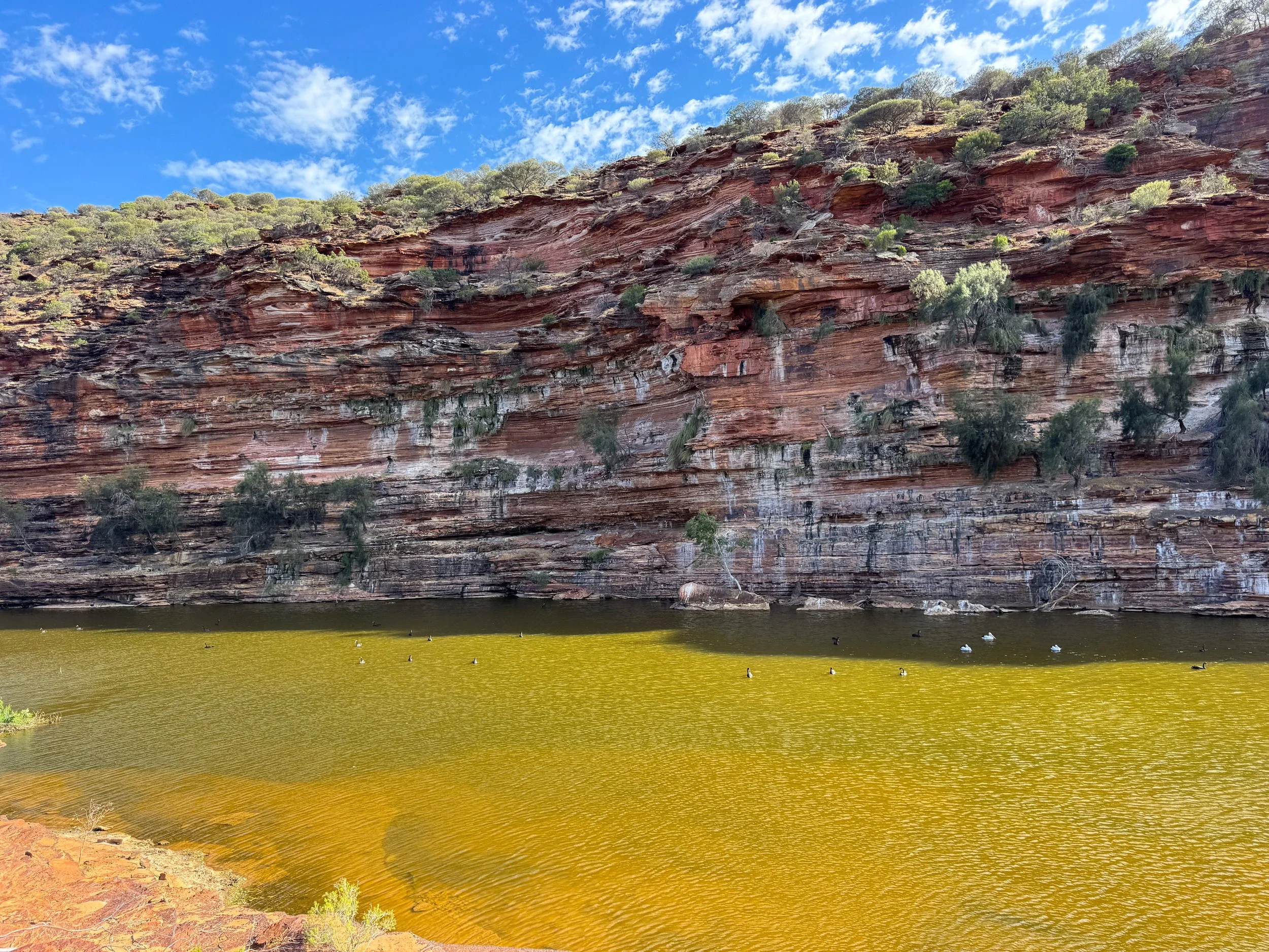
The Loop Trail. An adventurous and scenic trail leading 8km through The Murchison River Gorge, beginning at and returning to Nature’s Window. It follows the cliffside ridge of the dramatic gorge. A steep descent continues down layered sandstone formations to the base of the canyon. A fractured ledge with minimal clearance leads along the edge of the riverside. The trail follows a horseshoe bend with views of the canyon walls. It continues through a fragrant eucalyptus grove before ascending back up to the ridge. The trail is the best we hiked in Western Australia!
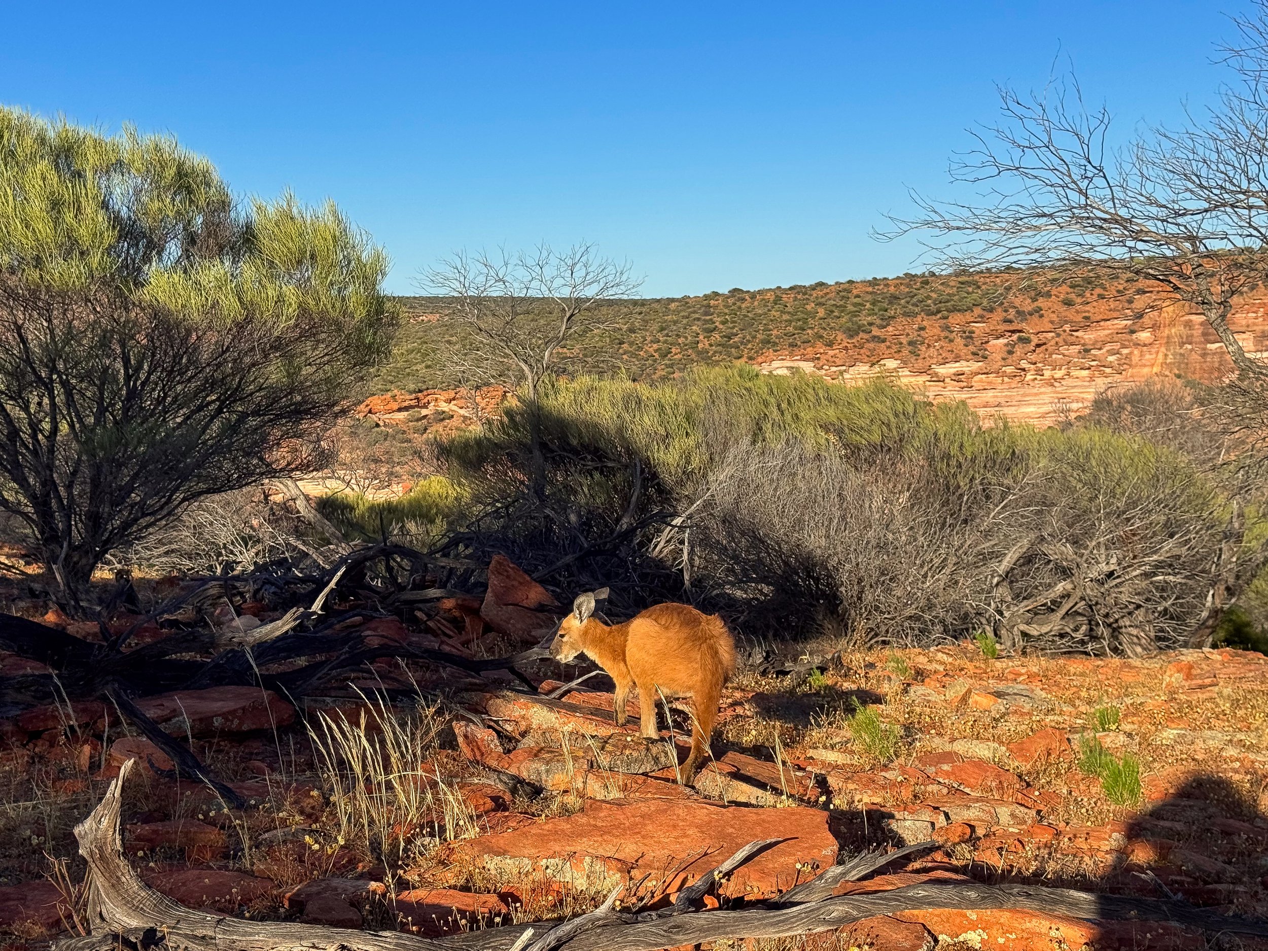
Wildlife Spotting. The gorge is home to a variety of wildlife. Pairs of kangaroos nibbled on grass along the trail and hopped down the gorge’s rocky cliffs. Pelicans and black swans swim in the Murchison River. Foot prints and tracks from emu, small mammals and lizards meander through the sand.
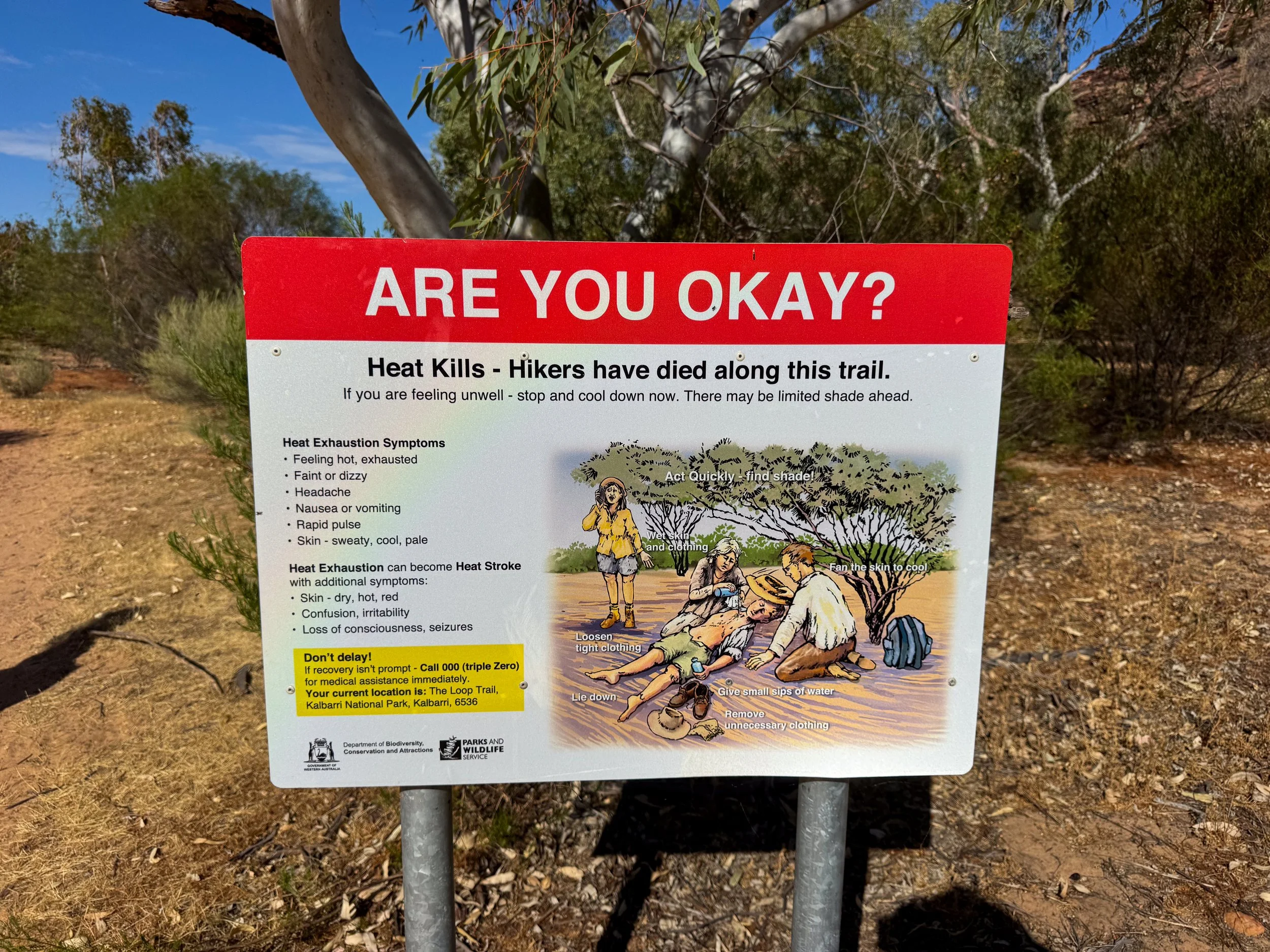
Advice for Visiting. The Loop Trail can be dangerous and uncomfortable! Here is some advice to keep in mind.
Avoid the Heat. The trail head closes at 7am due to extreme heat. It’s best to begin hiking just after sunrise. The temperatures reached 36C (97F) by 9am when we completed the hike.
Bring Water. Hydrate before the hike and carry enough water to last the duration. We carried 1.5L each, however it’s advised to carry 1L per hour.
Fly Nets. You absolutely need a fly net during the hike. We were swarmed by and covered in hundreds of flies.
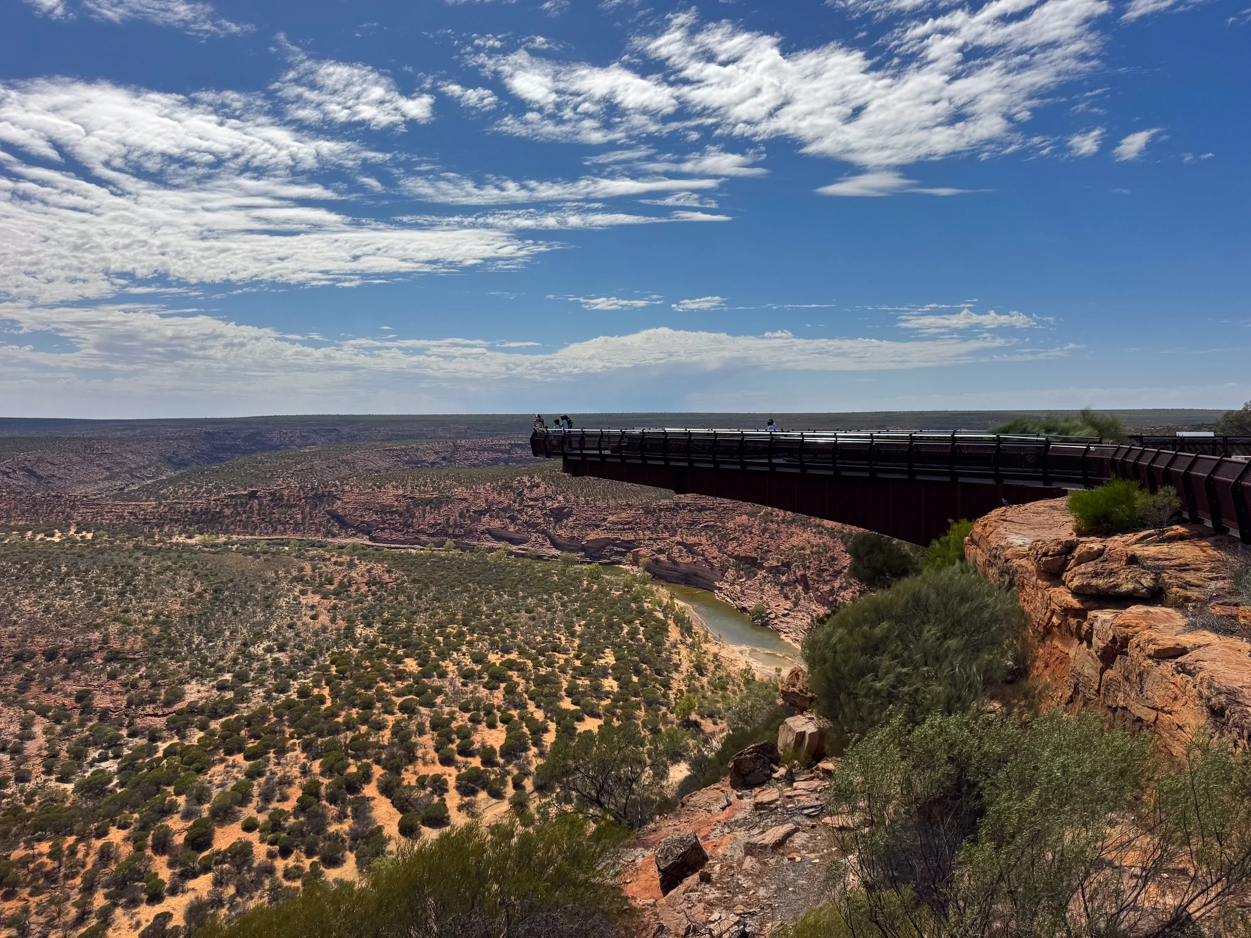
Kalbarri Skywalk. A pair of cantilevered walkways suspended hundreds of meters above the Murchison River Gorge. They offer panoramic views of the gorge and Outback landscape.
Z-Bend Lookout. A lookout point of the Murchison River Gorge’s most prominent bend, aptly named after its sharp right angular bends. A bonus sight is a fossilized 400 million year old “footprint” trail from a eurypterid, one of the planet’s first land dwelling creatures.
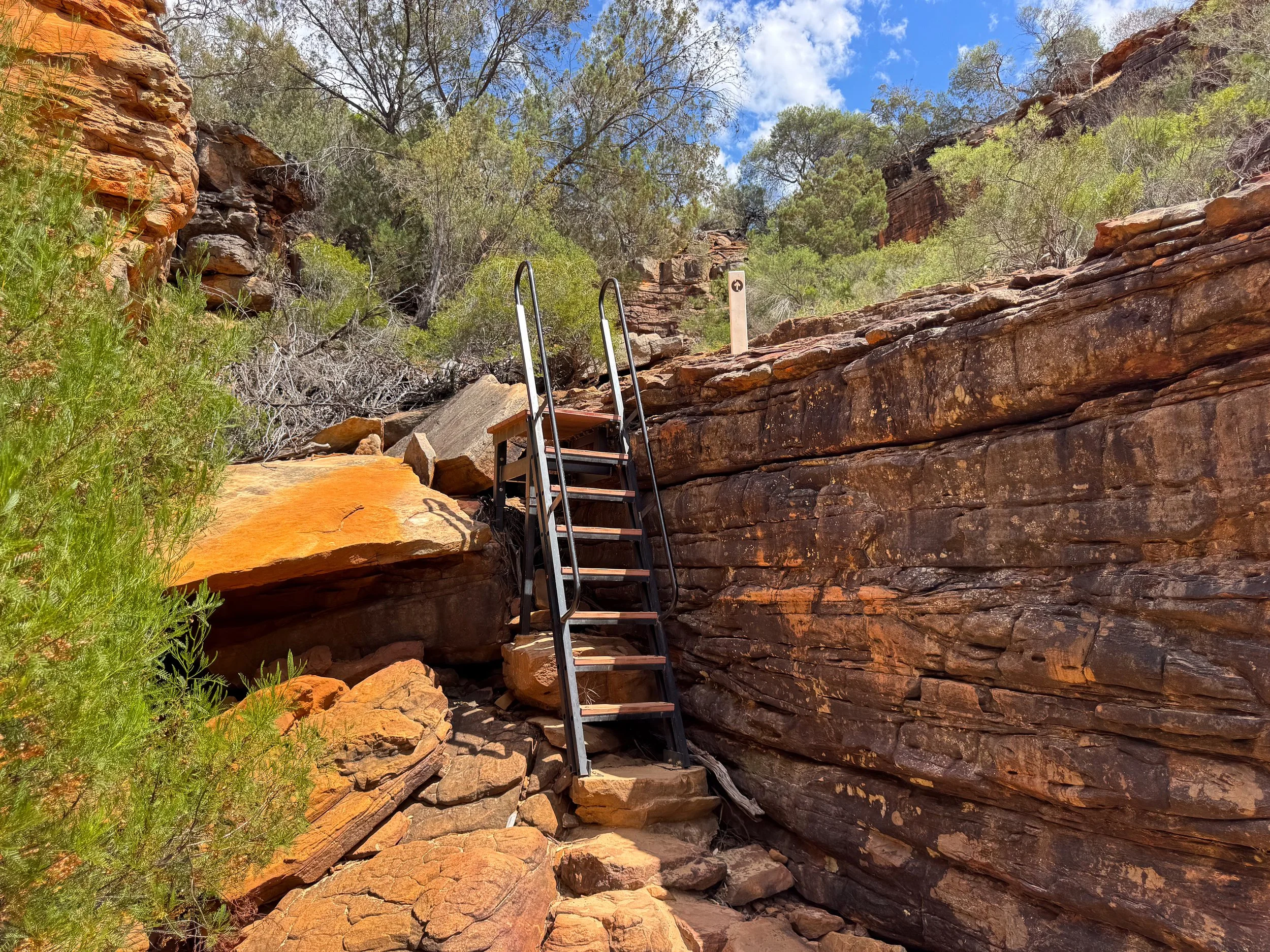

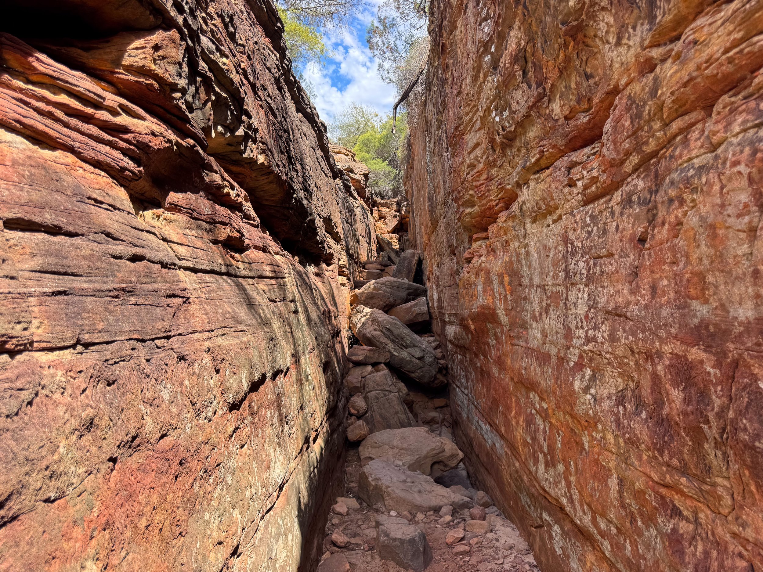
Z Bend River Trail. An adventurous 2.6km round trip trail leading to the Z Bend of the Murchison River. The semi-rigorous hike leads through steep crevices, down ladders and over large boulders to reach the river. Walk down the riverbed with beautiful views of the Z Bend.
Ross Graham Lookout. A scenic point with two lookout points of Murchison River Gorge. A short trail leads from the parking lot to the first viewpoint. A side trail continues slightly further into the gorge.
Hawks Head Lookout. A panoramic lookout of the Murchison River Gorge and landscape.
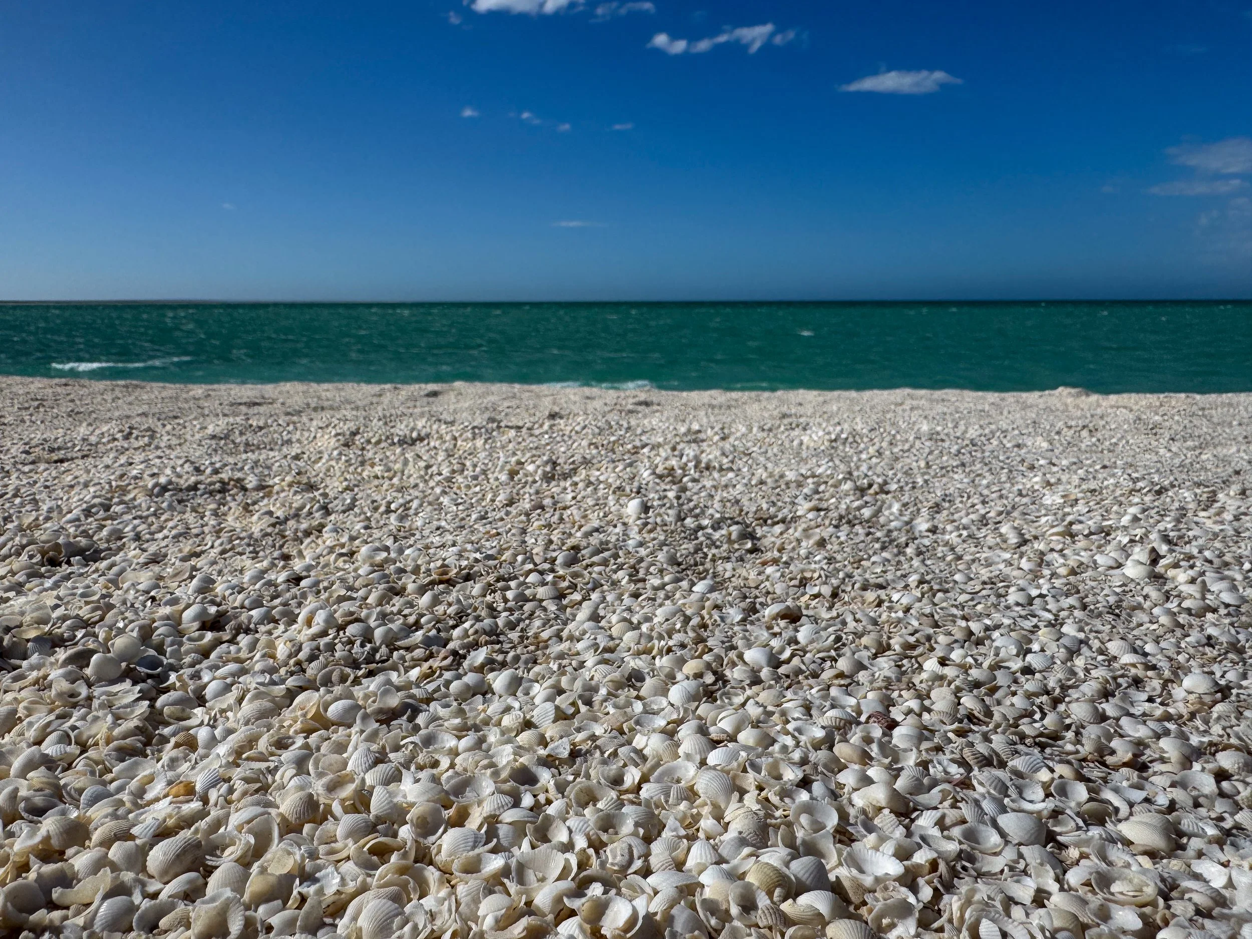
Shark Bay (Day 6)
Shark Bay is a large bay and marine park with picturesque beaches, scenic lookouts and small coastal towns.
Shell Beach. A magical beach covered in billions of tiny white shells lining the aquamarine shores of Shark Bay. Walk the beach, scoop up shells and toss them like sand in the wind.
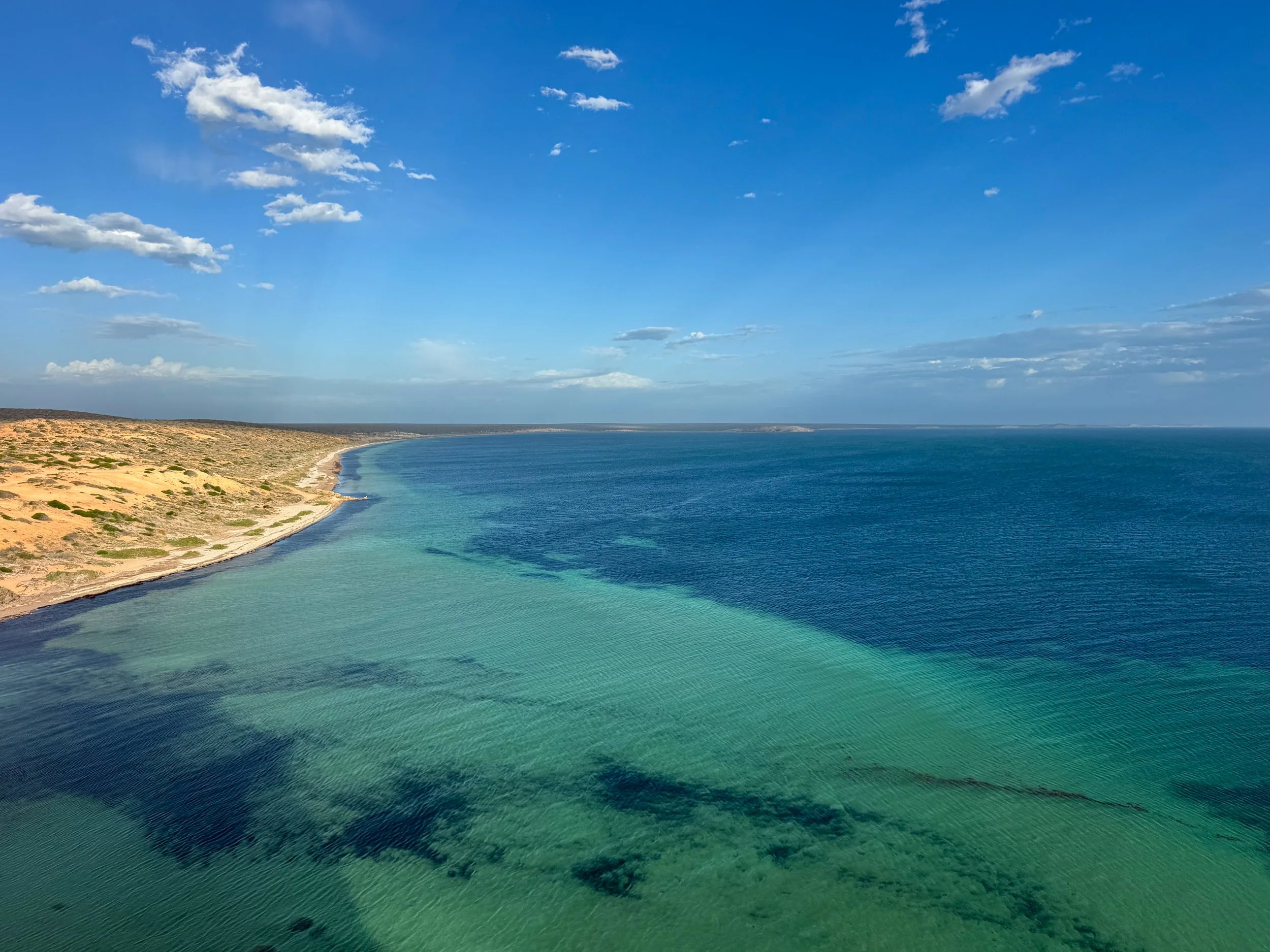
Eagle Bluff Lookout. A coastal lookout and boardwalk with views of the beaches, cliffs and shallow coastal waters. Come here to spot marine life including lemon sharks, nervous sharks, rays, sea turtles and aquatic birds.
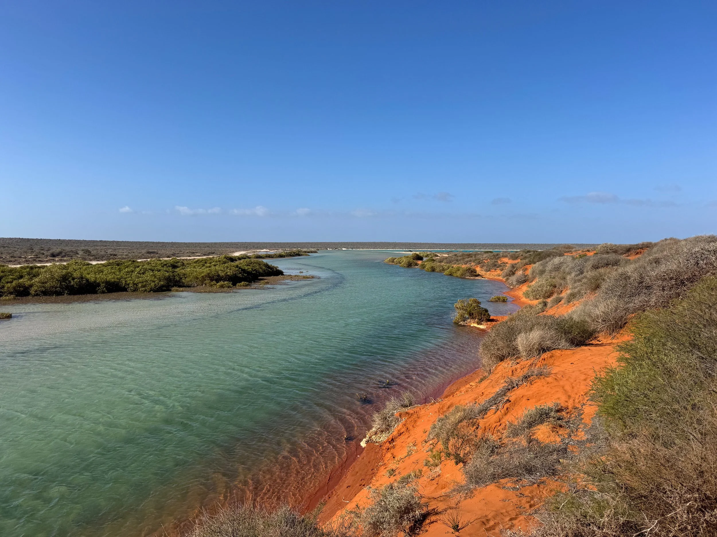
Little Lagoon Creek. A turquoise creek flowing from the bay into the Little Lagoon. A trail follows its banks to the mouth of the lagoon. Avoid swimming here due to poisonous stonefish.
Little Lagoon. A crystal clear lagoon with multihued blue waters. Bring a beach chair to relax on shore, swim in the shallow waters or barbecue at one of the grill pavilions.
Denham. A cute coastal town in Shark Bay home to holiday rentals, beaches and turquoise lagoons. Emus can often be spotted strutting around the edge of town.
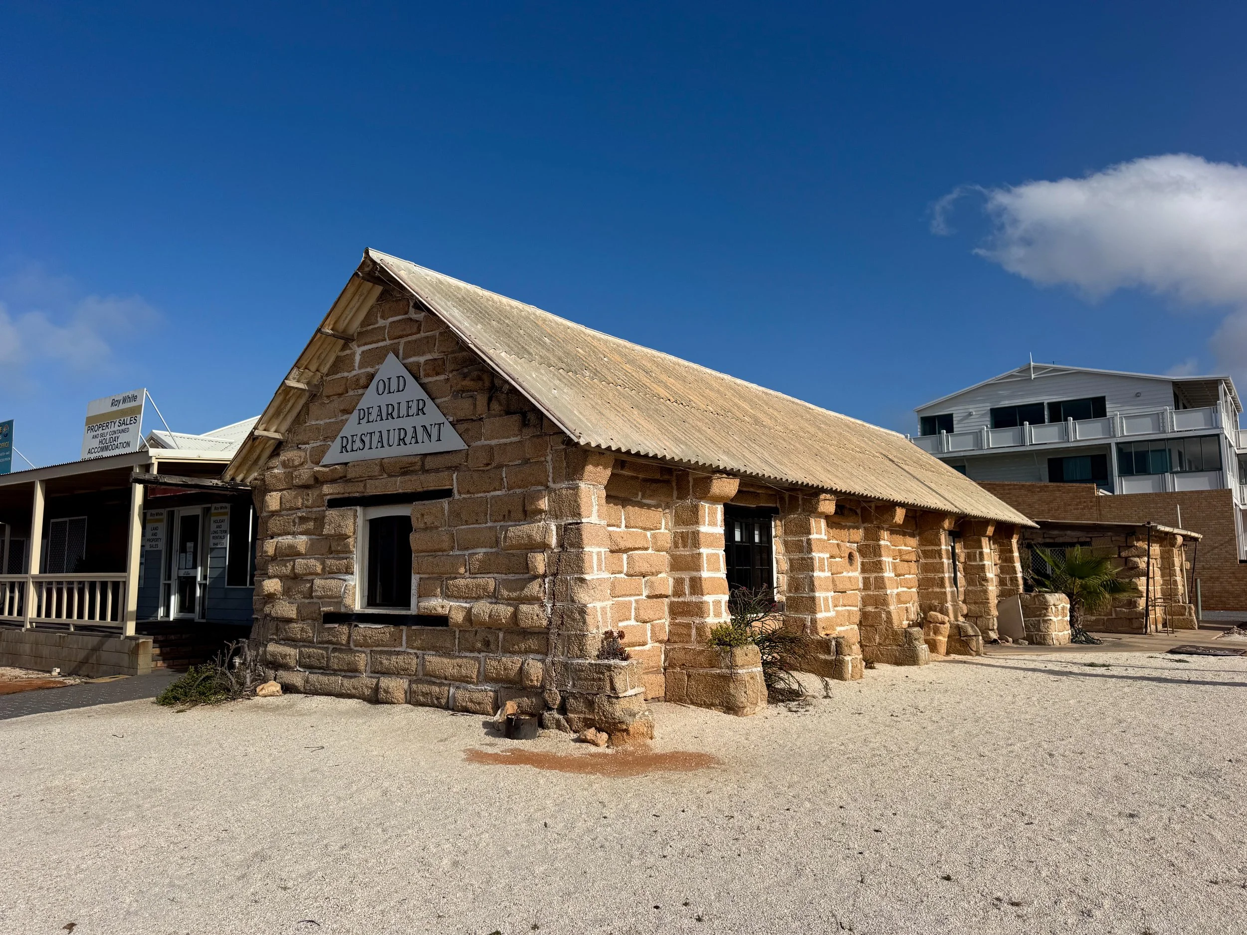
Places to Eat, Drink & Stay
The Old Pearler Restaurant. A seafood restaurant in a historic building made from pressed shell blocks. Its cozy interior offers a romantic setting for dinner. Bring your own bottle of wine and try the seafood chowder or pan fried cod.
Shark Bay Seafront Apartments. A bayside hotel with spacious apartments and well equipped kitchens. Each holiday rental has its own outdoor patios adjoined by a communal area with thatched gazebos, sun lounges and a barbecue. Reserve on Booking.
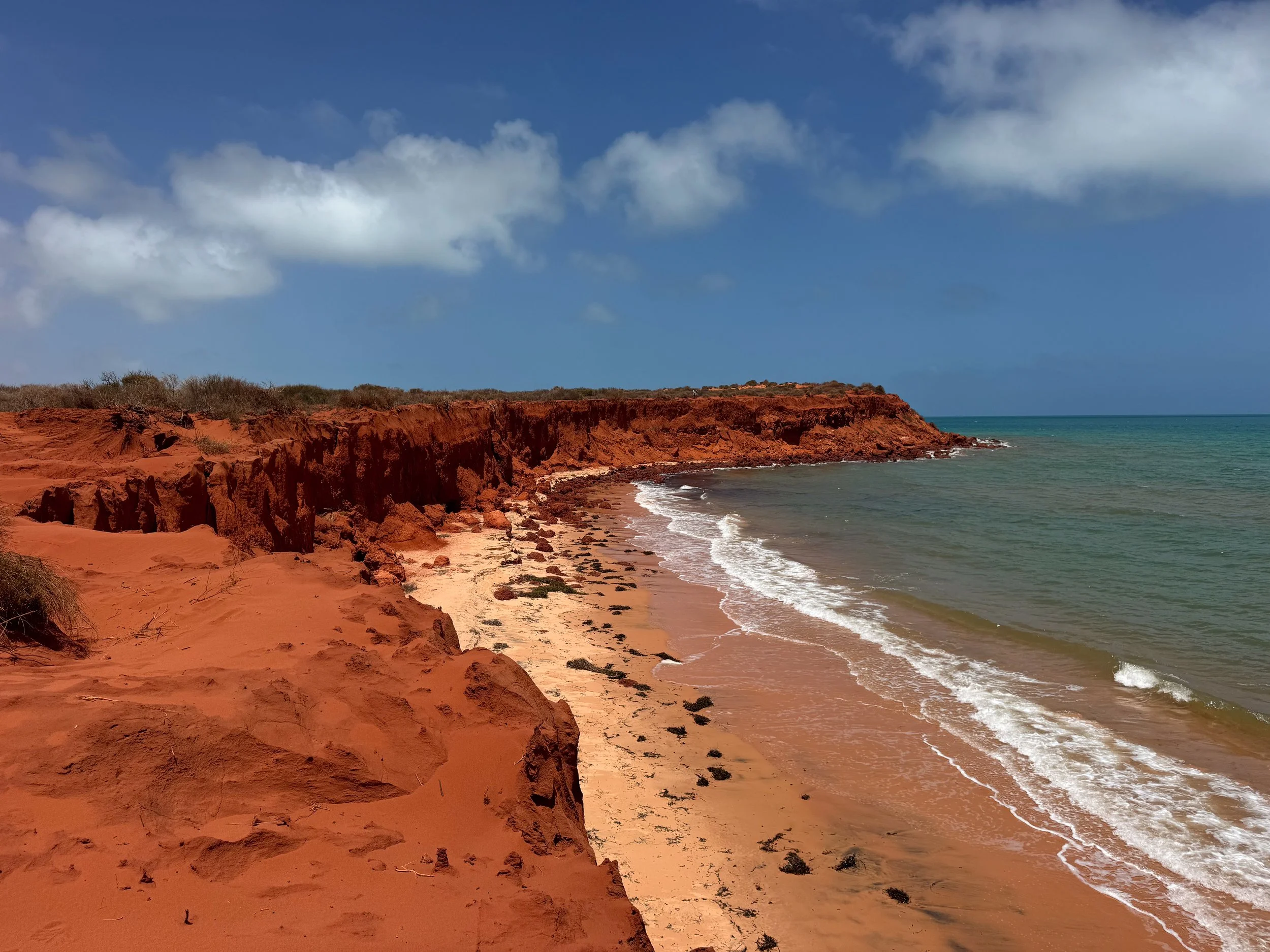
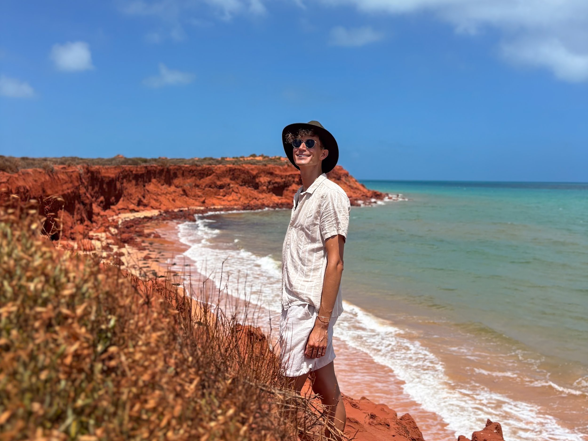
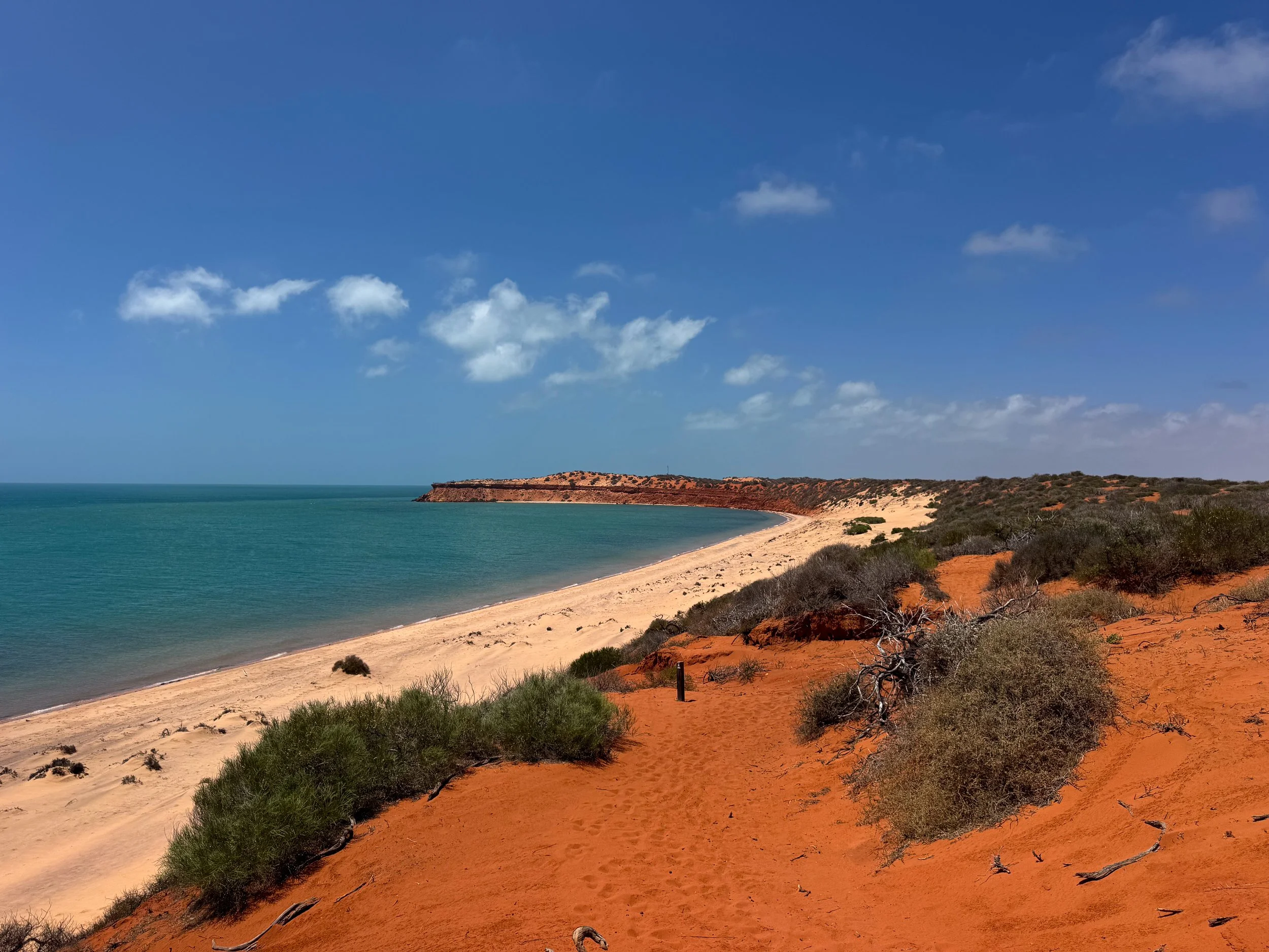
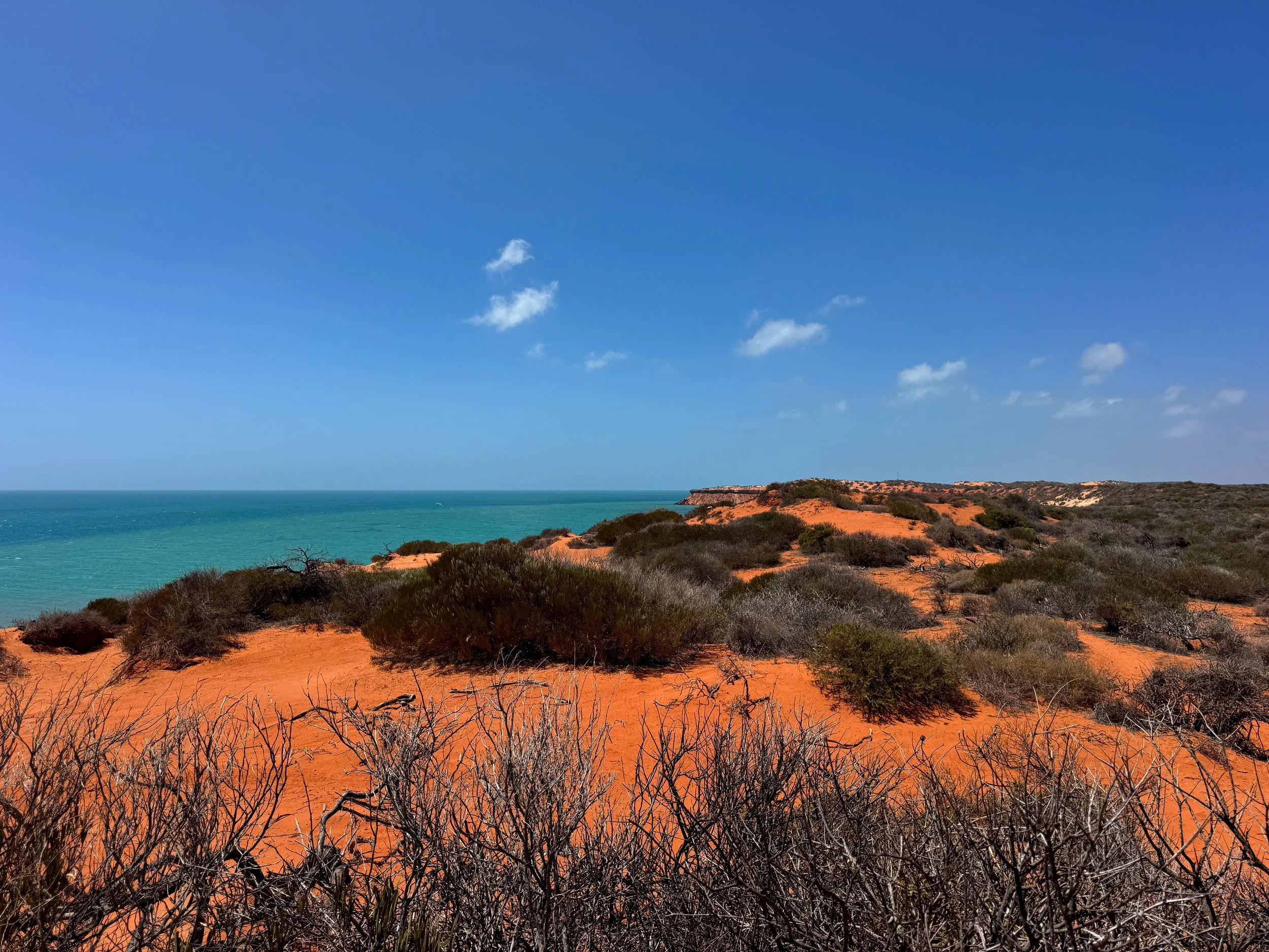
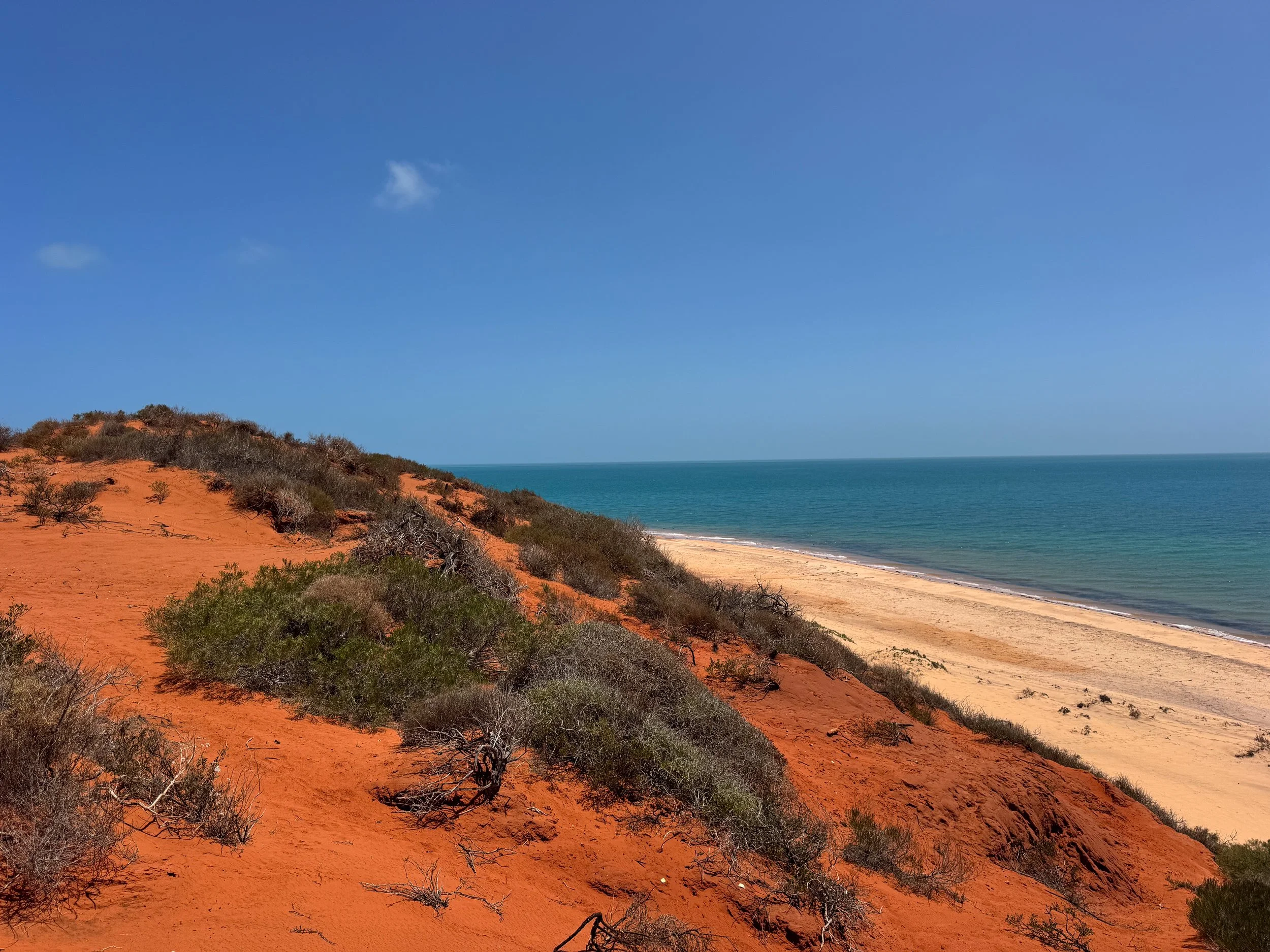
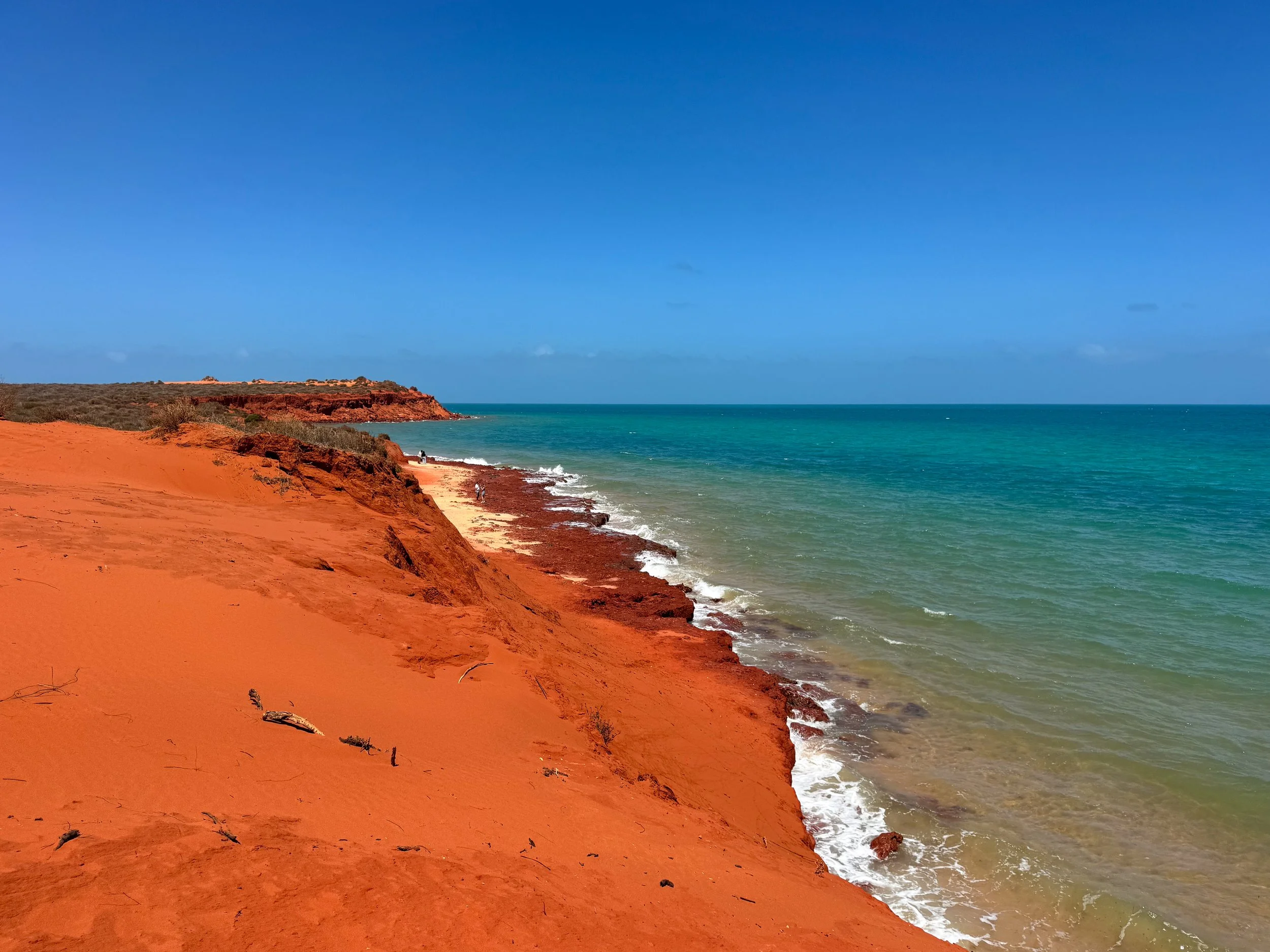

Francois Peron National Park (Day 7)
Francois Peron National Park is a remote peninsula where the desert meets the sea. Its reddish orange cliffs border the turquoise blue ocean. The landscape is blanketed in tufts of green bushes and clay plains with tiny dried shrubs. The park is home to wildlife like emus, kangaroos, monitor lizards, bearded dragons and venomous snakes. The shores and shallows are teeming with marine life including sharks, sea turtles and rays. It’s located about 375km north of Kalbarri and 327km south of Carnarvon.
Cape Peron Point. The northernmost point on the peninsula. Come here to hike the Wanamalu Walk Trail, a 3.5km coastal trail with views of the shrub covered desert, red rocky cliffs, white sand beaches and turquoise ocean.
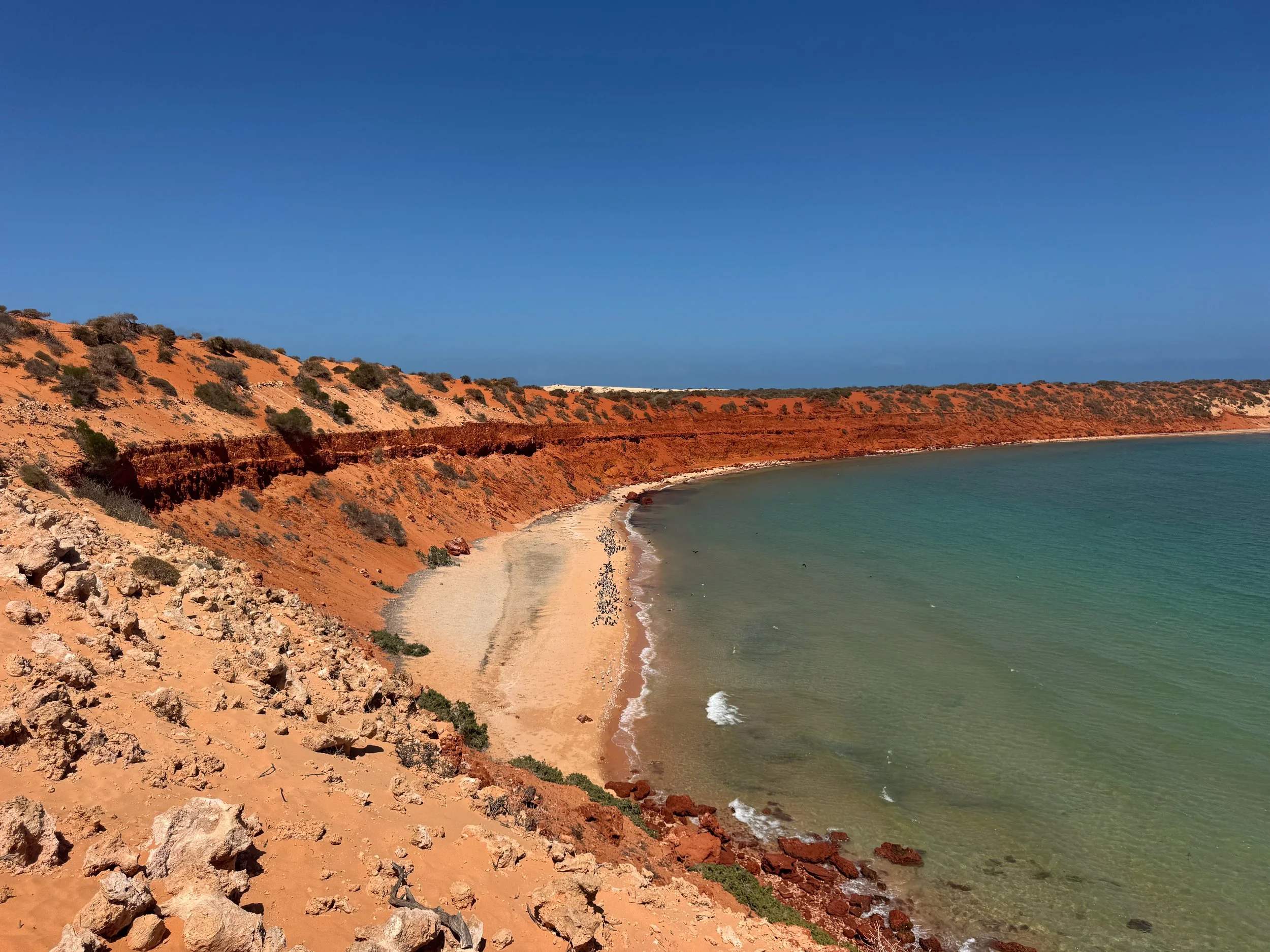
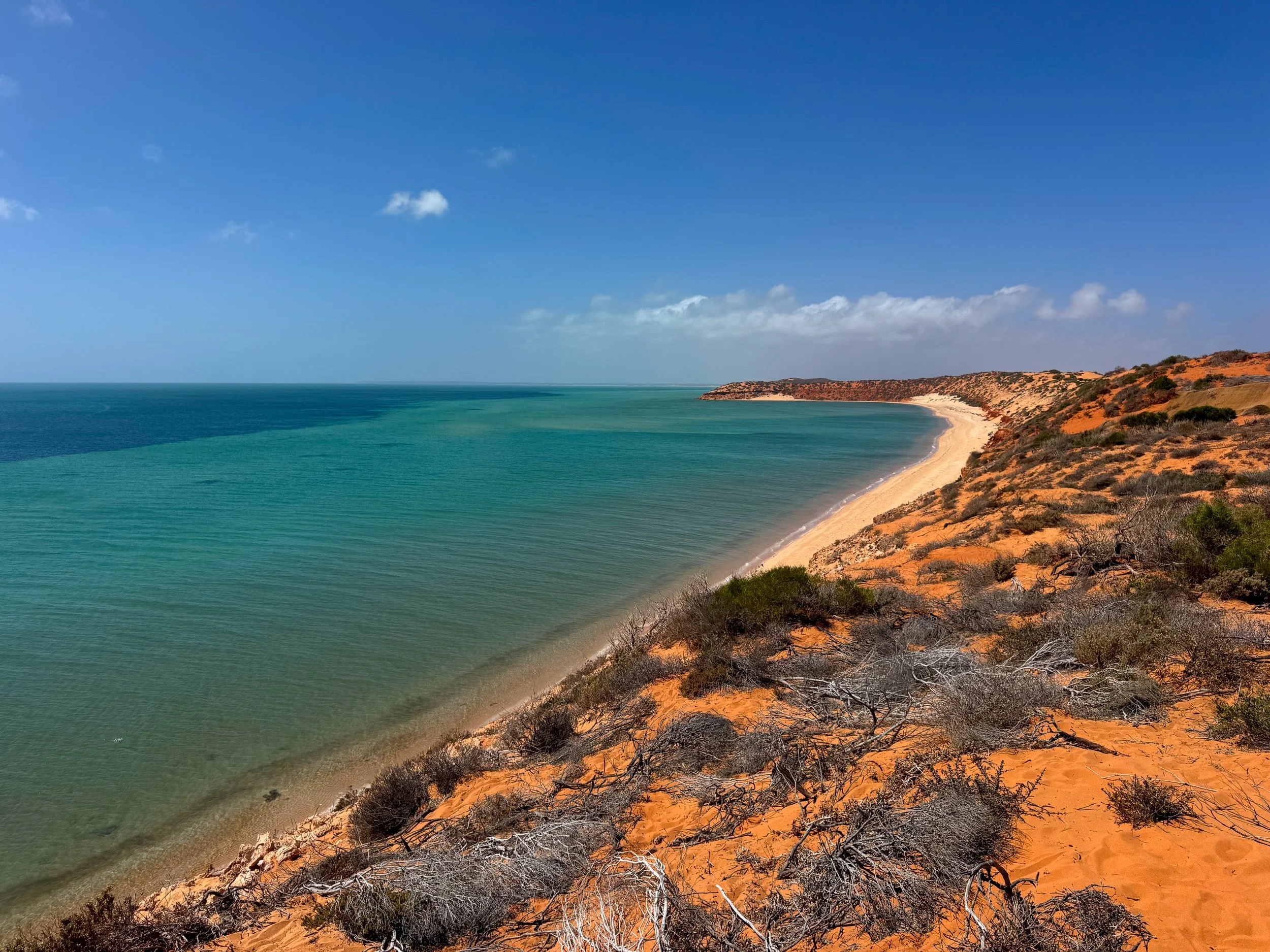
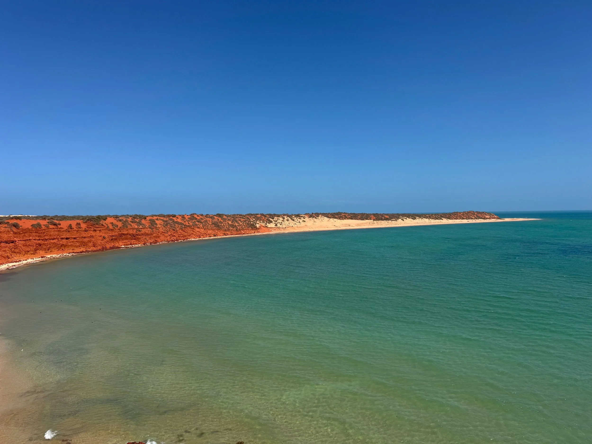
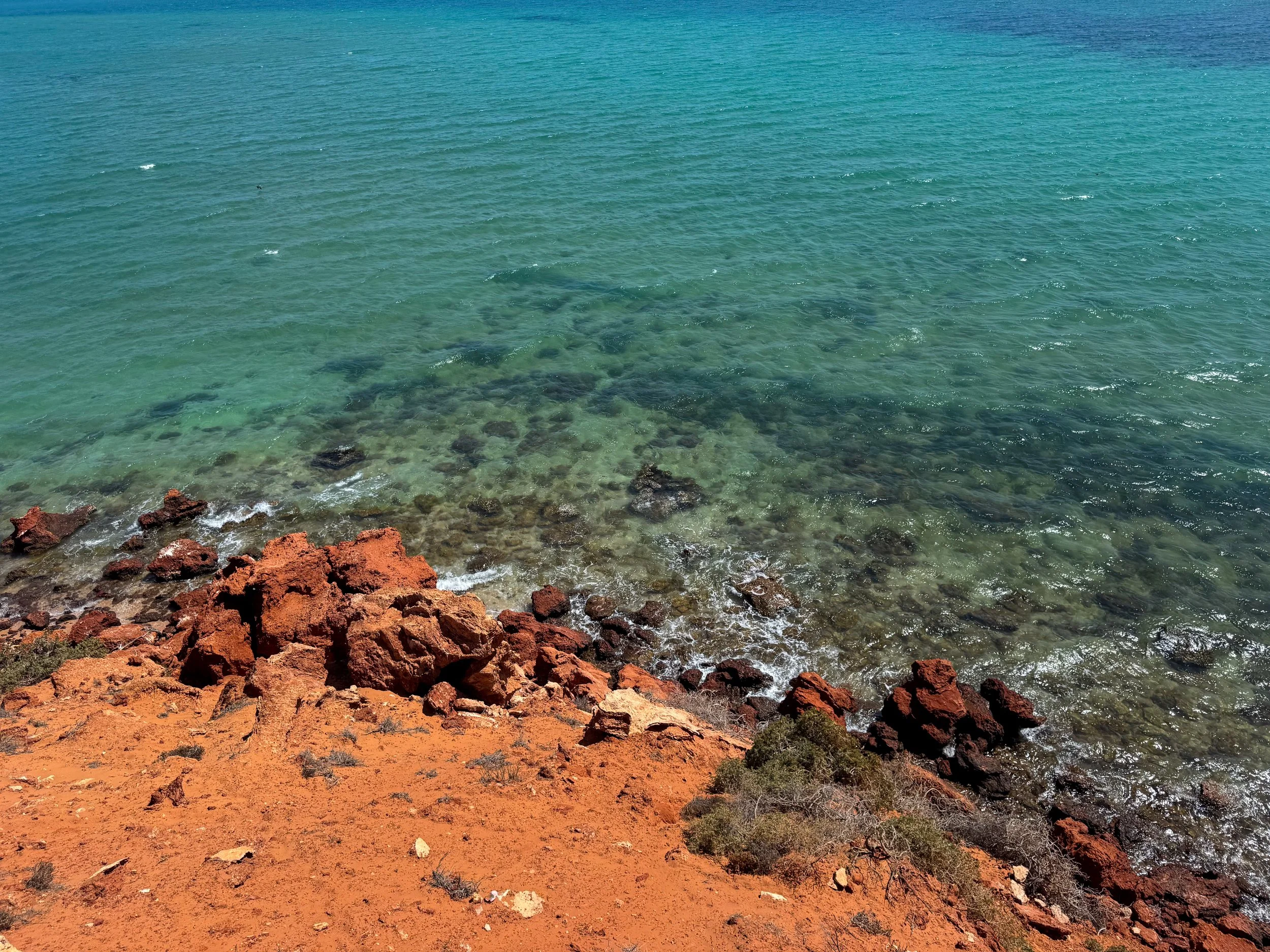
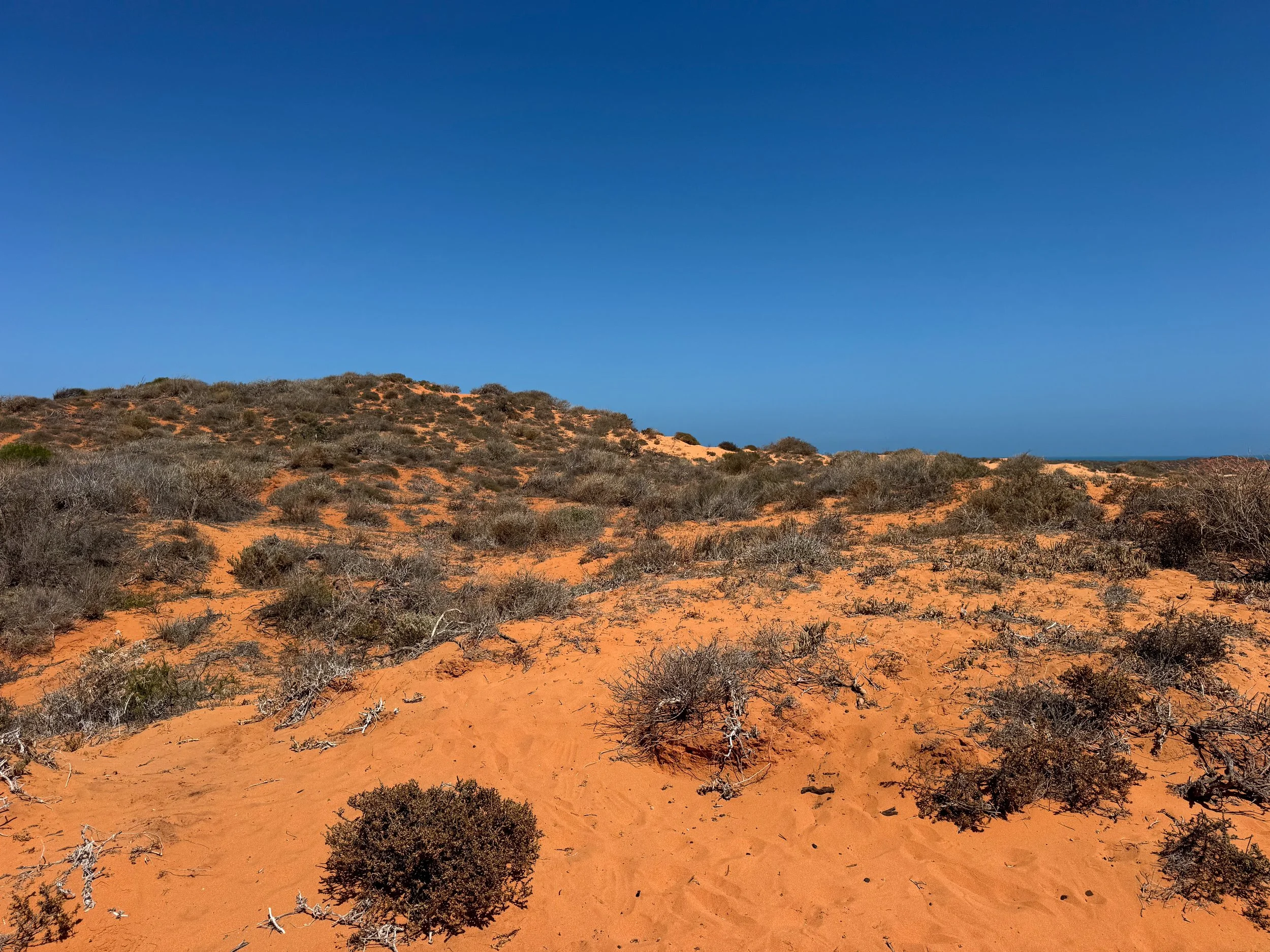
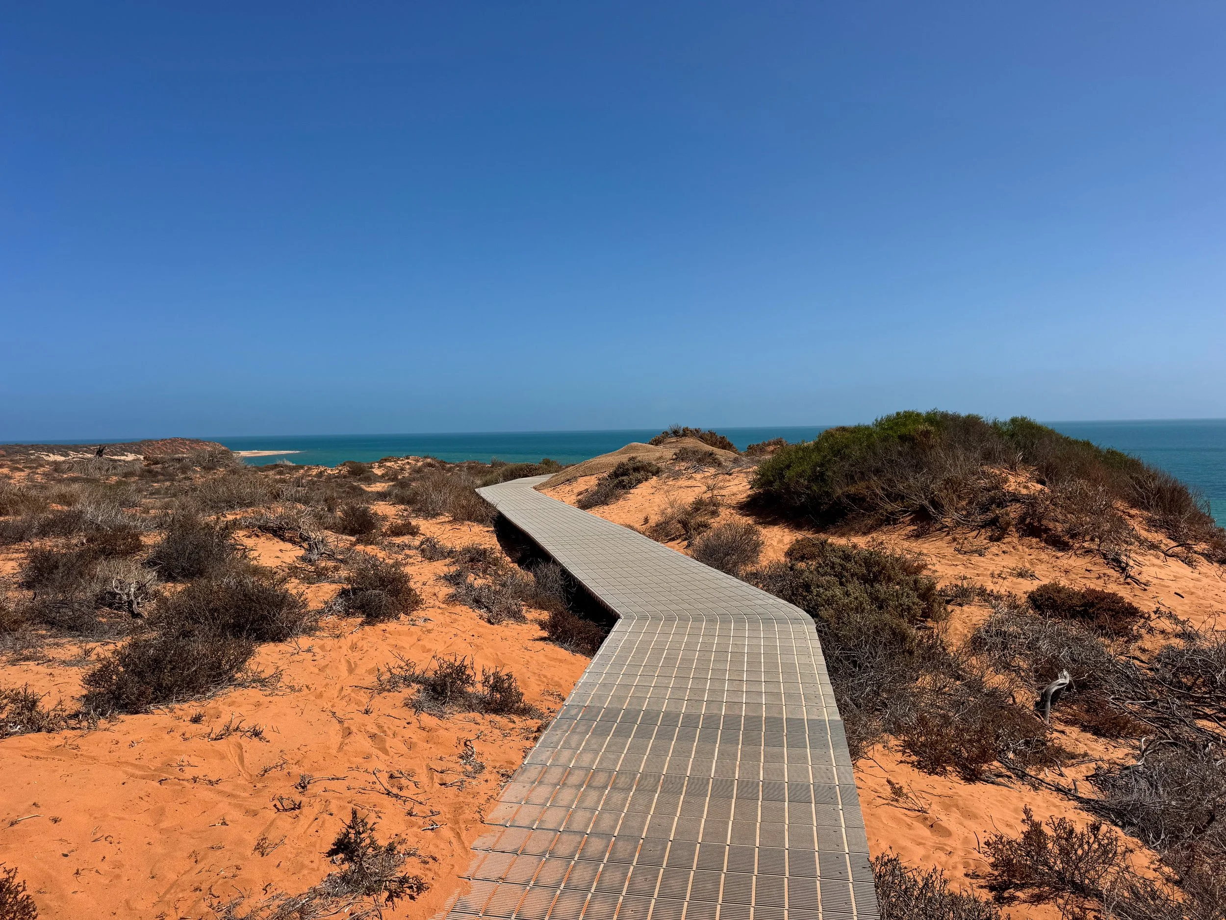
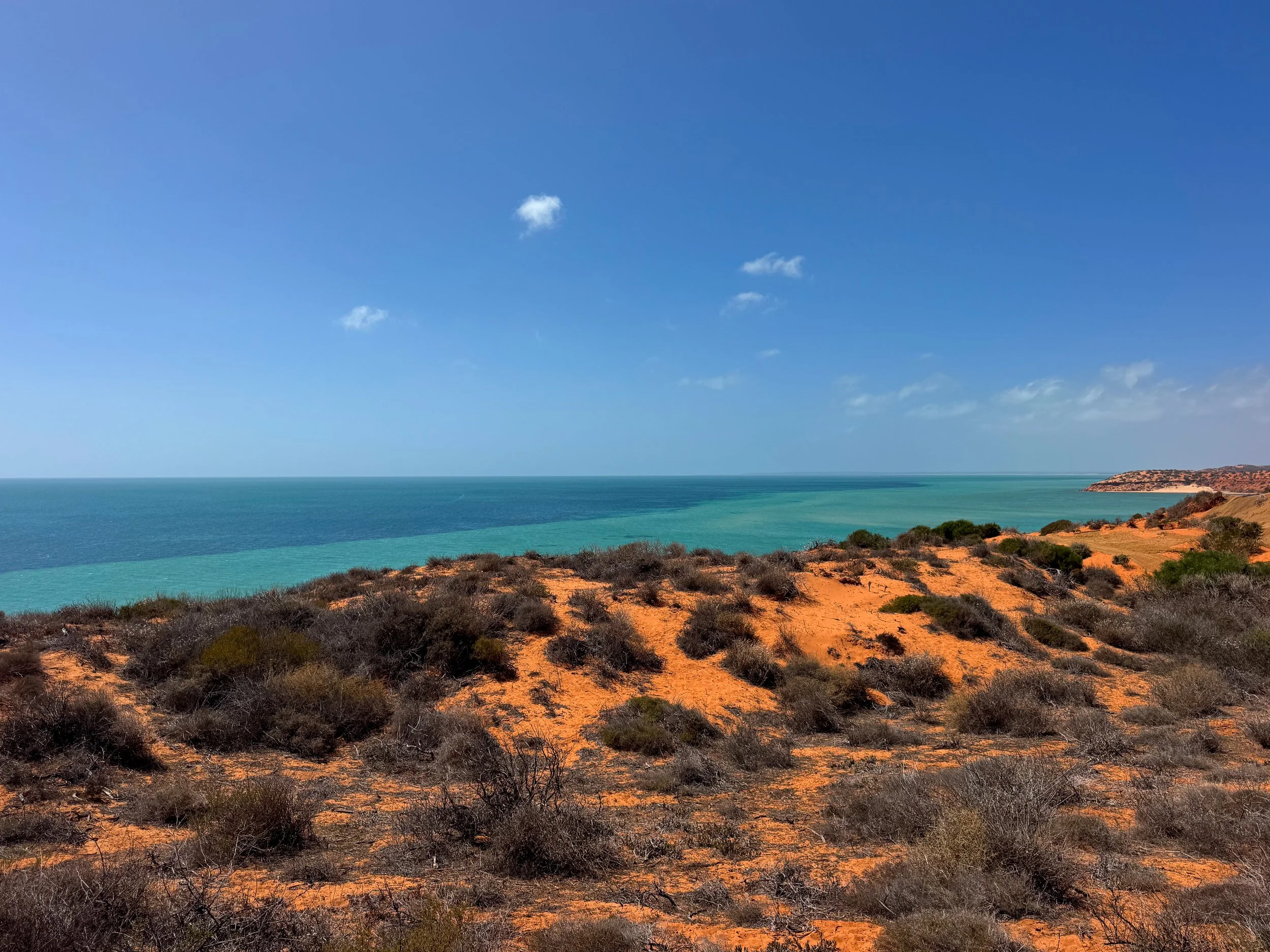
Slip Jack Point. A dramatic lookout point on the Cape Peron Peninsula. Reddish orange cliffs fade into white sand beaches hugging turquoise coastal waters. Large stingrays, cow tail rays, eagle rays, nervous sharks and schools of fish swim in the clear shallows below. Thousands of seagulls, cormorants and pelicans flock to the shoreline.
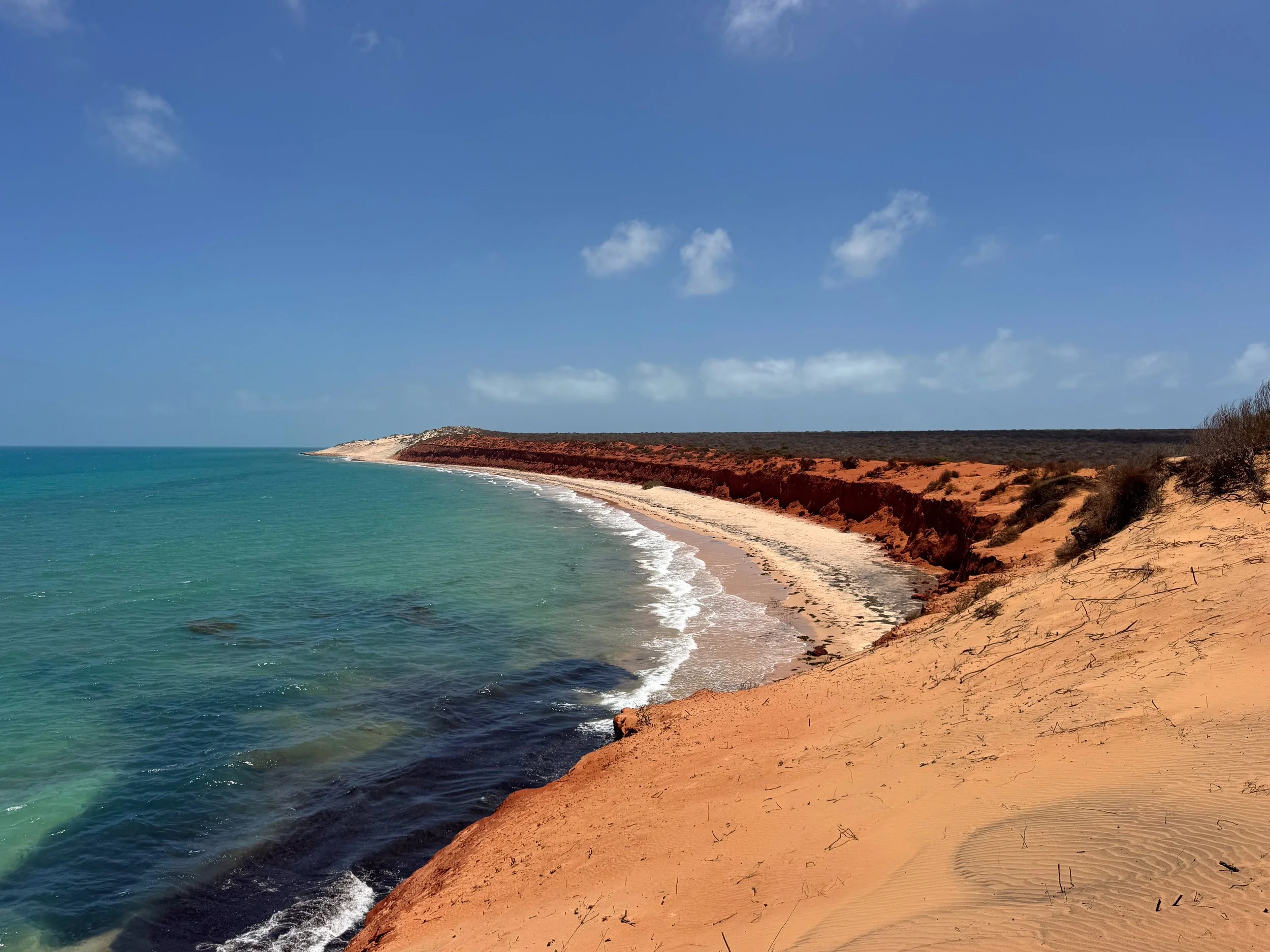
Bottle Bay. A remote beach home to an array of marine life. Drive down the shore to a short but steep trail with views of the crescent shaped white sand beach and its deep red cliffs. Watch for white tipped reef sharks, eagle rays, green sea turtles and loggerhead turtles from the cliffside view.
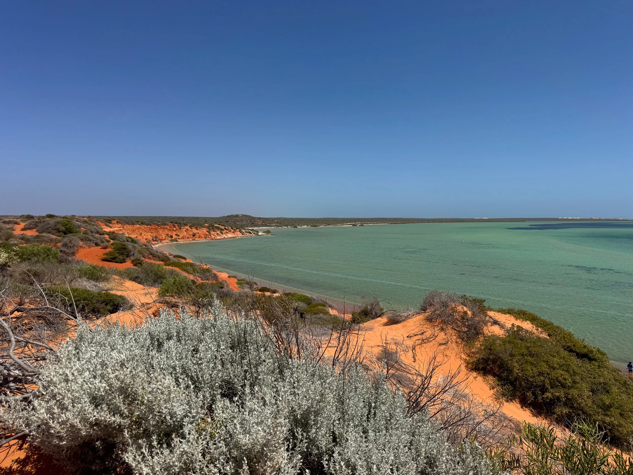
Big Lagoon. A blue lagoon colored in shades of aqua, turquoise and navy. A trail leads through a campground to the top of a dune with panoramic views. Orange sand flows from the dune into the warm and swimmable waters.
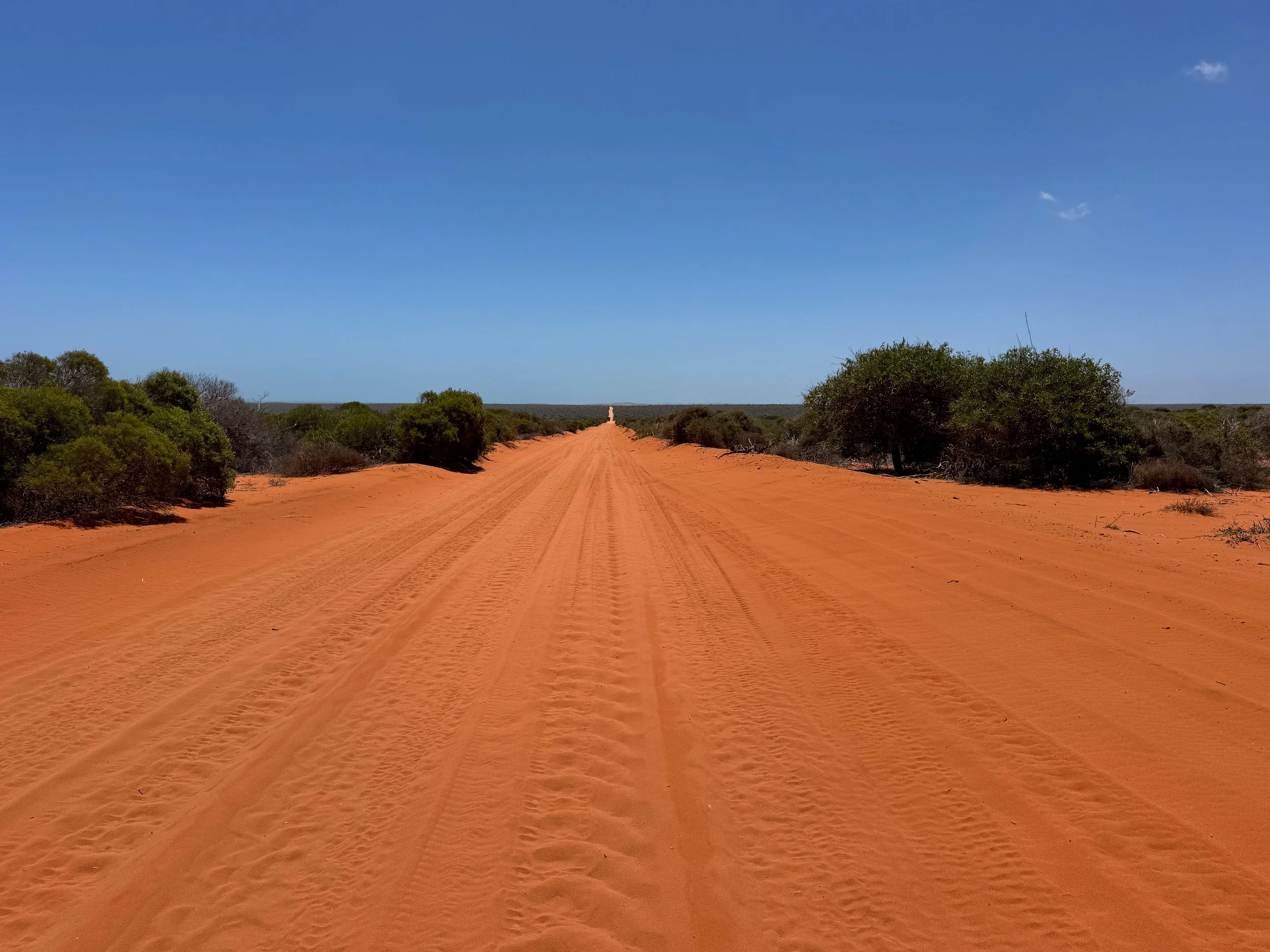
Getting Around. Francois Peron National Park is only accessible with a high clearance 4x4 vehicle. It requires experience to drive through to avoid getting bogged in the sandy roads. Unable to drive ourselves, we booked a full day tour from Denham with Shark Bay Coastal Tours.
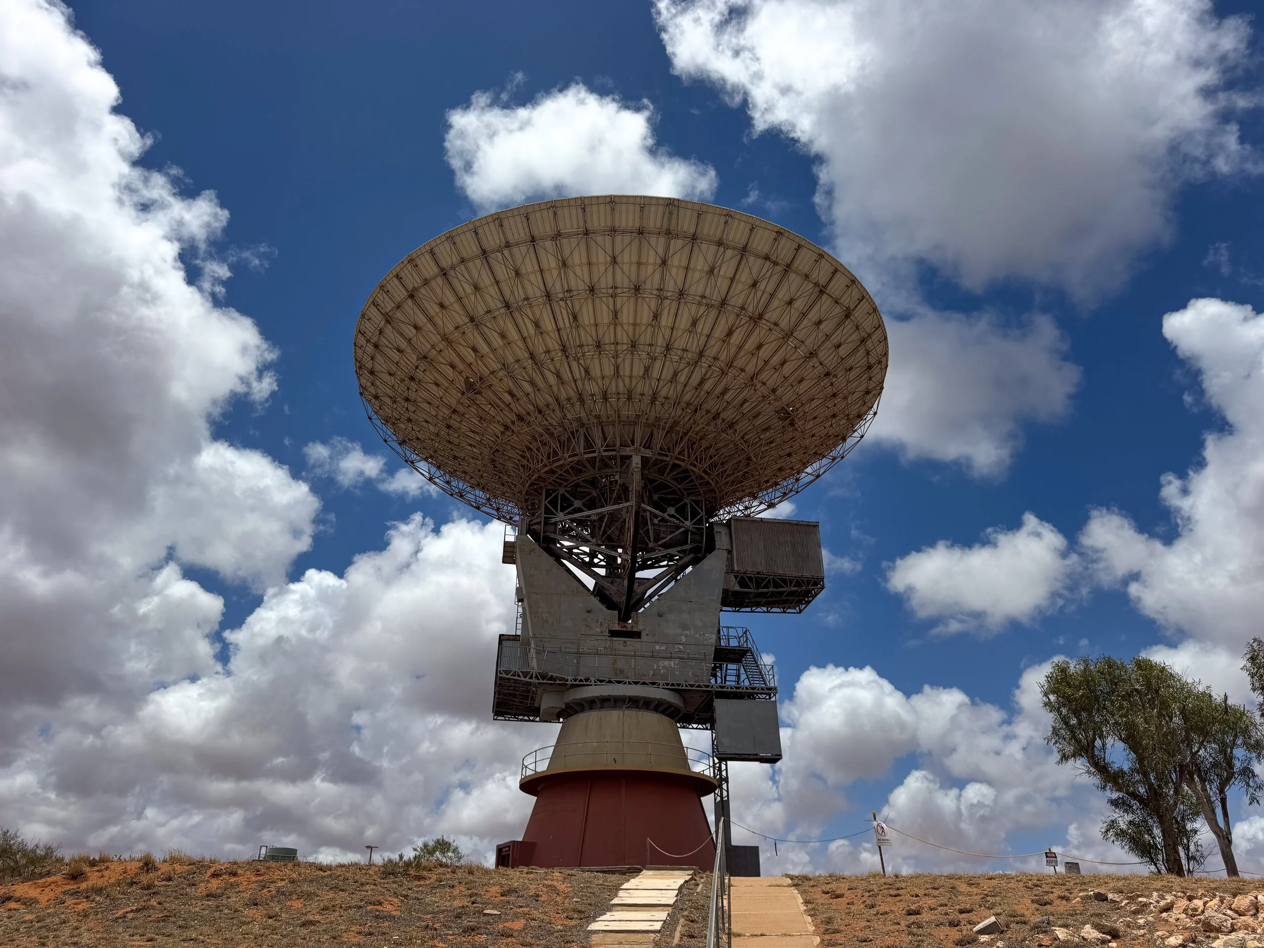
Carnarvon (Day 8)
Carnarvon is a large farm town located halfway between Shark Bay and Coral Bay. The region is responsible for producing a majority of Western Australia’s produce. It’s the perfect place to stop along the 6 hour drive to stock up on groceries and refuel. It’s located about 327km north of Denham in Francois Peron National Park and 237km south of Coral Bay.
Carnarvon Space and Technology Museum. A communications and monitoring station with large satellites used for some of NASA’s most historic space programs. The station includes an extremely well curated museum with retired NASA equipment, historic artifacts, a planetarium, a replica lunar lander, interactive simulators, photo booths and vintage arcade games.
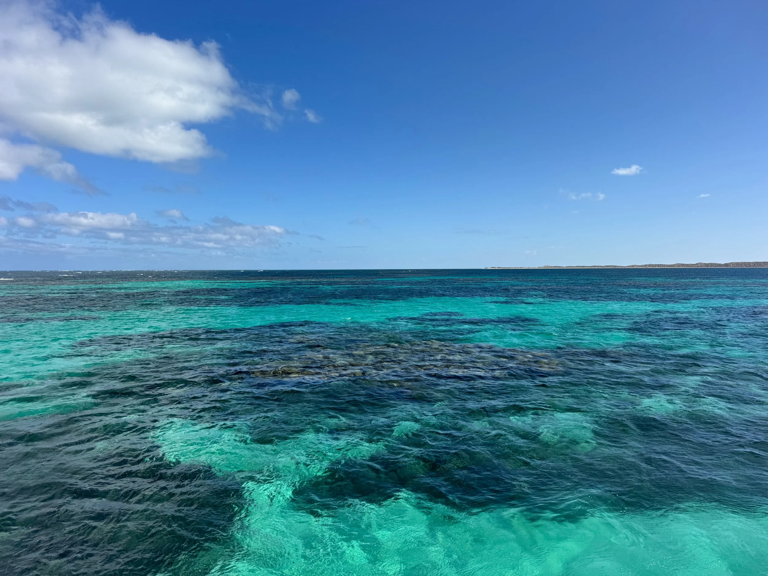
Ningaloo Reef (Days 9 - 11)
Ningaloo Reef is one of the world’s largest fringing coral reefs, stretching 300km along Cape Range from Coral Bay to Exmouth. Beneath the ocean’s prismatic blues is a world of subtropical corals, colorful fish, sea turtles, sharks, octopus and manta rays.
Subtropical Corals. Ningaloo Reef is a subtropical reef system. What it lacks in color, it makes up for in variety and complex shapes. The corals are mostly brown and tan with some purple and blue.
Coral Bleaching. The reef has experienced stress due to a multi year marine heatwave. Most corals near shore are in a disastrous state. The corals further along the edge of the reef are faring better.
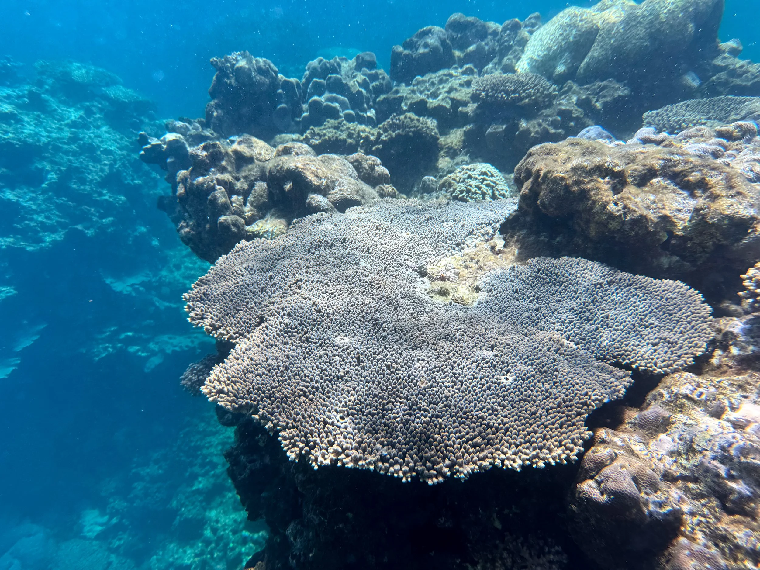
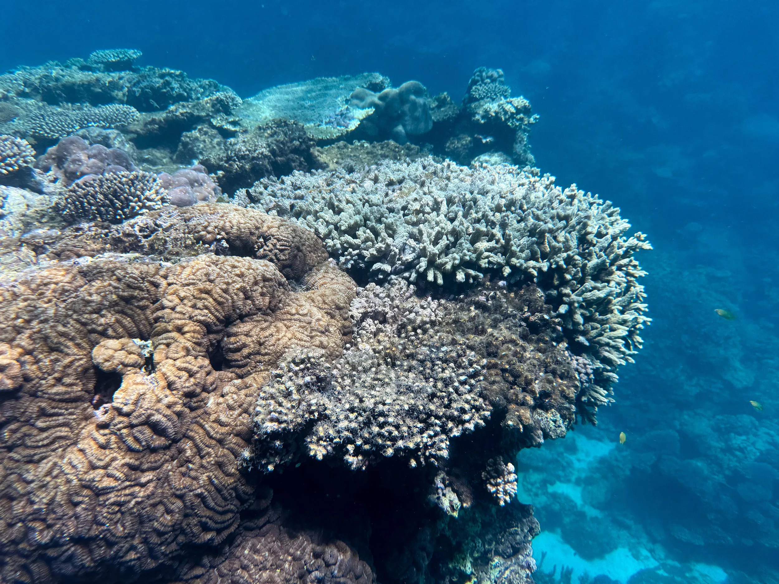
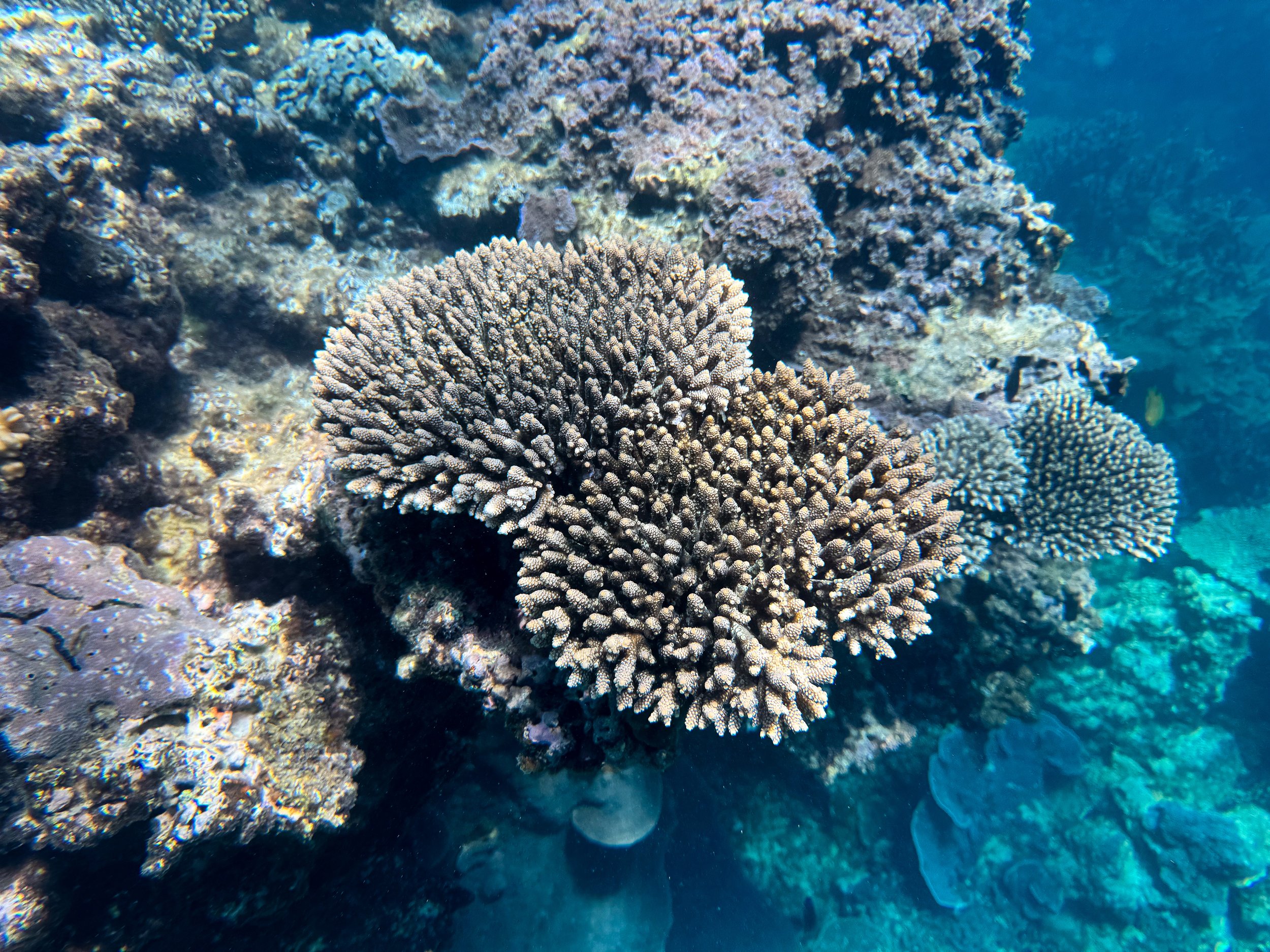
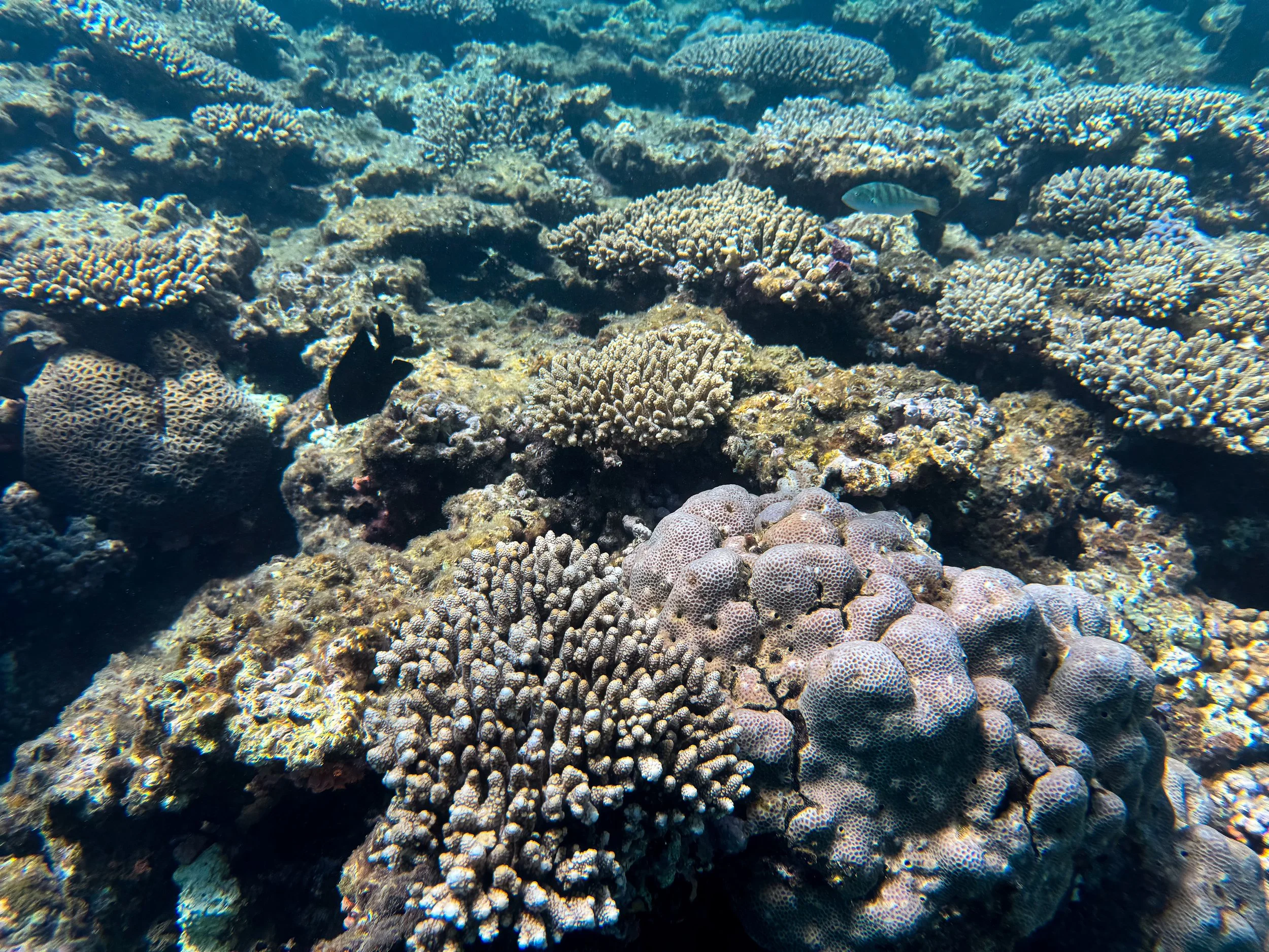
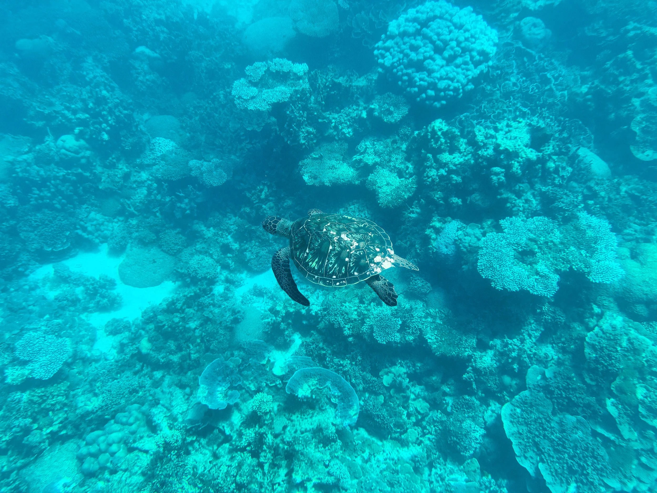
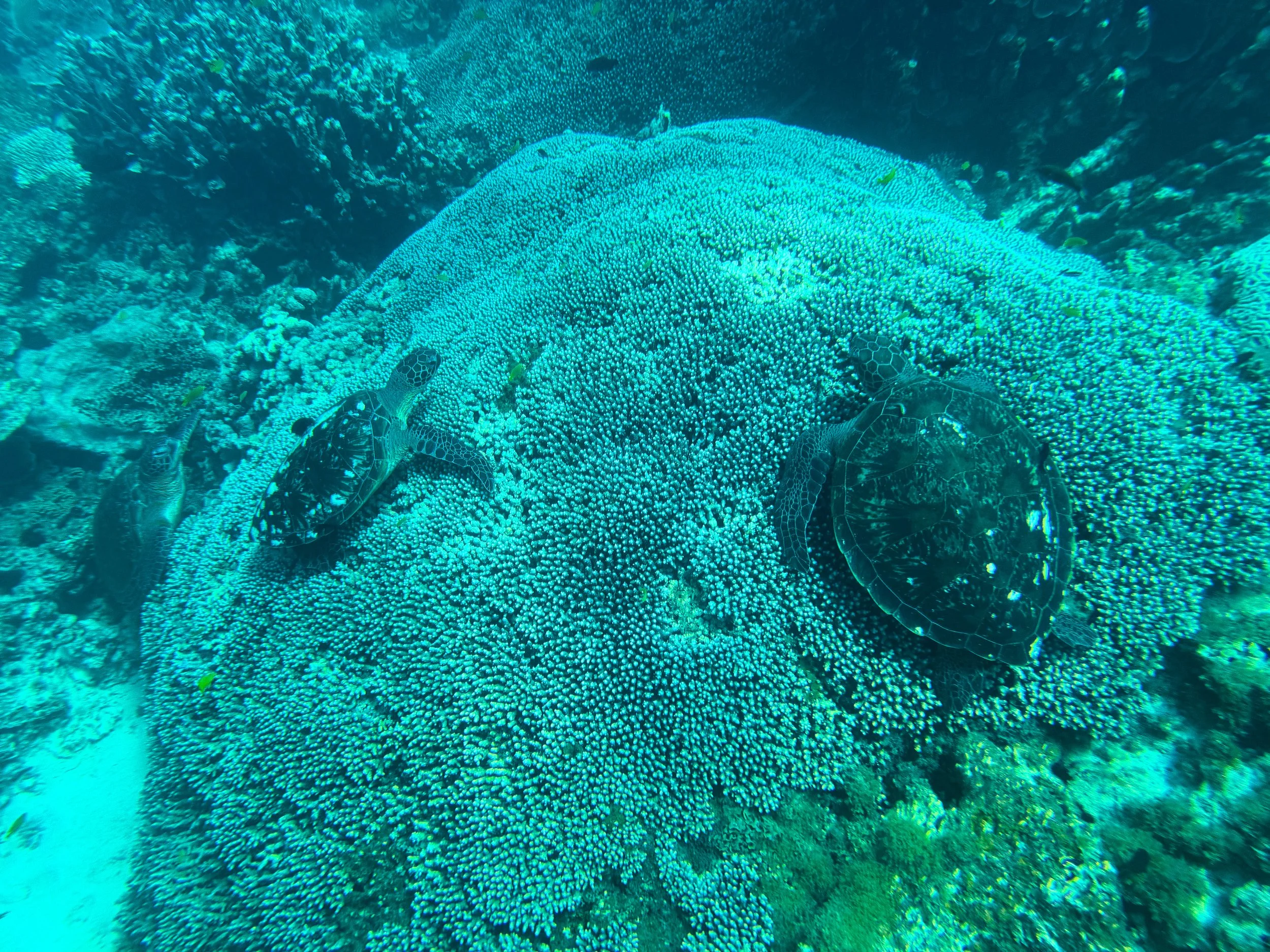
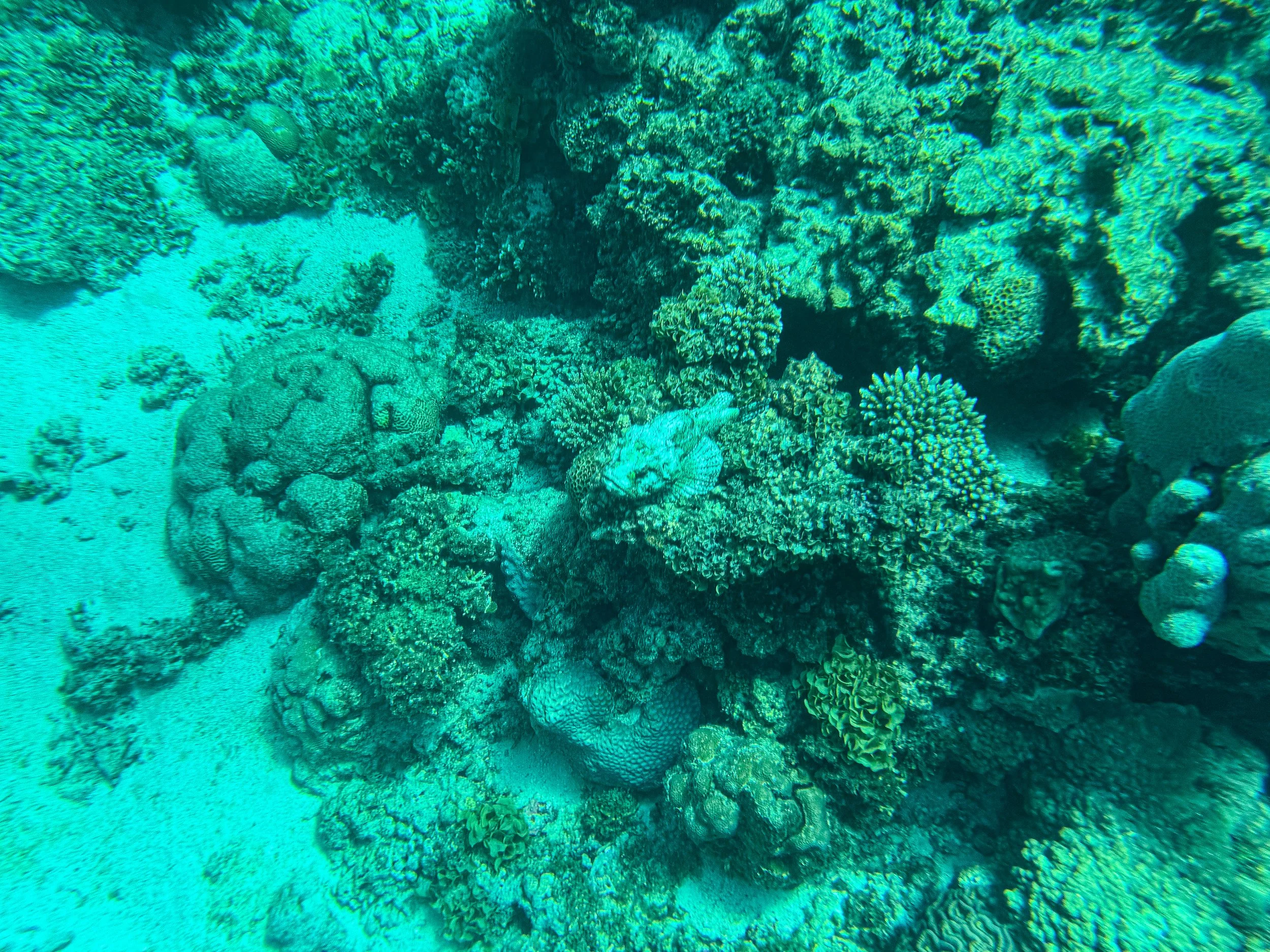
Coral Bay (Day 9)
A small resort town on the southern end of Ningaloo Reef. It’s home to beautiful beaches, snorkeling points, tour operators, hostels and campgrounds. It’s located about 237km north of Carnarvon and 150km south of Exmouth.
Coral Bay Snorkeling Tour. The coral mazes near the outer reef of Coral Bay are teeming with healthy corals and an abundance of marine life. We booked a full day snorkel tour with Coral Bay Eco Tours on Get Your Guide. The tour brought us to the South Maze, Blue Maze and Manta Cleaning Station.
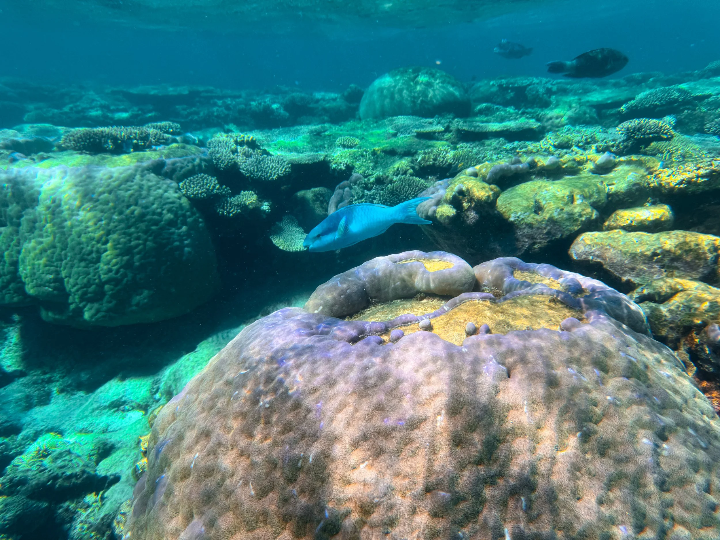
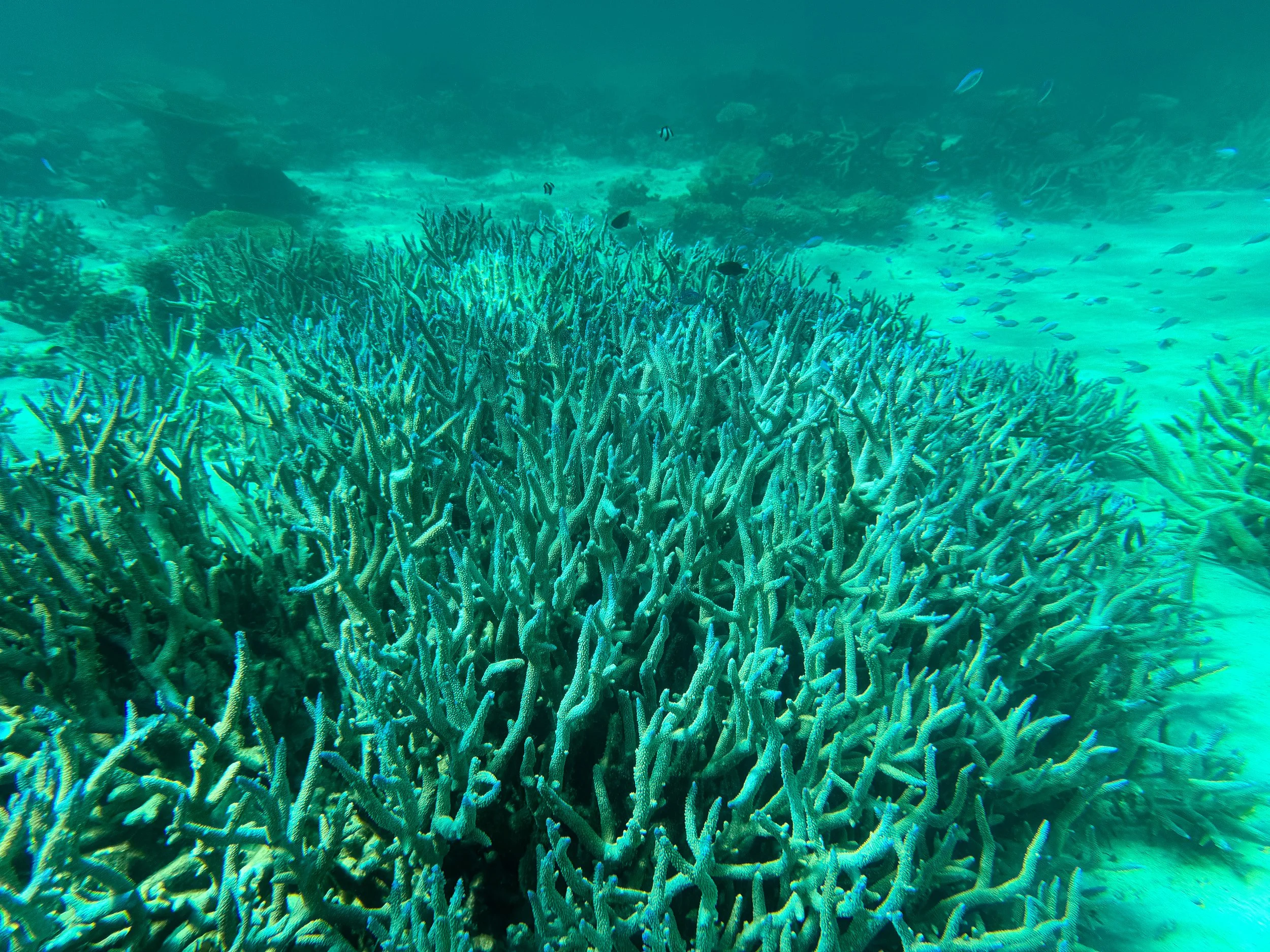

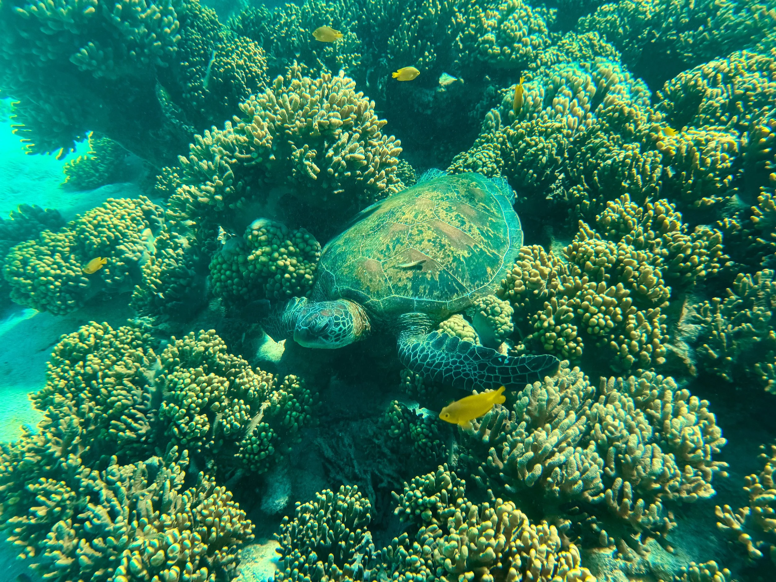
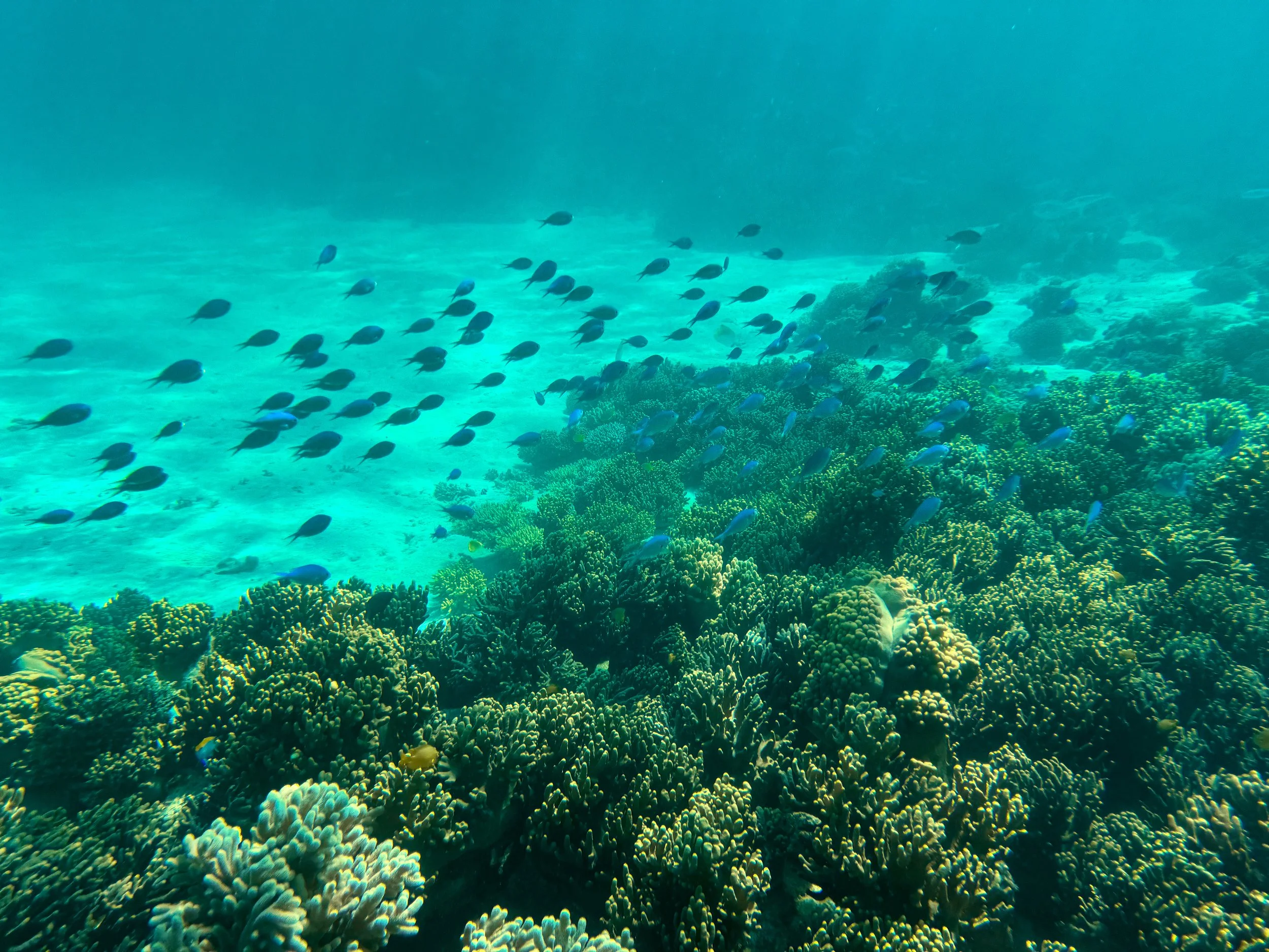
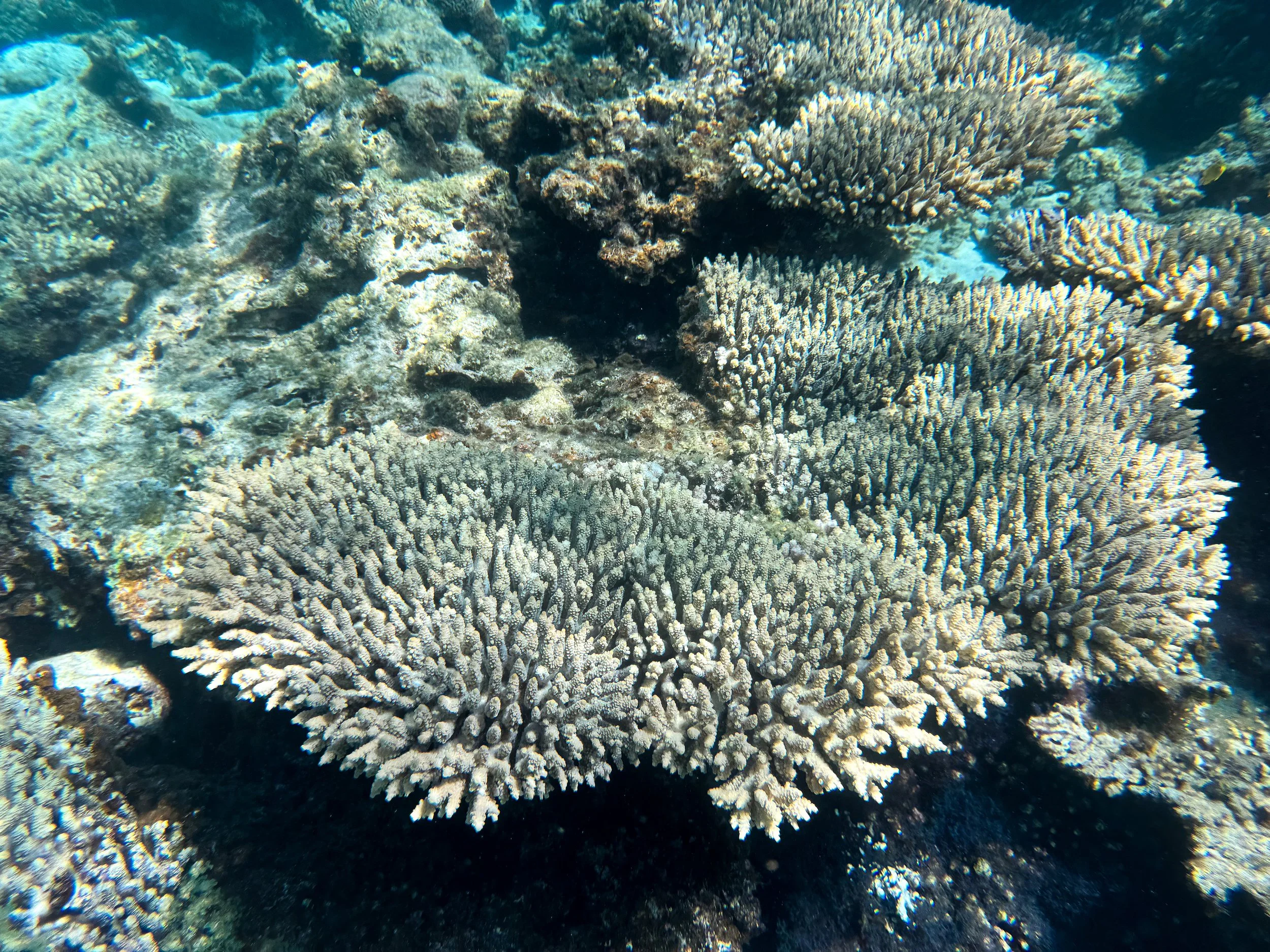
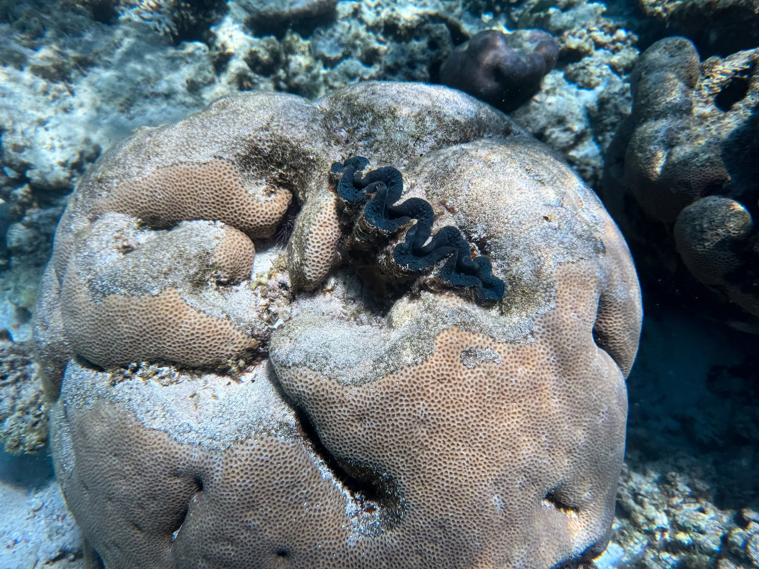
South Maze. An impressive maze of shallow coral boomies, sandy patches and an abundance of marine life. It’s located several hundred meters off shore from Paradise Beach in Coral Bay. Green sea turtles and schools of colorful fish swim throughout the reef. Blue clams and octopus nestle themselves into the corals. White tipped reef sharks sleep within coral caves. Stingrays and moray eels slink along sandy patches.
Blue Maze. A maze of large coral boomies, underwater canyons and a variety of marine life. It’s located several hundred meters offshore from Paradise Beach in Coral Bay. Countless tiny fish swim in the shallow waters above the corals boomies. Sea turtles swim through the reef and rest on coral beds. Well camouflaged octopus lurk within crevices of corals. Scorpion fish sit on corals awaiting passing prey.
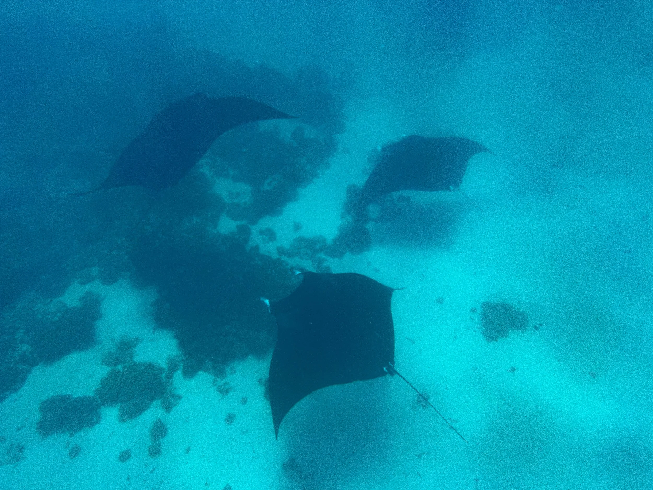
Manta Cleaning Station. Manta Rays are some of Ningaloo Reef’s most prominent animals. The graceful giants feed in the plankton rich waters and frequent “cleaning stations” on the reef where smaller fish groom them. We swam and snorkeled above one cleaning station, spotting 6 manta rays including a rare Melanistic Ray, recognizable by its jet black skin. At one point, 4 manta rays started rotating in a mesmerizing circular pattern. The cleaning station is located a few hundred meters offshore from Point Maud and Skeleton Beach in Coral Bay.
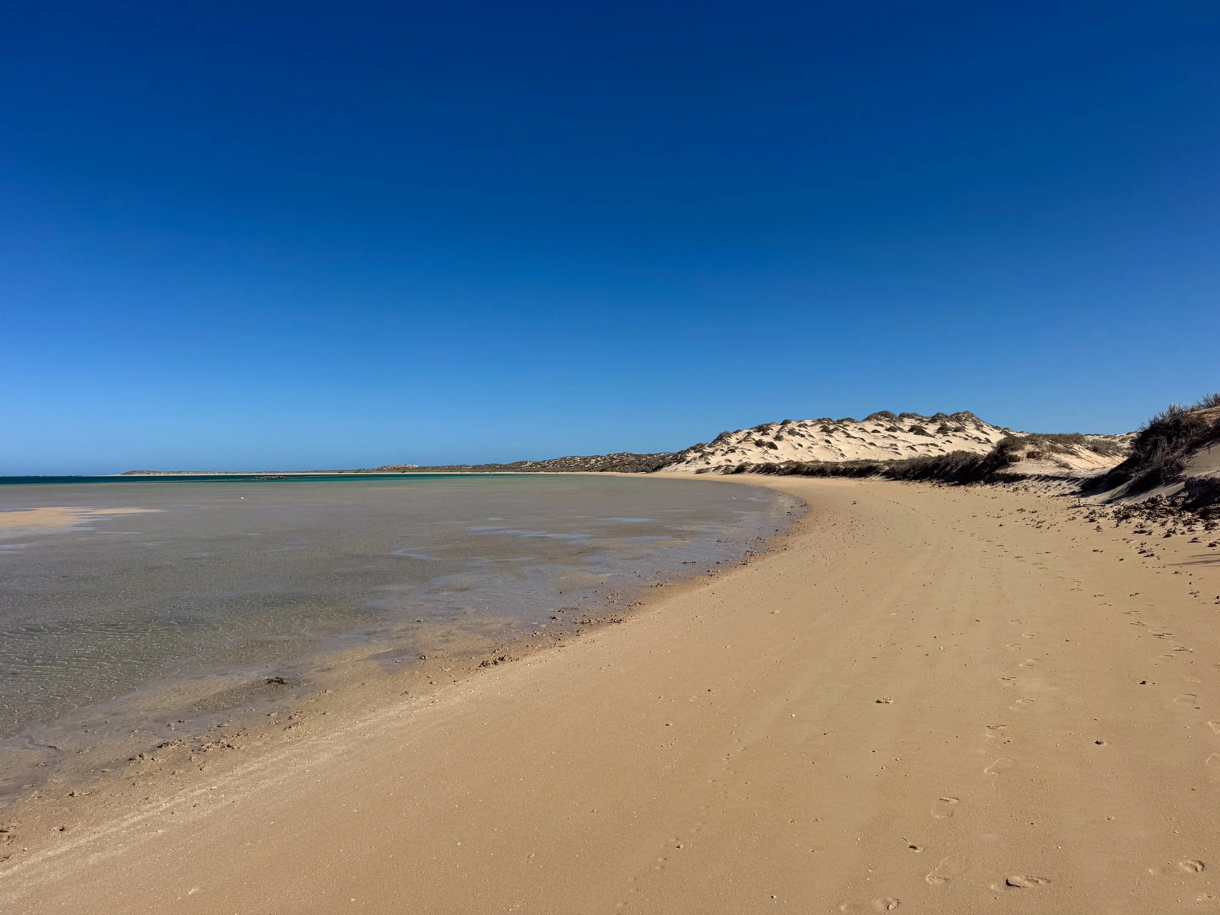
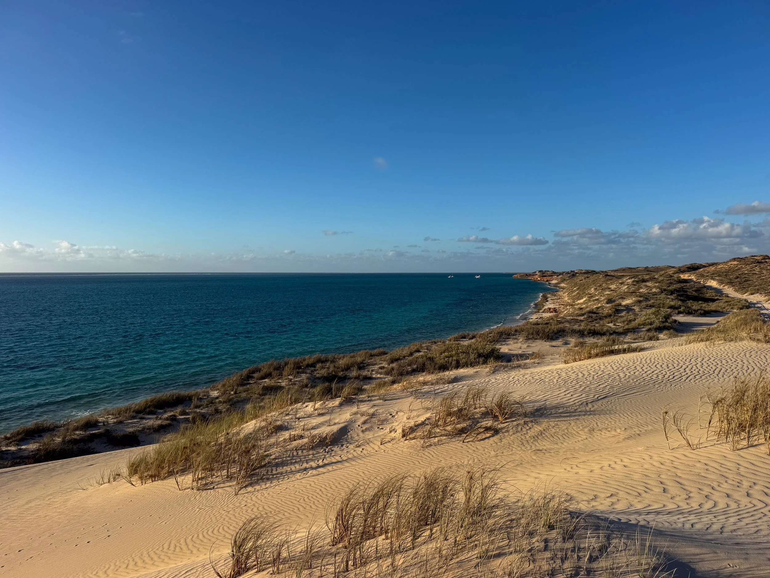
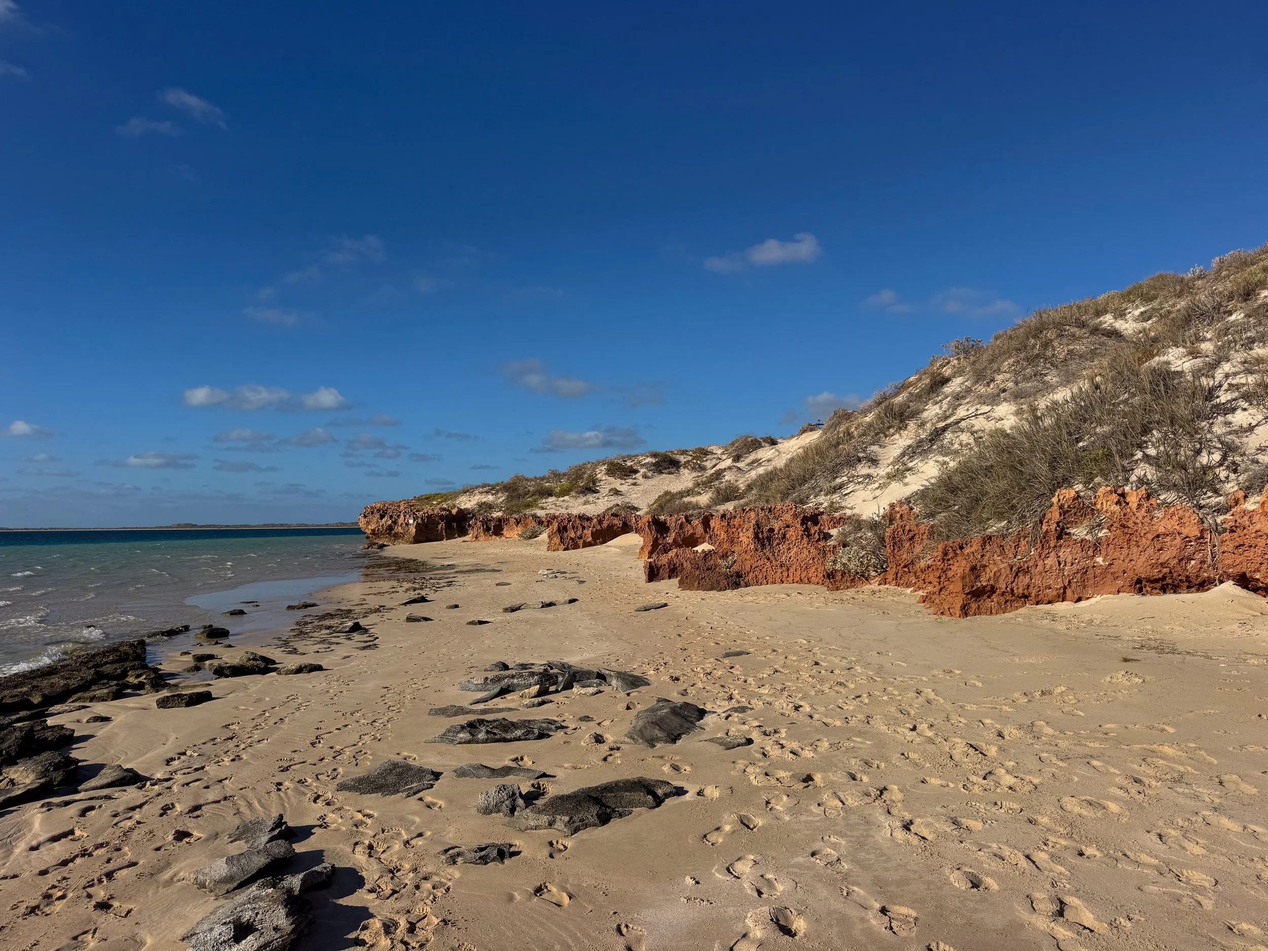
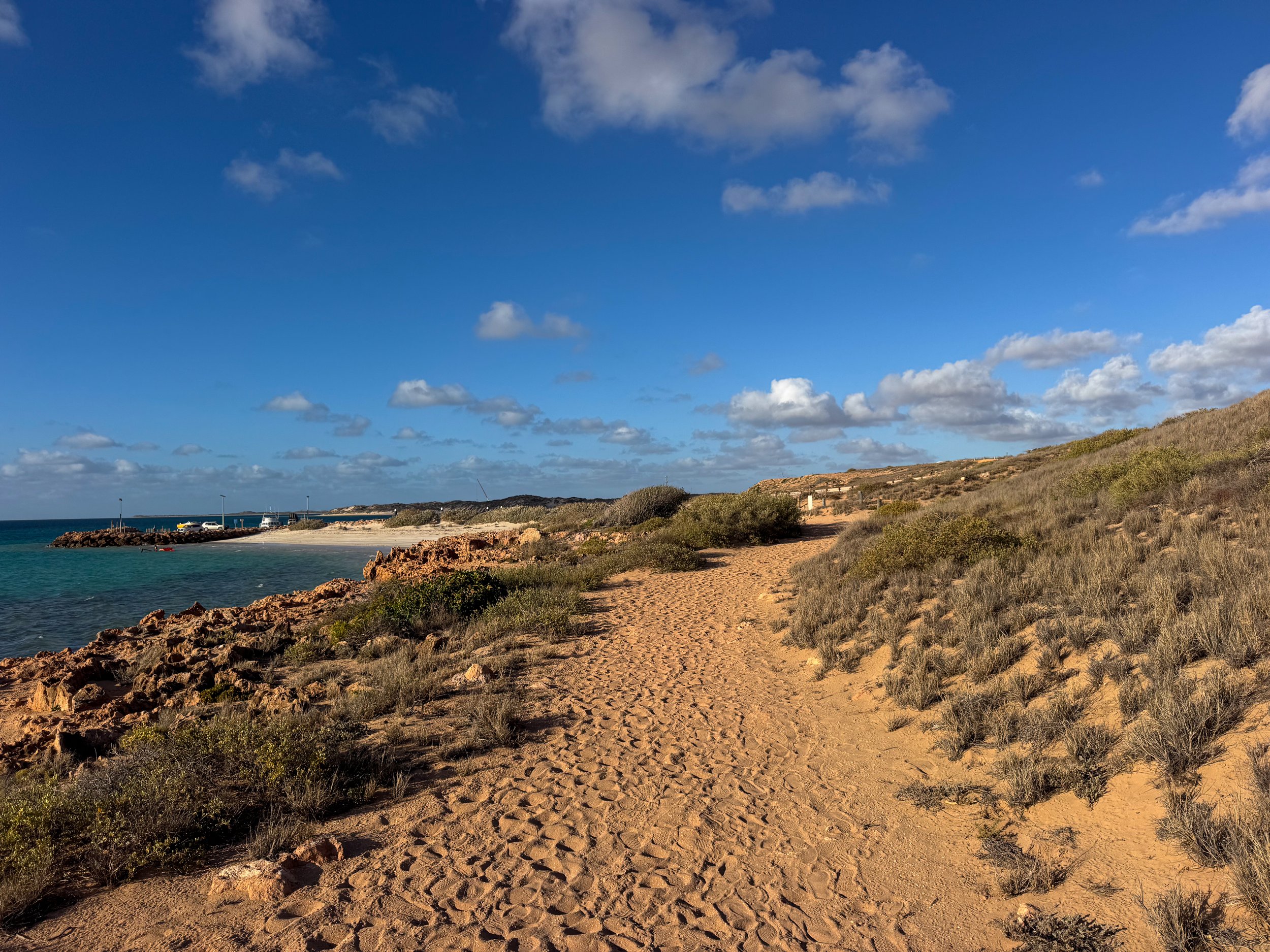
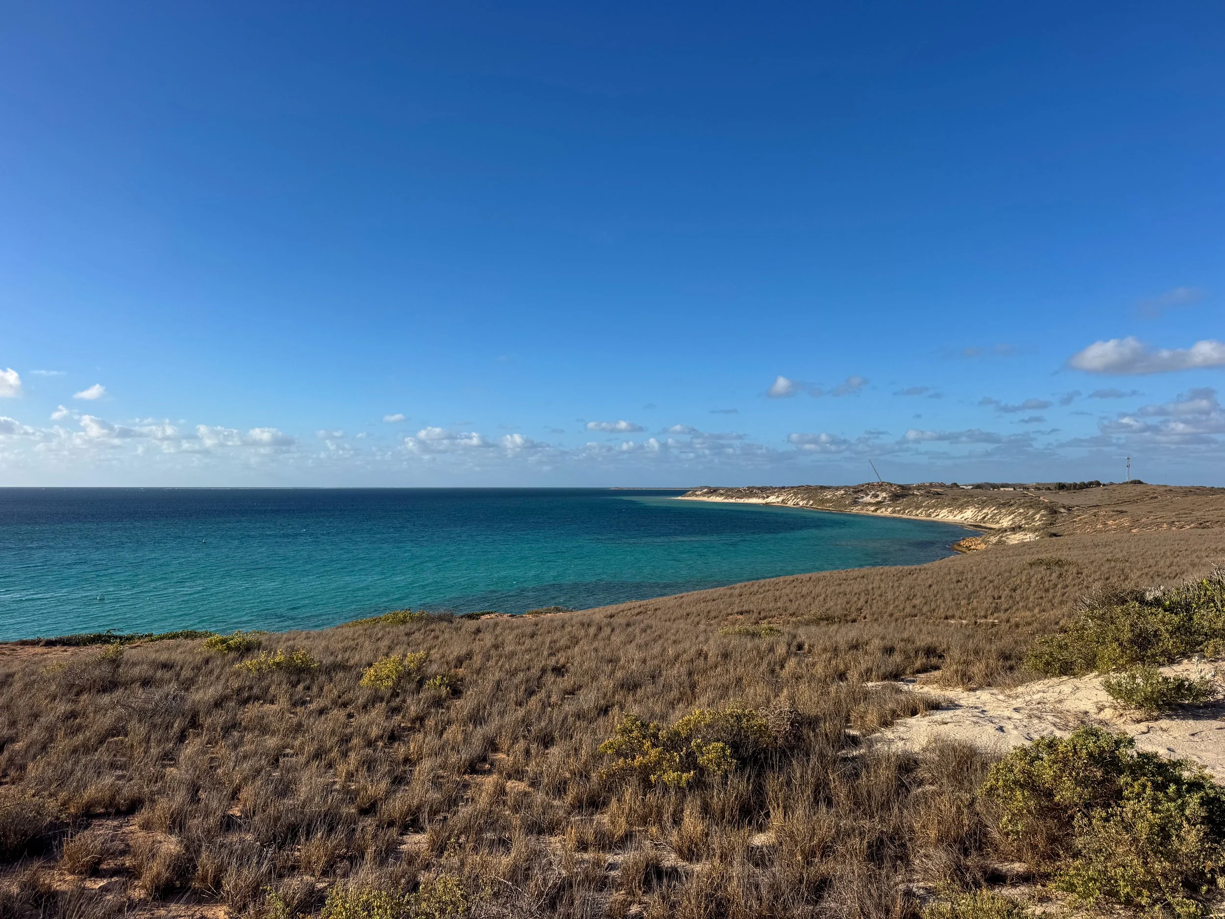
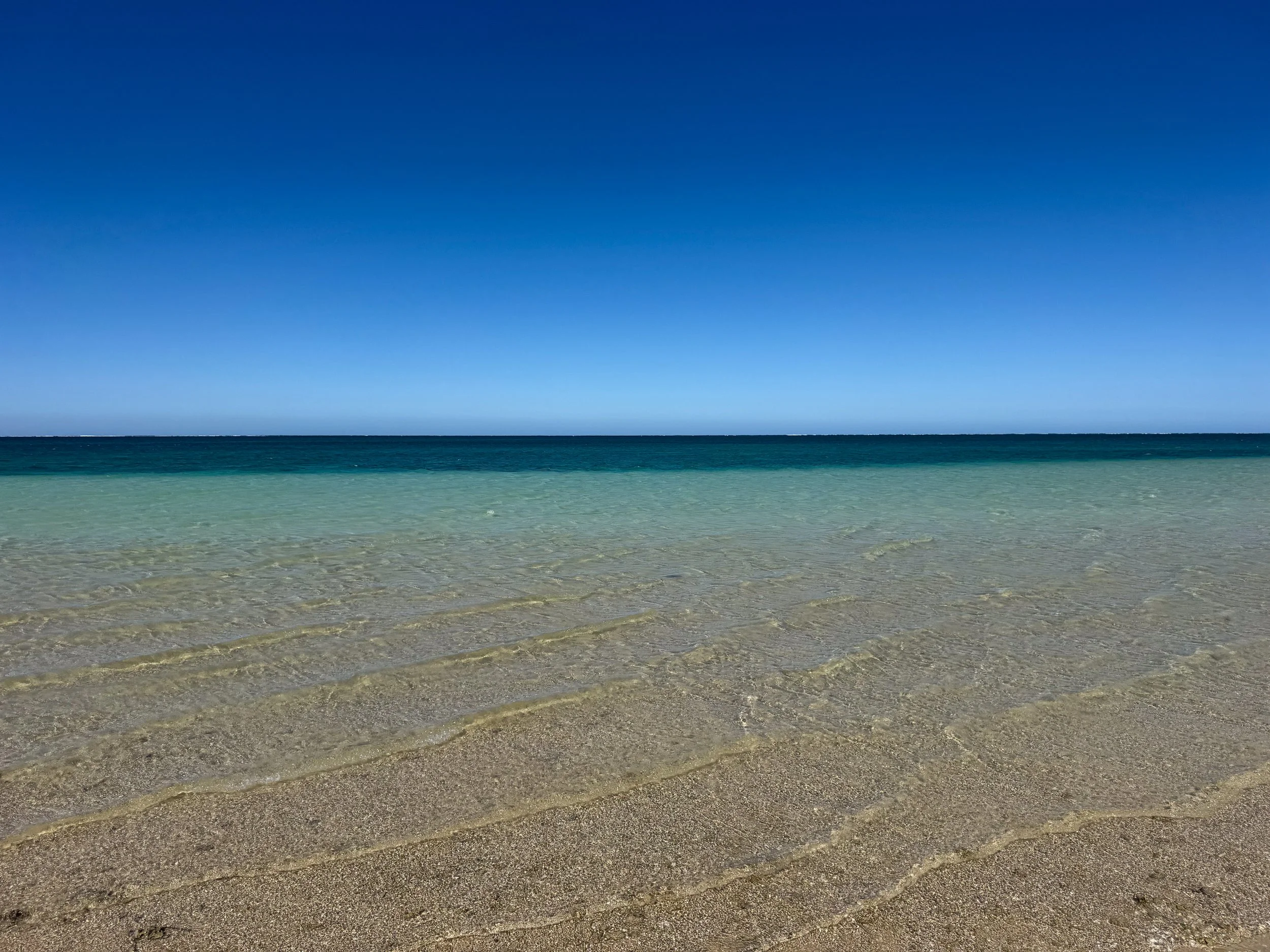
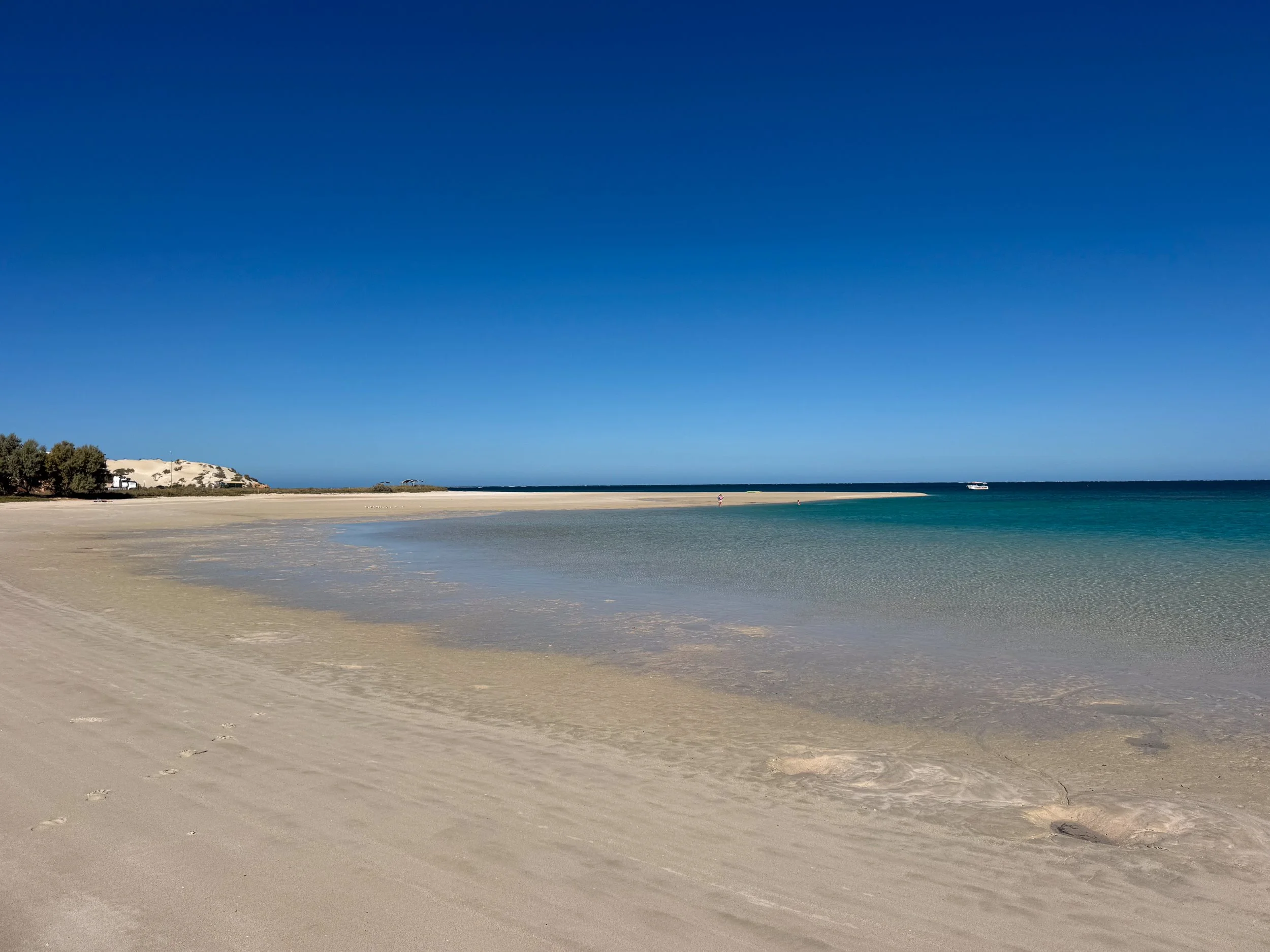
Coastal Sights
Bill’s Bay. A shallow bay with a protected white sand beach. It’s the most accessible beach in Coral Bay for swimming, sunbathing and snorkeling. Unfortunately most of the corals in the bay are dead.
Paradise Beach. A narrow beach stretching south along Coral Bay’s shore. The best area for snorkeling is on the opposite side of the point from Bill’s Bay. Be careful of Portuguese Man o’ Wars on windy days.
Shark Sanctuary. A tidal ocean lagoon separated by a thin coral band. It’s home to baby sharks and stingrays.
Coral Bay Walk Track. A coastal hiking path leading from Paradise Beach to the Coral Bay Jetty. It overlooks the ocean, reef and small beaches nestled between limestone cliffs.
Five Fingers Reef. A remote beach named after 5 small limestone ridges extending into the water. It’s a popular spot for snorkeling and wind surfing. The beach is only reachable by 4x4 or on foot from the Coral Bay Jetty.
Places to Eat, Drink & Stay
Bill’s Bar. The most popular pub in town with a large food and drink menu. It has a lively atmosphere bringing travelers and locals together each night. Try the peel and eat prawns with an Aussie craft beer.
Coral Resort Bakery. A bakery with a selection of savory pies, sweet baked goods and breads. Try the “Cheesymite Roll” swirled with cheddar and vegemite.
Sweet Coral Bay. An ice cream shop with classic and tropical fruit flavors. Try the “Whale Shark” made with white chocolate and spirulina (an edible blue-green algae).
Ningaloo Backpackers Club. A large hostel with a range of basic dorms, private rooms and shared restrooms. It offers a communal kitchen to cook meals, a bar to order drinks from and a pool to swim and lounge alongside. Reserve on Booking.
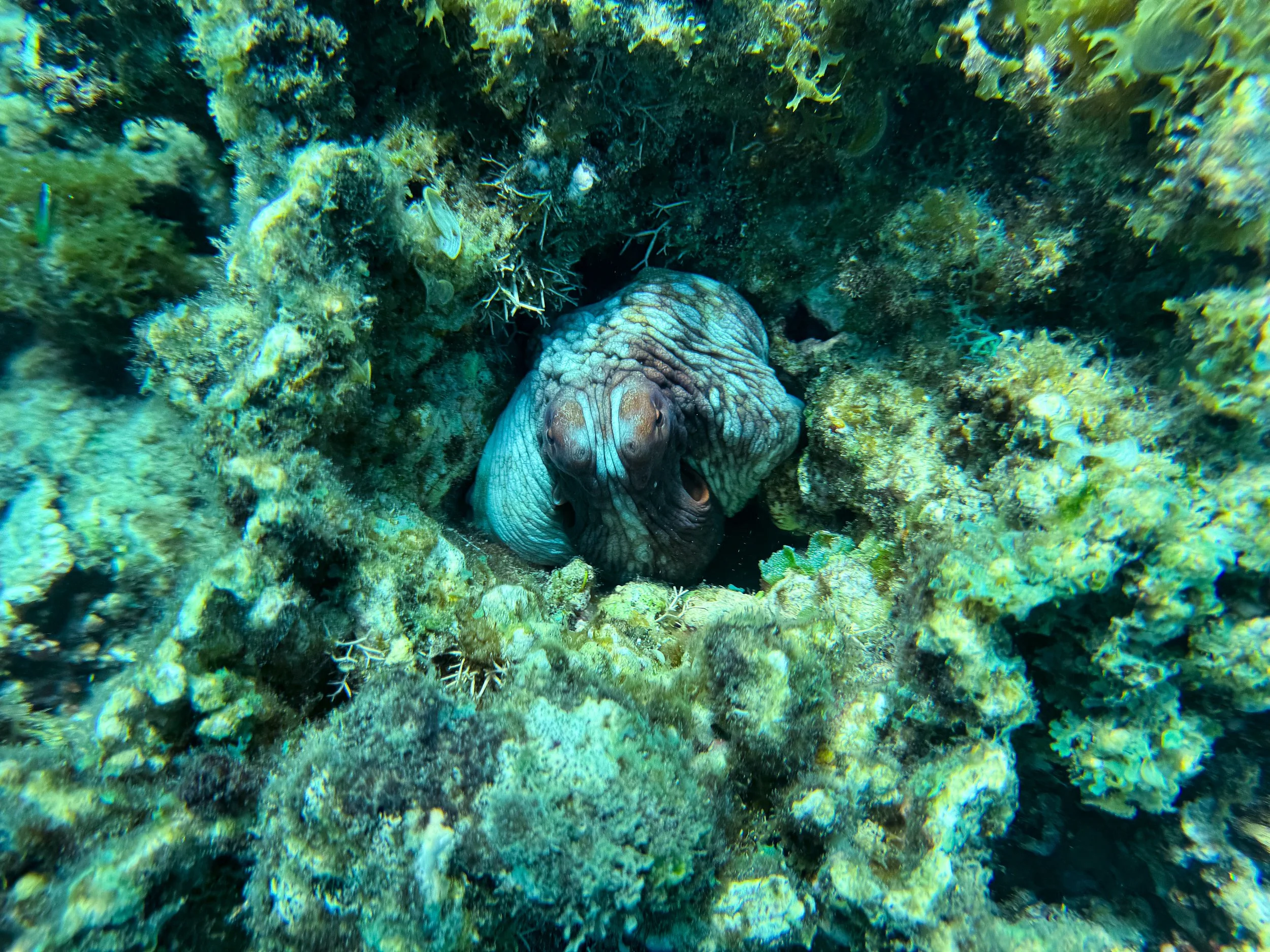
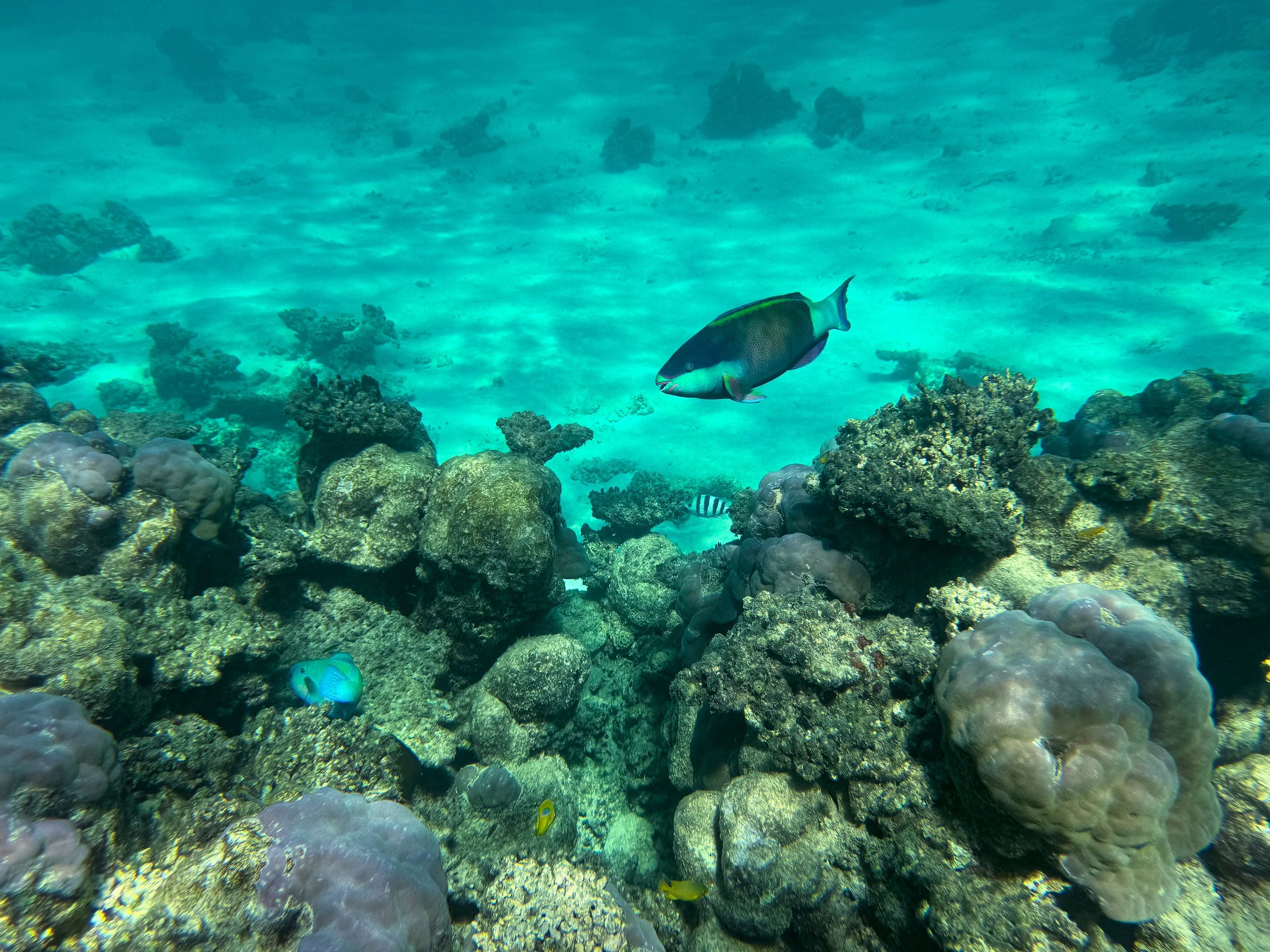
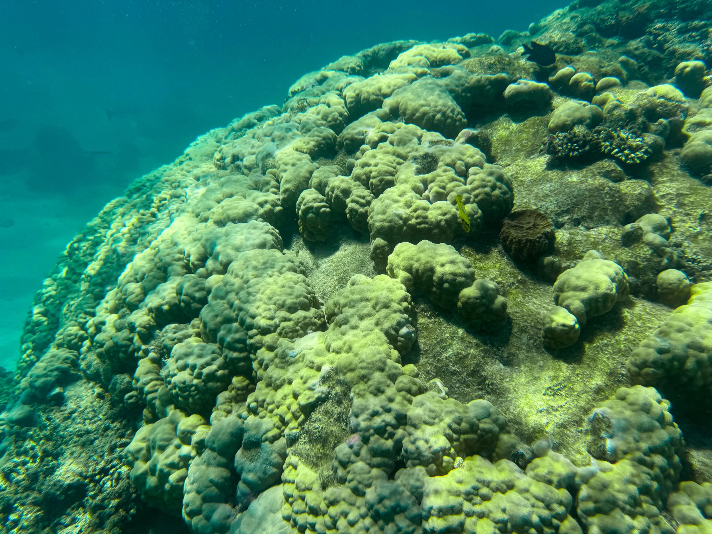
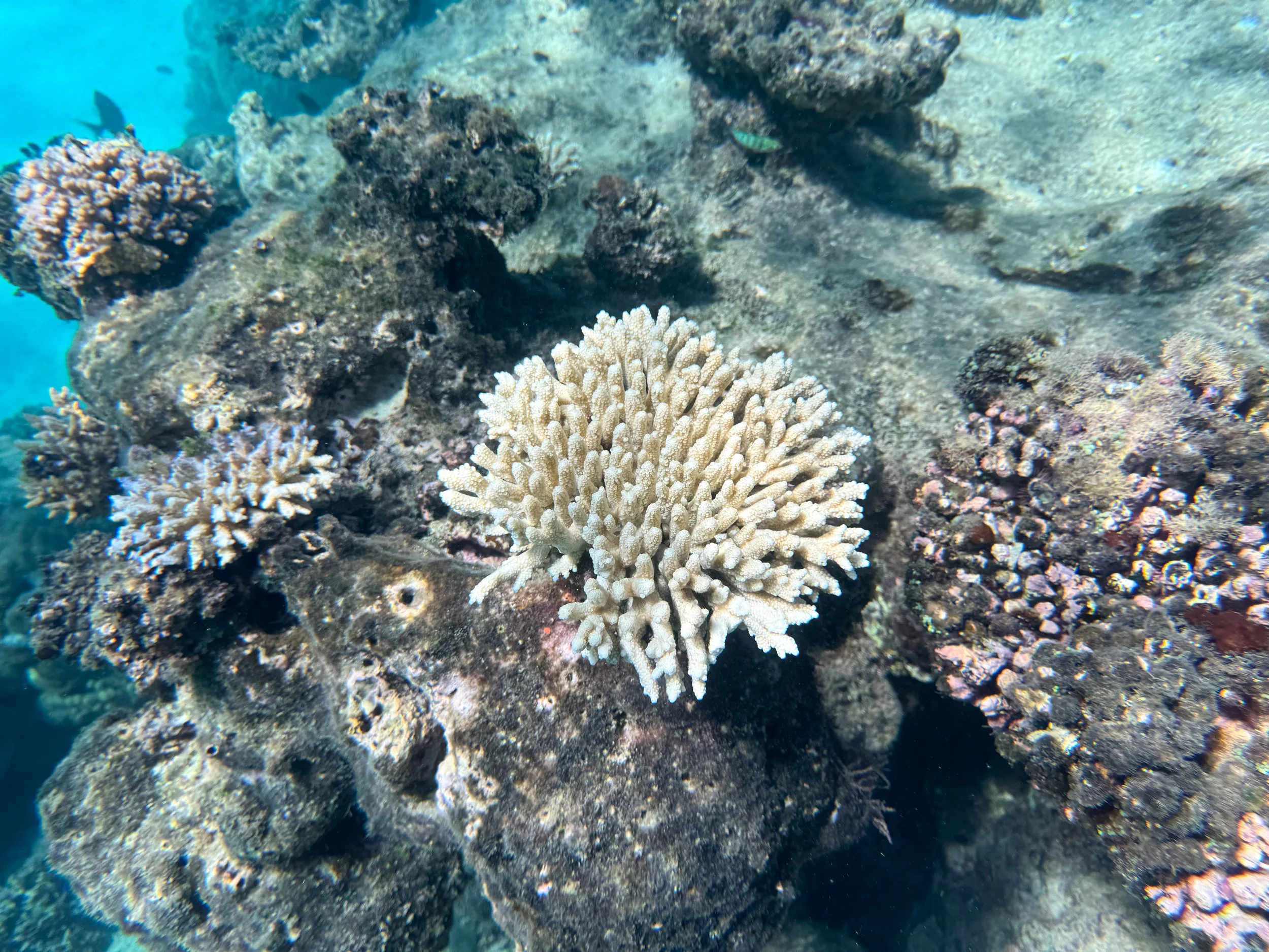
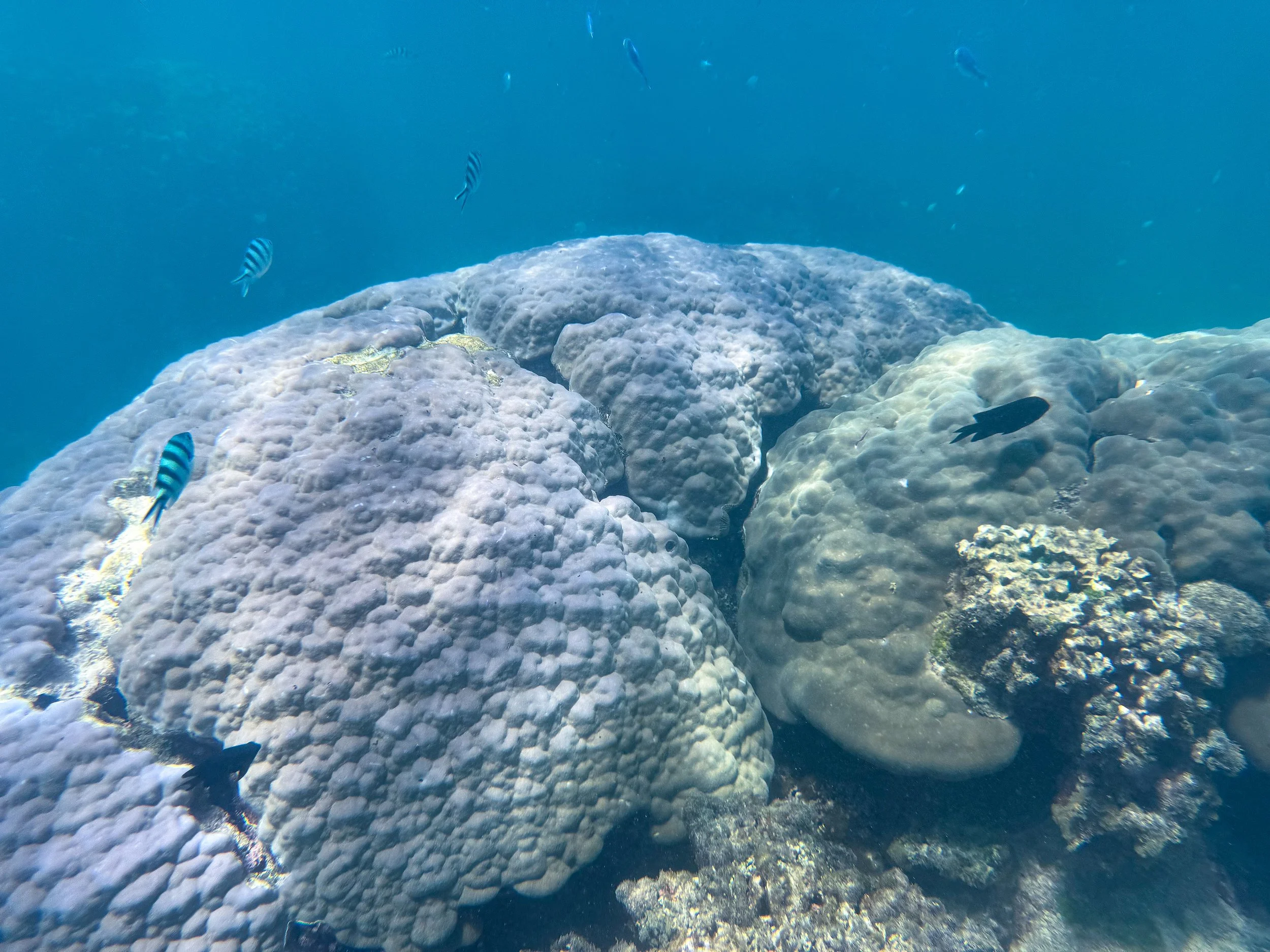
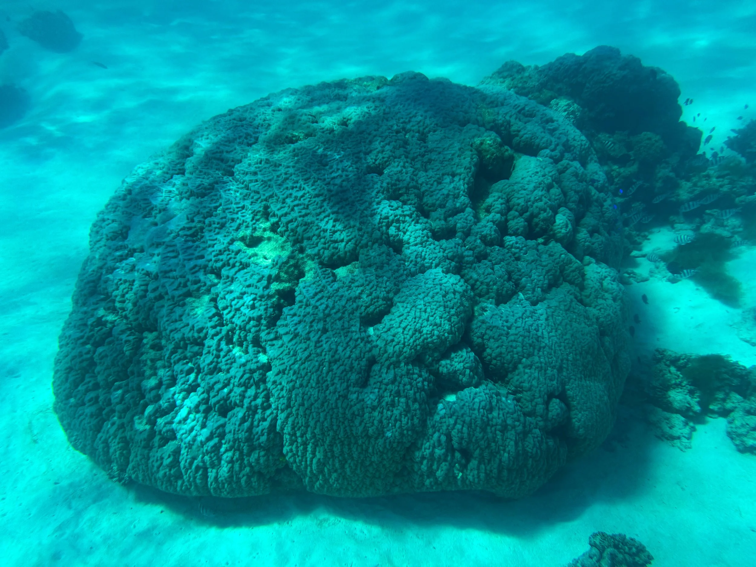
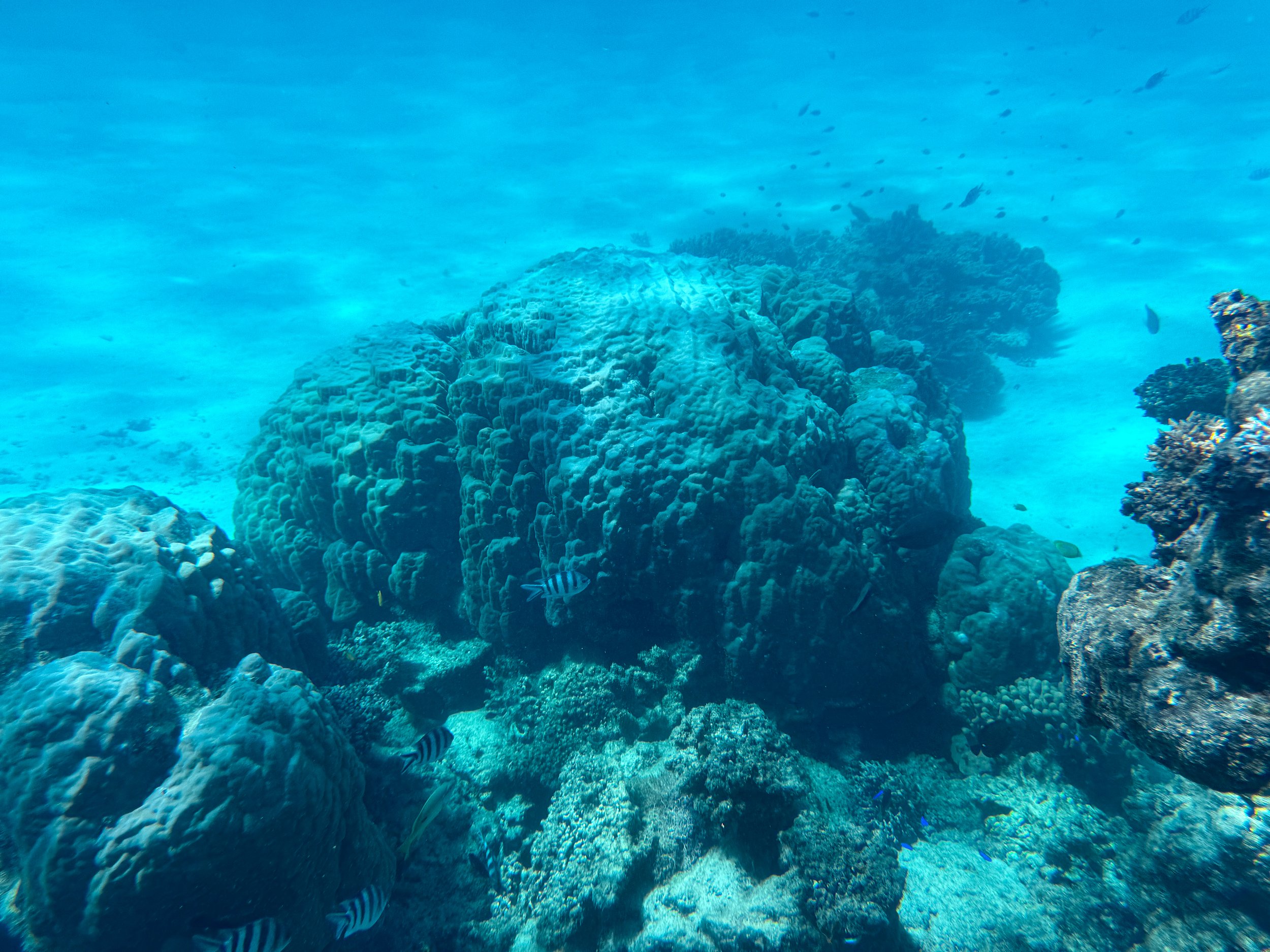
Exmouth (Day 10)
Exmouth is a remote resort town on the northeast side of Cape Range with access to many of the national park’s beaches, bays and gorges. It’s popular for its accommodations, tour operators, restaurants and micro breweries. It’s located about 150km north of Coral Bay.
Tantabiddi Sanctuary Zone. A coastal sanctuary in the north of Ningaloo Reef. It’s a habitat for sea turtles, playful dolphins and tropical fish. We snorkeled here on a half day tour with Cape Immersion Tours. The water glowed with intense shades of blue and turquoise. Groups of sea turtles mated near the surface while dolphins swam alongside the boat. We drift snorkeled in the current above reef formations. Bulbous purple, yellow and blue corals stood out amongst the expanse of dead corals. Giant grouper, camouflaged octopus, translucent squid and a white tipped reef shark were some of the underwater highlights. Book on Viator.
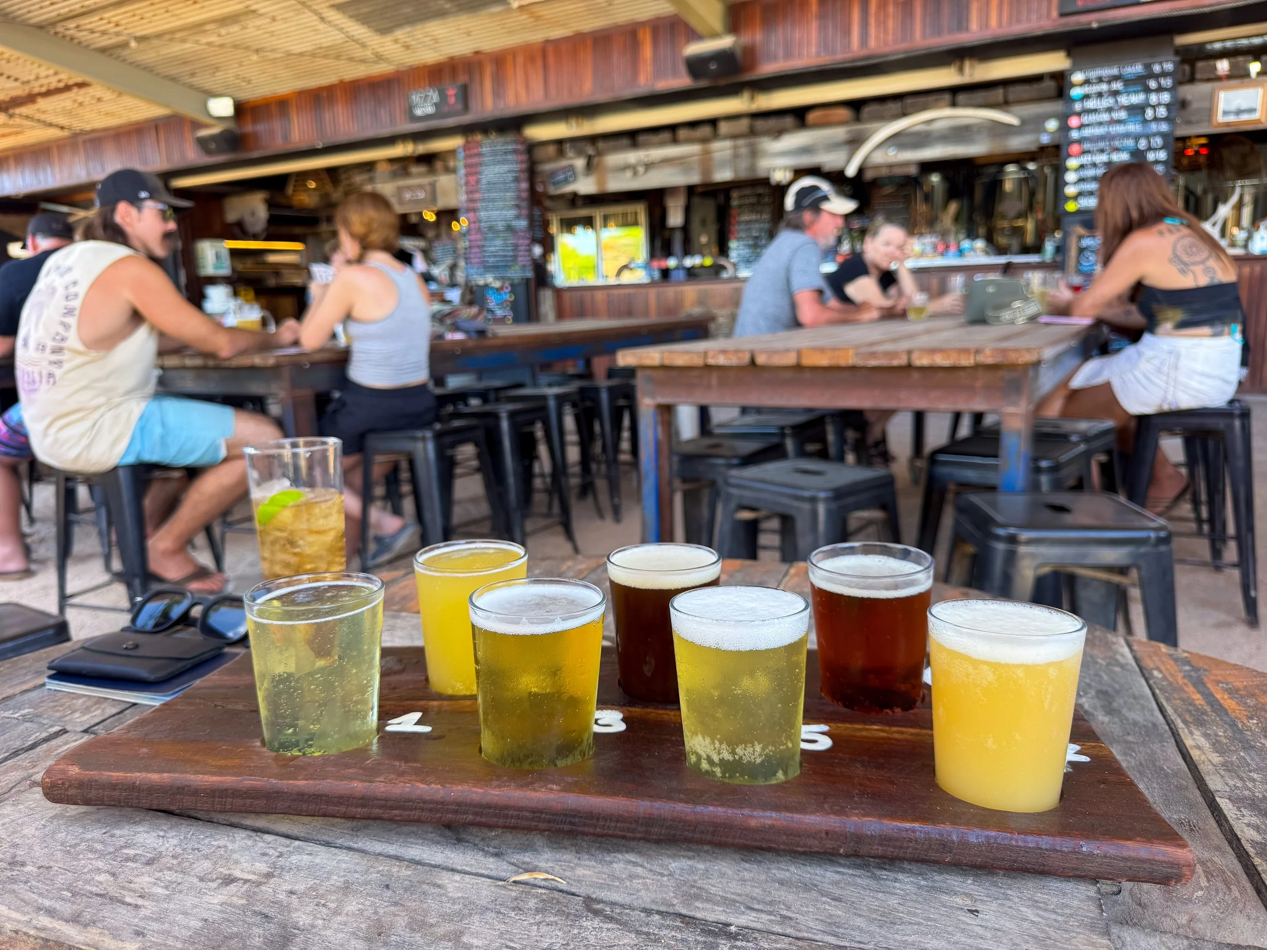
Whale Bone Brewing Co. A brewery and distillery in Exmouth with a range of craft beers, artisan spirits and flavorful pizzas. Order a paddle of 7 beers to taste the latest brews!
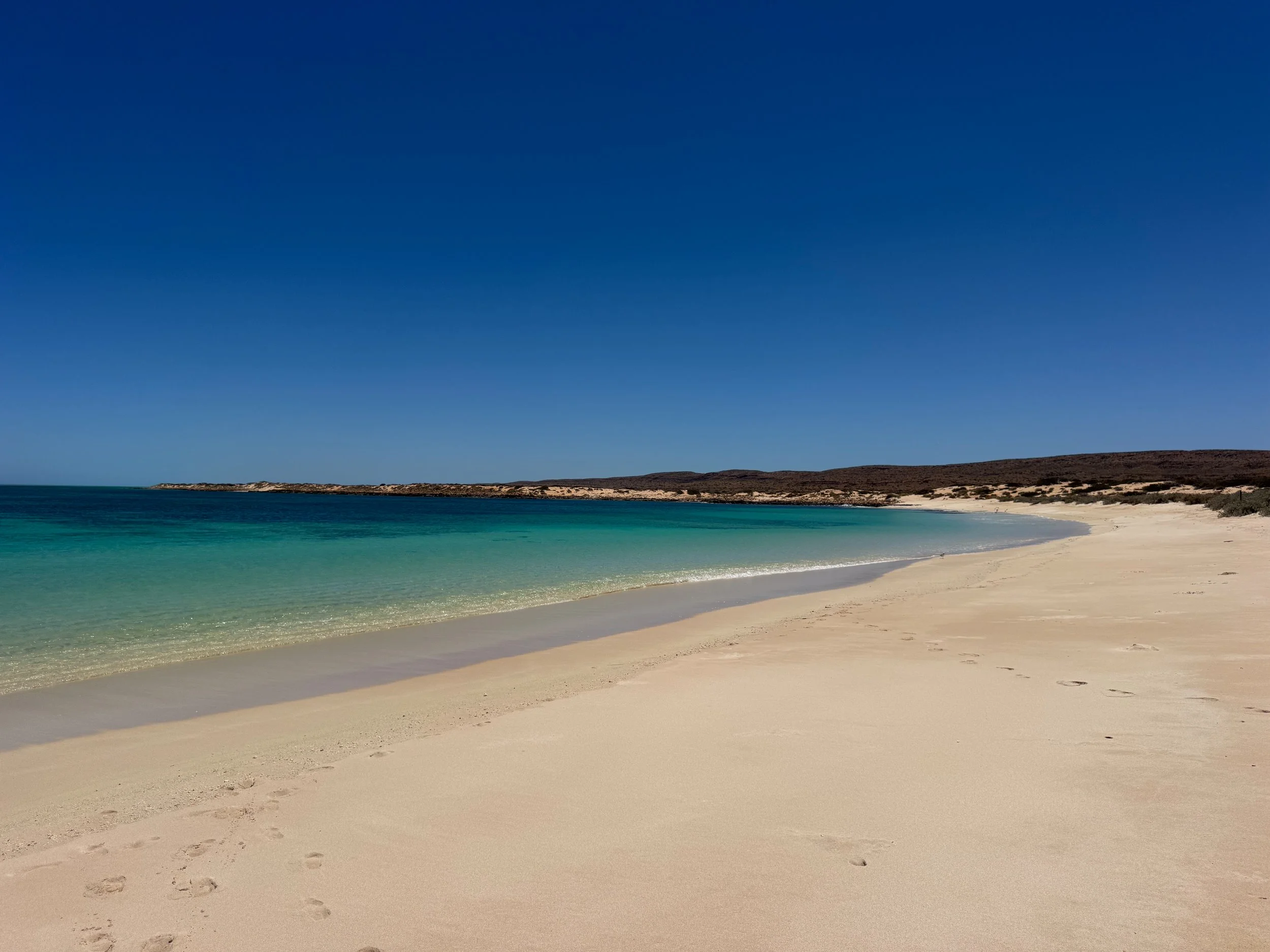
Cape Range National Park (Day 11)
A rugged and remote national park with steep gorges, hiking trails, coastal views and Australian wildlife.
Turquoise Bay. A picturesque bay with calm turquoise waters and crescent shaped white sand beach. It’s the perfect place to sunbathe and swim.
Turquoise Bay Drift Snorkel. Adjacent to Turquoise Bay is a lengthy beach with an expansive coral reef. It’s an ideal spot to drift snorkel and spot marine life. Walk down shore, swim out to the reef and let the current carry you. Exit a hundred meters before the sandy point to avoid outward currents.
Good to Know. The healthiest corals are a few hundred meters offshore. Avoid swimming out this far on windy days.
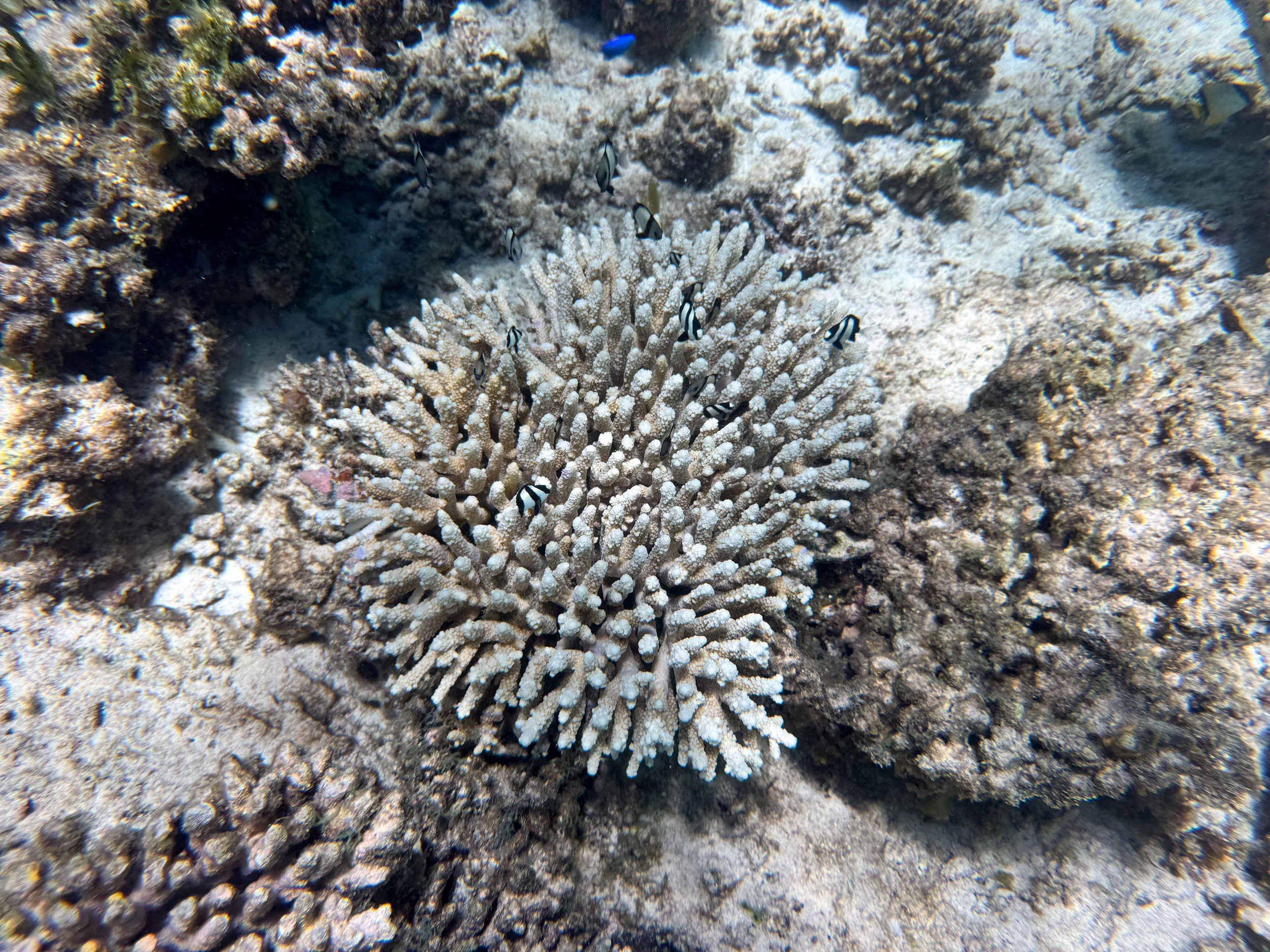
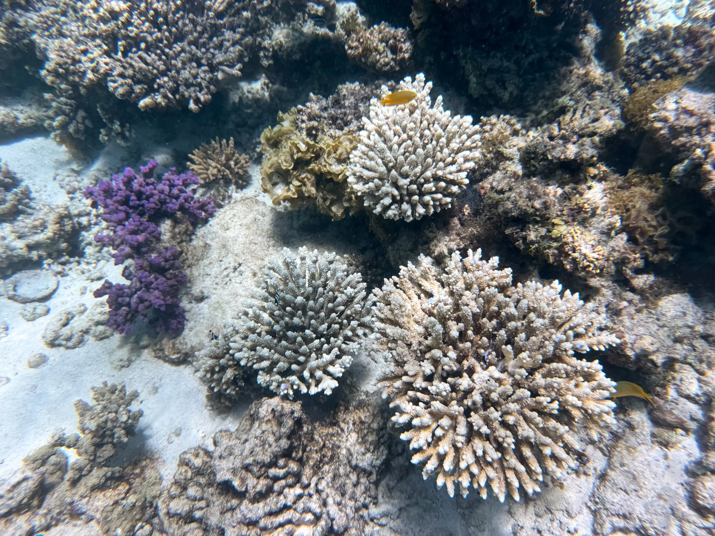
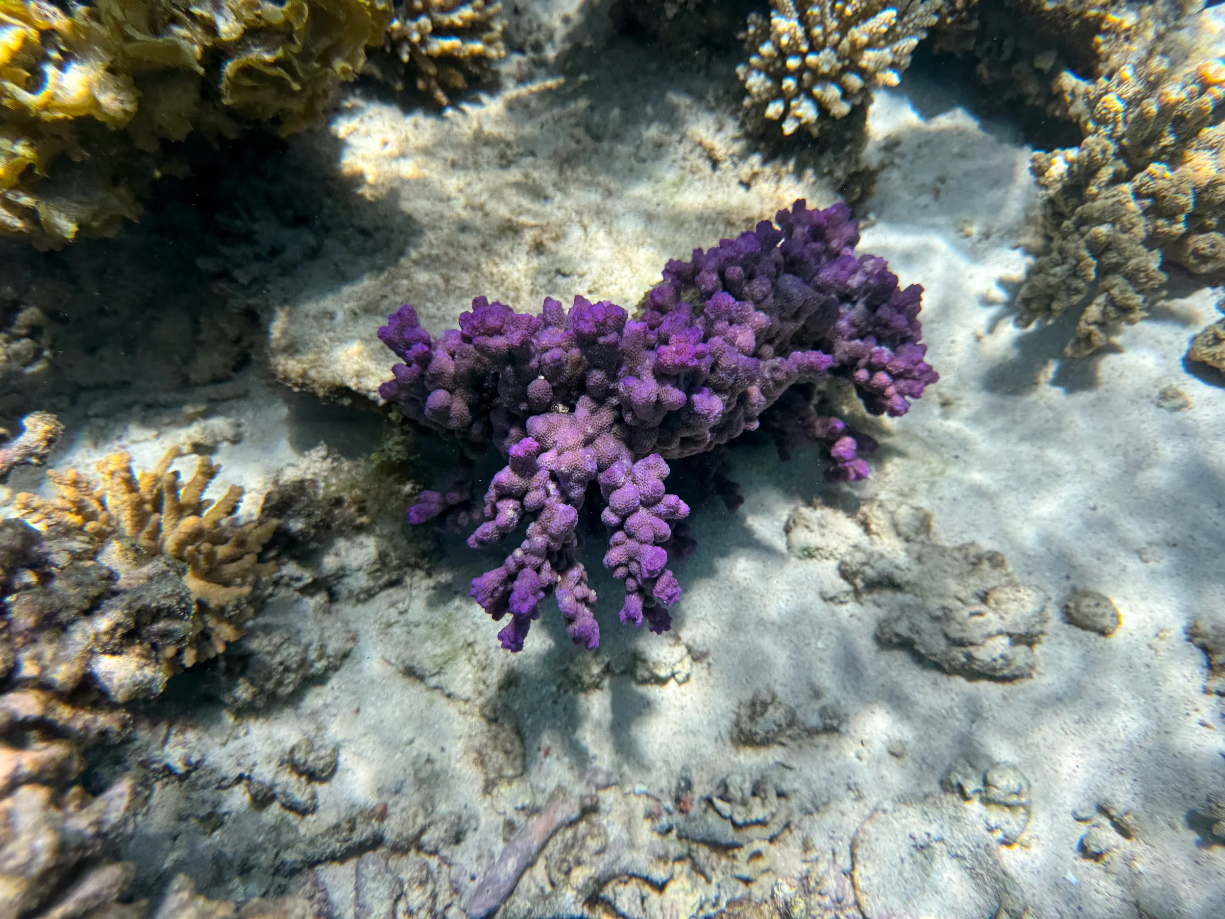

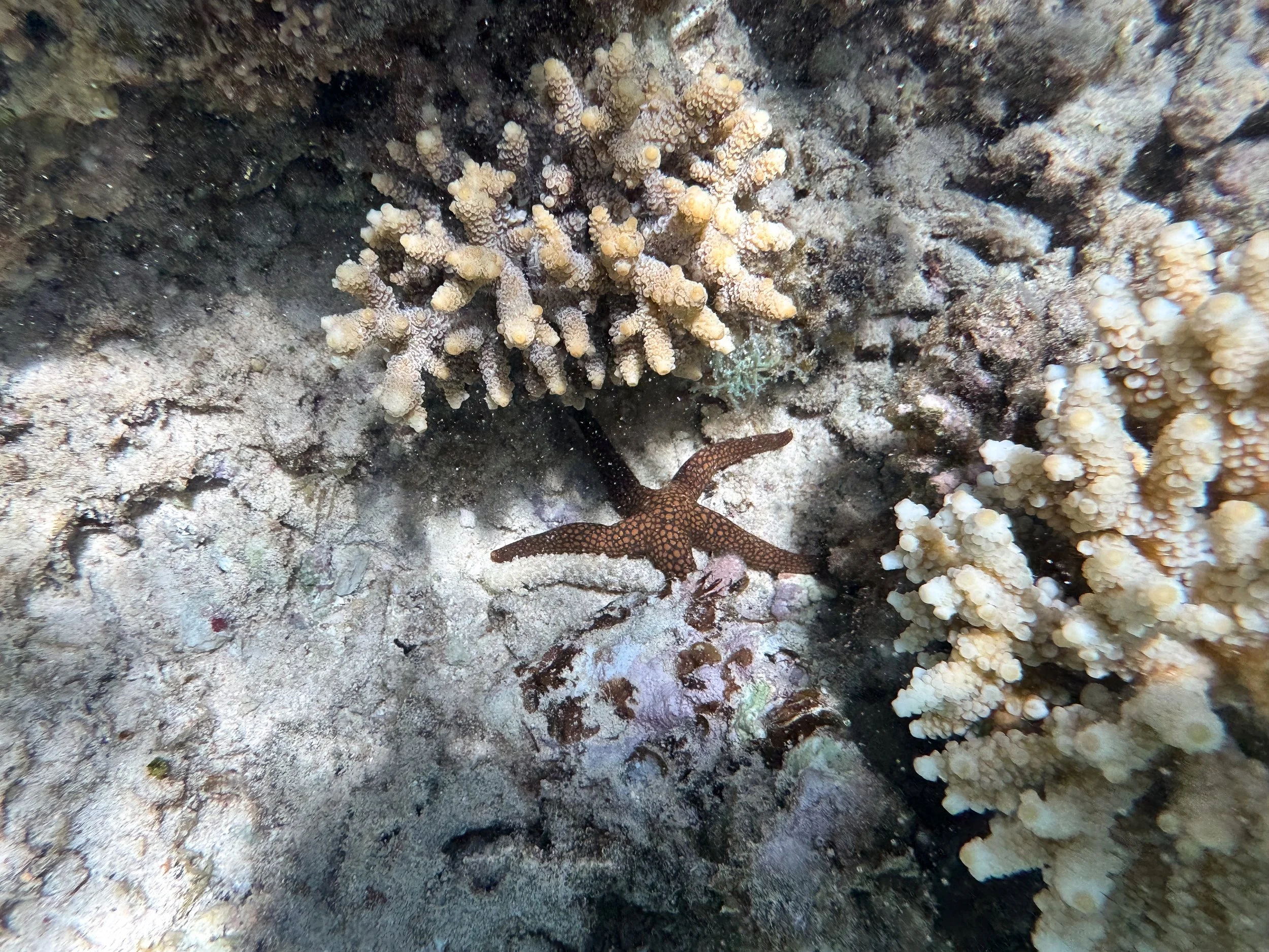
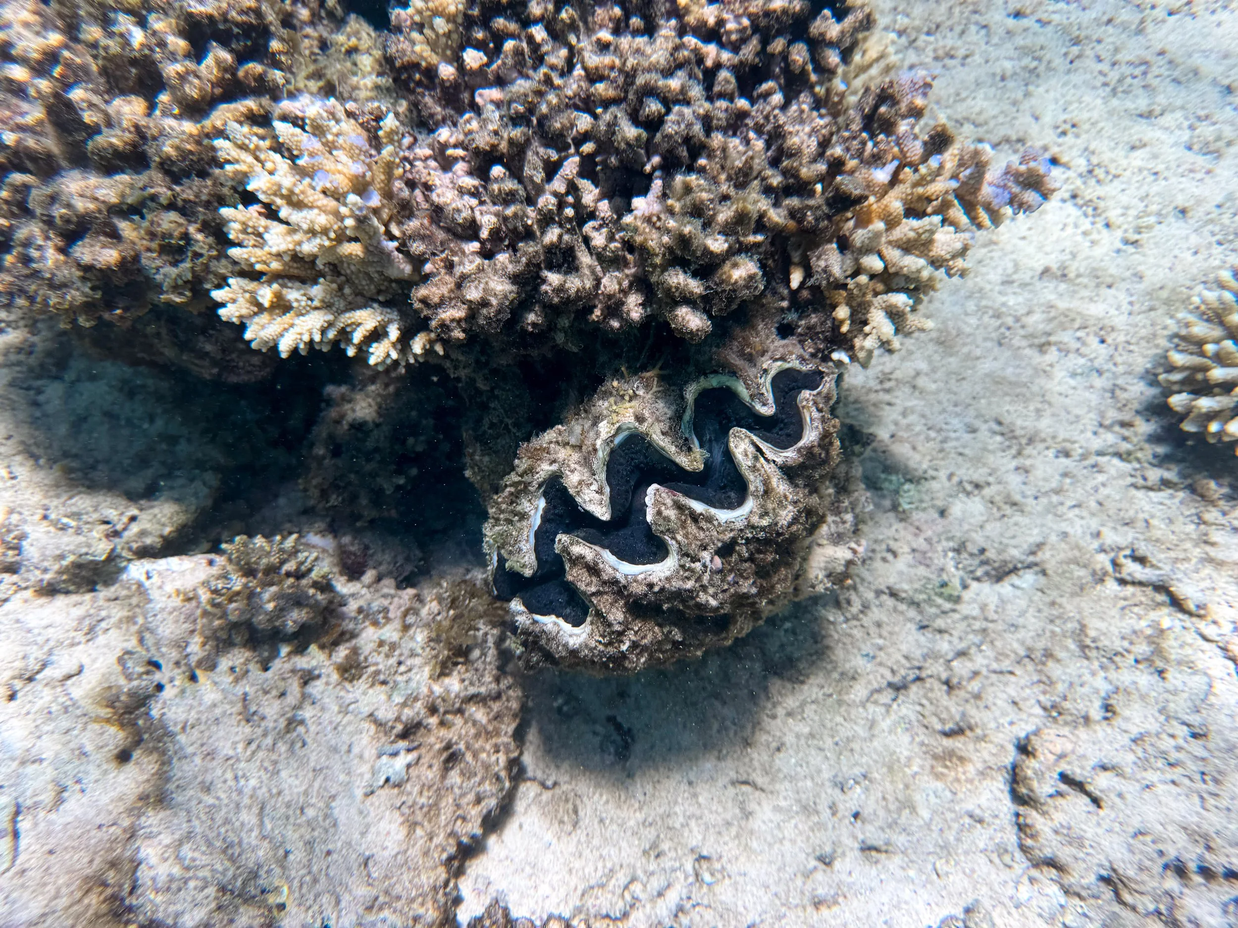
Oyster Stacks. A popular snorkeling beach with an easily accessible reef. Snorkel in the shallow coral gardens with all types of fish, blue clams, stingrays, sea urchins, sea cucumbers and starfish. Peer under the rocky structures to observe schools of large fish. It was one of our favorite places to snorkel outside of an official tour.
Turtle Rookery. A coastal area home to the largest sea turtle mating grounds in the Indian Ocean. Thousands of hawksbill, loggerhead and green sea turtles mate in the waters and hatch onshore between the months of October and April. Visit Mauritius Beach to observe them by day or night.
Mauritius Beach. A clothing optional white sand beach along the shores of the Turtle Rookery. Relax in the sun while spotting turtles mating offshore and viewing egg chambers dug in the sand the night before.
Mandu Mandu Gorge Walk. A scenic gorge with a 3km loop trail. The trail follows a dried cobblestone riverbed flanked by snaking canyon walls and verdant bushes. It climbs up the steep canyon wall with panoramic views of its ridge before looping back to the car park.
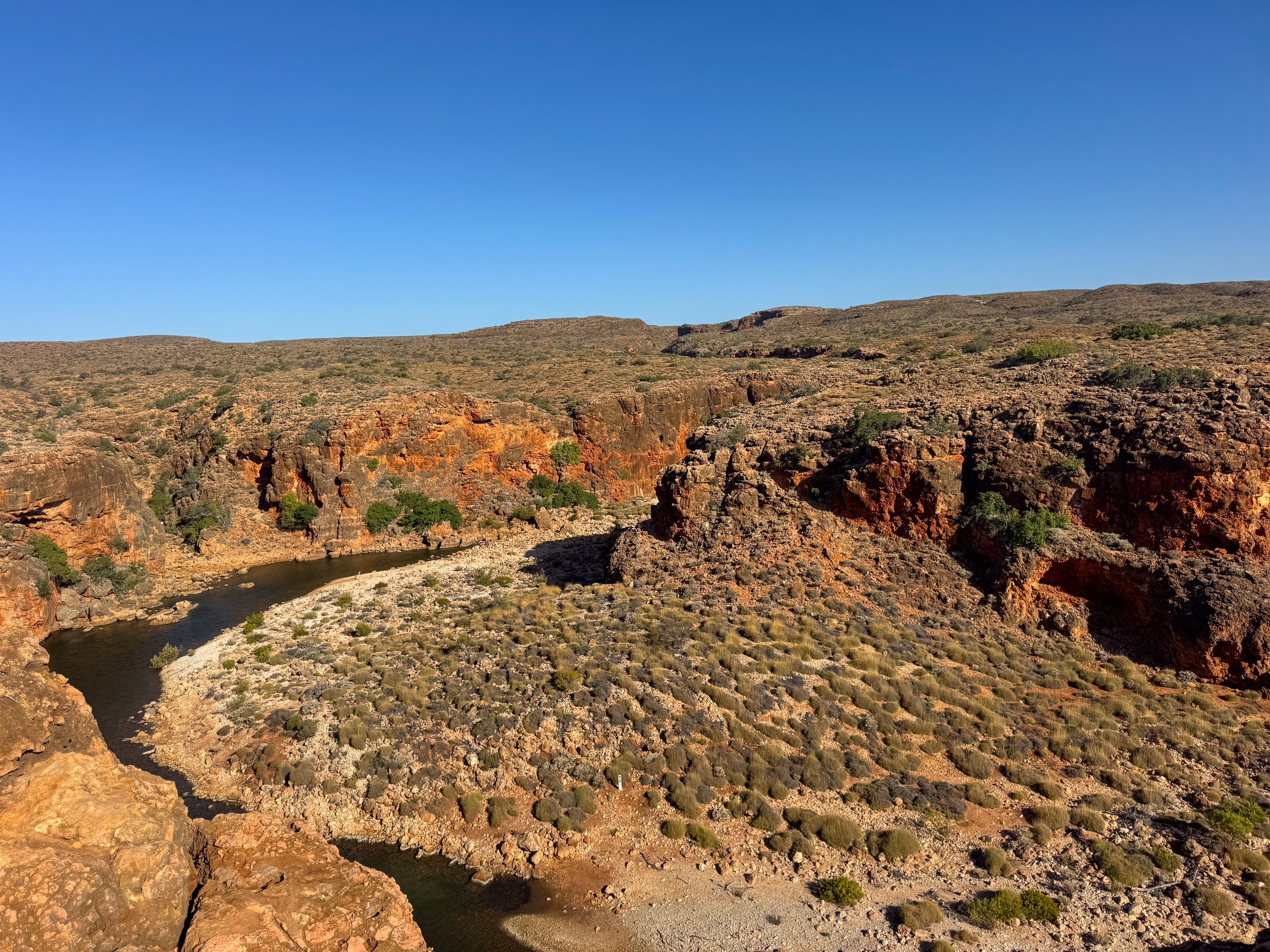
Yardi Creek Gorge. A winding creek with scenic nature walks and hiking trails along the edge of the gorge. Come here to spot rock wallabies hopping along the canyon and fruit bats hanging from the trees.
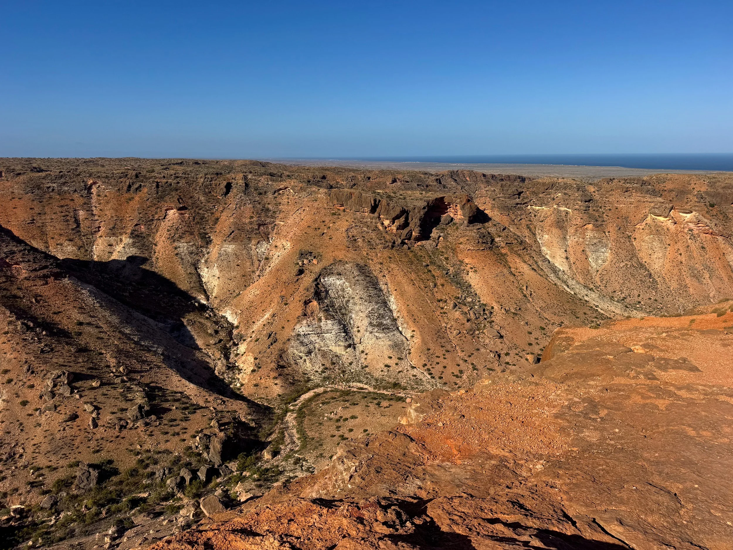
Charles Knife Canyon Gorge. A dramatic canyon in Cape Range National Park. Panoramic views of its rocky gorge and steep canyons are visible from scenic pull offs along Charles Knife Road. The 27km road is fully accessible by 2 wheel drive, ending at a turnaround.
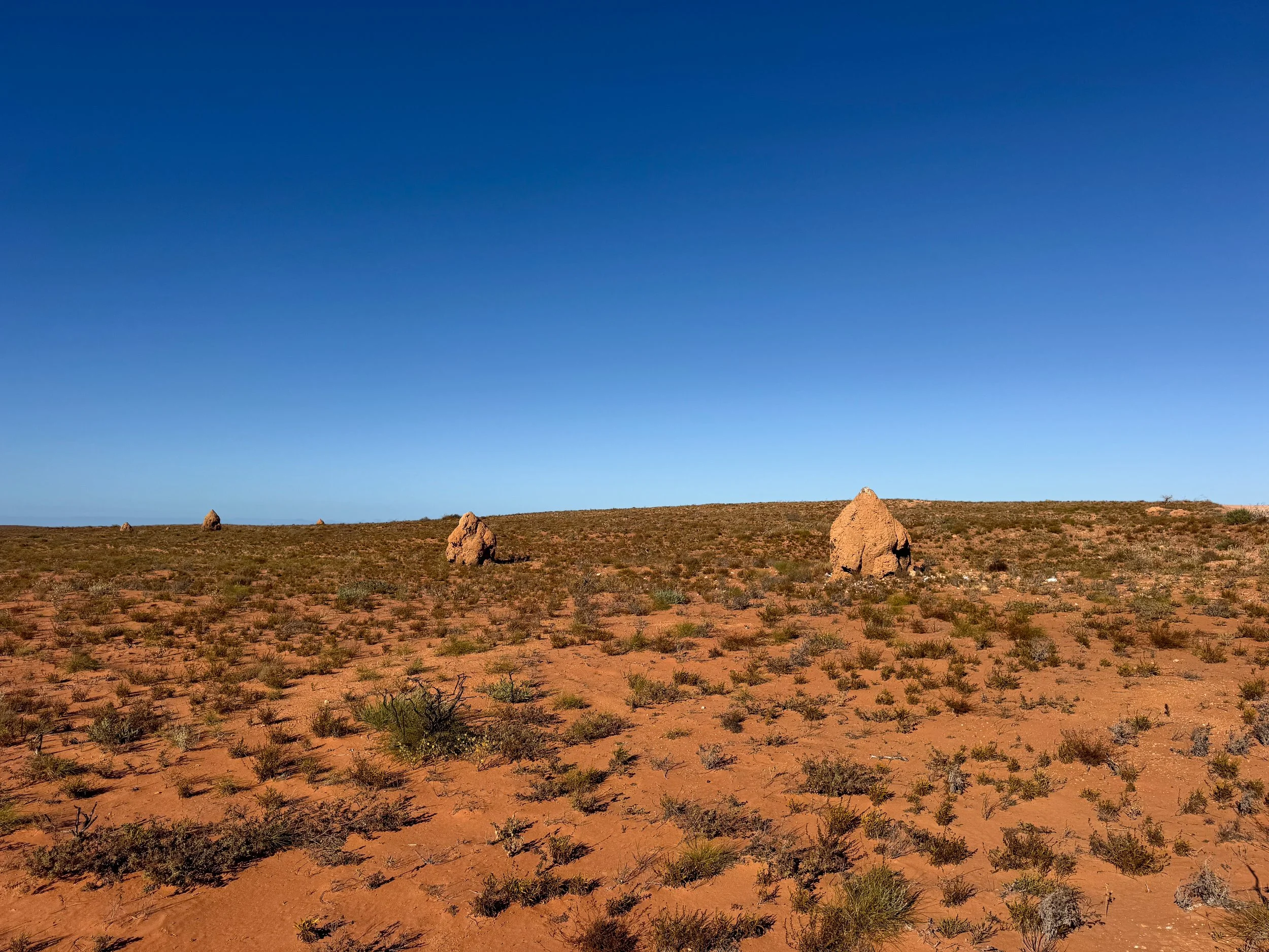
Cathedral Termite Mounds. The grassy landscape between Coral Bay and Exmouth is dotted with massive termite mounds, named after their cathedral-like structure. Roadside pull offs along Exmouth Road offer close up views.
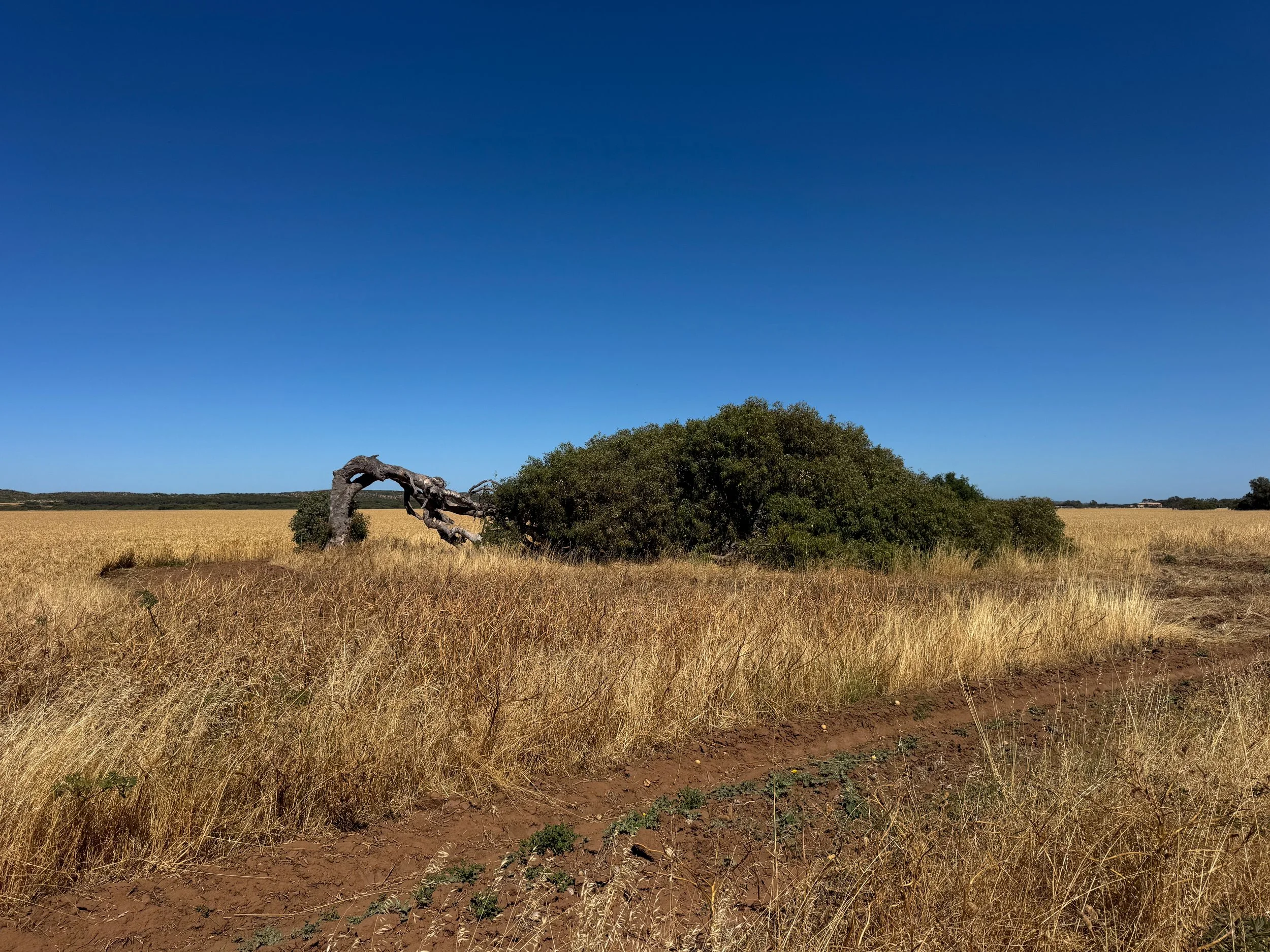
Geraldton (Day 12)
Geraldton is a great resting place when heading north or south along the Coral Coast. The city is home to restaurants, motels and Western Australia’s famed leaning trees. It’s located about 700km south of Coral Bay and 415km north of Perth.
Geraldton Leaning Tree. A windswept eucalyptus tree that grows horizontally along the ground. The leaning trees are a common sight in the area, however this is the only one closely viewable from this roadside pull off.
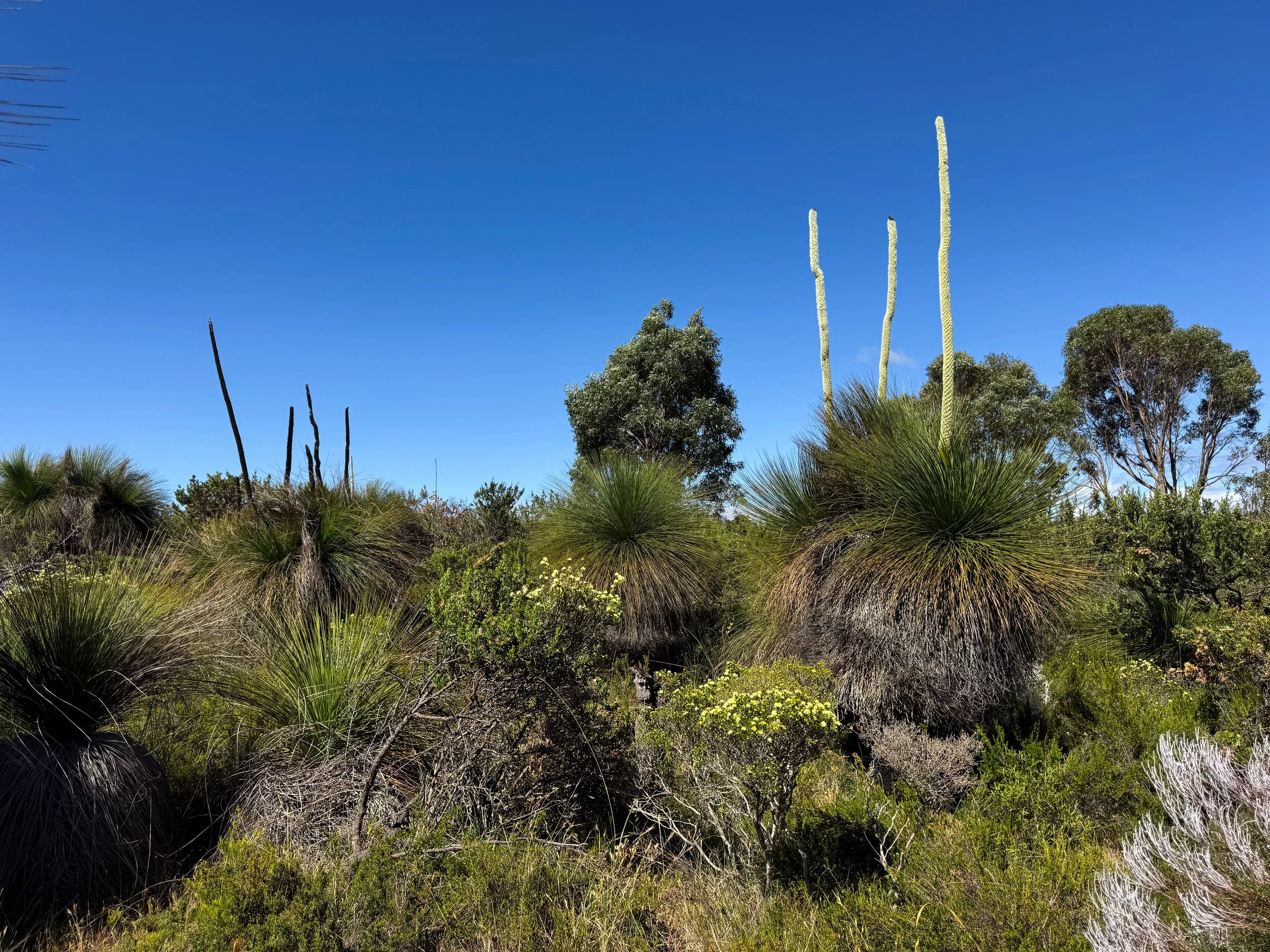

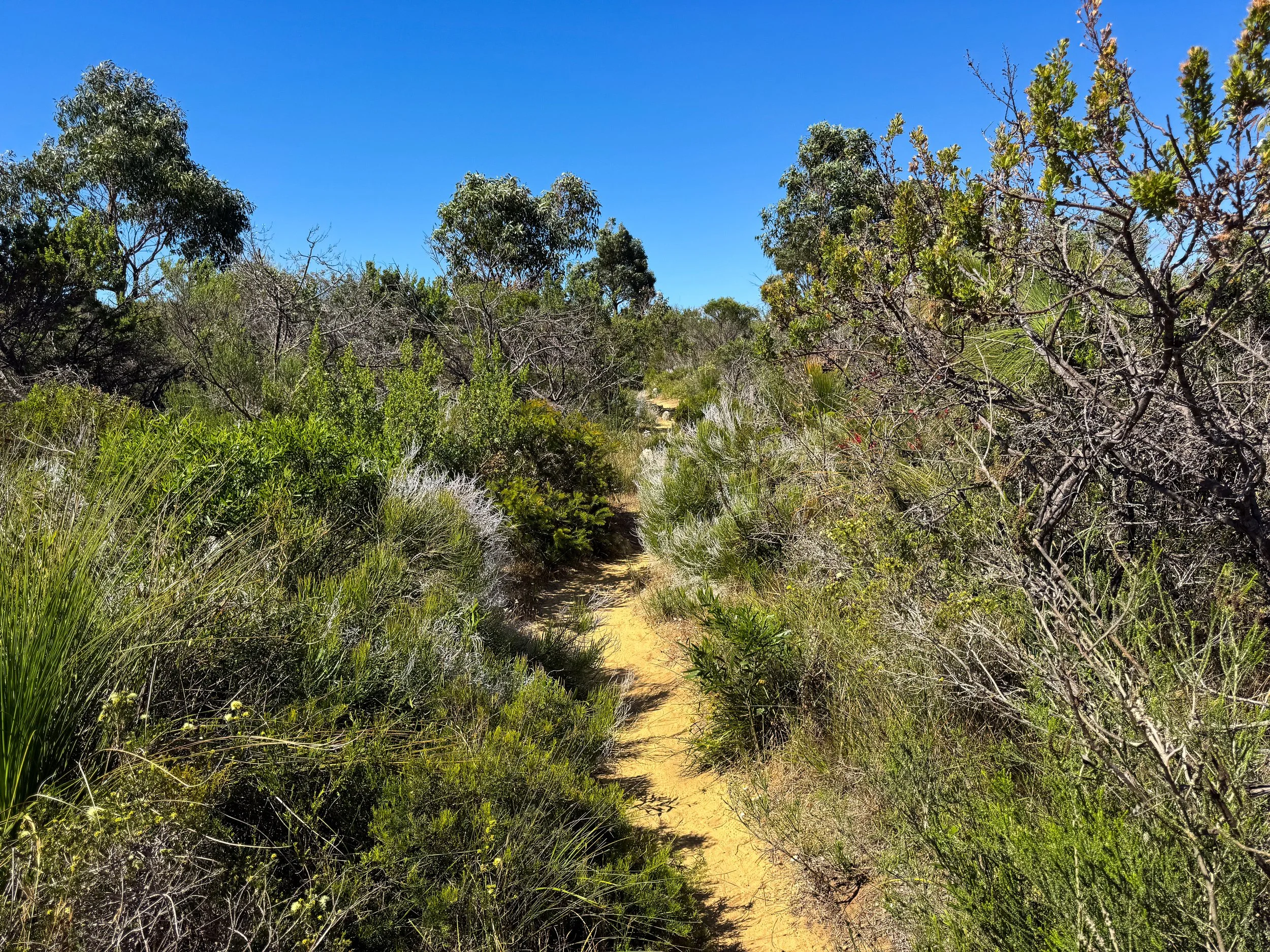
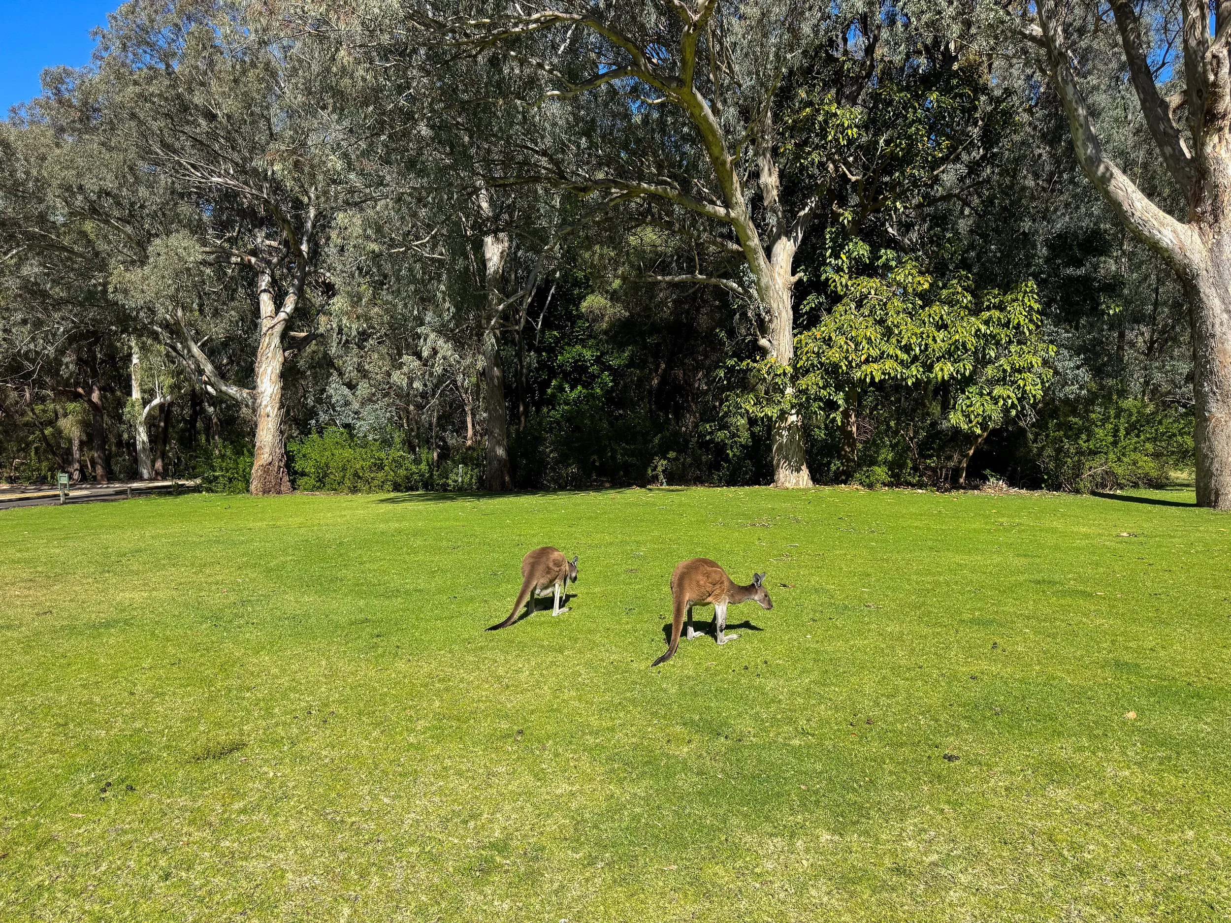

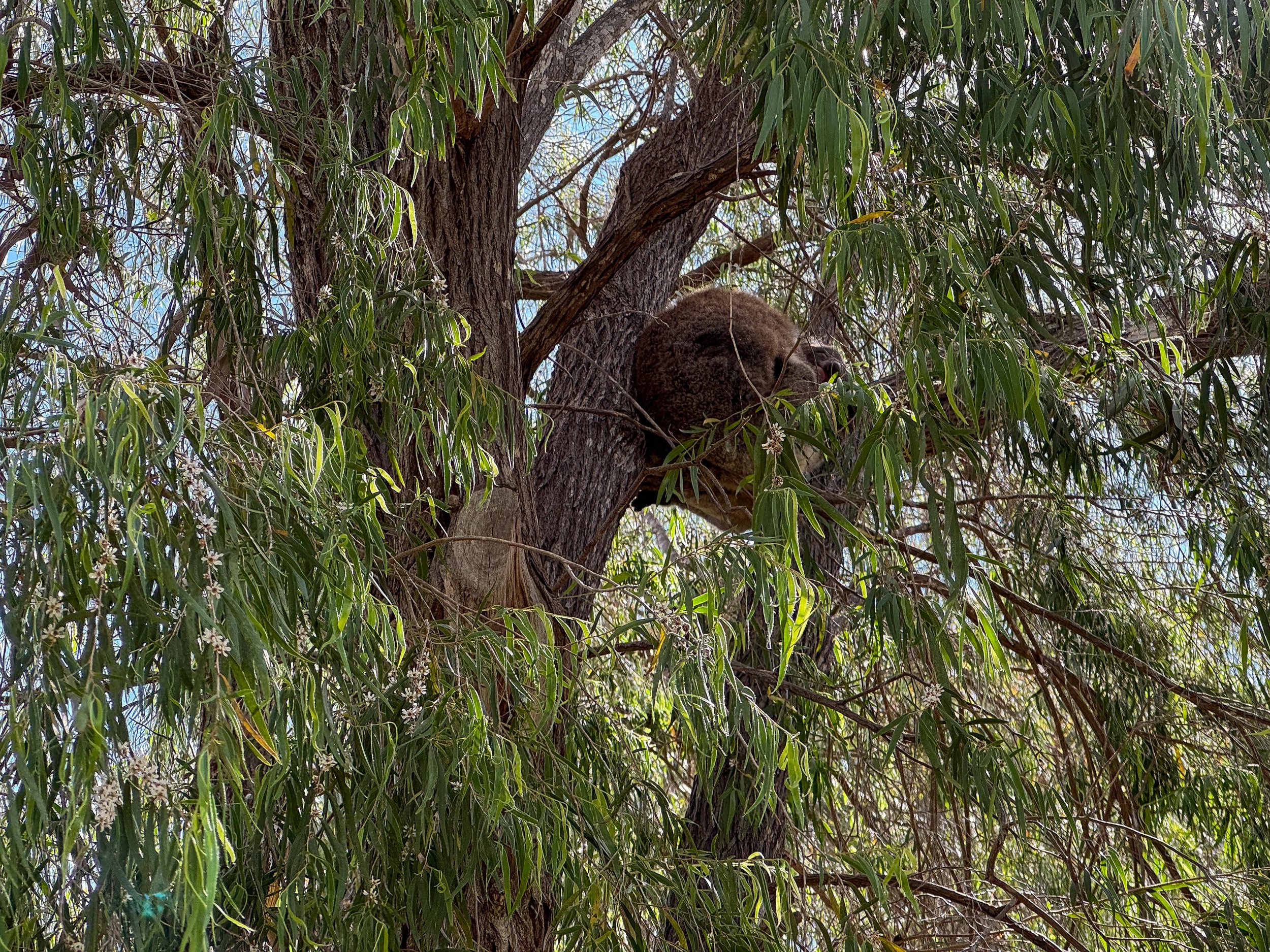
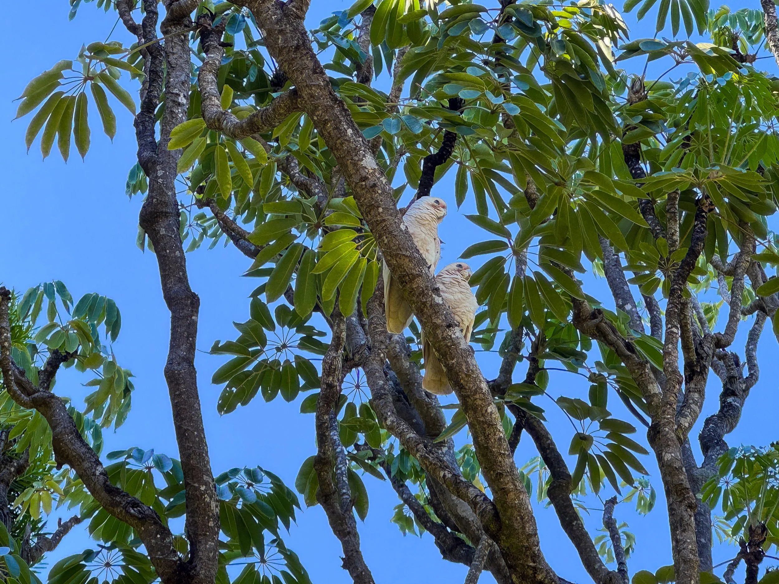
Yanchep National Park (Day 13)
Yanchep National Park is a sprawling oasis north of Perth. It was the last stop on our road trip of the Coral Coast heading back south. Nature walks lead through lush bush-lands. Parrots squawk and fly between trees. Sleepy koalas hang onto eucalyptus branches in a small sanctuary while kangaroos nibble on grasses in open fields.
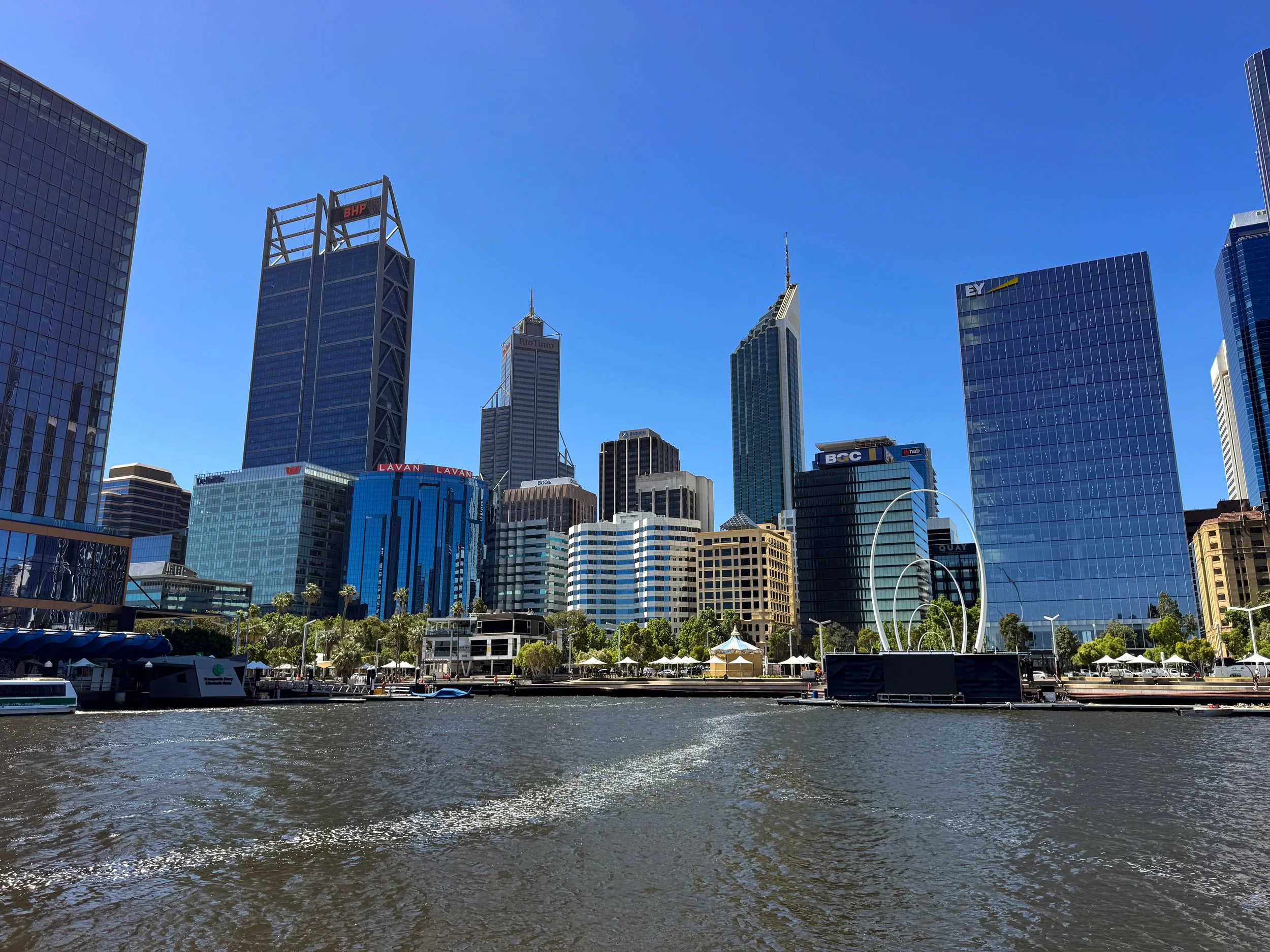
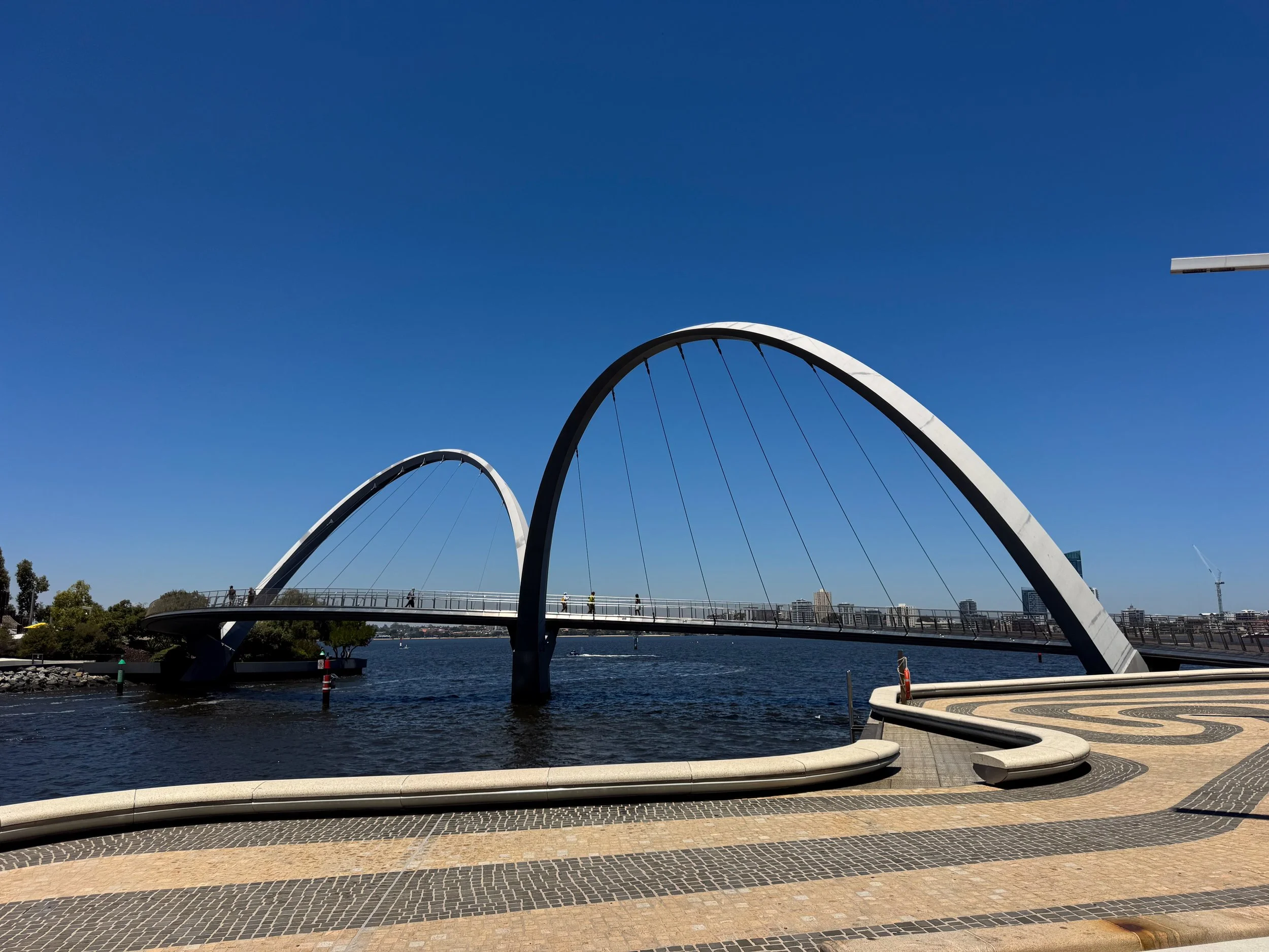
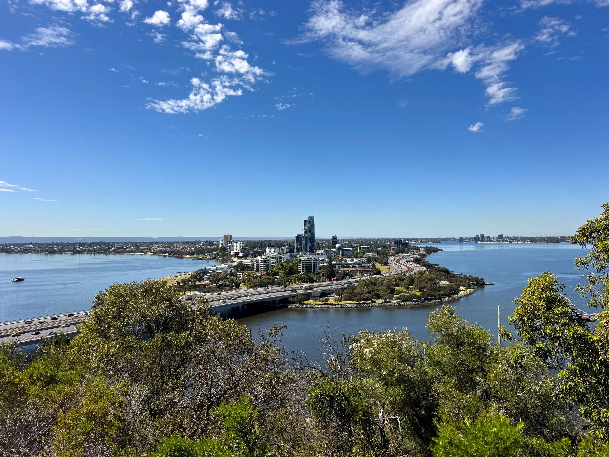
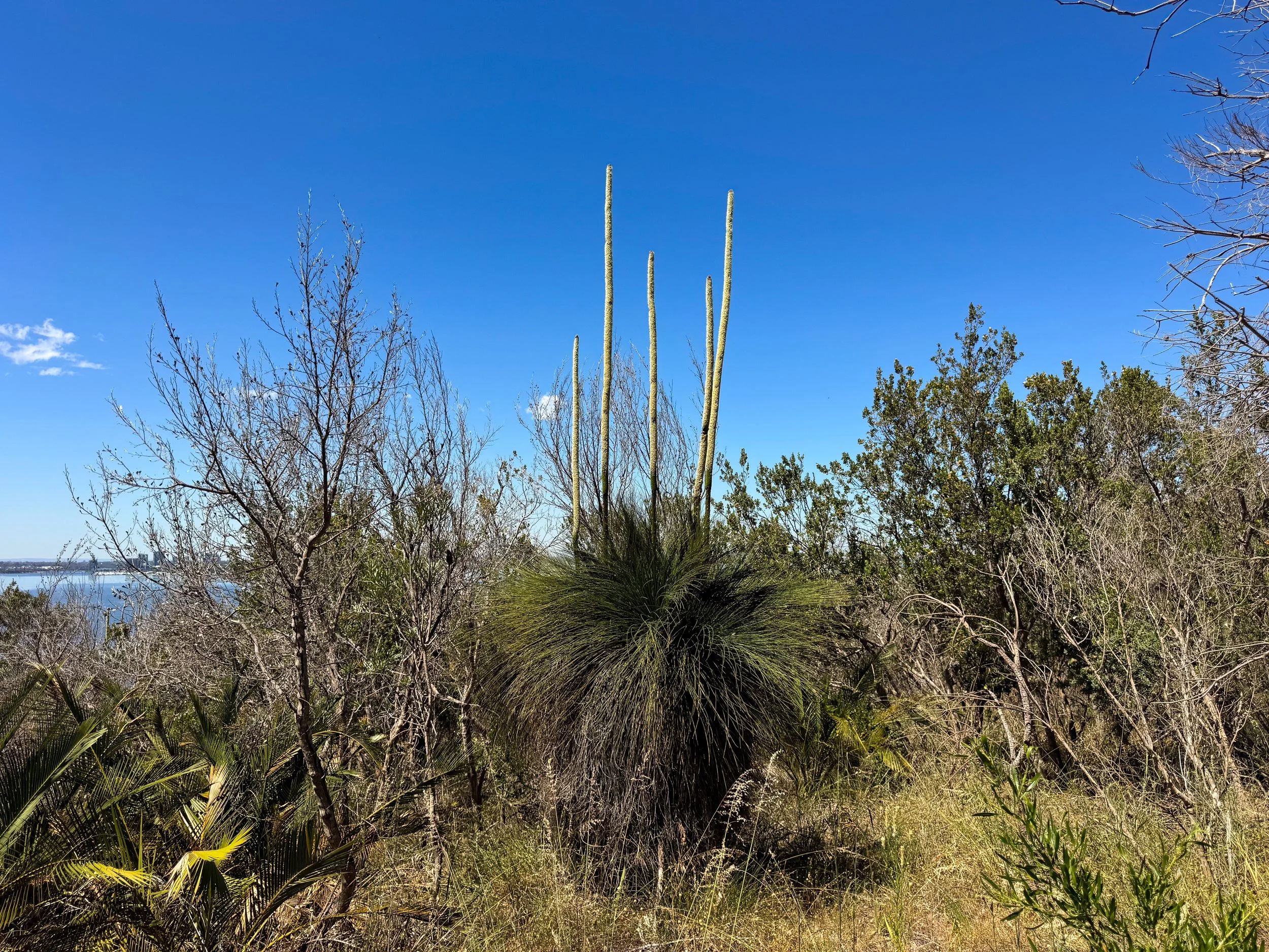
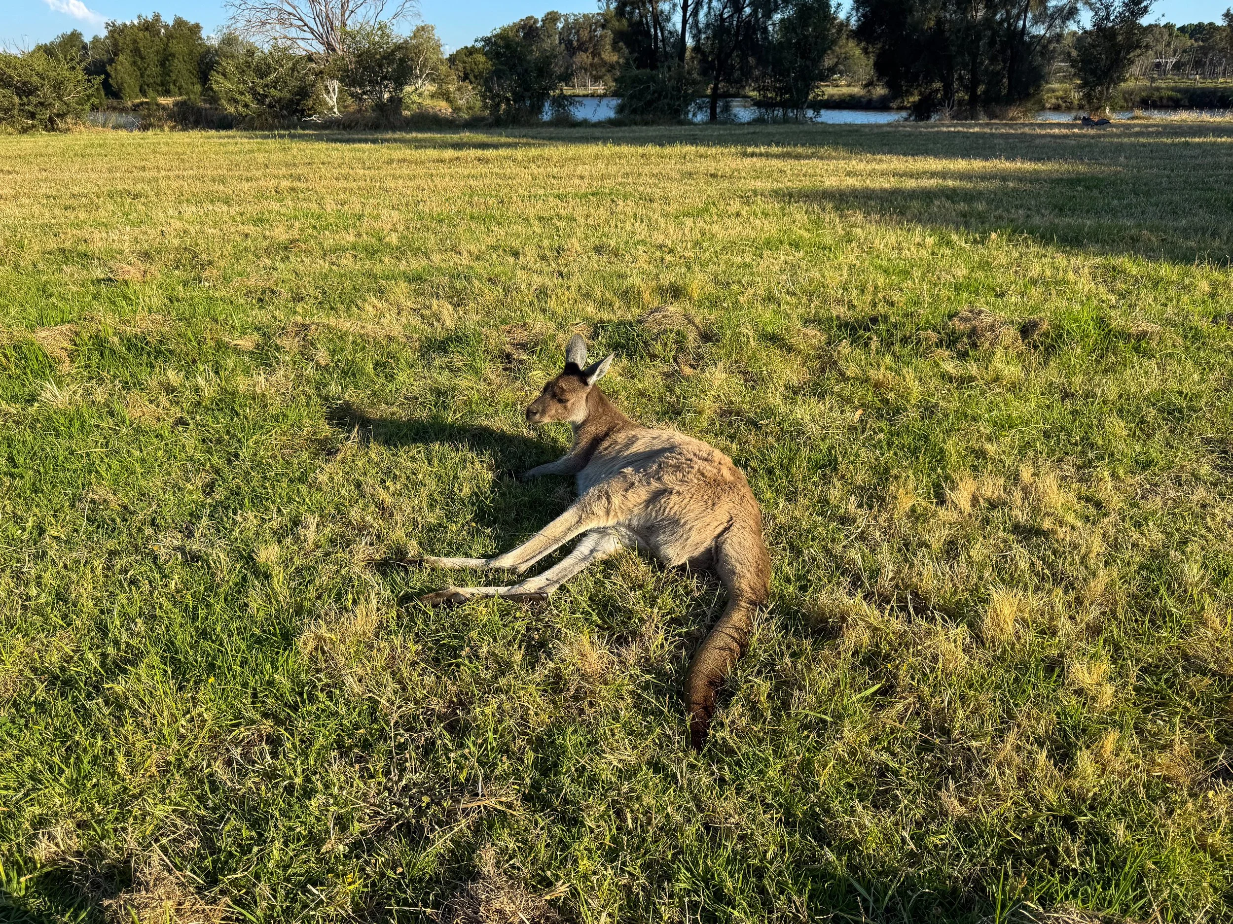
Perth (Day 14)
Perth is a sprawling metropolis with laid back vibes. Sunny days are enjoyed at city parks, exploring the riverwalk and shopping in covered arcades. The bustling food and nightlife scene offers plenty of options for dining out and sipping on cocktails. The city is a great starting or end point for road trips along the western coast.
Kings Park & Botanic Garden. A sprawling city park with native trees, plants and flowering gardens. Cliffside lookouts offer views of the Swan River. Meandering walkways transport you deep into nature, away from the sounds of the city. Take in the wildflowers, fluttering butterflies and fragrant eucalyptus trees.
Heirisson Island. A city park and kangaroo sanctuary on an island in the Swan River. Bush trails lead through grassy fields and wetlands where kangaroos graze. Visit during the late afternoon when the kangaroos are most active.
Elizabeth Quay. A contemporary riverfront park with funky boardwalks, skyline views and restaurants. Visit The Island for house brewed beers, pizzas and shareable bites.
London Court. An Old English style arcade in the Central Business District with tailors, jewelers, barbers and cafés.
Mount Lawley. A popular neighborhood with cafés, restaurants, late night bars, boutiques and shops.
Places to Eat, Drink & Stay
Hula Bar. A traditional and over the top tiki bar decorated with eclectic objects and dim colorful lights. They offer all the classics and several signature cocktails in vintage tiki mugs.
Lot Six Zero. A breakfast café with strong coffees and delicious spiced egg dishes served on sourdough bread and croissants.
El Publico. A taqueria on Beaufort Street in Mount Lawley serving authentically prepared tacos and mezcal.
Perth Airbnb. A Bali style guesthouse with a tranquil outdoor patio, small swimming pool and stylish living space. It’s a hidden gem perfect for a comfy stay. Reserve on Airbnb.
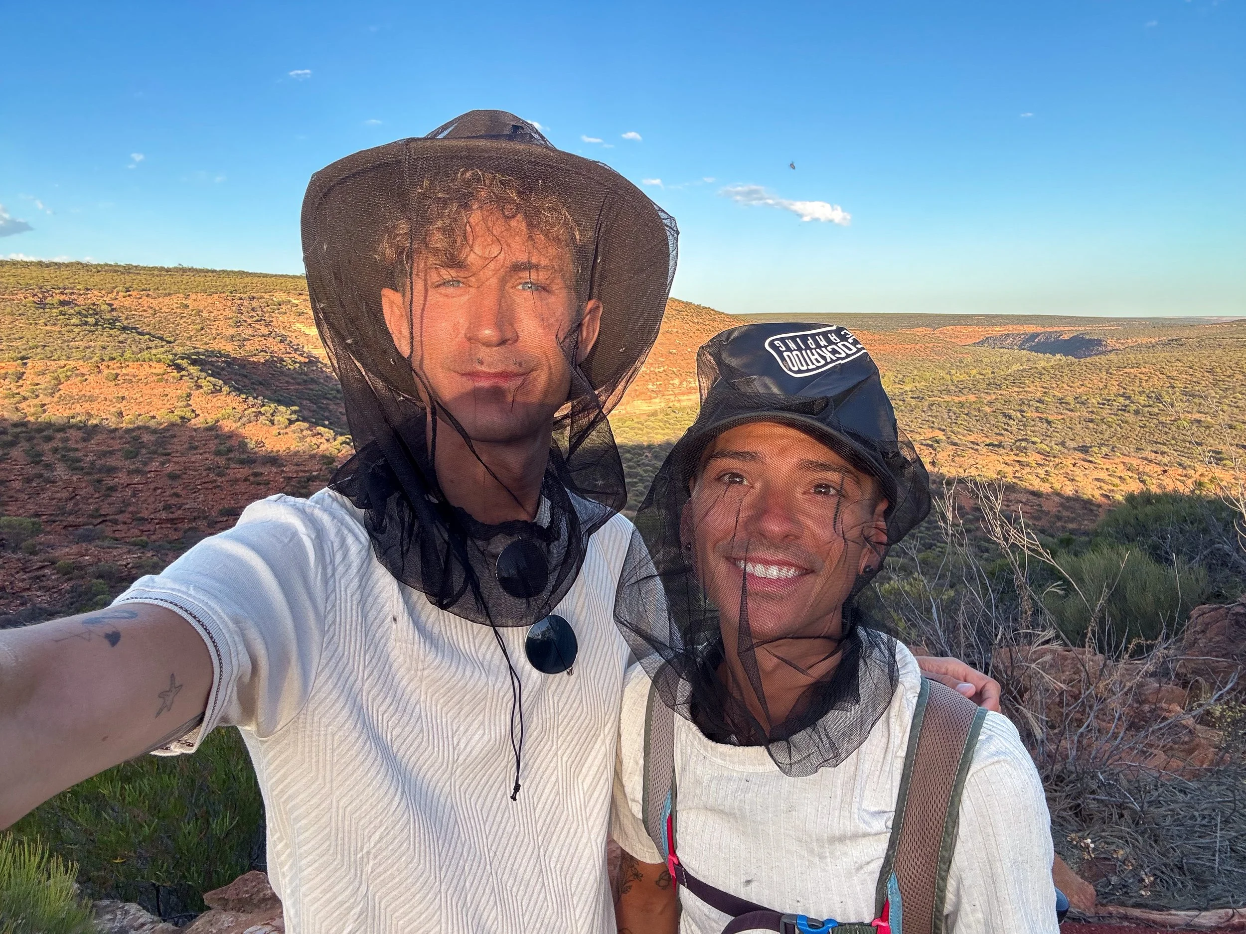
Location Specifics
When to Visit. Mid November is an ideal time to visit The Coral Coast and Western Australia. The days are mostly sunny making it the perfect time to maximize outdoor activities. It’s the cusp of summer so temperatures can range dramatically from cool to extremely hot.
Extreme Heat. The summer months invite extreme heat. Temperatures often exceed 40C (104F) and occasionally reach 50C (122F). Stay hydrated, cover your skin, wear loose flowy clothes and avoid peak heat hours. Be cautious when planning hikes.
Extreme UV. Western Australia boasts many beautiful sunny days. It comes with the price of extreme levels of UV. Wear SPF 50+ sunblock, sunglasses and hats for protection.
Summer Flies. Swarms of pestering flies are a constant annoyance across Western Australia during the summer months. Dozens hitch a ride on your clothes, buzz around your head and crawl on your face. Wear a fly net in addition to liberally applying insect repellent whenever hiking.
WA Holiday Park Pass. A park pass covering tickets / permits to nearly every park in Western Australia. We bought a 14 day pass at the Pinnacles Desert. It paid itself off after visiting 3 national parks.
Underwater Photography. Buy a waterproof phone case to take underwater photos of the coral reefs and marine life. We used the Pictar Waterproof Smartphone Caseavailable on Amazon or Walmart.
Driving in Western Australia
Car Rental. Perth is the best location to rent a car before beginning a roadtrip of Western Australia. We rented a 2WD from Sixt at the Perth Airport.
2WD vs 4WD. Most roads are well maintained enough to drive down using a 2 wheel drive vehicle. It’s best to plan your route ahead of time and read Google reviews for current road conditions. A 4WD is recommended while road tripping Western Australia but not necessary. It gets you access to more remote places.
Drive on the Left. Like many former British territories, Australians drive on the left side of the road. It only takes a day to get used to if unfamiliar.
Download Offline Maps. Service is spotty and infrequent the further north you drive. Download offline maps, pin locations and plan your route a day ahead.
Fuel. Refuel before beginning the next stretch of your roadtrip. Keep your fuel gauge at least half full. There are 100km stretches without gas stations.
Be Cautious at Dusk & Dawn. Kangaroos and wallabies are very active at dawn and dusk, especially along roadsides. Be extra cautious when driving during these hours.
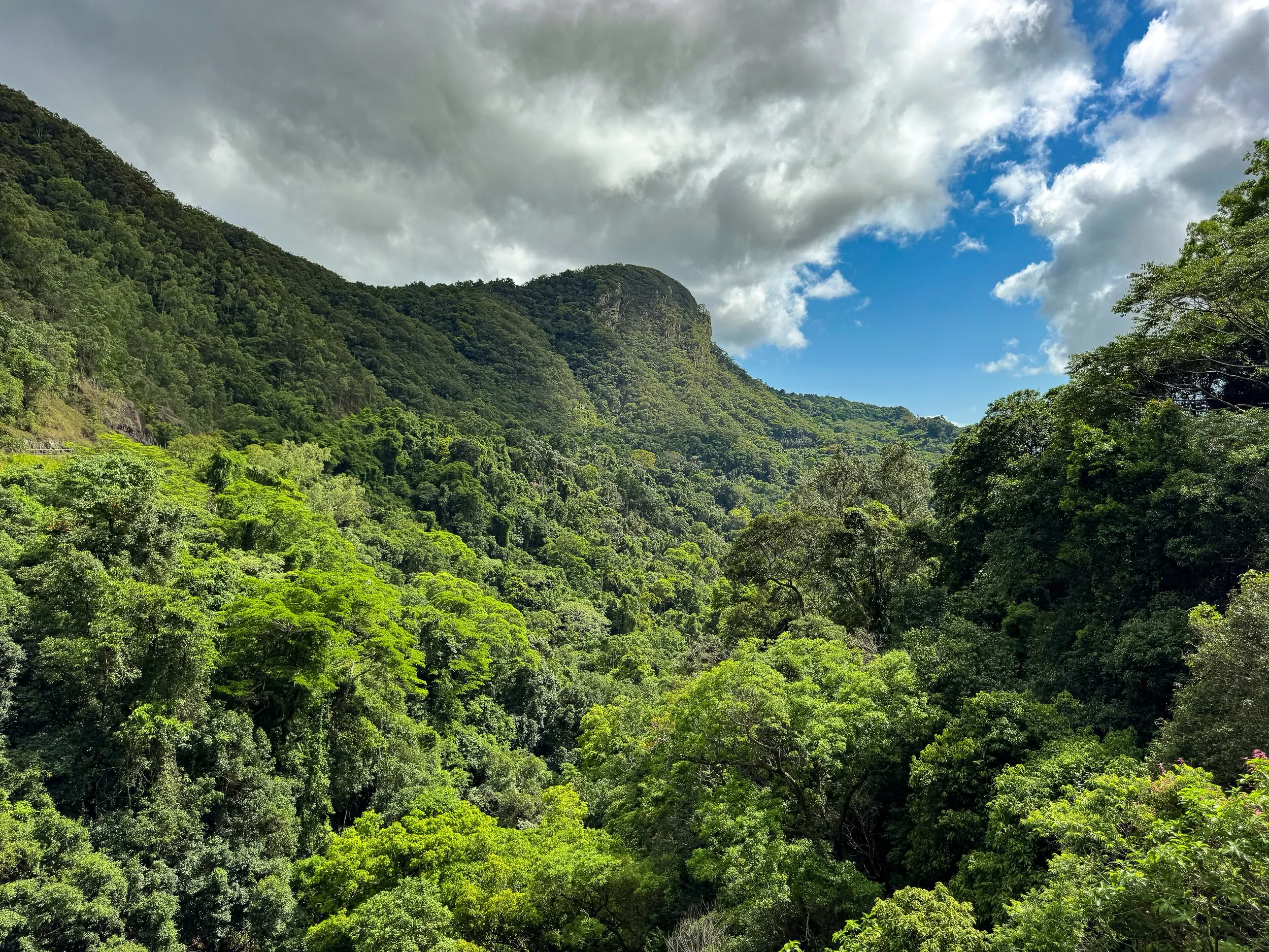
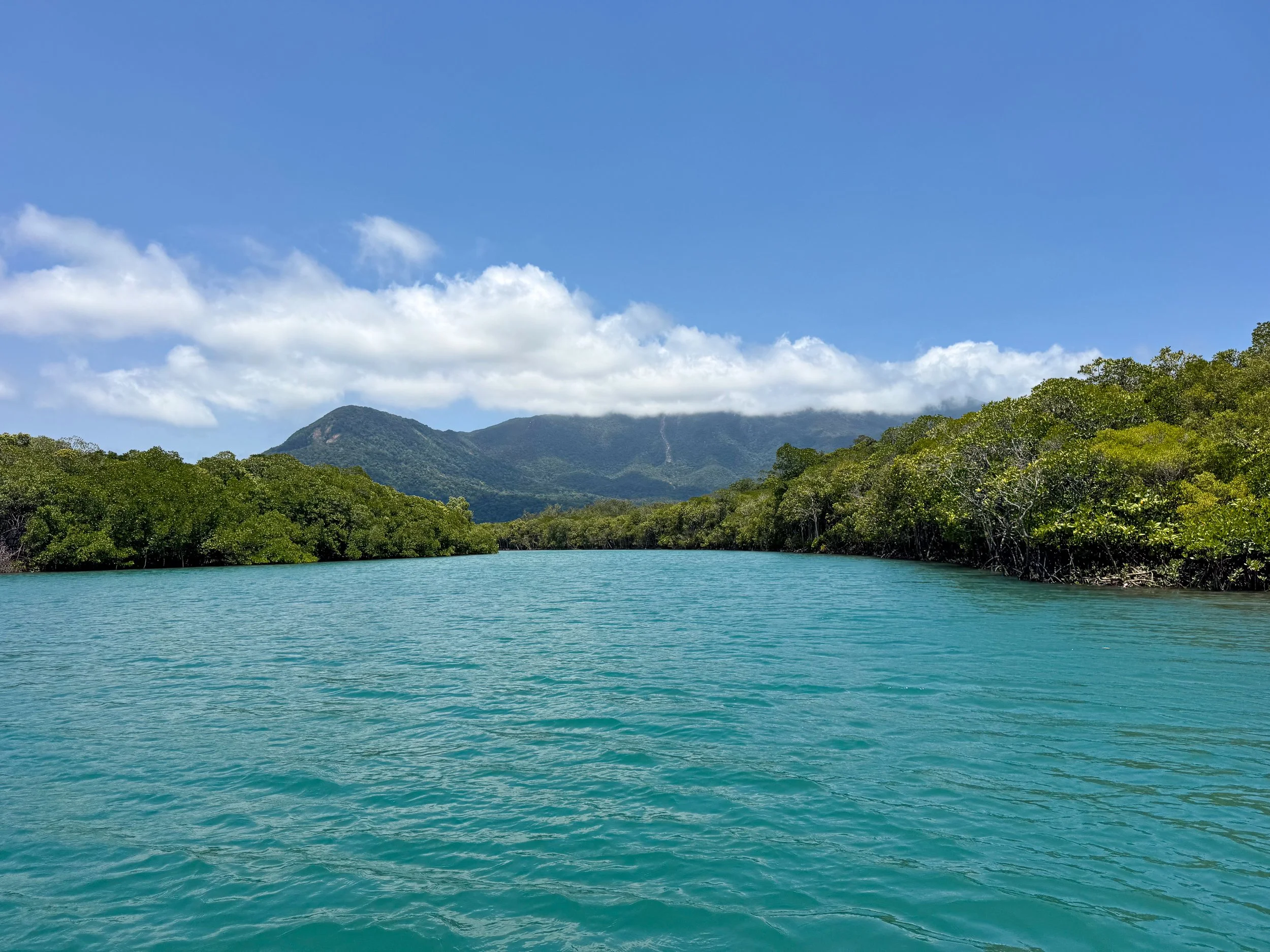
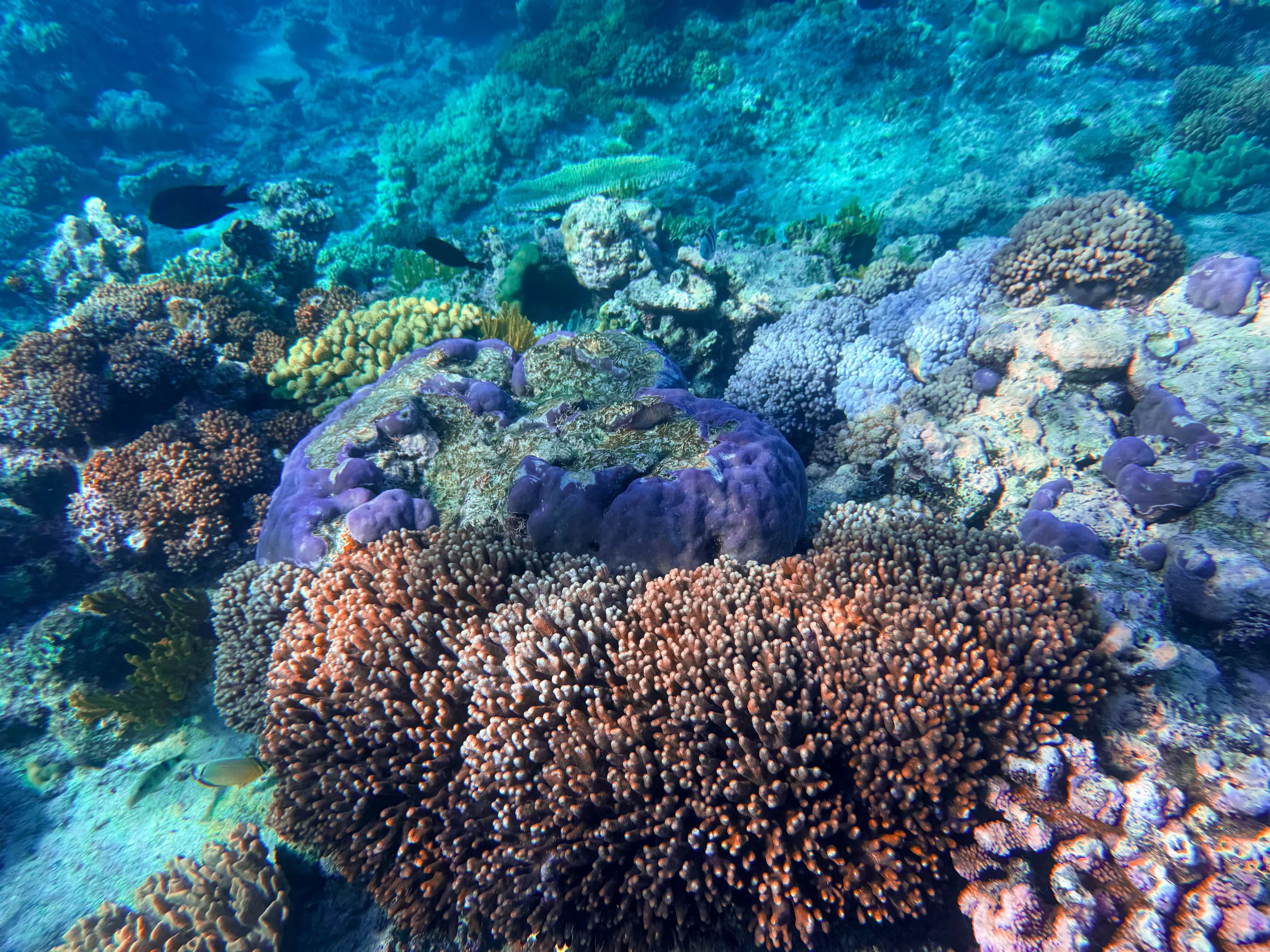
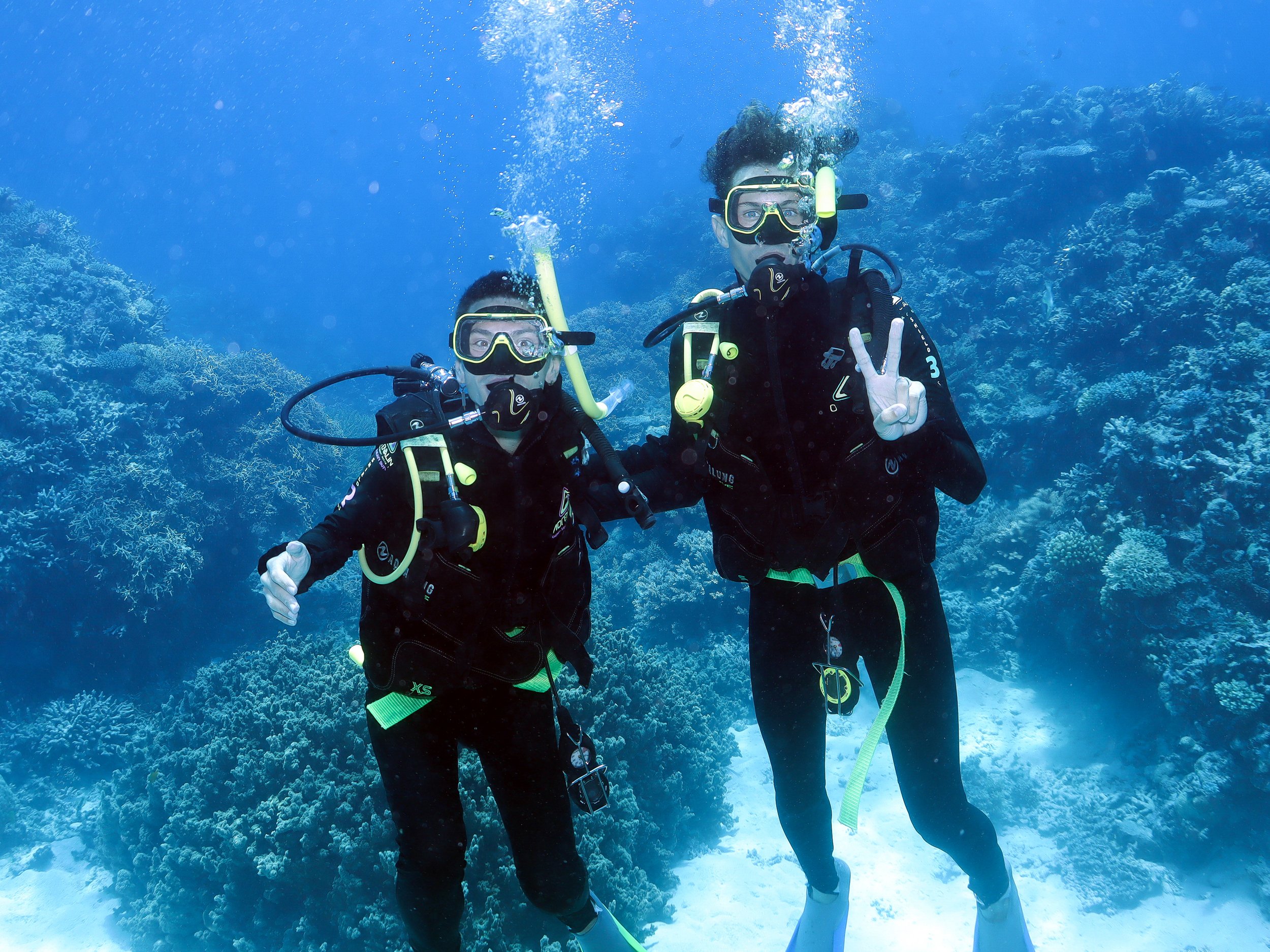
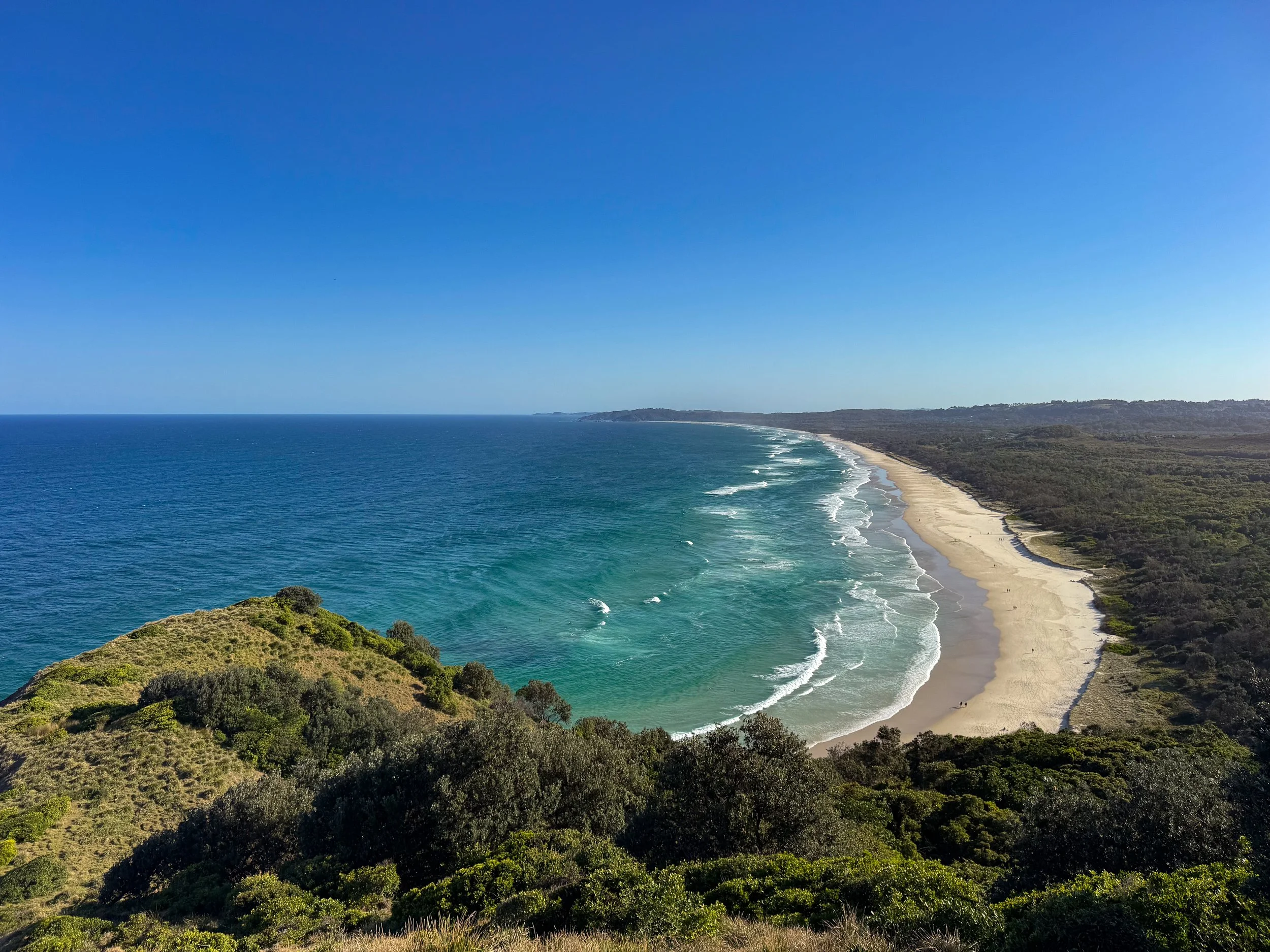
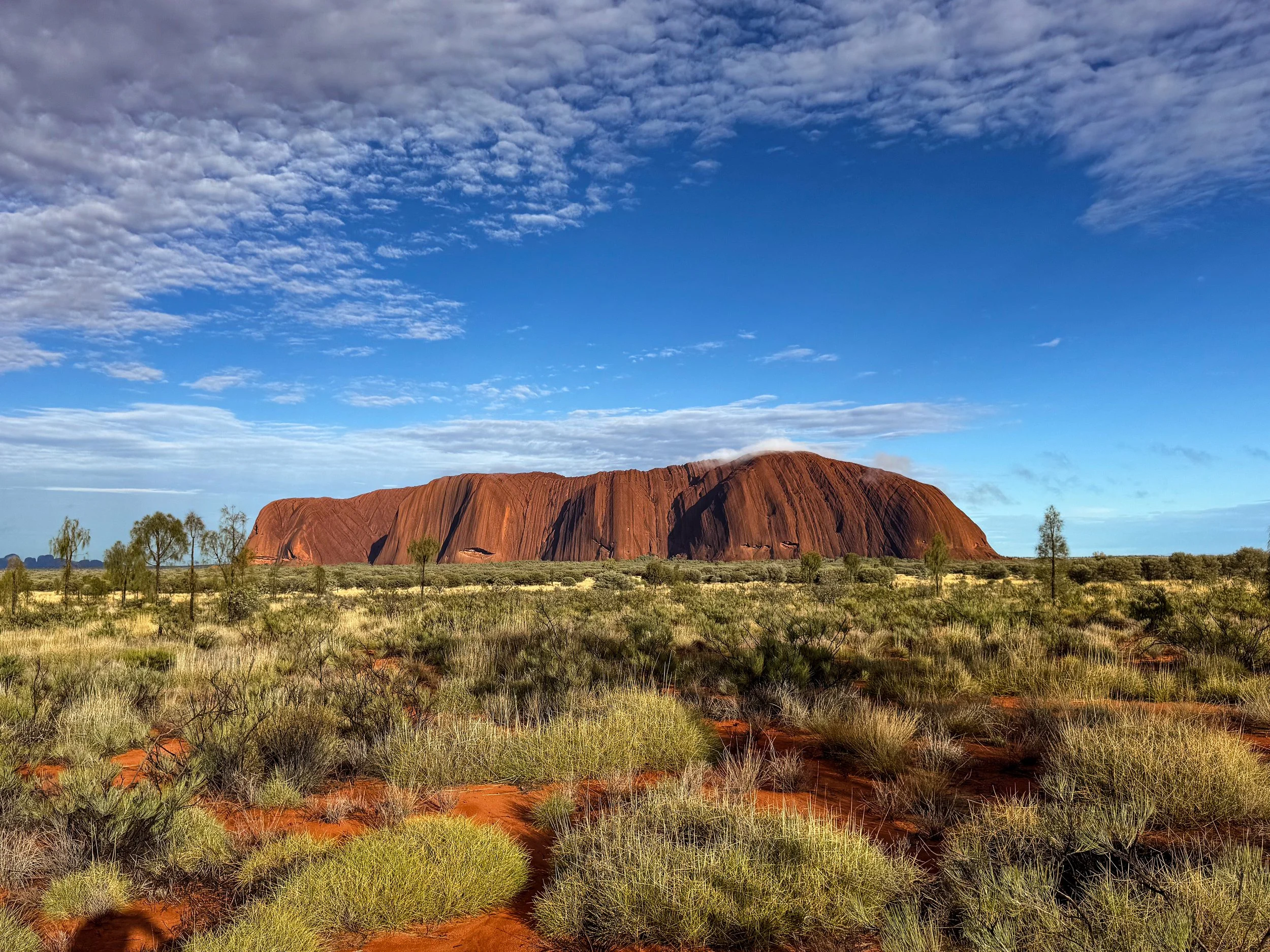
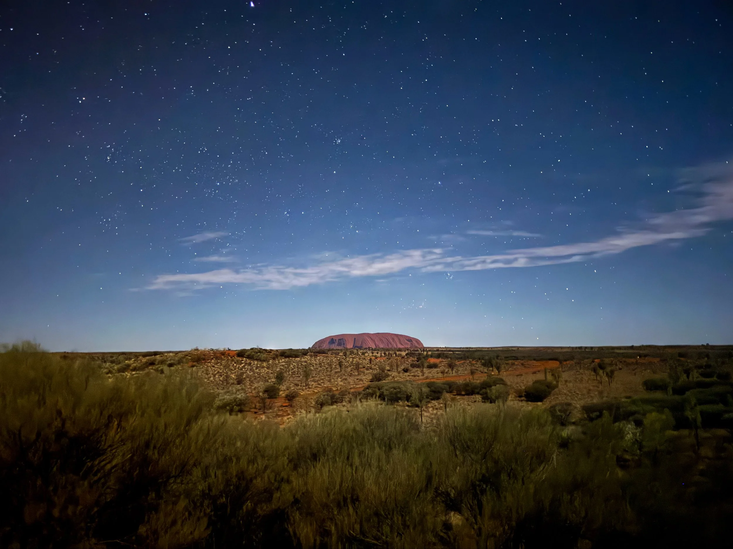
Elsewhere in Australia
From Western Australia's remote coastlines and marine wildlife to Queensland's tropical landscapes, Byron Bay's surf culture and Uluru's desert heart, discover more of Australia through these travel guides:
Tropical North Queensland Travel Guide: Cairns, Rainforests & Wildlife. Explore Tropical North Queensland from Cairns, where ancient rainforests, cascading waterfalls and remarkable wildlife meet palm fringed beaches and vibrant coral reefs.
Great Barrier Reef Travel Guide: Cairns, Coral Reefs & Marine Life. Dive into the Great Barrier Reef where vibrant coral gardens and extraordinary marine life thrive within one of Earth's most biodiverse underwater ecosystems.
Brisbane Travel Guide: Neighborhoods, Riverwalks & Island Adventures. Explore Brisbane where riverside neighborhoods, scenic riverwalks and nearby island adventures embody a laidback subtropical lifestyle shaped by nature.
Byron Bay Travel Guide: Surfing, Beaches & Cape Byron. Experience Byron Bay where surf culture, white sand beaches and scenic trails to Cape Byron embody Australia's quintessential beach town lifestyle.
Uluru Travel Guide: Kata Tjuta, Kings Canyon & Sacred Landscapes. Discover Uluru's sacred landscapes where ancient sandstone monoliths, desert hikes, canyon oases and Anangu traditions connect visitors to the Outback.
For Next Time…
The rugged and beautiful landscapes of The Coral Coast and Western Australia are calling for us to return.
Revisit Perth. One day in the city wasn’t enough time. We plan to explore for at least a full weekend and take day trips to Fremantle and Rottnest Island.
Roadtrip South. The southwest of Western Australia would be a roadtrip of its own. We plan to spend two weeks hopping from wine country in Margaret River to the white sand shores of Twilight Beach.
The Far North. Visit Broome and the nearby natural sites like The Coconut Wells, Horizontal Falls and Mimbi Caves.
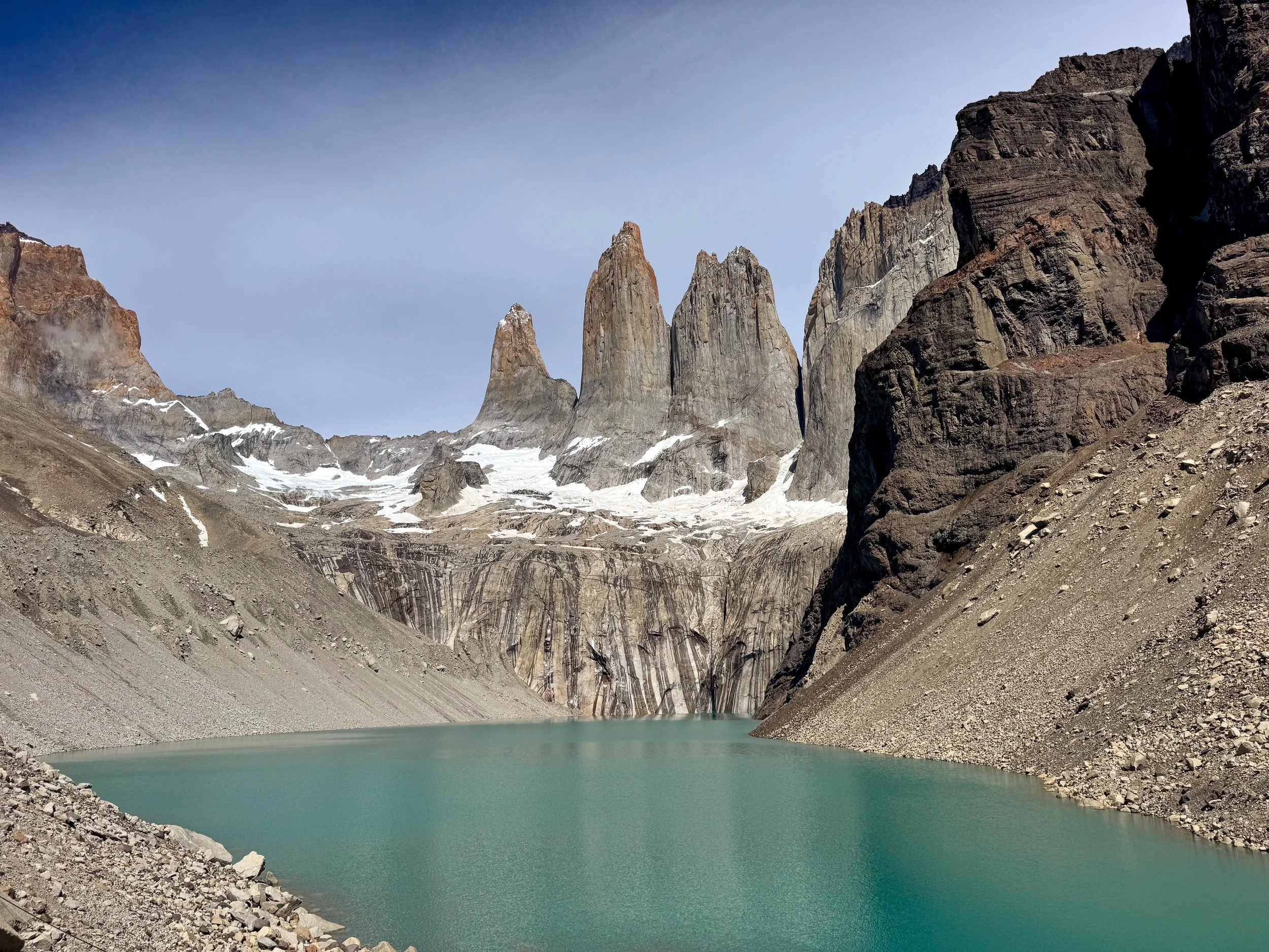
Patagonia Chile Travel Guide: Torres del Paine, Hiking & Road Trips
Road trip through Chilean Patagonia where scenic hikes, wildlife encounters, turquoise waterfalls and rugged landscapes create an unforgettable wilderness adventure.
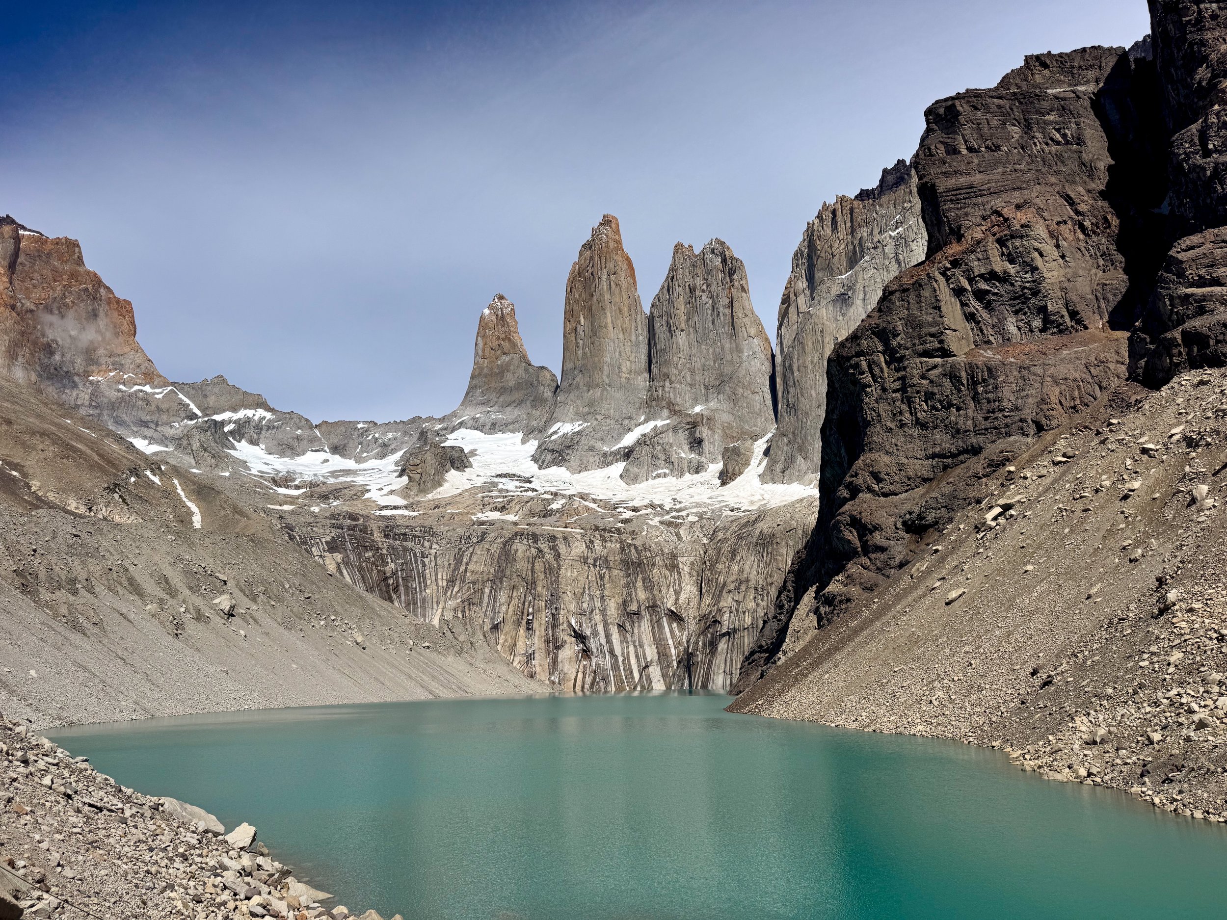
Patagonia, Chile
Patagonia is an awe inspiring and remote corner of the world spanning southern Chile. Its rugged terrain is covered in snow capped peaks, glacial lagoons, turquoise waterfalls and fjords. It’s an adventurous destination to road trip through with scenic lookouts, cave systems and mountainous hikes.
Torres del Paine National Park
Torres del Paine is a national park centered around three vertical white granite peaks at the base of a turquoise mountain lagoon. The vast landscape is comprised of jagged mountains, snowy glaciers, glacial lakes and lagoons, winding rivers with misty waterfalls and wildlife. It’s one of the most popular national parks in Patagonia with campgrounds, multi day treks and breathtaking natural sights.
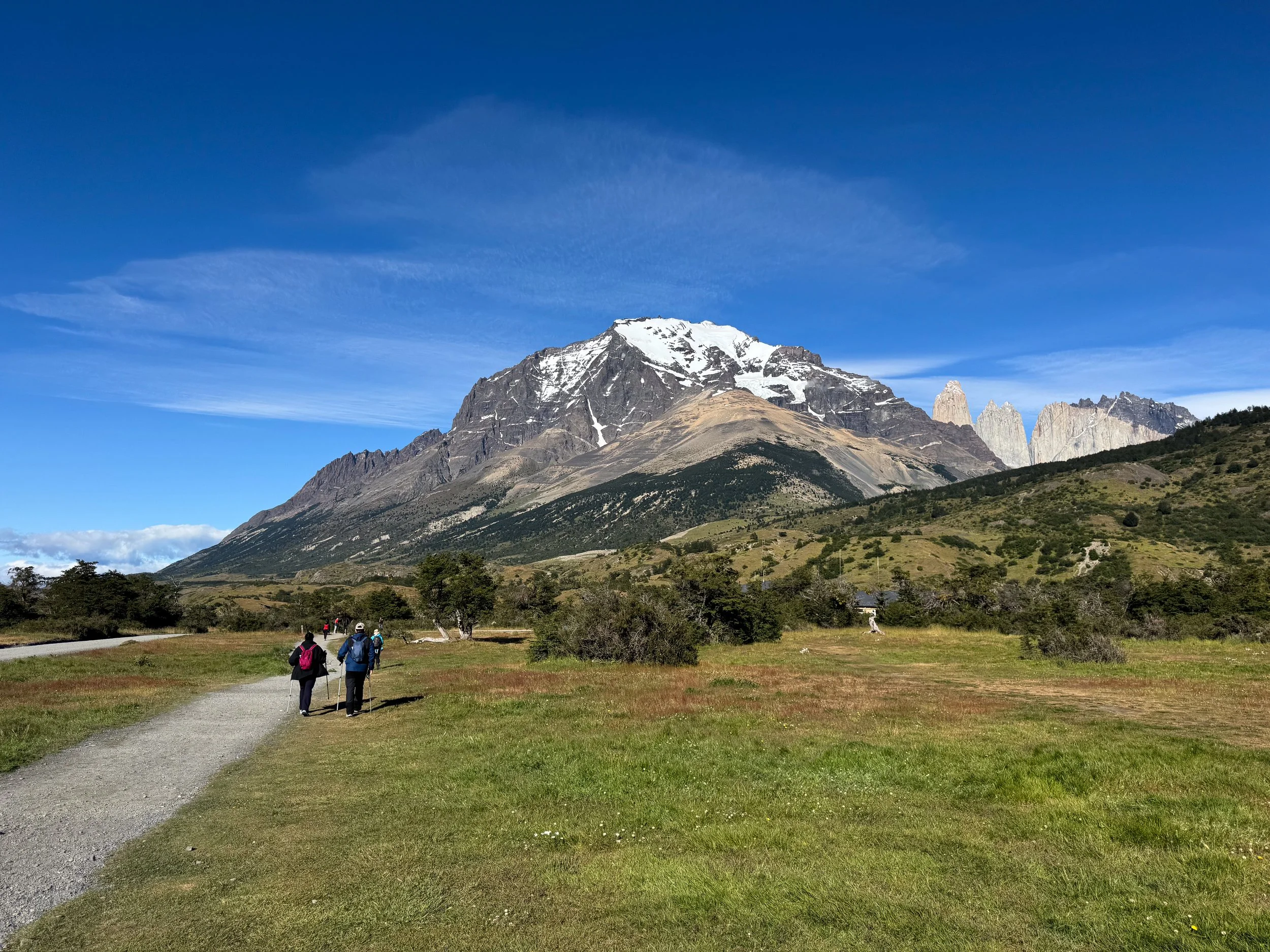
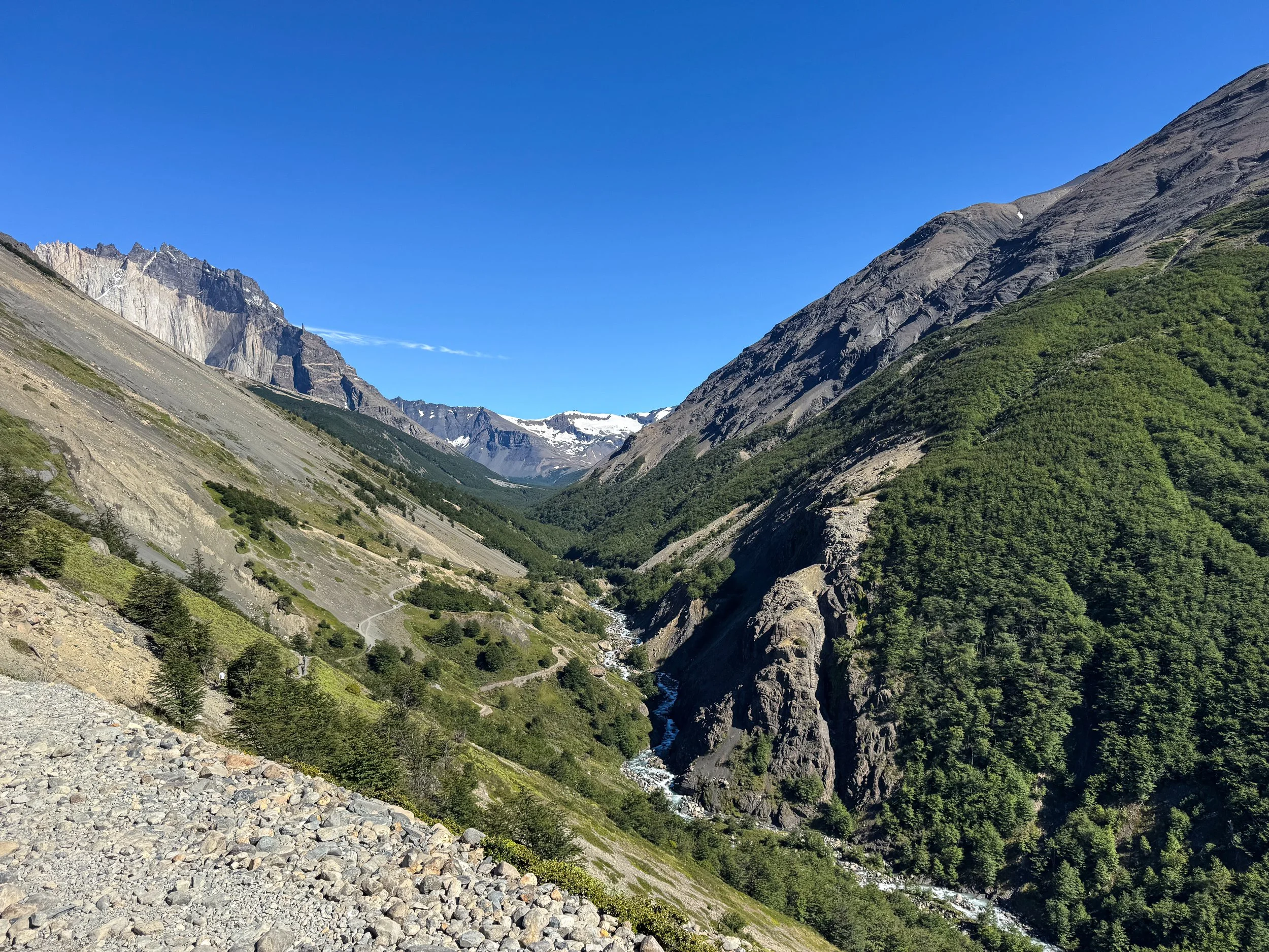
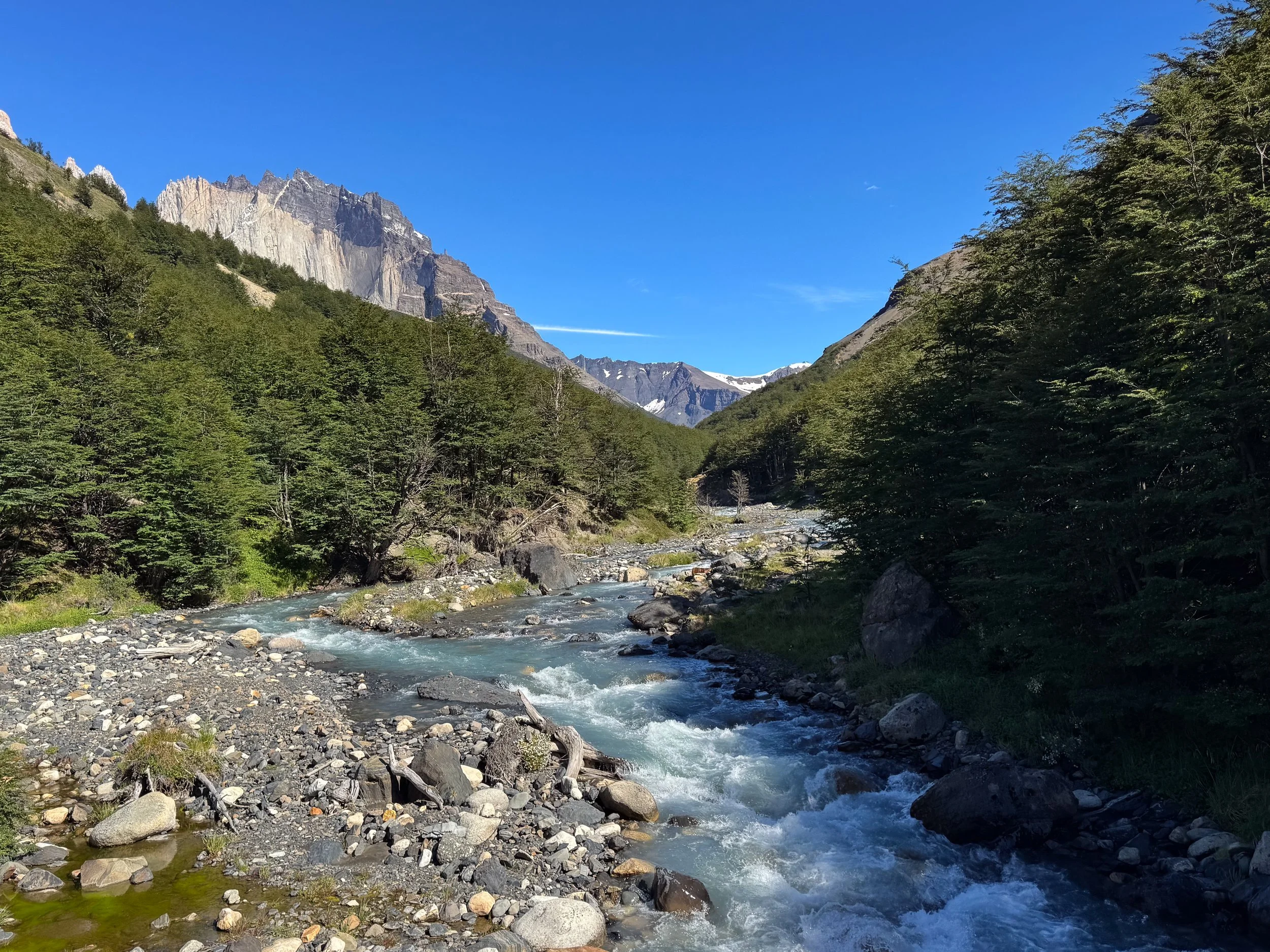
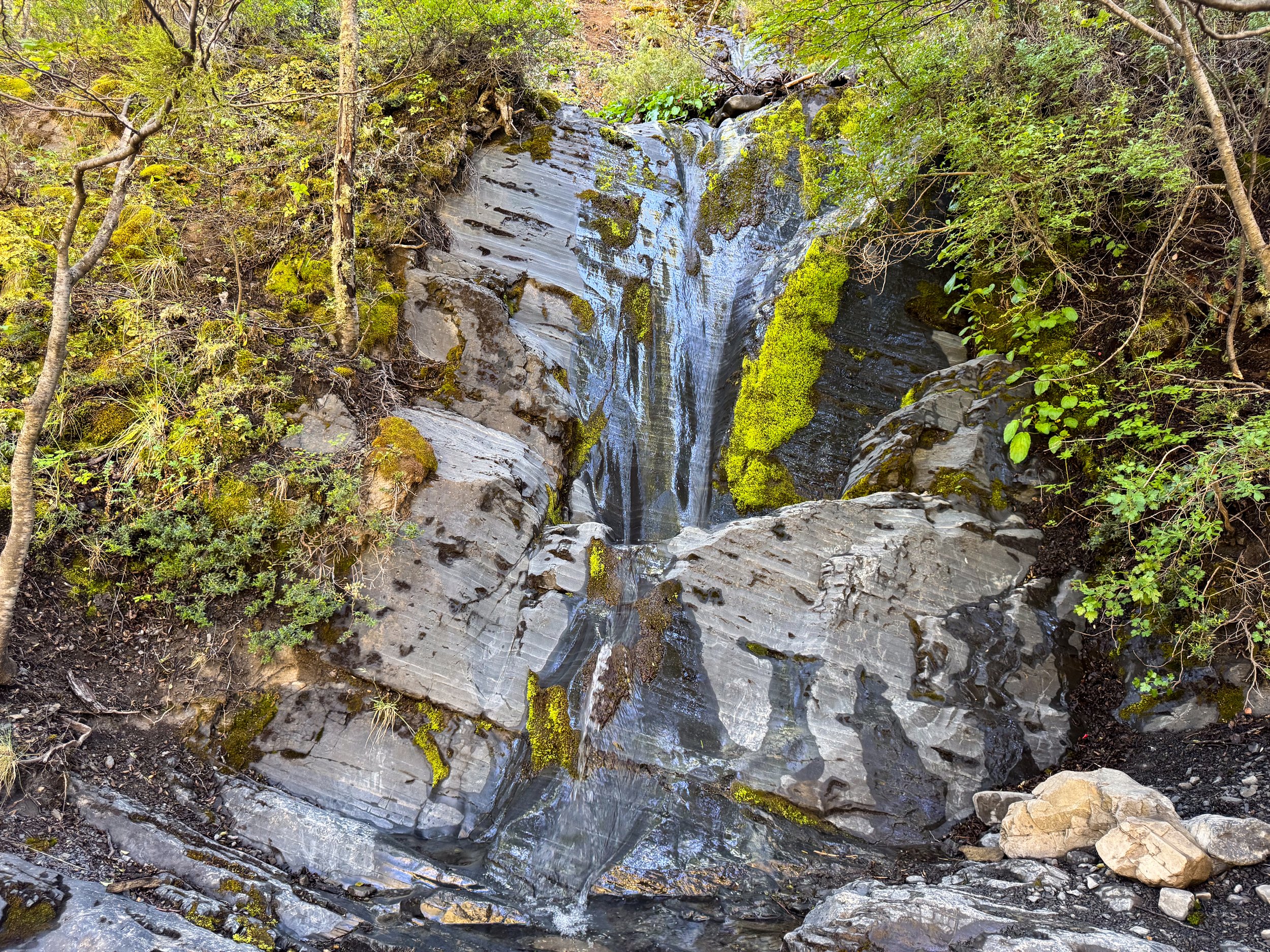
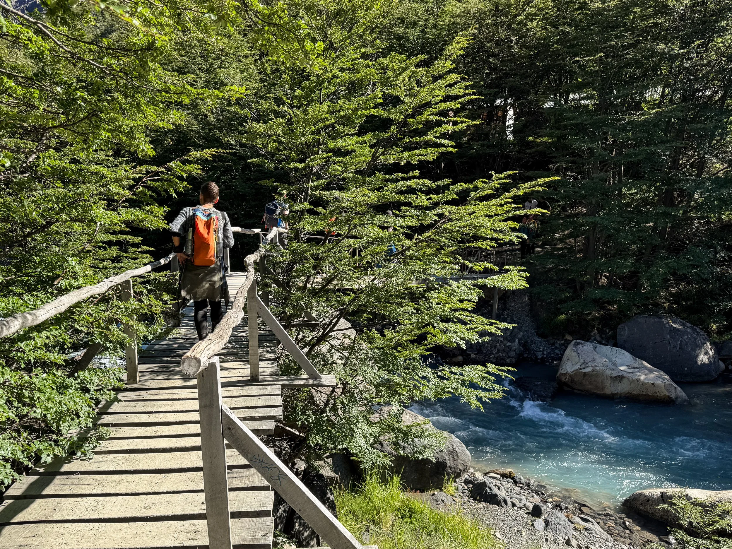
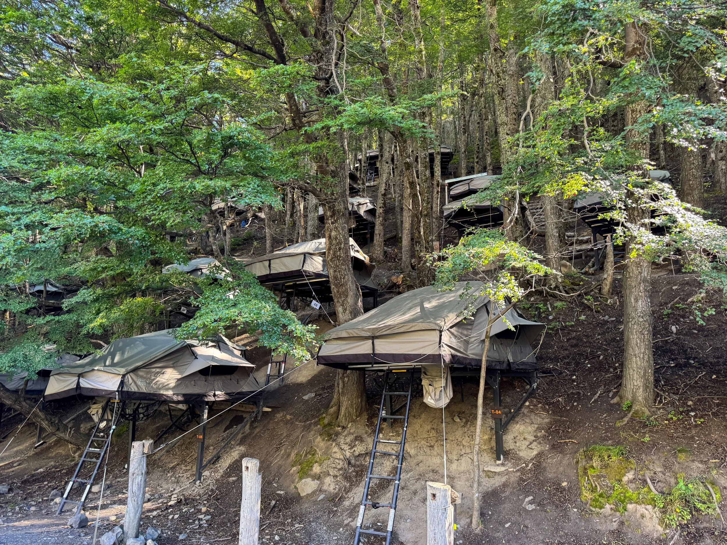
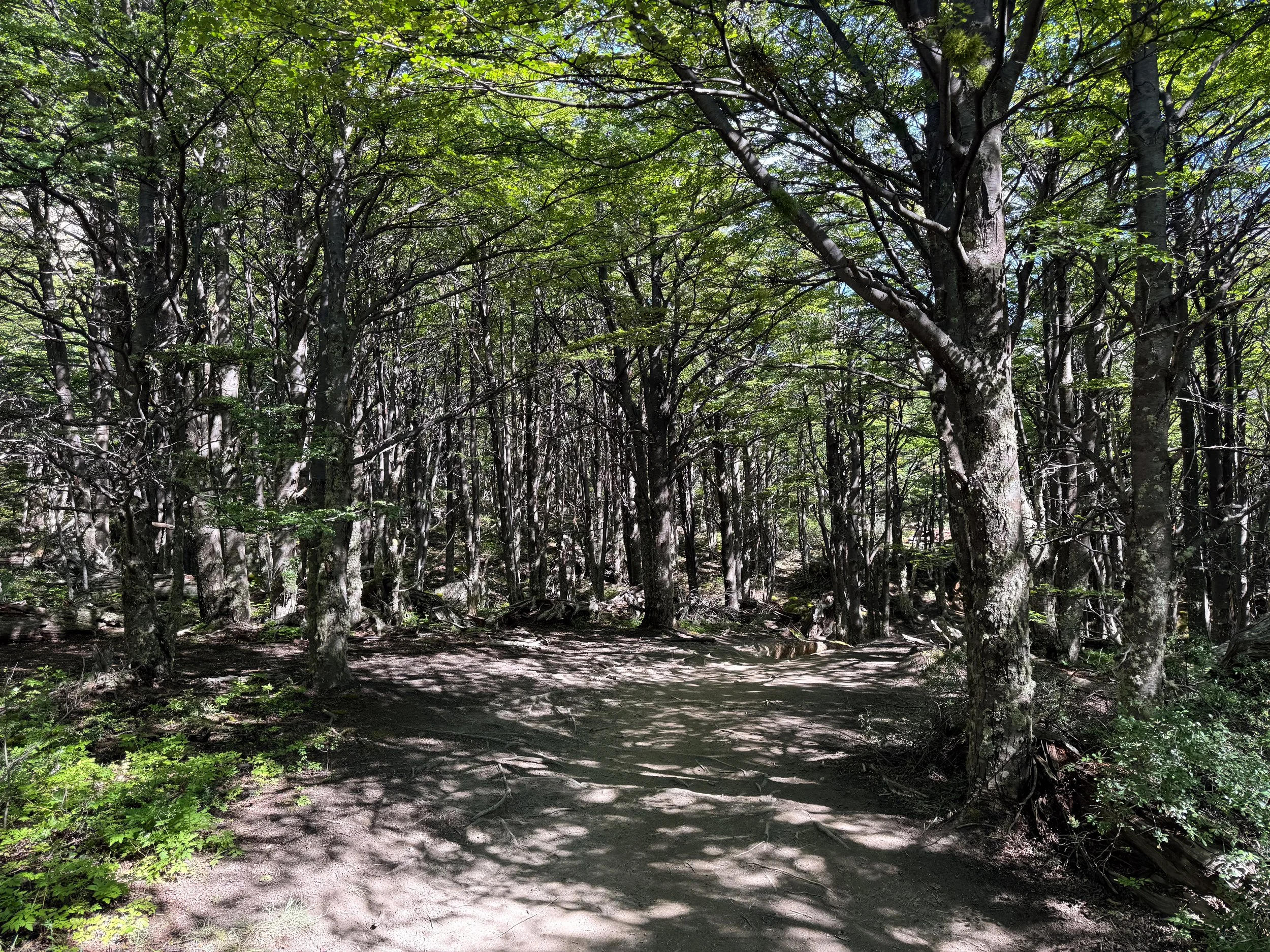
Sendero Mirador las Torres. A 16km roundtrip trail to the three iconic towers and glacial lagoon. It’s the most accessible hike in the national park and perfect for single day trekkers. Keeping a comfortable pace, we were able to hike from the welcome center to the lagoon in about 2 hours and 30 minutes.
Mirador las Torres Trailhead. The trailhead is reachable after a 1km hike from the welcome center across relatively flat terrain. The trail is well marked, with orange signs attached to red posts and two check points along the way, Refugio Chileno and Guardia Parques.
Refugio Chileno. From the trailhead, the route ascends and descends along the river for 3km before reaching Refugio Chileno. Along the way, we spotted condors circling above, blossoming flowers and bushes with El Calafate berries. Midway we stopped to admire the views at Paso de los Vientos, a panoramic lookout with sweeping views of the valley, forested mountainsides and snowcapped peaks. Refugio Chileno serves as many hikers’ “base camp” with a restaurant, small shop and campground of hillside tented platforms available for rent. We stopped here for a celebratory beer on the trek back.
Guardia Parques. For 3km after passing Refugio Chileno, the trail follows the river, crisscrossing it on wooden footbridges. After the third bridge, Puente Limit, the trail leads into a semi-hilly stretch of forest along the base of the mountains.
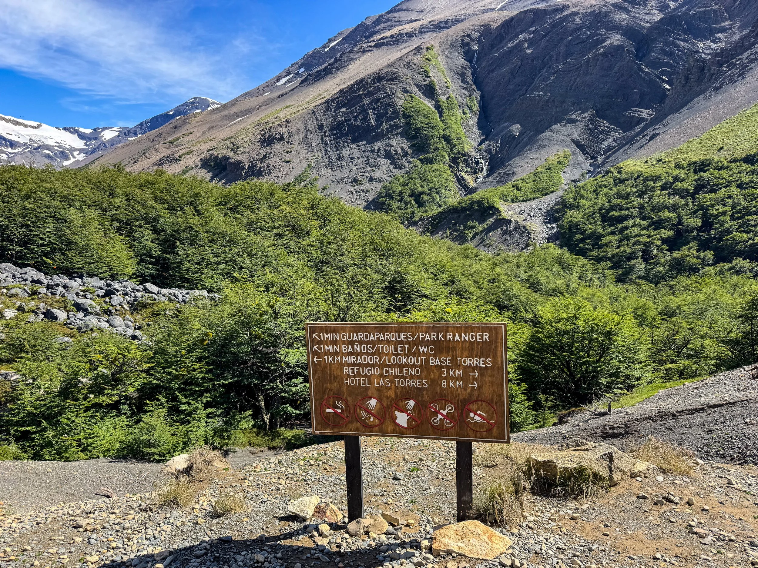
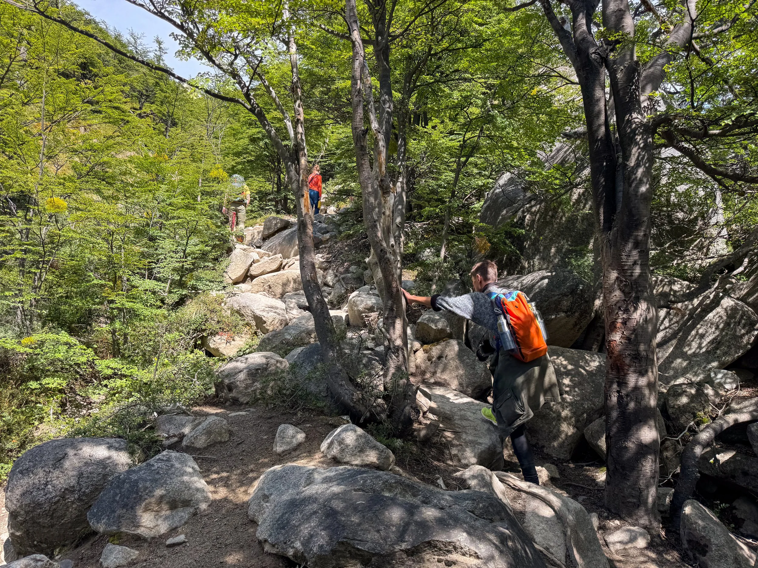
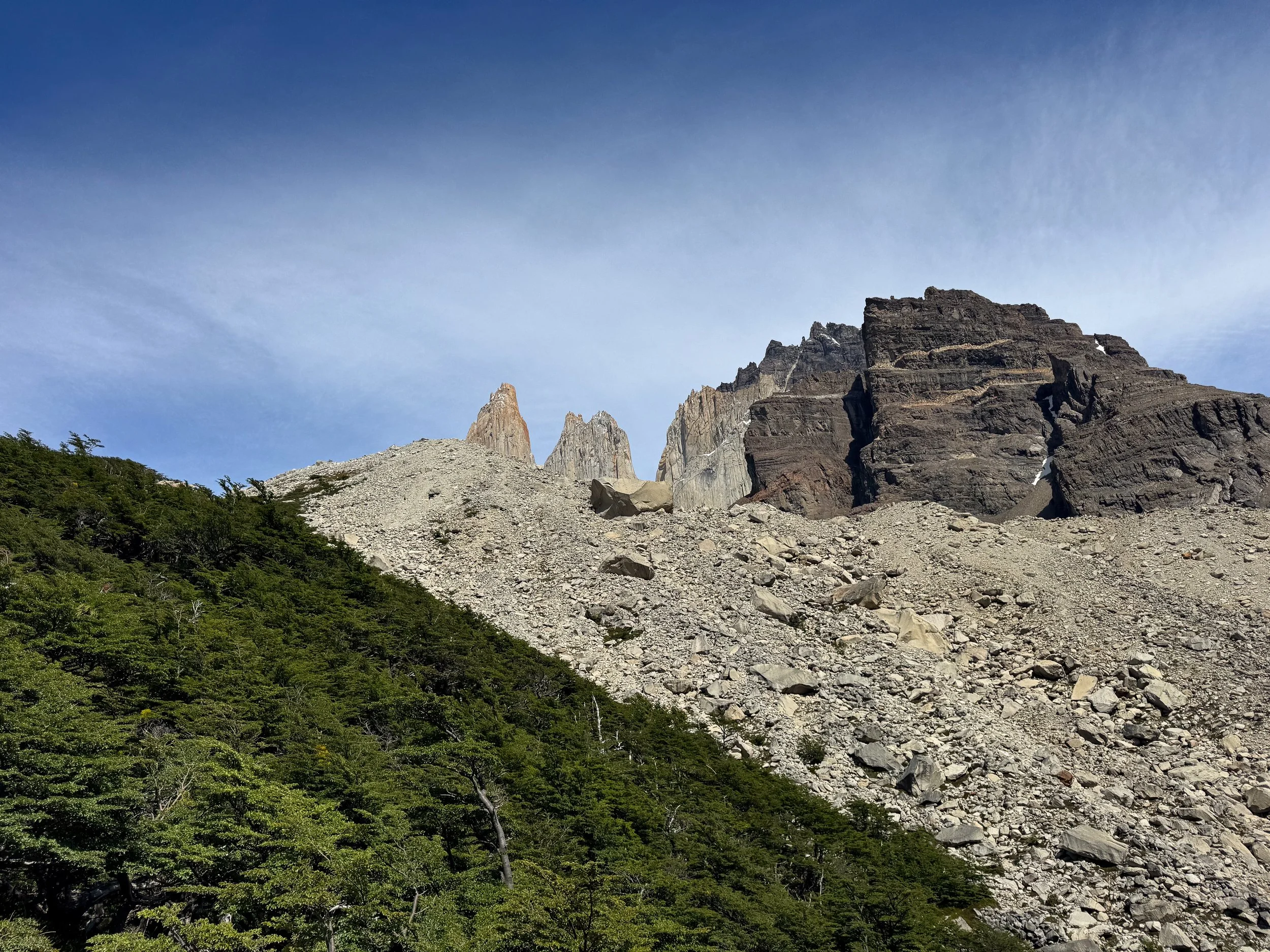
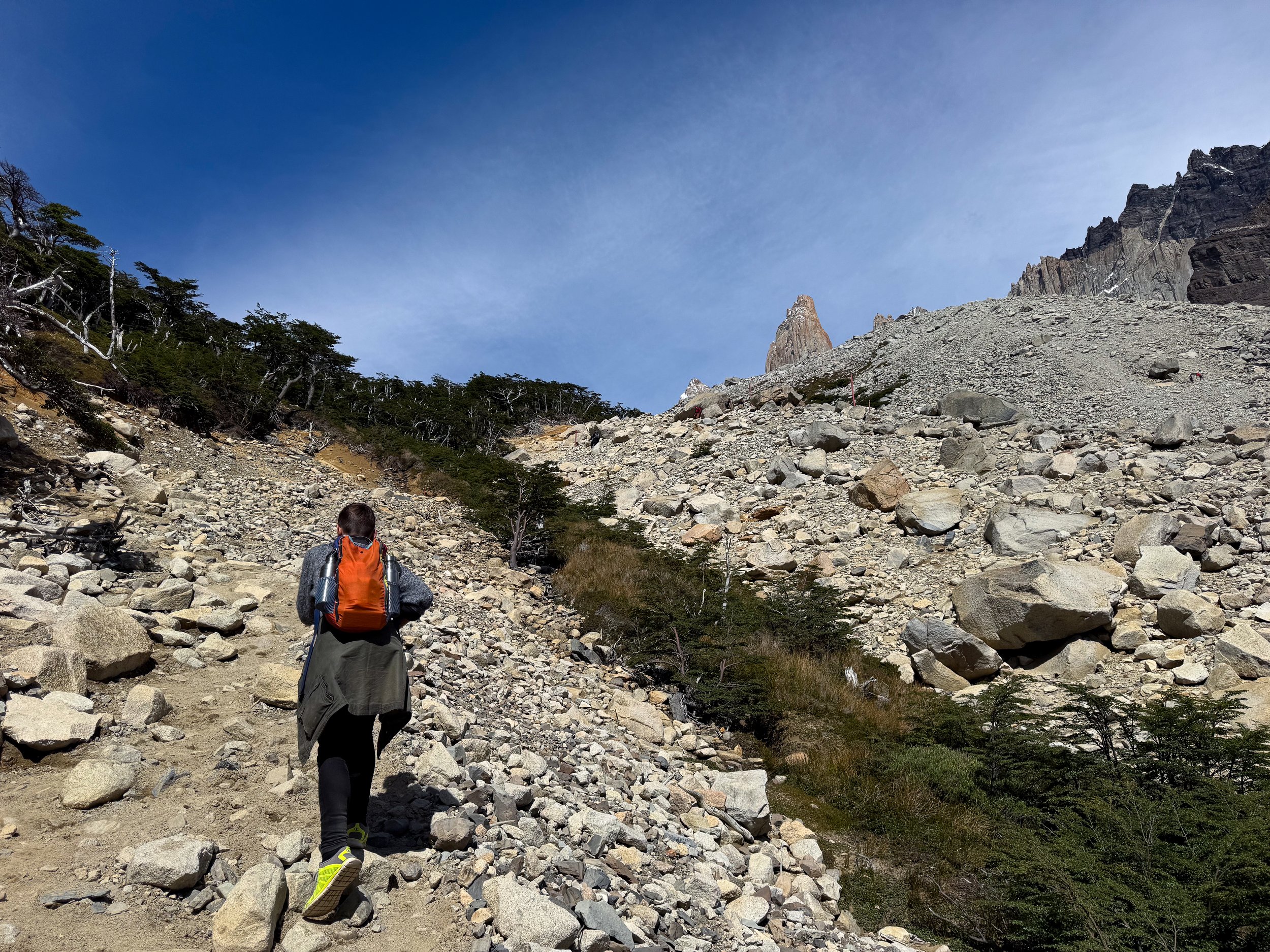
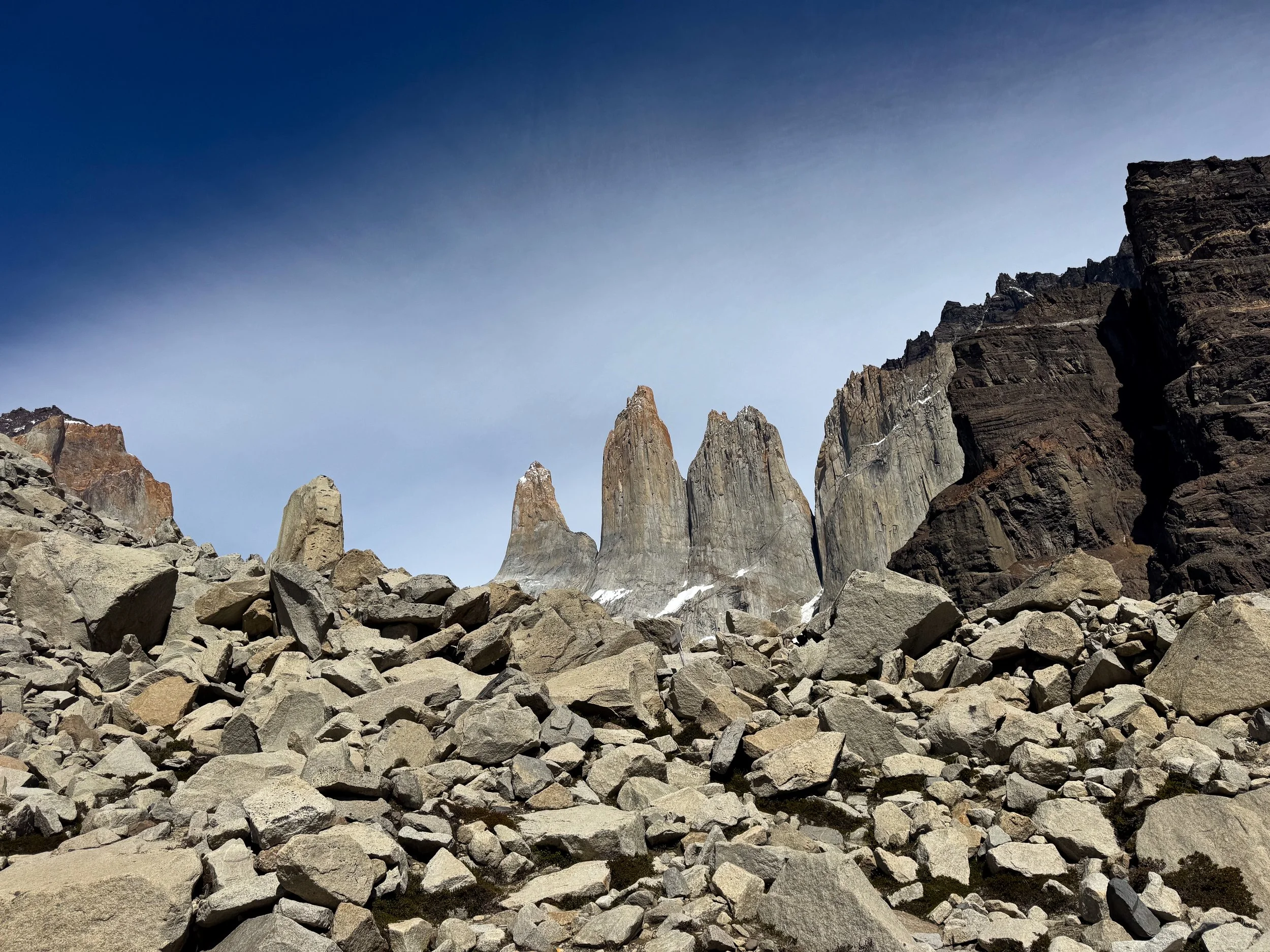
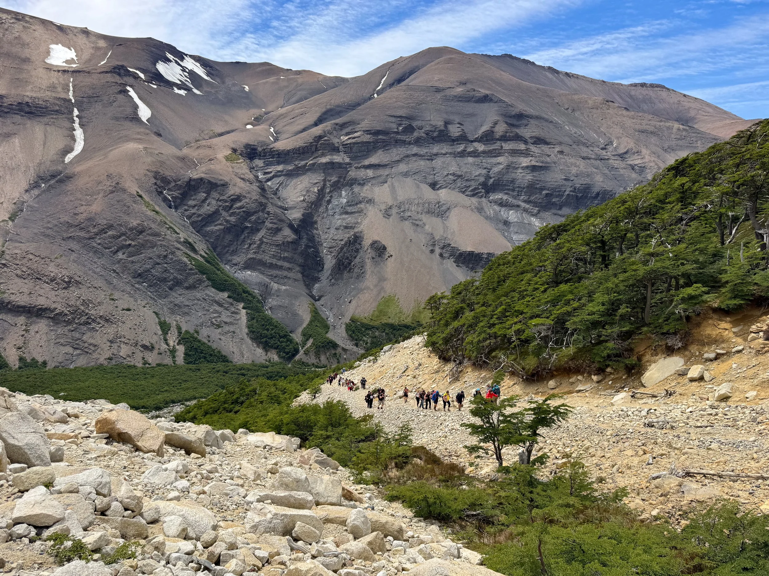

Guardia Parques. A clearing in the forest opens up to the second checkpoint, Guardia Parques. It’s here where the granite peaks of Torres del Paine only come back into view. It also marks the most rigorous point of the hike. From here, the final 1km of the trail leads over steep terrain, loose gravel and slippery boulders until coming upon the mirador! There is a ranger station and restroom at the Guardia Parque. The trail leads left to the mirador and right to continue further into the park.
Mirador las Torres. After hiking 8km, the reward was worth the Paine! The iconic view of the three white granite towers and turquoise lagoon came fully into view at the Mirador. We sat on the rocks, admired the inspiring landscape and watched as streams of water from the melting snow and ice ran down the cliff into the lagoon.
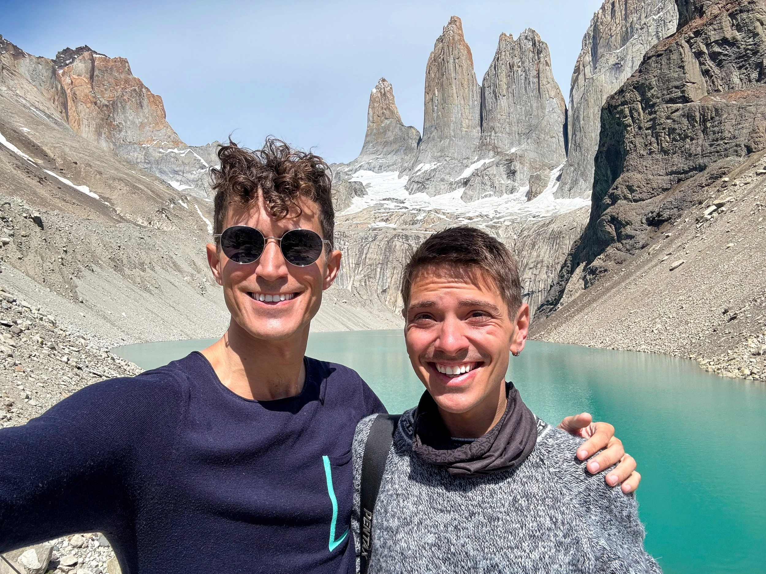
Getting Here. Drive to the Guardería Laguna Amarga to show your ticket and passport. The entrance is 1 1/2 hours from Puerto Natales and less than 10 minutes from Laguna Amarga. From here, drive 15 minutes to the Torres del Paine Welcome Center with a cafe, restrooms and shop. After passing through the welcome center, walk to the Torres de Paine Trail Head 1km away to begin the hike.
Tips for Visiting Torres del Paine National Park:
Tickets. Park tickets can be purchased 2 months in advance online with Pases Parques Nacionales. Tickets are valid for 3 or 7 days.
Hours. The park opens at 7am. Entry to the trail closes at 3pm and the mirador closes at 4pm. Begin hiking early to avoid the crowds.
Timing. We started the trek at 9am arriving to the lagoon at 11:30am. On the descent, the trail was packed with hundreds of hikers in line walking up the mountain.
Weather. Check the weather ahead of time and only hike on a clear day to maximize chances of seeing the granite towers in all their splendor.
Difficulty. It’s a long hike and difficult at times but not severely rigorous. We saw young children and met people over the age of 60 completing the hike.
Puerto Natales
Puerto Natales is a Patagonian port town. Its central location makes it easy to explore the region from. The city is comprised of modern cabins, converted shipping container buildings, wood tiled homes and sheet metal houses. The main street, Manuel Bulnes, is home to restaurants, cafes, bakeries, bars, grocery stores, outdoor outfitters and tour companies.
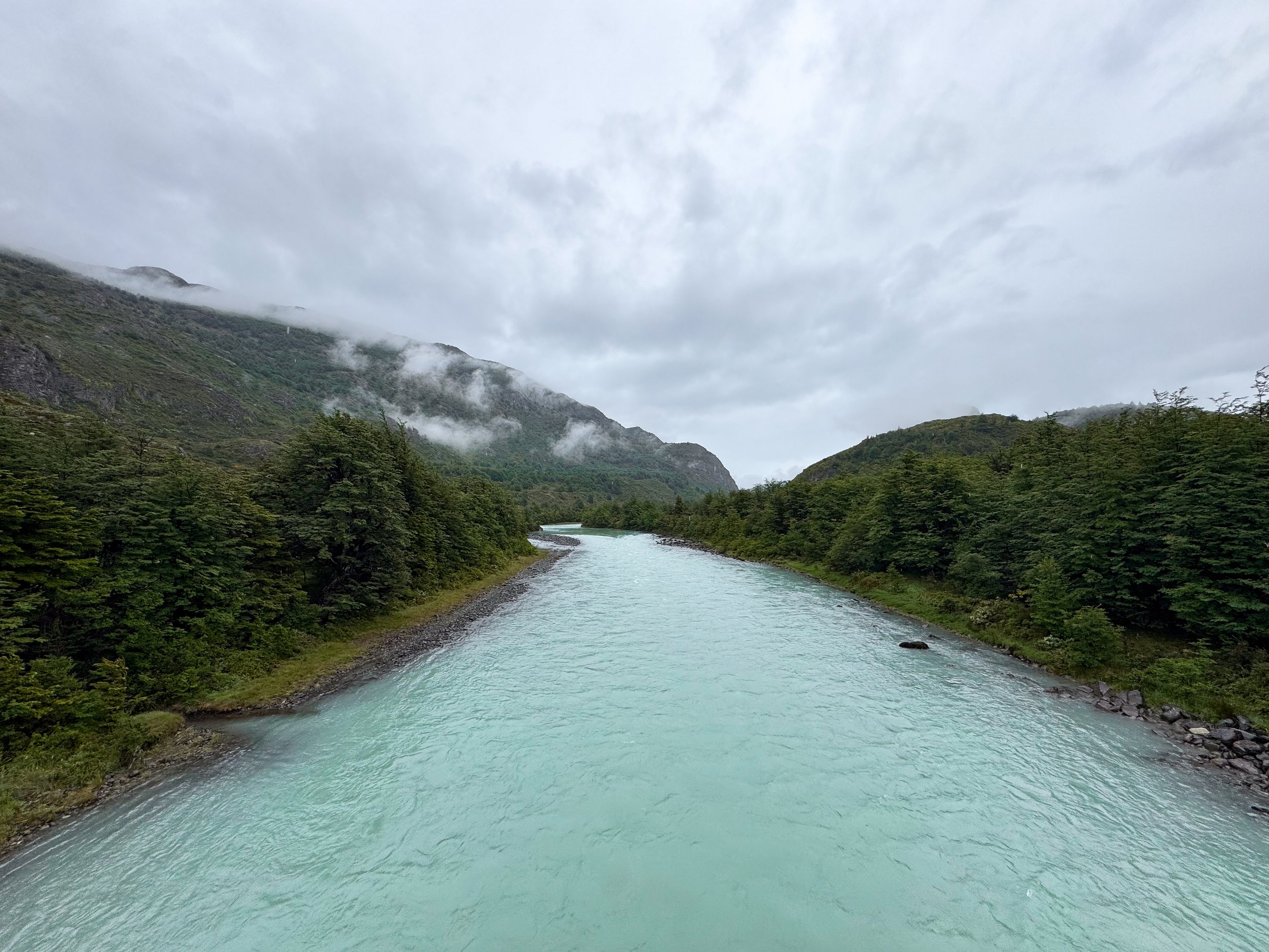
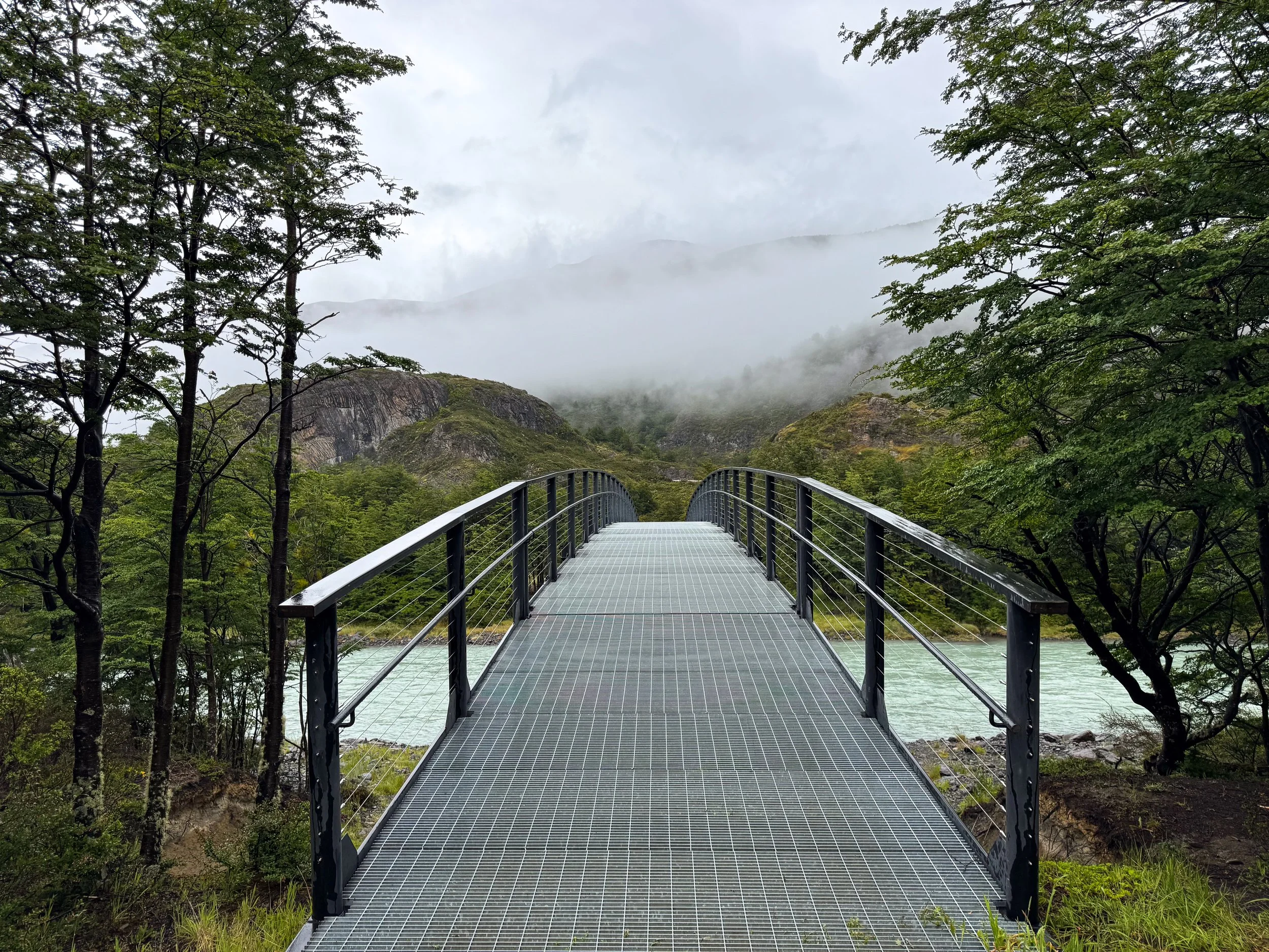
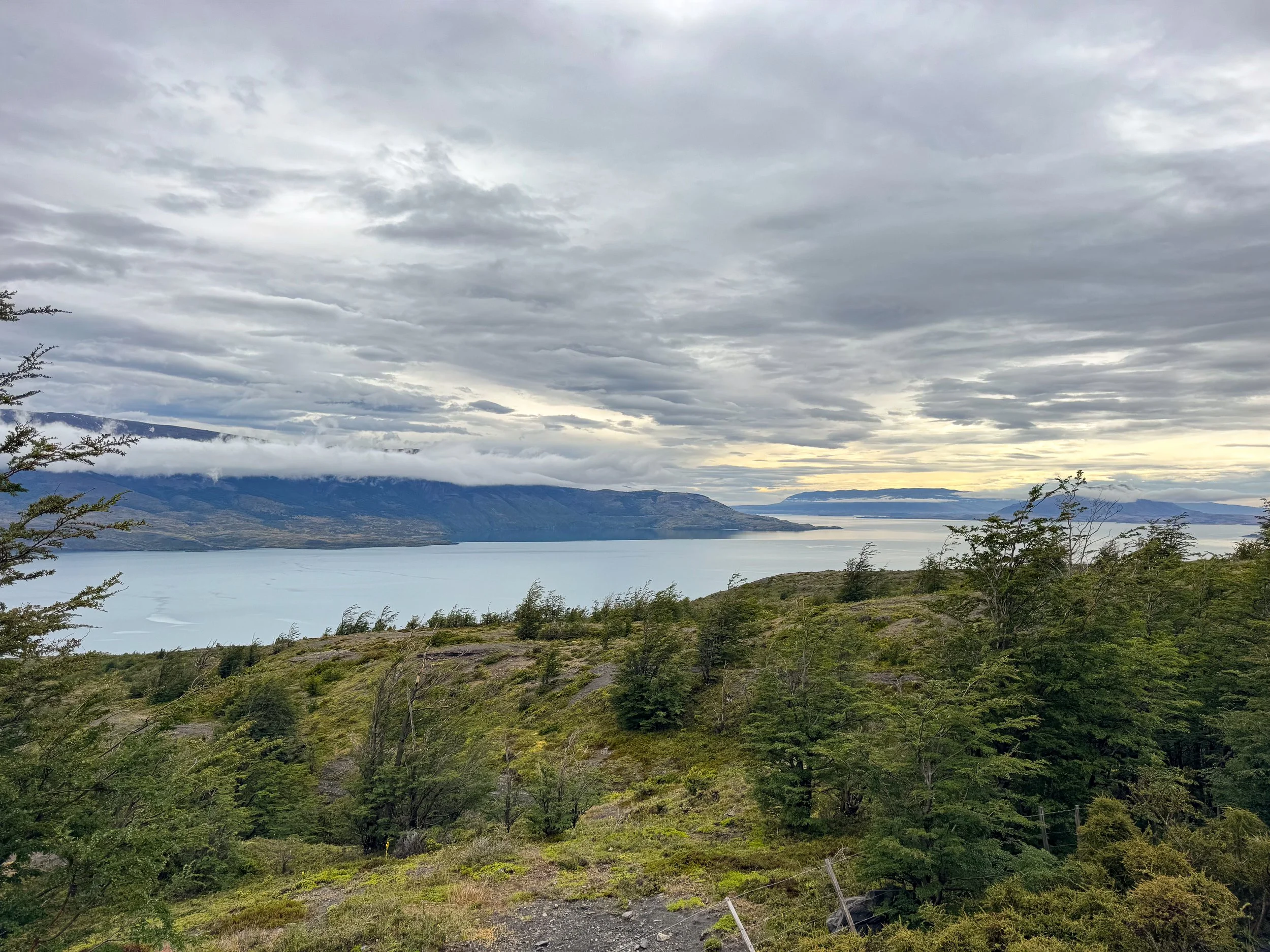
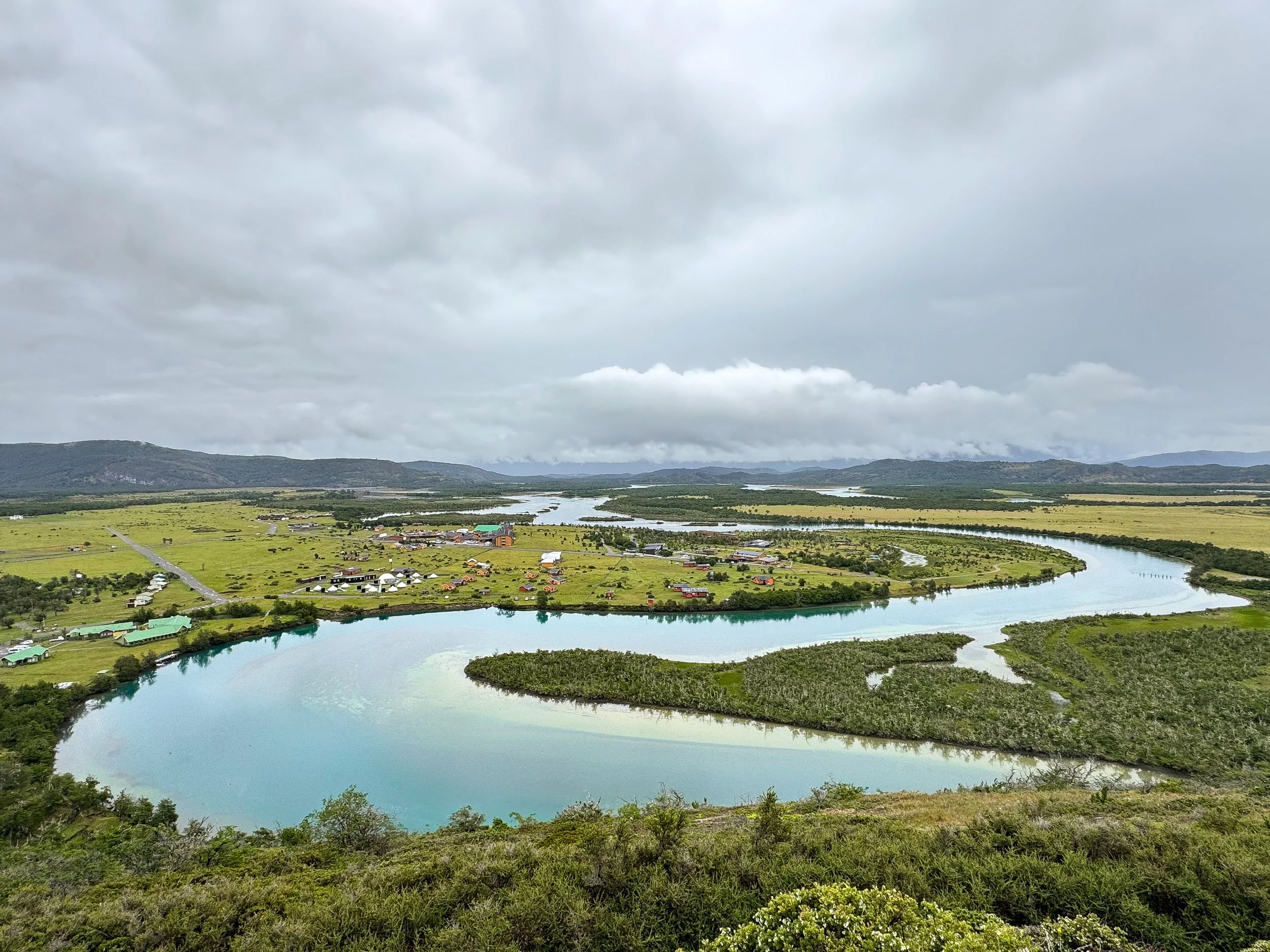
Patagonian Road Trip
We road tripped between Puerto Natales and Torres del Paine National Park, stopping at scenic lookouts, glacial lagoons, waterfalls, caves and hiking trails.
Cueva del Milodon. A massive cave once inhabited by prehistoric humans and the Milodon, a now extinct giant ground sloth. A trail leads to the cave from the visitor center, setting the stage with informational signs explaining the geology and formation of it, insights on the humans that lived within it 14,000 years ago and the former megafauna of the area, including the Milodon, Sabertooth tigers and Patagonian Panthers. The mouth of the cave is grand, measuring 200 meters deep, 80 wide and 30 tall. A trail leads into it past archeological dig sites, dangling stalactites and a panoramic overlook. The cave is located 30 minutes by car from Puerto Natales.
Mirador Grey. A series of roadside lookouts above Lago Grey, a greenish grey colored glacial lagoon surrounded by snowcapped mountains and lush hillsides. The miradors are located 1 hour from Cueva del Milodon.
Mirador Río Serrano. A scenic lookout on the bluffs over the Río Serrano Valley with views of the winding blue river and on a clear day, the mountain peaks of Torres del Paine. There is a small tourist town below with hostels, hotels and glamping sites. It’s often the entry point for most people staying outside of Torres del Paine National Park. The lookout is located 15 minutes from Mirador Grey.
Guardería Grey. A welcome center and restaurant with access to Sendero Lago Grey, a trail leading to the Grey Lake. We took the trail to a foot bridge across the Rio Pingo and to a peninsula with a black sand and pebble beach, far away views of the glacier and blue floating icebergs. Boat tours depart near the Hotel Lago Grey up to the leading edge of the Grey Glacier. The welcome center is located 30 minutes from Mirador Río Serrano.
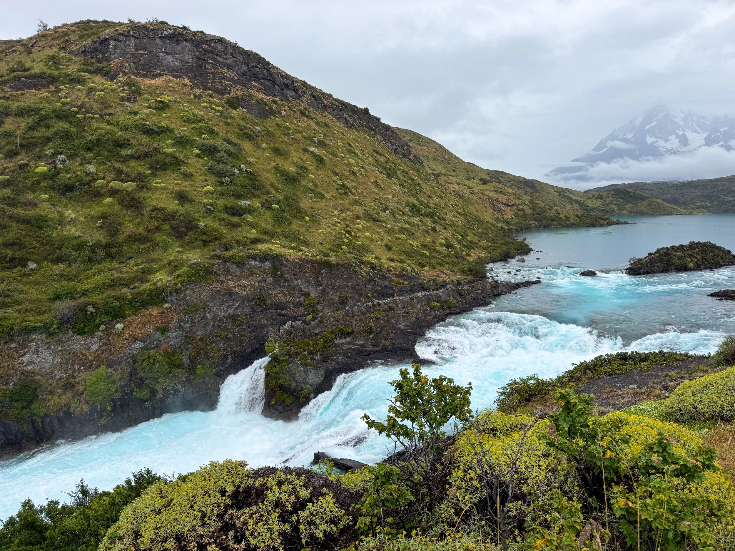
Salto Chico Falls. A turbulent and eclectic blue colored waterfall on the Rio Paine accessible by a wooden boardwalk from the parking lot. The boardwalk leads through the lush hillside along the volcanic stone banks of the river to reach the viewpoint. The trail takes less than 30 minutes round trip. There is a hotel, restaurant and spa here for people looking to stay the night in a natural and luxurious setting. The waterfall is located 30 minutes from Guarderia Grey.
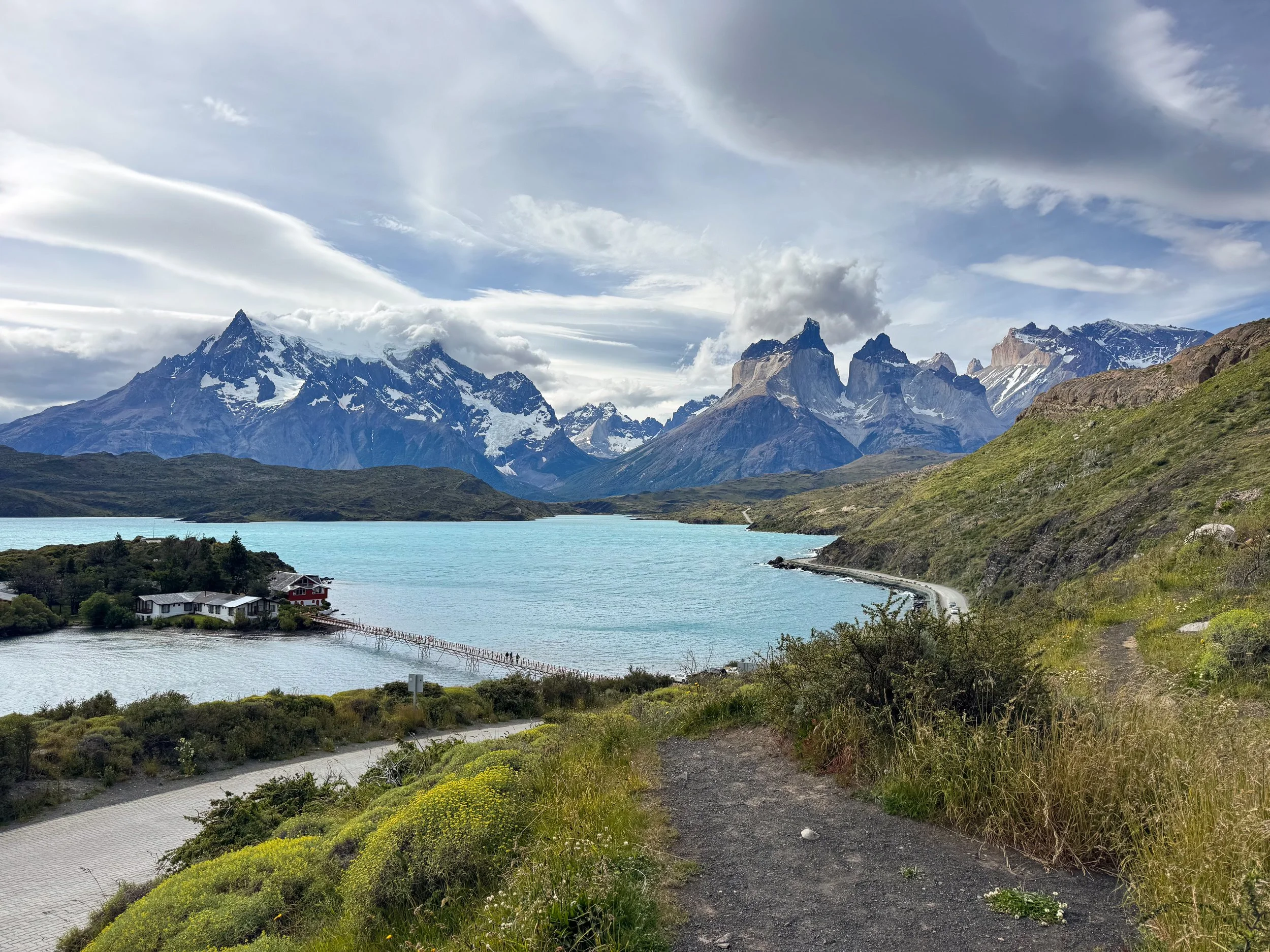
Mirador Lago Pehoé. An incredibly beautiful roadside lookout over Lago Pehoé with scenic views of the dark blue colored lake surrounded by rugged mountains. From here, a trail leads to Mirador de Condor with panoramic views. In view of the Mirador is an island with hotels and restaurants. The lookout is located less than 10 minutes from Salto Chico Falls.
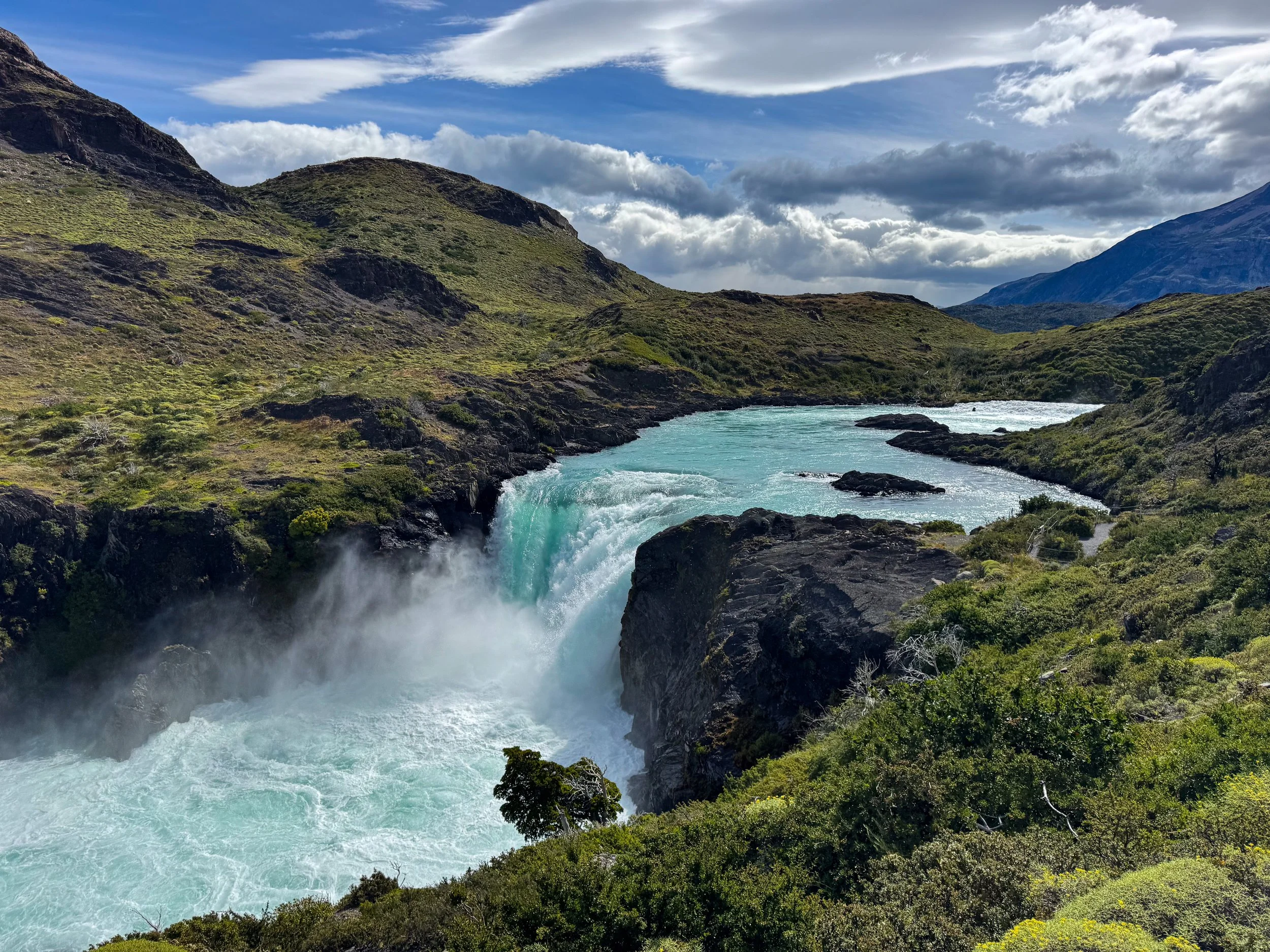
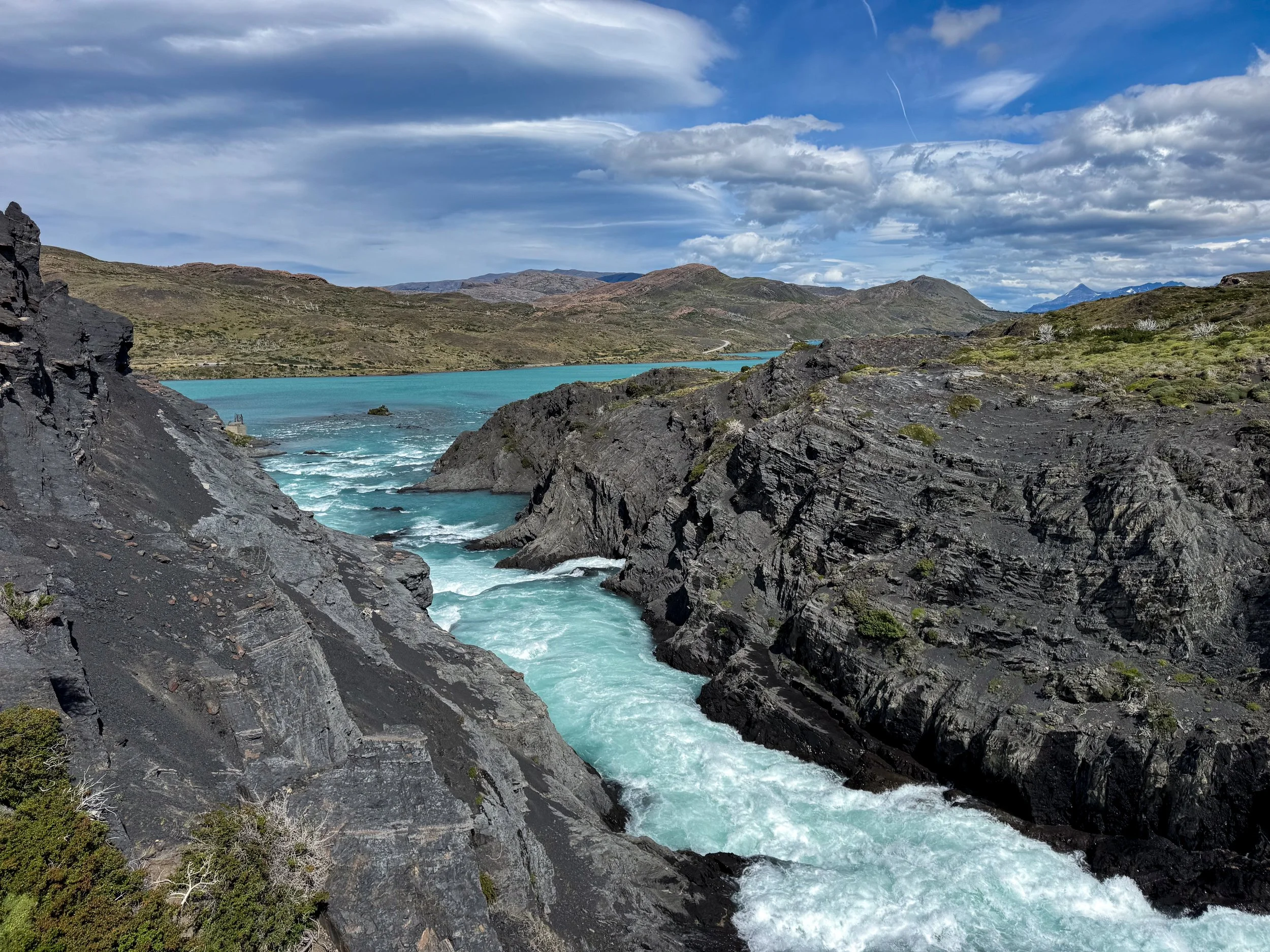
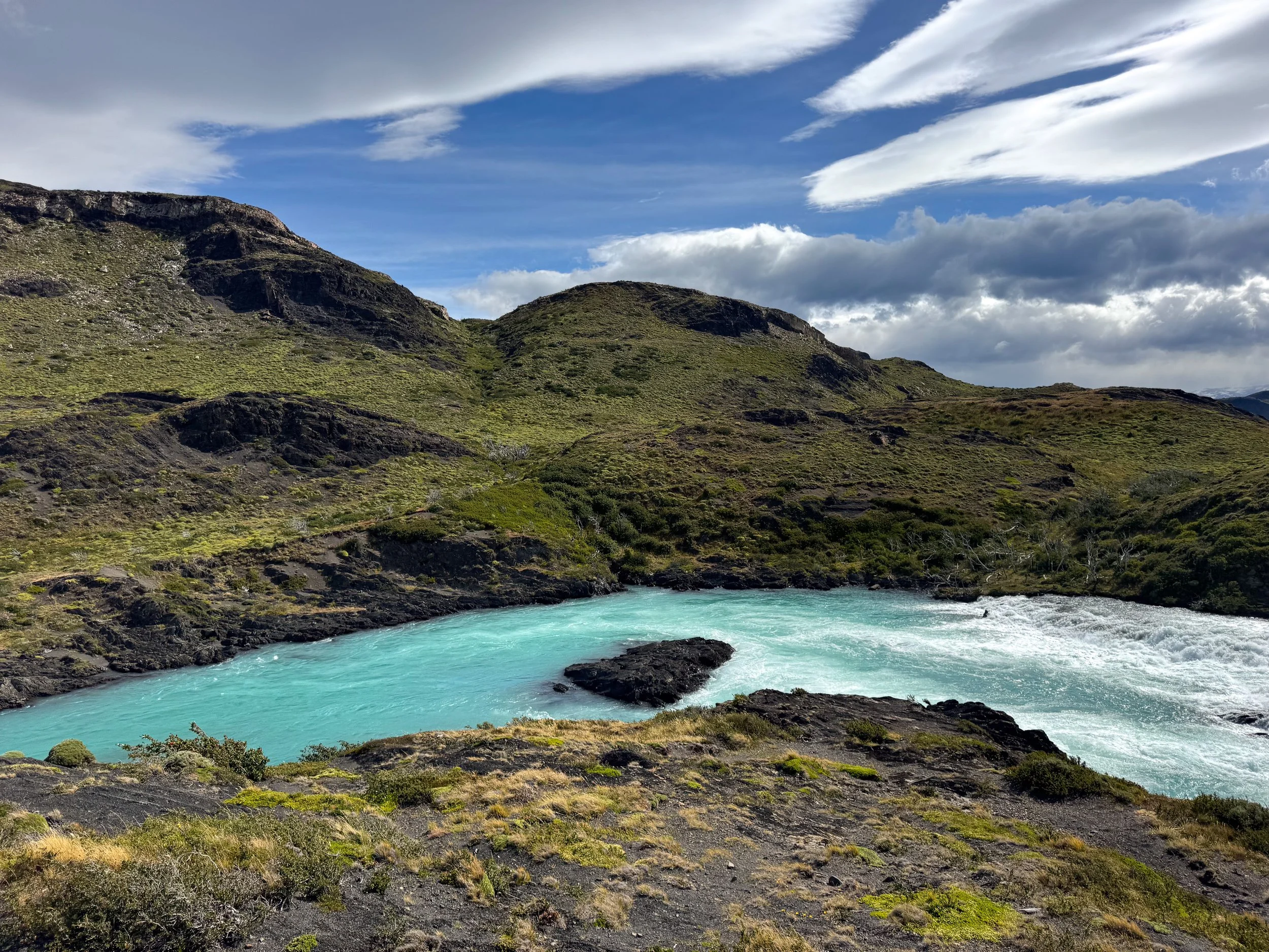
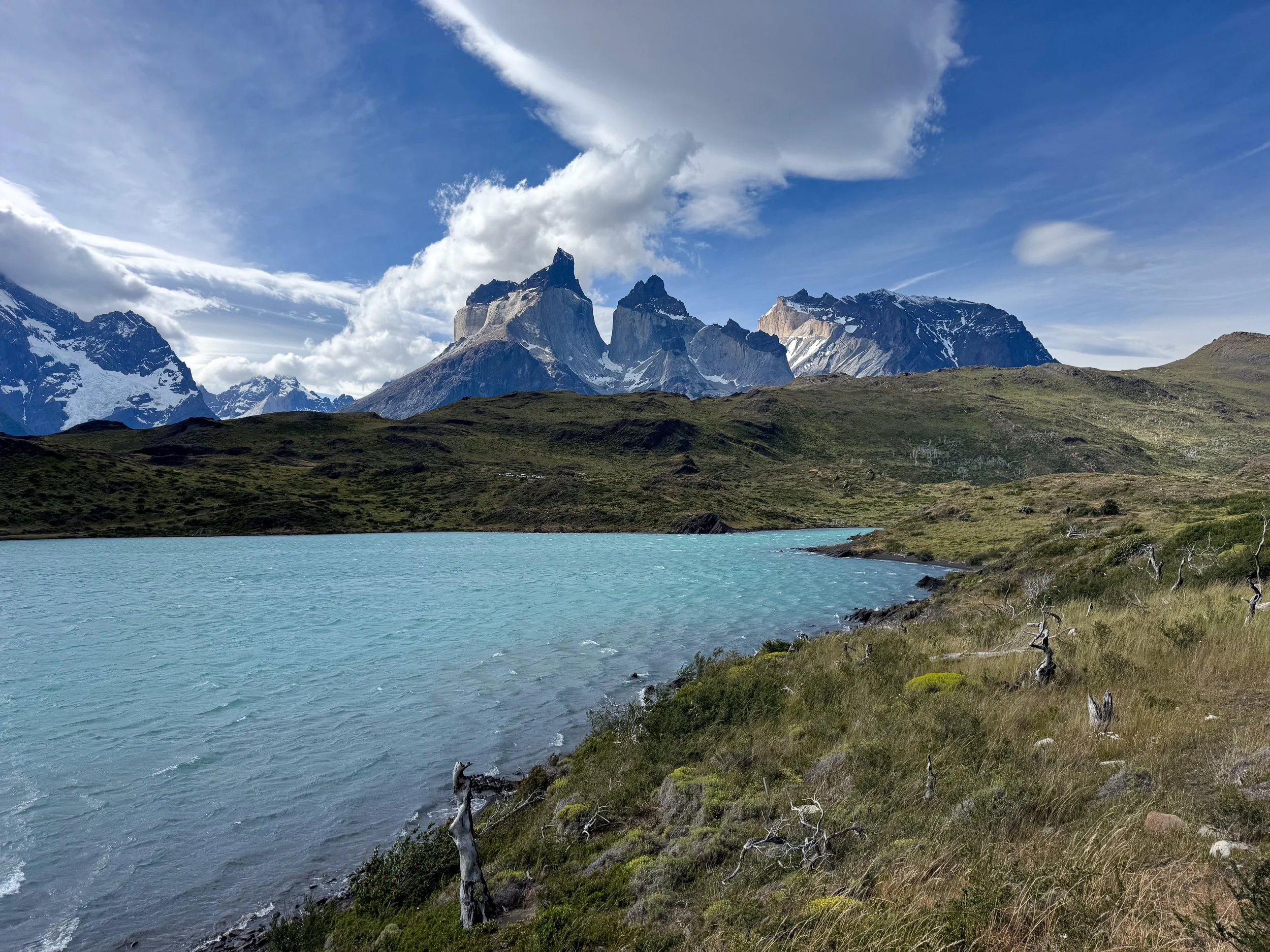
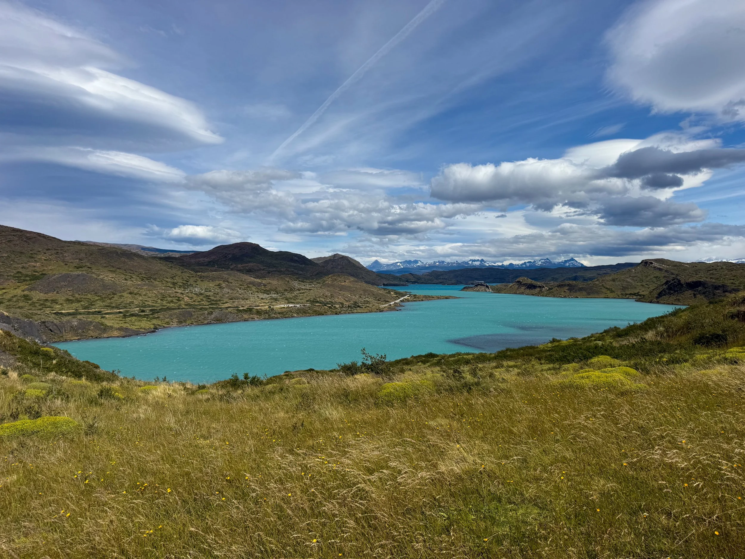
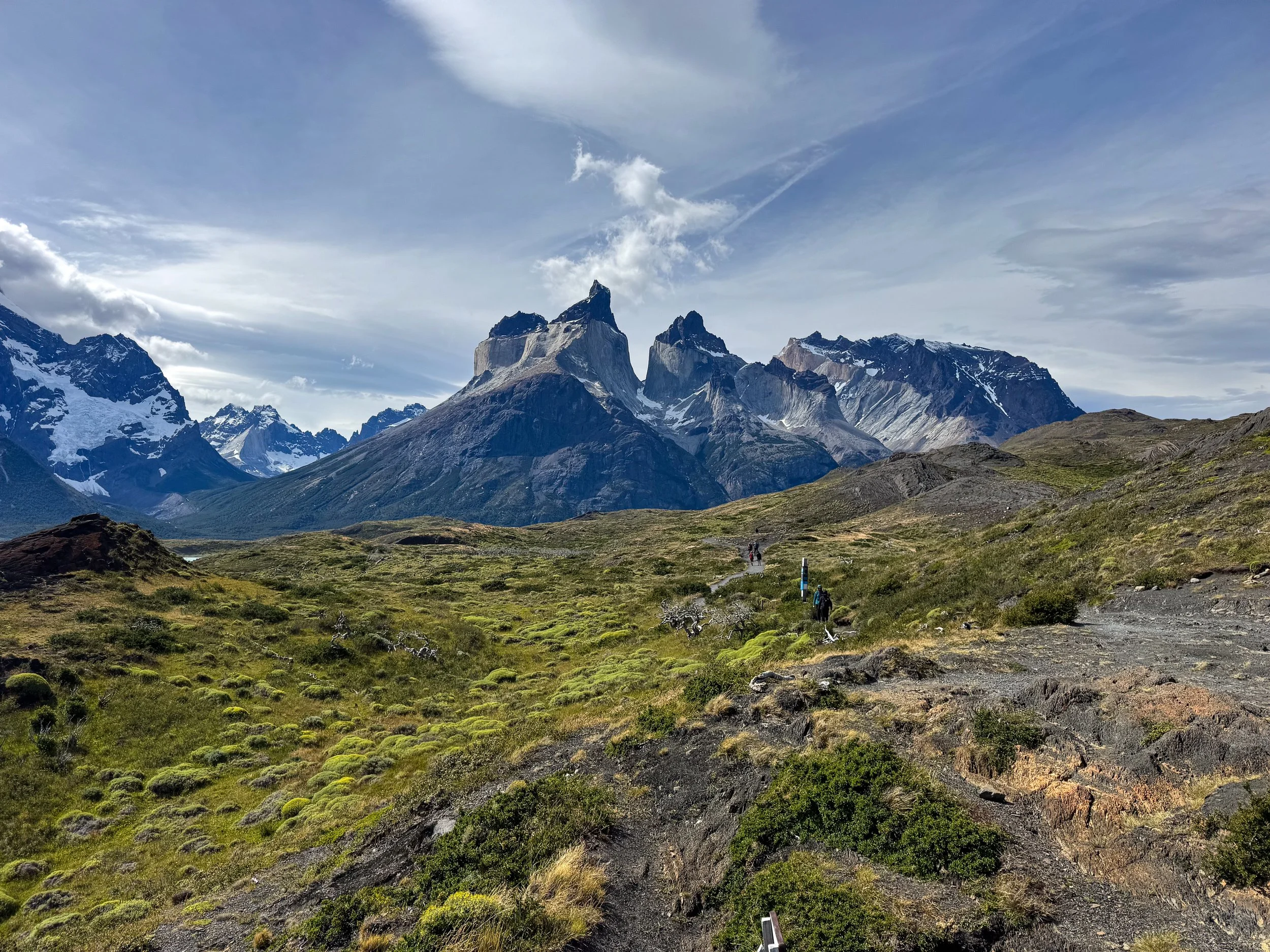
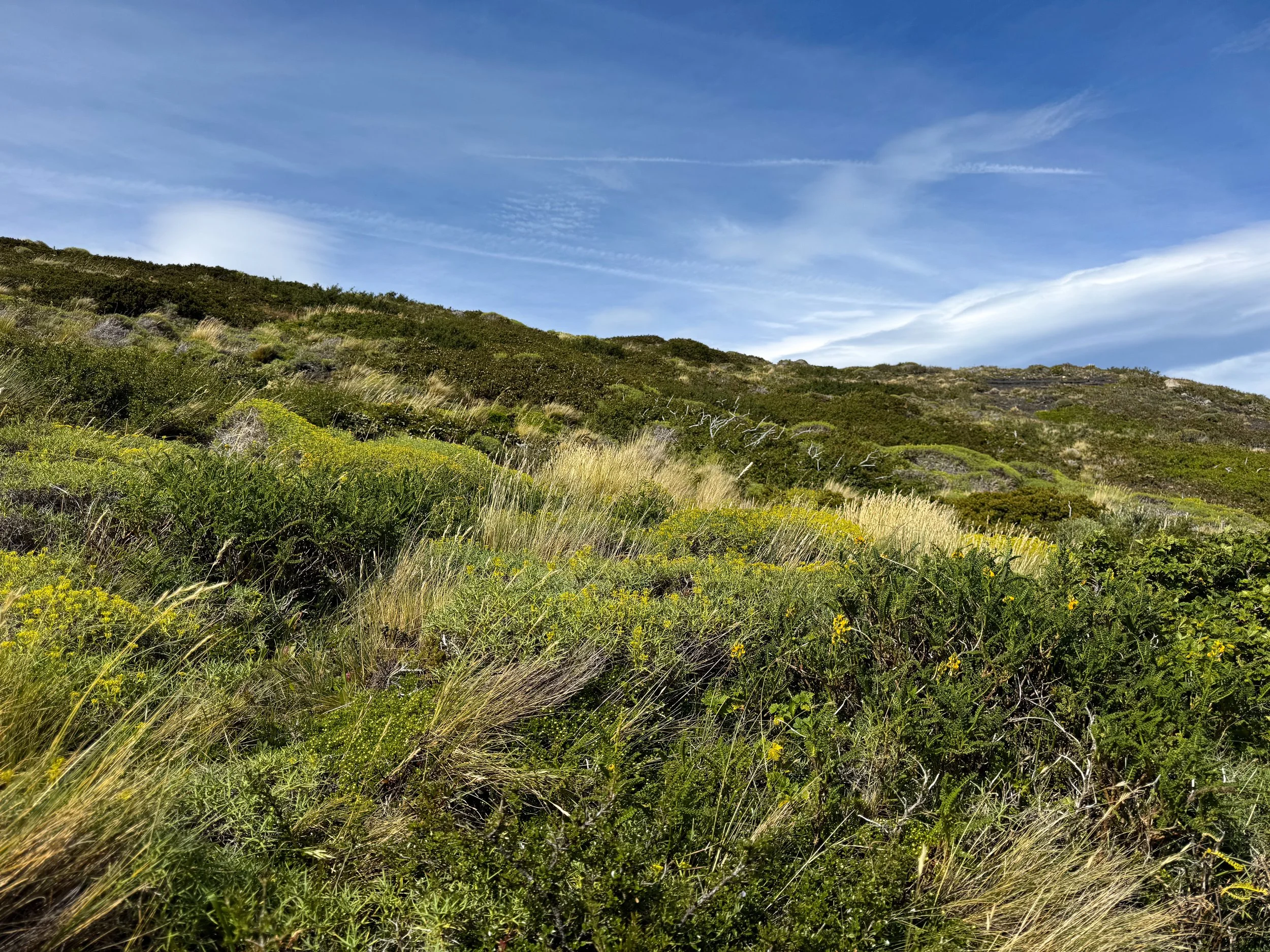
Salto Grande Waterfall. A misty aquamarine waterfall contrasted against black volcanic cliffs in a channel between two glacial lakes. The waterfall viewpoint is a 15 minute walk from the parking lot past lush hillsides with green bushes, flowering plants and mountainous views. The trail continues a further 5km to Mirador Cuernos with a lookout overNordenskjöld Lake. Beware of high winds that can reach speeds of 120km/h. The waterfall is located less than 15 minutes from Mirador de Condor.
Mirador Nordenskjöld Lake. A roadside lookout over a lagoon and lake with mountains on its opposite side. Between the mountains is a cascading glacier with blue ice and fresh snow. It was at this time that the rain started to subside. Soon afterwards, birds began flying around and guanaco started appearing on the tops of the hills, curiously looking around in all directions. The mirador is located 15 minutes from Salto Grande.
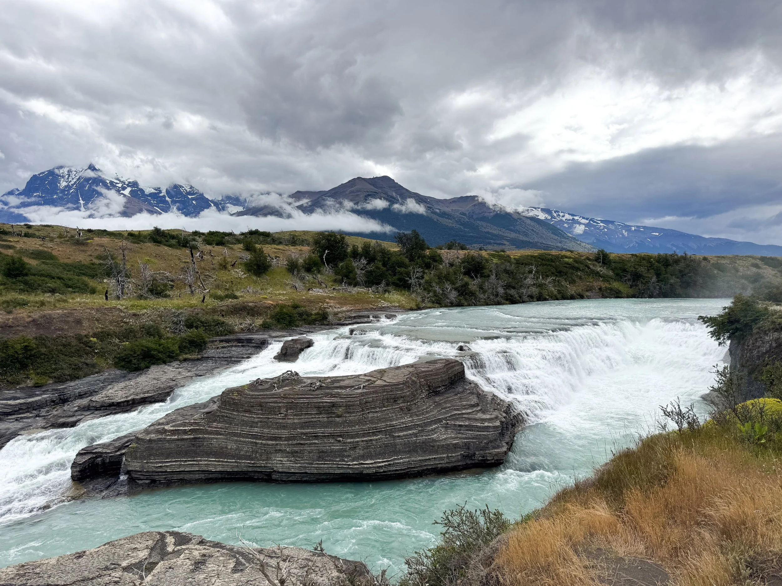
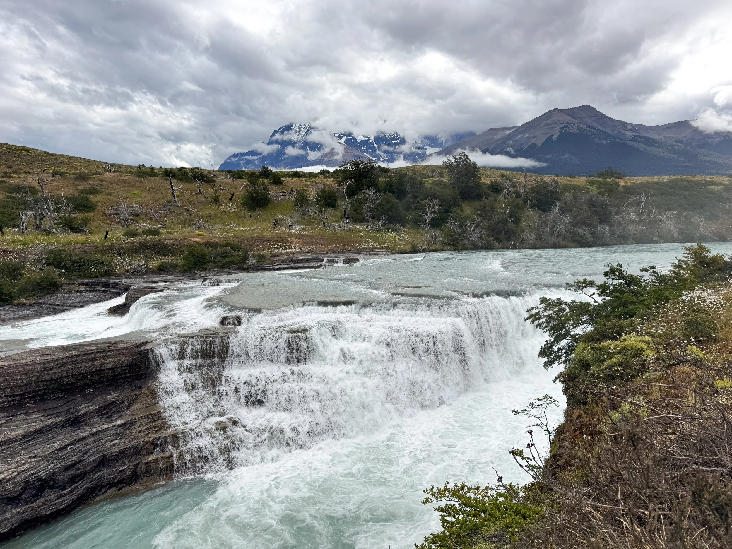
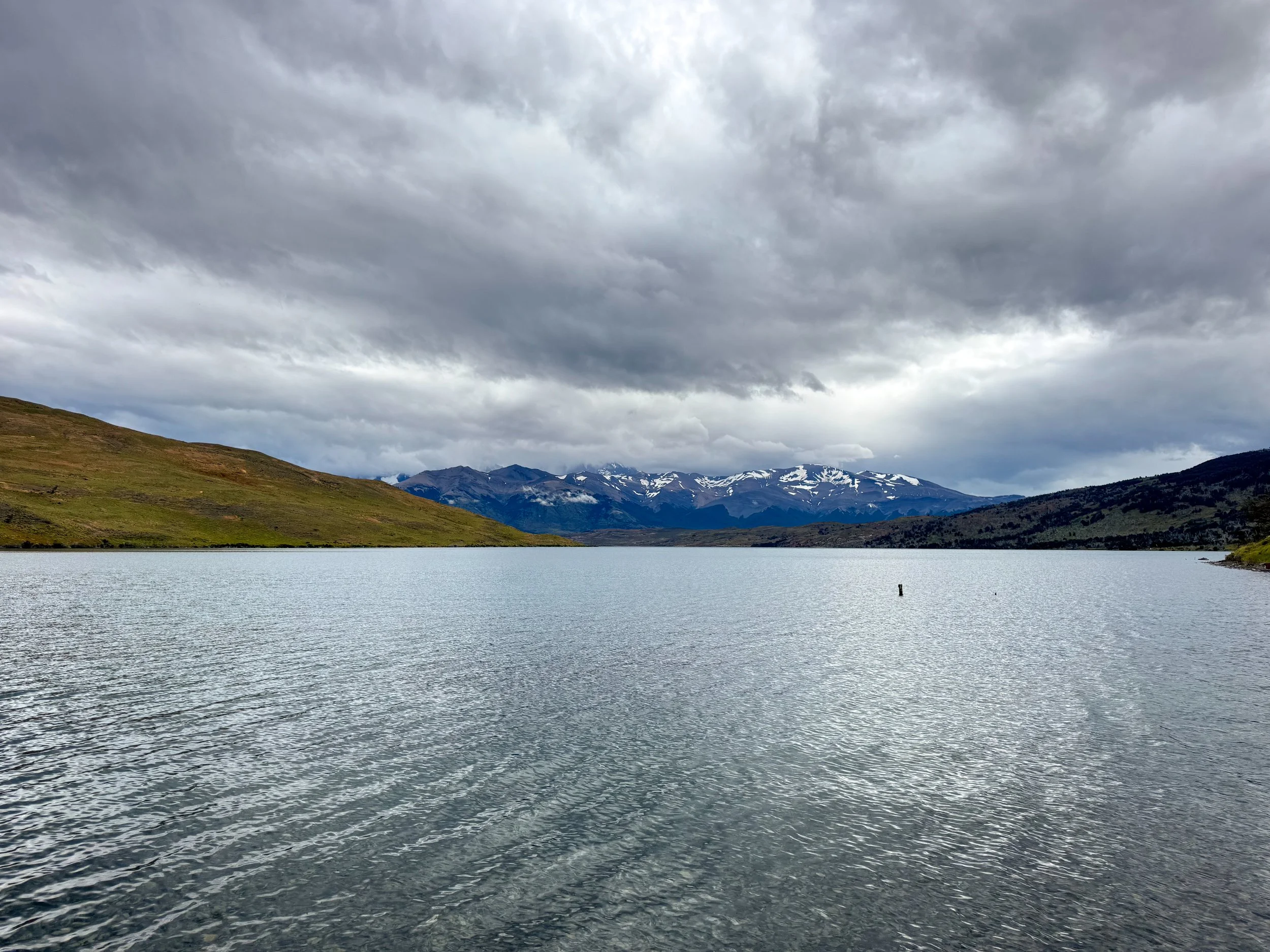
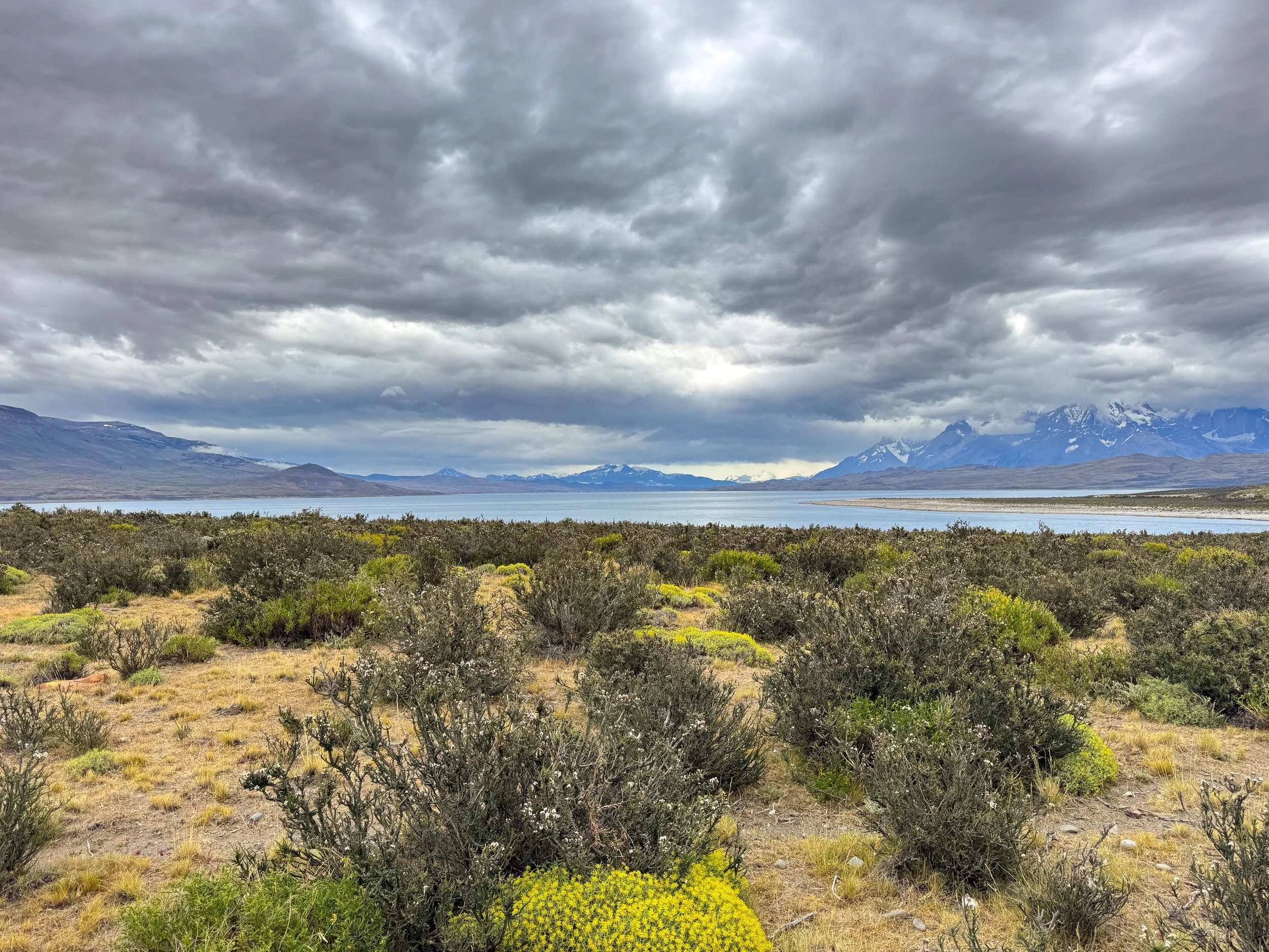
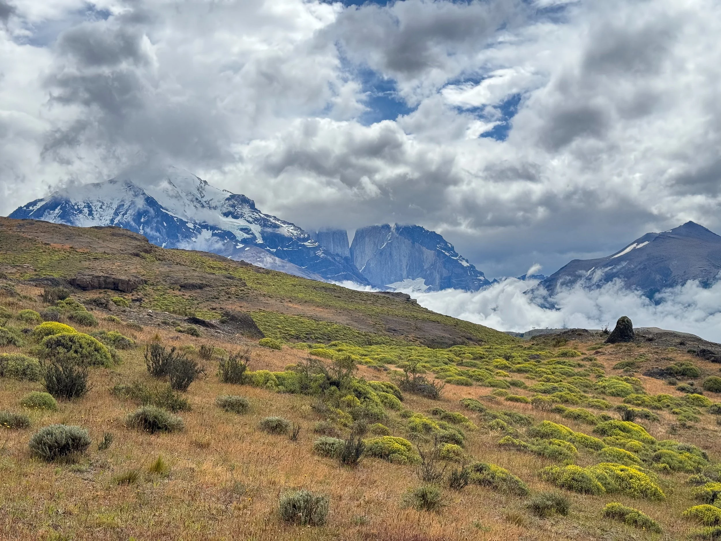

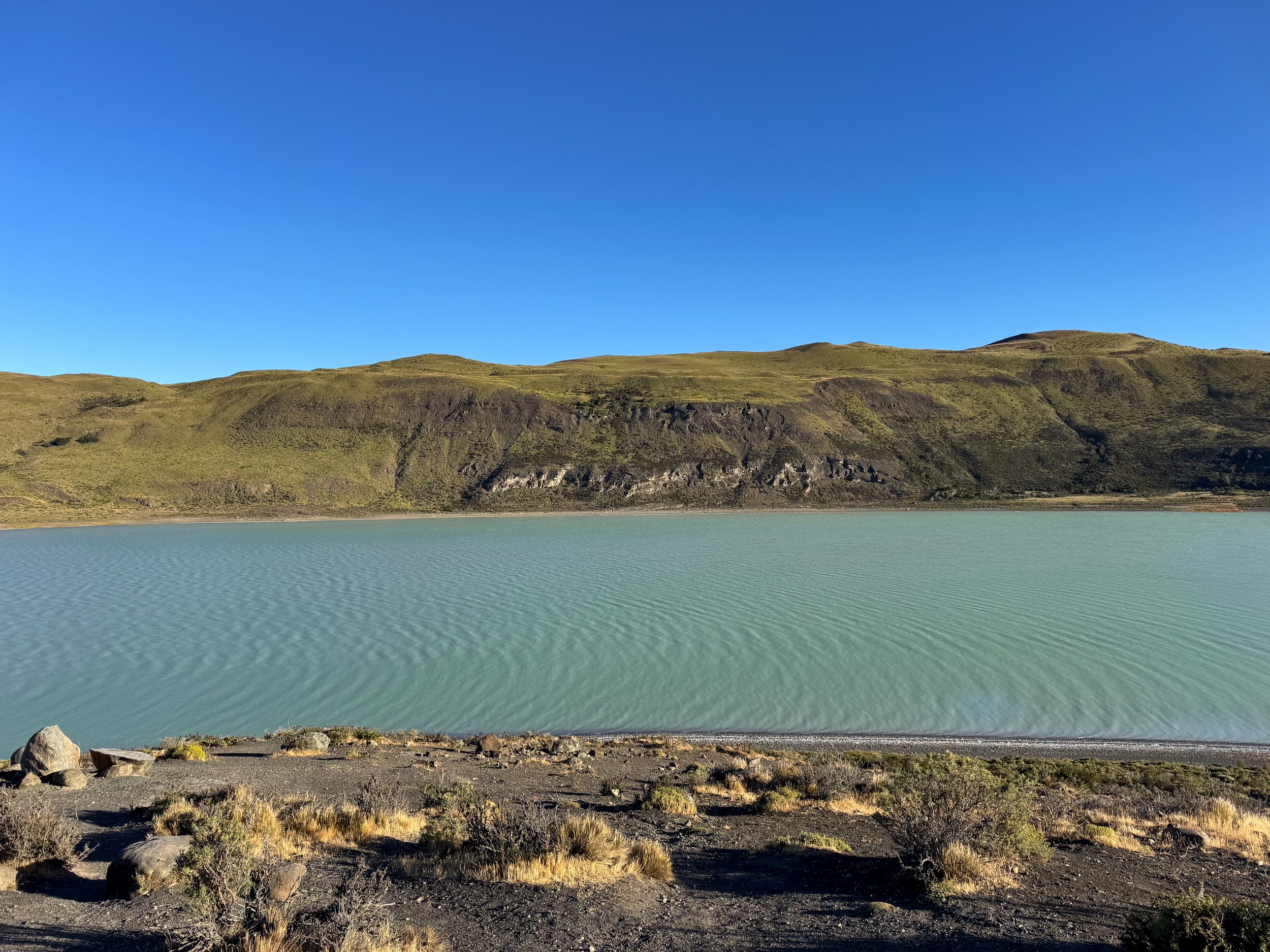
Cascada Río Paine. A cascading and angled waterfall in the Río Paine with views of the mountains. The roadside lookout is located 30 minutes from Mirador Nordenskjöld Lake.
Guardería Laguna Azul. A blue mountain lake surrounded by grassy fields home to the region’s largest population of Guanaco. Along its shores are narrow black sand and pebble beaches, hiking trails and a van campground. The lookout is located 15 minutes from Cascada Río Paine.
Laguna Amarga. A milky blue lagoon with partial views of the Torres del Paine from outside of the national park. On the day of our roadtrip, clouds completely obscured the granite peaks however, we saw an incredible view the following morning on our way to hike to their base. The lookout is located 30 minutes from Laguna Azul.
Mirador del Lago Sarmiento. A deep blue mountain lake surrounded by desert bushes and plants with views of the mountainous snow covered peaks in the distance. The lake is located on Ruta fin del Mundo 30 minutes from Laguna Amarga.
Mirador Lago Figueroa. A roadside lookout over a green lagoon at the base of tree and shrub covered hills. The lookout is located about 45 minutes from the lake and 30 minutes from Puerto Natales.
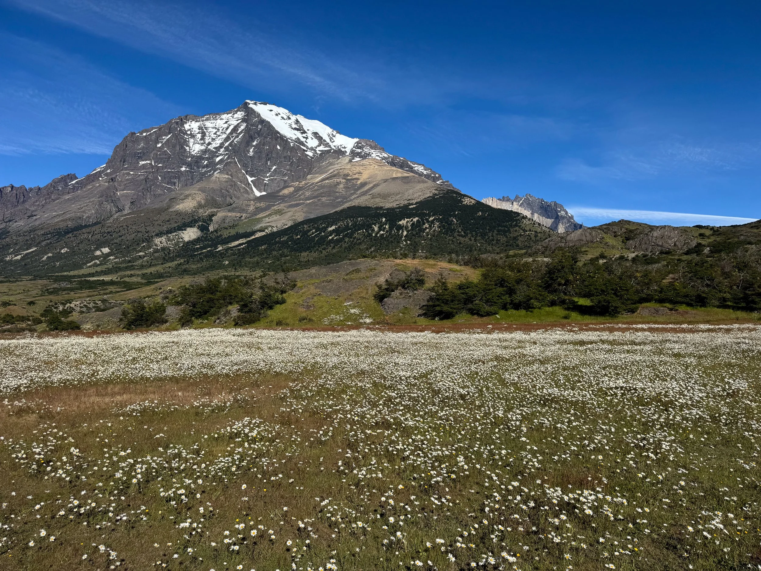
White Snow. In late December, super blooms of flowers emerge across the landscape. One of the most iconic is White Snow, a tiny white petaled flower with a yellow center that blooms by the millions, blanketing grass fields in a layer of white, imitating snow.
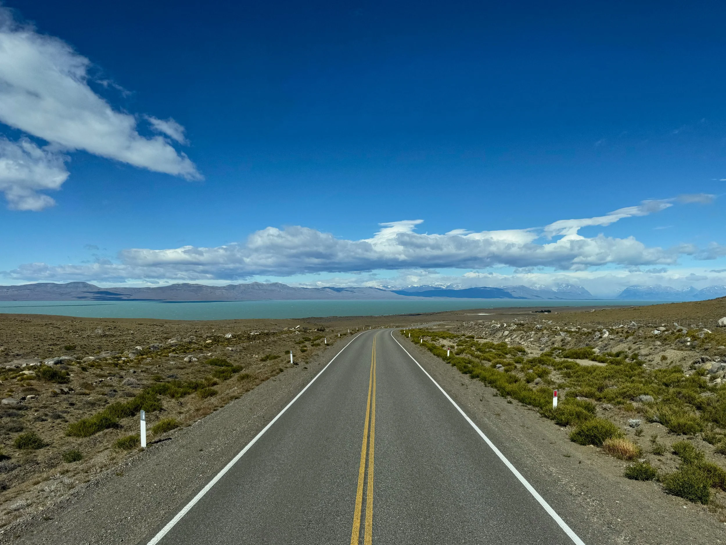
Driving in Patagonia
Driving in Patagonia was easy, granted we were driving during the warmer summer months with significantly more daylight than night. Regardless, there are different types of roads to be aware of when driving here.
Ruta fin del Mundo (End of the World Route). A vast highway leading through Patagonia to the southern tip of South America. Between Puerto Natales and Torres del Paine, the highway is well maintained with scenic lookouts and faster speeds than the asphalt and dirt back roads.
Asphalt Roads. The asphalt roads between Puerto Natales and Torres del Paine are the most dangerous due to clusters of deep potholes. Drive slowly and be ready for evasive maneuvering.
Dirt Roads. The dirt roads within Torres del Paine and between here and Puerto Natales are easy to drive on and regularly smoothed. Other than little bumps and clouds of dust, we had no issues. Keep distance between cars to avoid windshield chips.
Pro Tip. When leaving Puerto Natales, depart with a full tank of gas. There are no gas stations outside of the city.
Car Rental
One of the best ways to see Patagonia is on your own. Though expensive, having a car saved us from booking any costly tours and allowed us the freedom to move at our own pace. When in Puerto Natales, we rented a car and spent two days exploring the Torres del Paine National Park. We booked with Magallanes Rent-A-Car.We requested to book 6 months before arriving and paid a 50% deposit 1 month before and the remainder at pick up.
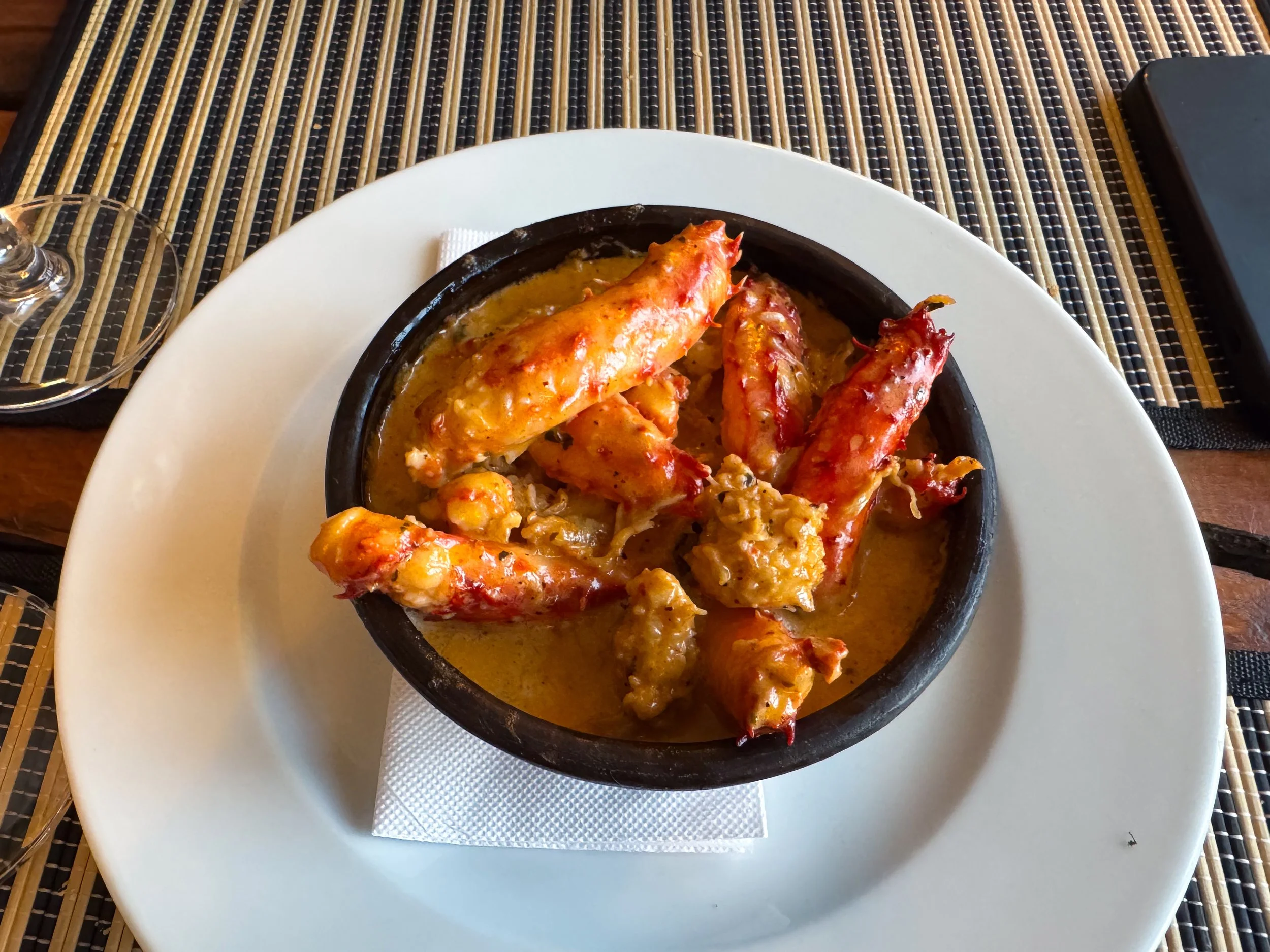
Chilean King Crab
Puerto Natales is famed in Chile for its seafood, specifically king crab. One of the best restaurants in town for king crab is Santolla. They serve entire king crabs and a range of dishes made from its meat. We savored 3 tapas style dishes: the crab legs cooked in a spicy white wine sauce, a king crab cake and scallops pil pil. To drink, a Patagonian gin & tonic and a glass of Chilean Carmenere. The restaurant built from repurposed shipping containers, a nod to the port town’s shipping industry.
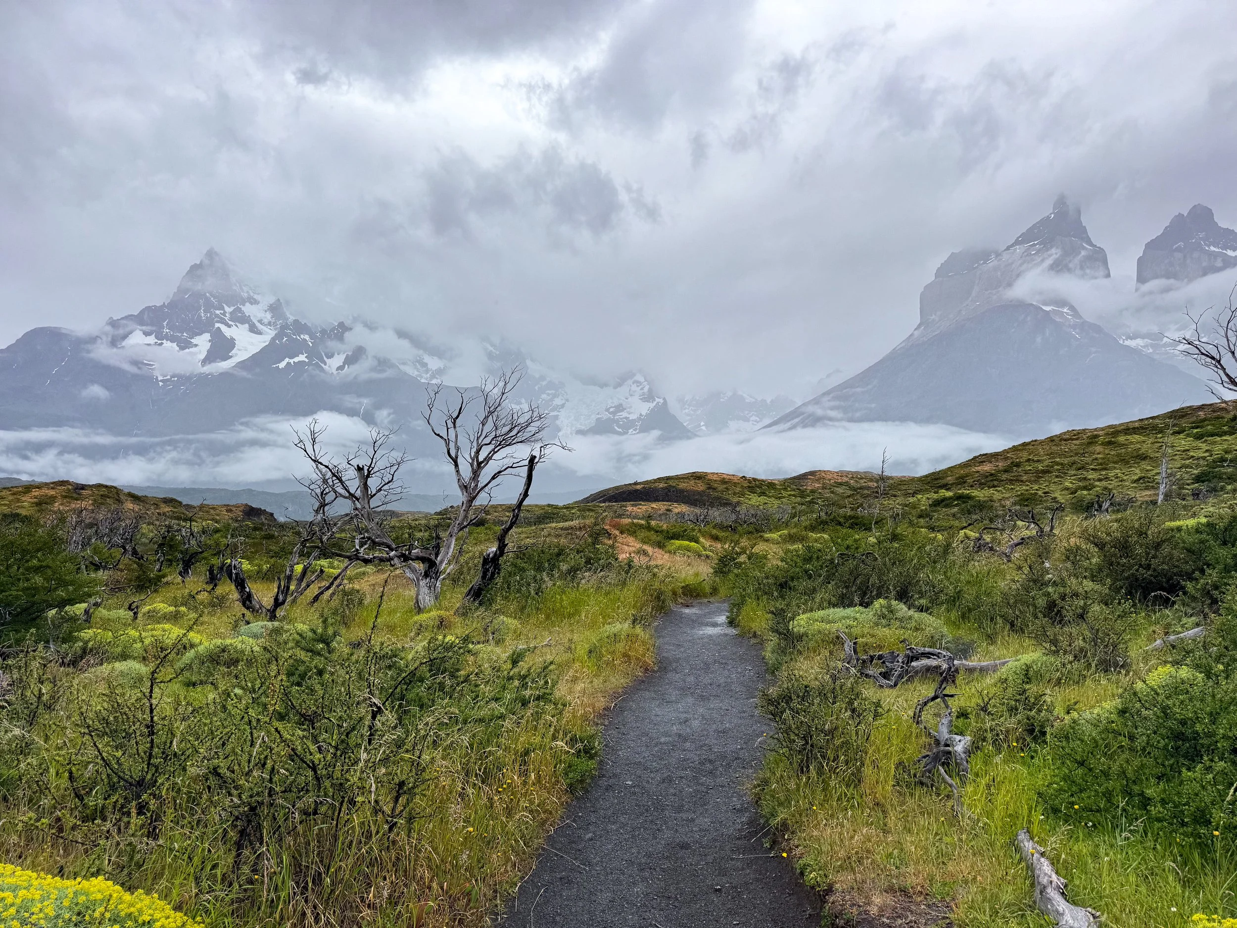
When to Visit
We visited Patagonia from mid to late December when the days are at their longest, lasting nearly 18 hours. The days are warm and the nights are chilly. The landscape was coming to life with green bushes, flowering shrubs and budding wild berries.
Location Specifics
Exchanging USD. You need to have near perfect bills free of tears, markings or a tattered appearance when exchanging for pesos or paying.
Cash vs Card. Cash is king however many places do accept card. There is often a fee ranging up to 20% for using card. There is an occasional 10% discount for paying in cash.
ATM. Regardless of banks, cash machines will only allow foreigners to request 2,000 pesos per day (about $2 USD) with fees costing close to 15,000 pesos.
Tipping. Tipping 10% is customary. Tips are cash only.
Prices. The prices of tours, cost of accommodations and meals are very expensive in Patagonia.
Ticket Fees. Ticket fees and entrance tickets often cost up to 3 times more for foreigners.
Bookings. Tours and accommodations book up in advance. We booked everything 2 to 6 months ahead of time.
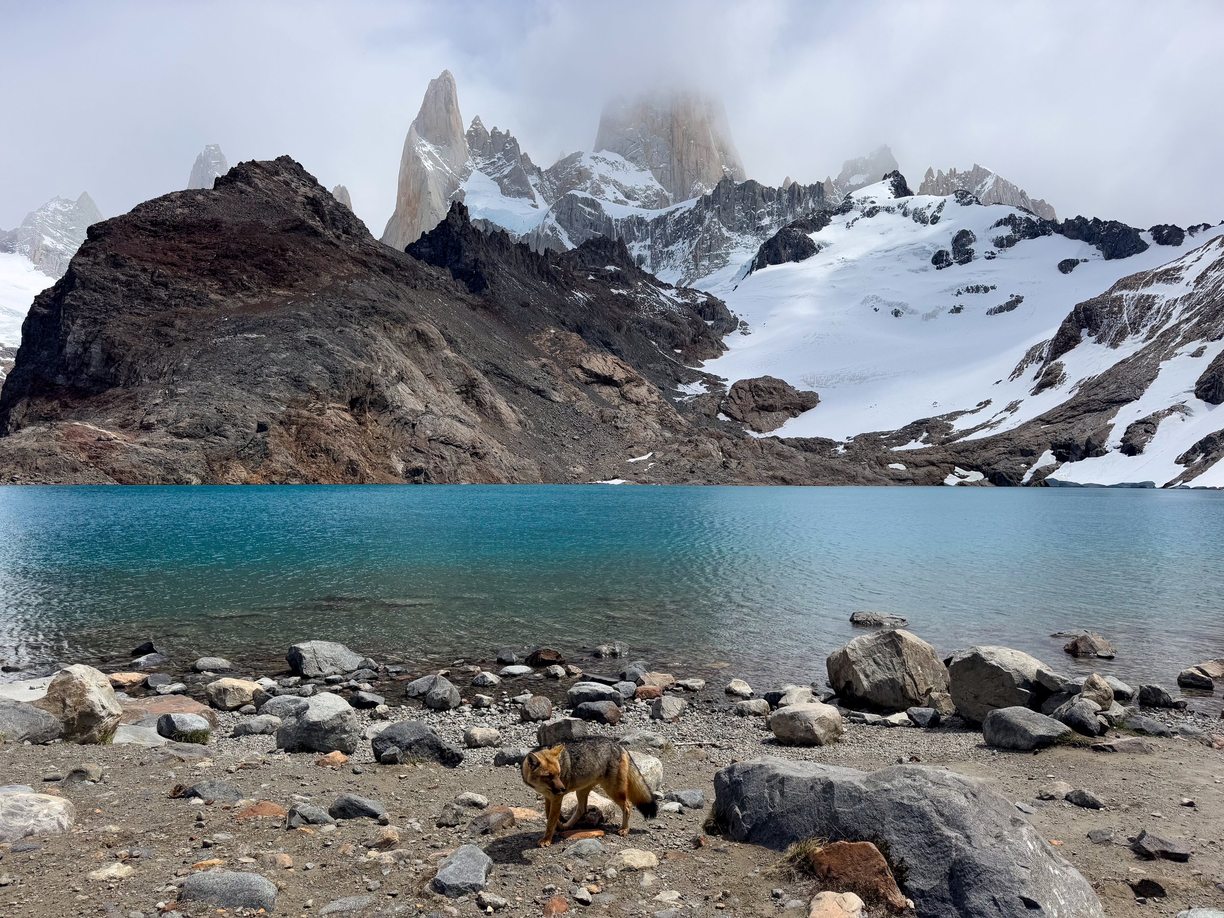
Elsewhere in Patagonia
From the rugged trekking routes of Torres del Paine to the glaciers and mountain towns of Argentine Patagonia, discover more of the shared Patagonian wilderness:
Patagonia Argentina Travel Guide: Perito Moreno Glacier, El Calafate & Fitz Roy. Explore Patagonia's dramatic landscapes where glaciers, turquoise lakes, snow capped mountains and alpine towns define Argentina's remote southern frontier.
For Next Time…
Walk with Penguins. Nearby the Chilean Patagonian town of Punta Arenas is a remote island home to colonies of penguins. We plan to tour the island and walk with them on our next trip to the region.
Tour the Fjords. Patagonia's fjords are a boat ride from the city’s port. When we return, we plan to tour them, their mountains, waterfalls and glaciers, including the Balmaceda and Serrano Glaciers.
Last Hope Distillery. Patagonian gin is one of our favorite styles of gin for its herbal and floral flavors. We missed our chance to visit the city’s only gin distillery. We hope to make it on one our first stops next time.
Puma Tracking. We saw signs and warnings about the Puma everywhere. We were either lucky or unlucky not to spot one. When we return, we plan to hire a guide to bring us puma tracking in hopes of spotting one of the big cats.